圣菲尼安湾,凯里郡,爱尔兰 St. Finian's Bay, County Kerry, Ireland (© Atlantide Phototravel/Getty Images)
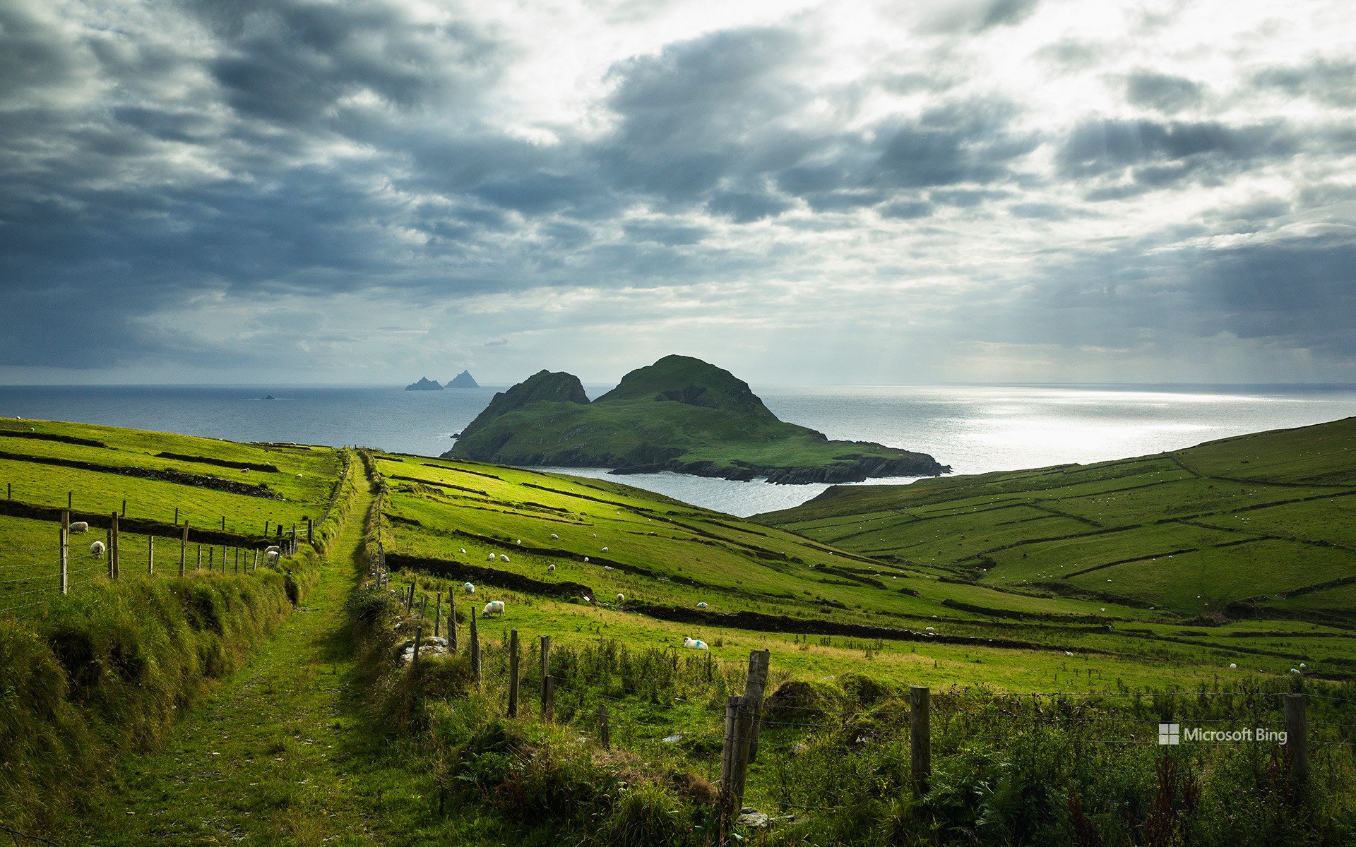
圣菲尼安湾,凯里郡,爱尔兰 St. Finian's Bay, County Kerry, Ireland (© Atlantide Phototravel/Getty Images)
今天,让我们穿绿衣裳吧! Let's wear green today!
圣菲尼安湾,凯里郡,爱尔兰
今天,全球数百万具有爱尔兰血统的人都在庆祝圣帕特里克节。圣帕特里克是爱尔兰国家的守护神,大约在公元432年,他将基督教引入到爱尔兰。公元461年3月17日,圣帕特里克逝世,这一天成为了爱尔兰纪念他的日子。
而在美国,圣帕特里克节也具有重要的文化意义,那里有超过3000万人声称自己拥有爱尔兰血统,尤其是在波士顿、纽约和芝加哥等城市。美国第一次庆祝圣帕特里克节的活动是在1737年波士顿举办的,组织者是思乡的爱尔兰士兵,其目的是纪念和传承他们的爱尔兰文化。现代的庆祝活动通常包括游行、传统爱尔兰音乐和舞蹈表演、穿绿色的服装,享用爱尔兰美食和饮料。转眼又到了圣帕特里克节,喜欢爱尔兰文化的你,是否已在夹克上别上了三叶草?
St. Patrick's Day
Today, we're looking out to sea from the green pastures of St Finian's Bay in County Kerry, Ireland, to celebrate St Patrick's Day. The country's patron saint introduced Christianity to Ireland around the year 432, and his passing on March 17, 461, became a day of commemoration in his homeland.
The holiday holds cultural significance in the United States, where there are over 30 million people who claim Irish ancestry, specifically in cities like Boston, New York, and Chicago. The first festivity in America took place in Boston in 1737, organized by homesick Irish soldiers to honor their heritage. The modern celebration typically includes parades, traditional Irish music, and dance performances, wearing green clothes, and indulging in Irish cuisine and beverages. Have you pinned a shamrock to your jacket yet?