瓦朗索勒高原的薰衣草田,法国 Lavender fields in Plateau de Valensole, France (© zpagistock/Getty Images)
追随香气的地平线 Fragrant horizons
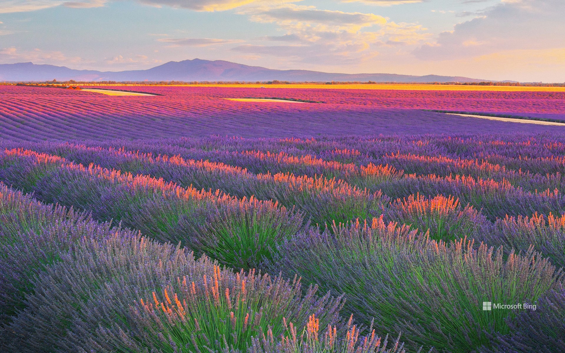
瓦朗索勒高原的薰衣草田,法国
若你正在寻找一场充满芬芳的夏日旅程,法国普罗旺斯的瓦朗索勒高原无疑是理想之选。从六月下旬至七月中旬,这片高原便会被紫色花海覆盖,宛如香气四溢的天然画布。高原坐落于海拔约1,900英尺的地带,面积达约300平方英里,是法国规模最大的薰衣草种植区之一。
薰衣草种植在该地区的兴起可追溯至19世纪,当时附近格拉斯地区的香水工业蓬勃发展。随着时间推移,薰衣草种植逐渐覆盖普罗旺斯,尤其集中在阳光充足、排水良好的高地地区,比如瓦朗索勒高原。如今,1700名种植者在大约62000英亩的土地上精心栽培这些薰衣草。所栽培的品种包括用于香水和护肤品的传统薰衣草,也种植茎更长的薰衣草杂交品种,常用于家居清洁用品和空气清新剂。瓦朗索勒的薰衣草田并非偶然的景致,而是香气与产业共生演化的结果。若希望尽情沉浸于这片紫色海洋之中,务必提前安排行程,循着薰衣草的香气,收获一个充满感官记忆的夏日。
Lavender fields in Plateau de Valensole, France
If you're looking for a scent-sational summer trip, follow your nose to the Plateau de Valensole in Provence, France. From late June to mid-July, this high plateau transforms into a purple sea of lavender. Situated more than 1,900 feet above sea level and spanning approximately 300 square miles, it is one of the largest areas in France dedicated to lavender cultivation.
Lavender has flourished in Provence for centuries. The ancient Romans brought the plant to southern France, using it for bathing, cooking, and healing. The word itself comes from 'lavare,' Latin for 'to wash.' By the Middle Ages, local monks were cultivating it for medicinal purposes. The real boom came in the 19th century, when the perfume industry in nearby Grasse took off. Over time, lavender fields spread across Provence, especially in high-sun, well-drained areas like Valensole. Today, 1,700 growers tend to around 62,000 acres of these shrubs. They cultivate both traditional lavender—for perfumes and skincare—and lavandin, the longer-stemmed cousin often found in household cleaning products and air fresheners. So don't just leave it to chance—plan ahead, follow the scent trail, and let your summer bloom with lavender memories.