日出时分的蒂雷纳村庄,法国新阿基坦大区科雷兹省 The hilltop village of Turenne at sunrise in the Corrèze department, Nouvelle-Aquitaine, France (© Tim Mannakee/plainpicture)
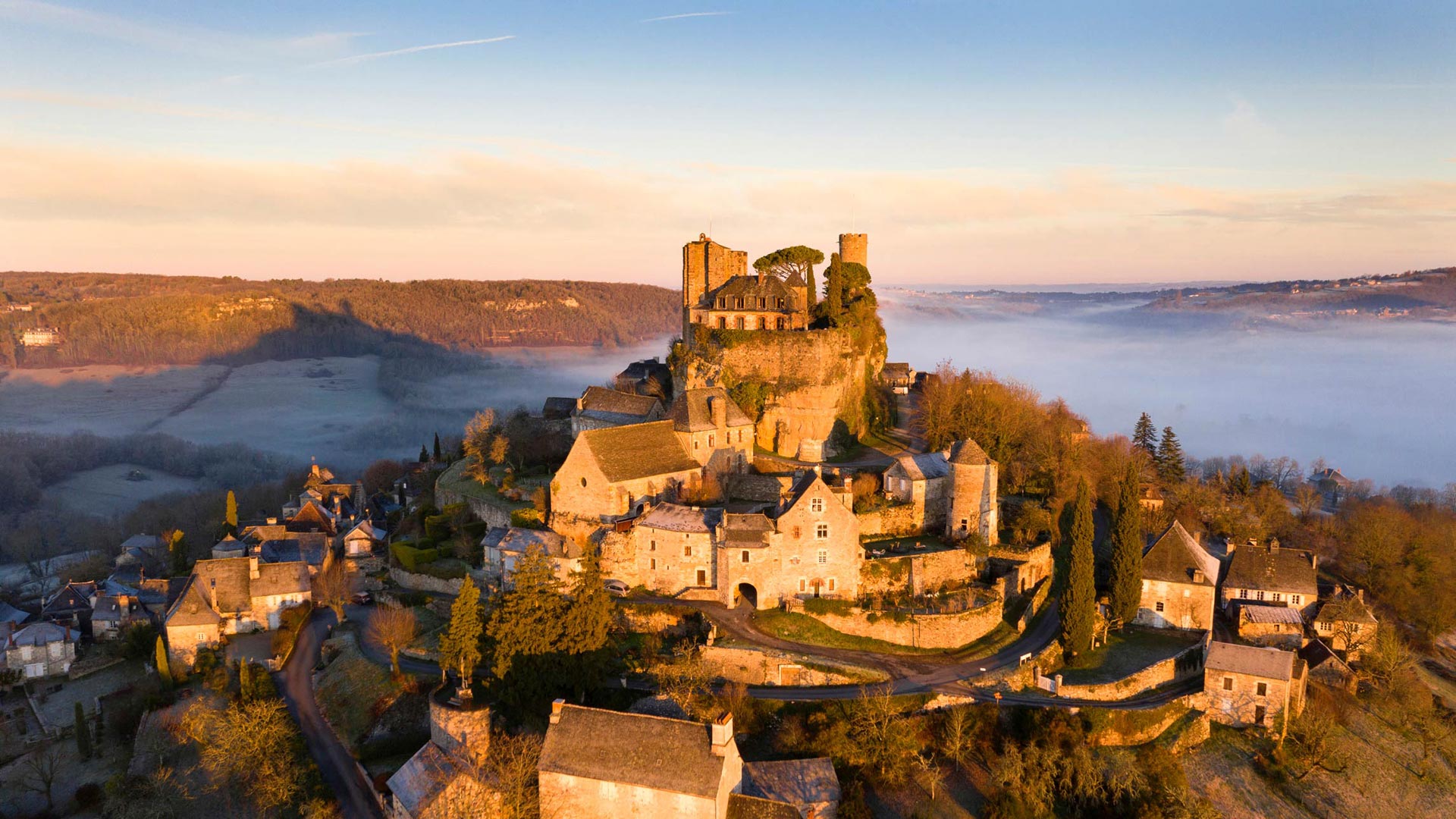
日出时分的蒂雷纳村庄,法国新阿基坦大区科雷兹省 The hilltop village of Turenne at sunrise in the Corrèze department, Nouvelle-Aquitaine, France (© Tim Mannakee/plainpicture)
科雷兹的宝石 Jewel of Correze
图伦内
Turenne是法国中部新阿基坦地区Corrèze省的一个公社。它的特点是它的高度和在悬崖顶部的独特位置。山顶城镇图雷纳俯瞰着四面八方的乡村。在山顶上,仍然保留着13世纪中世纪的图尔纳城堡遗址。这座城堡是中世纪法国最强大的王朝之一——图雷纳子爵的封建权力基础。从中世纪早期到18世纪,他们统治利穆赞、佩里戈和昆西地区近10个世纪。
Turenne
Turenne is a commune in the Corrèze department in the Nouvelle-Aquitaine region in central France. It is characterized by its height and unique position on top of a cliff. The hilltop town of Turenne overlooks the countryside in all directions. Atop the hill, there remain the ruins of the 13th-century medieval Château de Turenne. This castle served as the feudal powerbase of one of the most powerful dynasties in medieval France - the Viscounty of Turenne. They reigned over the regions of Limousin, Périgord, and Quercy for almost 10 centuries from the early Middle Ages until the 1700s.
坎彭万德山,基姆高地区阿绍,德国巴伐利亚州 View from Kampenwand mountain, Aschau im Chiemgau, Bavaria, Germany (© Toni Anzenberger/plainpicture)
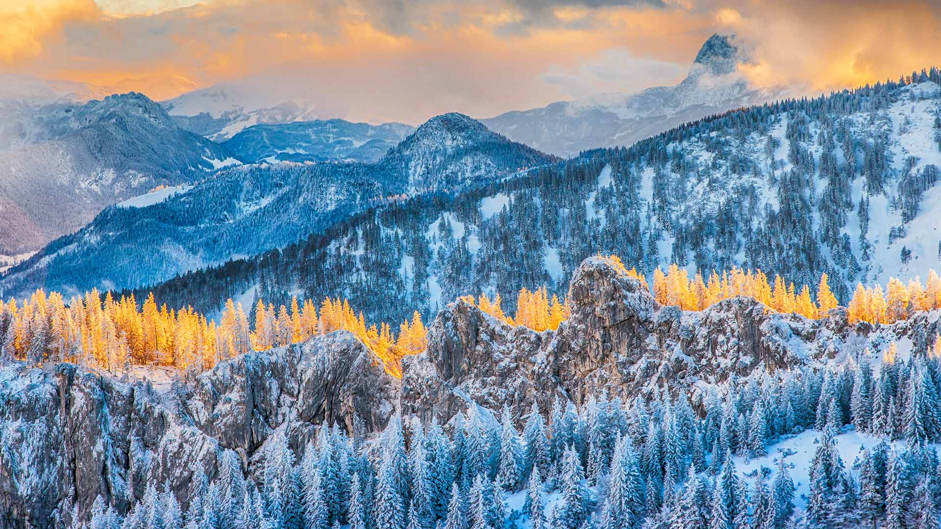
坎彭万德山,基姆高地区阿绍,德国巴伐利亚州 View from Kampenwand mountain, Aschau im Chiemgau, Bavaria, Germany (© Toni Anzenberger/plainpicture)
令人惊叹的山顶美景 Stunning mountain top view
巴伐利亚州坎本万德山
冬天已经来到了坎彭德的顶峰。在春季和夏季,许多徒步旅行者、山地自行车手、登山者、悬挂滑翔机和滑翔伞爱好者在这里嬉戏,在寒冷的季节,一点平静逐渐回归。现在,该地区正成为雪鞋徒步旅行者和滑雪旅游者的吸引力。
根据观看方向的不同,您可以欣赏坎彭德的壮丽全景。阿尔卑斯山麓和基姆山脉向北延伸,在晴朗的日子,你甚至可以看到西北部的慕尼黑电视塔。在南部-如这张照片中所示-可以看到巴伐利亚和奥地利山脉的独特景色。
Kampenwand mountain, Bavaria
Winter has already arrived at the summit of the Kampenwand. Where numerous hikers, mountain bikers, and climbers as well as hang-gliders, and paragliders cavort in spring and summer, a little calm gradually returns in the cold season. Now the region is becoming an attractive attraction for snowshoe hikers and touring skiers.
Depending on the viewing direction, you can enjoy a magnificent panorama from the Kampenwand. The foothills of the Alps with the Chiemsee stretch northwards, and on a clear day, you can even spot Munich's television tower in the northwest. In the south - as in this photo - there is a unique view of the Bavarian and Austrian mountains.
多哈艾哈迈德·本·阿里体育场, 卡塔尔 Ahmad Bin Ali Stadium in Doha, Qatar (© Qatar 2022/Supreme Committee via Getty Images)

多哈艾哈迈德·本·阿里体育场, 卡塔尔 Ahmad Bin Ali Stadium in Doha, Qatar (© Qatar 2022/Supreme Committee via Getty Images)
卡塔尔开球 Kickoff in Qatar
2022年国际足联世界杯
最后,经过多年的规划、建设和争议,2022年世界杯将在卡塔尔拉开帷幕。这是国际足球日历上最大的活动,汇集了全球顶尖球队,自豪地代表他们的国家。自1930年以来,这项享有盛誉的世界杯锦标赛每四年举行一次,但1942年和1946年第二次世界大战使其出轨。随着冠军法国队寻求卫冕,卡塔尔将面临激烈的竞争,决赛定于12月18日卡塔尔国庆日举行。这是中东国家主办的第一届世界杯,由于卡塔尔天气炎热,今年的天气比平时晚。
争议从一开始就围绕卡塔尔2022展开。足球管理机构国际足联(FIFA)的高级官员对卡塔尔承办世界杯过程中的腐败表示担忧,尽管内部调查并未证明有任何违规行为。很快,卡塔尔对该国价值200万的移民工人的待遇受到了批评,其中大部分来自非洲和亚洲,大赦国际等组织引用了不道德的劳工做法。尽管卡塔尔颁布了新的法律,以改善工人的安全、条件和薪酬,但大赦国际强调,这些法律也必须得到有效实施。也许随着足球迷涌入全国,电视摄像机的滚动,改革的程度将被揭示出来。
2022 FIFA World Cup
Finally, after years of planning, building, and controversy, the 2022 World Cup is kicking off in Qatar. It's the biggest event on the international soccer calendar, bringing together the globe's top teams to proudly represent their countries. The prestigious World Cup tournament has been held every four years since 1930, except when WWII derailed it in 1942 and 1946. There will be fierce competition in Qatar as the champion French team seeks to defend their title, with the final scheduled for Qatar National Day, December 18. This is the first World Cup hosted by a country in the Middle East, and it's later in the year than usual due to the hot weather in Qatar.
Controversy swirled around Qatar 2022 from the get-go. Senior officials in FIFA, soccer's governing body, expressed concerns about corruption in the process of awarding World Cup hosting to Qatar, though an internal investigation didn't prove any violation. Soon Qatar's treatment of the country's invaluable 2 million migrant workers—most from Africa and Asia—was criticized, with groups like Amnesty International citing unethical labor practices. While Qatar enacted new laws to improve worker safety, conditions, and pay due to the international spotlight, Amnesty has stressed that these laws must also be effectively implemented. Perhaps the extent of the reforms will be revealed as soccer fans flood the nation and the TV cameras roll.
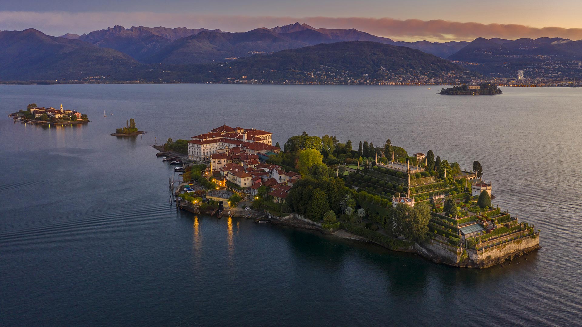
伊索拉贝拉岛,意大利马焦雷湖 (© Massimo Ripani/eStock)
船底星云中的宇宙悬崖 (© NASA, ESA, CSA, and STScI)
犹他州锡安国家公园的维尔京河,美国 Virgin River in Zion National Park, Utah (© Jonathan Ross/Getty)
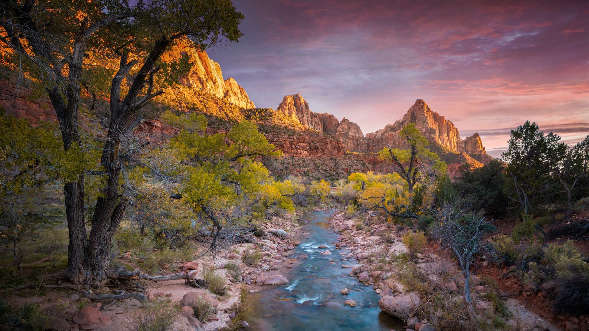
犹他州锡安国家公园的维尔京河,美国 Virgin River in Zion National Park, Utah (© Jonathan Ross/Getty)
锡安国家公园的维珍河
我们的照片将我们带到16英里长的维珍河,在那里它穿过犹他州锡安峡谷上游,形成了一个壮观的千英尺深的峡谷。流经锡安国家公园(今天已满103岁!),由于科罗拉多高原、大盆地和莫哈韦沙漠交汇处的独特生物群落,维珍河是其他地方所没有的独特植物和动物的家园。如果没有维珍河水系的水,像世界上最稀有的物种之一的wondfin小鱼这样的生物就不可能存在。
Virgin River in Zion National Park
Our photo brings us to a 16-mile stretch of the Virgin River where it cuts a spectacular thousand-foot-deep gorge through the upper reaches of Utah's Zion Canyon. Flowing through Zion National Park (which turns 103 today!), the Virgin River is home to unique plants and animals that aren't found anywhere else, due to the unique intersection of biomes found where the Colorado Plateau, Great Basin, and Mojave Desert all meet. Without the water of the Virgin River system, creatures like the woundfin minnow, one of rarest species on the planet, couldn't exist.
菲斯皇宫的大门,摩洛哥 The gates of the Royal Palace (Dar El Makhzen) in Fez, Morocco (© Adam Smigielski/Getty Images)
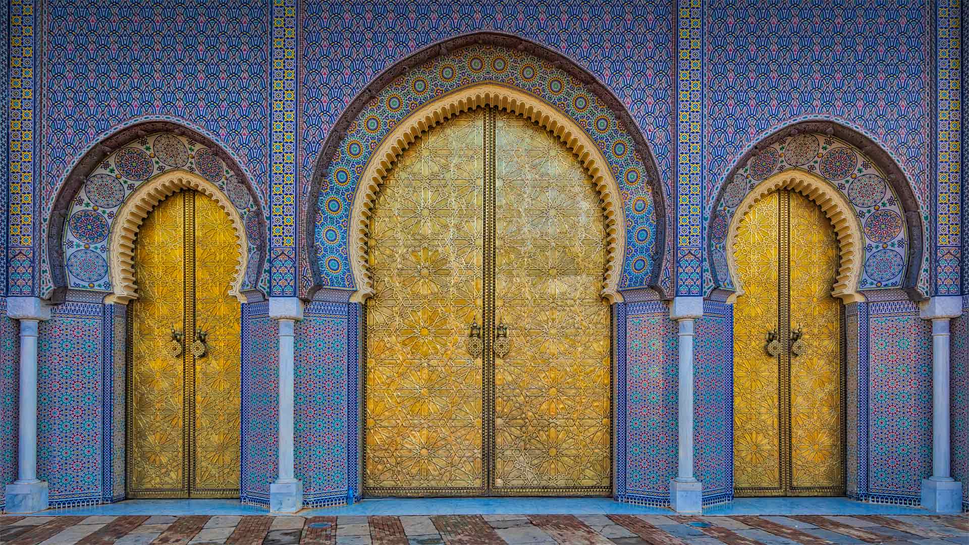
菲斯皇宫的大门,摩洛哥 The gates of the Royal Palace (Dar El Makhzen) in Fez, Morocco (© Adam Smigielski/Getty Images)
通往皇宫的大门 Keyholes to the kingdom
国际伊斯兰艺术日
联合国教科文组织于2019年宣布的国际伊斯兰艺术日每年11月18日举行,旨在庆祝伊斯兰的过去和当代艺术表现,并突出伊斯兰艺术家对世界文明的贡献。11月18日也是摩洛哥独立日,纪念苏丹穆罕默德五世于1955年从流亡返回摩洛哥。
我们的图像纪念了今天的两个事件:您看到的是摩洛哥国王在费兹市的王宫达尔·马克岑(Dar al-Makhzen)的正门。虽然宫殿最初建于1276年,但这些华丽的大门是在20世纪60年代和70年代增加的,由木材和青铜制成,加上复杂的马赛克瓷砖,这是伊斯兰艺术的一个标志,无论新旧。
International Day of Islamic Art
The International Day of Islamic Art, proclaimed by UNESCO in 2019, occurs every November 18 to celebrate past and contemporary artistic expressions of Islam, and to highlight Islamic artists' contributions to world civilization. November 18 also marks Morocco's independence day, or Fete de l'Independence, commemorating Sultan Muhammad V's return to Morocco from exile in 1955.
Our image honors both of today's events: You're beholding the main gates of the Dar al-Makhzen, the royal palace of the King of Morocco in the city of Fez. While the palace was originally founded in 1276, these ornate gates were added in the 1960s and '70s, crafted of wood and bronze—plus intricate mosaic tiling, a hallmark of Islamic art both old and new.
威拉米特国家森林麦肯齐河步道上的桥,美国 Bridge on the McKenzie River Trail, Willamette National Forest, Oregon (© Don Paulson/Danita Delimont)
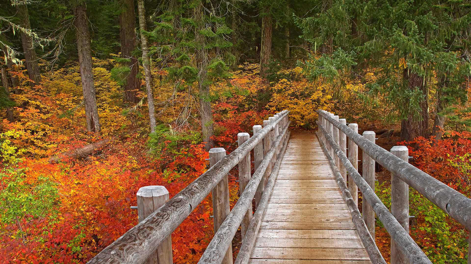
威拉米特国家森林麦肯齐河步道上的桥,美国 Bridge on the McKenzie River Trail, Willamette National Forest, Oregon (© Don Paulson/Danita Delimont)
徒步旅行 Take a hike!
麦肯齐河步道上的桥梁
我们的照片显示俄勒冈州的麦肯齐河国家休闲步道,威拉米特国家森林的一部分。这条小径蜿蜒于湖泊、河流和泉水之间,引导您穿过荫蔽的古老森林。其中一个亮点是可以俯瞰塔莫利奇蓝池(Tamolich Blue Pool),这是一个清澈见底的游泳池,由河水注入其中而成。
Bridge on the McKenzie River Trail
Our photo shows Oregon's McKenzie River National Recreation Trail, part of the Willamette National Forest. This trail winds by lakes, rivers, and springs, guiding you through shady old-growth forests. One highlight: the view overlooking Tamolich Blue Pool, a crystal-clear pool created by the river bubbling up into it.
梅萨维德国家公园的悬崖宫,美国 Cliff dwellings in Mesa Verde National Park in Colorado, USA (© Brad McGinley Photography/Getty Images)
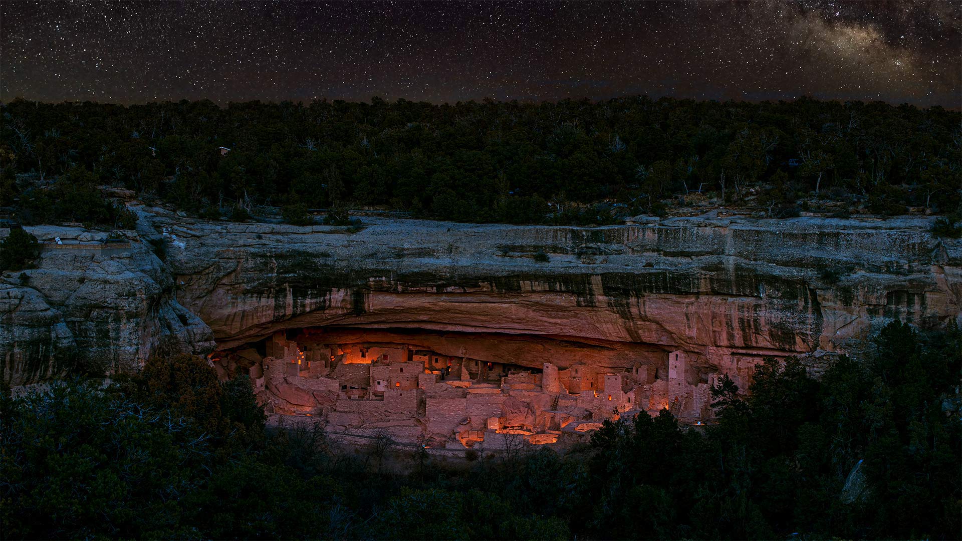
梅萨维德国家公园的悬崖宫,美国 Cliff dwellings in Mesa Verde National Park in Colorado, USA (© Brad McGinley Photography/Getty Images)
《保护世界文化和自然遗产公约》 A 50-year balancing act
世界遗产50年
在1972年11月16日的《世界遗产公约》上,联合国教科文组织通过了一项国际条约,首次将自然保护和文化遗产保护的概念联系起来。世界遗产项目是由埃及计划修建的阿斯旺大坝引发的,该大坝将淹没尼罗河流域的大片地区和数千件考古珍品。
梅萨维德国家公园是普埃布洛斯祖师居住了七个世纪的地方,1978年被联合国教科文组织委员会选为首批世界遗产。
50 years of World Heritage Sites
At its World Heritage Convention on November 16, 1972, UNESCO adopted an international treaty that for the first time linked the concepts of nature conservation and preservation of cultural properties. The World Heritage Sites program was sparked by Egypt's planned construction of the Aswan High Dam, which would have flooded a large swath of the Nile Valley and thousands of archeological treasures.
Mesa Verde National Park, where Ancestral Puebloans lived for seven centuries, was among the first World Heritage Sites chosen by the UNESCO committee, in 1978.
哈尔基岛的圣约翰骑士中世纪城堡遗址,希腊 Ruins of the medieval castle of the Knights of St. John above the village of Chorio, Halki Island, Greece (© Massimo Ripani/eStock Photo)
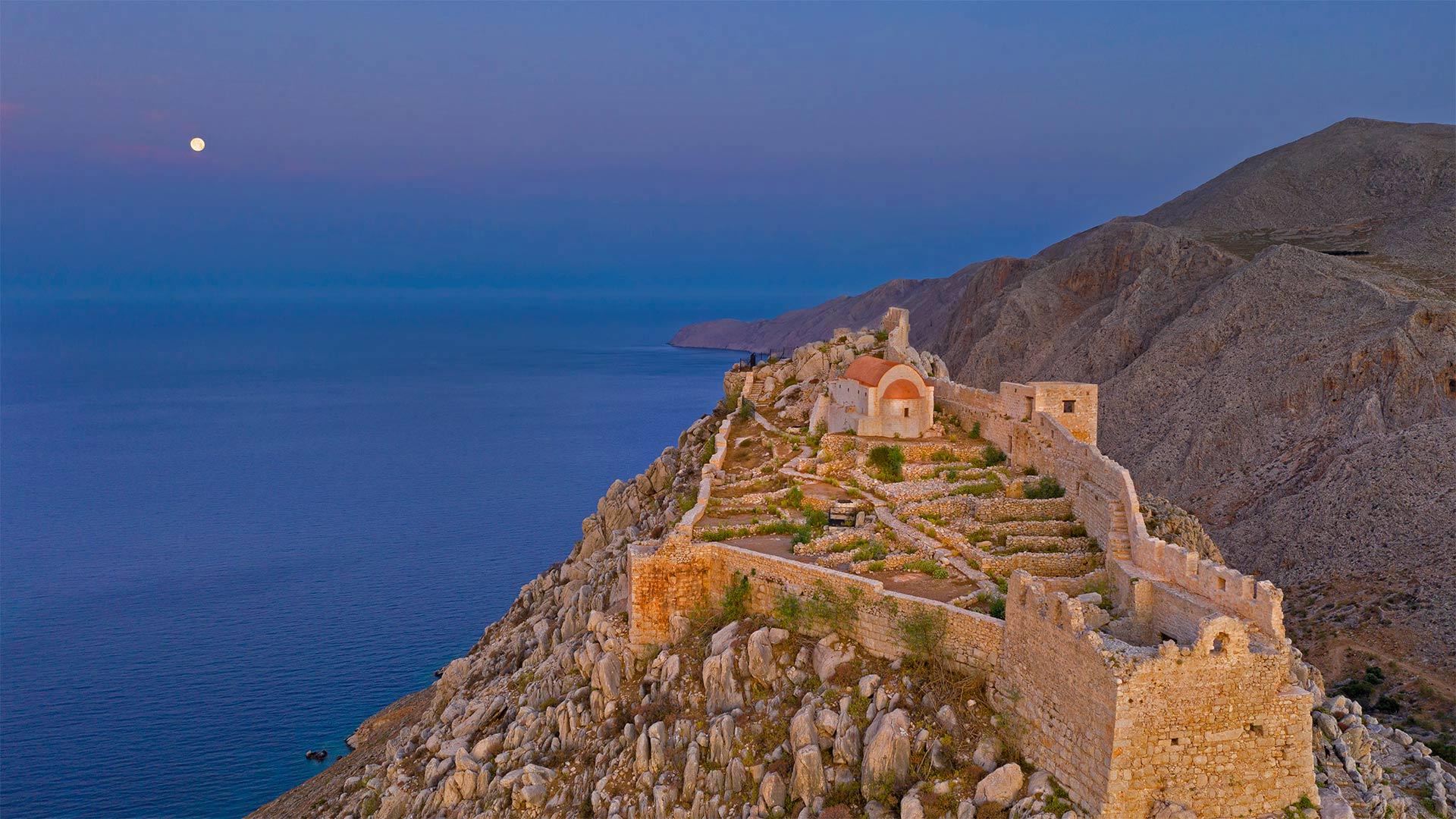
哈尔基岛的圣约翰骑士中世纪城堡遗址,希腊 Ruins of the medieval castle of the Knights of St. John above the village of Chorio, Halki Island, Greece (© Massimo Ripani/eStock Photo)
爱琴海之巅 High above the Aegean Sea
希腊哈尔基岛上的城堡废墟
哈尔基是爱琴海中的一个希腊小岛,当你需要逃离时,你会去那里。在人迹罕至的道路上,当其他希腊岛屿挤满游客时,哈尔基安静而困倦。到达目的地的唯一途径是从大得多的罗德岛乘坐渡轮。哈尔基岛的总面积只有1100平方英里,是多德卡内塞群岛中最小的有人居住的岛屿。
哈尔基岛上最受欢迎的景点之一是这座中世纪城堡的废墟,该城堡由圣约翰骑士团于14世纪在岛上朝南的海岸上现已废弃的乔里奥村建造。从岛上唯一的城镇恩波里奥港口村出发,步行很短,很上坡,岛上数百名常住居民大多住在这里。20世纪中叶,有相当一部分人口离开,其中许多人定居在墨西哥湾沿岸的佛罗里达州塔蓬斯普林斯镇,该镇号称拥有美国所有城市中最高比例的希腊裔美国人。来自哈尔基和其他希腊岛屿的人们被引诱到塔蓬泉从事海绵潜水员的工作,这是他们在希腊世代磨练的技能。这些天,哈尔基除了吃饭、放松和游泳外,没有什么其他活动。像所有希腊岛屿一样,哈尔基有美丽的海滩。在这里,你更有可能把它们都留给自己。
Castle ruins on the island of Halki, Greece
Halki, a tiny Greek island in the Aegean Sea, is the type of place you go to when you need a getaway from your getaway. Off the beaten path, Halki is quiet and sleepy when other Greek islands are flush with visitors. The only way to arrive is by ferry from the much larger island of Rhodes. Halki has a total area of just 11, sun-kissed square miles, the smallest inhabited island in the Dodecanese island group.
One of the most popular attractions on Halki is the ruins of this medieval castle built by the Knights of St. John in the 14th century in the now abandoned village of Chorio on the island's south-facing shore. It's a short, uphill walk from the only town on the island, the port village of Emporio, where most of the island's few hundred permanent residents live. A significant portion of the population left in the mid-20th century, many of them settling in the Gulf Coast town of Tarpon Springs, Florida, which lays claim to having the highest percentage of Greek Americans of any US city. People from Halki and other Greek islands were lured to Tarpon Springs to work as sponge divers, a skill they honed for generations in Greece. These days, not much goes on in Halki beyond eating, relaxing, and swimming. Like all Greek islands, Halki has beautiful beaches. Here, you're more likely to have them all to yourself.
