德国中世纪城市罗滕堡 Medieval city of Rothenburg ob der Tauber, Germany (© kanuman/Getty Images)
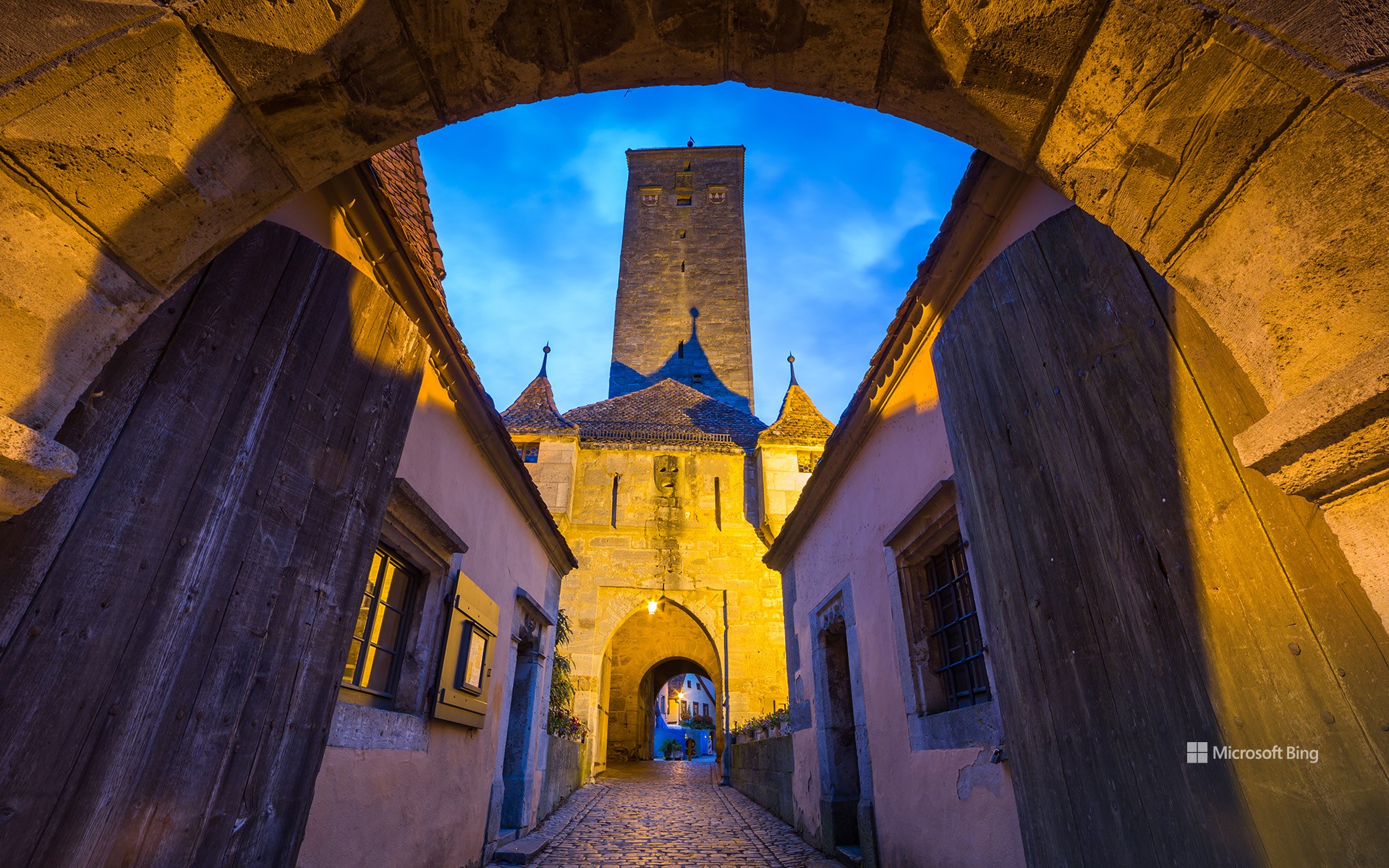
德国中世纪城市罗滕堡 Medieval city of Rothenburg ob der Tauber, Germany (© kanuman/Getty Images)
高耸入云的历史建筑 Towering with history
罗滕堡,巴伐利亚州,德国
看到这张图,你的脑海中是否浮现出了“童话”这个词?欢迎来到陶伯河畔的罗滕堡,或称“陶伯河上的红色要塞”,这里每个鹅卵石铺就的角落都散发着中世纪的魅力。在中世纪,这座巴伐利亚州的城墙小镇曾是一座自治城市,拥有6000名居民,是当时神圣罗马帝国的第二大城市。17世纪,罗滕堡的发展速度有所放缓,但仍保留了其原有的特色。图为城堡大门,它是在1356年罗滕堡城堡被地震摧毁后修建的。城堡大门内有一扇“针眼”门,其设计目的是在夜间主门关闭时作为进出城堡的唯一通道。但罗滕堡的魔力并不仅限于城墙,从维尔茨堡到富森的浪漫之路全长290英里,覆盖了巴伐利亚城堡林立的山谷。回程时,可以去凯特·沃尔法特圣诞村,这里是节日爱好者的梦想之地。所以,城堡迷们,来一场中世纪的探险吧。
Rothenburg ob der Tauber, Bavaria, Germany
Welcome to Rothenburg ob der Tauber, or 'Red Fortress above the Tauber River,' where medieval charm is around every cobbled corner. A self-ruling city in the Middle Ages, this walled Bavarian town once flourished with 6,000 inhabitants, the Holy Roman Empire's second-largest city at the time. The growth of Rothenburg ob der Tauber slowed in the 17th century, preserving its original character.
Pictured here is the Burgtor (castle gate), which was built after the original Rothenburg Castle was destroyed by an earthquake in 1356. Within the castle gate is an 'eye-of-the-needle' door, designed to be the only way in and out once the main gates closed at night. But Rothenburg's magic isn't confined to its walls. It's also a gateway to the 290-mile Romantic Road that runs from Würzburg to Füssen, covering Bavaria's castle-studded valleys.
斯卡拉布雷的新石器时代遗迹, 奥克尼群岛, 苏格兰 The neolithic settlement of Skara Brae, Orkney, Scotland (© Paul Williams - FunkyStock/Getty Images)
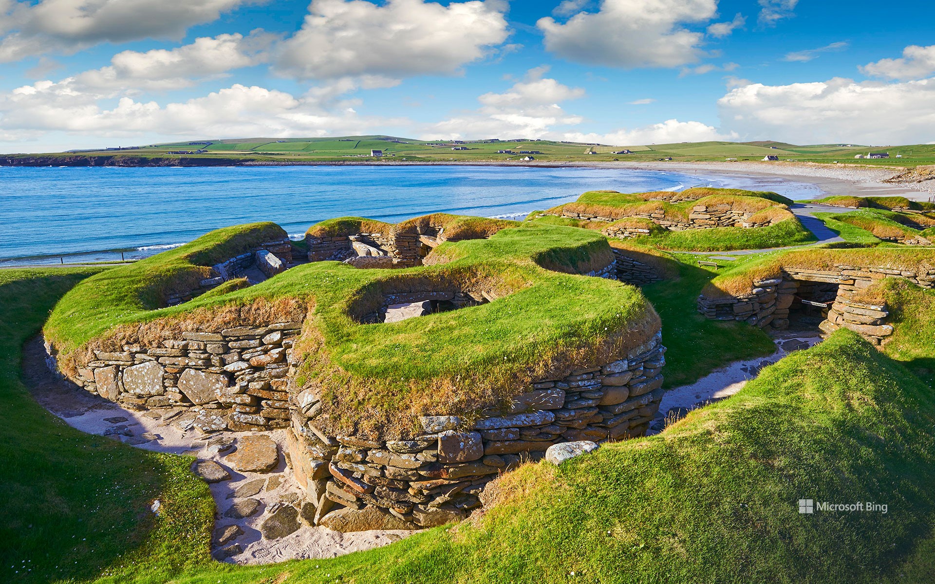
斯卡拉布雷的新石器时代遗迹, 奥克尼群岛, 苏格兰 The neolithic settlement of Skara Brae, Orkney, Scotland (© Paul Williams - FunkyStock/Getty Images)
挖掘过去 Digging into the past
斯卡拉布雷
说起节日,考古可能不是人们首先想到的,但7月13日至28日举办的英国考古节将改变这一现状。自1990年创办以来,英国考古节已发展成一个为期两周的活动。从9月到7月的巧妙转变让考古迷们更容易探索夏季挖掘工作和各种文物奇迹。今年的主题是“考古与社区”,邀请英国各地的考古爱好者参加由遗产组织、地方协会和热心人士组织的一系列现场和虚拟活动。想象一下,站在苏格兰奥克尼群岛斯卡拉布雷古老的石屋中(如图所示),这是5000多年前,新石器时代的定居者繁衍生息的地方。这座史前奇迹因1850年的一场暴风雨而暴露,因其惊人的保存能力而被誉为“苏格兰庞贝古城”,它比巨石阵甚至大金字塔还要古老。因此,拿起你的小铲子,准备深入挖掘传奇的历史故事吧。谁知道你会发现什么呢?
Skara Brae, Orkney, Scotland
Imagine standing amid Skara Brae's ancient stone houses on Scotland's Orkney archipelago, pictured here, where Neolithic settlers thrived over 5,000 years ago. Village life ended sometime around 2500 BCE and for centuries the homes were buried beneath sand and earth, until they were uncovered by a storm in 1850. This prehistoric marvel is sometimes dubbed the 'Scottish Pompeii' due to its astonishing preservation—older than Stonehenge and the Great Pyramids. It's part of the wider Heart of Neolithic Orkney UNESCO World Heritage Site, alongside other prehistoric survivors including the huge Ring of Brodgar stone circle. If digging up the past appeals, the Festival of British Archaeology is running July 13-28. So, grab your trowel and get ready to dig deep into the incredible, storied past. Who knows what you'll discover!
立石公园,神奈川县,日本 Tateishi Park, Kanagawa Prefecture, Japan (© blew_s/Shutterstock)
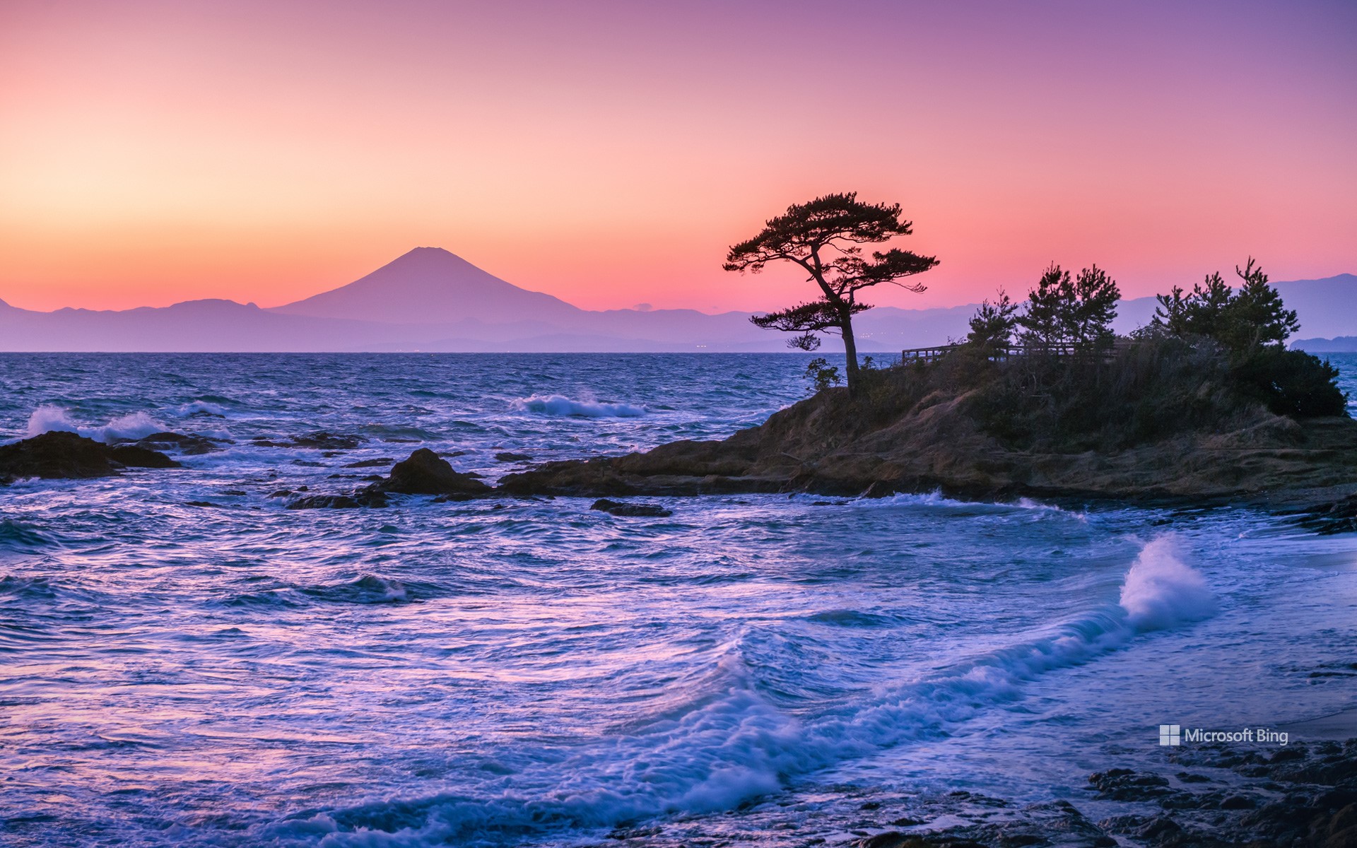
立石公园,神奈川县,日本 Tateishi Park, Kanagawa Prefecture, Japan (© blew_s/Shutterstock)
宁静惬意的海滨风光 Seas the day
立石公园,日本
今天的图片带我们来到横须贺市的立石公园,在这里可以欣赏相模湾和富士山的壮丽景色,是庆祝海洋日的理想场所。立石公园是一个风景优美的海滨公园,历史上曾激发过艺术家和摄影师的创作灵感。
Marine Day, Japan
Today, we're floating across the waves, following the ocean currents to Japan. Marine Day—海の日, Umi no Hi in Japanese—is celebrated on the third Monday in July. Japan has 14,125 islands and has over 18,400 miles of coastline, so it's no wonder the sea plays such a key role in its culture. It provides much of the country's food and is vital for trading and communicating with other nations.
One Marine Day tradition is to give thanks by throwing mud balls into the water; these balls are packed with microorganisms that help to purify the sea. Today's image takes us to Tateishi Park on Japan's largest island, Honshu. This scenic spot has stunning views of Sagami Bay and Mount Fuji, making it the perfect place to celebrate Japan's coastal waters.
卡帕多西亚的童话烟囱和窑洞,土耳其 Fairy chimneys and cave dwellings in Cappadocia, Türkiye (© Storm Is Me/Shutterstock)
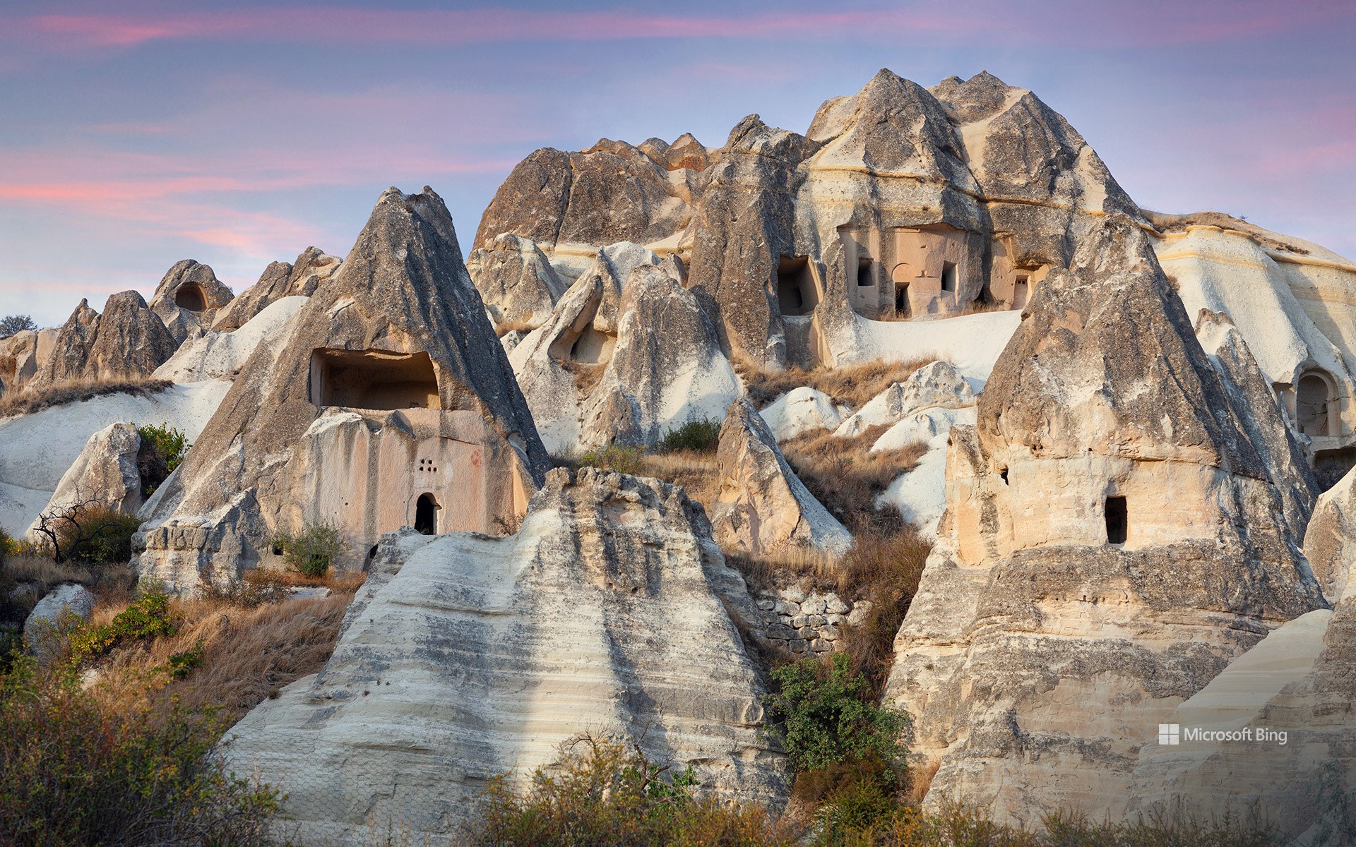
卡帕多西亚的童话烟囱和窑洞,土耳其 Fairy chimneys and cave dwellings in Cappadocia, Türkiye (© Storm Is Me/Shutterstock)
快看,这是沉积岩哦 Sedimentary, my dear
国际岩石日
今天是国际岩石日,我们要讨论的是花岗岩、石灰石和板岩。岩石有三种类型:火成岩是由凝固的岩浆和熔岩形成的;沉积岩是由沉积颗粒(如沙子)层层堆积而成;变质岩是其他岩石受热和受压后形成的。
今天的图片带我们来到位于土耳其中部的卡帕多西亚,这里有一种被称为“精灵烟囱”的石质结构。这些锥形石柱由凝灰岩制成,而凝灰岩正是火山灰和碎屑堆积而成的沉积岩。该地区的古代居民在岩石侧面雕刻了房屋和教堂。此外,该地区的地下城也很有名,这些地下城是从凝灰岩中凿出来的,为人们提供了一个安全的庇护场所。这只是历史上人类对岩石的众多用途之一。
International Rock Day
Are you ready to make some noise? Wait, not that sort of rock. Today, we're all about granite, limestone, and slate. There are three types of rock: igneous rocks formed from magma and lava; sedimentary rocks made from a mixture of particles like sand and mud; and metamorphic rocks that are the result of heat and pressure on other kinds of rock.
Today's image takes us to the 'fairy chimneys' of Cappadocia in central Türkiye. These cone-shaped pillars are made of tuff, a sedimentary rock formed from volcanic ash and debris. In the sides of the rocks, ancient residents carved homes and churches. The area is also famous for its underground cities, which were cut out of the tuff to provide shelter and safety. This is just one of the many uses for rocks that humans have come up with throughout history.
雷尼尔山国家公园的野花,华盛顿州,美国 Wildflowers in Mount Rainier National Park, Washington (© RomanKhomlyak/Getty Images)
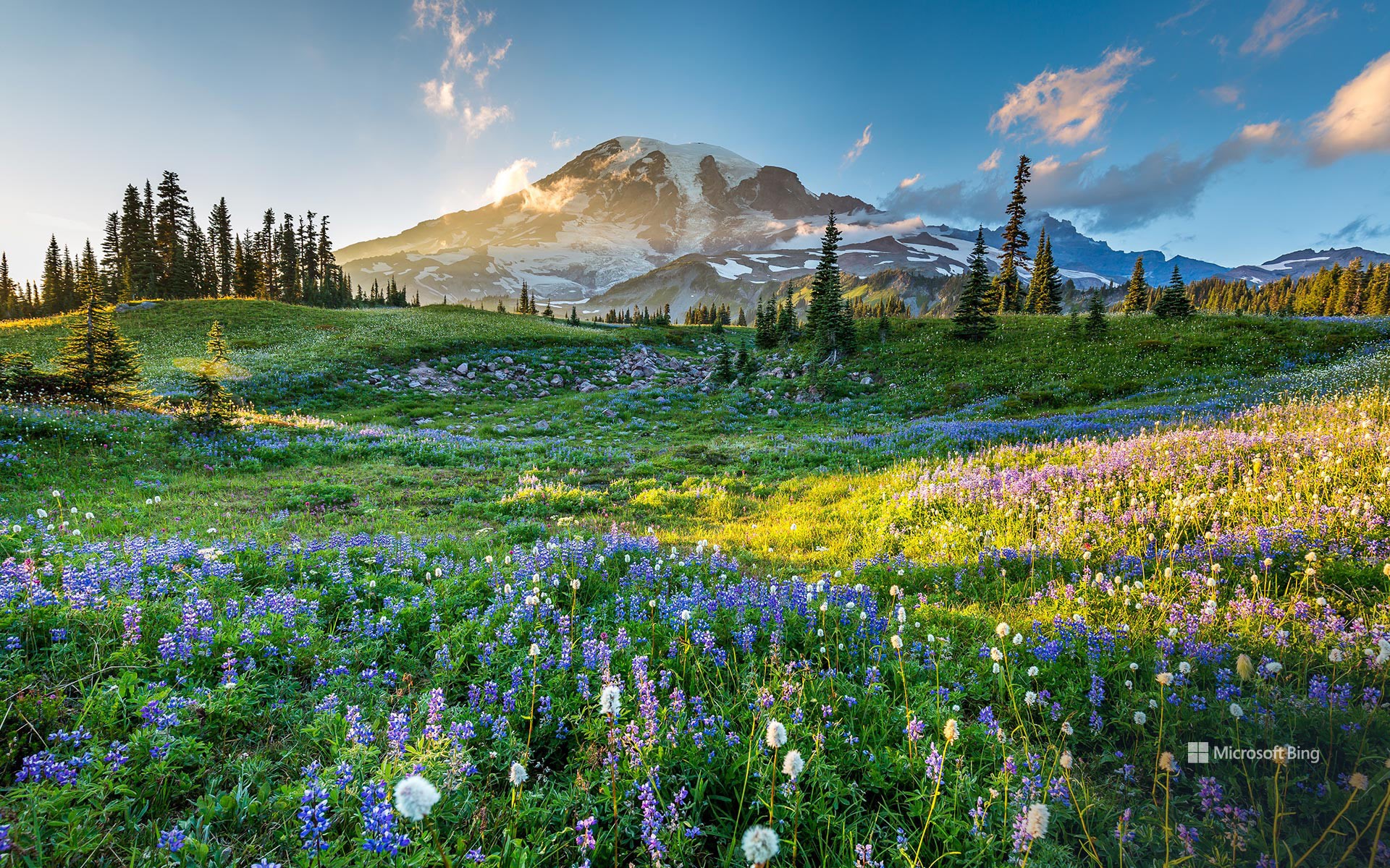
雷尼尔山国家公园的野花,华盛顿州,美国 Wildflowers in Mount Rainier National Park, Washington (© RomanKhomlyak/Getty Images)
风雨无阻 Come Rainier or shine
雷尼尔山国家公园
在雷尼尔山冰川的注视下,成片的野花绽放出勃勃的生机。每年夏天,这座山周围的草地上都会盛开着色彩鲜艳的亚高山花朵:紫色的紫菀、粉色的珊瑚兰和黄色的虎皮花只是这里的部分植物。雷尼尔山又名塔霍马山,海拔超14400英尺,是华盛顿州最高的山峰。它被36平方英里的冰川和永久雪原覆盖,是美国48个州中冰川覆盖率最高的山峰。
雷尼尔山国家公园占地23.6万英亩,包括高山、瀑布、草地和原始森林。除了各种植物外,公园里还生活着美洲狮、海狸、白头鹰和游隼等各种生物。雷尼尔山国家公园是一个颇受欢迎的登山目的地,每年约有10,000人试图攀登这座山。游客还可以沿着各种各样的小径徒步旅行。7月和8月是雷尼尔山最阳光明媚的时候,是游览雷尼尔山的最佳时间。
Mount Rainier National Park
In the shadow of Mount Rainier, a carpet of wildflowers bursts into life. Every summer, the meadows around this mountain are colored with vivid shades of blooming subalpine flowers: purple asters, pink coralroot, and yellow tiger lilies, and more. Also known as Tahoma, at over 14,400 feet, Mount Rainier is the tallest mountain in the state of Washington. It is covered by 36 square miles of glaciers and permanent snowfields, the highest glacier ice cover of any mountain in the lower 48 states.
Mount Rainier National Park encompasses mountains, waterfalls, meadows, and old-growth forests and teems with life, from cougars and beavers to bald eagles and peregrine falcons. It is also a popular climbing destination, with some 10,000 people attempting to scale the mountain every year while others enjoy hiking along its trails. It's never sunnier in Rainier than in July and August, making summer the perfect time to visit.
甘吉,西西里岛,意大利 Gangi, Sicily, Italy (© Andrea Caruso/Amazing Aerial Agency)

甘吉,西西里岛,意大利 Gangi, Sicily, Italy (© Andrea Caruso/Amazing Aerial Agency)
你是81亿人口中的一员 You are one in 8.1 billion
世界人口日
1987年,世界人口达到50亿大关,这是一个意义非凡的里程碑,由此产生了一个国际性的纪念日:五十亿人口日。伴随着急速增长的人口,一些相关的问题也亟待解决。因此,在1989年,联合国设立了世界人口日。如今,这不仅仅是一个纪念日,更是一个行动的呼吁。人口过剩导致地球的资源越来越少,敦促人类去正视那些紧迫的问题,如计划生育、垃圾和污染的增加、基础设施的缺失等等。当大都市里的人在和“过度拥挤”做斗争时,小地方的人口却在不断流失,导致人口分布失衡。一个典型的案例就是意大利西西里岛的甘吉镇,即今天图片展示的地方。在20世纪50年代,这个村庄大约有1.6万居民,如今,其人口只有6000多一点。为了振兴小镇,吸引人们的关注,甘吉镇将废弃的房屋赠送给那些有需要且愿意修复房屋的人。
World Population Day
In 1987, sometime around July 11, the world population reached the 5-billion mark. The United Nations recognized the need to address issues like family planning, infrastructure, waste, and pollution and established World Population Day in 1989. It is estimated that we hit 8 billion people in November 2022 and the UN expects the world to reach 9.7 billion people in 2050. But not everywhere faces the same challenges. While some areas struggle with overcrowding, others grapple with decreasing populations. The Italian town of Gangi, Sicily, seen in today's image, had about 16,000 residents in the 1950s. Today, it is home to little more than 6,000. Keen on revitalization, Gangi attracts new residents by giving away abandoned houses, on the condition that the properties are then restored.
阿根廷拉里奥哈省塔兰帕亚国家公园 Talampaya National Park, La Rioja province, Argentina (© Gonzalo Azumendi/Getty Images)
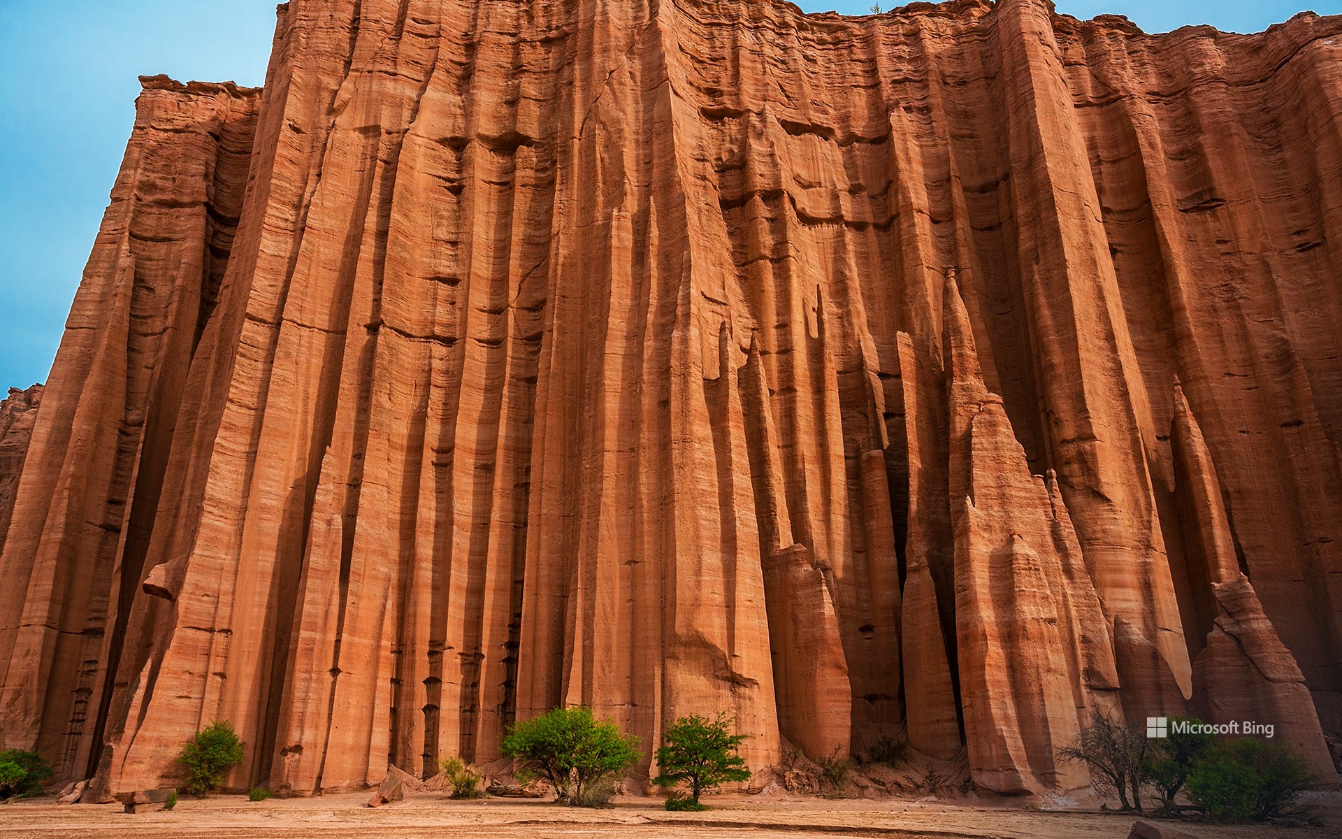
阿根廷拉里奥哈省塔兰帕亚国家公园 Talampaya National Park, La Rioja province, Argentina (© Gonzalo Azumendi/Getty Images)
千仞高壁 Feeling 'sedimental'?
阿根廷塔兰帕亚国家公园
今天是阿根廷独立日,塔兰帕亚国家公园邀请我们走进这个国家古老的心脏地带。它坐落在拉里奥哈省,占地830平方英里,是联合国教科文组织认定的世界遗产。公园里,红色的岩层高耸入云,海拔高达469英尺,上面还刻有史前生命的秘密。这里发现过迄今为止最古老的恐龙化石,还有神秘的岩画展示出古老的艺术。公园的悬崖和洞穴上有西恩纳加人、迪亚吉塔人和其他土著文明创造的岩画,他们曾在公元3世纪至9世纪居住在该地区。此外,当地的植物(如耐旱的灌木和仙人掌)和动物则展现了大自然的美丽。原驼、野兔和狐狸在土地上自由漫步,秃鹰、白喉沙雀和沙色窜鸟在天空翩翩起舞。野性的大自然在召唤你,邀请你到塔兰帕亚国家公园探险。
Talampaya National Park, Argentina
As Argentina celebrates Independence Day, Talampaya National Park invites us to venture into the country's ancient heart. Here, towering red rock formations reach skyward, and cliffs and caves feature petroglyphs created by the Ciénaga, Diaguita, and other Indigenous cultures more than 1,000 years ago. This 830-square-mile park in La Rioja province is also home to some of the oldest dinosaur remains ever found. Moreover, nature's beauty is shown in the local flora, like xeric shrubs and cactus, and fauna. Guanacos, hares, and foxes roam free, while condors, white-throated cacholotes, and sandy gallitos grace the skies above this UNESCO World Heritage Site.
越南安沛省木仓寨的水稻梯田 Rice terraces of Mù Cang Chải, Yên Bái province, Vietnam (© Kiatanan Sugsompian/Getty Images)
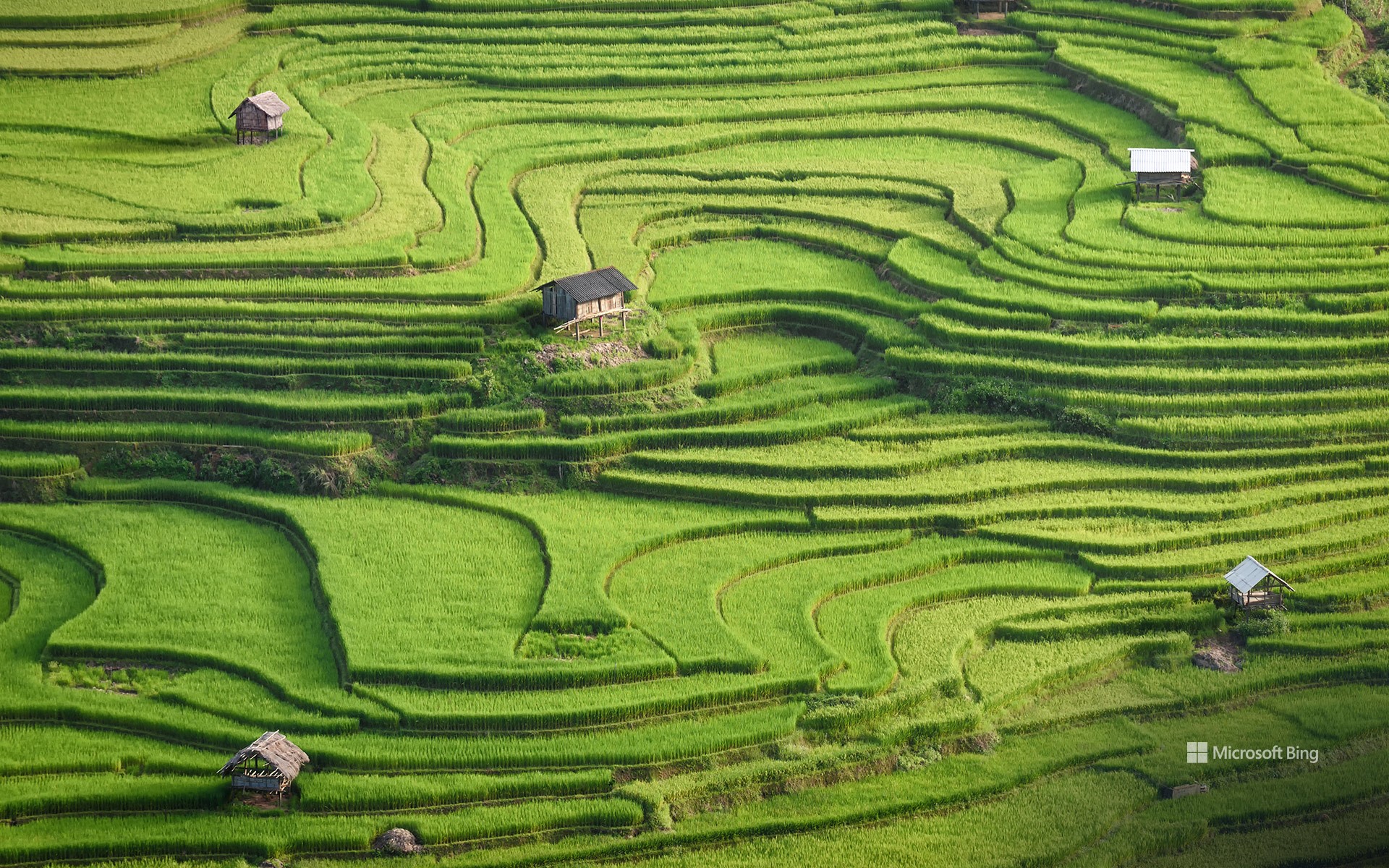
越南安沛省木仓寨的水稻梯田 Rice terraces of Mù Cang Chải, Yên Bái province, Vietnam (© Kiatanan Sugsompian/Getty Images)
阳光下的梯田 Rice and shine
越南安沛省木仓寨的水稻梯田
在越南安沛省连绵起伏的群山之中,木仓寨地区的水稻梯田是农耕文化的精华所在。苗族是一个以其丰富的文化和充满活力的服装而闻名的少数民族,世世代代精心雕刻着这些层叠的山丘。19世纪,苗族从中国迁徙到越南北部。他们擅长轮作(一种农业系统),在这种农业系统中,土地被暂时耕种,种植的作物包括小米、水稻、玉米和大麦,随后再恢复其自然植被。
木仓寨拥有约5,500英亩的梯田。正值收获季节,游客还可以在当地市场品尝越南美食和购买丰富多彩的纪念品,或登上罗盘秦村的山顶欣赏该地区迷人的地形地貌。
Rice terraces of Mù Cang Chải, Yên Bái province, Vietnam
Amid the rolling hills of northern Vietnam's Yên Bái province, the rice terraces of Mù Cang Chải district are a mosaic of agricultural excellence. The Hmong people, an ethnic minority who migrated here from China in the 19th century, have meticulously carved these cascading hills for generations. Mù Cang Chải boasts approximately 5,500 acres of terraced rice fields, which flood with water between September and October, reflecting the surrounding mountains and sky. Visitors can also indulge in Vietnamese dishes and colorful souvenirs at the local markets or climb to the peak of La Pan Tan village to enjoy views of this stunning landscape.
从康威河眺望康威城堡,威尔士 Conwy Castle looking over the River Conwy, Wales (© David Chapman/Alamy Stock Photo)
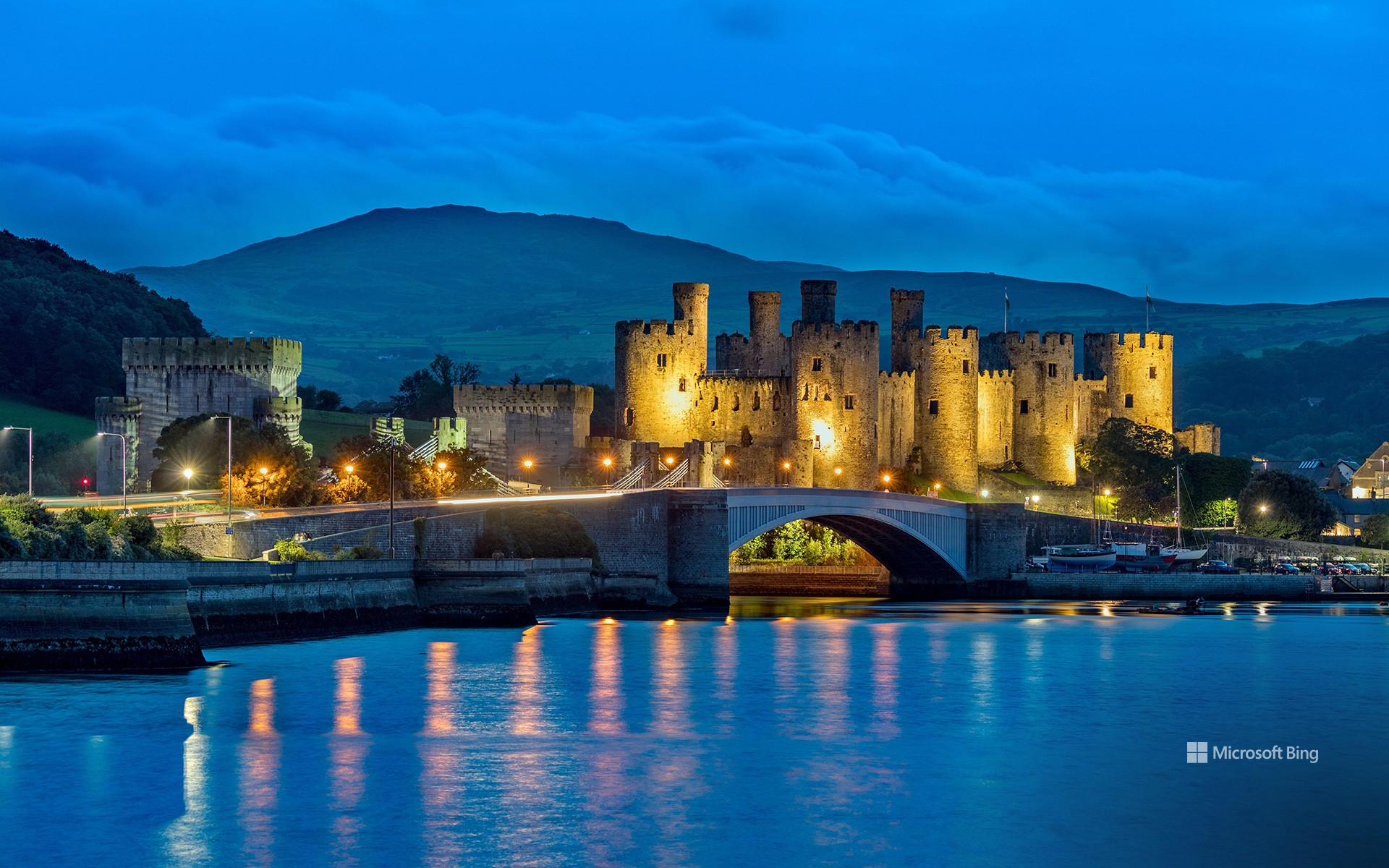
从康威河眺望康威城堡,威尔士 Conwy Castle looking over the River Conwy, Wales (© David Chapman/Alamy Stock Photo)
让我们扬帆起航! Rock the boat
康威河,威尔士
在康威河节上穿越时空,扬帆起航!这项活动于1993年首次在康威城堡下的康威码头举行,体现了威尔士航海传统的精髓。在码头日这一免费露天活动中,划船爱好者们可以尽情体验传统船只和现代船只进行友谊赛的乐趣。人们聚集在一起观看航海游行,品尝当地美食,如用茶、干果和香料调味的茶面包,以及由可食用海藻组成的海藻面包。
康威城堡建于1283年至1287年,由国王爱德华一世在征服威尔士时建造。这座城堡由被誉为欧洲中世纪最伟大的建筑师之一的圣乔治·詹姆斯设计,被联合国教科文组织列为世界文化遗产。下方的康威河全长34英里,其名称来源于威尔士语中的“cyn”(首领)和“gwy”(水)。康威城堡和这条河是对威尔士丰富而动荡的过去的永恒致敬。
Conwy, Wales
Welcome to walled town of Conwy, on the north coast of Wales, UK, and its spectacular medieval castle. Conwy Castle was built between 1283 and 1287 on the orders of English King Edward I, during his conquest of Wales. Designed by James of St. George, one of the greatest architects of the time, the castle is a UNESCO World Heritage Site which draws visitors from across the world.
The castle towers over the River Conwy, which this weekend hosts the annual Conwy River Festival, including boat races and other water-based events. Spectators gather to witness the nautical parade and enjoy local delicacies like bara brith, a tea bread flavored with tea, dried fruits, and spices, and laverbread made from edible seaweed. The name Conwy is from the Welsh words 'cyn' (chief) and 'gwy' (water) and the town sits at the mouth of the river. It is also the gateway to Eryri National Park, home to Wales's highest mountain Yr Wyddfa, or Snowdon in English.
丹翠雨林的诺亚海滩,昆士兰州,澳大利亚 Noah Beach in Daintree Rainforest, Queensland, Australia (© bjeayes/Getty Images)
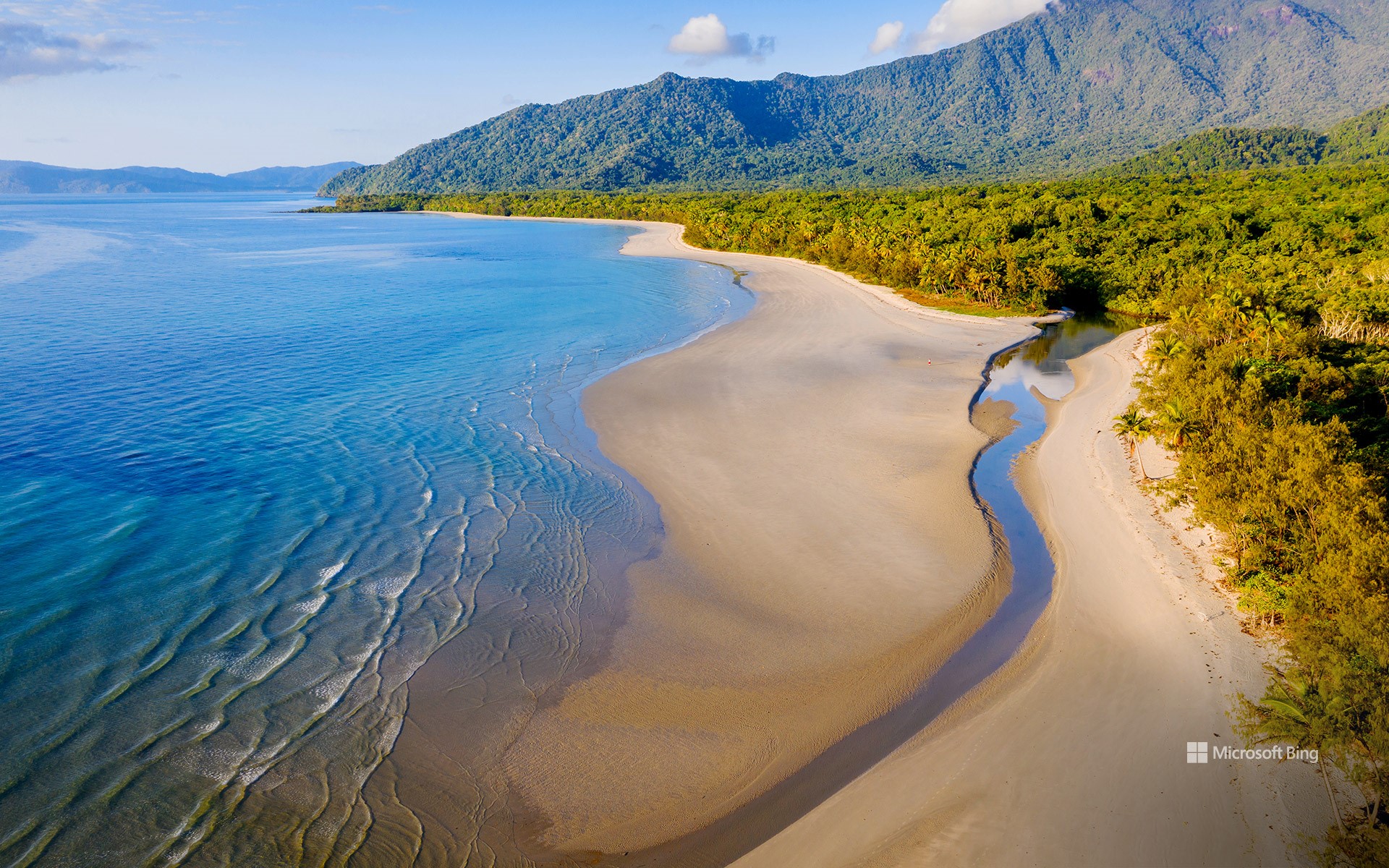
丹翠雨林的诺亚海滩,昆士兰州,澳大利亚 Noah Beach in Daintree Rainforest, Queensland, Australia (© bjeayes/Getty Images)
邂逅美丽海岸线 A coastal encounter
丹翠雨林的诺亚海滩,昆士兰州,澳大利亚
欢迎来到这片绿色与无尽蔚蓝交汇的土地!诺亚海滩位于澳大利亚昆士兰州北海岸,是丹翠雨林茂密枝叶环绕下的一片净土。这片海滩毗邻珊瑚海,作为两种截然不同的生态系统,热带雨林与蔚蓝海水却能完美融合。丹翠国家公园这个僻静区域拥有一片柔软的金色沙滩,国家公园内有参天大树、茂盛的蕨类植物以及该地区特有的其他植物物种。这片热带雨林是澳大利亚同类雨林中面积最大的,据说已经存在了1.8亿年,是世界上最古老的热带雨林。这里有一个保护区,是稀有和濒危物种的家园,比如双垂鹤鸵和班尼特树袋鼠,在地球上其他地方找不到。无论是在森林树冠下探险,还是享受大海的涛声,这个地方都能满足你!
Daintree Rainforest and Noah Beach, Queensland, Australia
Welcome to a land where greenery meets the endless blue. On the North Queensland coast of Australia, encircled by dense foliage, is Noah Beach. A fascinating blend of two ecosystems, here the Daintree Rainforest seamlessly meets the azure waters of the Coral Sea. This secluded area of the Daintree National Park boasts a stretch of soft, golden sands while elsewhere there are towering trees, lush ferns, and other plant species unique to the area. The Daintree is believed to have been around for up to 180 million years, making it the oldest tropical rainforest in the world. It is also Australia's largest uninterrupted stretch of tropical rainforest and home to rare species like Bennett's tree-kangaroo, found nowhere else on our planet.