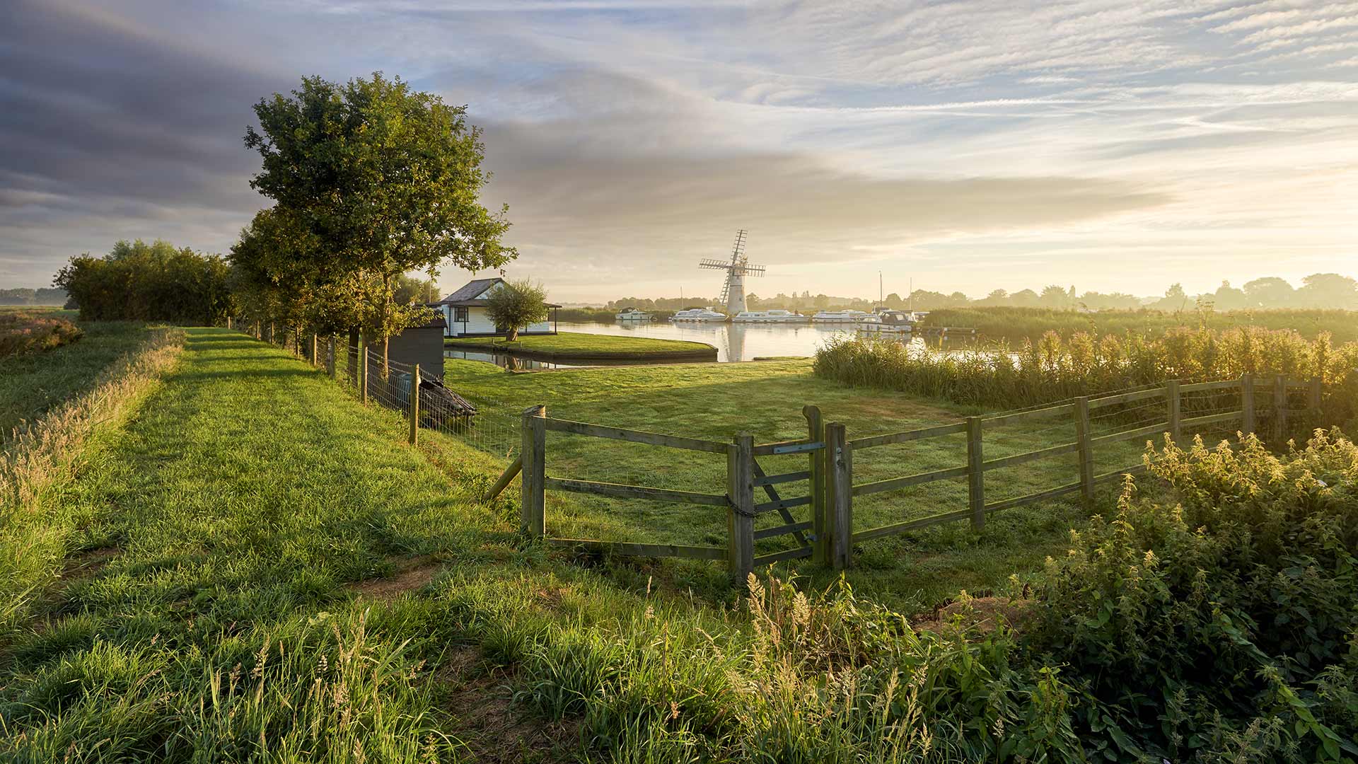
达拉斯分水岭, 科罗拉多州西南部 Dallas Divide in southwest Colorado (© Ronda Kimbrow/Shutterstock)
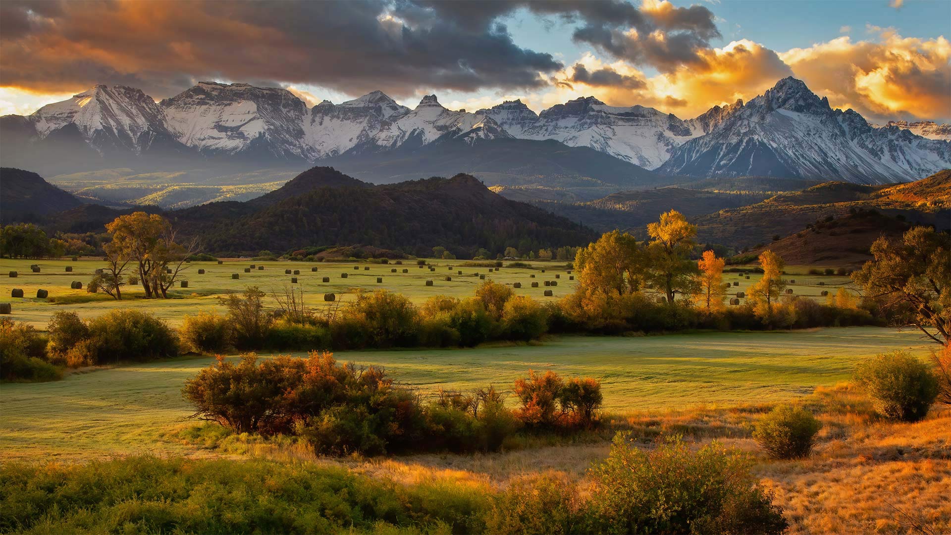
达拉斯分水岭, 科罗拉多州西南部 Dallas Divide in southwest Colorado (© Ronda Kimbrow/Shutterstock)
A valley view at 9,000 feet
This is the Dallas Divide, but we're hundreds of miles from (and 8,500 feet above) North Texas. This saddle amid the southwestern Colorado Rockies cuts a swath just north of the San Juan Mountains. Nestled in those peaks you'll find Telluride, Silverton, and other former mining towns that got a boost from the Rio Grande Southern Railroad when it came to the Dallas Divide in 1890. Nowadays the divide hosts US Highway 62, a less-traveled byway for most Colorado travelers—but worth the detour if you're keen on a sweeping valley vista.
海拔9000英尺的山谷景色
这是达拉斯分水岭,但我们离北德克萨斯州数百英里(海拔8500英尺)。这座位于科罗拉多州落基山脉西南部的马鞍山在圣胡安山脉以北划出一条狭长的地带。坐落在这些山峰上,你会发现泰勒里德、西尔弗顿和其他以前的矿业城镇,这些城镇在1890年到达达拉斯分水岭时受到了格兰德南部铁路的推动。如今,这条分水岭拥有美国62号公路,对于大多数科罗拉多州的旅行者来说,这是一条人迹罕至的小道,但如果你想看到一片广阔的山谷景色,那么绕道而行是值得的。
中国江苏省南通市幼儿园学生在画布上绘画的鸟瞰图 Aerial view of kindergarteners drawing on a canvas in Nantong, in the Jiangsu province of China (© Xu Hui/VCG via Getty Images)

中国江苏省南通市幼儿园学生在画布上绘画的鸟瞰图 Aerial view of kindergarteners drawing on a canvas in Nantong, in the Jiangsu province of China (© Xu Hui/VCG via Getty Images)
A day to celebrate teachers
Today is World Teachers' Day. The UN created this day back in 1994 to draw attention to the vital role that teachers play in providing kids like these a quality education. The observation also highlights the obstacles that teachers face every day, particularly in challenging times like these.
Despite the massive disruptions to classrooms around the world because of the coronavirus pandemic, teachers everywhere have continued to work hard every day to encourage young people to learn and grow, and to think about the world around us. So, when these kindergartners are finished drawing, our hope is that they let their teachers know how appreciated they are! And we hope you can do something special for the teachers in your lives today, too.
庆祝教师节
今天是世界教师节。联合国早在1994年就设立了这一天,以提请人们注意教师在为这些孩子提供优质教育方面所起的重要作用。这项观察还突出了教师每天面临的障碍,特别是在这样一个充满挑战的时代。
尽管冠状病毒大流行对世界各地的教室造成了巨大的破坏,但各地的教师每天都在继续努力工作,鼓励年轻人学习和成长,并思考我们周围的世界。所以,当这些幼儿园的孩子们完成绘画时,我们希望他们能让他们的老师知道他们是多么的感激他们!我们也希望你们能在今天的生活中为老师们做些特别的事情。
爱德华王子岛的森林和树冠,加拿大 (© OliverChilds/Getty Images)
绚烂的仙女座星系 Andromeda galaxy (© NASA/JPL-Caltech)

绚烂的仙女座星系 Andromeda galaxy (© NASA/JPL-Caltech)
Hey neighbor, it's World Space Week!
Space is a big, lonely place, so it's nice to know we have neighbors. The pictured Andromeda Galaxy is our Milky Way's closest—right next door at 2.5 million light years away. Our cordial relationship with Andromeda goes back about 10 billion years to when both galaxies were still forming. But trouble is brewing: Andromeda is on a collision course with the Milky Way, due for impact in 4 billion years. This neighborhood's about to get rough…
Sometime in the 4 billion years we have left (preferably this World Space Week, October 4-10), we encourage you to turn your attention to the stars, whether on a trip to the countryside, the planetarium, or your backyard. World Space Week's 2021 theme is 'Women in Space'—and it's also the theme of today's quiz. How much do you know about the final frontier's famous females?
嘿,邻居,这是世界太空周!
太空是一个又大又孤独的地方,所以知道我们有邻居很好。照片中的仙女座星系是我们银河系最近的邻居,距离我们250万光年远。我们与仙女座星系的亲密关系可以追溯到大约100亿年前,当时两个星系都还在形成。但麻烦正在酝酿:仙女座正在与银河系发生碰撞,预计将在40亿年后发生碰撞。这附近就要闹了…
在我们剩下的40亿年中的某个时候(最好是10月4日至10日的世界空间周),我们鼓励你将注意力转向星星,无论是去乡村、天文馆还是你的后院。2021年世界空间周的主题是“太空中的女性”——这也是今天测验的主题。你对《最后的边疆》的著名女性了解多少?
古罗马斗兽场,西班牙桑蒂蓬塞镇的罗马古城遗迹 The Roman amphitheater of Itálica near Santiponce, Spain (© Amazing Aerial Agency/Offset by Shutterstock)
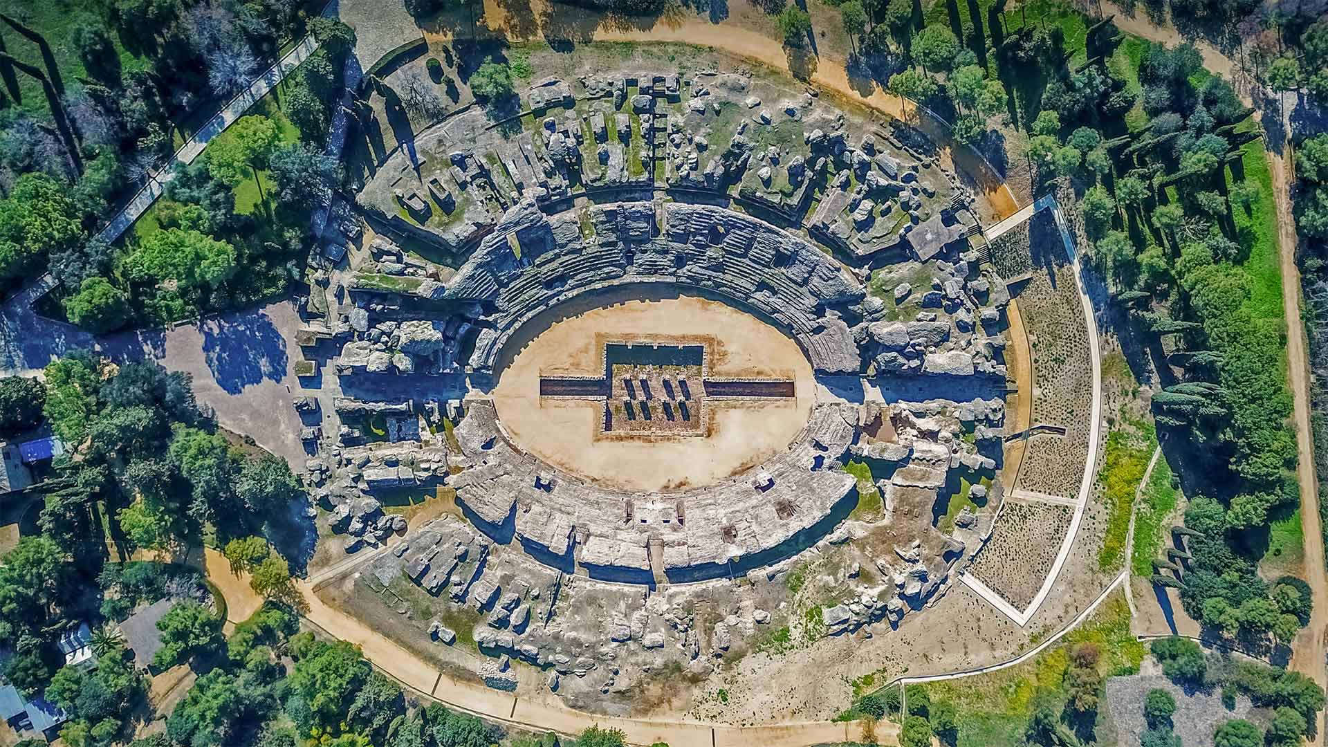
古罗马斗兽场,西班牙桑蒂蓬塞镇的罗马古城遗迹 The Roman amphitheater of Itálica near Santiponce, Spain (© Amazing Aerial Agency/Offset by Shutterstock)
Birthplace of Roman emperors
Just a few miles north of Seville, Spain, you'll find the ancient ruins of Itálica, the first Roman settlement in what is now Spain and the first Roman city outside of Italy. The city was founded in 206 BCE by the Roman general Scipio as a place to house veterans from the Second Punic Wars. Itálica was also the birthplace of at least two Roman emperors.
For centuries, Itálica was an elaborate urban center with a temple, a theater, public baths, gorgeous homes for the monied elite, and a population of about 8,000 residents. This aerial view is of the city's famous amphitheater, where thousands of spectators came from near and far to watch the bloody gladiator fights, hunts of wild beasts, and public executions. The 'entertainment' here was not for the faint of heart.
Today, the modern Spanish city of Santiponce has grown up around—and even atop—the ruins. Tourists come here to walk the preserved Roman streets, admire the mosaics, and imagine the scenes of life and death that happened in this amphitheater nearly 2,000 years ago.
罗马皇帝的出生地
在西班牙塞维利亚以北几英里的地方,你会发现古老的Itálica遗址,这是现在西班牙的第一个罗马定居点,也是意大利以外的第一个罗马城市。这座城市由罗马将军西皮奥于公元前206年建立,是第二次布匿战争退伍军人的住所。伊塔利卡也是至少两位罗马皇帝的出生地。
几个世纪以来,伊塔利卡一直是一个精心设计的城市中心,有寺庙、剧院、公共浴场、摩尼德精英的华丽家园,人口约8000人。这张鸟瞰图是该市著名的圆形剧场,数千名观众从四面八方赶来观看血腥的角斗士搏斗、野兽狩猎和公开处决。这里的“娱乐”不是为胆小鬼准备的。
今天,西班牙现代城市圣蒂蓬斯在废墟周围甚至在废墟上发展起来。游客们来到这里,是为了漫步保存完好的罗马街道,欣赏马赛克,想象2000年前发生在这个圆形剧场里的生死场景。
北坡自治市镇的伊维沙克河,阿拉斯加州 The Ivishak River in the North Slope Borough, Alaska (© Don Paulson/Danita Delimont)
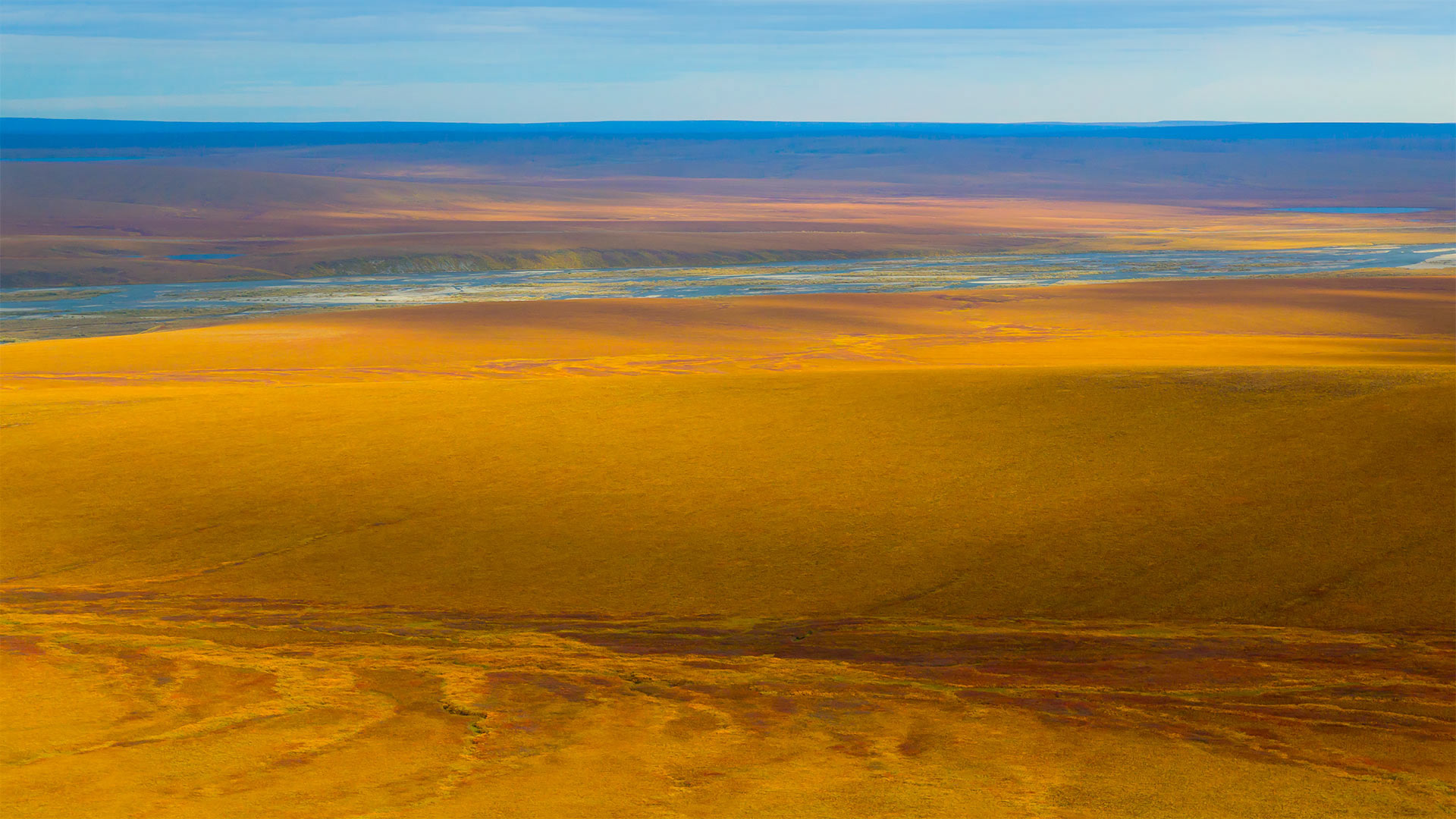
北坡自治市镇的伊维沙克河,阿拉斯加州 The Ivishak River in the North Slope Borough, Alaska (© Don Paulson/Danita Delimont)
A river on the tundra
This mesmerizing expanse captures a small stretch of the 95-mile-long Ivishak River in northern Alaska. The Ivishak flows in the Philip Smith Mountains and the foothills of the Arctic National Wildlife Refuge. The entire run of the river is in a region called the North Slope Borough, Alaska's northernmost borough (Alaska is divided into boroughs, not counties). Look at the magnificent colors and textures this photo captures—it's a view that's preserved and protected by the Wild and Scenic Rivers Act.
The act was signed into law on October 2, 1968. The main purpose of the bill was to identify 'certain selected rivers of the [US] which, with their immediate environments, possess outstandingly remarkable scenic, recreational, geologic, fish and wildlife, historic, cultural or other similar values, shall be preserved in free-flowing condition…' Sure, we could have summed it up for you, but instead quoted the exact text from the Wild and Scenic Rivers Act to show how all-encompassing the intent of the protection is.
冻土带上的河流
这片迷人的广袤土地捕捉到了阿拉斯加北部95英里长的伊维沙克河的一小段。Ivishak河流经菲利普史密斯山脉和北极国家野生动物保护区的山麓。整条河流都在一个叫做北坡区(North Slope Bourough)的区域内,这是阿拉斯加最北端的一个自治区(阿拉斯加分为自治区,而不是县)。看看这张照片捕捉到的壮丽色彩和纹理,这是一幅受《野生和风景河流法》保护的风景画。
该法案于1968年10月2日签署成为法律。该法案的主要目的是确定“某些选定的[美国]河流及其周围环境,具有显著的风景、娱乐、地质、鱼类和野生动物、历史、文化或其他类似价值,应在自由流动的条件下予以保护……”当然,我们可以为您总结一下,而是引用了《野生和风景河流法》的确切文本,以表明保护的意图是多么全面。
中国【 国庆快乐 】( © GettyImages )
加利福尼亚州的一艘集装箱船,美国 Container ship in San Pedro, California (© Cameron Venti/Getty Images)

加利福尼亚州的一艘集装箱船,美国 Container ship in San Pedro, California (© Cameron Venti/Getty Images)
Global commerce in motion
The COVID-19 pandemic has been rough sailing for everyone, and especially so for seafarers on shipping vessels. As if moving more than 80% of the world's goods wasn't a big mission already, the pandemic brought about urgent needs in every corner of the globe, while also forcing travel restrictions that made shipping more complicated. Hundreds of thousands of sailors and other shipping personnel have found themselves stuck on ships much longer than planned as virus precautions impede crew changes.
So this year's World Maritime Day—always observed on the last Thursday in September—is a good day to salute the workers who help keep global commerce in motion. World Maritime Day was established by the UN to improve shipping efficiency through international standards and cooperation—on safe crew-change procedures during a pandemic, for example. Maritime Day also aims to put seafarers and their sacrifices in the spotlight. Thanks, sailors!
全球商业活动
新冠病毒-19大流行对每个人来说都是一次艰难的航行,尤其是对船舶上的海员来说。似乎运输世界上80%以上的货物还不是一项重大任务,这场大流行在全球每个角落都带来了迫切的需求,同时也迫使旅行限制,使运输更加复杂。由于病毒预防措施阻碍了船员的更换,数十万水手和其他船务人员发现自己被困在船上的时间比计划的要长得多。
因此,今年的世界海事日总是在9月的最后一个星期四举行,这是一个向帮助保持全球商业运转的工人致敬的好日子。例如,世界海事日是由联合国设立的,目的是通过国际标准和在大流行期间安全船员更换程序方面的合作来提高航运效率。海事日还旨在让海员及其牺牲成为人们关注的焦点。谢谢,水手们!
日本富士山 Mount Fuji in Japan (© The Asahi Shimbun/Getty Images)
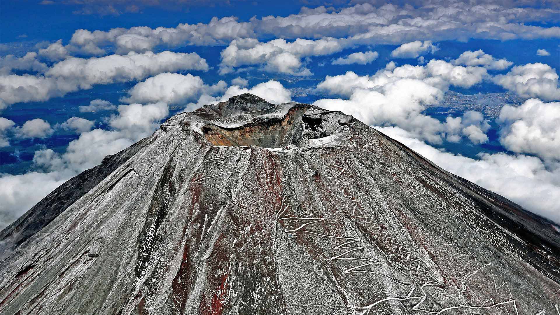
日本富士山 Mount Fuji in Japan (© The Asahi Shimbun/Getty Images)
The snows of Fuji
This shot of Mount Fuji's symmetrical cone was taken in September 2020, showcasing the first snow of the season. The dusting proved short-lived, melting off in just a couple of days. And snow wouldn't come again until the end of December—raising new concerns about decades of rising temperatures on Fuji's slopes.
As we tiptoe toward another winter, we're cheering on Mount Fuji for a snowier season. It just isn't the same without that iconic white top!
富士的雪
这张富士山对称圆锥体的照片拍摄于2020年9月,展示了该季节的第一场雪。灰尘般的雪是短暂的,在几天内就融化了。直到12月底才会下雪,这引起了人们对富士山坡数十年来气温不断上升的新担忧。
当我们蹑手蹑脚地走向另一个冬天时,我们正在富士山上为一个雪季欢呼。没有标志性的白色上衣就不一样了!


