奥林匹克国家公园石狮海滩,华盛顿州,美国 Shi Shi Beach in Olympic National Park, Washington (© T.M. Schultze/TANDEM Stills + Motion)
奥林匹克国家公园石狮海滩,华盛顿州,美国 Shi Shi Beach in Olympic National Park, Washington (© T.M. Schultze/TANDEM Stills + Motion)
日落的阴影 Shades of sunset
石狮海滩,奥林匹克国家公园,华盛顿州
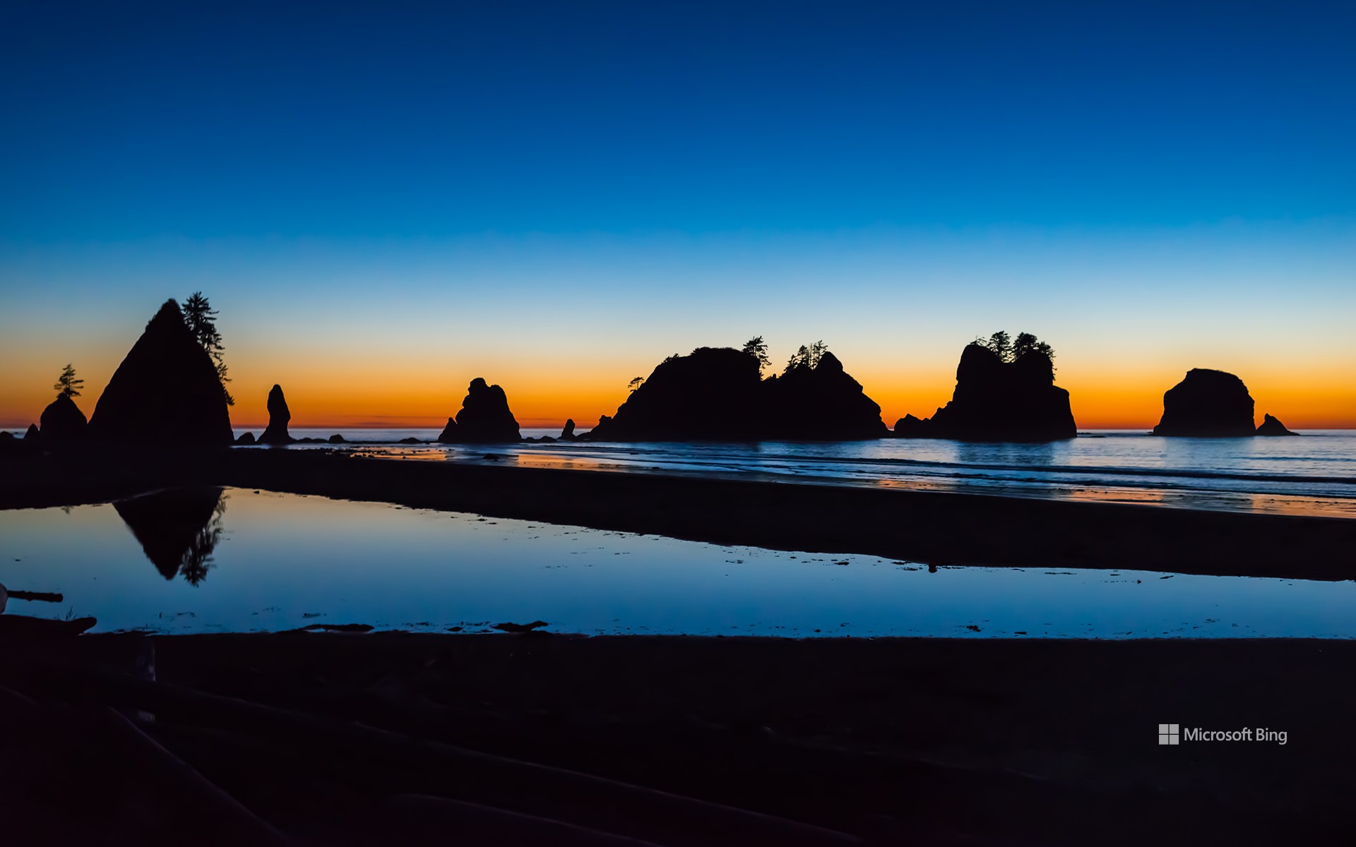
奥林匹克国家公园始建于1938年,是一处未受污染的荒野胜地。该公园位于华盛顿州奥林匹克半岛,占地近1,440平方英里。从冰川覆盖的高山到温带雨林,这里的生态系统如迷宫般错综复杂,既是野生动物的家园,也是探险家和历史爱好者的度假胜地。公园内的石狮海滩宁静美丽,太平洋的浪花拍打着海蚀柱和沙岸,正如今天的图片所示。这个国家公园被认定为国际生物圈保护区,拥有600英里长的小径,徒步旅行者可以沿着海岸线徒步跋涉,在“拱门点”观赏海滩的海拱门。游客可以近距离观赏奥林匹斯山,这里有红胸䴓、冬鹪鹩和斑点猫头鹰等300多种鸟类。观赏完美景后,游客还可以在新月湖中畅游一番。阿拉瓦角以北的沿海荒野地区,包括那里的海滩,2000多年来一直是太平洋西北海岸马卡部落的家园,游客可以在附近的马卡保留地了解其文化。
Shi Shi Beach, Olympic National Park, Washington
Olympic National Park, established in 1938, offers an escape into unspoiled wilderness. It covers nearly 1,440 square miles on Washington's Olympic Peninsula. With a labyrinth of ecosystems that range from glacier-capped mountains to temperate rainforests, the park is a home for wildlife and an International Biosphere Reserve. Within it lies Shi Shi Beach, a serene stretch where the Pacific laps against sea stacks and sandy shores, as seen in today's image.
From here, you can follow one of the park's many trails and trek along the coast to see the beach's sea arch at Point of the Arches, an outcrop that has over 30 sea stacks, columns of rock rising from the beach. Within the park, visitors can get a closer look at Mount Olympus, spot over 300 bird species like red-breasted nuthatches, winter wrens, and spotted owls. They can also take a refreshing swim in Lake Crescent. The coastal wilderness area north of Cape Alava, including Shi Shi Beach, has been home to the Makah Tribe of the Pacific Northwest Coast for over 2,000 years. Visitors can gain an insight into their culture at the nearby Makah Reservation.
黄石国家公园的美洲野牛,怀俄明州,美国 American bison in Yellowstone National Park, Wyoming (© Ian Shive/TANDEM Stills + Motion)
黄石国家公园的美洲野牛,怀俄明州,美国 American bison in Yellowstone National Park, Wyoming (© Ian Shive/TANDEM Stills + Motion)
从濒临灭绝到成为国家的象征 From near extinction to national icon
美洲野牛,黄石国家公园,美国
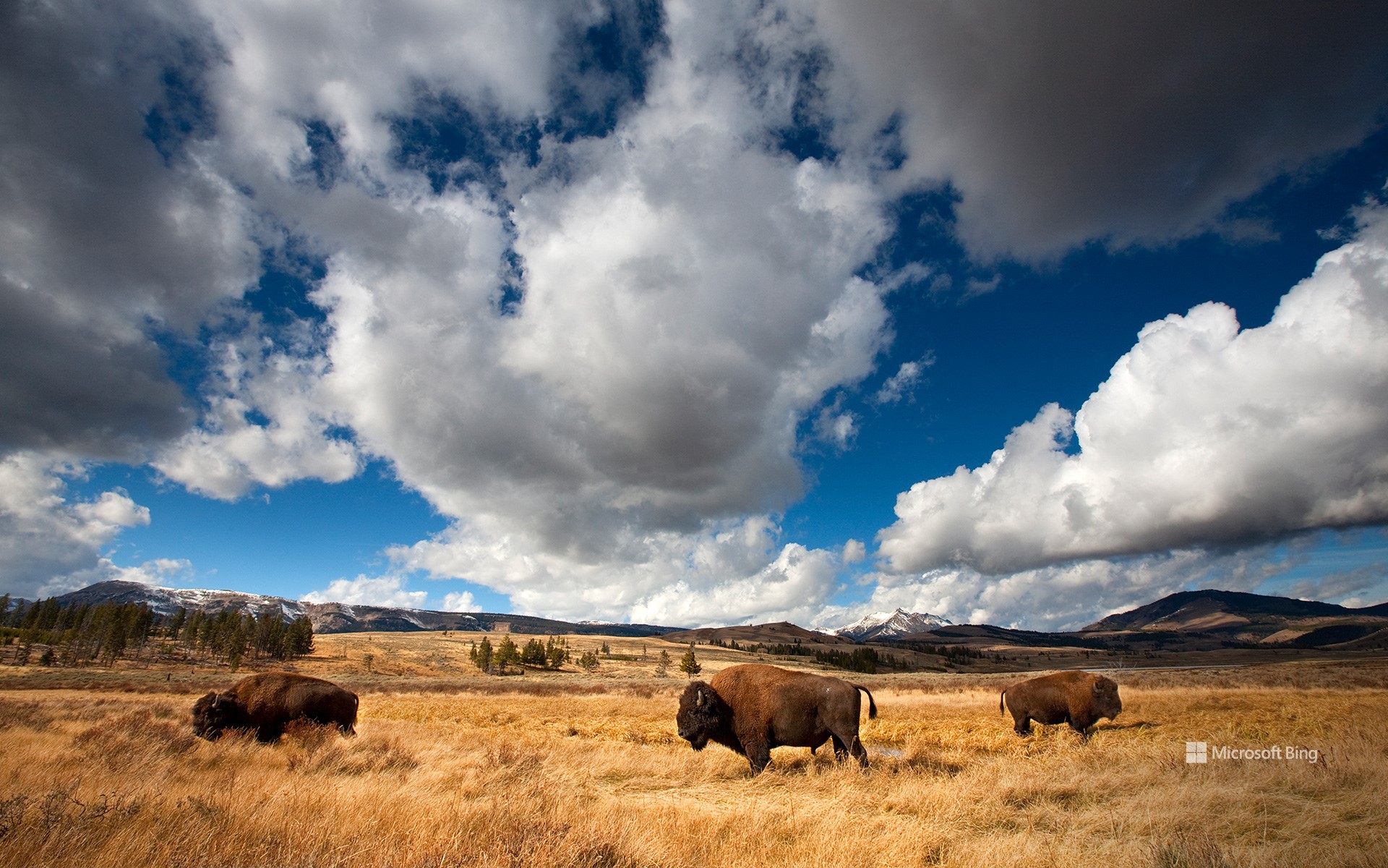
很久很久以前,在北美一望无际的草原上,生活着一种强壮威武的动物,名叫美洲野牛。这些动物是许多美洲原住民部落生活的重要组成部分,可以为他们提供食物、衣服和工具。19世纪末,由于过度捕猎和疾病,它们的数量急剧下降,从多达6000万头下降到不足1000头。于是,一群环保主义者、农场主和美国原住民加入了拯救野牛的行列。现在,有50多万头野牛重新在大自然中漫步,许多都在黄石国家公园这样的保护区内生活。今天,在每年11月第一个星期六的美国国家野牛日,我们向这些高贵的动物致敬:它们是美国精神和人们为拯救它们所做出的不懈努力的见证。
从野牛镍币到野牛州旗,野牛是美国文化中根深蒂固的象征,所以美国野牛在2016年被正式指定为美国的国家哺乳动物也就不足为奇了。野牛是北美最大的哺乳动物,俄罗斯也曾引进过野牛。虽然野牛族群复苏了,但故事还没有结束。这些动物仍然面临着各种挑战,比如栖息地的丧失和猎杀的威胁。
National Bison Day
Once upon a time, in the boundless grasslands of North America, there roamed creatures of great strength and majesty—the American bison. These animals were a key part of life for many Native American tribes, providing food, clothing, and tools. Their population dwindled perilously low in the late 1800s, falling from as many as 60 million to fewer than 1,000 due to excessive hunting and disease. Enter a group of conservationists, ranchers, and Native Americans who stepped in to save the species. Now, over 500,000 bison roam again, many in protected areas like Yellowstone National Park, featured in today's image. Today, on National Bison Day, observed every first Saturday in November, we honor these noble creatures—a testament to the American spirit and the monumental conservation efforts to save them.
It's no wonder the bison was officially named the national mammal in 2016. From the buffalo nickel to state flags, they are a deeply embedded symbol in American culture. Bison are North America's largest mammals, and they have been introduced as far away as Russia. While the bison has made a heroic recovery, the story isn't over. These animals still face challenges, including habitat loss and hunting.
博迪州立历史公园,莫诺县,加利福尼亚州,美国 Bodie State Historic Park, Mono County, California (© Julien McRoberts/Tetra Images, LLC/Alamy Stock Photo)
博迪州立历史公园,莫诺县,加利福尼亚州,美国 Bodie State Historic Park, Mono County, California (© Julien McRoberts/Tetra Images, LLC/Alamy Stock Photo)
“淘金热”后的鬼城 Ghosts of the gold rush
博迪州立历史公园,加利福尼亚州
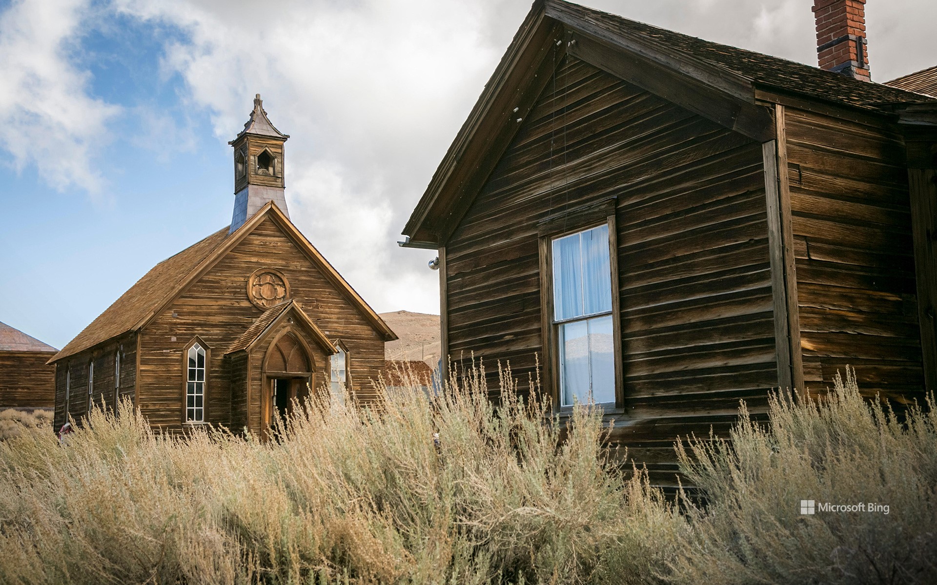
在加利福尼亚州博迪鬼魅般的寂静中,时间仿佛都静止了。这个曾经繁荣一时的淘金小镇始建于1860年。博迪以W.S.博迪的名字命名,他是一位发现了黄金的探矿者,但在目睹小镇崛起之前不幸死于一场暴风雪。当地发现大量金矿后,居民增加到近1万人,酒吧、舞厅和酿酒厂鳞次栉比。但随着金矿枯竭,小镇的财富也随之消失。矿场关闭,人口减少,到1915年,这个地方被遗弃了。现在,博迪的街道已经空无一人,木质建筑也已破败不堪。
如今,这里已成为美国保存最完好的鬼城之一。漫步在街道上,你可以窥探尘封的房屋和店面,甚至还能发现辉煌时期的瓷器碎片和方形钉子等小物件。传说中,博迪的鬼魂守卫着这个小镇,那些带走纪念品的人可能会被诅咒。如果这还吓不倒你,那你亦会被告知:把纪念品带回家也是违反公园规定的。因此,如果哪天真的来到博迪,请务必只带着回忆离开,以免镇上的鬼魂跟着你回家。
Bodie State Historic Park, California
In the ghostly silence of Bodie, California, it feels like time stands still. This mining camp became a booming gold rush town in the 1870s, after a cave-in revealed a rich vein of gold. Bodie was named after W.S. Bodey, a prospector who died in a blizzard before seeing the town's rise. When large deposits were found there, it grew to nearly 10,000 residents, with saloons, dance halls, and breweries lining its streets. But as the gold ran dry, so did the town's fortunes. The mines closed, the population dwindled, and by 1915, the place was abandoned. Bodie's streets are now empty, its wooden buildings frozen in decay.
Today, Bodie is one of America's best-preserved ghost towns. Wandering through the streets, you can peer into dusty homes and storefronts, and even find small artifacts like shards of china and square nails from the glory days. Legend has it that Bodie's ghosts fiercely guard the town, and those who take souvenirs risk being cursed with bad luck. Taking items home is also strictly against the park's rules. So, be sure to leave with nothing but memories—lest the town's spirits follow you home.
雪莉夫人森林和古堡遗迹,新罕布什尔州,美国 Madame Sherri Forest and the remnant of an old castle, New Hampshire (© yggdrasill/Shutterstock)
雪莉夫人森林和古堡遗迹,新罕布什尔州,美国 Madame Sherri Forest and the remnant of an old castle, New Hampshire (© yggdrasill/Shutterstock)
无处可去的阶梯 Stairway to nowhere
雪莉夫人森林
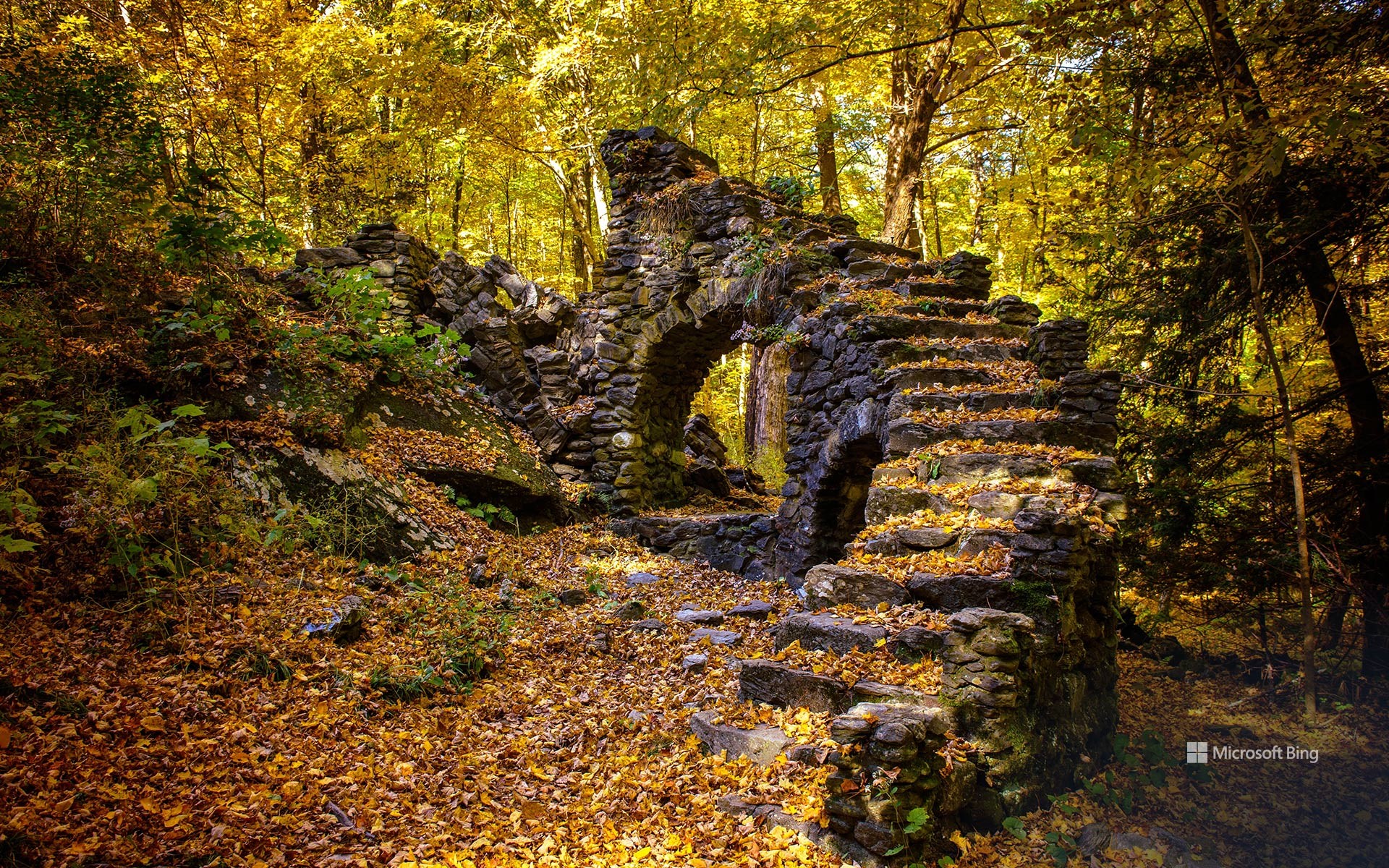
位于新罕布什尔州切斯特菲尔德的雪莉夫人森林是一个充满历史和自然美景的迷人景点。这里曾是安托瓦内特·雪莉夫人在20世纪30年代建造的奢华住宅所在地。雪莉夫人是一位20年代的华丽服装设计师,以举办奢华派对而闻名,她高调地来到镇上后,经常乘坐司机驾驶的帕卡德轿车,身披皮草,成为了当地人的谈资。随着财富的减少,她的“城堡”年久失修,遭到了破坏。1959年,雪莉夫人返回时发现自己的房产已成废墟,从此再也没有回来过。1963年的一场大火烧毁了这座房子,只留下了石头地基、标志性的阶梯和一个通向孤零零烟囱的大壁炉。
如今,雪莉夫人故居所在的森林占地500多英亩,有风景优美的徒步小径,穿过林地、铁杉树林,绕过宁静的小溪,为户外运动爱好者提供了如诗如画的环境。这片区域由新罕布什尔州森林保护协会管理,是为了纪念雪莉夫人而命名的,其中还包括通往雪莉夫人故居废墟的小径。因此,虽然房子与森林原本是分开的,但现在它们已经紧密地交织在一起。
Madame Sherri Forest, New Hampshire
Madame Sherri Forest in Chesterfield, New Hampshire, is a captivating destination steeped in history and natural beauty. It was once the site of an extravagant house built in the 1930s by Madame Antoinette Sherri, a flamboyant 1920s costume designer known for her lavish parties. Madame Sherri's dramatic arrivals in town, often in a chauffeur-driven Packard, draped in furs, became the talk of the locals. As her fortune declined, her 'castle' fell into disrepair and was vandalized. In 1959, she returned to find her property in ruins and never came back. A fire destroyed the house in 1963, leaving behind only the stone foundation, an iconic staircase, and a large fireplace leading to a lone chimney.
Today, the forest where her house once stood spans over 500 acres and offers scenic hiking trails through woodlands, hemlock groves, and around peaceful brooks, a picturesque setting for outdoor enthusiasts. Managed by the Society for the Protection of New Hampshire Forests, this area was named in honor of Madame Sherri, and it also includes trails that lead to the ruins of her former estate. So, while the house was originally separate from the forest, the two are now intricately entwined.
乔治·史密斯州立公园的柏树,佐治亚州,美国 Cypress trees in George L. Smith State Park, Georgia (© Chris Moore/TANDEM Stills + Motion)
乔治·史密斯州立公园的柏树,佐治亚州,美国 Cypress trees in George L. Smith State Park, Georgia (© Chris Moore/TANDEM Stills + Motion)
在秋天里傲然挺立 Standing tall in fall
乔治·史密斯州立公园的柏树,佐治亚州,美国
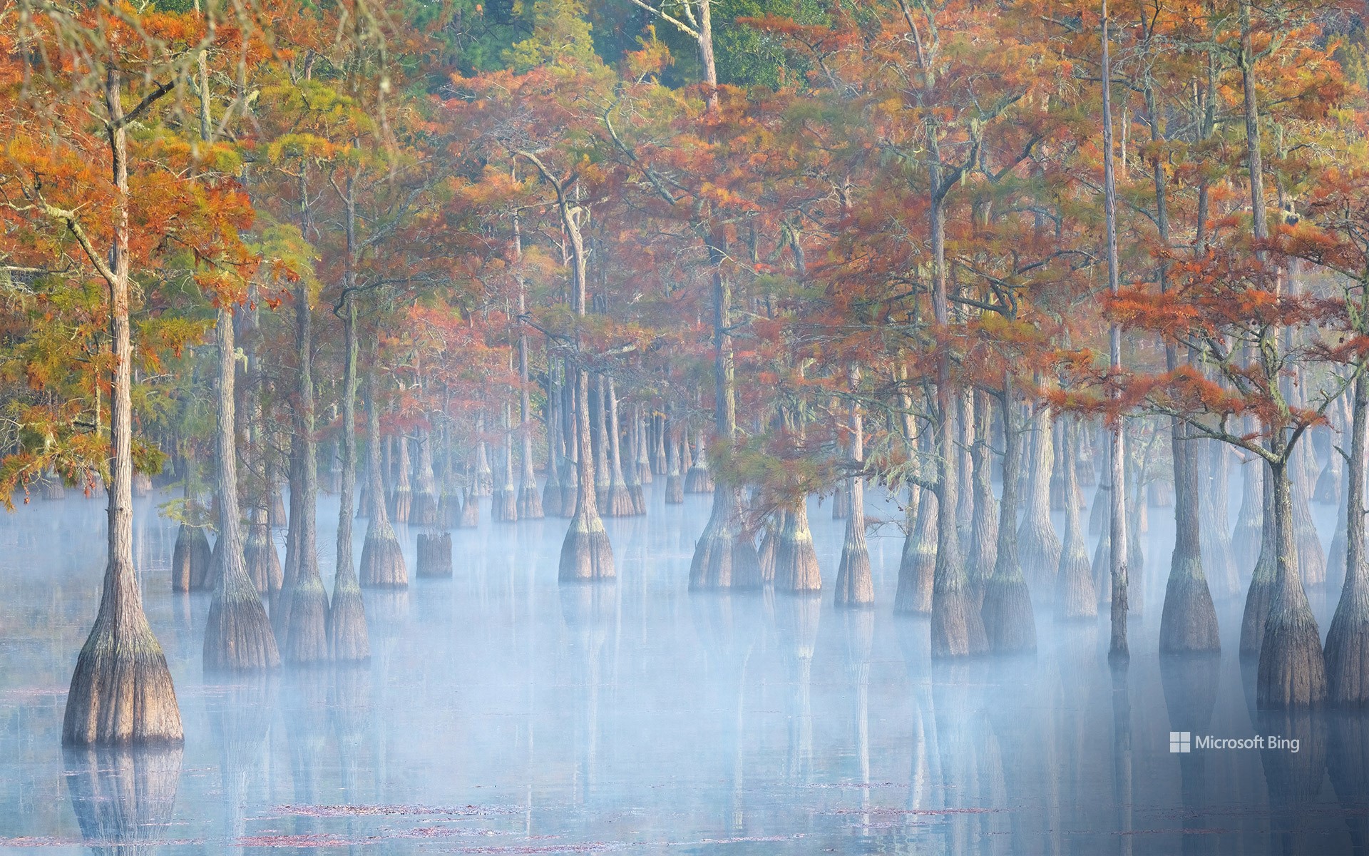
你见过坚韧、喜欢沼泽环境且总是很时髦的柏树吗?这些树可以长到100多英尺高,幼时通常呈金字塔状。在今天的图片中,我们来到了乔治·史密斯州立公园,该公园位于乔治亚州伊曼纽尔县,占地1634英亩。从今天的图片中可以看到,该公园的中心是一个占地412英亩的磨坊池塘,这里是钓鱼和划独木舟的好去处。池塘里生长着池柏和秃柏树,这两种树是美国的原生树种。公园内有长达7英里的蜿蜒小径,带领游客穿过沙地,经过鸟类保护区和龟类栖息地。这里的硬木树是啄木鸟和其他鸟类的天堂,而松软的土壤则为陆龟提供了理想的穴居地。无论在哪个季节,这座公园都能为所有人提供一个宁静的休闲场所。
Cypress trees in George L. Smith State Park, Georgia
The sturdy, swamp-loving, cypress trees pictured in the mist on our homepage can grow over 100 feet tall. These towering specimens are found in George L. Smith State Park, which spans 1,634 acres in Emanuel County, Georgia. The park's centerpiece is a 412-acre mill pond, a favorite spot for fishing and canoeing. Out of its waters grow pond cypress and bald cypress trees, two varieties that are native to the southeastern US. Winding through the park are over 7 miles of nature trails, leading visitors through sandy landscapes past a bird sanctuary and tortoise habitat. The hardwood trees here are a haven for woodpeckers and other birds, while the soft soil provides ideal burrowing ground for tortoises. No matter the season, this park promises a peaceful retreat for all.
曼哈顿中央公园的秋天,纽约,美国 Autumn in Central Park, Manhattan, New York (© mapman/Shutterstock)
曼哈顿中央公园的秋天,纽约,美国 Autumn in Central Park, Manhattan, New York (© mapman/Shutterstock)
邂逅秋日的林荫道 Fall in the Mall
曼哈顿中央公园的秋天,纽约
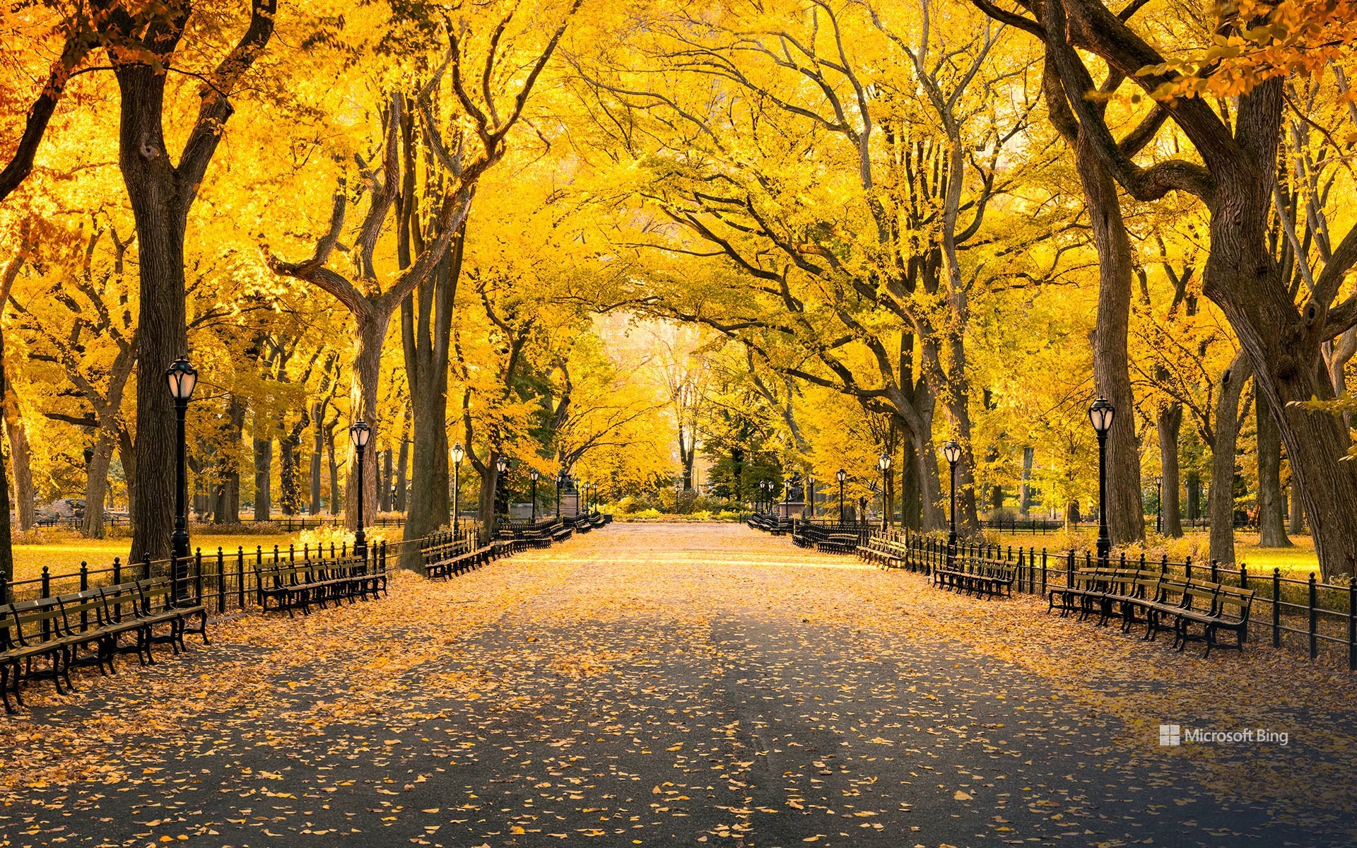
每年秋天,纽约中央公园18000棵树木中的许多树,都会染上黄色、红色和橙色的色调。秋天是中央公园出镜率最高的季节之一,它为《当哈利遇见莎莉》和《头发》等电影提供了标志性的拍摄背景。树木不仅通过温度来感知冬天的到来,还通过日出和日落时光线照射到树叶上的角度来感知。由于纽约高楼林立,光线、阴影和温度的独特相互作用往往导致公园里的秋叶比城市里的其他地方来得晚。
今天的图片展示的是中央公园林荫大道的秋天,这是一条于19世纪中期设计和建造的人行道。林荫道的两侧是长椅和美国榆树,道路上方的树冠恰似弧形拱门,让人仿佛置身于大教堂中。这条长达四分之一英里的长廊是公园里唯一一条笔直的道路,旨在为不同阶层和背景的纽约人提供一个聚集、漫步、休憩的场所,或许还能让他们在这里思考四季的变化。
Autumn in Central Park, New York
Every autumn, many of the 18,000 trees in Central Park, New York, are painted in shades of yellow, red, and orange. It's one of Central Park's most photographed seasons, and fall in the park has provided iconic backdrops for movies like 'When Harry Met Sally…' and 'Hair.' Trees sense the coming of winter not only by temperature, but by the angle at which sunlight hits their leaves. Because of New York's buildings, the unique interaction of light, shadows, and temperatures often results in fall foliage occurring later in the park than the rest of the city.
Today's image features fall in the Mall, a pedestrian walkway designed and built in the mid-1800s. Flanked by benches and American elm trees, the Mall's canopy was meant to evoke an architectural space like a cathedral. The quarter-mile promenade is the park's only straight path, and it was intended to be a place for New Yorkers of all classes and backgrounds to gather, stroll, sit, and perhaps ponder the passing seasons.
马布尔附近的白杨树,科罗拉多州,美国 Aspens near Marble, Colorado (© Jason Hatfield/TANDEM Stills + Motion)
马布尔附近的白杨树,科罗拉多州,美国 Aspens near Marble, Colorado (© Jason Hatfield/TANDEM Stills + Motion)
色彩斑斓的秋天 Colorado in full color
马布尔附近的白杨树,科罗拉多州
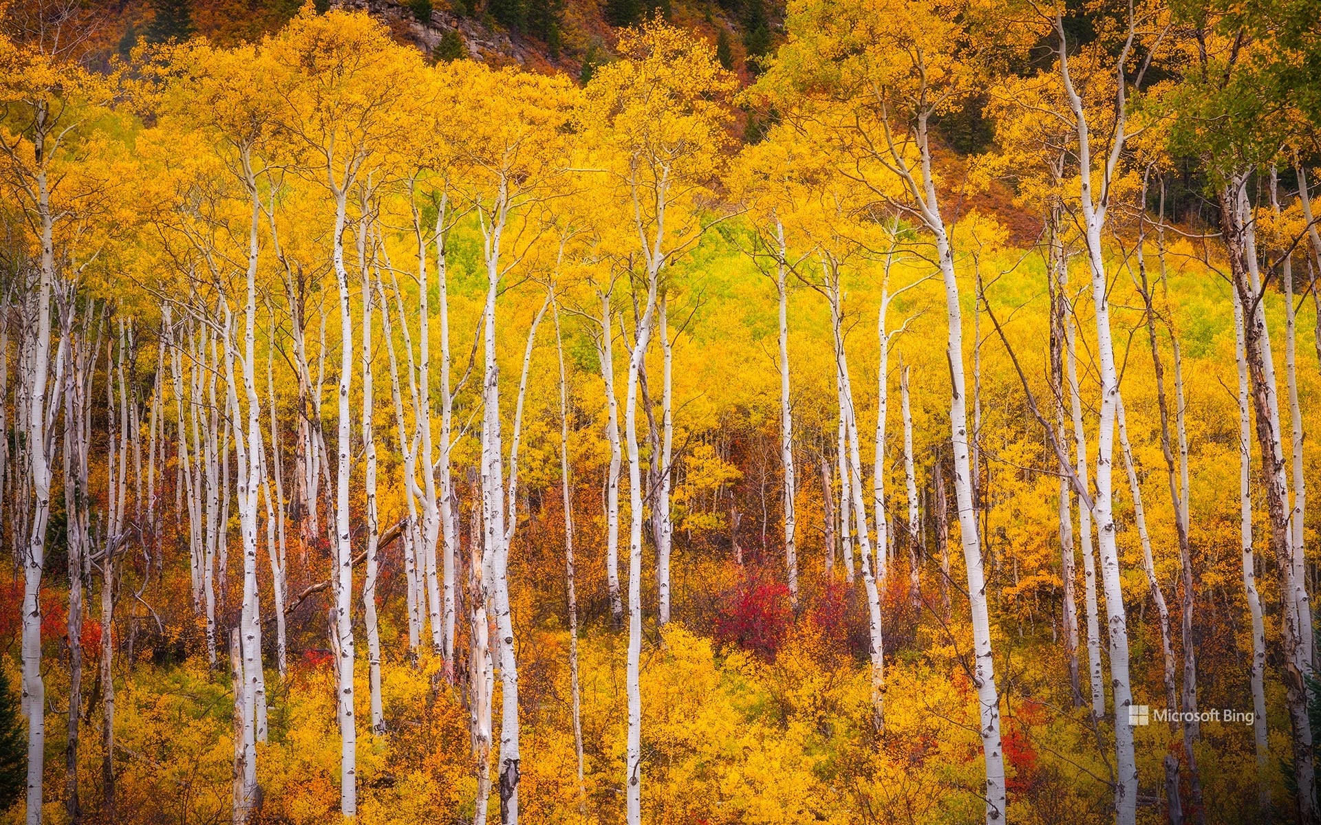
纤细的白色树干直插云霄,即使是微风拂过,树叶也会摇曳生姿——白杨树是美国荒野的象征。它们广泛分布在美国西部各州,尤其是犹他州和科罗拉多州。这些树是北美分布最广的本土物种。正如今天这张在科罗拉多州马布尔附近拍摄的照片一样,白杨树林的秋景令人叹为观止,白杨树叶在秋天会变成明亮的金黄色,点亮整个景观。白杨树不仅美丽,而且在生物学上也令人着迷。它们以大型群落的形式生长,起源于单一的根系,是地球上最大的生物之一。树群中的每棵树都具有相同的遗传特征。当白杨树被砍伐或受损时,根系会继续存活,从而使新的枝条萌发并生长,这有助于形成一个弹性的网络,可以在野火等恶劣的条件下生存。这种物种能迅速在附近被烧毁的地区生根发芽,即使野火燎原也能再生。白杨树不仅仅是赏心悦目的风景,它们更象征着坚韧不屈的精神。
Aspens in the White River National Forest, Colorado
Slender white trunks reaching skyward and leaves fluttering even in the gentlest breeze—aspen trees are a symbol of the American wilderness. Found across the western states, especially in Utah and Colorado, these trees are the most widespread native species in North America. Their fall foliage is breathtaking, with their leaves turning a vibrant yellow that lights up the landscape, as seen in today's photo, which was taken in the White River National Forest, Colorado.
Aspens are not only beautiful but also biologically fascinating. They grow in large colonies that originate from a single root system, making them some of the largest living organisms on Earth. Each tree in the colony is genetically identical. When an aspen tree is cut down or damaged, the root system remains alive, allowing new shoots to emerge and grow, which helps create a tenacious network that can survive harsh conditions, including wildfires. This species quickly colonizes areas that have been recently burned down and can regenerate even after frequent fires. Aspen trees are more than just a treat for the eyes; they are an example of nature's resilience.
郊狼峡谷拱门中的白杨树,格兰峡谷休闲区,犹他州,美国 Cottonwoods seen through an arch in Coyote Gulch, Glen Canyon Recreation Area, Utah (© Stephen Matera/TANDEM Stills + Motion)
郊狼峡谷拱门中的白杨树,格兰峡谷休闲区,犹他州,美国 Cottonwoods seen through an arch in Coyote Gulch, Glen Canyon Recreation Area, Utah (© Stephen Matera/TANDEM Stills + Motion)
一抹金色 Golden glimpses
郊狼峡谷,格兰峡谷休闲区,犹他州
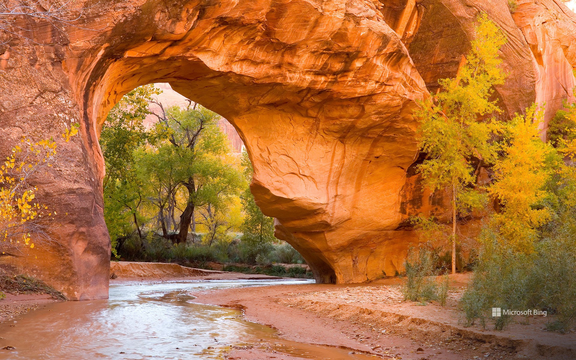
在犹他州郊狼峡谷天然拱门的衬托下,生机盎然的金色白杨树与埃斯卡兰特峡谷地区色彩斑斓的岩层相映成趣。郊狼峡谷是著名的背包旅行目的地,这里有高耸的垂直峡谷壁、狭窄的缝隙峡谷、穹顶、拱门和天然桥梁。峡谷的上游位于大阶梯埃斯卡兰特国家纪念区内,而今天的图片展示的是峡谷下游的格兰峡谷休闲区。这个休闲区成立于1972年。由美国国家公园管理局管理,是一个兼顾休闲和保护的保护区。与主要侧重于自然保护的国家公园不同,格兰峡谷休闲区会提供各种设施,包括四个公共露营地、两个小型机场和几家游艇租赁服务公司,因此成为了游客的热门目的地。
温德河,布鲁克斯山脉,北极国家野生动物保护区,阿拉斯加州,美国 Wind River, Brooks Range, Arctic National Wildlife Refuge, Alaska (© Design Pics/DanitaDelimont)
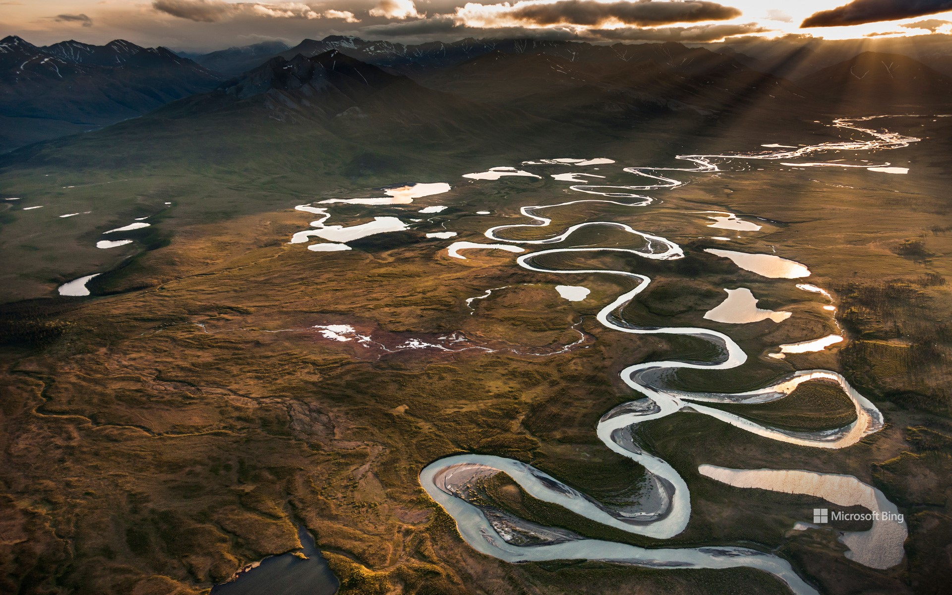
温德河,布鲁克斯山脉,北极国家野生动物保护区,阿拉斯加州,美国 Wind River, Brooks Range, Arctic National Wildlife Refuge, Alaska (© Design Pics/DanitaDelimont)
河流的狂野舞蹈 River's wild dance
温德河,北极国家野生动物保护区,阿拉斯加州
你是否想过美国那些野生河流是如何保持原始状态的?这要归功于《野生与风景河流法案》,它于1968年的今天被签署成为法律。这项立法还创建了国家野生与风景河流系统,旨在保护那些具有杰出的自然、文化以及休闲价值的特定河流,使其保持自由流动的状态。这个国家系统管理着40个州的209条河流,它们的总长超过12700英里,但不到美国350万英里河流的四分之一。在这个系统中,河流被分类为野生、风景或休闲河流。例如今天图片中看到的温德河就是一条野生河流,它尚处于孤立且未被开发的状态。这条85英里长的河流从菲利普·史密斯山脉流向昌达拉河的东支,蜿蜒穿过一个布满湖泊和湿地的河谷。作为北极国家野生动物保护区的一部分,这个河谷是一个繁荣的栖息地,居住着白大角羊、驼鹿、北美驯鹿、灰熊等动物。在这个充满变化的世界里,还有如此原生态的河流,真令人欣慰。
Wild and Scenic Rivers Act
Ever wonder how some of our rivers stay unspoiled? It's thanks to the Wild and Scenic Rivers Act, which was signed into law on this day in 1968. This legislation created the National Wild and Scenic Rivers System, which preserves rivers with exceptional natural, cultural, and recreational qualities.
The national rivers system oversees more than 13,000 miles of 228 rivers across 41 states and Puerto Rico, a tiny fraction of the 3.5 million miles of US rivers. It categorizes rivers as wild, scenic, or recreational. The Wind River in northeastern Alaska, seen in today's image, is a wild river, isolated and undeveloped. It flows for 85 miles, from the Philip Smith Mountains to the East Fork of the Chandalar River, winding through a valley filled with lakes and wetlands. Part of the Arctic National Wildlife Refuge, this river valley is a bustling habitat for Dall sheep, moose, caribou, and grizzly bears. In a changing world, it's comforting to know these rivers will remain unchanged.
横跨胡萨托尼克河的西康沃尔廊桥,康涅狄格州,美国 West Cornwall Covered Bridge over the Housatonic River, Connecticut (© pabradyphoto/Getty Images)
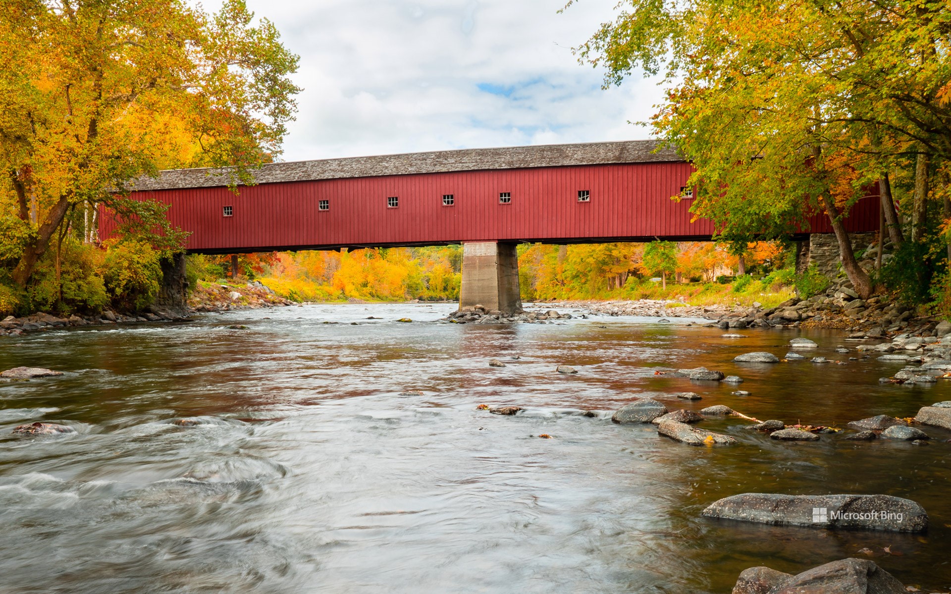
横跨胡萨托尼克河的西康沃尔廊桥,康涅狄格州,美国 West Cornwall Covered Bridge over the Housatonic River, Connecticut (© pabradyphoto/Getty Images)
连接康涅狄格州 Connecting Connecticut
西康沃尔廊桥,康涅狄格州
廊桥的顶棚和壁板,可以保护里面的木质结构,使其免受风雨的侵蚀,从而大大提高它的耐用性,图中的西康沃尔廊桥就是一个很好的例子。美国的许多廊桥建于19世纪,但很少有廊桥能幸存至今,那些幸存下来的往往是因为其历史和视觉价值,才得以保留。
康涅狄格州康沃尔的西康沃尔廊桥横跨胡萨托尼克河,是一座历史悠久的木结构桁架桥。该桥建于1864年,使用了一座早期桥梁的中墩,是康涅狄格州仅存的三座有顶桥梁之一。其独特的设计结合了“汤恩格构桁架”和双柱桁架,使其在廊桥中显得与众不同。大约在50年前,人们对西康沃尔廊桥进行了改造。1975年,它被认定为国家历史建筑,至今仍支持正常的交通通行。这座廊桥曾出现在电影和明信片中,展现了新英格兰村庄的经典形象。
West Cornwall Covered Bridge, Connecticut
Covered bridges like West Cornwall Covered Bridge, pictured in today's image, were designed with roofs and siding to protect their wooden structures from weathering, greatly increasing their durability. While many were built in the 19th century, few have survived to the present day, and the ones that have are often preserved for their historical and visual significance.
The West Cornwall bridge in Cornwall, Connecticut, is a historic wooden lattice truss bridge that spans the Housatonic River. Constructed in 1864 using the central pier from an earlier bridge, it's one of only three remaining roofed bridges in Connecticut. Modified about 50 years ago, it was recognized as a national historic building in 1975 and still supports traffic today. The bridge has appeared in films and postcards, embodying the classic image of a New England village.