标签 加利福尼亚 下的文章
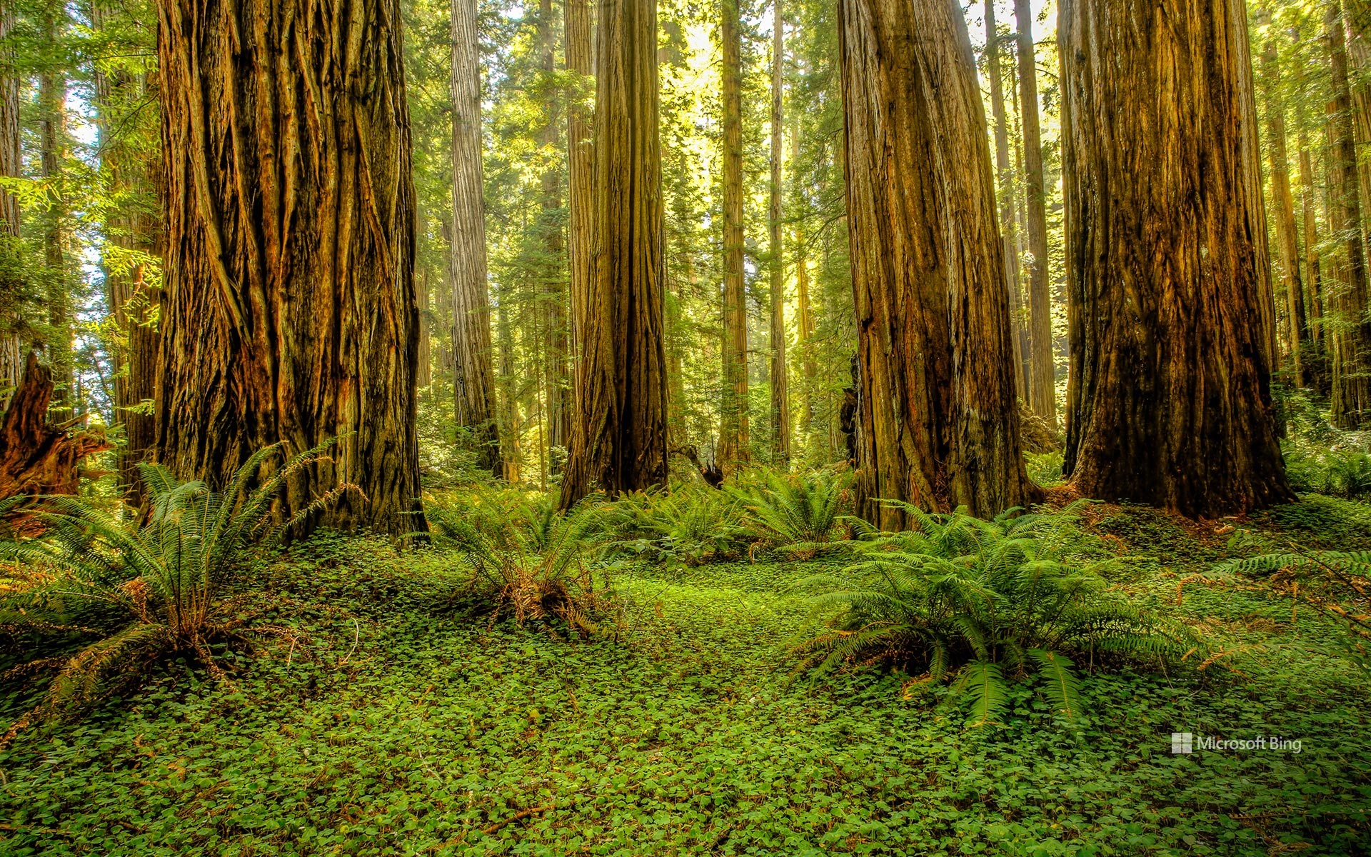
红木国家公园和州立公园, 加利福尼亚州, 美国 Grove of redwoods in Redwood National and State Parks, California (© Bob Pool/Getty Images)
红木国家公园和州立公园, 加利福尼亚州, 美国 Grove of redwoods in Redwood National and State Parks, California (© Bob Pool/Getty Images)
就在这里驻足吧 Park it here
红木国家公园和州立公园, 加利福尼亚州
国家公园周今天落下帷幕,但这些森林已经庆祝大自然数千年了。走进一个树木直插云霄的世界。位于加利福尼亚州红木国家公园和州立公园的红木林,是地球上最高的树木之一,高达超过 370 英尺。州立公园包括红木国家公园、德尔诺特海岸红木州立公园、杰迪戴亚·史密斯红木州立公园和草原溪红木州立公园。有些红木树在玛雅人建造神庙和中国修建长城时就已经存在了。自 1968 年起被保护,这座公园保留了全球近一半现存的原始红木森林。
漫步于杰迪戴亚·史密斯红木州立公园的斯托特林地或红木国家公园的“第一夫人”林地中,能在红木树间享受宁静的漫步时光。您还可以徒步探索仅凭许可证才能进入的“高树小径”,在那里可以近距离观赏到这些最高的树木。红杉国家公园的生态系统是许多动物的家园,包括罗斯福麋鹿、黑熊、香蕉蛞蝓以及濒危的云雀鹱。在郁郁葱葱的树冠下,蕨类植物和苔藓茂盛生长,而沿海的雾气则为这些树木提供了不可缺少的水分。无论是徒步穿越这些参天巨树之间,还是仅仅站在它们的树荫下,这种体验都会令人感到心生敬畏。
Redwood National and State Parks, California
Step into a world where trees touch the sky. The redwood groves of Redwood National and State Parks (RNSP) in California are home to some of the tallest trees on Earth, soaring over 370 feet high. The combined RNSP contain Redwood National Park, Del Norte Coast Redwoods State Park, Jedediah Smith Redwoods State Park, and Prairie Creek Redwoods State Park. Some of these redwoods were alive when the Mayans built their temples, and the Great Wall of China was under construction. Protected since 1968, the park preserves nearly half of the world's remaining old-growth redwoods.
Walk through Stout Grove in Jedediah Smith Redwoods State Park or Lady Bird Johnson Grove in Redwood National Park for a quiet stroll among the redwoods. You can also hike the Tall Trees Trail, a permit-only path where you can closely witness the tallest trees. The RNSP ecosystem is home to many animals, including Roosevelt elk, black bears, banana slugs, and the endangered marbled murrelets. Ferns and moss thrive beneath the leafy canopy, while coastal fog provides essential moisture to the trees. Whether hiking beneath these towering giants or simply standing in their shadows, the experience is humbling.
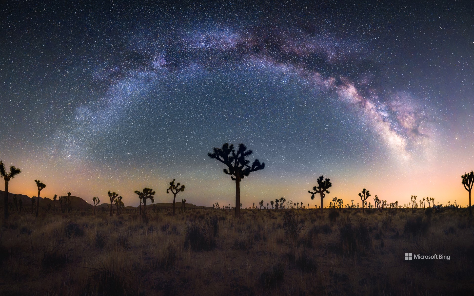
银河下的约书亚树,加利福尼亚州,美国 Joshua trees under the Milky Way, California (© Chao Zhang/Getty Images)
银河下的约书亚树,加利福尼亚州,美国 Joshua trees under the Milky Way, California (© Chao Zhang/Getty Images)
银河的魔力之下 Under the spell of the Milky Way
国际暗黑周
想象一下,站在一片漆黑的天空下,银河像一条发光的丝带横跨天际。这正是“国际暗黑周”希望带给我们的体验。每年四月,在新月周(今年是4 月 21 日至 27 日)期间,人们被邀请关闭灯光,仰望星空。这项活动由高中生詹妮弗·巴洛于2003 年发起,旨在对抗光污染。体验夜空之美的最佳地点之一是位于加利福尼亚州东南部的约书亚树国家公园,这是一个国际黑暗公园。在这里,由于没有人工光源的干扰,游客可以看到我们的祖先曾经看到过的星星。你知道吗?光污染使我们无法看到银河系中的大多数星星。通过减少光污染,我们可以重新与宇宙的美丽和神奇建立联系。
International Dark Sky Week
Imagine standing under a sky so dark that the Milky Way stretches across it like a luminous ribbon. This is the experience that International Dark Sky Week aims to bring back. Every April, during the week of the new moon (this year from April 21 to 27), we are invited to turn off our lights and gaze at the stars. The event was initiated by Jennifer Barlow, a high school student in 2003, to combat light pollution. One of the best places to experience the night sky's beauty is Joshua Tree National Park in southeastern California, an International Dark Sky Park. Here, the absence of artificial light allows visitors to see the stars as our ancestors once did. Did you know that light pollution prevents us from seeing most of the stars in the Milky Way? By reducing it, we can reconnect with the universe's beauty and wonder.
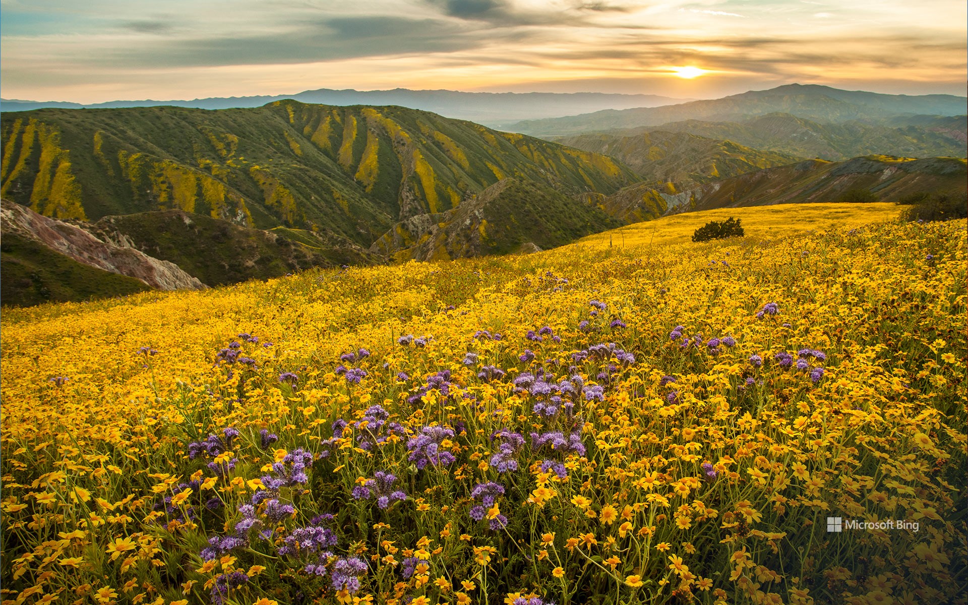
卡里佐平原国家纪念碑的超级花期,加利福尼亚州,美国 Superbloom in Carrizo Plain National Monument, California (© Robb Hirsch/TANDEM Stills + Motion)
卡里佐平原国家纪念碑的超级花期,加利福尼亚州,美国 Superbloom in Carrizo Plain National Monument, California (© Robb Hirsch/TANDEM Stills + Motion)
花海绽放 Burst of blooms
卡里佐平原国家纪念碑的超级花期,加利福尼亚州
在沙漠地区,大片花朵绽放的景象并不常见,但在超级花海期间,原本干旱的土地将被无尽的花田覆盖。这种罕见的自然现象发生在美国加利福尼亚州和亚利桑那州,当雨季来临,沉睡在土壤中的野花种子被唤醒,形成壮观的花海景观。加利福尼亚州的超级花海通常每十年出现一次,然而21 世纪持续的干旱使其愈发罕见。超级花海不仅展示了加州丰富的植物多样性,还吸引游客前来观赏,短暂地促进当地经济发展。今日图片中的卡里佐平原国家纪念碑正是观赏这一壮观景象的最佳地点之一。这片广阔的封闭型草原位于加利福尼亚州圣路易斯奥比斯波县东南部,全长约50英里,宽约15英里。坦布洛山脉和卡连特山脉的山丘,以及苏打湖附近的谷地,都会变成一片五彩斑斓的野花拼图,绚丽至极。你曾有幸见过超级花海吗?
Superbloom in Carrizo Plain National Monument, California
It's not every day you see a desert burst into colors, but during a superbloom, arid land is covered with endless stretches of flowers. This rare phenomenon happens in California and Arizona when the rainy season awakens wildflower seeds that have been lying dormant in the soil. Superblooms in California typically occur once a decade, but prolonged droughts in the 21st century have made them increasingly less frequent. Drawing attention to California's diverse flora and rural federal lands, these events offer temporary boosts to local economies.
One of the best spots to witness this spectacular phenomenon is Carrizo Plain National Monument, seen in today's image of a superbloom in 2017. A vast enclosed grassland in southeastern San Luis Obispo County, California, this spot is approximately 50 miles long and 15 miles wide. Here, the hills of the Temblor and Caliente Ranges, along with the valley floor near Soda Lake, transform into a patchwork of colorful wildflowers when conditions are right. Have you ever had the chance to see a superbloom?
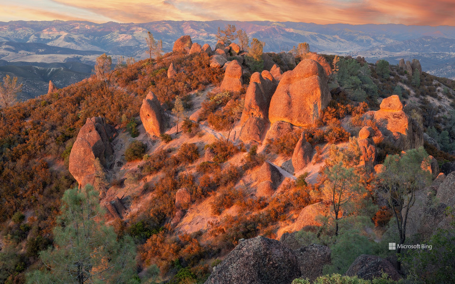
尖峰国家公园的高峰步道,圣贝尼托县,加利福尼亚州,美国 High Peaks Trail at Pinnacles National Park, San Benito County, California (© yhelfman/Getty Images)
尖峰国家公园的高峰步道,圣贝尼托县,加利福尼亚州,美国 High Peaks Trail at Pinnacles National Park, San Benito County, California (© yhelfman/Getty Images)
诞生于火,历久弥坚 A monumental milestone
加利福尼亚州尖峰国家公园成立纪念日
欢迎来到加州中部的尖峰国家公园,布满了锯齿状山峰、石塔、巨石和奇特的洞穴。1908年,当时西奥多·罗斯福总统将该地区指定为国家纪念地。随后在2013年,尖峰正式升级为国家公园。在庆祝其成立周年之际,让我们花点时间欣赏这个地方。2300万年前的一次火山喷发,造就了公园独特的地貌。这段炽热的历史创造了高耸的岩柱、峭壁和塌落巨石形成的堆积洞穴。经过数百万年的板块构造运动,这片土地向北推移,使公园远离了最初的火山发源地。真是一段漫长而奇妙的旅程!
公园内有各种徒步路线,既有轻松的步道,也有极具挑战的攀爬路径。例如,今日图片中展示的高峰步道,以陡峭的攀爬和狭窄通道著称,极为考验体力;而熊谷水库则提供了更悠闲的漫步体验。此外,尖峰国家公园也是多种野生动物的家园,包括山猫、野兔、黑尾鹿,以及啄木鸟和蝙蝠等鸟类,吸引着众多野生动物爱好者。公园最珍贵的宝藏之一是曾濒临灭绝的加利福尼亚神鹰。通过成功的保护计划,这些雄伟的鸟类被重新引入,成为尖峰国家公园引以为傲的成就。
Anniversary of Pinnacles National Park, California
Jagged pinnacles and spires, monoliths, and unusual caves—welcome to Pinnacles National Park in central California. President Theodore Roosevelt designated the area as a national monument in 1908, and Pinnacles would earn its status as a national park in 2013. As we celebrate the park's anniversary today, let's take a moment to appreciate this landscape. Pinnacles owes its formations to an ancient volcanic eruption that occurred 23 million years ago. The fiery beginnings made towering spires, cliffs, and talus caves, which are created by falling boulders wedged into narrow canyons. Over millennia, tectonic forces shifted the landmass northward, leaving the park far from its volcanic birthplace. Talk about a journey!
Pinnacles offers a variety of trails, from easy walks to challenging climbs. The High Peaks Trail, featured in today's image, tests your stamina with steep climbs and narrow passages, while Bear Gulch Reservoir provides a more relaxed stroll. Pinnacles is home to a range of wildlife including bobcats, jackrabbits, and black-tailed deer, and bird species like woodpeckers and bats, making it attractive for wildlife enthusiasts. Among the park's many treasures are once-endangered California condors, which were reintroduced here in a successful conservation effort.
水晶码头的圣诞树,太平洋海滩,加利福尼亚州,美国 Christmas tree at Crystal Pier, Pacific Beach, San Diego, California (© SamAntonioPhotography/Getty Images)
水晶码头的圣诞树,太平洋海滩,加利福尼亚州,美国 Christmas tree at Crystal Pier, Pacific Beach, San Diego, California (© SamAntonioPhotography/Getty Images)
冲浪、沙滩和圣诞老人 Surf, sand, and Santa
水晶码头的圣诞树,圣地亚哥,加利福尼亚州
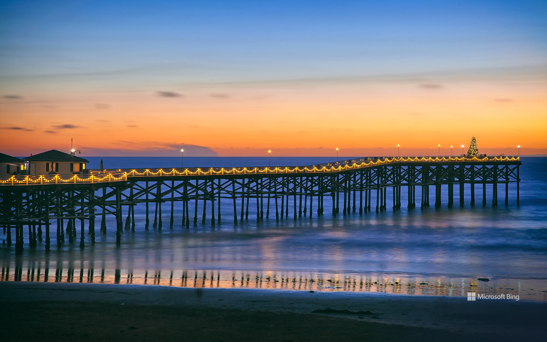
圣诞老人有足够的跑道可以降落,但要想光临你家的烟囱,那就只能祝你好运了。今天,我们在加利福尼亚州圣地亚哥的太平洋海滩为圣诞节做准备。虽然这里可能不会下雪,但在阳光明媚的南加州,圣诞节前仍然充满了节日气氛。在圣地亚哥的圣诞小径上,有许多美丽的圣诞树,其中一棵20英尺高的圣诞树位于装饰一新的水晶码头尽头。
Christmas tree on Crystal Pier, San Diego, California
Santa has plenty of runway to land his sleigh, but good luck trying to find a chimney. Today, we're getting ready for Christmas at Pacific Beach in San Diego, California. While it might not snow here, there's still plenty of yuletide spirit leading up to Christmas in sunny Southern California. Among many beautiful examples on San Diego's Christmas Tree Trail is the 20-foot tree at the end of a festively decorated Crystal Pier.
Stretching out 872 feet into the water, the pier has been a Pacific Beach icon since 1927. Once home to a ballroom and carnival-like midway, Crystal Pier has since become a mellower vacation destination and one of the few places on the West Coast with rental accommodations over the ocean. Open to the public during the day and 24/7 for hotel guests, the pier is an ideal place to take in panoramic coastal views, watch whales and surfers at play, do some fishing, or bathe in glorious coastal sunsets. Pacific Beach also has a lively restaurant, bar, and club scene if eggnog isn't your thing. There are certainly colder places to spend Christmas, but perhaps no place cooler than Crystal Pier.
莫诺湖的石灰华地层,加利福尼亚州,美国 Tufa formations on Mono Lake, California (© Susanna Patras/TANDEM Stills + Motion)
莫诺湖的石灰华地层,加利福尼亚州,美国 Tufa formations on Mono Lake, California (© Susanna Patras/TANDEM Stills + Motion)
石灰华塔的崛起 The rise of tufa
加州莫诺湖上石灰岩的形成
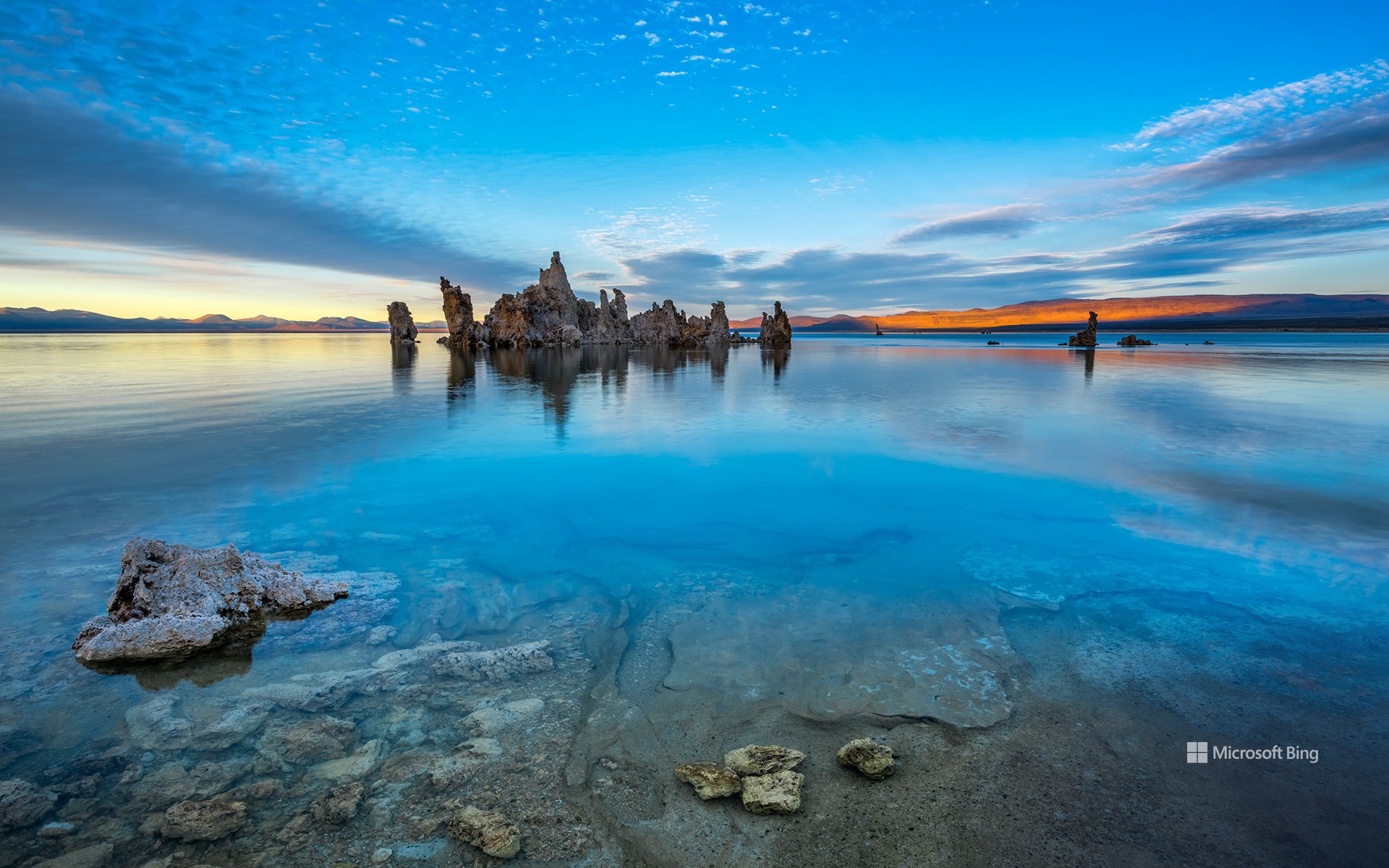
在时间的缓慢流逝下,凝灰岩——一种多孔石灰岩,成为大自然中最壮观的地貌之一。虽然这些塔在许多地方都能找到,但今天的图片展示的是加利福尼亚州莫诺县的莫诺湖。当富含钙质的淡水从几条小溪流入湖中,与湖中的碱性水混合后,就形成了这些结构。几个世纪以来,这种相互作用导致碳酸钙堆积,在湖面上形成了石灰华塔。为了保护这些塔,加利福尼亚州议会于1981年建立了莫诺湖图法国家自然保护区。
莫诺湖是一个迷人的沙漠湖泊,湖水呈弱碱性,没有天然出口。这里的生态系统欣欣向荣,生活着数十亿只盐水虾和碱蝇。这些小生物是加利福尼亚海鸥和黑颈䴙䴘等各种候鸟必不可少的零嘴。太平洋航道是鸟类从阿拉斯加一直飞往巴塔哥尼亚的主要迁徙路线,而莫诺湖作为食物供应地,是航道上一个极为重要的中转站。
Tufa formations in Mono Lake, California
Shaped by the slow passage of time, tufa—a type of porous limestone—emerges as one of nature's most spectacular formations. While these towers can be found in many places, today's image shows some at Mono Lake in Mono County, California. These structures develop when calcium-rich fresh water, percolating up through springs and vents, mixes with carbonate in the lake. Over centuries, this interaction caused calcium carbonate to build up, forming tufa spires above the lake's surface. To preserve the tufa towers, the Mono Lake Tufa State Natural Reserve was established in 1981.
Mono Lake is a fascinating desert lake with hypersaline and alkaline waters and no natural outlet. It supports a thriving ecosystem teeming with billions of brine shrimp and alkali flies. These tiny creatures are essential snacks for a variety of migratory birds, like California gulls and eared grebes. As a food source, Mono Lake is a critical pit stop along the Pacific Flyway, a major migration route for birds journeying from Alaska all the way south to Patagonia.
州立公园,索诺玛海岸,美国加利福尼亚州 Sonoma Coast State Park, California (© Rachid Dahnoun/Tandem Stills + Motion)
州立公园,索诺玛海岸,美国加利福尼亚州 Sonoma Coast State Park, California (© Rachid Dahnoun/Tandem Stills + Motion)
潮汐与暮色 Tides and twilight
索诺玛海岸州立公园,加利福尼亚州
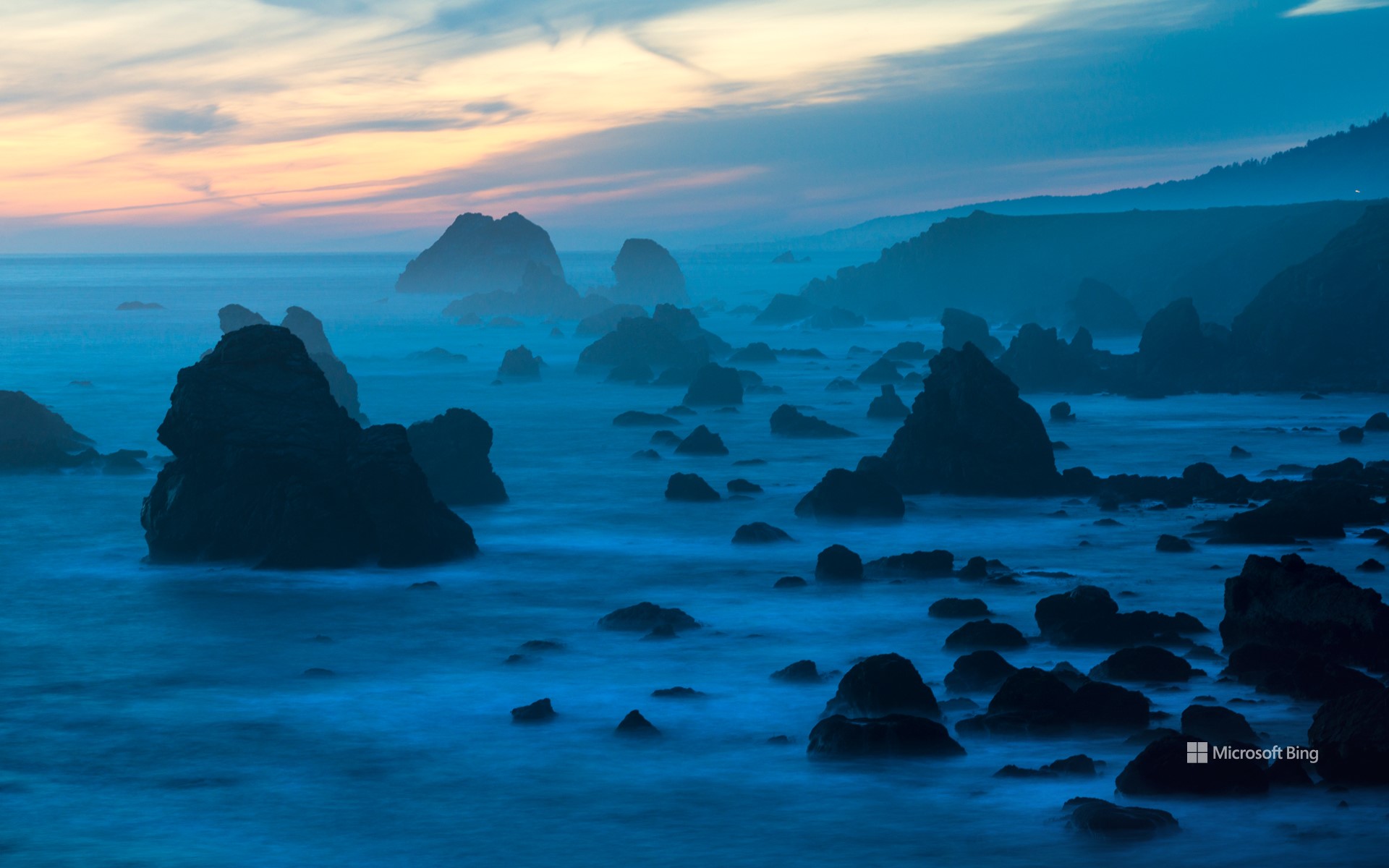
索诺玛海岸州立公园拥有风景如画的沙滩、天然拱门和幽静的海湾。该公园建于1934年,涵盖了詹纳湾和博德加湾之间17英里的北加州海岸线。野生动物爱好者可以在这里看到海豹、海狮、鲸鱼以及各种鸟类,比如鹀鸟、莺、雀、麻雀和黄鹂。历史爱好者可以探索海蚀柱形成的痕迹,这些痕迹据说是四万年前在该地区游荡的猛犸象留下的。公园内还有一些历史遗迹,比如19世纪初俄罗斯人在博德加湾建造的堡垒。公园附近的罗斯堡是由俄美公司于1812年建立的。这个定居点标志着俄罗斯殖民在北美最南端的扩张。该要塞主要作为毛皮贸易的枢纽,专注于在太平洋沿岸捕猎海獭。到19世纪30年代中期,毛皮贸易逐渐衰落,1841年,这座堡垒被卖给了美国企业家约翰·萨特。
Sonoma Coast State Park, California
Sonoma Coast State Park offers a picturesque retreat with its sandy beaches, natural arches, and secluded coves. Established in 1934, the park encompasses 17 miles of Northern California coastline between Jenner and Bodega Bay. Wildlife enthusiasts can spot seals, sea lions, whales, and a variety of birds like towhees, warblers, finches, sparrows, and orioles. History buffs will enjoy exploring the sea stack formation with rubbing marks believed to have been made by mammoths that roamed the area 40,000 years ago. The park is also home to historical sites like Bodega Head, where Russians built a fort in the early 1800s.
Fort Ross, near the park, was established in 1812 by the Russian-American Company. This settlement marked the southernmost expansion of Russian colonization in North America. The fort primarily served as a hub for the fur trade, focusing on hunting sea otters along the Pacific coast. By the mid-1830s, the fur trade had declined, and in 1841, the fort was sold to John Sutter, an American entrepreneur.
巨型海藻森林中的加州海狮,下加利福尼亚,墨西哥 California sea lion in a forest of giant kelp, Baja California, Mexico (© Claudio Contreras/Minden Pictures)
巨型海藻森林中的加州海狮,下加利福尼亚,墨西哥 California sea lion in a forest of giant kelp, Baja California, Mexico (© Claudio Contreras/Minden Pictures)
海中的“狮子王” The lion king of the sea
海藻森林中的海狮,下加利福尼亚,墨西哥
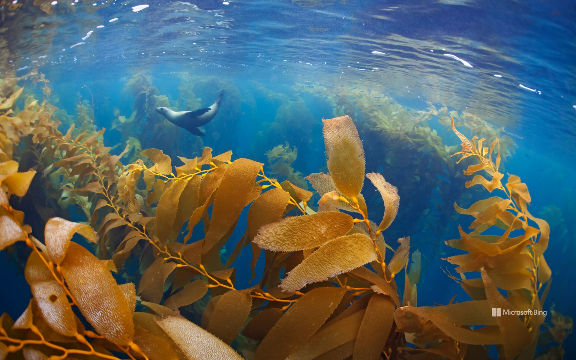
从哥斯达黎加到阿拉斯加,漫步在这些城市的任何一座码头上,你都可能听到海狮嬉闹的叫声在空气中回荡。加州海狮(如图所示)经常在北美西海岸的岩石海岸边上晒太阳。这些海洋哺乳动物属于鳍足动物,经常被误认为是海豹。有一个简单的方法可以区分这两种动物:看它们的耳朵,海狮有明显的耳朵皮瓣,而海豹没有。
海狮与巨型海藻还有着独特的关系,今天的图片拍摄于墨西哥的下加利福尼亚,图中那些长长的水下植物在理想条件下可以长到175英尺,它们随着水流轻轻摇曳,形成一道美丽的风景。海藻森林是各种海洋生物的家园,如海狮和小型无脊椎动物,海蜗牛、对虾和水母等,还有多种鱼类也生活在其中,如鳕鱼,石斑鱼和濑鱼等。厚厚的海藻在水中摆动,海狮穿梭其间,捕食藏在叶子里的鱼儿。另一方面,海狮也会反过来把海藻当成庇护所,利用海藻来躲避鲨鱼等掠食者。它们藏在褐藻的叶子间,与周围的环境融为一体,迷惑敌人的眼睛。海藻生长迅速,是各种海洋生物繁衍生息的理想栖息地。
Sea lion in a kelp forest, Baja California, Mexico
Take a stroll along almost any marina from Costa Rica to Alaska, and you'll likely hear the playful barks of sea lions echo through the air. California sea lions, like the one pictured, are a common sight basking in the sun along the rocky shores of North America's western coast. These marine mammals, belonging to the pinniped group, are often mistaken for seals. An easy way to distinguish between them is by looking at their ears—sea lions have visible flaps, seals don't.
Sea lions also have a special relationship with giant kelp, seen in today's image from Baja California, Mexico. These towering underwater plants, which can grow up to 175 feet in ideal conditions, sway gently with the currents, creating beautiful scenery. Kelp forests are home to a diverse array of marine life, including sea lions, tiny invertebrates like snails, prawns, and jellyfish, and a wide range of fish, like cod, rockfish, and wrasse. Sea lions twist and turn through the thick kelp strands, hunting fish hiding within the leaves. They also use kelp as refuge from predators like sharks, blending in with the fronds of the brown algae to avoid detection. Kelp's rapid growth makes it an ideal habitat for marine life of all types to thrive.
博迪州立历史公园,莫诺县,加利福尼亚州,美国 Bodie State Historic Park, Mono County, California (© Julien McRoberts/Tetra Images, LLC/Alamy Stock Photo)
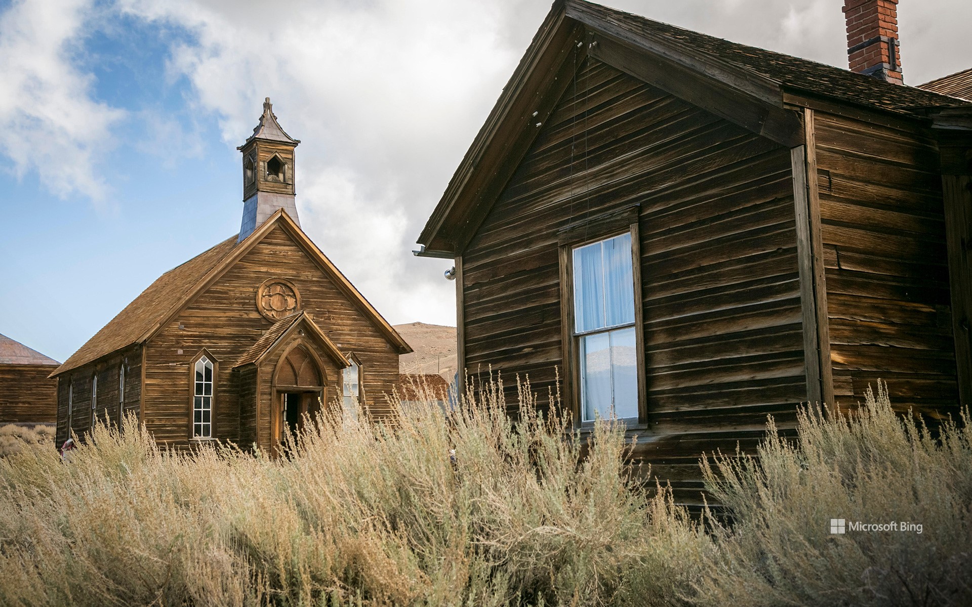
博迪州立历史公园,莫诺县,加利福尼亚州,美国 Bodie State Historic Park, Mono County, California (© Julien McRoberts/Tetra Images, LLC/Alamy Stock Photo)
“淘金热”后的鬼城 Ghosts of the gold rush
博迪州立历史公园,加利福尼亚州
在加利福尼亚州博迪鬼魅般的寂静中,时间仿佛都静止了。这个曾经繁荣一时的淘金小镇始建于1860年。博迪以W.S.博迪的名字命名,他是一位发现了黄金的探矿者,但在目睹小镇崛起之前不幸死于一场暴风雪。当地发现大量金矿后,居民增加到近1万人,酒吧、舞厅和酿酒厂鳞次栉比。但随着金矿枯竭,小镇的财富也随之消失。矿场关闭,人口减少,到1915年,这个地方被遗弃了。现在,博迪的街道已经空无一人,木质建筑也已破败不堪。
如今,这里已成为美国保存最完好的鬼城之一。漫步在街道上,你可以窥探尘封的房屋和店面,甚至还能发现辉煌时期的瓷器碎片和方形钉子等小物件。传说中,博迪的鬼魂守卫着这个小镇,那些带走纪念品的人可能会被诅咒。如果这还吓不倒你,那你亦会被告知:把纪念品带回家也是违反公园规定的。因此,如果哪天真的来到博迪,请务必只带着回忆离开,以免镇上的鬼魂跟着你回家。
Bodie State Historic Park, California
In the ghostly silence of Bodie, California, it feels like time stands still. This mining camp became a booming gold rush town in the 1870s, after a cave-in revealed a rich vein of gold. Bodie was named after W.S. Bodey, a prospector who died in a blizzard before seeing the town's rise. When large deposits were found there, it grew to nearly 10,000 residents, with saloons, dance halls, and breweries lining its streets. But as the gold ran dry, so did the town's fortunes. The mines closed, the population dwindled, and by 1915, the place was abandoned. Bodie's streets are now empty, its wooden buildings frozen in decay.
Today, Bodie is one of America's best-preserved ghost towns. Wandering through the streets, you can peer into dusty homes and storefronts, and even find small artifacts like shards of china and square nails from the glory days. Legend has it that Bodie's ghosts fiercely guard the town, and those who take souvenirs risk being cursed with bad luck. Taking items home is also strictly against the park's rules. So, be sure to leave with nothing but memories—lest the town's spirits follow you home.
巨型红杉,红杉国家公园,加利福尼亚州,美国 Giant sequoias, Sequoia National Park, California (© Galyna Andrushko/Shutterstock)
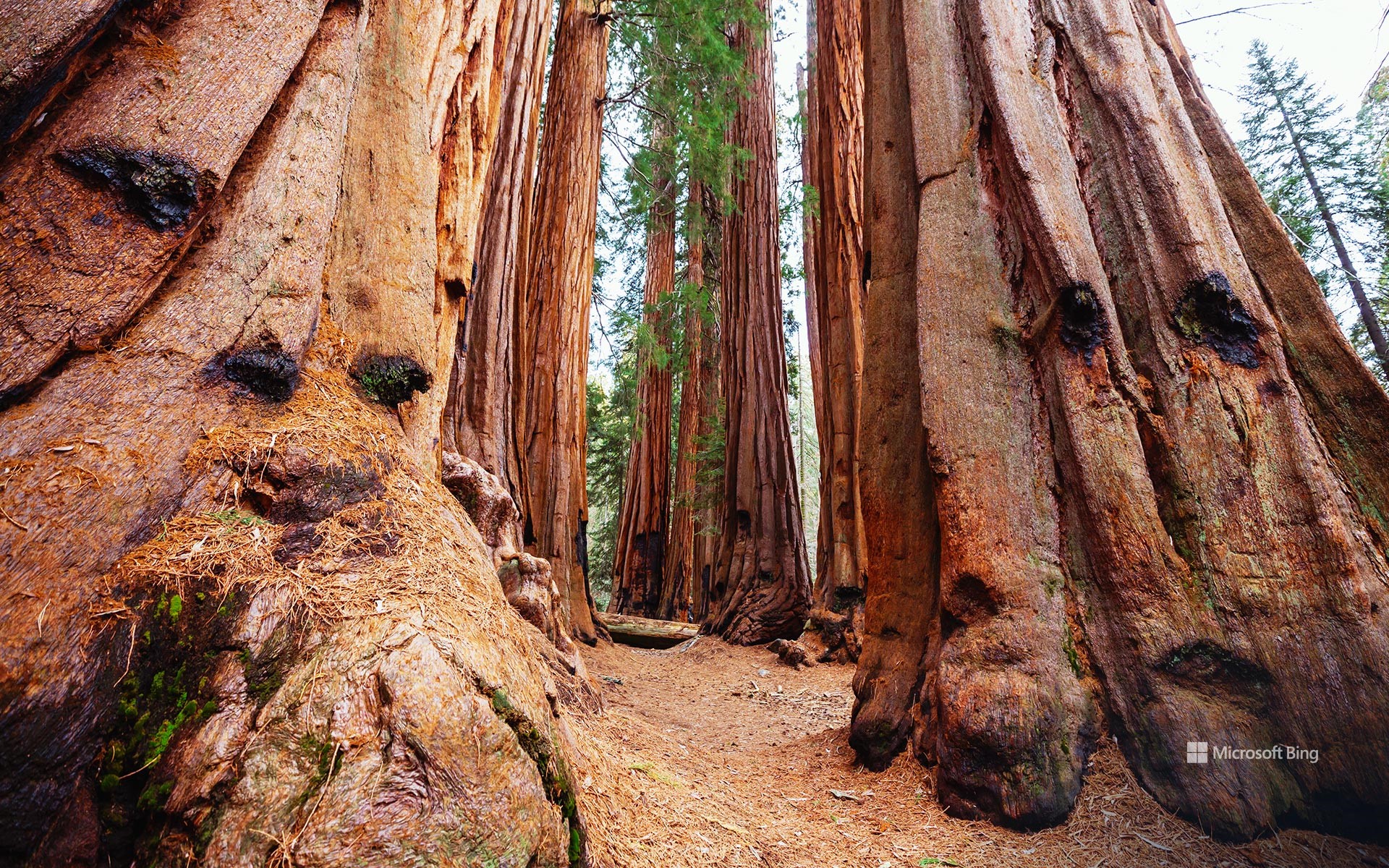
巨型红杉,红杉国家公园,加利福尼亚州,美国 Giant sequoias, Sequoia National Park, California (© Galyna Andrushko/Shutterstock)
古代巨人的王国 The realm of ancient giants
红杉国家公园134周年纪念日
1890年的今天,红杉国家公园在内华达山脉南部成立,旨在保护美国的自然奇观之一。红杉国家公园以占地面积超过629平方英里的巨型红杉树命名,是黑熊、骡鹿等野生动物以及包括莺、莺雀、鹟在内的200多种鸟类的家园。这里的巨型红杉树已经扎根2200多年,是地球上最古老的生物之一。公园里著名的谢尔曼将军树高达275英尺。它以美国内战将军威廉·特库姆塞·谢尔曼的名字命名,不仅高,而且宽度超过36英尺。游客们蜂拥而至,捕捉这些古老巨树的瞬间,它们红褐色的纤维状树皮和宽阔的树枝唤起了一种鲜活的历史感。
Sequoia National Park's 134th anniversary
On this day in 1890, Sequoia National Park was founded in the southern Sierra Nevada of California to protect one of America's natural splendors. Named after the giant sequoias that dominate the landscape, the park spans more than 629 square miles and is home to wildlife such as black bears, mule deer, and over 200 species of birds, including warblers, vireos, and flycatchers. The giant sequoia trees here have been rooted for more than 2,200 years and are among Earth's oldest living organisms. The park's renowned General Sherman tree rises to an astonishing 275 feet. Named after the American Civil War general William Tecumseh Sherman, it's not only tall but is also more than 36 feet wide. Visitors flock to capture moments among these ancient giants, whose reddish-brown, fibrous bark and wide-reaching branches evoke a sense of living history.