标签 国家公园 下的文章
加利福尼亚湾中数千条杰克鱼成群游动,墨西哥普尔莫角国家公园 Thousands of jack fish swimming together at Cabo Pulmo National Park, Sea of Cortez, Baja California, Mexico (© Christian Vizl/Tandem Stills + Motion)
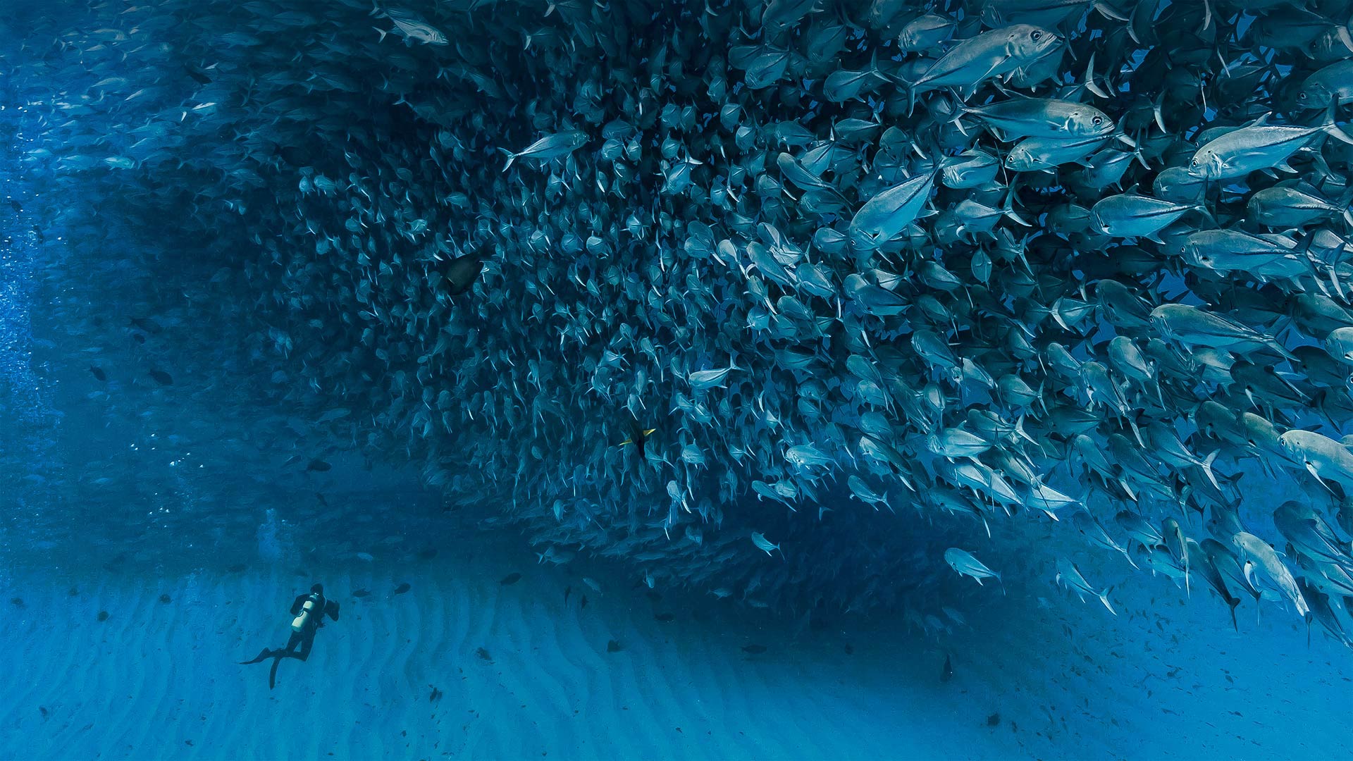
加利福尼亚湾中数千条杰克鱼成群游动,墨西哥普尔莫角国家公园 Thousands of jack fish swimming together at Cabo Pulmo National Park, Sea of Cortez, Baja California, Mexico (© Christian Vizl/Tandem Stills + Motion)
A day for our oceans
To celebrate World Oceans Day, we're swimming through a shoal of jack fish just off the coast of Baja, California, in Cabo Pulmo National Park. This Mexican marine park in the Sea of Cortez is home to the northernmost and oldest coral reef on the west coast of North America, estimated to be about 20,000 years old. Jacks are clearly plentiful here, but divers and snorkelers in Cabo Pulmo can also come across many other species of fish and marine mammals, including many varieties of sharks, whales, dolphins, tortoises, and manta rays.
For this year's World Oceans Day, the UN chose the theme 'The Ocean: Life & Livelihoods,' to raise awareness of the nearly 3 billion people worldwide who depend on oceans for their food and way of life. The residents of Cabo Pulmo know a little about this—to help revitalize their previously unprotected and overfished waters, the Mexican government turned Cabo Pulmo into a national park in 1995. But more controversially, they also banned fishing, a big deal in an area where many residents lived off the food they caught by hand. The preservation efforts paid off, though—researchers say the park experienced a 460% increase in the number of fish living in park waters between 1999 and 2009, turning Cabo Pulmo one of the world's most robust marine reserves. Now, many residents who once relied on fishing have been able to move into jobs in ecotourism or other vocations supporting the park.
海洋的一天
为了庆祝世界海洋日,我们正在加利福尼亚州巴哈海岸附近的卡波普尔莫国家公园游泳。这座位于科尔特斯海的墨西哥海洋公园是北美洲西海岸最北、最古老的珊瑚礁的所在地,据估计大约有2万年的历史。杰克在这里显然很丰富,但在卡波普尔莫潜水员和潜水者也可以遇到许多其他种类的鱼类和海洋哺乳动物,包括许多种类的鲨鱼、鲸鱼、海豚、乌龟和蝠鲼。
今年的世界海洋日,联合国选择了“海洋:生命与生计”这一主题,以提高全世界近30亿以海洋为食物和生活方式的人们的认识。卡波普尔莫的居民对此略知一二,为了帮助恢复他们以前未受保护和过度捕捞的水域,墨西哥政府在1995年将卡波普尔莫变成了一个国家公园。但更具争议的是,他们还禁止捕鱼,这在一个许多居民靠手工捕捞的食物为生的地区是一件大事。保护工作取得了成效,不过研究人员说,1999年至2009年间,公园水域的鱼类数量增加了460%,使卡波普尔莫成为世界上最强大的海洋保护区之一。现在,许多曾经依赖捕鱼的居民已经能够从事生态旅游或其他支持公园的职业。
格林内尔湖,蒙大拿州冰川国家公园 Grinnell Lake, Glacier National Park, Montana (© Pung/Shutterstock)
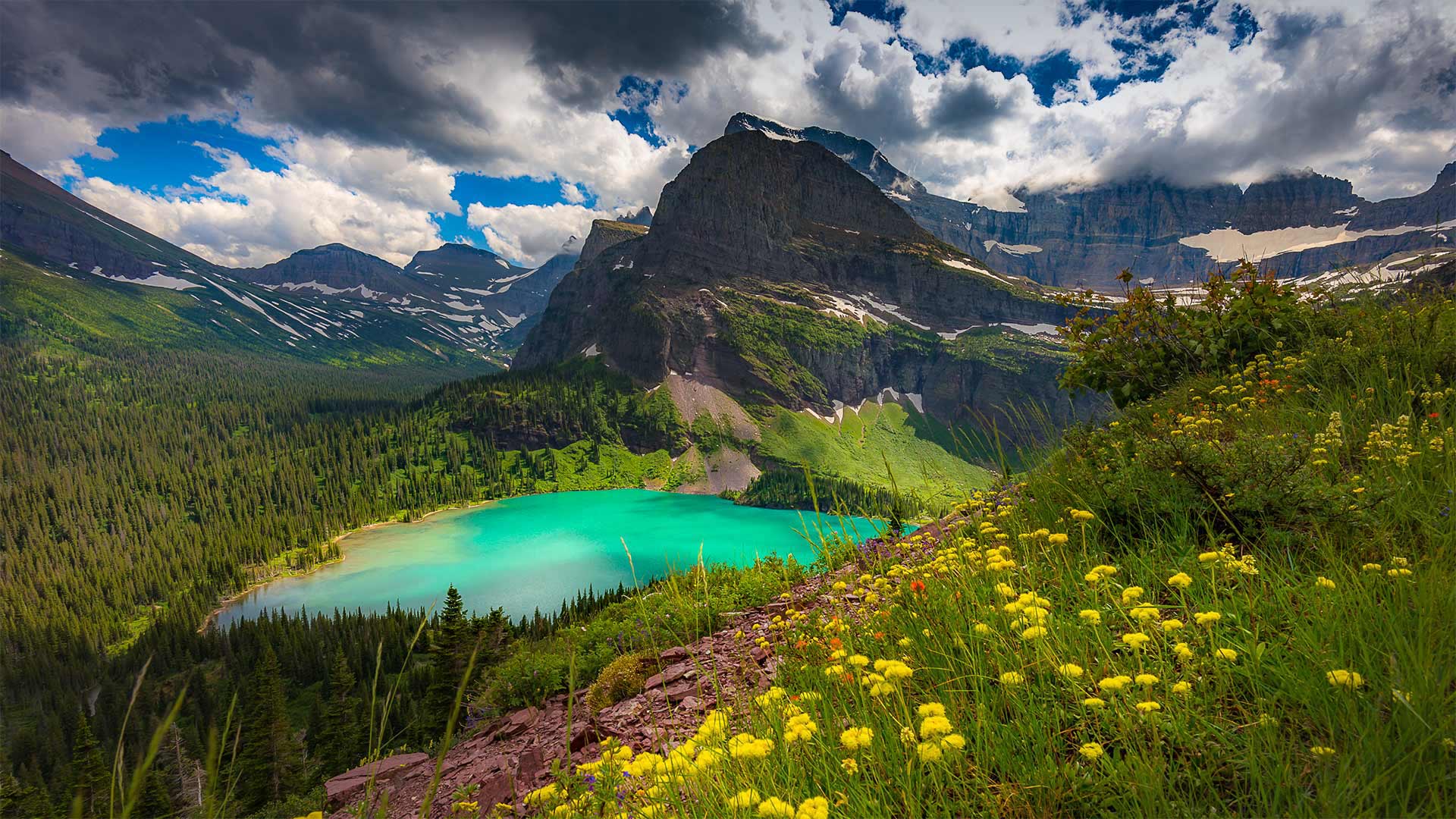
格林内尔湖,蒙大拿州冰川国家公园 Grinnell Lake, Glacier National Park, Montana (© Pung/Shutterstock)
'The Crown of the Continent'
With one million acres of rugged, northwestern Montana wilderness to explore, a trip to Glacier National Park could fill up an entire summer and more. But let's just take one day and virtually visit Grinnell Lake. A 7-mile loop trail, a relatively easy one in this rugged country, takes you to the shores of the lake turned emerald-green by glacial silt. Grinnell Lake—as well as Mount Grinnell and Grinnell Glacier—is named for the naturalist and Audubon Society founder George Bird Grinnell. For two decades, he lobbied for the creation of the park, and on May 11, 1910, the 'Crown of the Continent,' as Grinnell dubbed this area, became the nation's 10th national park.
“大陆之冠”
有一百万英亩崎岖不平的蒙大拿州西北部荒野可供探索,一次冰川国家公园之旅可能会填满整个夏天,甚至更多。但让我们花一天时间去参观格林内尔湖吧。在这个崎岖的国家,一条7英里长的环形小径相对容易,它会带你到达湖岸,湖岸被冰川淤泥染成翠绿。格林内尔湖以及格林内尔山和格林内尔冰川是以博物学家和奥杜邦协会创始人乔治·伯德·格林内尔命名的。二十年来,他一直在游说建立这个国家公园,1910年5月11日,格林内尔称之为“欧洲大陆之冠”的这个地区成为美国第十个国家公园。
文斯利代尔,英格兰约克郡谷地国家公园 Wensleydale, Yorkshire Dales National Park, North Yorkshire, England (© Guy Edwardes/Minden Pictures)
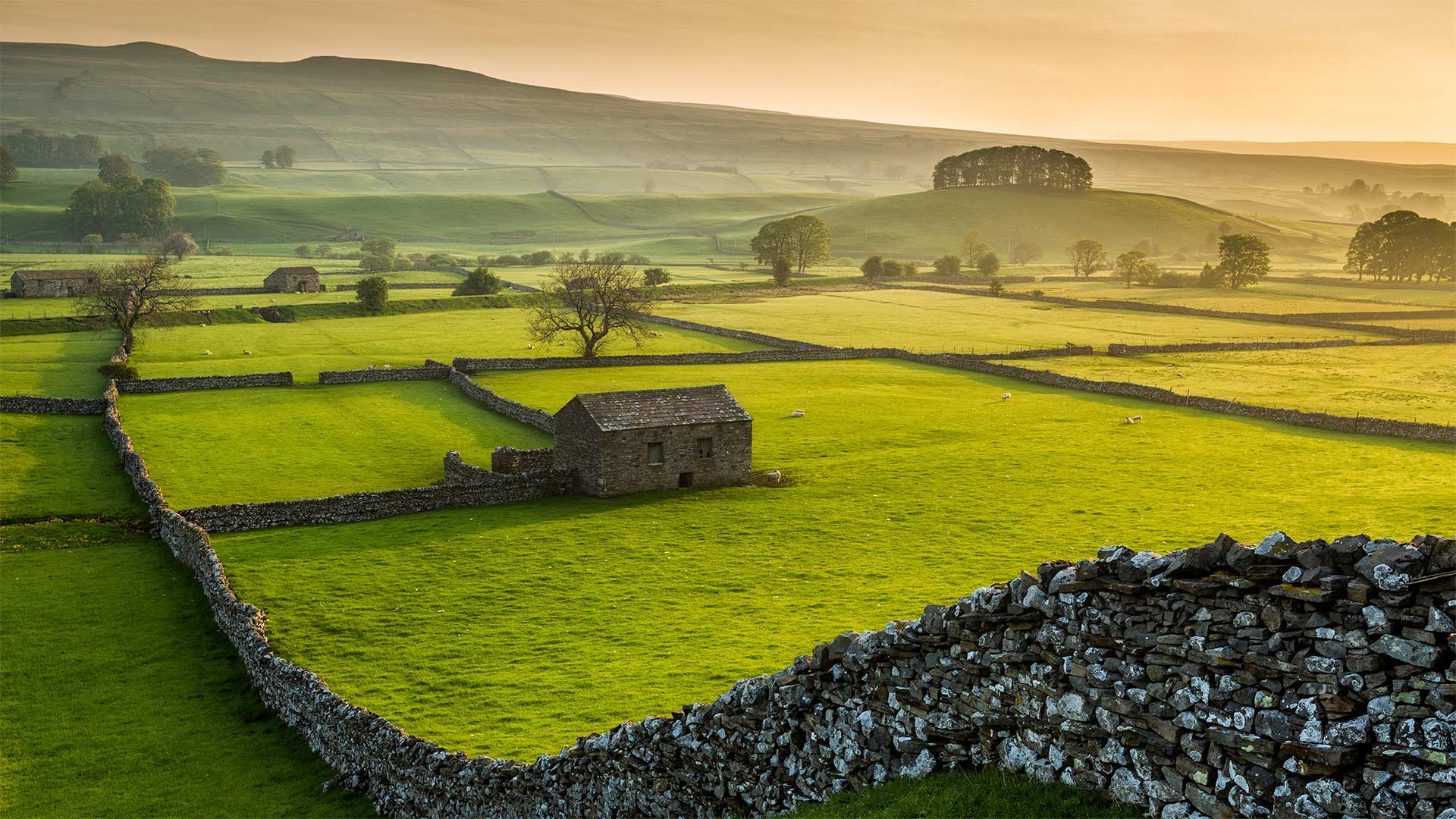
文斯利代尔,英格兰约克郡谷地国家公园 Wensleydale, Yorkshire Dales National Park, North Yorkshire, England (© Guy Edwardes/Minden Pictures)
'Cheese! We'll go somewhere where there's cheese!'
Ahh, the pastoral countryside of the Yorkshire Dales in Northern England. Dewey mornings, grazing farm animals, hand-built dry stone walls, and…cheese? Well, if you're a fan of the beloved British claymation series 'Wallace & Gromit,' then you may have first heard of this area of the Yorkshires, Wensleydale, because of its local cheese. In fact, the animated duo's notorious affinity for the local curd--which Wallace likes because producers thought it makes his face look 'nice and toothy'—became so widespread that it helped the Wensleydale cheesemakers stave off bankruptcy.
Cheese aside, another staple of Wensleydale, and the surrounding Yorkshire Dales National Park, are the 5,000 miles of dry stone walls that have crisscrossed the landscape for centuries. The walls were built by farmers to delineate boundaries, clarify land ownership, and more practically, to keep their cows and sheep from wandering off. The walls are considered 'dry' because they were built with no mortar to bind the stones together. Larger stones form a base for the wall, upon which smaller stones are stacked to create two parallel wall faces, constructed simultaneously. More stones are then used to fill in the gap between the two wall faces, with gravity doing the rest. While that may sound flimsy, a well-constructed dry stone wall can last at least 100 years.
“奶酪!我们要去有奶酪的地方
啊,英格兰北部约克郡山谷的田园乡村。杜威的早晨,放牧的农场动物,手工建造的干石墙,还有……奶酪?好吧,如果你是一个喜爱的英国粘土系列'华莱士和格罗米特'的粉丝,那么你可能第一次听说这个地区的约克郡,温斯莱代尔,因为它的当地奶酪。事实上,这对动画片中的二人组对当地乳酪臭名昭著的亲和力——华莱士喜欢这种乳酪,因为制作人认为这种乳酪能让他的脸看起来“又漂亮又有牙齿”——变得如此广泛,这帮助温斯利代尔奶酪制造商避免了破产。
除了奶酪之外,温斯莱代尔的另一大主食,以及周围的约克郡戴尔国家公园,都是绵延5000英里的干石墙,几个世纪以来,这些石墙纵横交错。这些围墙是由农民建造的,目的是划定边界,明确土地所有权,更实际的是,防止他们的牛羊四处游荡。这些墙被认为是“干的”,因为它们建造时没有用砂浆将石头粘合在一起。较大的石头形成墙的基础,较小的石头堆放在上面,形成两个平行的墙面,同时建造。然后用更多的石头填充两个墙面之间的缝隙,剩下的部分由重力来完成。虽然这听起来很脆弱,但一座建造良好的干石墙至少可以使用100年。
新河峡国家公园中的新河峡大桥,西弗吉尼亚州 New River Gorge Bridge in the New River Gorge National Park and Preserve, West Virginia (© Entropy Workshop/iStock/Getty Images Plus)
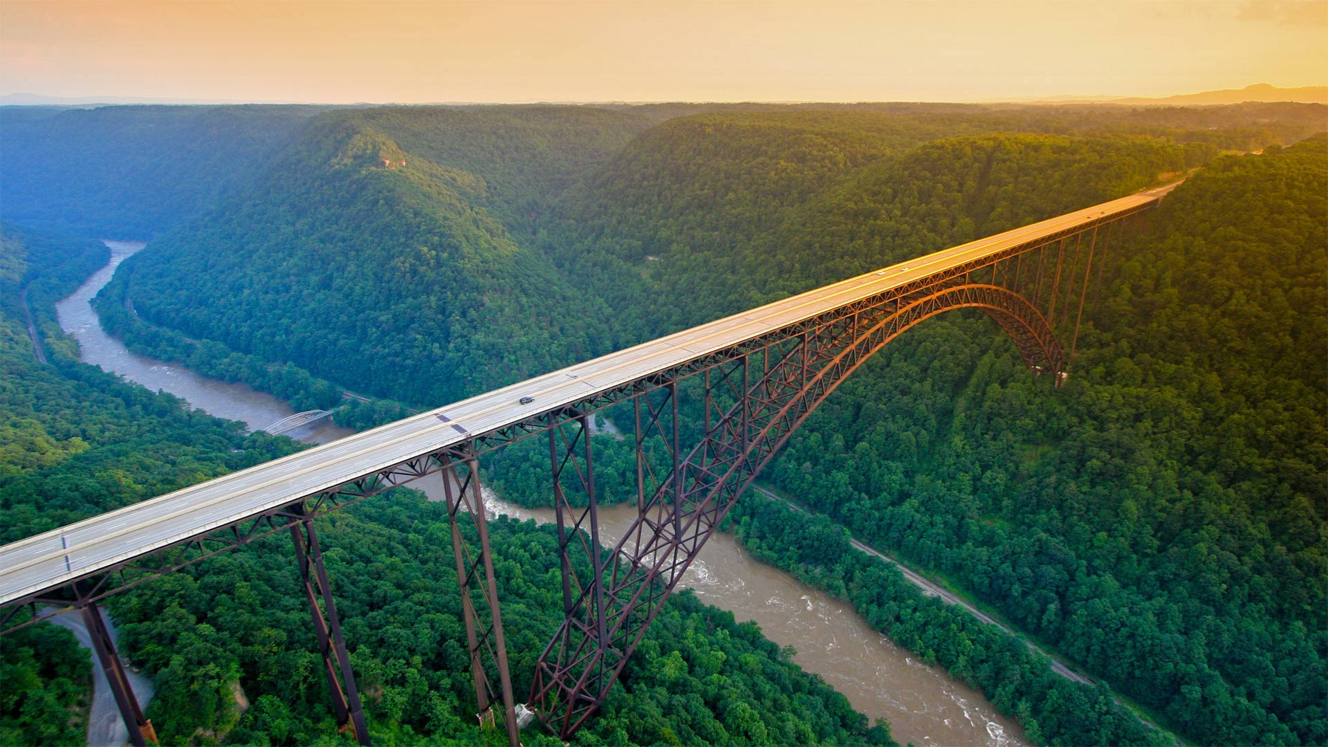
新河峡国家公园中的新河峡大桥,西弗吉尼亚州 New River Gorge Bridge in the New River Gorge National Park and Preserve, West Virginia (© Entropy Workshop/iStock/Getty Images Plus)
A river runs through it
To kick off National Park Week, which begins today, we're visiting America's newest national park, the New River Gorge National Park and Preserve, in West Virginia. This incredible view is of the New River Gorge Bridge, which, when completed in 1977, was the world's highest bridge carrying a regular roadway. It held that distinction for 24 years and is now a popular attraction for BASE jumpers and rappelers.
Far below the bridge is the New River, which—despite its name—is the second oldest river in the world. Its exact age is unknown, but geologists believe the New River is a segment of the preglacial Teays River, which fossil evidence suggests could be 320 million years old. Today, rafters and kayakers come to ride the New River rapids, which can reach a level of Class V, which means they're among the most difficult waters to navigate.
一条河穿过它
为了拉开今天开始的国家公园周的序幕,我们将参观美国最新的国家公园,西弗吉尼亚州的新河峡谷国家公园和保护区。这是令人难以置信的观点是新河峡谷大桥,这是在1977年建成时,世界上最高的桥梁进行定期道路。24年来,它一直保持着这一殊荣,现在已经成为跳垒和饶舌的热门景点。
桥下远处是新河,尽管它的名字是世界上第二古老的河流。它的确切年龄不得而知,但地质学家认为这条新河是前冰期Teays河的一段,化石证据表明这条河可能有3.2亿年的历史。今天,椽子和皮划艇来乘坐新的河流急流,这可以达到五级水平,这意味着他们之间的最困难的水域航行。
伦索伊斯马拉年塞斯国家公园,巴西巴雷里尼亚斯市 Lençóis Maranhenses National Park in Barreirinhas, Brazil (© WIN-Initiative/Getty Images)
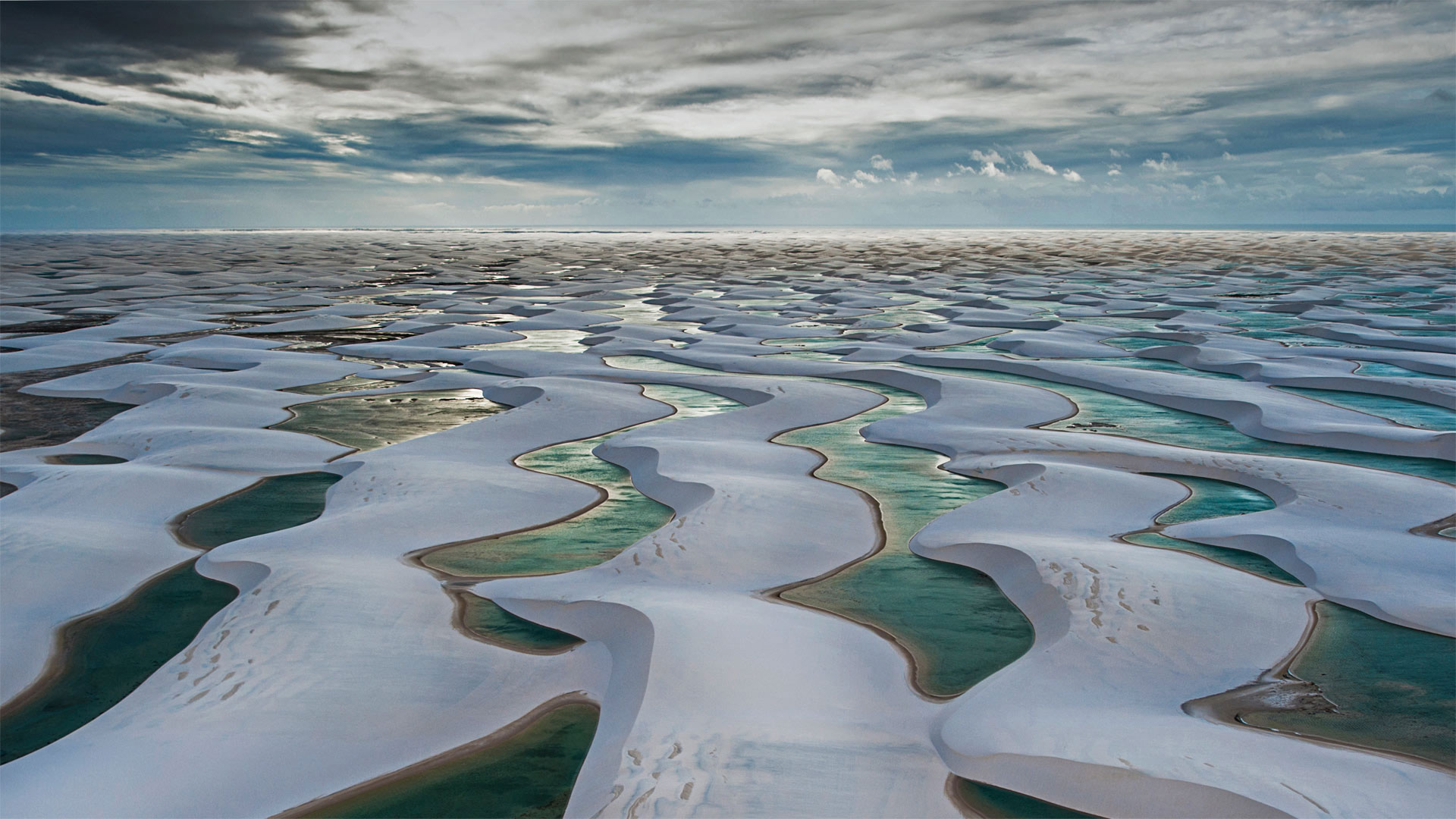
伦索伊斯马拉年塞斯国家公园,巴西巴雷里尼亚斯市 Lençóis Maranhenses National Park in Barreirinhas, Brazil (© WIN-Initiative/Getty Images)
White dunes, blue lagoons
From the air, the mesmerizing tapestry of sandy dunes and lagoons you see here gives Lençóis Maranhenses National Park an otherworldly, desert-like appearance. Located in the sparsely populated Northeast corner of Brazil, this park gets far too much annual rainfall—nearly 50 inches—to be considered a desert. In fact, heavy rain is part of what makes this place unique: Nearly 70% of its annual rainfall comes between January and May, filling the park's nearly 40,000 lagoons to the brim with fresh rainwater. Why doesn't the water sink into the sand? A layer of impermeable bedrock beneath the dunes prevents that from happening.
Despite its remote location, the park, established in 1981, has become a popular destination for ecotourists. They come partly to see the many kinds of animals and plants that manage to thrive here, including several endangered species. One of the park's most famous inhabitants is the predatory Atlantic wolffish, which lies dormant during the dry season by burying itself into the layers of wet mud in the lagoons, only to reemerge to snack on unsuspecting prey as the pools refill with the rains.
白色沙丘,蓝色泻湖
从空中看,这里迷人的沙丘和泻湖挂毯给了伦索斯马兰森斯国家公园一个超凡脱俗的沙漠般的外观。这个公园位于巴西人口稀少的东北角,年降雨量高达近50英寸,不算沙漠。事实上,暴雨是这个地方独特之处的一部分:每年近70%的降雨量来自1月至5月,公园近4万个泻湖被新鲜雨水填满。为什么水不沉进沙子里?沙丘下面的一层不透水的基岩阻止了这种情况的发生。
尽管地理位置偏远,但这座建于1981年的公园已成为生态旅游者的热门目的地。他们来这里的部分原因是看到许多种类的动植物在这里繁衍生息,包括一些濒临灭绝的物种。该公园最著名的居民之一是捕食性的大西洋狼鱼,它在旱季蛰伏在泻湖的湿泥层中,结果又重新出现,在雨水不断涌入的池塘中捕食毫无防备的猎物。
斯诺登山与兰贝里斯山口,英国史诺多尼亚国家公园 Mount Snowdon and the Llanberis Pass in Snowdonia National Park, North Wales, United Kingdom (© Alan Novelli/Alamy)
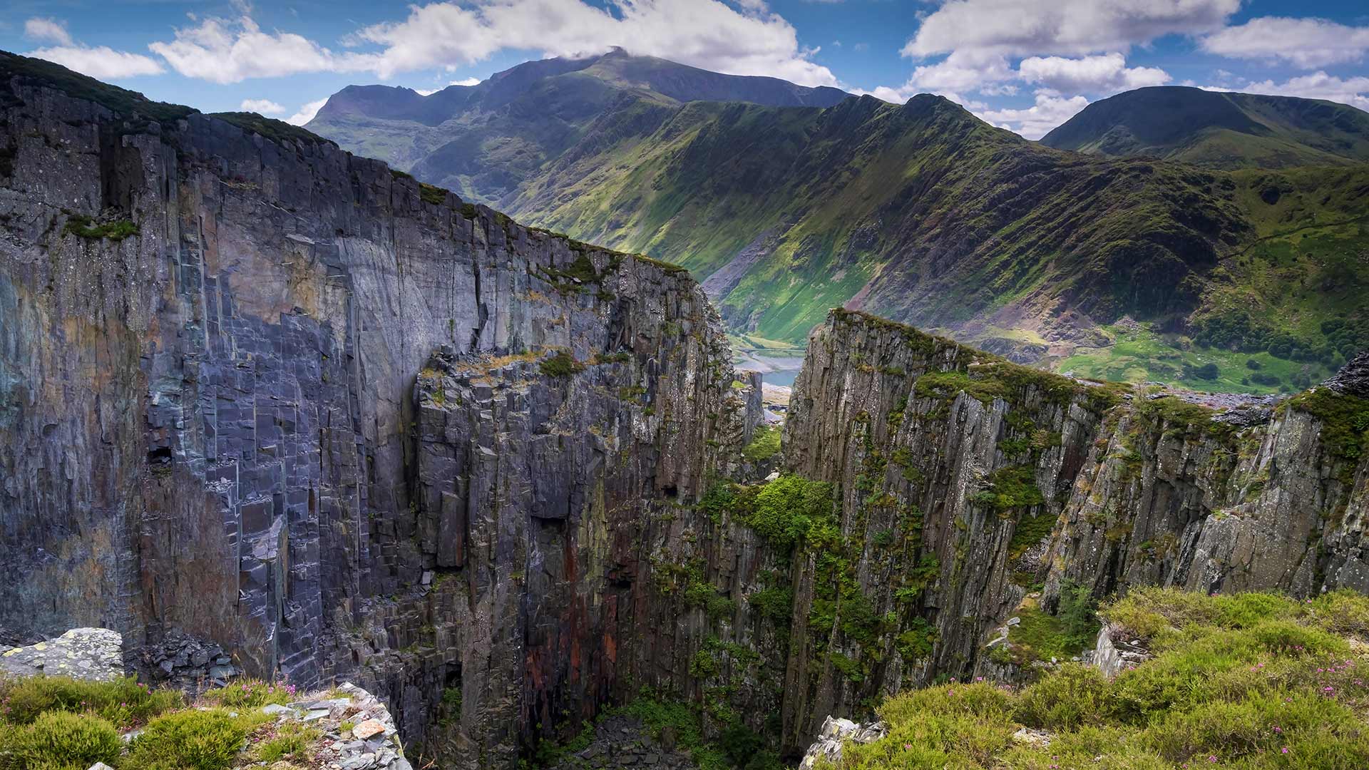
斯诺登山与兰贝里斯山口,英国史诺多尼亚国家公园 Mount Snowdon and the Llanberis Pass in Snowdonia National Park, North Wales, United Kingdom (© Alan Novelli/Alamy)
A chiselled landscape
This dramatic view brings together two Welsh icons. In the distance sits the country’s highest mountain, Snowdon, while the towering walls of slate in the foreground nod to an industry which has reshaped the landscape here over the centuries. This is the former Dinorwic quarry in the county of Gwynedd, once the second-largest slate quarry in the world after nearby Penrhyn. Slate was first extracted here by the Romans but the process really gathered steam during the industrial revolution, when it became known as the industry that ‘roofed the world’.
At its height in the late 19th century, thousands of men were employed at Dinorwic and the Welsh slate industry as a whole extracted about 485,000 tonnes a year. Slate quarrying chiselled its way into the landscape and communities grew up around it. But in 1969, Dinorwic closed, a victim of falling demand and cheaper imports. Now Dinorwic is home to the National Slate Museum of Wales, thanks in part to the efforts of the quarry’s former chief engineer, Hugh Richard Jones, who saved the 51ft (15.4m)-wide waterwheel and other equipment from being sold off.
Welsh slate has a worldwide reputation for quality and was used in the construction of Westminster Hall in London, Copenhagen City Hall and the Royal Exhibition Building in Melbourne, Australia. An important part of Welsh industrial and cultural heritage, this slate landscape has been nominated by the UK government for Unesco World Heritage status.
轮廓分明的风景
这一戏剧性的景象汇集了两个威尔士图标。远处坐落着该国最高的山峰斯诺登,而前景中高耸的石板墙表明,几个世纪以来,这一行业重塑了这里的景观。这是格温内德县的前迪诺维奇采石场,曾经是仅次于附近的彭恩的世界第二大板岩采石场。石板最早是罗马人在这里开采的,但在工业革命期间,这一过程真的积聚了蒸汽,当时它被称为“给世界盖屋顶”的工业。
在19世纪末的鼎盛时期,成千上万的人受雇于迪诺维奇,整个威尔士板岩行业每年开采约48.5万吨。石板采石逐渐进入了风景区,周围的社区也随之发展起来。但在1969年,Dinorwic关闭了,成为需求下降和进口价格下降的受害者。如今,迪诺维奇是威尔士国家石板博物馆的所在地,这在一定程度上要归功于采石场前总工程师休·理查德·琼斯(Hugh Richard Jones)的努力,他挽救了这座51英尺(15.4米)宽的水车和其他设备,使其免遭抛售。
威尔士板岩的质量在世界范围内享有盛誉,曾用于伦敦威斯敏斯特大厅、哥本哈根市政厅和澳大利亚墨尔本皇家展览大楼的建设。作为威尔士工业和文化遗产的重要组成部分,这块石板景观已被英国政府提名为联合国教科文组织世界遗产。
摇篮山-圣克莱尔湖国家公园,澳大利亚塔斯马尼亚州 Cradle Mountain-Lake St. Clair National Park, Tasmania, Australia (© Paparwin Tanupatarachai/Getty Images)
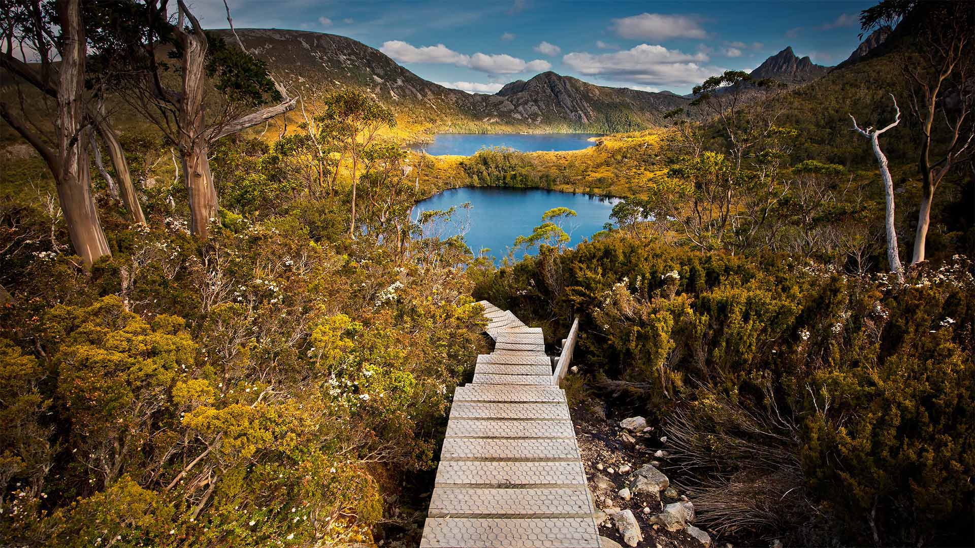
摇篮山-圣克莱尔湖国家公园,澳大利亚塔斯马尼亚州 Cradle Mountain-Lake St. Clair National Park, Tasmania, Australia (© Paparwin Tanupatarachai/Getty Images)
The wild heart of Tasmania
This boardwalk leads to one of the many lakes that dot Tasmania's Cradle Mountain–Lake St. Clair National Park, one of the crown jewels of the island's Wilderness World Heritage area. Covering over 623 square miles in the interior of the island, the park is home to an incredible diversity of flora and fauna. Marsupials like Bennett's wallabies, quolls, Tasmanian pademelon, and the legendary Tasmanian devils, as well as short-beaked echidnas, platypuses, wombats, and Tasmanian pygmy possums can be found in its ancient forests and lakes.
In late April and into May, locals and visitors delight in the 'Turning of the Fagus' when the leaves of the deciduous Tasmanian beech trees turn brilliantly yellow, orange, and red. The Overland Track, as 65-mile-long circuit of the park is a popular route for visitors, whether exploring a portion of it over a day or taking a week to complete the entire route. Overnight hikers can stay in warming huts built along the way and spend the night dazzled by the stars and the aurora australis (aka the southern lights) in one of island's best stargazing locations.
塔斯马尼亚的野心
这条木板路通往点缀塔斯马尼亚摇篮山的众多湖泊之一——圣克莱尔湖国家公园,是该岛荒野世界遗产区的王冠明珠之一。这个公园占地623平方英里,是岛上动植物多样性令人难以置信的家园。像贝内特的小袋鼠、小袋鼠、塔斯马尼亚的帕德梅隆和传说中的塔斯马尼亚魔鬼,以及短嘴针鼹、鸭嘴兽、袋熊和塔斯马尼亚侏儒负鼠等有袋动物都可以在其古老的森林和湖泊中找到。
在4月下旬到5月,当地人和游客都喜欢“水青冈的转变”,因为每年落叶的塔斯马尼亚山毛榉树的叶子都会变成明亮的黄色、橙色和红色。陆上赛道,作为公园65英里长的赛道,是游客的热门路线,无论是探索一天的一部分,还是花一周的时间完成整个路线。夜间徒步旅行者可以住在沿途建造的温暖小屋里,在岛上最好的观星地点之一度过被星星和南极光(又名南极光)所眩目的夜晚。
鸟瞰高耸入云的洛根山,加拿大克鲁瓦尼国家公园 Aerial image of Mount Logan rising above the clouds in Kluane National Park, Yukon, Canada (© plainpicture/Design Pics/Robert Postma)

鸟瞰高耸入云的洛根山,加拿大克鲁瓦尼国家公园 Aerial image of Mount Logan rising above the clouds in Kluane National Park, Yukon, Canada (© plainpicture/Design Pics/Robert Postma)
Walking in the clouds
Mount Logan is the highest mountain in Canada, and the second-highest peak in North America after Denali. The mountain was named after Sir William Edmond Logan, a Canadian geologist and founder of the Geological Survey of Canada (GSC). Logan is believed to have the largest base circumference of any non-volcanic mountain on Earth. Due to active tectonic uplifting, Mount Logan is still rising in height.
云中漫步
洛根山是加拿大的最高峰,也是北美仅次于德纳利的第二高峰。这座山是以加拿大地质学家、加拿大地质调查局(GSC)创始人威廉·埃德蒙德·洛根爵士的名字命名的。洛根被认为是地球上所有非火山山脉中基围最大的。由于活跃的构造抬升,洛根山仍在上升。
弗洛勒斯岛上的纳闽巴霍,印度尼西亚科莫多国家公园 Komodo National Park, Labuan Bajo, Flores, Indonesia (© Thrithot/Adobe Stock)

弗洛勒斯岛上的纳闽巴霍,印度尼西亚科莫多国家公园 Komodo National Park, Labuan Bajo, Flores, Indonesia (© Thrithot/Adobe Stock)
Here there be dragons
Welcome to Komodo National Park, founded in 1980 to protect the Komodo dragon—a monitor lizard that evolved in this insular environment to be much larger-'scale' than its fellows. Found only on the islands we see here—Komodo and Padar—and a handful of others nearby, it's the biggest lizard walking the Earth today. Not only walking but sprinting: Since adult Komodo dragons often prey on swift Timor deer, you'll sometimes see a dragon in a dead sprint after its would-be dinner, reaching up to 13 miles an hour.
这里有龙
欢迎来到科莫多国家公园,该公园成立于1980年,旨在保护科莫多巨蜥——一种在这个岛屿环境中进化的巨蜥,其“规模”要比同类大得多。只在我们看到的科莫多岛和帕达尔岛以及附近的其他一些岛屿上发现,它是今天地球上行走的最大的蜥蜴。不仅是步行,而且是短跑:由于成年科莫多龙经常捕食速度很快的帝汶鹿,你有时会看到一条龙在吃过晚餐后,以每小时13英里的速度在死气沉沉地短跑。
亚伊马火山与前景中的智利南洋杉,智利孔吉利奥国家公园 Volcano Llaima with Araucaria trees in the foreground, Conguillío National Park, Chile (© Fotografías Jorge León Cabello/Getty Images)
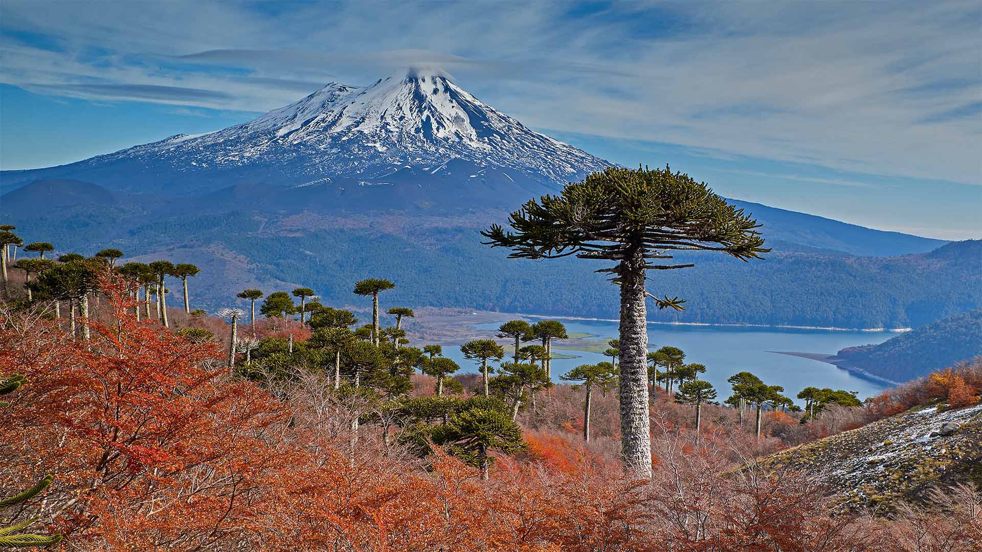
亚伊马火山与前景中的智利南洋杉,智利孔吉利奥国家公园 Volcano Llaima with Araucaria trees in the foreground, Conguillío National Park, Chile (© Fotografías Jorge León Cabello/Getty Images)
Fall for Chile
Autumn in Chile varies widely as one travels from the Atacama Desert in the north more than 2,600 miles south to the tip of Tierra del Fuego. Around halfway between these two extremes you can find Conguillío National Park and the volcano Llaima at Chile's center. In March, at the start of the Southern Hemisphere's autumn, the leaves of the deciduous forest begin to turn color and fall, and the native Chilean pine trees (Araucarias) stand out even more strikingly.
Because of their distinctive appearance and the fact that they thrive in a wide range of climates, the trees became a favorite of botanists in the 19th century, who transported and cultivated them in many temperate climates around the world. The 'monkey puzzle' trees got their common English name in the 1850s when English barrister Charles Austin observed that 'It would be a puzzle for a monkey to climb that.' Even more amazing is that these trees can live over a thousand years and are themselves living fossils, descended from a lineage stretching back 260 million years to the time of the dinosaurs.
爱上智利
智利的秋天变化很大,人们从北部的阿塔卡马沙漠向南行驶2600多英里,到达火地岛的顶端。在这两个极端的中间,你可以看到智利国家公园和智利中心的拉伊马火山。今年3月,南半球秋季伊始,落叶林的树叶开始变色、飘落,智利本土的松树(Araucarias)更加引人注目。
由于其独特的外观和在各种气候条件下茁壮成长的事实,这些树在19世纪成为植物学家的最爱,他们在世界各地的许多温带气候条件下运输和栽培它们。19世纪50年代,英国大律师查尔斯·奥斯汀(Charles Austin)指出,猴子爬上那棵树将是一个谜,于是“猴子拼图”树就有了共同的英文名称。更令人惊奇的是,这些树能活上一千多年,而且本身就是活化石,其世系可追溯到公元前2.6亿年恐龙。