纽约公共图书馆总部翻新后的玫瑰主阅览室,纽约市 The renovated Rose Main Reading Room inside the New York Public Library Main Branch, New York City (© Sascha Kilmer/Getty Images)

纽约公共图书馆总部翻新后的玫瑰主阅览室,纽约市 The renovated Rose Main Reading Room inside the New York Public Library Main Branch, New York City (© Sascha Kilmer/Getty Images)
So many books, so little time
May 23, 2021 marks the 110th anniversary of the opening the of the New York Public Library's Main Branch (now known as The Stephen A. Schwarzman Building). Back just before the turn of the 20th century, a group of New York City businessmen decided that if their hometown was ever going to compete with Paris and London as a center of urban culture, then it needed a great library.
It took almost two decades and a lot of brainpower and money to create the architectural masterpiece that stands today on New York's 42nd Street. On the day it opened to the public, 30,000 to 50,000 people streamed through its doors to take in the architecture and gaze at the one million books on display. The first book request was filed at 9:08 AM and was delivered to the reader 6 minutes later through the library's rapid delivery system. Since then, it's become part of the very fabric of New York and has been featured in movies from 'Breakfast at Tiffany's' to 'Ghostbusters' to 'Spiderman.'
Today, we turn our gaze to the Beaux-Arts delight that is the Main Branch's Rose Reading Room. It is truly one of the city's great public spaces, a lavish hall where one can come to escape the bustle of the city streets and the honking of taxis. This room underwent an extensive renovation after one of the gilded rosettes crashed to the floor in May 2014. Now it's all spiffed up and in perfect form for its anniversary celebration.
这么多的书,这么少的时间
2021年5月23日是纽约公共图书馆主分馆(现称斯蒂芬A。施瓦茨曼大厦)。早在20世纪之交之前,一群纽约市的商人就决定,如果他们的家乡要与巴黎和伦敦作为城市文化中心竞争,那么它就需要一个伟大的图书馆。
它花了将近二十年的时间,用了大量的脑力和金钱,才创造出今天矗立在纽约42街的建筑杰作。在它向公众开放的那天,三万到五万人从它的门前涌进,参观这座建筑,观看展出的一百万本书。第一本书是在上午9点08分提出的,6分钟后通过图书馆的快速投递系统投递给读者。从那时起,它就成为了纽约的一部分,并出现在从《蒂凡尼早餐》到《鬼怪》再到《蜘蛛侠》的电影中
今天,我们将目光转向博克斯艺术的喜悦,这是主要分支的玫瑰阅览室。这真的是一个城市的伟大的公共空间,一个奢华的大厅,人们可以在这里逃离繁忙的城市街道和出租车鸣笛。2014年5月,一个镀金的花环掉在地上,这间屋子经过了一次大范围的翻新。现在,它已经装饰得整整齐齐,为它的周年庆典提供了完美的形式。
由中世纪的城墙包围着的市镇,西班牙滨海托萨 The medieval walled town in Tossa de Mar, Catalonia, Spain (© dleiva/Alamy)
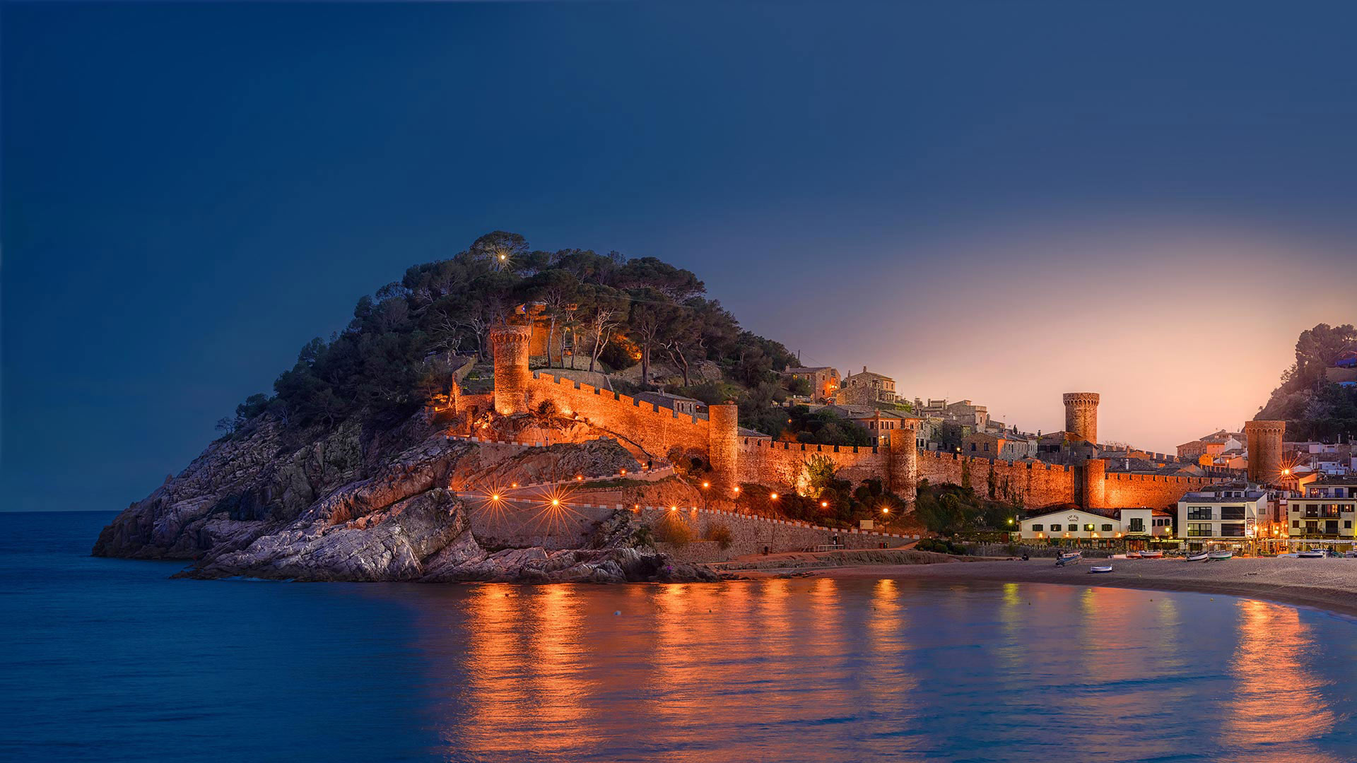
由中世纪的城墙包围着的市镇,西班牙滨海托萨 The medieval walled town in Tossa de Mar, Catalonia, Spain (© dleiva/Alamy)
Blue paradise on the Costa Brava
On Spain's Costa Brava, about 45 miles north of Barcelona, lies a perfectly preserved medieval town just beyond the enceinte (stone wall) you see curving up the hillside. La Vila Vella (The Old Town) blends with the more modern, larger city of Tossa de Mar. Here, the 21st century melds beautifully with the 14th.
Modern hotels are just out of the camera's viewfinder. Visitors can spend their days sunbathing on the beach, diving in the sea or strolling La Vila Vella's narrow, winding streets past centuries-old architecture. Just beyond the defensive walls is the deep blue sea. It was this view that inspired French painter Marc Chagall to nickname Tossa de Mar 'blue paradise.' In fact, Tossa de Mar has long been a haven for artists. Actress Ava Gardner loved the town so much while making two movies there in the '50s that the town has erected a statue in her memory.
布拉瓦海岸蓝色天堂
在西班牙的布拉瓦海岸,巴塞罗那以北大约45英里,坐落着一个保存完好的中世纪城镇,就在你看到的蜿蜒的山坡上。拉维拉维拉(老城区)与更现代化、更大的城市托萨德马尔融合在一起。在这里,21世纪与14世纪完美融合。
现代化的旅馆就在照相机的取景器外。游客可以在沙滩上晒日光浴,在海里潜水,或者漫步在拉维拉维拉的狭窄蜿蜒的街道上,这是一座古老的建筑。就在防御墙的后面是深蓝色的大海。正是这种观点启发了法国画家马克·夏加尔给托萨德马尔起了一个绰号“蓝色天堂”。事实上,托萨德马尔长期以来一直是艺术家的天堂。女演员艾娃·加德纳(Ava Gardner)在50年代拍摄两部电影时非常喜欢这个小镇,以至于小镇在她的记忆中竖起了一座雕像。
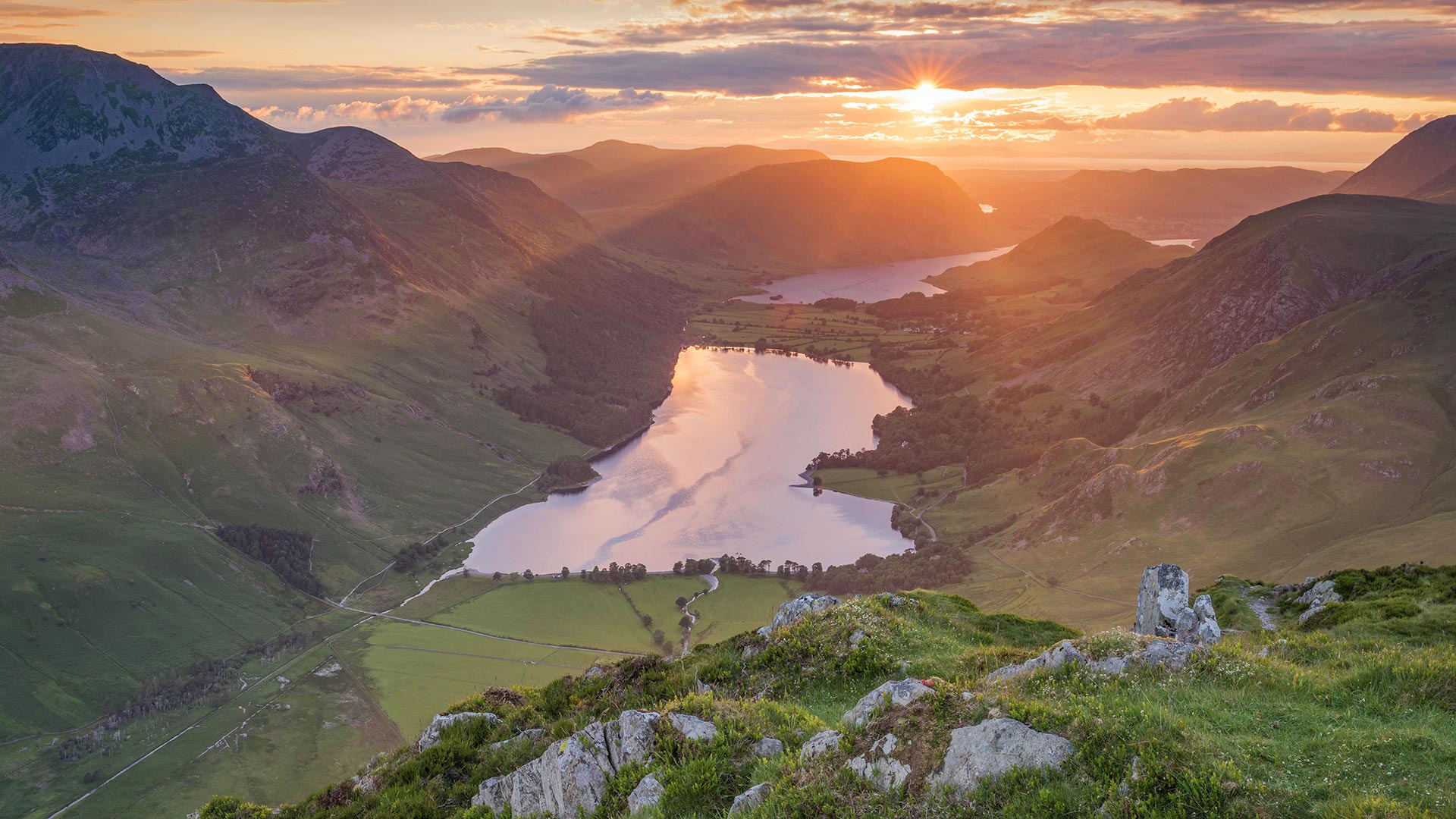
巴特米尔湖上的落日 ,英格兰湖区 (© Stewart Smith/Alamy)
飘落的杜鹃花瓣铺在Grassy Ridge Bald山的小径上,北卡罗莱纳州皮斯加国家森林 Fallen rhododendron petals line a trail on Grassy Ridge Bald, Pisgah National Forest, North Carolina (© aheflin/Getty Images Plus)
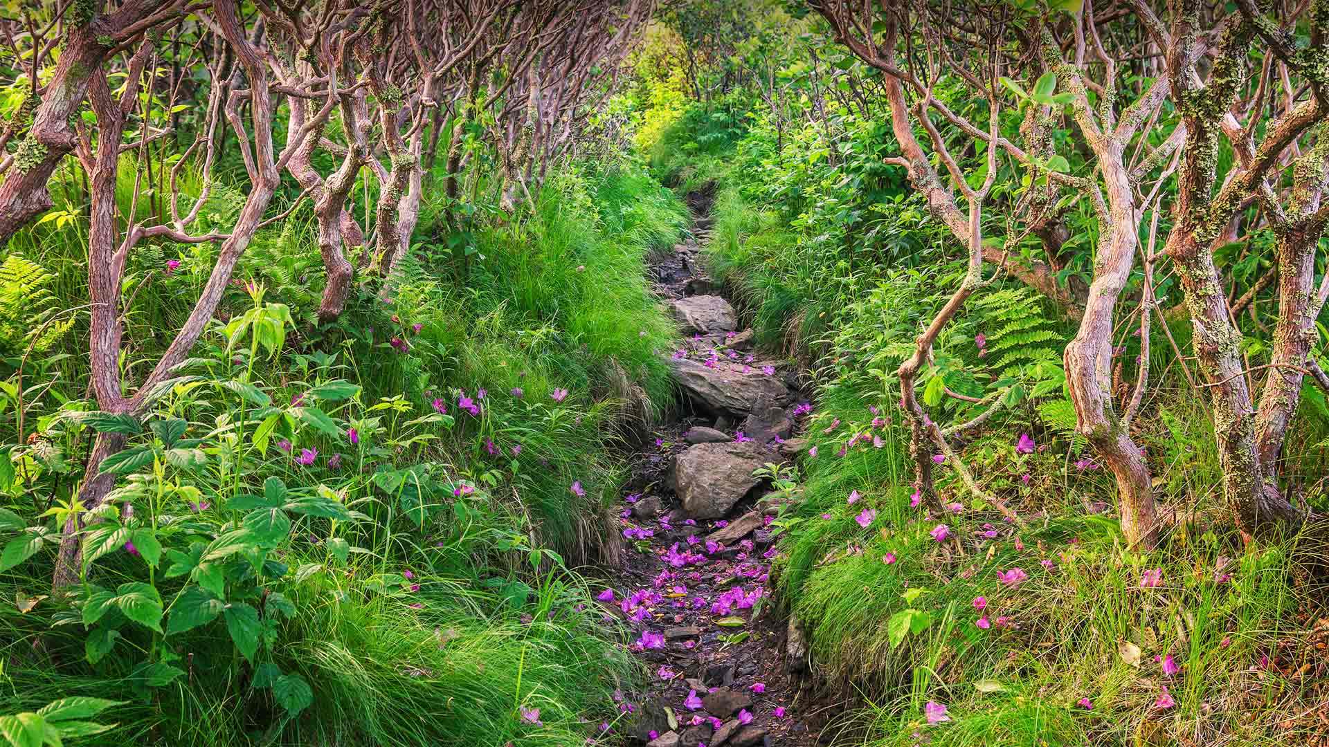
飘落的杜鹃花瓣铺在Grassy Ridge Bald山的小径上,北卡罗莱纳州皮斯加国家森林 Fallen rhododendron petals line a trail on Grassy Ridge Bald, Pisgah National Forest, North Carolina (© aheflin/Getty Images Plus)
A path lain with petals
Pisgah National Forest, in western North Carolina, is primarily a hardwood forest boasting 500,000 acres of mountainous peaks and cascading waterfalls that attract hikers, anglers, mountain bikers, and more. But from mid-May to mid-June, the crowds flock here to hike trails that lead to incredible views: acres of native Catawba rhododendrons in full blossom.
The trail pictured here leads to Grassy Ridge Bald and to the 'rhodies.' Grassy Ridge Bald is one of several treeless, grassy ridges found in Pisgah's Roan Mountains, which straddle the Tennessee and North Carolina border. The area boasts not just Catawba rhododendrons, but also huge swaths of orange flame azaleas and wildflowers. If you're lucky, you may even spot the rare Gray's Lily, which was first discovered on Roan Mountain.
铺满花瓣的小路
皮斯加国家森林位于北卡罗来纳州西部,主要是一片硬木森林,拥有50万英亩的山峰和瀑布,吸引着远足者、钓鱼者、山地自行车手等等。但从5月中旬到6月中旬,人们蜂拥到这里徒步旅行,这里可以看到令人难以置信的景色:成片的当地卡塔巴杜鹃花盛开。
图中的这条小径通向“草岭秃顶”和“罗地亚”。草岭秃顶是在横跨田纳西州和北卡罗来纳州边界的皮斯加罗恩山脉发现的几种无树、长满草的山脊之一。这个地区不仅拥有卡塔巴杜鹃,还有大片的橙色火焰杜鹃花和野花。如果你幸运的话,你甚至可以发现罕见的灰百合,这是最早在罗安山发现的。
西班牙马拉加蓬皮杜中心 Centre Pompidou Málaga in Málaga, Spain (© Wim Wiskerke/Alamy)
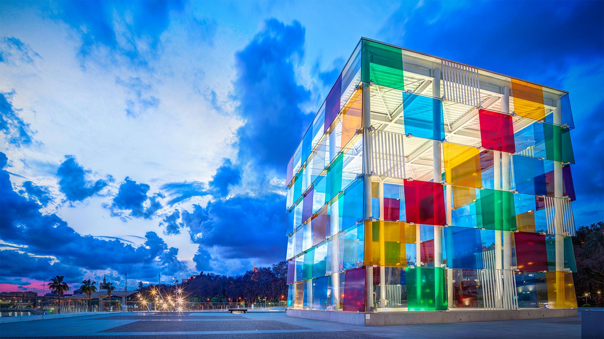
西班牙马拉加蓬皮杜中心 Centre Pompidou Málaga in Málaga, Spain (© Wim Wiskerke/Alamy)
International Museum Day
On International Museum Day, we're looking at the Centre Pompidou Málaga in Spain, an offshoot of the modern art museum in Paris. This location was introduced in 2015 as a pop-up branch—a temporary, underground space for exhibitions and multi-disciplinary experiences as well as workshops dedicated to younger audiences. Originally scheduled for a 5-year run, it was extended until 2025. The piece we see here, 'El Cubo,' created by French artist Daniel Buren, is the only part of the museum that's visible above ground. The glass cube functions as a multicolored skylight, its panels projecting tinted light into the subterranean museum's courtyard below.
International Museum Day began in 1977, with participating museums, galleries, and similar institutions offering free or reduced admission, as well as programs to highlight the work they do. In 2020, the format was adapted to focus on virtual activities, and this year will offer a mix of online, hybrid, and in-person events. As museums around the world begin to re-open their doors, this year's theme is 'The Future of Museums: Recover and Reimagine.'
国际博物馆日
在国际博物馆日,我们看到的是西班牙拉加蓬皮杜市中心,巴黎现代艺术博物馆的一个分支。2015年,这一位置作为一个弹出式分支引入,是一个临时地下空间,用于展览和多学科体验,以及专门为年轻观众举办的研讨会。原计划运行5年,延长至2025年。我们在这里看到的是法国艺术家丹尼尔·布伦(Daniel Buren)创作的“El Cubo”,这是博物馆中唯一能在地面上看到的部分。玻璃立方体的功能就像一个五颜六色的天窗,它的面板将有色光线投射到地下博物馆的庭院下面。
国际博物馆日始于1977年,参加活动的博物馆、美术馆和类似机构提供免费或减少门票,以及突出他们所做工作的项目。2020年,这种形式被调整为以虚拟活动为重点,今年将提供在线、混合和面对面的活动。随着世界各地的博物馆开始重新开放,今年的主题是“博物馆的未来:复原和重新想象”
奥勒松,挪威 Ålesund, Norway (© AWL Images/Offset by Shutterstock)
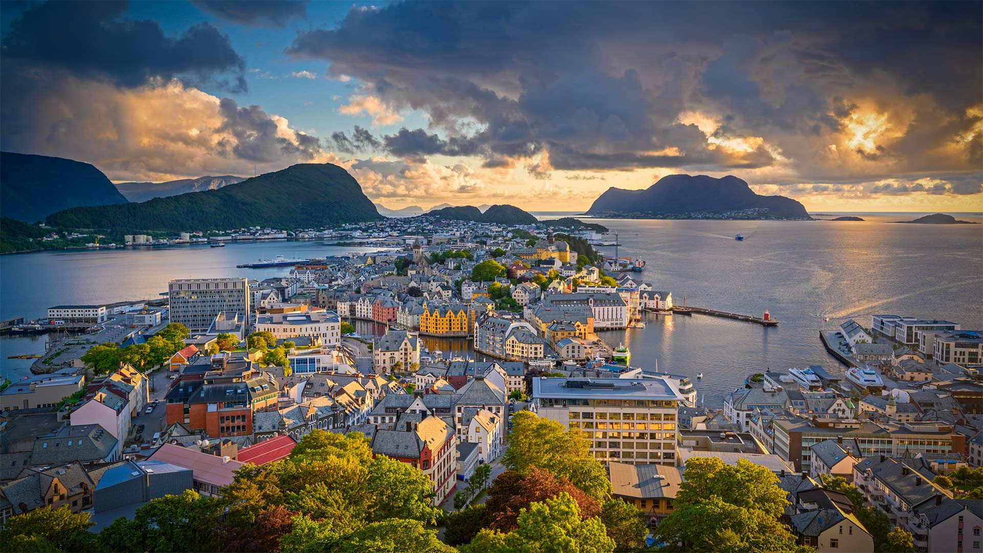
奥勒松,挪威 Ålesund, Norway (© AWL Images/Offset by Shutterstock)
Happy Syttende Mai!
If you have Norwegian roots, May 17, aka Syttende Mai, is a day to celebrate. On this day in 1814, the Constitution of Norway was signed, declaring Norway an independent kingdom. Today we honor this stunning country by flying over the town of Ålesund, nestled amid the mountains and fjords in the western part of the country. This seaport stretches across several islands linked by bridges and is known for its charming Art Nouveau architecture. In ordinary years, Ålesund draws hordes of tourists and serves as a gateway for visitors to explore the bird island of Runde as well as Geirangerfjord, considered one of Norway's most beautiful fjords.
祝你快乐!
如果你有挪威的根,5月17日,又名Syttende Mai,是一个值得庆祝的日子。1814年的今天,挪威宪法签署,宣布挪威为独立王国。今天,我们飞过这个令人惊叹的国家Å莱松,坐落在该国西部的群山和峡湾之中。这个海港横跨几个岛屿,由桥梁连接,以其迷人的新艺术主义建筑而闻名。平日里,Å莱松德吸引了大批游客,成为游客探索伦德鸟岛以及被认为是挪威最美丽峡湾之一的盖兰热峡湾(Geirangerfjord)的门户。
鸟瞰瓜塔佩巨岩,哥伦比亚瓜塔佩 Aerial view of El Peñón de Guatapé, Guatapé, Antioquia, Colombia (© Amazing Aerial Agency/Offset by Shutterstock)
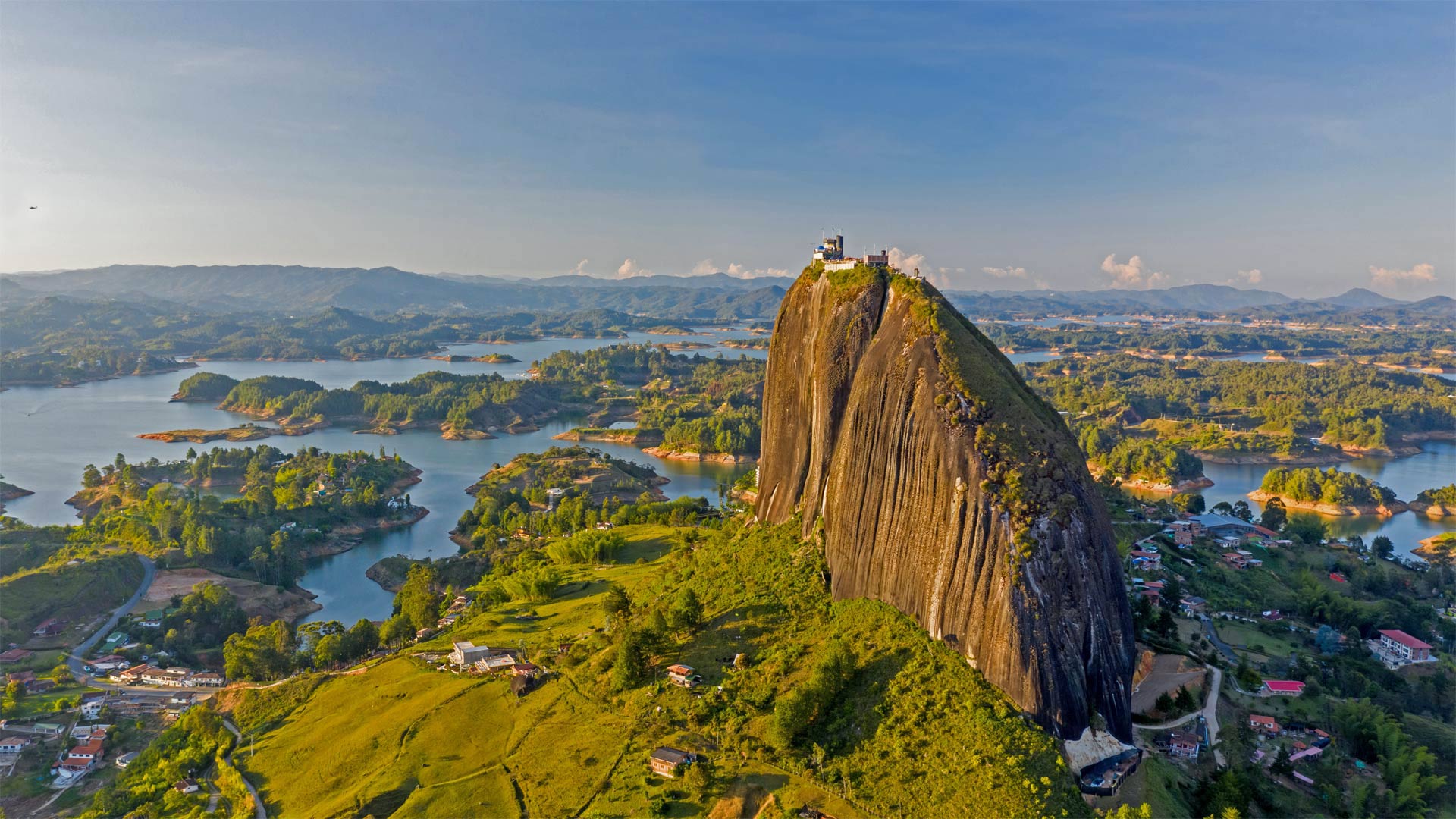
鸟瞰瓜塔佩巨岩,哥伦比亚瓜塔佩 Aerial view of El Peñón de Guatapé, Guatapé, Antioquia, Colombia (© Amazing Aerial Agency/Offset by Shutterstock)
A magnificent monolith
Towering more than 650 feet, El Peñón de Guatapé (The Rock of Guatapé) is an inselberg, which is geologist-speak for a stone monolith that stands alone amid relatively flat surroundings. This huge rock is found in northwest Colombia, a region once inhabited by indigenous Tahamí people, who are said to have worshipped El Peñón, as many locals now call it. Probably because it's so smooth, no one is known to have climbed the rock until 1954, when a small group of friends scaled it by wedging a series of boards into a vertical crack. It took them five days to reach the top.
These days El Peñón is considerably easier to climb, but it'll still make you work for that view at the top. Into the same crack the climbers used back in '54, a masonry staircase now makes several switchbacks all the way to the summit. Each of the 740 stairs is numbered, so you can be reminded with each step just how many more remain before you arrive at the viewing platform up top.
宏伟的巨石
高达650英尺,瓜塔佩岛 (瓜塔佩之岩) 是一个孤山,这是地质学家所说的在相对平坦的环境中独立存在的一块石头。这块巨石发现于哥伦比亚西北部,该地区曾是土著塔哈姆人的聚居地í 据说崇拜艾尔佩的人ñón、 正如许多当地人现在所说。可能是因为它太光滑了,直到1954年,一小群朋友用楔子把一系列木板塞进一条垂直的裂缝里,才知道有人爬上过这块岩石。他们花了五天时间才到达顶峰。
这些天埃尔佩ñón是相当容易攀登,但它仍然会使你在顶部的看法工作。在54年登山者使用过的同一条裂缝中,一个石质楼梯现在可以在通往山顶的路上进行多次转换。740个楼梯中的每一个都有编号,因此在您到达顶部的观景台之前,每一步都可以提醒您还有多少楼梯。
帕瑞纳天文台的望远镜和星迹,智利阿塔卡马沙漠 Telescopes and star trails at Paranal Observatory, Atacama Desert, Chile (© Matteo Omied/Alamy)

帕瑞纳天文台的望远镜和星迹,智利阿塔卡马沙漠 Telescopes and star trails at Paranal Observatory, Atacama Desert, Chile (© Matteo Omied/Alamy)
Happy Astronomy Day!
No, that's not a downpour of lightsabers—but it's no typical night sky either. Stargazing here at Paranal Observatory, on a mountaintop in Chile's desolate Atacama Desert, you'll get one of the clearest possible naked-eye views of the southern skies. This 'lightsaber' effect comes from the photo's long exposure: What we're seeing is these stars' paths as they track across the night sky due to our planet's rotation. The dazzling colors indicate temperature, from chilly red (5,000-ish degrees Fahrenheit) to balmy blue (temps in the tens of thousands).
What about those structures beneath the starry sky? They're three of the eight telescopes making up the Very Large Telescope, an aptly named project of the European Southern Observatory. Together the telescopes compose photographs of astronomically fine focus: If you were to drive a car on the surface of the moon (which we don't advise trying), the VLT could snap a crystal-clear shot of your headlights.
天文学节快乐!
不,那不是一场光剑雨,但也不是典型的夜空。在智利荒凉的阿塔卡马沙漠的山顶上,你可以用肉眼看到最清晰的南方天空。这种“光剑”效应来自于照片的长时间曝光:我们看到的是由于我们星球的自转,这些恒星在夜空中的轨迹。耀眼的颜色表示温度,从冷红色(5000华氏度)到温和的蓝色(数万华氏度)。
星空下的那些建筑呢?它们是组成超大型望远镜的八个望远镜中的三个,这是欧洲南方天文台的一个恰当命名的项目。这些望远镜一起组成了天文上精细聚焦的照片:如果你在月球表面驾驶一辆汽车(我们不建议你尝试),VLT可以拍下你的头灯的清晰照片。
上弗洛雷斯塔附近晨雾中亚马逊雨林,巴西马托格罗索 Amazon rainforest with fog in the morning near Alta Floresta, Mato Grosso, Brazil (© Pulsar Imagens/Alamy)
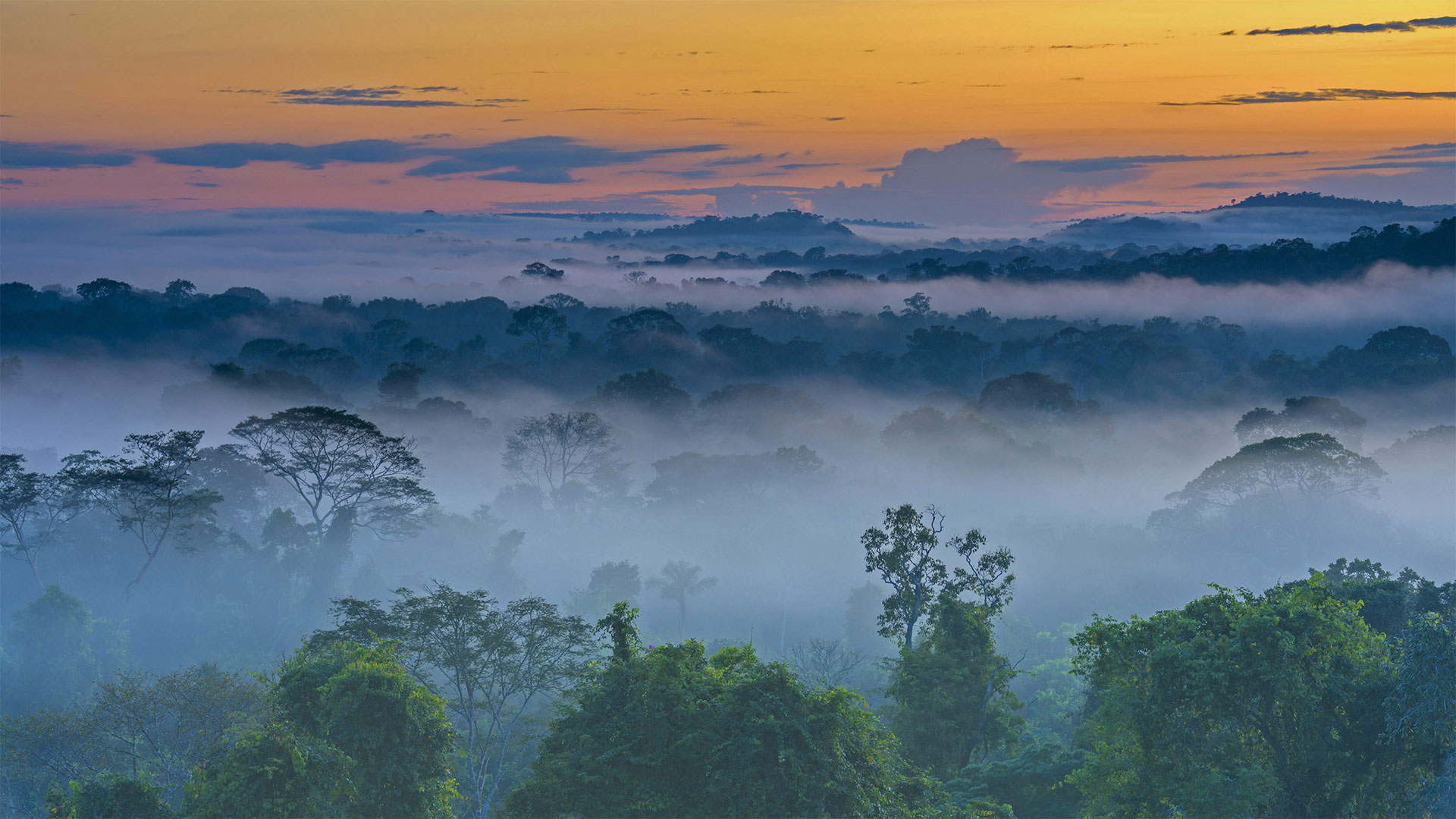
上弗洛雷斯塔附近晨雾中亚马逊雨林,巴西马托格罗索 Amazon rainforest with fog in the morning near Alta Floresta, Mato Grosso, Brazil (© Pulsar Imagens/Alamy)
A misty morning in Brazil
The Amazon rainforest is big. Almost unimaginably big. To begin to grasp its immensity, consider these numbers: The Amazon rainforest covers about 2% of the world's surface area, nearly 2.1 million square miles across South America, mostly (nearly 60%) in the country you see here, Brazil. It's an area that accounts for over half the Earth's remaining rainforests. The breadth of biodiversity is incomparable–nearly 16,000 different tree species, 40,000 species of other plants, 2.5 million insect species, and over 2,000 different types of birds and mammals. Incredibly, perhaps a tenth of the planet's known species call the Amazon home, many of which have not even been identified.
Yet, despite its vastness and ecological riches, the Amazon and the world's rainforests in general are in jeopardy, with large swaths of these precious environments being stripped and spoiled every day. Recent analysis has revealed some ominous warning signs that the Amazon rainforest, long known as the 'Lungs of the World,' is now spewing out as much greenhouse gas as it can store because of rampant deforestation here. If true, this is a bad sign in our battle against climate change. Hopefully, these warnings will raise awareness about the importance of rainforests, and the vital 'carbon sink' role they play in creating and maintaining the air that we breath. The more we learn about rainforests, the more we appreciate how our own future, and the future of our planet, hinges upon their health.
巴西雾蒙蒙的早晨
亚马逊雨林很大。几乎难以想象的大。要开始理解它的浩瀚,考虑一下这些数字:亚马逊雨林覆盖了大约2%的世界表面积,几乎210万平方英里横跨南美洲,大部分(近60%)在你看到的国家,巴西。这个地区占了地球剩余雨林的一半以上。生物多样性的广度是无与伦比的——将近16000种不同的树种,40000种其他植物,250万种昆虫,2000多种不同类型的鸟类和哺乳动物。令人难以置信的是,地球上大约十分之一的已知物种称亚马逊为家,其中许多物种甚至还没有被确认。
然而,尽管亚马逊地区幅员辽阔,生态资源丰富,但它和整个世界的雨林都处于危险之中,大片宝贵的环境每天都被剥夺和破坏。最近的分析揭示了一些不祥的警告信号,长期以来被称为“世界之肺”的亚马逊雨林,由于这里森林砍伐猖獗,现在正喷出尽可能多的温室气体。如果这是真的,那么这是我们应对气候变化斗争中的一个坏迹象。希望这些警告能提高人们对雨林重要性的认识,以及它们在创造和维持我们呼吸的空气中所起的重要“碳汇”作用。我们对雨林了解得越多,我们就越了解我们自己的未来,以及我们星球的未来如何取决于它们的健康。
美瑛町的四季彩之丘,日本 Shikisai no Oka flower gardens in Biei, Japan (© Tanya Jones/Shutterstock)
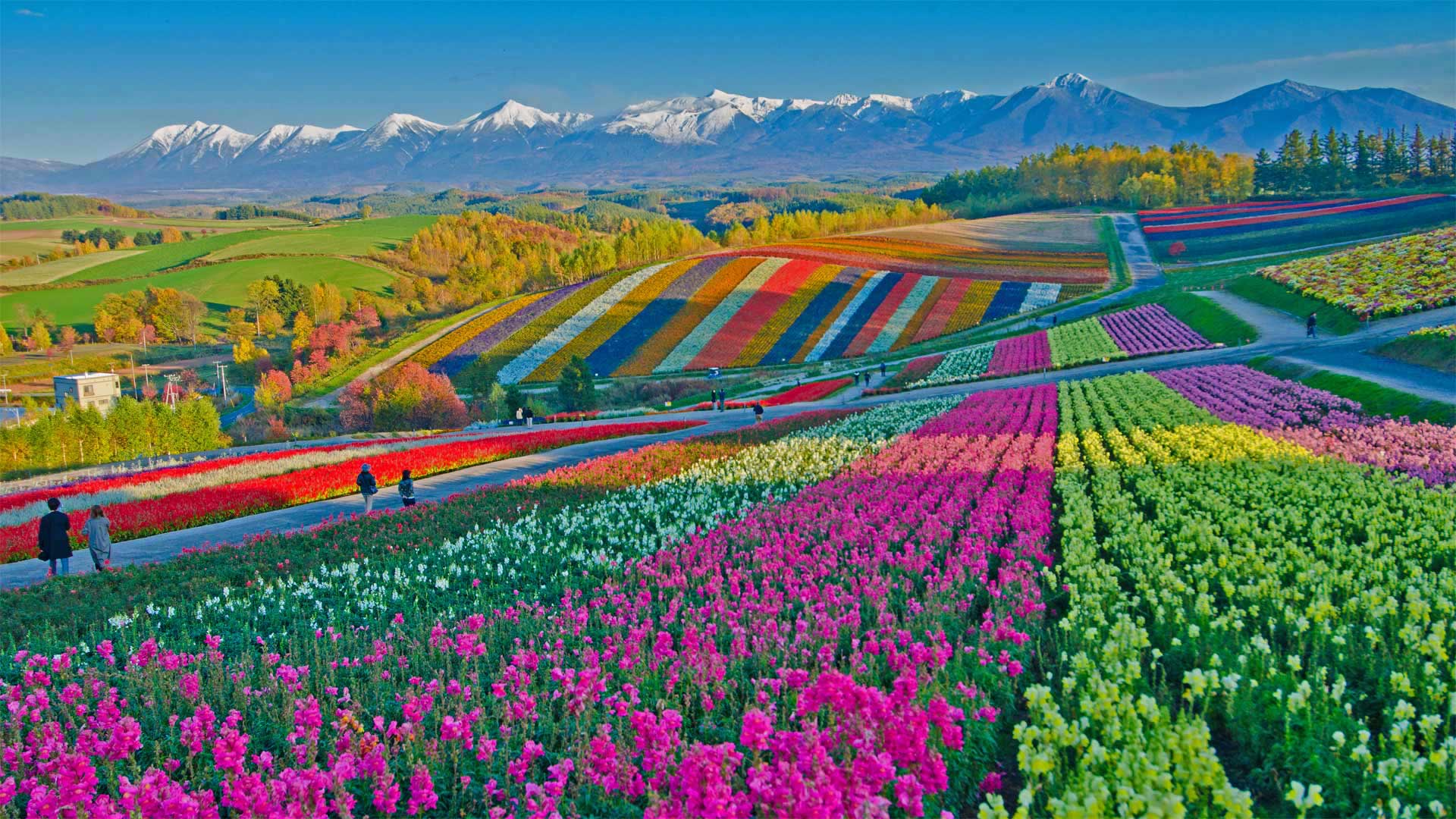
美瑛町的四季彩之丘,日本 Shikisai no Oka flower gardens in Biei, Japan (© Tanya Jones/Shutterstock)
Hues of Hokkaido
The Japanese prefecture of Hokkaido is known the world over as a winter wonderland. But once the snow melts, it's not long before the northerly island becomes a summery extravaganza of color. Just outside the town of Biei in central Hokkaido's hilly highlands, gardeners cultivate a rainbow blanket of tulips, lupine, marigolds, dahlias, and many more flowering plants. So wide is the assortment here at Shikisai no Oka (meaning 'Hills of Seasonal Colors') that if you visit between April and October, you're sure to find at least one type of flower in full bloom.
北海道的色调
日本北海道县被全世界称为冬季仙境。但一旦雪融化,不久,北风岛就变成了夏季色彩的盛宴。就在北海道中部丘陵高地的碧井镇外,园丁们种植着一片彩虹般的郁金香、羽扇豆、万寿菊、大丽花和更多的开花植物。Shikisai Nooka(意为“季节性色彩的山丘”)的品种繁多,如果你在4月至10月期间造访,你肯定会发现至少有一种花开得很茂盛。
