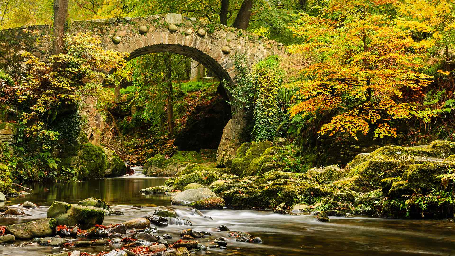
托利莫尔森林公园的弗利桥,英国北爱尔兰 (© Adrian McGlynn/Alamy)
海月水母和一群无刺的黄金水母,印度尼西亚 Moon jelly and an aggregation of stingless golden jellyfish in a landlocked marine lake, Raja Ampat, West Papua, Indonesia (© Alex Mustard/Minden Pictures)

海月水母和一群无刺的黄金水母,印度尼西亚 Moon jelly and an aggregation of stingless golden jellyfish in a landlocked marine lake, Raja Ampat, West Papua, Indonesia (© Alex Mustard/Minden Pictures)
World Jellyfish Day
Today we're celebrating World Jellyfish Day—even though these creatures are best described as otherworldly. Despite their alien qualities (not to mention their inability to vocalize), jellyfish have a lot to say to us about the history of life on Earth.
For example, species like the moon jelly and smaller golden jellies in our picture possess primitive eyes that only detect the presence of light, like the nourishing sunbeams they're chasing here. But some of their cousins, like the box jellyfish, boast several complex eyes with corneas and retinas. These differences help biologists understand how the human eye evolved to process such dazzling spectacles as the jellyfish's delicate dance.
世界水母日
今天我们要庆祝世界水母日,尽管这些生物被形容为超凡脱俗的。尽管水母有着异族的特质(更不用说它们不会发声),但它们对地球上的生命史有着很多的看法。
例如,在我们的照片中,像月亮果冻和较小的金色果冻这样的物种拥有原始的眼睛,它们只能探测到光线的存在,就像它们在这里追逐的滋养阳光一样。但是他们的一些表亲,比如盒子水母,拥有几只复杂的眼睛,有角膜和视网膜。这些差异有助于生物学家了解人类眼睛是如何进化来处理水母微妙的舞蹈等令人眼花缭乱的景象的。
亡灵节上点缀公墓的万寿菊,墨西哥米却肯州 (© Irwin Barrett/Design Pics/Alamy)
薄雾笼罩的松树林,越南 Misty pine forest in the Central Highlands of Vietnam (© Thanh Thuy/Moment/Getty Images)
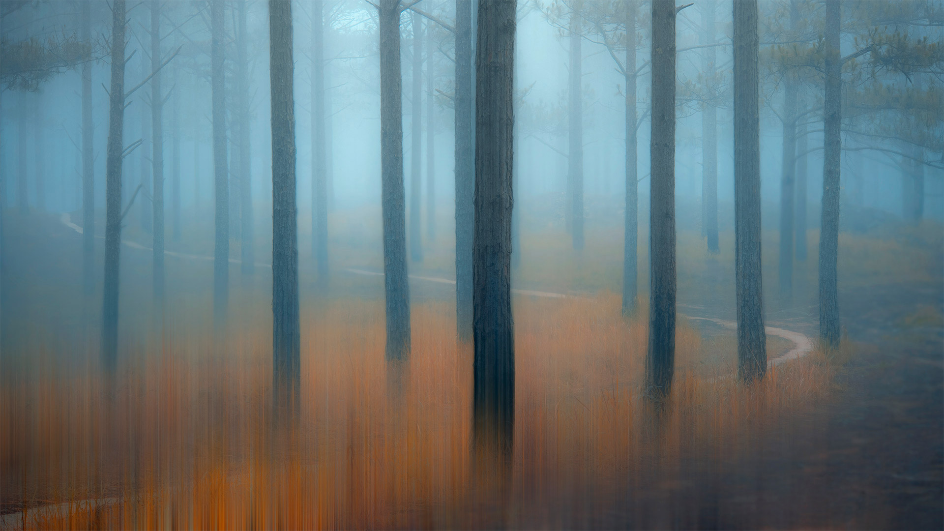
薄雾笼罩的松树林,越南 Misty pine forest in the Central Highlands of Vietnam (© Thanh Thuy/Moment/Getty Images)
Misty Pine Forest
The woods are a tranquil place, but can be scary for a lone wanderer. Out here, you could suddenly find yourself running from the big bad wolf, escaping a witch's clutches, or just plain old lost. Though often in the old stories, scary places like this are also where the hero overcomes a great obstacle or finds a valuable treasure. Could you be in luck?
The spindly pine forests of the Central Highlands of Vietnam, shown here, are the setting for many traditional tales of evil spirits and spells. But even if you don't believe in all that magic stuff, a forest can still feel enchanted when twilight bathes the misty air. Just don't lose your way out here…
雾松林
森林是一个宁静的地方,但对一个孤独的流浪者来说却很可怕。在这里,你可能会突然发现自己在逃离大灰狼,逃离女巫的魔爪,或者只是普通的迷失。虽然在古老的故事中经常出现,但像这样可怕的地方也是英雄克服巨大障碍或找到宝贵财富的地方。你运气好吗?
如图所示,越南中部高地细长的松林是许多传统邪灵和咒语故事的背景。但即使你不相信所有这些神奇的东西,当暮色沐浴在朦胧的空气中时,森林仍然会感到被施了魔法。只是别在这里迷路…
北奥塞梯-阿兰共和国的一片墓地,俄罗斯 Necropolis near Dargavs, North Ossetia, Russia (© Yakov Oskanov/Shutterstock)
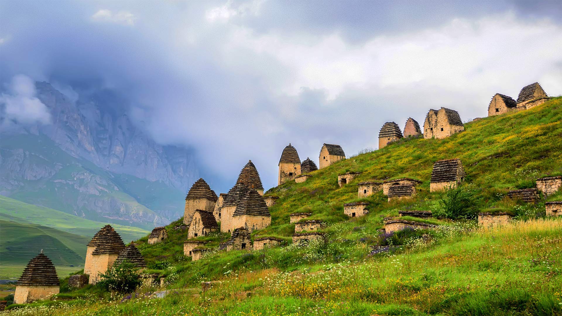
北奥塞梯-阿兰共和国的一片墓地,俄罗斯 Necropolis near Dargavs, North Ossetia, Russia (© Yakov Oskanov/Shutterstock)
Necropolis Near Dargavs
Be glad we're merely paying a virtual visit to this 'City of the Dead' outside Dargavs, Russia. Local folklore warns that if you set foot here, you won't escape with your life. We're not sure the dead pose such a mortal danger, but what's certain is that this is a dead-quiet village. These vaulted-roof huts are not homes—they're crypts.
Were you here, you might peer into the sole window of any of these huts and see the inhabitants, some entombed with their earthly possessions, others laid to rest in rowboats to paddle into the afterlife. Many of the remains are preserved unsettlingly well—and they more than outnumber you. In use from at least the 16th to 18th centuries, this necropolis is populated by about 10,000 departed ancestors.
Spooked enough yet? If not, try today's quiz about cemeteries, tombstones, and other grave matters…if you dare.
达尔加夫附近的墓地
很高兴我们只是虚拟地参观了俄罗斯达尔加夫郊外的这座“死亡之城”。当地民间传说警告说,如果你踏上这里,你将无法逃命。我们不确定死者是否会构成致命的危险,但可以肯定的是,这是一个死寂的村庄。这些拱形屋顶小屋不是家,而是地窖。
如果你在这里,你可能会从这些小屋的唯一窗户望出去,看到里面的居民,有些人被埋在地上,有些人躺在划艇上,准备划入来世。许多遗骸保存得令人不安,数量超过你。至少从16世纪到18世纪,这个墓地居住着大约10000名逝去的祖先。
够吓人了吗?如果不是的话,试试今天关于墓地、墓碑和其他坟墓的小测验……如果你敢的话。
牛顿市的一片南瓜地,美国马萨诸塞州 A pumpkin patch in Newton, Massachusetts (© Frank Debonis/EyeEm/Alamy)

牛顿市的一片南瓜地,美国马萨诸塞州 A pumpkin patch in Newton, Massachusetts (© Frank Debonis/EyeEm/Alamy)
Pumpkin
It's not too late to pick up a pumpkin to add some Halloween flair to your doorstep. Although pumpkins are grown across the country, most of the 2 billion pounds produced in the US come from five states: California, Illinois, Indiana, Pennsylvania, and Texas. While California grows the most pumpkins headed for the jack-o'-lantern market, Illinois wins in poundage, though, most of its crop ends up as pie filling or other processed products—perhaps even your pumpkin spice latte?
And while we're talking orange orbs, what is a pumpkin exactly? You might think they're vegetables, but botanists say they're the fruit of pumpkin vines. They're considered fruit because pumpkins contain seeds and grow from the same part of the plant that produces flowers. Whether you opt to consume or carve, we invite you to enjoy this fruit of the spookiest season!
南瓜
现在还来得及拿起一个南瓜来给你的门阶增添万圣节的气息。尽管南瓜在全国各地都有种植,但美国生产的20亿磅南瓜中的大部分来自五个州:加利福尼亚州、伊利诺伊州、印第安纳州、宾夕法尼亚州和得克萨斯州。虽然加利福尼亚州种植的南瓜最多,销往南瓜灯市场,但伊利诺伊州的南瓜收成却以手续费取胜,尽管如此,它的大部分南瓜收成都是馅饼馅料或其他加工产品,甚至是你的南瓜香料拿铁?
当我们谈论橙色球体时,南瓜到底是什么?你可能认为它们是蔬菜,但植物学家说它们是南瓜藤的果实。南瓜之所以被认为是水果,是因为南瓜含有种子,并且是从植物的同一部位生长而成的。无论您选择消费还是雕刻,我们都邀请您享受这个最恐怖季节的水果!
黑林山中的赤狐,德国 Red fox in the Black Forest of Germany (© Klaus Echle/Minden Pictures)
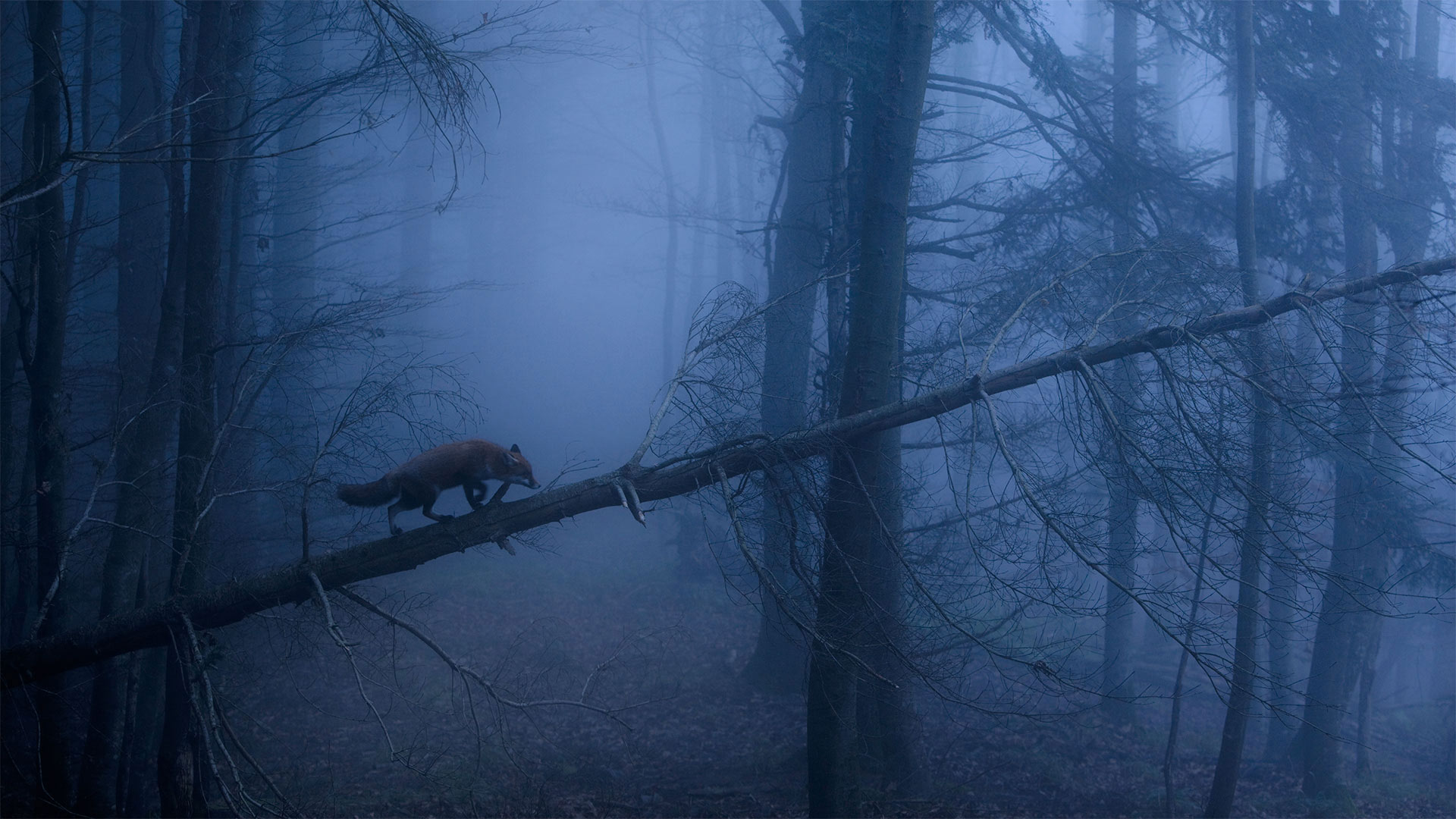
黑林山中的赤狐,德国 Red fox in the Black Forest of Germany (© Klaus Echle/Minden Pictures)
A red fox stalks the Black Forest
Even in the most flattering daylight, foxes somehow always seem up to no good. Not to mention when they're spotted slinking up a fallen tree in a dank, shadowy Black Forest in Germany. These cunning canids get away with a lot just by being cute, don't you think?
That mischievous twinkle in a fox's eye hasn't gone unnoticed by countless cultures around the world. Most fox myths venerate the critter as a trickster or even a shapeshifter who outfoxes larger, meaner foes like lions and bears. But the fox is said to sometimes hoodwink humans too…so keep your wits about you while wandering the wilderness.
一只红狐在黑森林里游荡
即使在最讨人喜欢的日子里,狐狸也似乎总是做得不好。更不用说他们在德国潮湿阴暗的黑森林里偷偷爬上一棵倒下的树了。这些狡猾的犬科动物仅仅因为可爱就逃脱了很多惩罚,你不这么认为吗?
这种恶作剧般的眨眼行为并没有被全世界无数文化所忽视。大多数关于狐狸的神话都把这种小动物视为一个骗子,甚至是一个变形者,它能击败更大、更卑鄙的敌人,如狮子和熊。但是据说狐狸有时也会欺骗人类……所以在荒野中游荡时,要保持机智。
阿尔达河上的魔鬼桥,保加利亚 Dyavolski Most (Devil's Bridge) over the Arda River in Bulgaria (© Petar Mladenov/Alamy)

阿尔达河上的魔鬼桥,保加利亚 Dyavolski Most (Devil's Bridge) over the Arda River in Bulgaria (© Petar Mladenov/Alamy)
Does this crossing carry a curse?
You've heard of a bridge over troubled waters, but what if the bridge is troubled too? Legend tells of a Bulgarian stonemason, Dimitar, who was tasked with solving a bridge problem here in the early 1500s. Dimitar was hired to construct a crossing that wouldn't collapse into the rushing Arda river, as had all previous spans in this strange spot.
How could Dimitar build a bridge to beat all the others? By making a deal with the devil, of course. As one version of the story goes, Lucifer impelled Dimitar to encase his wife's shadow in the stonework, which imbued the bridge with supernatural strength against the rapids. The diabolical catch? Trapping her shadow meant she was doomed to death once construction was completed. Dimitar finished the bridge in 40 days, and his wife died shortly after.
Dyavolski Most (Devil's Bridge) in the Rhodope Mountains of southern Bulgaria stands tall to this day as proof of Dimitar's deadly pact. Or could it be, perhaps, that Dimitar was just a really good stonemason? Five centuries on, it's all water under the bridge…
这个十字路口有诅咒吗?
你听说过一座跨越麻烦的桥,但如果这座桥也有麻烦呢?传说中有一位名叫迪米塔尔的保加利亚石匠,在16世纪初被派来解决这里的一座桥梁问题。迪米塔尔被雇来建造一条不会倒塌到湍急的阿尔达河中的渡口,就像在这个陌生的地方以前所有的跨度一样。
迪米特尔怎么能建造一座桥梁来击败其他所有人?当然是和魔鬼做交易。正如故事的一个版本所说,路西法迫使迪米特尔将他妻子的影子包裹在石雕中,石雕使桥充满了抵御急流的超自然力量。恶魔般的捕获?困在她的影子里意味着一旦建筑完工,她就注定要死。迪米特尔在40天内完成了这座桥,他的妻子不久就去世了。
位于保加利亚南部罗多普山脉的迪亚沃斯基Most(魔鬼之桥)屹立至今,是迪米塔尔致命契约的证明。或者,也许迪米特尔只是一个真正优秀的石匠?五个世纪过去了,桥下全是水…
像巨大指纹一样的Bavljenac岛,克罗地亚 Bavljenac Island, Croatia (© Julien Duval/Amazing Aerial Agency)
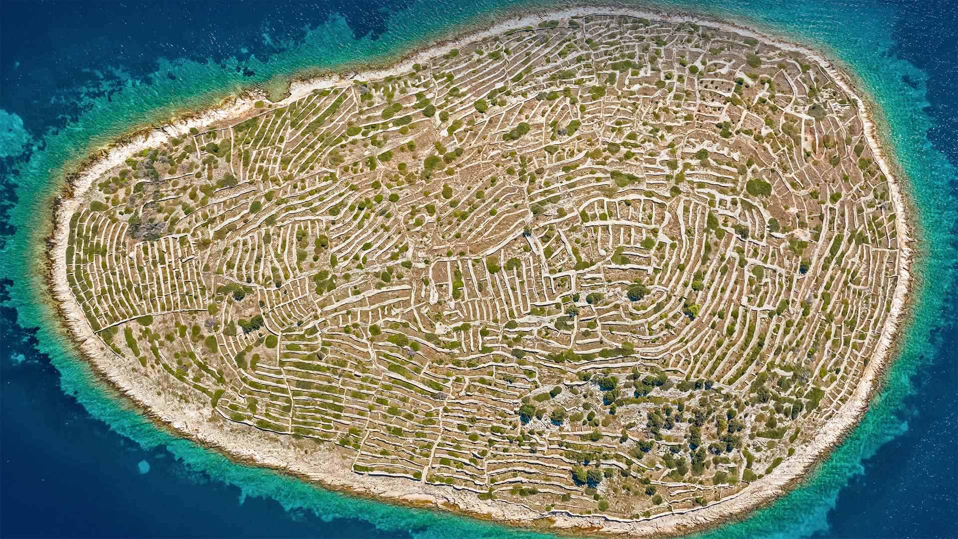
像巨大指纹一样的Bavljenac岛,克罗地亚 Bavljenac Island, Croatia (© Julien Duval/Amazing Aerial Agency)
This 'fingerprint' is one of a kind
Of the 1,246 islands on Croatia's fragmented coast, the unique isle of Bavljenac might be the most identifiable. It's nicknamed 'Fingerprint Island' for its miles of dry-stone walls that look like the whorled ridges of a human fingerprint. The tiny, uninhabited landmass in the Adriatic Sea was once an agricultural center. In the 19th century—the heyday of Croatian wine production— farmers from the nearest populated island built the winding walls on Bavljenac to protect olive trees and grapevines from the winds blowing in from the Adriatic.
这种“指纹”是独一无二的
在克罗地亚支离破碎海岸上的1246个岛屿中,独一无二的巴夫勒耶纳克岛可能是最容易辨认的。它的绰号是“指纹岛”,因为它有几英里长的干石墙,看起来像是人类指纹的螺纹纹路。亚得里亚海中无人居住的小块陆地曾经是一个农业中心。19世纪是克罗地亚葡萄酒生产的全盛时期,来自最近人口稠密岛屿的农民在巴夫勒耶纳克修建了蜿蜒的城墙,以保护橄榄树和葡萄藤免受亚得里亚海吹来的风的影响。
