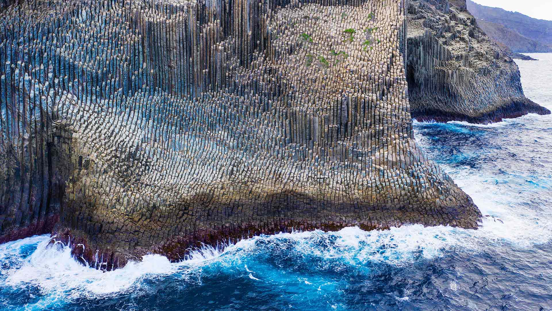
鸟瞰兰萨罗特岛的La Geria葡萄园,西班牙加那利群岛 Aerial view of La Geria vineyards, Lanzarote, Canary Islands, Spain (© Orbon Alija/Getty Images)
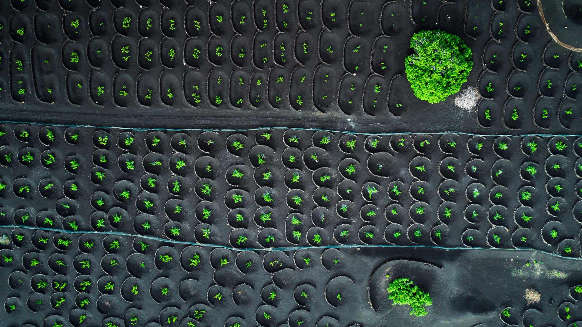
鸟瞰兰萨罗特岛的La Geria葡萄园,西班牙加那利群岛 Aerial view of La Geria vineyards, Lanzarote, Canary Islands, Spain (© Orbon Alija/Getty Images)
Volcanic vineyards
What you can see today in our picture is a bird view of La Geria vineyards, in the Canary island of Lanzarote. They have been there since 18th century and are cultivated following a very special technique, because the vines are planted under the volcanic lapilli, a blanket of ash about two and a half meters thick that covers the land since Timanfaya volcano erupted in 1730 transforming the landscape forever.
To reach the fertile soil, farmers first dig a cone-shaped hole and then build a small stone wall to protect the vines from the trade winds. And since the volcanic ash on the surface prevents rainwater evaporation and captures environmental moisture, plants do not even need added watering.
The variety the most cultivated in this place is volcanic Malvasia, a very special and also very delicate white grape allowing both dry and sweet wines. Due to its unique characteristics, La Geria has also been a protected area since 1987, just as the neighbour Timanfaya National Park, where you can see up to 25 volcanoes concentrated in 51 square kilometers.