天津滨海新区图书馆, 中国天津 Tianjin Binhai New Area Library in Tianjin, China (© Imaginechina Limited/Alamy)

天津滨海新区图书馆, 中国天津 Tianjin Binhai New Area Library in Tianjin, China (© Imaginechina Limited/Alamy)
看到和被看到 See and be seen
World Book Day
World Book Day takes us to the Tianjin Binhai New Area Library in Tianjin, China. Nicknamed 'The Eye,' this immense, stunning facility was completed in 2017 as the focal point of the Binhai Cultural Center. Designed by Dutch design firm MVRDV in collaboration with local architects, the library's floor-to-ceiling bookshelves appear well stocked with books, but most of them are actually printed images. The real books are stored in traditional rooms with normal shelves. Still, it looks super cool.
The original idea for World Bood day was conceived in 1922 by Spanish writer Vicente Clavel Andrés to honor famed 16th century author Miguel de Cervantes. It was first celebrated in 1926 on October 7, Cervantes' birthday, before being moved in 1930 to his death date, April 23, which is also the date of William Shakespeare's death. In Spain, the day often involves an exchange of gifts, with the traditional gifts being a book and a rose. In 1995 the United Nations Educational, Scientific and Cultural Organization (UNESCO) established World Book Day as a worldwide celebration of the written word and the power of stories.
世界图书日
世界图书日带我们去中国天津的天津滨海新区图书馆。这个巨大而令人惊叹的设施被称为“眼睛”,作为滨海文化中心的中心,于2017年竣工。由荷兰设计公司MVRDV与当地建筑师合作设计,图书馆从地板到天花板的书架似乎堆满了书籍,但其中大部分实际上都是印刷品。真正的书存放在传统的房间里,有普通的书架。不过,它看起来超级酷。
1922年,西班牙作家维森特·克拉维尔·安德烈斯(Vicente Clavel Andrés)为纪念16世纪著名作家米格尔·德·塞万提斯(Miguel de Cervantes)而构思了世界嘘声日的最初构想。1926年10月7日,塞万提斯的生日,第一次庆祝这个节日。1930年,塞万提斯去世,也就是4月23日,也就是威廉·莎士比亚去世的日子。在西班牙,这一天通常包括交换礼物,传统的礼物是一本书和一朵玫瑰。1995年,联合国教育、科学及文化组织(UNESCO)设立了世界图书日,作为全世界对文字和故事力量的庆祝。
维多利亚纪念堂,印度加尔各答 (© Roop_Dey/Shutterstock)
卡鲁拉国家公园里的小湖,爱沙尼亚 Small lake in Karula National Park, Valgamaa County, Estonia (© Sven Zacek/Minden Pictures)
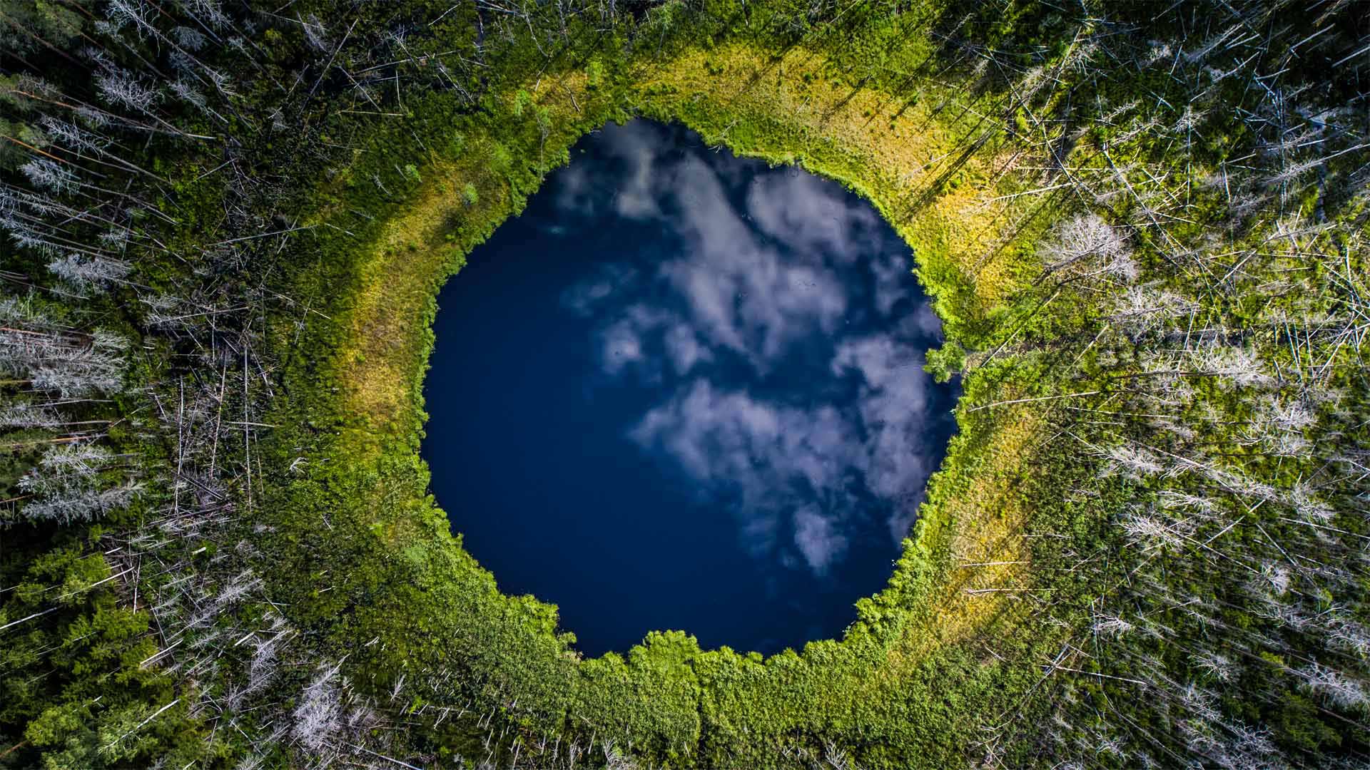
卡鲁拉国家公园里的小湖,爱沙尼亚 Small lake in Karula National Park, Valgamaa County, Estonia (© Sven Zacek/Minden Pictures)
世界之眼 Eye of the world
Earth Day
For this year's Earth Day we find ourselves floating above Karula National Park, the smallest national park in the smallest Baltic nation. Visiting this jewel of Estonia feels appropriate for Earth Day, as it is home to a variety of endangered species, including animals such as the pond bat, the lesser spotted eagle, and the black stork. Rare plants thrive here, too, like the endangered Baltic orchid, mezereon, and the daisyleaf grape fern. In addition to the draw of its biodiversity, Karula is a popular spot for camping, adventure tourism, fishing, nature photography, hiking, and cycling.
On this day in 1970, some 20 million Americans rallied in communities across the United States to raise awareness of environmental issues. The landmark event is credited for sparking the passage in the 1970s of the most comprehensive environmental reform legislation in US history, including the creation of the Clean Air, Clean Water, and Endangered Species Acts, as well as the Environmental Protection Agency (EPA). Earth Day is now celebrated in nearly 200 countries and has grown to include Earth Week and even Earth Month celebrations. That's good news for Earth's residents, big and small.
地球日
今年的地球日,我们发现自己漂浮在最小的波罗的海国家中最小的国家公园卡鲁拉国家公园上空。在地球日参观爱沙尼亚的这颗明珠感觉很合适,因为它是各种濒危物种的家园,包括池蝠、小斑鹰和黑鹳等动物。珍稀植物也在这里茁壮成长,比如濒临灭绝的波罗的海兰花、梅泽伦和戴西莱夫葡萄蕨。除了吸引生物多样性,卡鲁拉还是露营、探险旅游、钓鱼、自然摄影、徒步旅行和骑自行车的热门景点。
1970年的这一天,大约2000万美国人在美国各地的社区集会,以提高人们对环境问题的认识。这一里程碑式的事件被认为是20世纪70年代促使美国历史上最全面的环境改革立法获得通过的原因,包括制定了《清洁空气、清洁水和濒危物种法案》以及环境保护局(EPA)。现在,近200个国家都在庆祝地球日,并且已经发展到包括地球周甚至地球月的庆祝活动。这对地球上大大小小的居民来说都是好消息。
在公路上吃草的绵羊,冰岛 Sheep graze along a road, Iceland (© Matthew Kuhns/Tandem Stills + Motion)
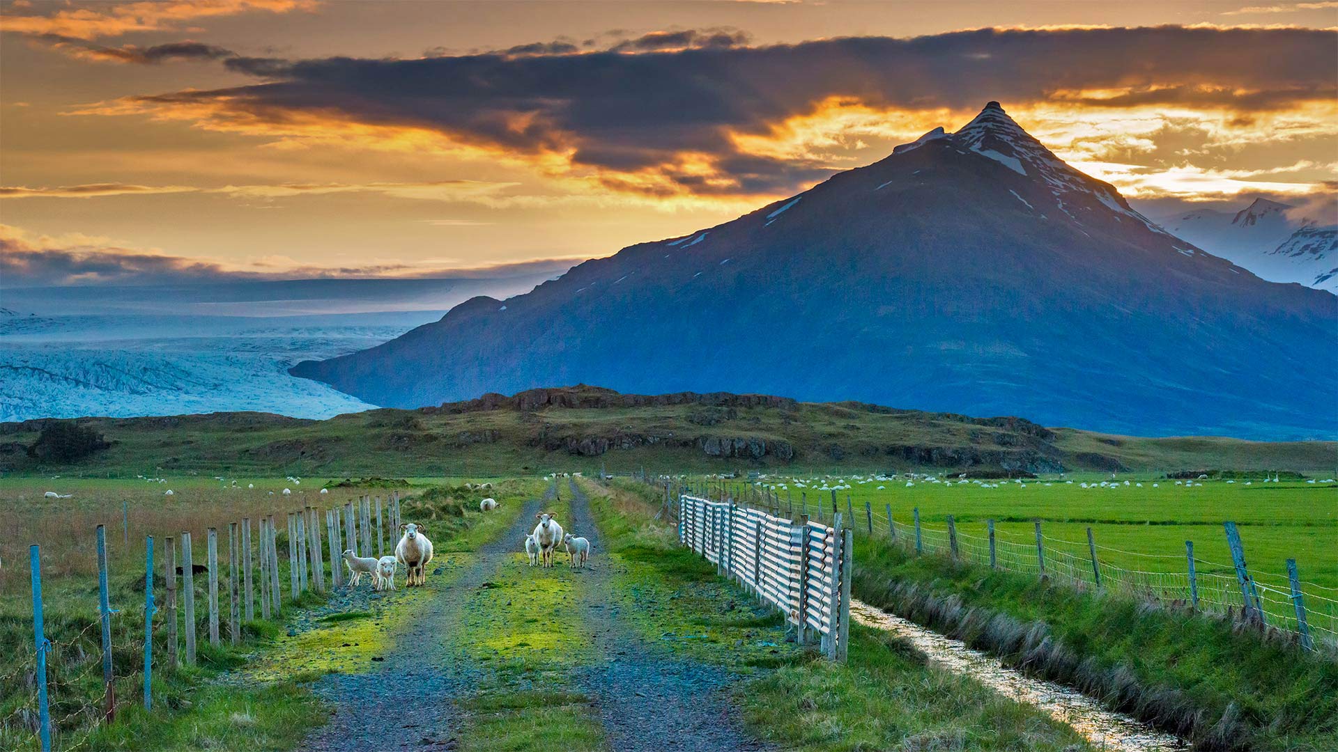
在公路上吃草的绵羊,冰岛 Sheep graze along a road, Iceland (© Matthew Kuhns/Tandem Stills + Motion)
今天冰岛人在庆祝什么? What are Icelanders celebrating today?
First day of summer
After long—very long—winter nights, it's not surprising that the First Day of Summer is cause for a big celebration in Iceland. The public holiday falls on the first Thursday after April 18, and launches Harpa, the first summer month of the old Norse calendar that was followed by the country's first inhabitants. The year was split into just two seasons back then—summer and winter—which explains why Sumardagurinn Fyrsti, the First Day of Summer, falls in chilly April. Indeed, folklore has it that if you put a dish of water outside the night before the holiday and it freezes, you'll have a good summer. Regardless of temperature, the holiday does herald the arrival of those famously long days with little darkness, a welcome relief after the light-deprived winter months.
So how do Icelanders celebrate the First Day of Summer? Well, they take part in flag-waving local parades, listen to marching bands, and enjoy outdoor games and sports with family and friends. There's a tradition of giving summer gifts ('sumargjafir'), and those are often connected to outdoor activities—maybe a bike or a soccer ball, or new clothes—to encourage children to play together in the fresh air after the long, frigid winter. And of course, what celebration would be complete without food? The holiday gets people cranking up the barbecue and gathering for 'summer' food, even though the average high temperature in April is in the 40s. Getting cold watching a parade? Icelandic crepes with thick cream and jam inside will warm you up. Feeling chilly but you're determined to think 'summer'? Join the hardy Icelanders who make ice cream a First Day of Summer must-have.
初夏
在漫长的冬夜之后,不足为奇的是,夏天的第一天是冰岛举行盛大庆祝活动的原因。公共假日在4月18日之后的第一个星期四,并推出了哈帕,这是古挪威历法中的第一个夏季月份,随后是该国的第一批居民。这一年分为两个季节,分别是夏季和冬季,这也解释了为什么Sumardagurinn Fyrsti,夏季的第一天,会在寒冷的四月降临。事实上,民间传说,如果你在假期前一天晚上把一盘水放在外面,水结冰了,你就会有一个美好的夏天。不管气温如何,这个节日确实预示着那些以漫长而黑暗少著称的日子的到来,在光线不足的冬季几个月后,这是一种受欢迎的解脱。
那么冰岛人如何庆祝夏天的第一天呢?嗯,他们参加挥舞国旗的地方游行,听游行乐队,和家人朋友一起享受户外游戏和运动。有一种传统是赠送夏季礼物(“sumargjafir”),这些礼物通常与户外活动有关,比如自行车或足球,或者新衣服,以鼓励孩子们在漫长寒冷的冬天后在新鲜空气中一起玩耍。当然,没有食物,什么样的庆祝活动才算完整?尽管4月的平均高温在40多度,但这个节日还是会让人们开始烧烤,并聚在一起吃“夏季”食物。看游行会感冒吗?冰岛薄饼里面有厚厚的奶油和果酱会让你暖和起来。感觉很冷,但你决定去想“夏天”?加入坚韧不拔的冰岛人的行列吧,他们把冰淇淋作为夏季的第一天必备品。
十六湖国家公园,克罗地亚 Plitvice Lakes National Park, Croatia (© Janne Kahila/Getty Images)
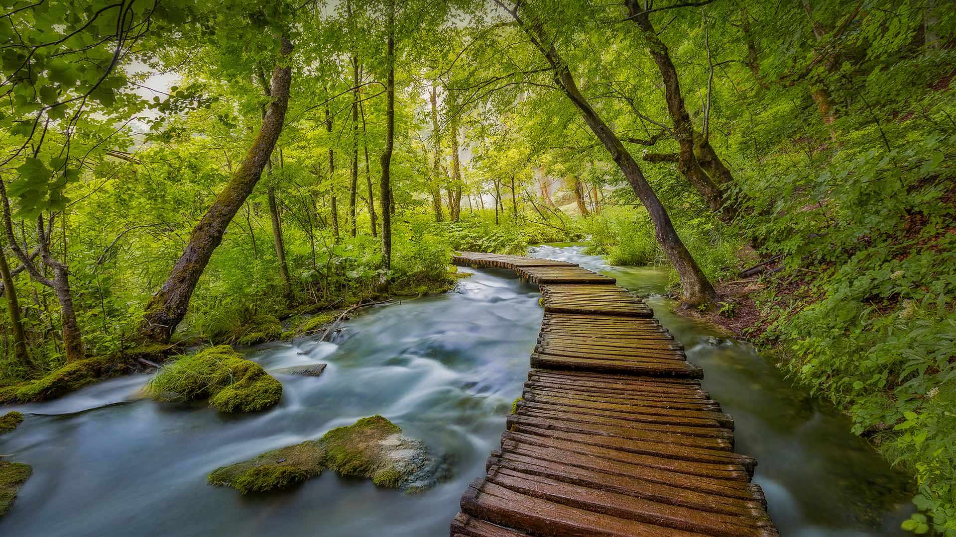
十六湖国家公园,克罗地亚 Plitvice Lakes National Park, Croatia (© Janne Kahila/Getty Images)
巴尔干湖上的木板路 Boardwalk over Balkan lakes
Plitvice Lakes National Park in Croatia
In a country more famous for its coastline, about a million visitors each year venture inland to amble along these boardwalks and marvel at spectacular lakes and mountains. Plitvice Lakes National Park is the oldest and largest of Croatia's national parks. The big attraction is the series of 16 descending, turquoise-colored lakes, connected by subterranean karst rivers, and above ground by streams and waterfalls. The lakes are separated by natural dams of travertine, which is deposited by moss, algae, and bacteria. The water changes color from green to azure to gray depending on the angle of the light and the density of minerals and organisms in the water. About 11 miles of wooden boardwalk make it easy for people to wander among the lakes, falls, and caves that are open to visitors year-round.
The 115-square-mile park was established in 1949 in what is now central Croatia, near the border of Bosnia and Herzegovina. In 1979, Plitvice's unique beauty put it on the list UNESCO World Heritage Sites. The lakes seem to magically disappear into the moss-covered earth, and then reappear downstream, proof enough that these woods are indeed enchanted.
克罗地亚的普利特维兹湖国家公园
在一个以海岸线闻名的国家,每年大约有100万游客冒险到内陆,沿着这些木板路漫步,欣赏壮观的湖泊和山脉。普利特维兹湖国家公园是克罗地亚最古老、最大的国家公园。最大的吸引力是16个下降的绿松石色湖泊,由地下喀斯特河流连接,地面上由溪流和瀑布连接。湖泊之间由苔藓、藻类和细菌沉积的钙华天然坝隔开。根据光线的角度以及水中矿物质和生物体的密度,水的颜色会从绿色变为蓝色再变为灰色。大约11英里长的木板路使人们可以轻松地在全年开放的湖泊、瀑布和洞穴中漫步。
这座115平方英里的公园建于1949年,位于现在的克罗地亚中部,靠近波斯尼亚和黑塞哥维那边境。1979年,普利特维奇独特的美景将其列入联合国教科文组织世界遗产名录。这些湖泊似乎神奇地消失在苔藓覆盖的土地上,然后再次出现在下游,这足以证明这些森林确实被施了魔法。
梅萨维德国家公园的方形塔楼,美国科罗拉多州 Square Tower House in Mesa Verde National Park, Colorado (© lightphoto/Getty Images)
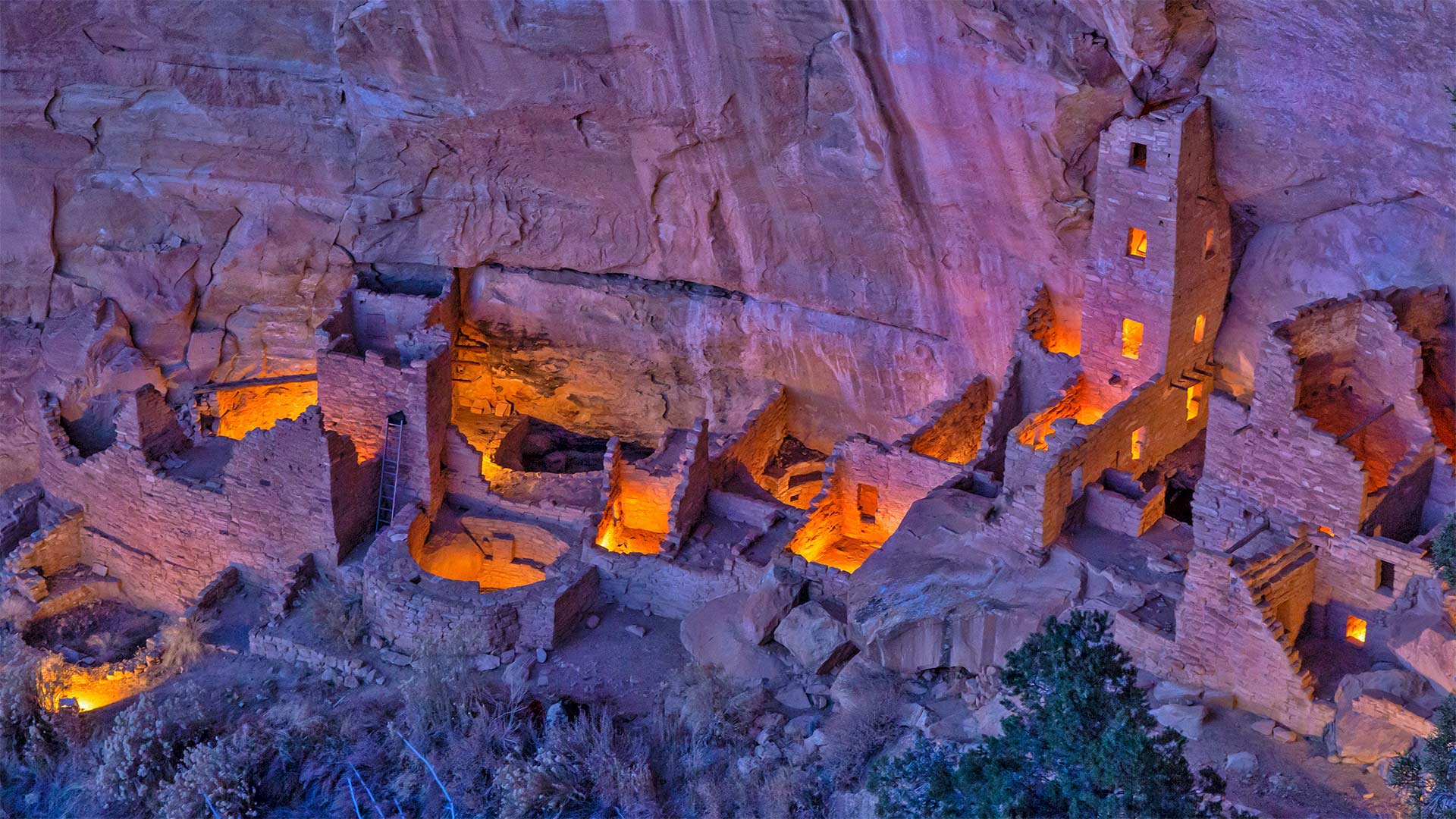
梅萨维德国家公园的方形塔楼,美国科罗拉多州 Square Tower House in Mesa Verde National Park, Colorado (© lightphoto/Getty Images)
普韦布洛城堡 Castle of the Ancestral Puebloans
Square Tower House in Mesa Verde National Park
We continue our celebration of National Park Week (through April 24)–and the UNESCO International Day for Monuments and Sites–with a visit to the impressive Square Tower House in Mesa Verde National Park. Square Tower House is one of many cliff dwellings constructed by the Ancestral Puebloans in what is now the American Southwest. At 27 feet, it's the tallest structure in the park. Square Tower House is also notable for its kiva, a round, sunken room used for ceremonies. Unlike most of the ancient kivas found in the region, the kiva at Square Tower House has an intact original clay roof supported by wooden beams.
Ancestral Puebloans lived in today's Four Corners region, where the borders of Colorado, Utah, Arizona, and New Mexico meet at a single point. It's unclear when exactly this culture emerged, but the current consensus is that the Ancestral Puebloans appeared in this area a little more than 3,000 years ago. They're believed to have built the series of cliff dwellings for defensive reasons as various factions competed for scarce resources when the region suffered from a prolonged drought. It's thought that the changing climate eventually became so severe that it likely drove them from the cliff dwellings sometime around 1300 CE, just a century or so after construction began. Today, many of the cliff dwellings have been restored and visitors can view the homes and kivas of the builders.
梅萨维德国家公园的方形塔楼
我们继续庆祝国家公园周(至4月24日)——以及联合国教科文组织纪念物和遗址国际日——参观梅萨维德国家公园令人印象深刻的方形塔楼。方塔住宅是普埃布劳恩斯家族在现在的美国西南部建造的众多悬崖住宅之一。它高27英尺,是公园里最高的建筑。方形塔楼房屋也因其kiva而著名,kiva是一个圆形的下沉式房间,用于举行仪式。与该地区发现的大多数古代基瓦不同,广场塔楼的基瓦房屋有一个完整的原始粘土屋顶,由木梁支撑。
普韦布劳恩斯的祖先生活在今天的四角地区,科罗拉多州、犹他州、亚利桑那州和新墨西哥州的边界在这里交汇。目前尚不清楚这种文化是什么时候出现的,但目前的共识是,祖先普韦布洛人在3000多年前就出现在这个地区。据信,当该地区遭受长期干旱时,各派系为了争夺稀缺资源,出于防御原因,他们修建了一系列悬崖住宅。据认为,气候变化最终变得如此严重,可能在公元1300年左右的某个时候,也就是建筑开始后的一个世纪左右,将他们赶出悬崖住宅。如今,许多悬崖上的住宅已经修复,游客可以看到建筑商的房屋和地窖。
黄石国家公园的大棱镜泉鸟瞰图,美国怀俄明州 Aerial view of Grand Prismatic Spring, Yellowstone National Park, Wyoming (© AirPano LLC/Amazing Aerial Agency)
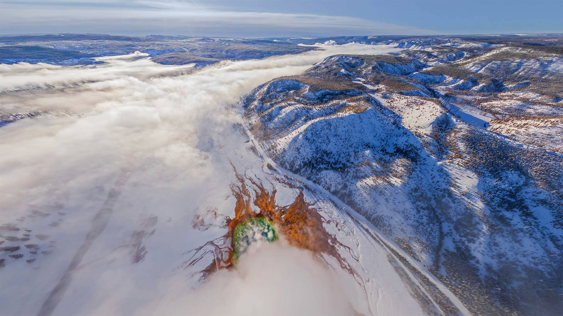
黄石国家公园的大棱镜泉鸟瞰图,美国怀俄明州 Aerial view of Grand Prismatic Spring, Yellowstone National Park, Wyoming (© AirPano LLC/Amazing Aerial Agency)
“美国最好的想法”起源于此 'America's best idea' began here
National Park Week begins
Only a very small percentage of Yellowstone's total visitors see the park when it looks like this. In winter, when the park grows quiet, its hydrothermal features really stand out, like the rainbow-hued Grand Prismatic Spring near the center of this image, the most photographed feature in Yellowstone.
Just the inspiration we need as we start National Park Week, an occasion to celebrate the splendor of our park system and turn to thoughts of hiking, paddling, and camping. The 'Week' is actually a bit longer, starting today and running through Sunday, April 24. Yellowstone was established by congress 150 years ago as the nation's first national park. Today, there are 63, and they include the volcanoes of Hawaii, the giant sequoias of California, the Grand Canyon, and the desolate moonscape of the Badlands.
Perhaps no national park better captures the American landscape than Yellowstone, 3,500 square miles of lakes, canyons, rivers, mountains, waterfalls, hot springs, and its charismatic megafauna—bison, wolves, elk, and grizzly bears. But it's Yellowstone's hydrothermal sites that really set it apart. Old Faithful might be the most famous, but it's only one of 10,000 around here. Although the park is still chilly in April, you'll have the place mostly to yourselves. Only about 44,000 visit Yellowstone in April, compared to the nearly 1 million who gather each July. If you need more incentive, entrance fees today, in honor of National Park Week, are on the house.
国家公园周开始
当黄石公园看起来像这样时,只有很小比例的游客参观了它。在冬天,当公园变得安静时,它的热液特征真的很突出,比如这张图片中心附近彩虹色的大棱柱形泉水,这是黄石公园拍摄最多的特征。
这正是我们开始国家公园周时所需要的灵感。国家公园周是一个庆祝我们公园系统辉煌的时刻,我们可以考虑徒步旅行、划船和露营。“一周”实际上要长一点,从今天开始,一直持续到4月24日周日。黄石公园是美国国会在150年前建立的第一个国家公园。如今,这里有63座火山,其中包括夏威夷的火山、加利福尼亚州的巨大红杉、大峡谷和荒地荒凉的月球景观。
也许没有哪个国家公园能比黄石公园更好地捕捉到美国的风景。黄石公园有3500平方英里的湖泊、峡谷、河流、山脉、瀑布、温泉,以及迷人的大型动物群——野牛、狼、麋鹿和灰熊。但真正让它与众不同的是黄石公园的热液遗址。老忠实可能是最有名的,但它只是这里一万个中的一个。虽然四月份公园里仍然很冷,但你可以独处。4月份只有大约4.4万人参观黄石公园,而每年7月有近100万人聚集在这里。如果你需要更多的奖励,为了纪念国家公园周,今天的入场费是免费的。
2021年9月24日,克里斯托和Jeanne Claude在凯旋门追寻遗迹, 法国巴黎 Arc de Triomphe wrapped in posthumous art installation by Christo and Jeanne-Claude on September 24, 2021, in Paris, France (© Bruno de HOGUES/Getty Images)

Arc de Triomphe wrapped in posthumous art installation by Christo and Jeanne-Claude on September 24, 2021, in Paris, France 2021年9月24日,克里斯托和Jeanne Claude在凯旋门追寻遗迹, 法国巴黎 (© Bruno de HOGUES/Getty Images)
An icon is 'Wrapped' 图标被“包装”
World Art Day
To celebrate World Art Day, we're taking a look at one of the greatest triumphs (pun intended) of public art—last fall's 'L'Arc de Triomphe, Wrapped,' by the late artists Christo and wife Jeanne-Claude. Completed and staged 16 months after Christo's death at age 84, 'Wrapped' was the fruition of an idea 60 years in the making. On view for 16 days from Saturday, September 18 to Sunday, October 3, 2021, the project required 269,000 square feet of recyclable silvery-blue polypropylene fabric that completely covered the monument. The fabric glistened and glimmered with the changing light of Paris. The pleated fabric was held fast to the arch by nearly two miles of red rope.
Over the decades, Christo and artistic partner Jeanne-Claude created several large-scale installations at famous landmarks around the world, using fabric in tandem with landscapes and structures like Berlin's Reichstag and New York's Central Park.
World Art Day was declared by the International Association of Art, a UNESCO partner, as an international celebration of the fine arts, and to promote awareness of creative activity all over the world. It is celebrated every April 15, which also aptly marks the birthday of Leonardo da Vinci, the embodiment of creativity.
世界艺术日
为了庆祝世界艺术日,我们来看看去年秋天由已故艺术家克里斯托和妻子珍妮·克劳德(Jeanne Claude)创作的《凯旋门》(L’Arc de Triomphe,Wrapped),这是公共艺术最伟大的成就之一(双关语)。在克里斯托84岁去世16个月后完成并上演的《包裹》是一个酝酿了60年的创意的成果。从星期六,9月18日至星期日,2021年10月3日的16天,项目需要269000平方英尺的可回收银蓝色聚丙烯织物,完全覆盖了纪念碑。织物在巴黎不断变化的光线下闪闪发光。褶皱的布料被将近两英里长的红绳牢牢地固定在拱门上。
几十年来,克里斯托和艺术合作伙伴珍妮·克劳德在世界各地著名的地标建筑创作了几部大型装置作品,将织物与柏林国会大厦和纽约中央公园等景观和建筑相结合。
联合国教科文组织的合作伙伴国际艺术协会宣布世界艺术日为国际性的艺术庆典,旨在促进全世界对创意活动的认识。每年4月15日都会庆祝它,这也恰如其分地标志着创造力的化身莱昂纳多·达芬奇的生日。
达特穆尔国家公园的薄雾,英格兰德文郡 (© AWL Images/Danita Delimont)
科罗拉多河上的马蹄湾,美国亚利桑那州 Horseshoe Bend, Arizona (© Michael Dunn/Getty Images)
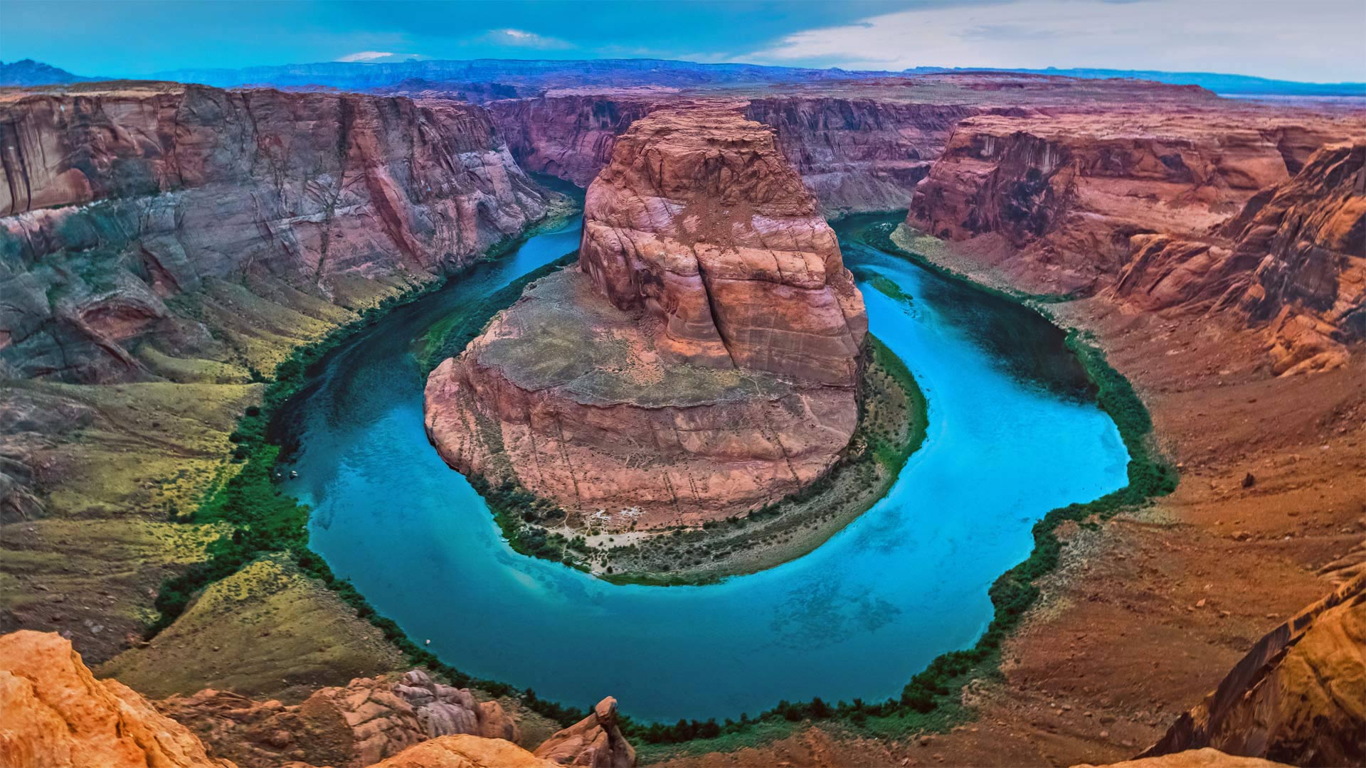
科罗拉多河上的马蹄湾,美国亚利桑那州 Horseshoe Bend, Arizona (© Michael Dunn/Getty Images)
打卡马蹄湾会带来好运吗? Does this horseshoe bring good luck?
Horseshoe Bend, Arizona
Grab your boots and gear, today we're heading to Arizona to hike out to Horseshoe Bend. Known as the 'east rim of the Grand Canyon,' it's actually about 140 miles from the other rims and is really more a part of nearby Glen Canyon. Scientifically, the beautiful view exists thanks to something called an 'entrenched meander.' Around six million years ago, the area was closer to sea level. The Colorado River, following the path of least resistance, meandered and became trapped when the Colorado Plateau uplifted around five million years ago. Over time, the river water cut through exposed sandstone, forming the thousand-foot-deep, 270-degree horseshoe-shaped bend.
Horseshoe Bend used to be a locally loved gem until social media came around to spread photos like this one. Now, nearly two million tourists a year hike to this national splendor. It's believed that, eventually, the Colorado River will cut through the neck of the bend. So, if you want your selfie with the horseshoe, you only have another million years, give or take.
亚利桑那州马蹄湾
带上你们的靴子和装备,今天我们要去亚利桑那州徒步去马蹄弯。它被称为“大峡谷的东边缘”,实际上距离其他边缘约140英里,实际上更像是附近格伦峡谷的一部分。从科学角度讲,这美丽的景色之所以存在,是因为有一种叫做“根深蒂固的曲流”的东西大约600万年前,该地区接近海平面。科罗拉多河沿着阻力最小的路径蜿蜒而行,在大约500万年前科罗拉多高原抬升时陷入困境。随着时间的推移,河水穿过裸露的砂岩,形成了千英尺深、270度马蹄形的弯曲。
马蹄弯曾经是当地人喜爱的珍宝,直到社交媒体开始传播像这样的照片。现在,每年有近200万游客徒步前往这个国家的辉煌。据信,科罗拉多河最终将穿过弯道的颈部。所以,如果你想在马蹄铁上自拍,你只能再活一百万年,不管付出与否。
