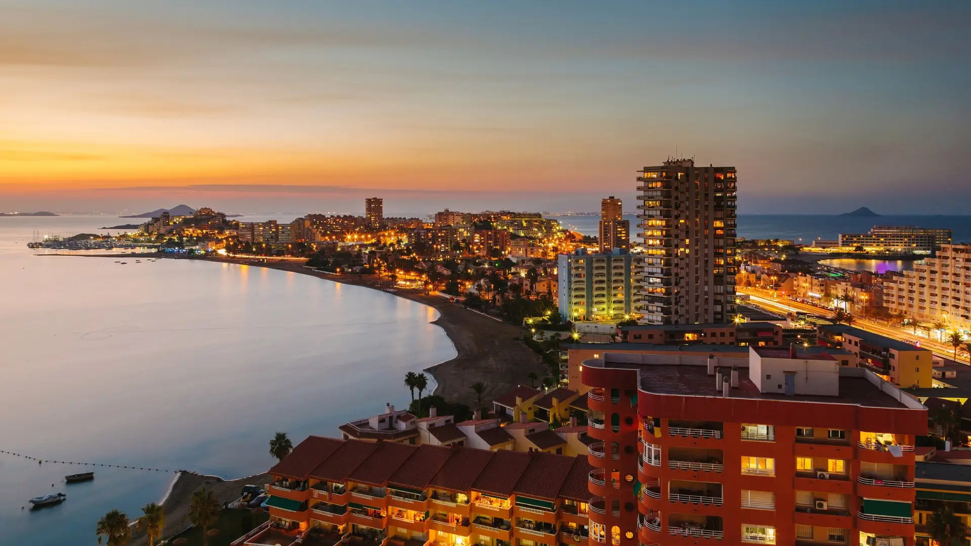
特拉蒙塔纳山中的老橄榄园,马略卡岛,西班牙 Old olive grove in the Serra Tramuntana range, Majorca, Spain (© cinoby/Getty Images)
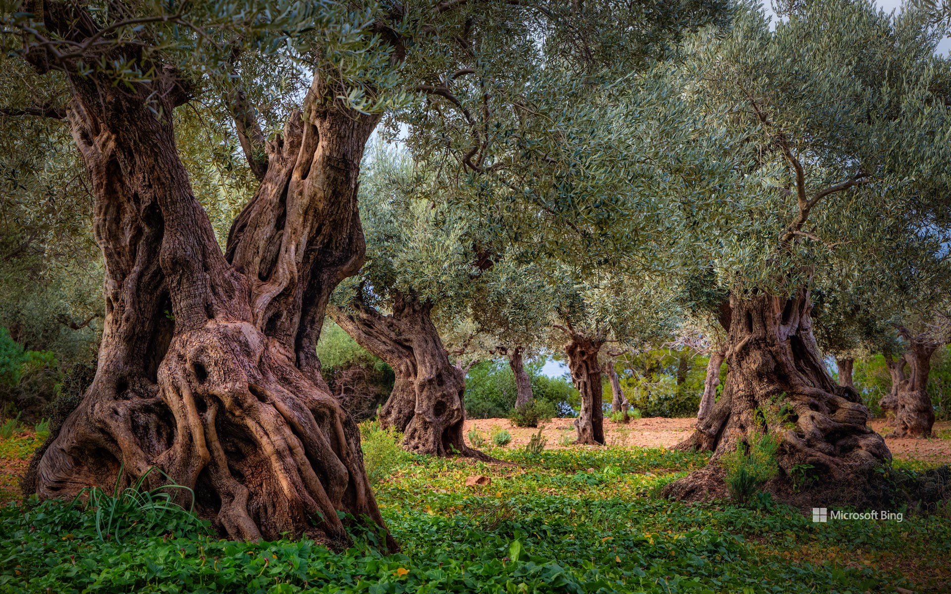
特拉蒙塔纳山中的老橄榄园,马略卡岛,西班牙 Old olive grove in the Serra Tramuntana range, Majorca, Spain (© cinoby/Getty Images)
从树上到餐桌之上 From the tree to the table
西班牙马略卡岛,巴利阿里群岛,特拉蒙塔纳山
巴利阿里群岛之一的西班牙马略卡岛种植橄榄的历史可以追溯到2000多年前。腓尼基人和希腊人是这里的早期定居者,他们将第一批橄榄树引进这个岛屿,北海岸的特拉蒙塔纳山脉是这些橄榄树的故乡。在伊斯兰时代,由于橄榄园的不断扩大,橄榄油开始在马略卡岛美食和烹饪传统中担任重要角色。
马略卡岛的橄榄树坎德特获得了西班牙“最佳纪念橄榄”的荣誉称号。据估计,这棵古老的树已有1100多年的历史。2011年,特拉蒙塔纳山区文化景观被联合国教科文组织列为世界遗产。如今,来自世界各地的游客纷纷前往该群岛,品味历史与“液体黄金”
Serra de Tramuntana, Majorca, Spain
They've been growing olives on the Spanish island of Majorca in the western Mediterranean for more than 2,000 years. Early settlers, the Phoenicians and Greeks, introduced the first olive trees but the groves in the Serra de Tramuntana range expanded during Spain's Islamic era, between 709 and 1492. Olive oil became a crucial ingredient in culinary traditions on Majorca, the largest of the Balearic Islands. One ancient tree on the island, Can Det, is estimated to be more than 1,100 years old, and is still producing olives.
In 2011, the Serra de Tramuntana was established as a UNESCO World Heritage Site. Today, tourists from all over the world visit the archipelago to taste history and the 'liquid gold.'
石英岩地层,普拉亚德尔锡伦西奥,西班牙 Quartzite formation, Playa del Silencio, Asturias, Spain (© Jean-Philippe Delobelle/Minden Pictures)
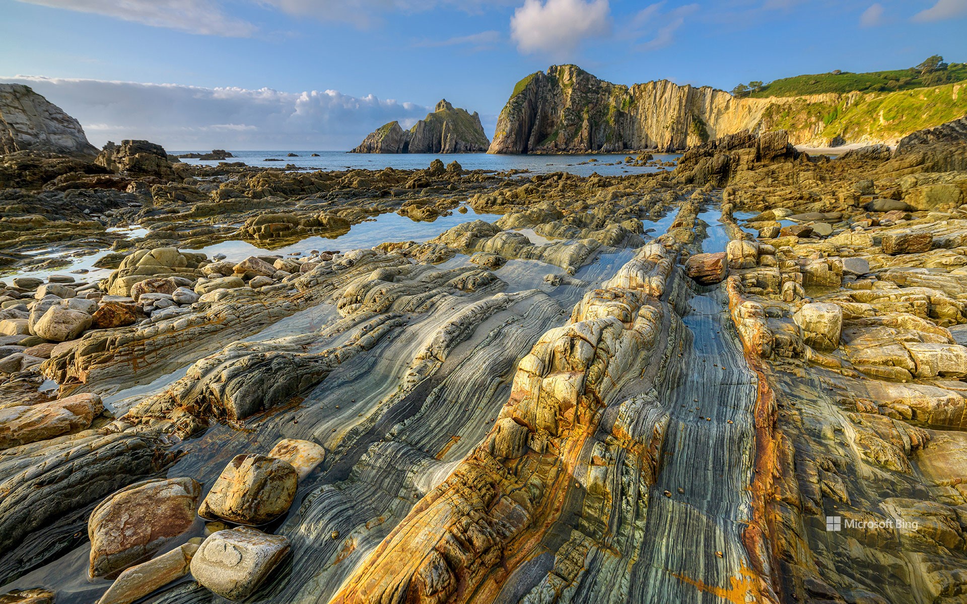
石英岩地层,普拉亚德尔锡伦西奥,西班牙 Quartzite formation, Playa del Silencio, Asturias, Spain (© Jean-Philippe Delobelle/Minden Pictures)
宁静之地 A quiet place, indeed
普拉亚德尔锡伦西奥,西班牙
西班牙的阿斯图里亚斯地区以其自然美景、丰富的艺术遗产和美食而闻名。此外,该地区还有许多隐藏的“宝藏”,照片上的“寂静海滩”就是其中之一。寂静海滩是一个贝壳形状的小海湾,该地不仅环境清幽,还有一个天然的露天岩石剧场。海滩远离市区,没有商业气息和喧闹的人群。在这里,险峻的悬崖和金色的沙滩是散心冥想的理想之地,而附近的洞穴和水上活动则为渴望冒险的游客提供了刺激的体验。
海岸线上的地质奇观是由石英岩历经数百万年才形成的:当石英颗粒逐渐取代原始岩石并保持其纹理时,这一壮丽的景观也就随之出现了。这些岩石有着复杂的花纹和颜色,其中一些看起来就像古旧的木头。
Playa del Silencio, Spain
Spain's Asturias region, known for its greenery, artistic legacy, and excellent food, has many hidden gems. Our homepage image shows Playa del Silencio, or Beach of Silence, a shell-shaped cove with a natural rock amphitheater. Far away from urban areas and noisy crowds, the beach enjoys a sense of isolation and solitude. Rugged cliffs surround golden sands perfect for soaking up its peaceful vibes, while nearby caves and water activities provide exciting adventures for those who crave them.
The rocky shoreline seen here is made of quartzite, formed over millions of years. This spectacular display was created when quartz grains gradually replaced the original rock while maintaining its texture. With their intricate patterns and colors, some of these rocks resemble ancient wood.
卡斯蒂利亚-拉曼恰的风车,西班牙 Windmills in Castilla-La Mancha, Spain (© Getty Images)
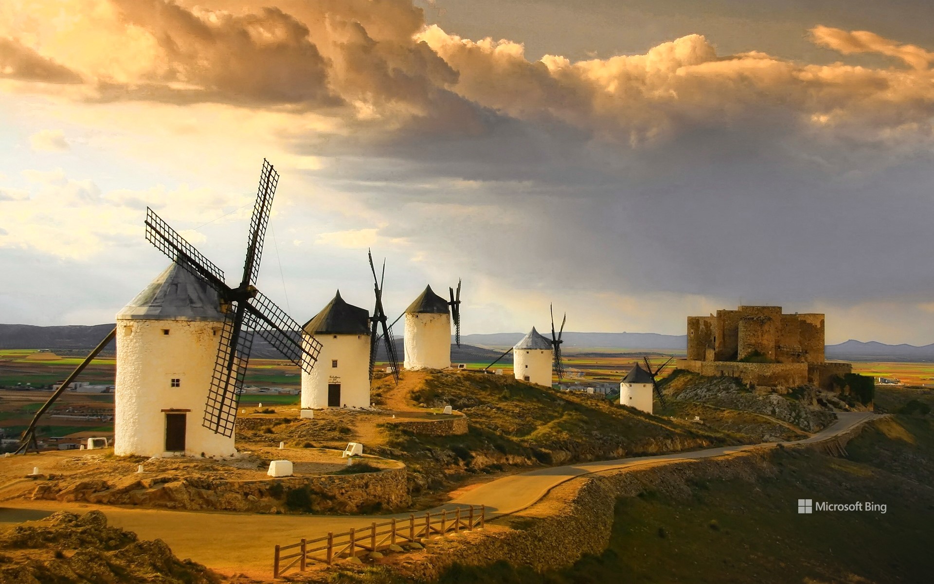
卡斯蒂利亚-拉曼恰的风车,西班牙 Windmills in Castilla-La Mancha, Spain (© Getty Images)
西班牙骑士的“劲敌” A Spanish knight's greatest foes
卡斯蒂利亚-拉曼恰, 西班牙
在孔苏埃格拉小镇上,到处都流传着堂吉诃德的冒险故事,他是塞万提斯笔下的英雄,是西班牙史诗小说《堂吉诃德》的主人公。这个位于卡斯蒂利亚-拉曼恰的旅游胜地因一座名为卡尔德里科的小山丘而出名。这座山丘顶部有12座白色风车,或许正是这些风车激发了塞万提斯的灵感。在小说中,塞万提斯将它们描绘成一支巨人军队。风车由石墙和木制叶片构成,其中一些风车的历史可追溯到16世纪,它们曾是碾磨谷物的工具,如今成为见证历史的活化石。
卡斯蒂利亚-拉曼恰是西班牙第三大区,仅次于卡斯蒂利亚-莱昂和安达卢西亚,但与其面积相比,这里的人口相对较少。该地区的首府托莱多拥有重要的建筑和文化遗产,包括古城和托莱多大教堂,1986年,托雷多被联合国教科文组织评为世界文化遗产。因此,如果你有出游计划,不妨去卡斯蒂利亚-拉曼恰,听一听古老风车的低语,感受塞万提斯笔下的自由与勇敢。
Castilla-La Mancha, Spain
In the Spanish town of Consuegra, echoes linger of the adventures of Don Quixote, the hero of Miguel de Cervantes' epic novel. This tourist destination in Castilla-La Mancha is famous for its rocky ridge, known as Cerro Calderico, crowned with 12 white windmills. The windmills are thought to have inspired Cervantes to write the famous scene in which Don Quixote mistakes them for an army of giants. With their stone walls and wooden blades, some date back to the 16th century, when they were built to grind grain.
Castilla-La Mancha is the third-largest region—after Castile y León and Andalusia—in Spain but one of the least densely populated. The regional capital city, Toledo, has a significant architectural and cultural legacy—including Old Town and the Catedral de Toledo—that led to its designation as a UNESCO World Heritage site in 1986. So, for your next quest, let the windmills of Castilla-La Mancha whisper their timeless tales in your ear.
托雷维耶哈潟湖,阿利坎特,西班牙 Laguna de Torrevieja, Alicante, Spain (© Juan Maria Coy Vergara/Getty Images)
托雷维耶哈潟湖,阿利坎特,西班牙 Laguna de Torrevieja, Alicante, Spain (© Juan Maria Coy Vergara/Getty Images)
粉红色,很好看 Pretty in pink
托雷维耶哈潟湖,阿利坎特,西班牙
大自然中的水是什么颜色?我们的第一反应通常是蓝色或绿色。但是你见过粉色的水吗?这片粉红湖泊就是西班牙阿利坎特的托雷维耶哈潟湖。这个湖泊的含盐度非常高,湖面上还有自然形成的盐结晶团,使它成为富含胡萝卜素的微生物藻类繁殖的完美家园,因此才形成了这片粉红的水域。这里的甲壳类动物吃掉这些藻类后,也会变成粉色,进而又被火烈鸟吃掉,最终让火烈鸟也变成了粉色。
Laguna de Torrevieja, Spain
When we encounter bodies of water in nature, we might expect hues of blue, from the pale cyan shade of lagoons to the navy blue of deep lakes. But pink water—where on Earth could that be found? At (deep breath) El Parque Natural de Las Lagunas de La Mata y Torrevieja in Alicante, Spain. Here, there are two lakes: one green and one pink, and it is the latter that you see on our homepage. The highly saline water, dotted with clusters of salt crystals, is the perfect environment for microscopic algae, which are rich in carotenes. This results in the rosy tinge that protects the algae from solar radiation. And the pink is just getting started, as the algae are eaten by tiny crustaceans, which turn pink and are then eaten by flamingos, which acquire the rosy hue as well.
拉曼加,穆尔西亚,西班牙 (© SOMATUSCANI/Getty Images)
莫罗哈夫莱海滩和科罗拉达斯海滩,富埃特文图拉岛,西班牙加那利群岛 Morro Jable and Playa del Matorral, Fuerteventura, Canary Islands, Spain (© Gavin Hellier/Getty Images)
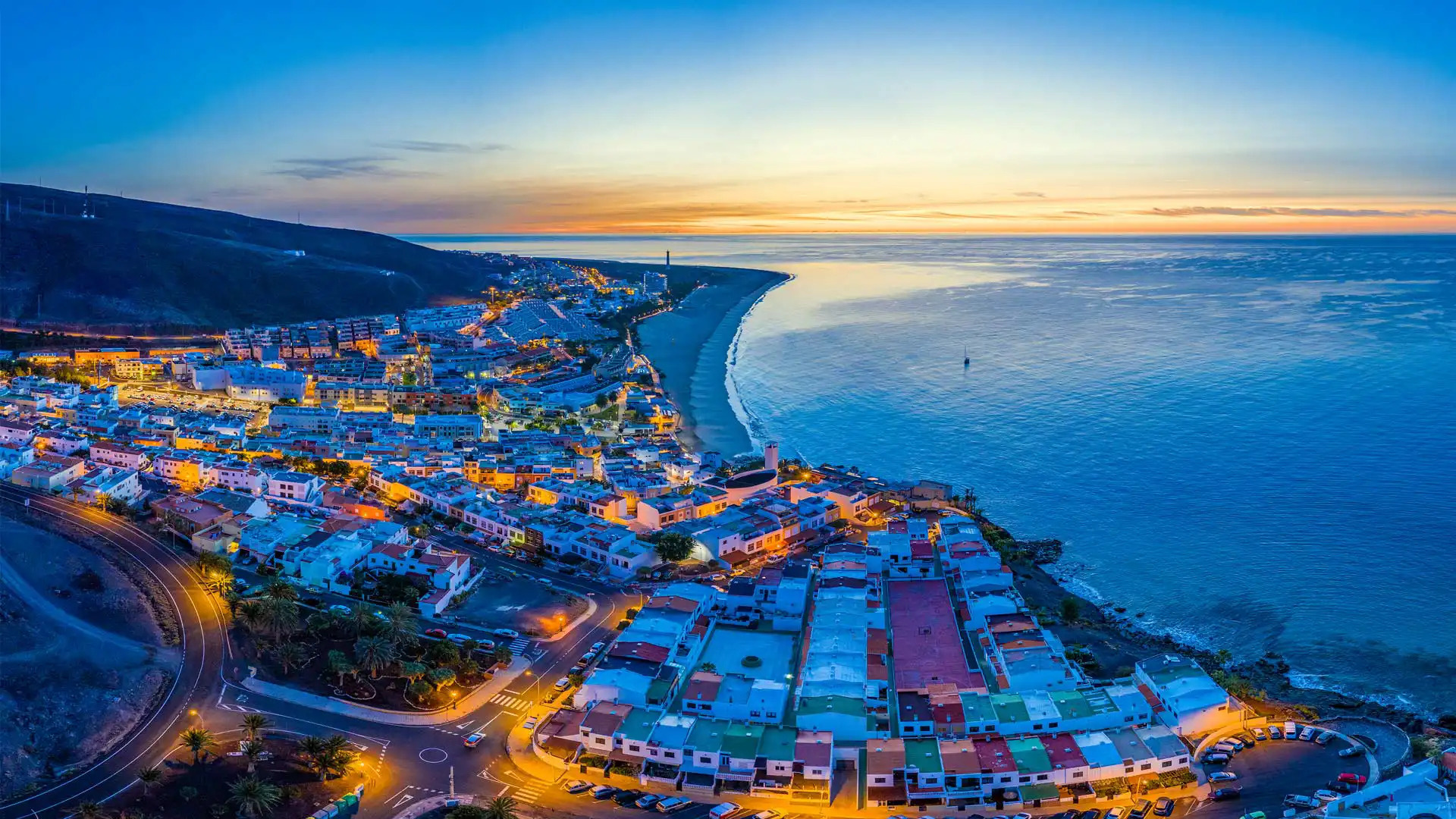
莫罗哈夫莱海滩和科罗拉达斯海滩,富埃特文图拉岛,西班牙加那利群岛 Morro Jable and Playa del Matorral, Fuerteventura, Canary Islands, Spain (© Gavin Hellier/Getty Images)
文化交汇的岛屿 An island crossroad of culture
加那利群岛
数千年的时光里,加那利群岛一直是各种文化的交汇地。早在公元前40年,这片火山群岛就引起了罗马人的兴趣;999年,阿拉伯商人又来到了这里。几百年间,热那亚、马略卡、葡萄牙和法国的殖民者也纷至沓来。这里的农业种植历史悠久,香蕉、番茄及土豆是主要农作物。如今,加纳利群岛是西班牙的一部分。最初的航海者来这里寻找贸易机会,而如今的游客来这里探索国家公园、躺在沙滩上放松、以及欣赏壮丽的落日。
The Canary Islands, Spain
Welcome to Fuerteventura, one of Spain's Canary Islands, found nearly 70 miles off the northwestern coast of Africa. For thousands of years, the volcanic islands have served as an international crossroads, attracting the interest of the Romans, Arab traders, and European navigators. Agriculture has long been important here, with bananas, tomatoes, and potatoes among the main crops. But while the first voyagers came in search of trade, today's visitors come to explore the many beautiful national parks and relax on beaches like the Playa del Matorral on Fuerteventura, seen here during a spectacular sunset.
科尔多瓦的古罗马桥,西班牙 Roman bridge, Córdoba, Spain (© Jeremy Woodhouse/Getty Images)
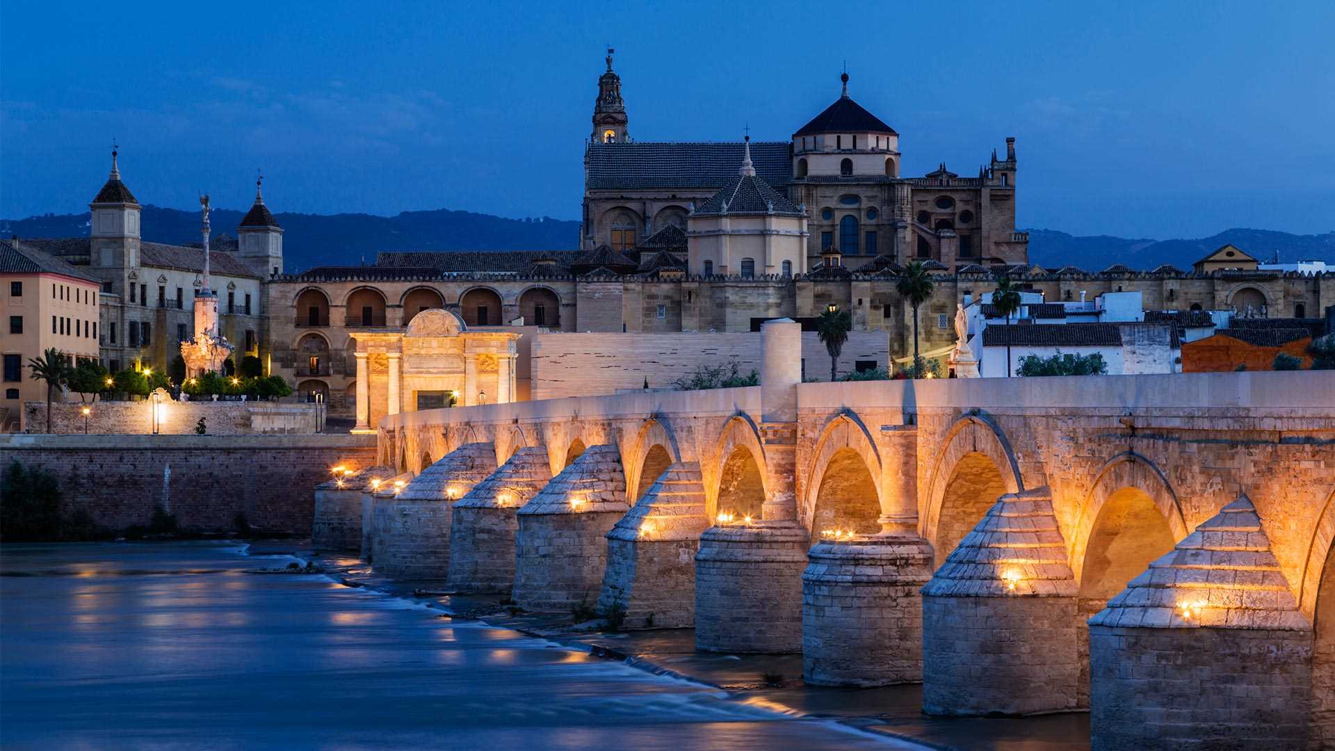
科尔多瓦的古罗马桥,西班牙 Roman bridge, Córdoba, Spain (© Jeremy Woodhouse/Getty Images)
这座古桥在哪呢? Where is this historical bridge?
古罗马桥,科尔多瓦,西班牙
科尔多瓦的古罗马桥跨越瓜达尔基维尔河,是这座城市的一处历史地标。这座桥始建于公元前1世纪罗马帝国的扩张时期,在历史上曾被多次重建,目前这座桥的主体是在8世纪由阿拉伯人重建。虽然它已经承载了数个世纪的交通往来,但现在这座桥仅供行人通行。如果你觉得它很眼熟,可能是因为你曾在《权力的游戏》第五季中见过它,在剧中它是虚构的瓦兰提斯城的一部分。
Roman bridge of Córdoba, Spain
The Roman bridge of Córdoba, in the ancient Spanish city’s historic center, has been rebuilt several times over the centuries. For 2,000 years it was the city’s only bridge across the Guadalquivir River, originally built in the first century BCE during the expansion of the Roman Empire. Much of the current bridge dates from reconstruction in the 8th century following the Moorish conquest, a period when hundreds of mosques and palaces were built, and Córdoba became one of Europe's largest cities and a center of learning and culture.
While it has seen centuries of traffic, the bridge is now only open to pedestrians, following the opening of the Miraflores Bridge in 2004. If it looks familiar, you might have spotted it standing in as part of the fictional city of Volantis in 'Game of Thrones.'
阿圭罗村庄,西班牙 Agüero, Spain (© Andrea Comi/Getty Images)
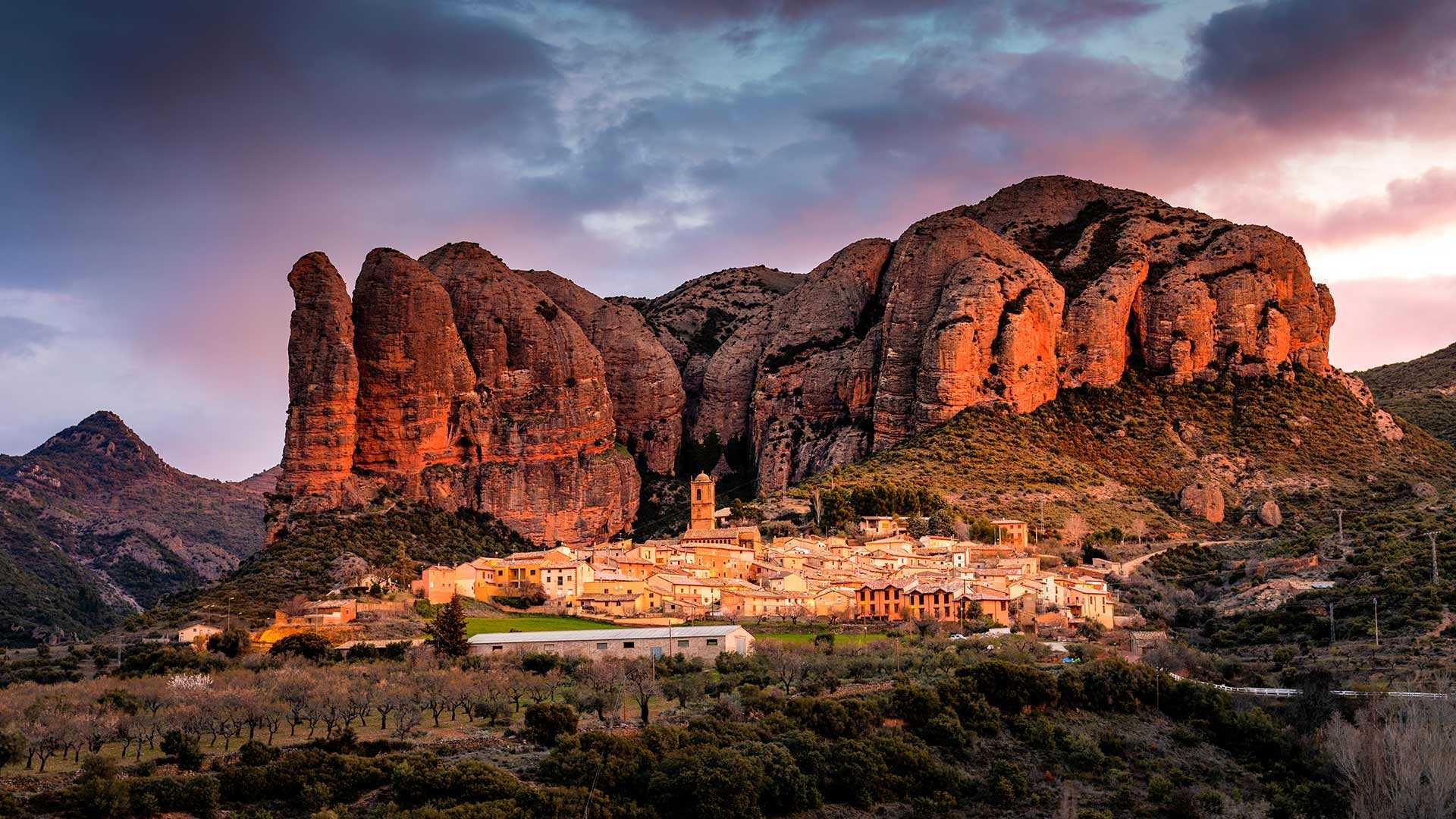
阿圭罗村庄,西班牙 Agüero, Spain (© Andrea Comi/Getty Images)
如此美景在何处? Where is this scenic view?
阿圭罗村庄,韦斯卡省,西班牙
美丽的阿圭罗村庄位于西班牙韦斯卡省,它坐落在独特的粉灰色群山之中。村庄背后是被称为里格洛斯岩的悬崖,非常适合拍照。这个拥有130位居民的小村庄还有一座建于12世纪的教堂。如果你是历史爱好者、攀岩爱好者,或二者兼修,那就请把阿圭罗列入旅行目的地清单吧。
Agüero, Huesca province, Spain
Residing in the lap of the distinctive pink-grey mountains is the pretty village of Agüero in the Huesca province of Spain. The textured cliffs known as Los Mallos act as a backdrop to the village, making it incredibly photogenic. The miniature village with its 130 inhabitants is a tourist attraction due to the 12th-century Romanesque Church of Santiago. This national monument is also a sight to behold with its intricate carvings of remarkable beasts and religious scenes created by the artist known only as the Master of San Juan de la Pena. If you consider yourself a history buff, a rock climber, or both, put Agüero on your travel list.
西班牙马德里,Cibeles喷泉和马德里市政厅为国际妇女节点亮 Cibeles Fountain and Madrid City Hall lit for International Women's Day, Madrid, Spain (© dpa picture alliance/Alamy)
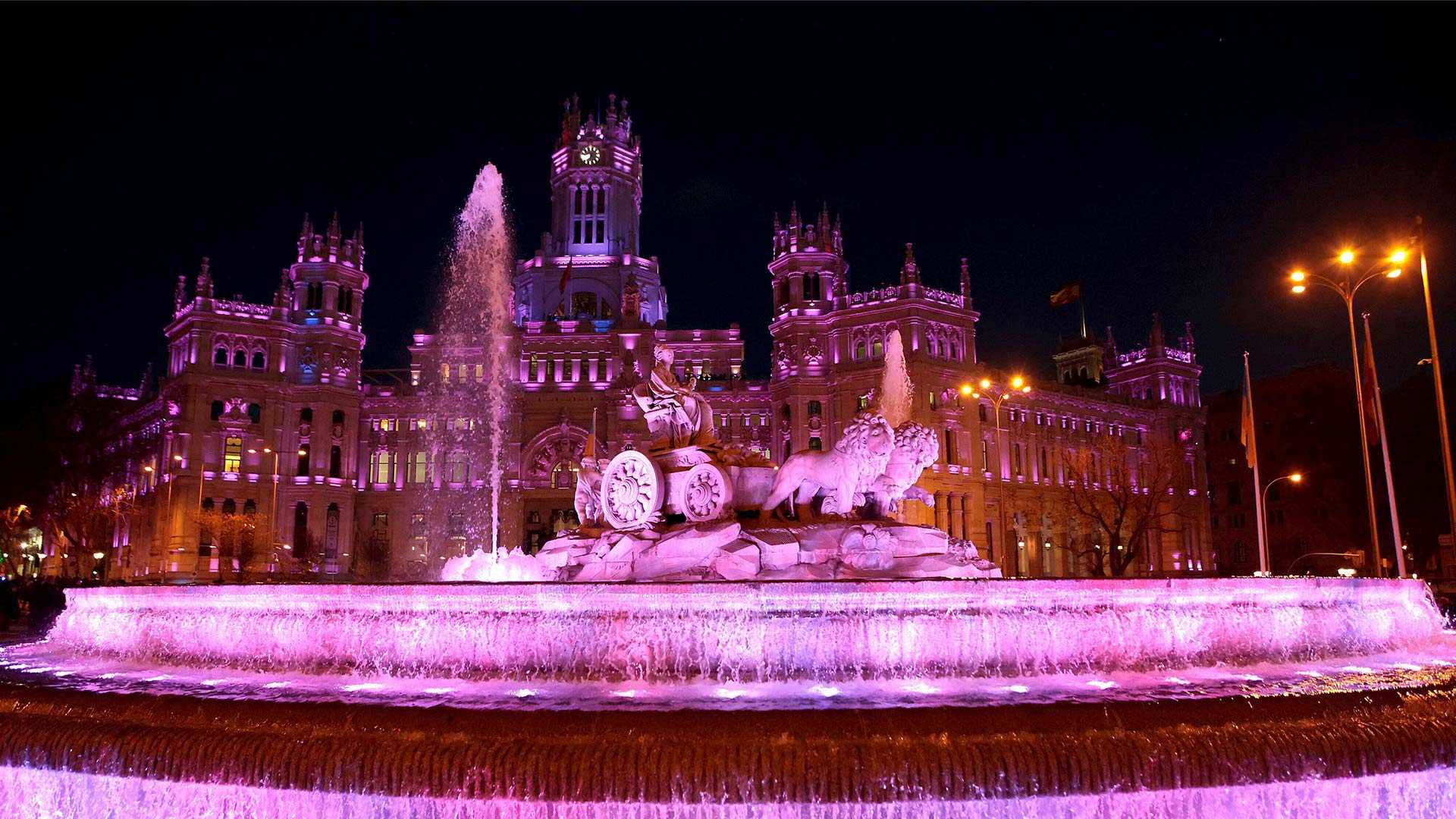
西班牙马德里,Cibeles喷泉和马德里市政厅为国际妇女节点亮 Cibeles Fountain and Madrid City Hall lit for International Women's Day, Madrid, Spain (© dpa picture alliance/Alamy)
庆祝女性 Celebrating women
国际妇女节
今天是国际妇女节,这一天庆祝全世界的妇女,并采取行动创造一个多样化、包容和公平的世界。这一天起源于1910年德国活动家克拉拉·泽特金(Clara Zetkin)在一次会议上提出组织国际日的想法,并于次年开始。历史充满了妇女的重大成就和贡献。玛丽·居里获得了诺贝尔物理学和化学奖。Ada Lovelace于1836年编写了世界上第一个计算机程序。1964年,帕特西·明克是第一位当选美国国会议员的有色人种女性。姐姐Rosetta Tharpe影响了一代人,并帮助创建了摇滚乐流派。今天,我们与所有过去和现在的妇女一起庆祝她们的成就。今天你能做些什么来帮助创造一个性别平等的世界?
International Women's Day
Today is International Women's Day, a day to celebrate women all over the globe and to take action to create a world that's diverse, inclusive, and equitable. The day originated when German activist Clara Zetkin pitched the idea of organizing an international day at a conference in 1910 and it was observed starting the following year. History brims over with the significant accomplishments and contributions of women. Marie Curie won Nobel Prizes in both physics and chemistry. Ada Lovelace wrote the world's first computer program in 1836. In 1964, Patsy Mink was the first woman of color elected to US Congress. Sister Rosetta Tharpe influenced a generation and helped create the genre of rock and roll. Today we celebrate their achievements along with those of all women, past and present. What can you do today to help create a world with gender parity?
内格拉廷湖,格拉纳达,西班牙 Negratín Reservoir, Granada, Spain (© Andres Martinez Olmedo/Getty Images)
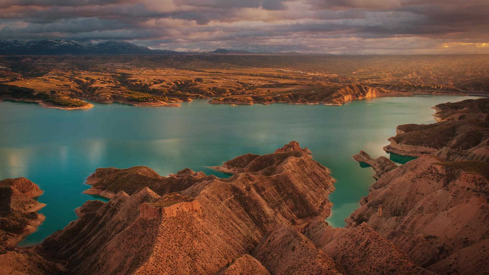
内格拉廷湖,格拉纳达,西班牙 Negratín Reservoir, Granada, Spain (© Andres Martinez Olmedo/Getty Images)
大自然的画作 Nature's own canvas
内格拉廷湖,格拉纳达,西班牙
今天照片上这个宁静美丽的湖泊是内格拉廷湖,是西班牙安达卢西亚最大的淡水湖之一。内格拉廷湖位于格拉纳达世界地质公园
的中心,由瓜迪亚纳梅诺尔河上的大坝截流而形成,是自然爱好者的天堂。湖边有一个帆船俱乐部,举办各种水上活动,这也使得内格拉廷湖成为了一个亲近大自然和放松身心的度假胜地。湖周围还有壮观的悬崖、沟壑和沙漠。无论春夏秋冬,这里的风景都美得让人窒息。
Negratín Reservoir, Granada, Spain
Step into a world of beauty and serenity with one of the largest freshwater lakes in Andalusia, Spain. The Negratín Reservoir is a nature lover's paradise, created by the Negratín Dam on the Guadiana Menor River and located in the heart of the Granada Geopark. There is a sailing club by the lake, and a variety of aquatic activities make it a popular destination for people looking to relax and unwind in the lap of nature. With imposing cliffs, gullies, and a rugged desert setting all around, the area's landscape is simply breathtaking no matter the time of year.

