标签 海岸 下的文章
风景秀丽的加勒比海岸,哥伦比亚 Caribbean coast near Buritaca, Colombia (© Nicholas Hills/Getty Images)
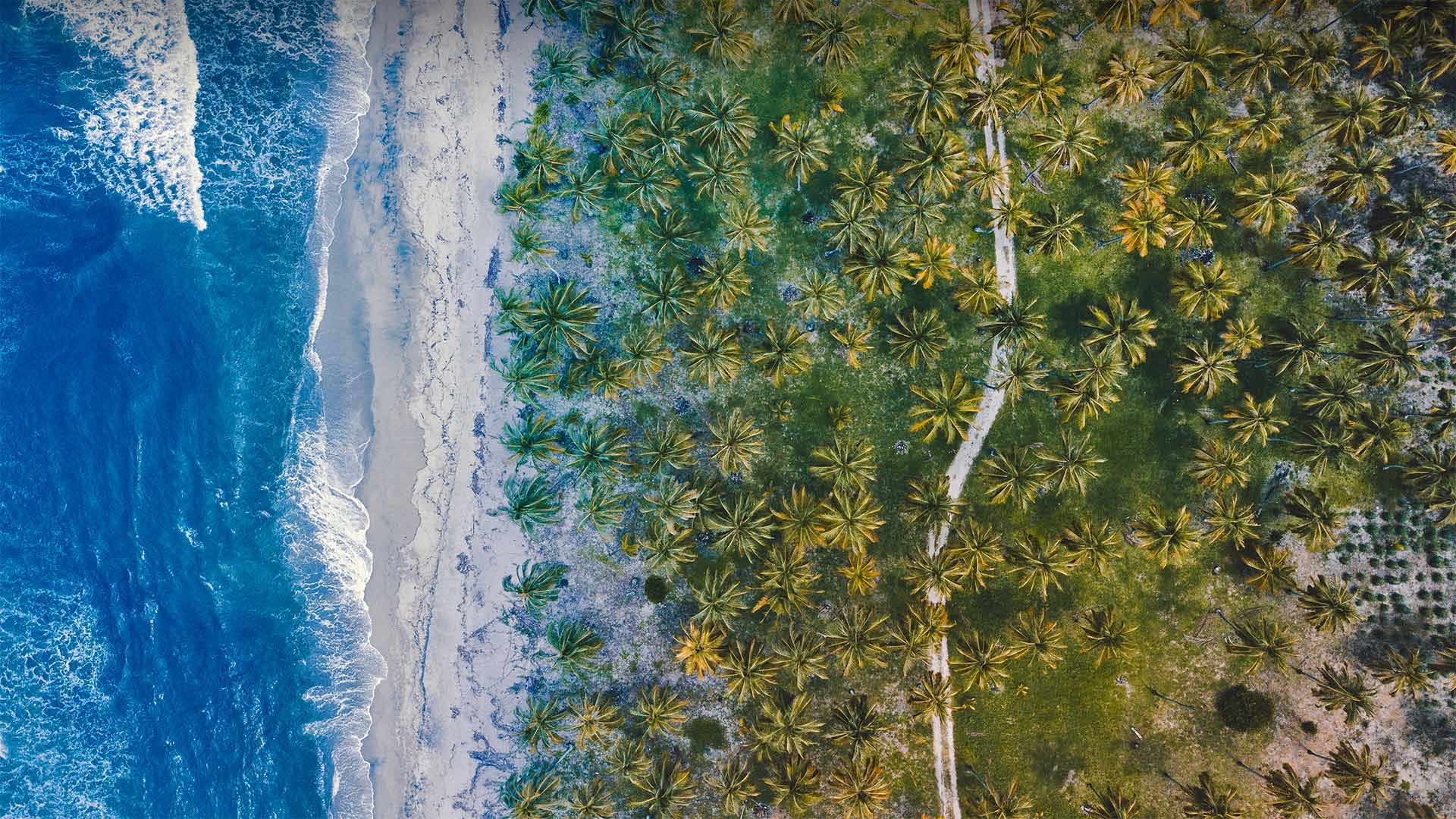
风景秀丽的加勒比海岸,哥伦比亚 Caribbean coast near Buritaca, Colombia (© Nicholas Hills/Getty Images)
哥伦比亚的加勒比海岸线 The Caribbean coastline of Colombia
Northern coast of Colombia
Central America becomes South America at the shores of Colombia, the northernmost country in South America. Colombia is the only country in South America that has coastline on both the Caribbean Sea to the east and the Pacific Ocean to the west. Seen here is a stretch of beach near Buritaca, on the Caribbean side of Colombia. This region of Colombia boasts some of the most beautiful beaches in the country. It is also among the country's most ecologically diverse with jungle, desert, and the highest coastal mountain range in the world, the Sierra Nevada.
Colombia's colonial history began in this region when Spanish conquistadors landed in 1499. Within 50 years, the Spanish had established the kingdom of Granada beginning a rule that would last nearly 300 years.
哥伦比亚北部海岸
中美洲在哥伦比亚海岸变成了南美洲,哥伦比亚是南美洲最北的国家。哥伦比亚是南美洲唯一一个东临加勒比海、西临太平洋的国家。这里可以看到哥伦比亚加勒比海一侧布里塔卡附近的一片海滩。哥伦比亚的这个地区拥有全国最美丽的海滩。它也是该国生态多样性最丰富的地区之一,有丛林、沙漠和世界上最高的沿海山脉内华达山脉。
哥伦比亚的殖民历史始于1499年西班牙征服者登陆该地区。在50年内,西班牙人建立了格拉纳达王国,开始了一个持续近300年的统治。
海岸旁的二见浦夫妇岩,日本三重县 Meoto Iwa (Wedded Rocks) off the coast of Ise, Mie Prefecture, Honshu, Japan (© Marco Gaiotti/plainpicture)
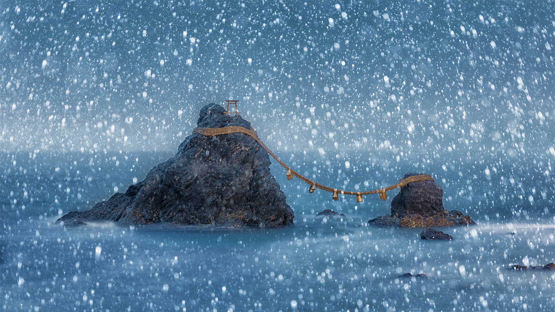
海岸旁的二见浦夫妇岩,日本三重县 Meoto Iwa (Wedded Rocks) off the coast of Ise, Mie Prefecture, Honshu, Japan (© Marco Gaiotti/plainpicture)
Wedded Rocks, Japan
Just off the shore of the city of Ise, in the southern-central region of Japan's main island, Honshu, two rocks represent a sacred union between a divine couple. Known collectively as Meoto Iwa (Wedded Rocks), these sea stacks represent Izanagi and Izanami, the married brother-and-sister deities who created the islands of Japan and its gods in Japanese mythology. The large rock on the left is said to be the husband, Izanagi–at its peak is a small torii, a symbolic gateway marking the entrance to a Shinto shrine. The smaller rock represents his wife, Izanami.
The smitten sea stacks are joined together in matrimony by a thick rope braided of rice straw called 'shimenawa,' which is used as a symbol of purity and protection in the Shinto religion. The sacred rope is replaced in a special ceremony, held three times each year during the months of May, September, and December. The best time to see the rocks is at dawn during summer or twilight in winter, when the sun and moon, respectively, rise between them. If the weather is clear and the gods are on your side, you might even catch a glimpse of Mount Fuji in the distance. But we think it's just as beguiling with heavy snowflakes gently falling all around.
婚礼岩石,日本
离日本本州岛中南部的伊瑟市不远,两块岩石代表着一对神圣的夫妻之间的神圣结合。这些海堆被统称为Meoto Iwa(Wedded Rocks),它们代表了在日本神话中创造了日本岛屿及其诸神的已婚兄弟姐妹神Izanagi和Izanami。左边的大石头据说是丈夫Izanagi——山顶上是一个小牌坊,一个象征性的大门,标志着神社的入口。较小的岩石代表他的妻子伊扎纳米。
被击倒的海垛在婚礼上由一根由稻草编织而成的粗绳连接在一起,称为“shimenawa”,在神道教中被用作纯洁和保护的象征。在每年5月、9月和12月举行的三次特殊仪式中,更换神圣绳索。观赏这些岩石的最佳时间是夏季的黎明或冬季的黄昏,此时太阳和月亮分别从它们之间升起。如果天气晴朗,众神在你身边,你甚至可以瞥见远处的富士山。但我们认为,这和四周轻轻飘落的厚厚的雪花一样迷人。
苏阿海沟,萨摩亚乌波卢岛南海岸 To Sua Ocean Trench on the south coast of Upolu Island in Samoa (© Chris McLennan/Alamy)
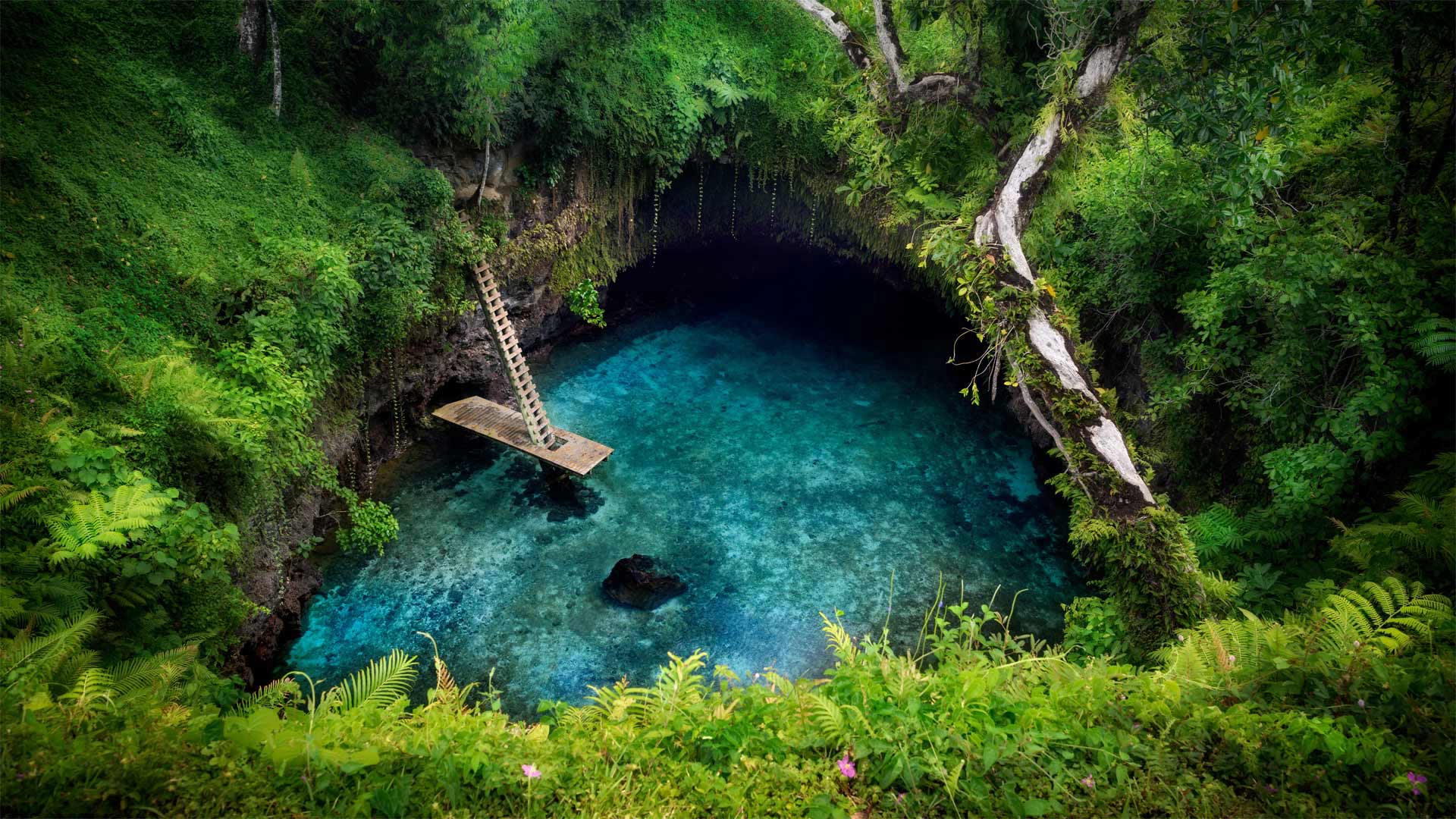
苏阿海沟,萨摩亚乌波卢岛南海岸 (© Chris McLennan/Alamy)
To Sua Ocean Trench
This majestic swimming hole on Samoa's Upolu Island sits just inland from the Pacific coast. It was formed when the roof of an ancient lava tube collapsed, exposing the 98-foot-deep teal-blue pool. This is the largest of many such tide pools and blow holes formed in the area many thousands of years ago. An underground cave system connects this swimming hole to the nearby ocean, and the water rises and falls with the tides.
'To Sua' translates to English as 'big hole.' While accurate, it feels like an understatement in this context. For adventurous visitors to Upolu Island, To Sua Ocean Trench can feel like a trip to another world. To get to this natural saltwater pool, make your way along a cliffside path surrounded by lush forest. Then climb down to the waters via the wooden ladder. After your swim, you can squeeze through a cave-like lava tube to find yourself on a short, sandy beach.
到苏阿海沟
萨摩亚乌波卢岛上这座宏伟的游泳池位于太平洋海岸的内陆。它是在一条古代熔岩管的顶部坍塌,露出98英尺深的蓝绿色水池时形成的。这是数千年前在该地区形成的众多潮汐池和气孔中最大的一个。一个地下洞穴系统将这个游泳洞连接到附近的海洋,海水随着潮汐涨落。
“To Sua”在英语中译为“big hole”虽然准确,但在这种情况下,这感觉像是轻描淡写。对于到乌波卢岛探险的游客来说,到苏亚海沟就像到另一个世界旅行。要到达这个天然的咸水池,请沿着一条被茂密森林环绕的悬崖边小径前进。然后通过木梯爬下水面。游泳后,你可以挤过一个洞穴状的熔岩管,发现自己在一个短的沙滩上。
坎伯兰岛国家海岸,美国佐治亚州 Cumberland Island National Seashore, Georgia (© Wilsilver77/Getty Images Plus)
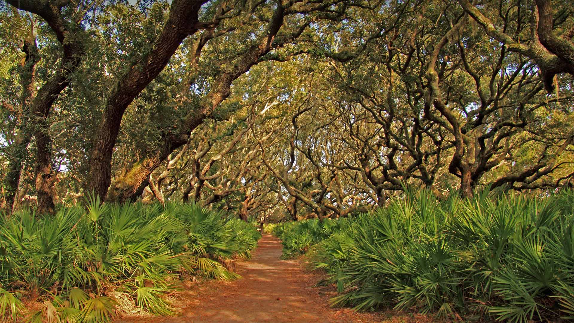
坎伯兰岛国家海岸,美国佐治亚州 Cumberland Island National Seashore, Georgia (© Wilsilver77/Getty Images Plus)
Cumberland Island National Seashore
Along the southernmost stretch of Georgia's Atlantic coast are several barrier islands, and Cumberland is the largest. The US National Park Service (NPS) protects 9,800 acres of the island's wilderness, a place where, as the NPS says, nature and history meet. Human occupation on Cumberland Island touches on numerous milestones in the story of America.
Eventually, Cumberland became a vacation getaway for wealthy industrialists in the 20th century before it became a protected public land.
The natural beauty of the island's maritime forests and marshes add to Cumberland's unique charm. And a lush ecosystem supports the island's diverse array of wildlife, including armadillos, alligators, and herds of feral horses.
州坎伯兰海岸国家公园
沿着乔治亚州大西洋海岸最南端有几个屏障岛,坎伯兰岛是最大的。美国国家公园管理局(NPS)保护着岛上9800英亩的荒野,正如NPS所说,这里是自然和历史交汇的地方。坎伯兰岛上的人类占领涉及到美国历史上的许多里程碑。
最终,坎伯兰在成为受保护的公共土地之前,在20世纪成为富有实业家的度假胜地。
岛上海洋森林和沼泽的自然美景增添了坎伯兰独特的魅力。繁茂的生态系统支撑着岛上各种各样的野生动物,包括犰狳、短吻鳄和成群的野马。
日出时的麦克拱岩,俄勒冈南海岸 Mack Arch Rock at sunrise on the southern Oregon coast (© Dennis Frates/Alamy)
日出时的麦克拱岩,俄勒冈南海岸 Mack Arch Rock at sunrise on the southern Oregon coast (© Dennis Frates/Alamy)
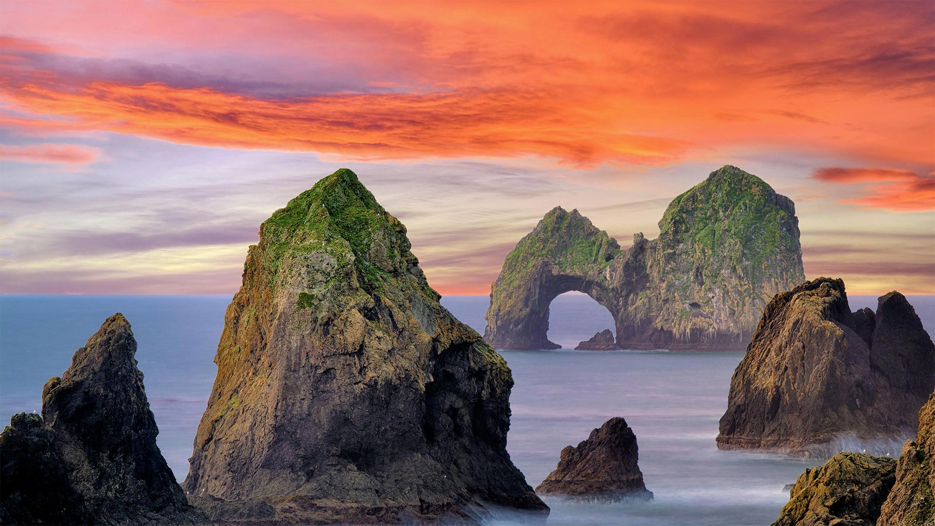
Southern Oregon coast, Mack Arch Rock
One of the common sights along the Oregon coast are the colossal rock formations known as sea stacks that jut from the Pacific and form an indelible, craggy imprint in your memory. The sea stacks you see here run next to a grassy promontory in the southern part of the state that overlooks a mostly inaccessible stretch of coastline.
In the background of this image is the Mack Arch, one of the largest naturally formed arches on the Pacific Coast and part of the Mack Reef archipelago. These clusters of sea stacks and beaches are home to a large concentration of seabirds like cormorants, black oystercatchers, gulls, and murres, as well as harbor seals and other marine wildlife. To help preserve this pristine sanctuary, the US Fish & Wildlife Service has designated it part of the Oregon Islands National Wildlife Refuge and closed the area off to the public. So have the owners of all the privately-owned land and beach that surround the refuge. So, if you're looking to get a close-up view of Mack Arch, your best bet is to do so by plane or boat.
俄勒冈州南部海岸,Mack Arch Rock
俄勒冈州海岸的一个常见景观是巨大的岩层,被称为海垛,它们从太平洋伸出,在你的记忆中形成一个不可磨灭、崎岖不平的印记。你在这里看到的海垛位于该州南部的一个长满青草的海角旁,俯瞰着一段几乎无法到达的海岸线。
这张图片的背景是麦克拱门,它是太平洋海岸最大的自然形成的拱门之一,也是麦克礁群岛的一部分。这些成簇的海垛和海滩是鸬鹚、黑牡蛎捕手、海鸥和海鸥等海鸟以及海豹和其他海洋野生动物的聚集地。为了帮助保护这个原始的保护区,美国鱼类和野生动物服务局已将其指定为俄勒冈群岛国家野生动物保护区的一部分,并对公众关闭了该区域。避难所周围所有私有土地和海滩的所有者也是如此。所以,如果你想近距离观察马克拱门,最好是坐飞机或船。
奥林匹克海岸国家海洋保护区的海岸线,美国华盛顿州 The shoreline of Olympic Coast National Marine Sanctuary, Washington state (© Chris Moore/Tandem Stills + Motion)
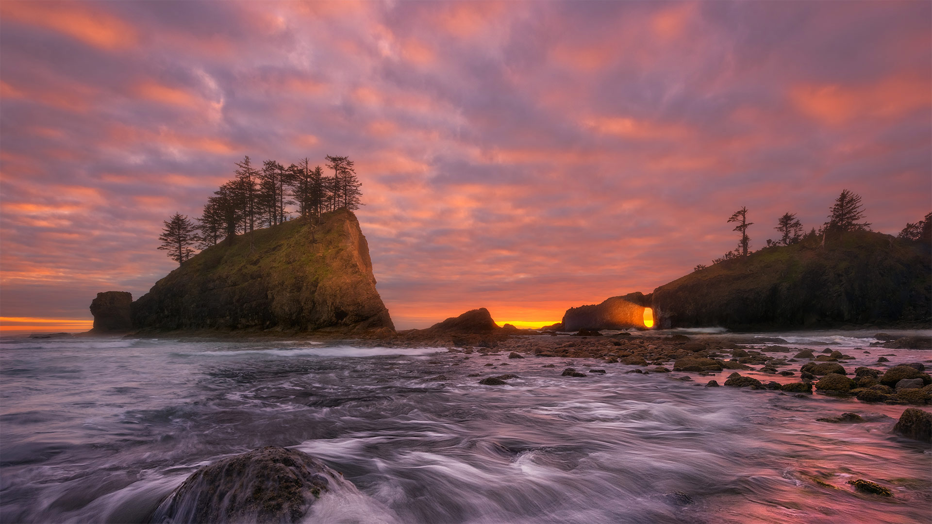
奥林匹克海岸国家海洋保护区的海岸线,美国华盛顿州 The shoreline of Olympic Coast National Marine Sanctuary, Washington state (© Chris Moore/Tandem Stills + Motion)
A wild, craggy corner of the United States
The sun is setting here on the west coast of Washington state's rugged Olympic Peninsula, where more than 3,000 square miles of marine waters are protected as part of the Olympic Coast National Marine Sanctuary. Wondering where exactly we are? Look at a map of the United States and draw your finger up the west coast until it ends where the Strait of Juan de Fuca meets the Pacific Ocean. Those final 135 miles of shoreline form the landward boundary of the sanctuary, which also extends seaward 25 to 50 miles.
This area attracts more than 3 million visitors a year. Many come to catch glimpses of the 29 species of marine mammals that reside in or migrate through this area, like humpback, gray, and orca whales, plus seals, sea lions, and sea otters. Salmon and halibut thrive here, as do any number of seabirds that make their nests in the craggy rock walls, seagrass, and treetops. At low tide, visitors explore tidepools teeming with life. This sanctuary is more than ecological resource, it's also home to vibrant Native American tribes. The Makah, Quileute, Hoh, and Quinault have been here for centuries, long before the first English sea captains spotted the coast and gave it its current name.
美国的一个荒凉、崎岖的角落
太阳落在华盛顿州崎岖不平的奥林匹克半岛西海岸,这里有3000多平方英里的海洋水域作为奥林匹克海岸国家海洋保护区的一部分受到保护。想知道我们到底在哪里?看一张美国地图,把手指指向西海岸,直到胡安·德富卡海峡与太平洋交汇处为止。最后135英里的海岸线形成了保护区的陆地边界,也向海延伸了25到50英里。
这个地区每年吸引300多万游客。许多人来这里是为了瞥见居住在该地区或迁徙经过该地区的29种海洋哺乳动物,如座头鲸、灰鲸和虎鲸,以及海豹、海狮和海獭。鲑鱼和大比目鱼在这里繁衍生息,许多海鸟也在峭壁、海草和树梢筑巢。在退潮时,游客们探索充满生命的潮滩。这个保护区不仅仅是生态资源,它还是充满活力的美洲土著部落的家园。早在第一批英国船长发现海岸并给它起了现在的名字之前,Makah、Quileute、Hoh和Quinault就已经在这里生活了几个世纪。
在伯利角冲浪的人们,澳大利亚黄金海岸 People surfing at Burleigh Heads, Gold Coast, Australia (© Vicki Smith/Getty Images)
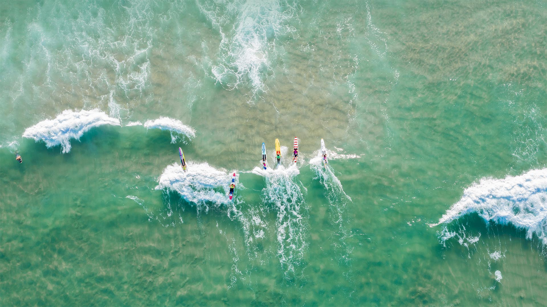
在伯利角冲浪的人们,澳大利亚黄金海岸 People surfing at Burleigh Heads, Gold Coast, Australia (© Vicki Smith/Getty Images)
Surf's up—Down Under
It's International Surfing Day! Here in the US we may be welcoming summer tomorrow, but these Aussie surfers are saying g'day to the rad waves of winter. Though peak surf season is autumn (that is, our spring) here in the Gold Coast area of Queensland, these tropical beaches offer world-class breaks all year long.
We Americans usually think California when we think surfing, but the sport's history runs deeper here in the South Pacific. Fijians, Tahitians, Hawaiians, and other Pacific Islanders have been riding waves for several hundred years at least. It wasn't until the early 1900s that Hawaiian Olympic swimmer Duke Kahanamoku demonstrated the sport for both US and Australian officials, creating a wave of popularity that has yet to break.
冲浪在下面
今天是国际冲浪日!在美国,明天我们可能会迎来夏天,但这些澳洲人却在向冬天的狂潮致敬。虽然昆士兰州黄金海岸地区的冲浪高峰期是秋天(也就是我们的春天),但这些热带海滩全年都提供世界级的休息。
当我们想到冲浪时,我们美国人通常会想到加利福尼亚,但这项运动在南太平洋的历史更为悠久。斐济人、塔希提人、夏威夷人和其他太平洋岛民至少已经乘风破浪几百年了。直到20世纪初,夏威夷奥运会游泳运动员杜克·卡哈纳莫库(Duke Kahanamoku)才向美国和澳大利亚官员展示了这项运动,创造了一波尚未打破的人气。
马德拉岛的北海岸,葡萄牙 The north coast of Madeira, Portugal (© Hemis/Alamy)
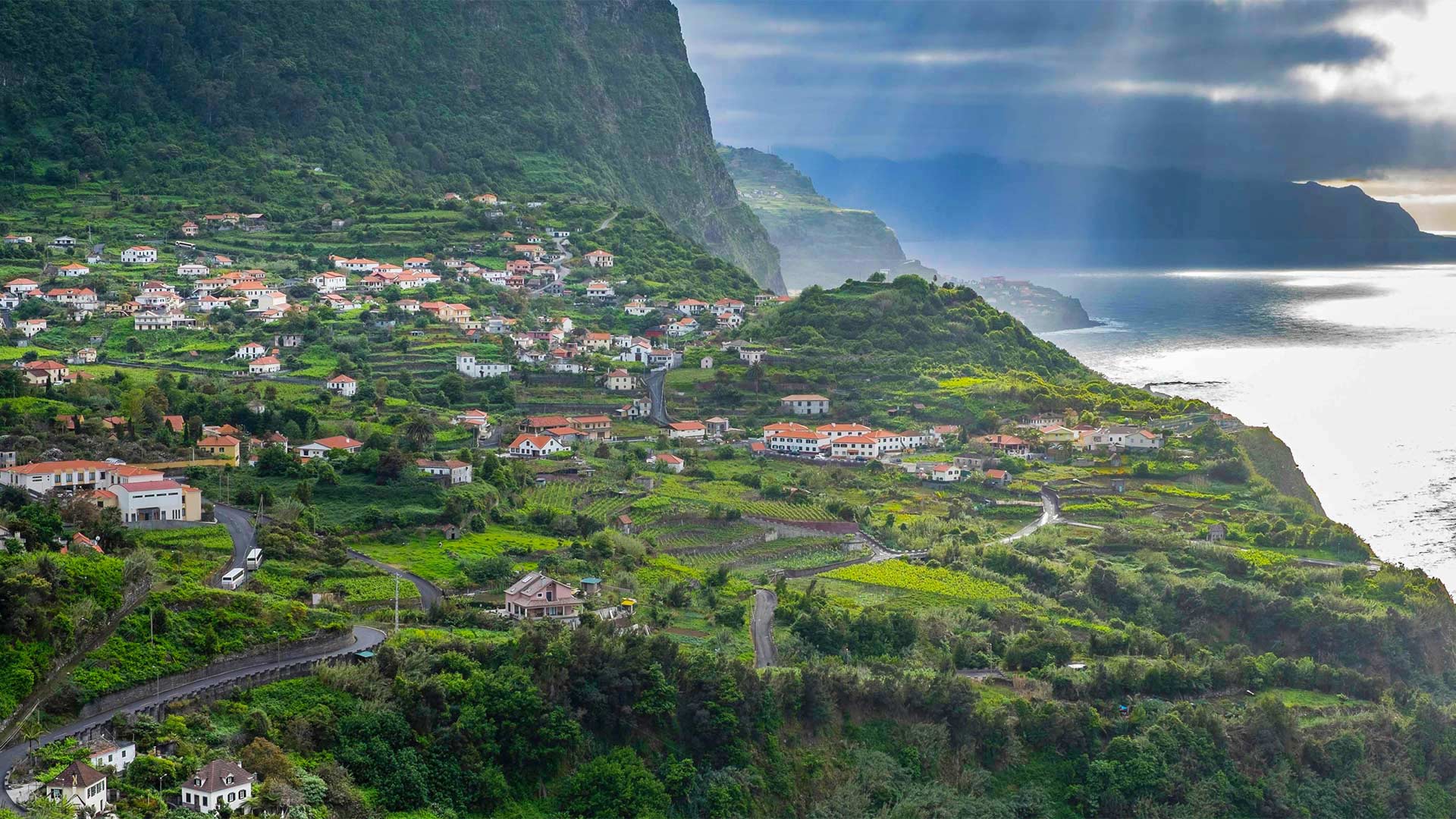
马德拉岛的北海岸,葡萄牙 The north coast of Madeira, Portugal (© Hemis/Alamy)
Exploring the 'Pearl of the Atlantic'
We're taking a view of the island of Madeira, by far the largest island in the Madeira archipelago, which sits 320 miles off the coast of Morocco in the North Atlantic. Part of an autonomous region of Portugal, Madeira, known as the 'Pearl of the Atlantic,' boasts a diverse forest ecosystem, endemic flora and fauna, and the largest living stand of laurel trees in the world. It's a great place to hike, too. Trails run alongside irrigation channels, called levadas, that move water all over the island. Walks range from easy strolls in the countryside to precarious hikes along mountain ridges or into remote parts of the forests. Afterward, the calorie-depleted can dig into a local delicacy like peixe espada com banana (fried local fish with banana) and sip on Madeira wine. Saúde!
探索“大西洋明珠”
我们正在观看马德拉岛,这是迄今为止马德拉群岛中最大的岛屿,位于北大西洋摩洛哥海岸320英里外。作为葡萄牙自治区的一部分,被称为“大西洋明珠”的马德拉拥有多样化的森林生态系统、特有的动植物群和世界上最大的活月桂林。这也是徒步旅行的好地方。小径沿着被称为levadas的灌溉渠延伸,这些灌溉渠将水输送到全岛。散步的范围从乡村的轻松漫步到沿着山脊或进入森林偏远地区的危险徒步旅行。之后,消耗掉的热量可以吃到当地的美味,比如peixe espada com香蕉(用香蕉炸当地鱼),然后啜饮马德拉葡萄酒。萨乌德!