Knuthöjdsmossen自然保护区, 海勒福什市, 瑞典 Knuthöjdsmossen nature reserve, Sweden (© Sven Halling/DEEPOL/plainpicture)
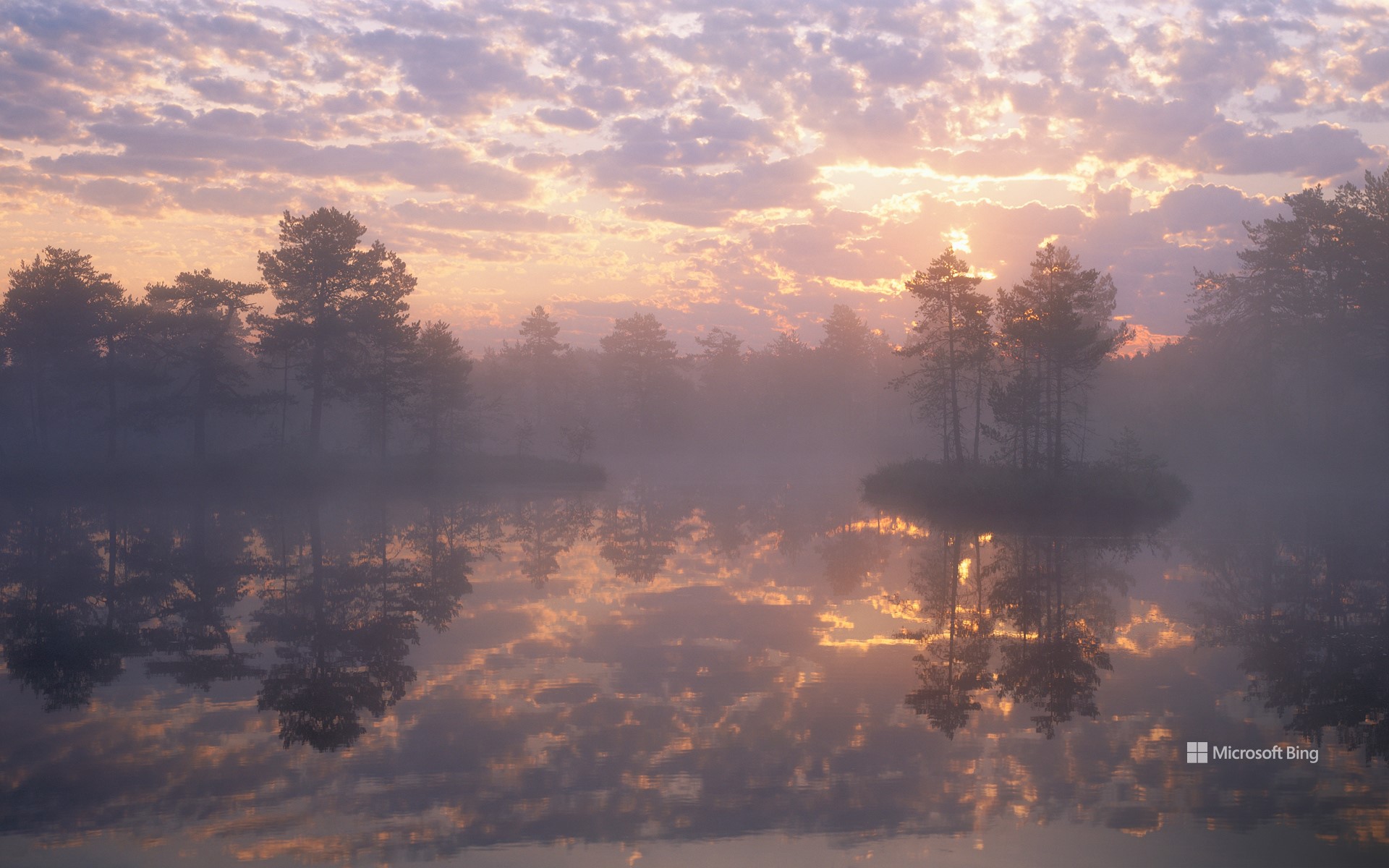
Knuthöjdsmossen自然保护区, 海勒福什市, 瑞典 Knuthöjdsmossen nature reserve, Sweden (© Sven Halling/DEEPOL/plainpicture)
古冰川遗迹之地 An ancient glacial landscape
Knuthöjdsmossen自然保护区, 瑞典
克努特霍德斯莫森自然保护区位于瑞典海勒福什市附近,占地近250英亩。这片宁静的绿洲拥有环形木栈道,穿越沼泽地带,沿途分布着多个小湖泊、沙丘、湿地与松林。其中部分路段无障碍设计,适合轮椅和婴儿车通行。
该地区地貌约形成于一万年前,源自最后一次内陆冰川的融化过程,遗留下冰碛堆积物与冰川河流沉积沙层。保护区内最高的沙丘——斯托拉·哈勒福斯迪嫩,高达33英尺,是诸多稀有昆虫的重要栖息地,其中包括学名为Formica cinerea的灰蚁等极为稀见的物种。对于鸟类观察者而言,这里堪称天堂。你可以观测到包括红喉潜鸟、北方戴胜、青脚鹬与普通秋沙鸭在内的多样鸟种。区内主要树种为松树,同时还生长着矮桦、乌鸦莓与野迷迭香等灌木植物。无论你是热衷生态探索的自然爱好者,还是渴望远离喧嚣的宁静旅行者,克努特霍德斯莫森自然保护区都将为你提供一处值得流连的目的地。
冰岛冰川河流鸟瞰图 Aerial view of glacial rivers in Iceland (© rybarmarekk/Shutterstock)
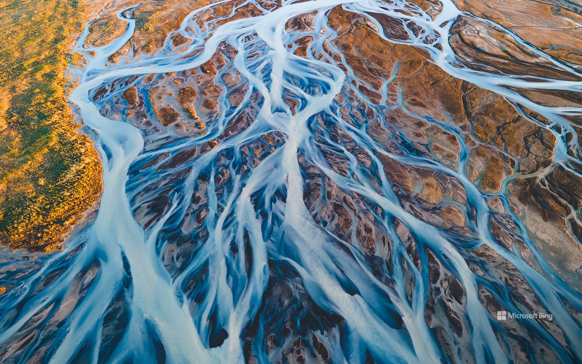
冰岛冰川河流鸟瞰图 Aerial view of glacial rivers in Iceland (© rybarmarekk/Shutterstock)
来自冰与火之国 From the land of fire and ice
冰川河流,冰岛
“冰与火之国”冰岛的冰川河流在数千年的时间里塑造了冰岛的地貌。今天图片中的河流就是由瓦特纳、朗格和霍夫斯等巨大冰川的融水形成的。瓦特纳冰川是冰岛第一大冰川,覆盖面积超3000平方英里,约占冰岛国土面积10%。冰川融化后,冰川水携带着细小的沉积物,形成了乳白色的辫状河流系统,与火山地形的泥土色调形成鲜明对比。每年春夏季节,河流都会因季节性融水而激增,不断塑造和重塑这片土地。从空中俯瞰,可以看到它们错综复杂的图案,就像一幅幅复杂的艺术品,在地形上交织着向北大西洋延伸。冰岛的水不仅仅是一道美丽的风景,它在可再生能源方面也发挥着重要作用。水流为水电站提供动力,巩固了冰岛作为可持续能源领导者的地位。
Glacial rivers in Iceland
Iceland's glacial rivers have shaped the landscape here in the land of fire and ice over thousands of years. The rivers seen in today's image are formed from the meltwater of vast glaciers like Vatnajökull, Langjökull, and Hofsjökull. Vatnajökull, the largest ice cap in Iceland, covers over 3,000 square miles—approximately 10% of the country's landmass. As the glaciers melt, the water carries fine sediments, creating a braided river system with a milky appearance that contrasts with the earthy tones of the volcanic terrain. Every spring and summer, the rivers swell with seasonal meltwater, continually shaping and reshaping the land. Aerial views reveal their intricate patterns, interwoven across the terrain toward the North Atlantic Ocean. The water also powers hydroelectric power stations, reinforcing Iceland's status as a leader in sustainable energy.
斯卡夫塔山的瀑布,瓦特纳冰川国家公园,冰岛 Waterfall in Skaftafell, Vatnajökull National Park, Iceland (© Nopasorn Kowathanakul/Getty Images)
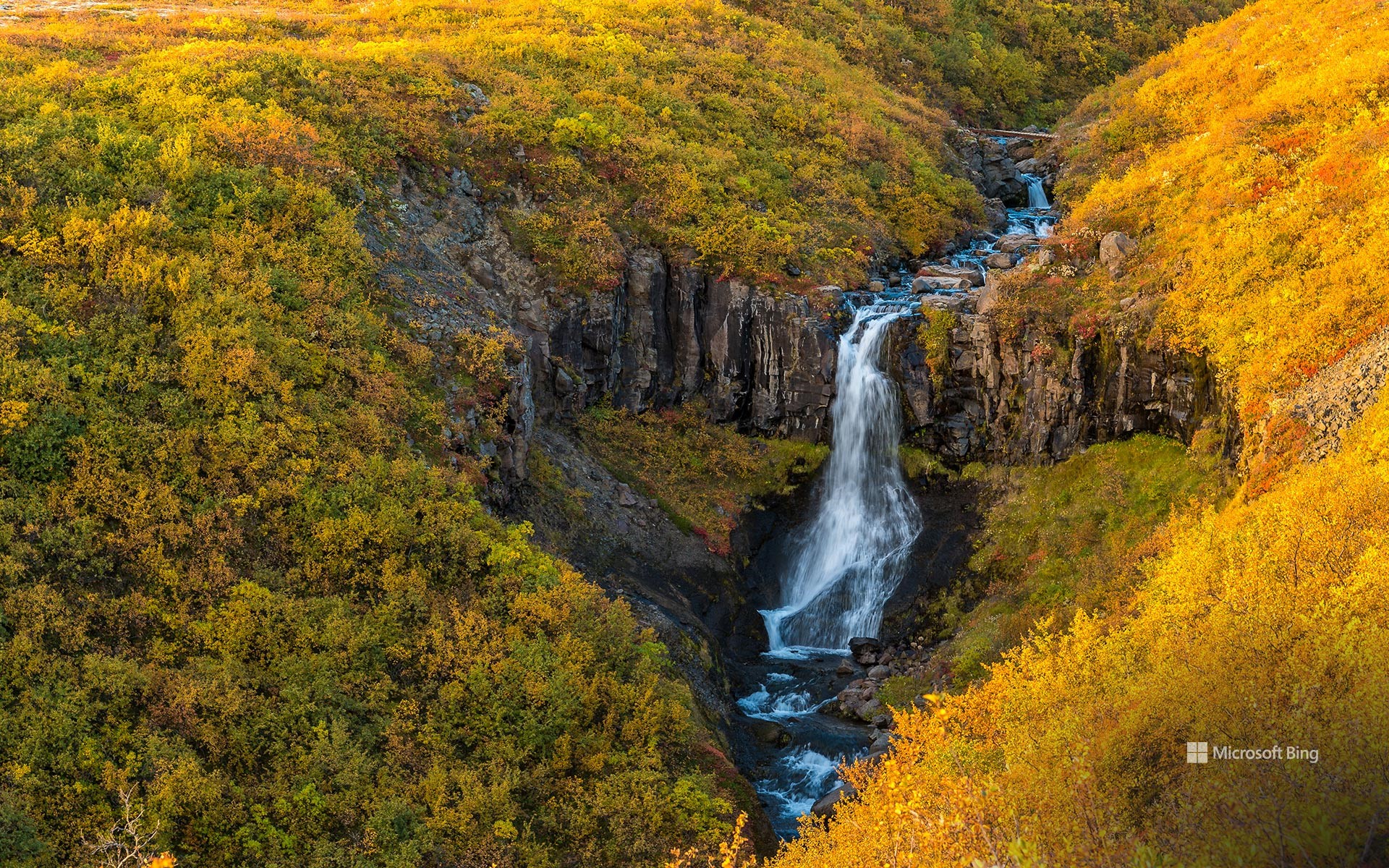
斯卡夫塔山的瀑布,瓦特纳冰川国家公园,冰岛 Waterfall in Skaftafell, Vatnajökull National Park, Iceland (© Nopasorn Kowathanakul/Getty Images)
你会相信这种观点吗? Falling for this view?
斯卡夫塔山,瓦特纳冰川国家公园,冰岛
在冰岛的斯卡夫塔山,秋天不仅仅是一个季节,更是一种体验。从冰川到瀑布,再到北极光,瓦特纳冰川国家公园中的这片区域展示了大自然的原始之美。斯卡夫山曾经是一个繁荣的农场,现在是一个保护区,它是几千年来火山火焰和冰川水激烈交织形成的。作为欧洲第二大冰盖瓦特纳冰川的一个分支,斯卡夫塔山冰川像一条冰冻的河流一样延伸开来,吸引着游客在导游的带领下徒步旅行。公园内的斯瓦蒂瀑布的水源则来自冰川融水。瀑布周围环绕着深色的熔岩柱,从远处看就像一颗心脏,冰岛国家大剧院和雷克雅未克的哈尔格林姆斯教堂的设计灵感就来源于此。斯卡夫塔山的徒步路径既有简单的步行道,又有具有挑战性的攀登路线,每个人都能在这里找到适合自己的路。虽然这个季节的日照时间可能较短,但也有好的地方。当夜幕降临时,极光经常出现,将天空变成绿色和粉色的混合漩涡。
Skaftafell, Vatnajökull National Park, Iceland
In Iceland's Skaftafell, fall isn't just a season—it's an experience. From glaciers to waterfalls, like the one featured here today, to northern lights, this area in Vatnajökull National Park is a showcase of nature's raw beauty. Skaftafell's dramatic landscape was formed over thousands of years by the fierce interplay of volcanic fire and glacial water. Here, the glacier Skaftafellsjökull, a branch of Iceland's largest ice cap, Vatnajökull, stretches out like a frozen river, inviting visitors for guided hikes. Then there's Svartifoss, another waterfall in the park, fed by glacial meltwater. Surrounded by dark lava columns resembling a heart from afar, this waterfall inspired the design of Iceland's National Theatre and the Hallgrímskirkja church in Reykjavík.
Skaftafell's hiking trails range from easy walks to challenging climbs, so there's something for everyone. While the daylight hours may be shorter in this season, there's a bright side—literally. As night falls, the auroras often appear, turning the sky into a swirling mix of green and pink.
勃朗峰上的冰海,夏慕尼,法国 (© Hagenmuller Jean-François/Hemis/Alamy)
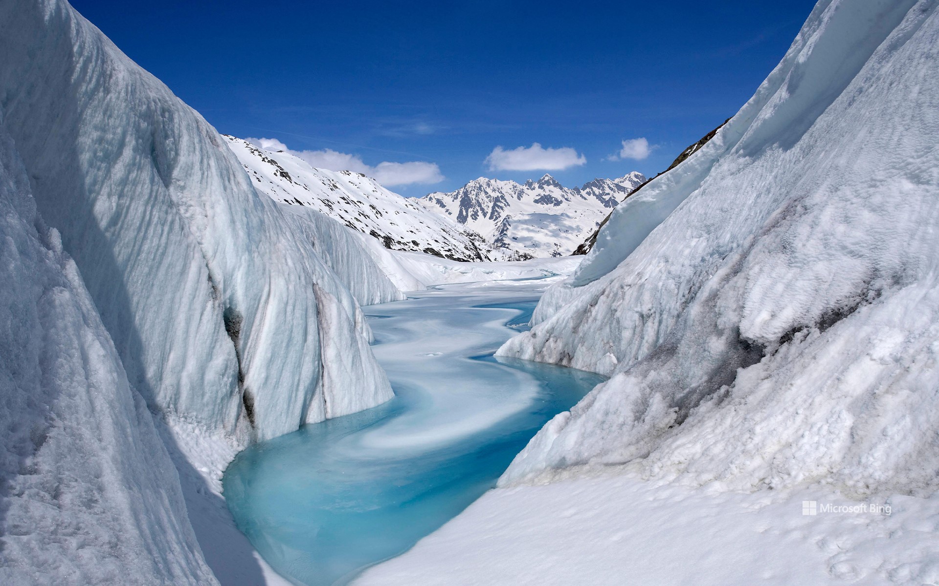
勃朗峰上的冰海,夏慕尼,法国 (© Hagenmuller Jean-François/Hemis/Alamy)
岌岌可危的冰川
冰海,夏慕尼
冰海是法国阿尔卑斯山脉最著名的冰川之一,它坐落于勃朗峰地块的北坡,靠近夏慕尼,长约7公里,深200米,是法国最大的冰川。它由冰块缓慢而稳定的运动形成,形成时间可追溯至几千年前。
不幸的是,这个自然宝藏正在经受气候变化带来的剧烈影响。每一年,该冰川都在以惊人的速度缩小、变薄,以至于其厚度减少了几十米。而人类活动排放的温室气体是造成冰川快速融化的主要原因,岩石的存在则加剧了这一情况。如今的情况令人担忧,而我们人类能做的,是采取相应的措施去缓解气候变化对冰川的影响,保护阿尔卑斯山的宝藏。
原驼,冰川国家公园,阿根廷 Guanacos in Los Glaciares National Park, Patagonia, Argentina (© Yva Momatiuk and John Eastcott/Minden Pictures)
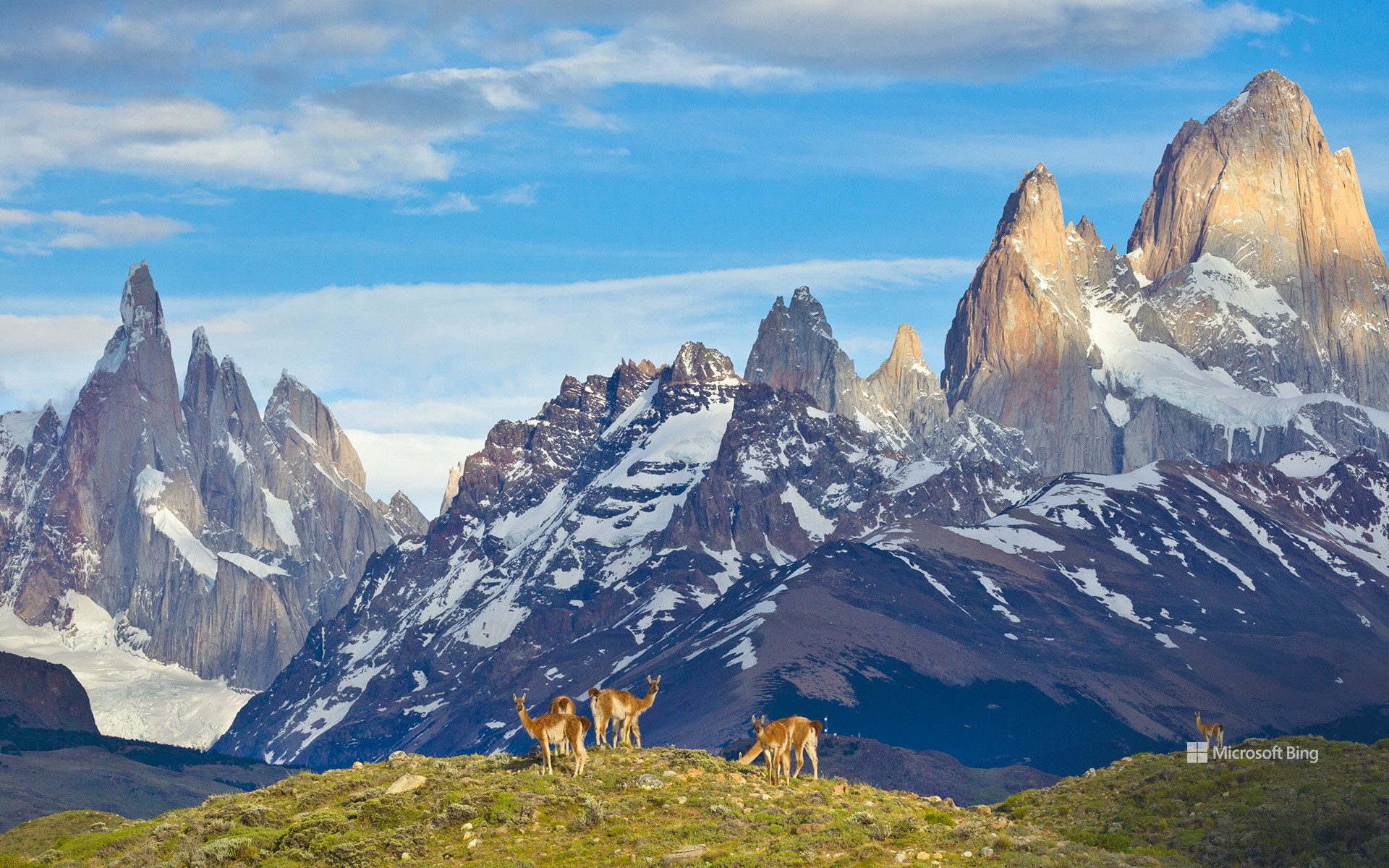
原驼,冰川国家公园,阿根廷 Guanacos in Los Glaciares National Park, Patagonia, Argentina (© Yva Momatiuk and John Eastcott/Minden Pictures)
出逃的美洲鸵 Llamas on the loose
国家美洲驼日
穿上登山鞋出门吧,因为今天是国家美洲驼日!12月9日是专门用来欣赏这些聪明且可驯化的动物的日子。您需要到安第斯山脉去看看它们那被称为原驼的野生表亲。据说,原驼起源于约4000万年前的北美中部平原。不过,它们逐渐迁移到了南美洲,在公元前4500年左右被驯化,并获得了美洲鸵的称号。
在今天的图片中,展示了在阿根廷的洛斯格拉兹阿勒冰川国家公园内自由漫步的原驼,它们有着深肉桂色的羊毛和卡通般的面孔。尽管它们外表可爱,但有时也会带点粗鲁在身上:原驼和美洲驼都会通过吐口水来维护自己在种群中的统治地位和阻止同类的入侵。不过,不要因此而放弃参加有组织的美洲驼徒步旅行,它们可是很棒的伙伴!
National Llama Day
Strap on your hiking boots because it's National Llama Day! December 9 is a designated day to appreciate these intelligent and trainable creatures. You'll need to visit the Andes Mountains to see their wild cousins, guanacos. Guanacos are believed to have originated in the central plains of North America 40 million years ago, but they gradually migrated to South America. Scientists think llamas descended from guanacos and were first domesticated around 4500 BCE.
As seen in today's image, guanacos are often spotted roaming free in Los Glaciares National Park, Argentina, sporting dark cinnamon-colored wool and cartoonish-looking faces. Cute as they are, they can be a bit rude: Both guanacos and llamas defend themselves by spitting to assert dominance within their herd or to keep intrusive peers at bay. Don't let this deter you from going on an organized llama trek though—they can make for great pack animal companions!
冰川湾国家公园里的兰普鲁冰川,美国阿拉斯加州 Lamplugh Glacier in Glacier Bay National Park, Alaska (© Andrew Peacock/Getty Images)
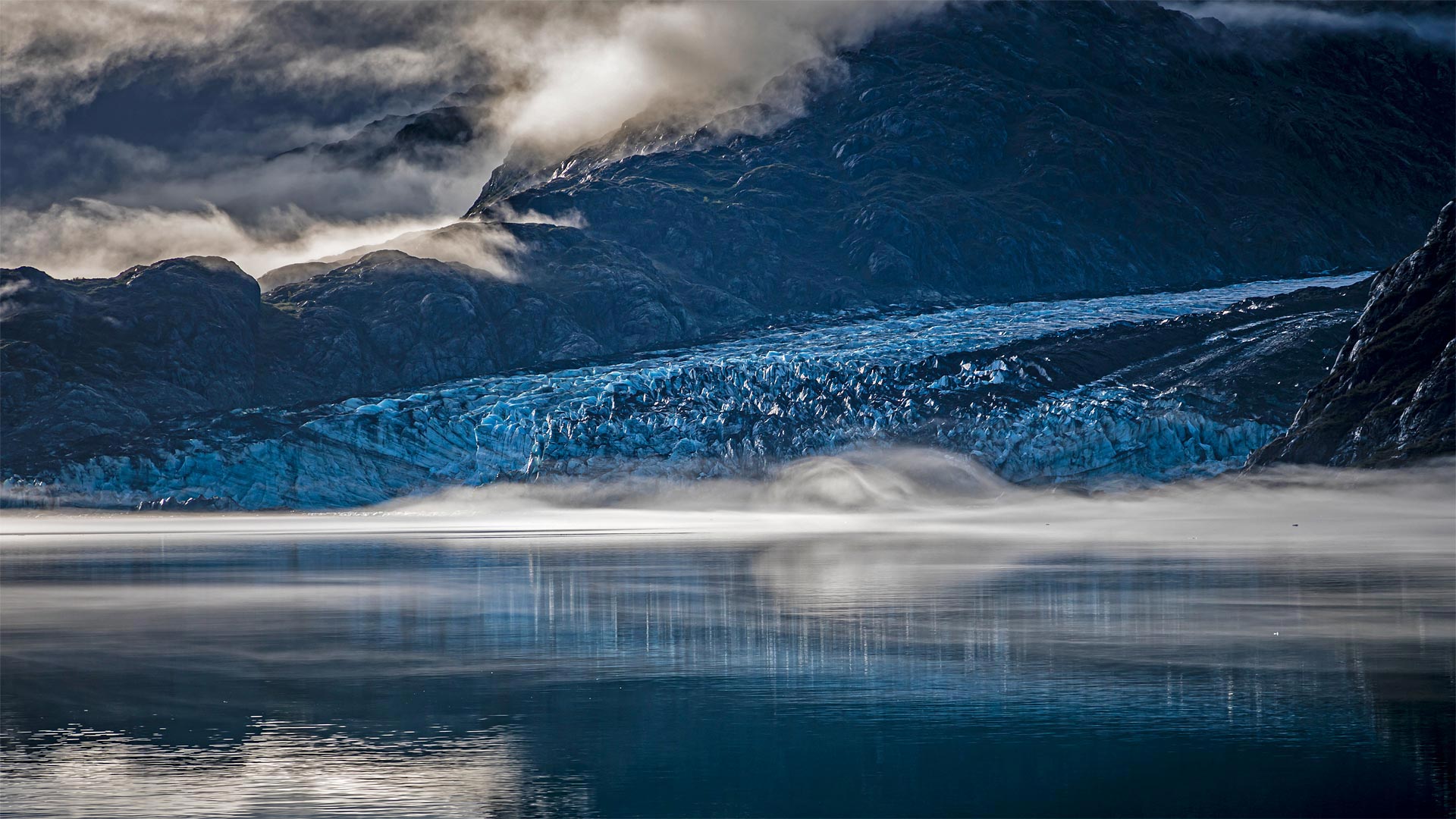
冰川湾国家公园里的兰普鲁冰川,美国阿拉斯加州 Lamplugh Glacier in Glacier Bay National Park, Alaska (© Andrew Peacock/Getty Images)
古老的冰川与大海相遇的地方 Where ancient ice meets the sea
Glacier Bay National Park and Preserve
Think of this special spot as the place where two different Alaskas meet—its vast icy north and its verdant maritime south. Glacier Bay is named for this area's dominant feature, the rivers of ice that carve the landscape and periodically calve icebergs into the sea. On February 26, 1925, President Calvin Coolidge declared much of the land around the bay a national monument. But the protected area was greatly expanded in 1980, when a 3.3-million-acre expanse of glaciers, fjords, rainforest, coastline, and mountain peaks was named a national park and preserve.
Pictured here is Lamplugh Glacier, one of the relatively few tidewater glaciers in the park; the vast majority are found inland. Lamplugh is known for its intense blue color—ice and water absorb the red wavelength of white light and transmit blue light, which is what we end up seeing. The thicker and more pure the ice, the more blue it appears.
冰川湾国家公园
把这个特殊的地方想象成两个不同的阿拉斯加人在广阔的冰雪覆盖的北方和苍翠的海洋南面相遇的地方。冰川湾是以该地区的主要特征命名的,冰的河流切割景观,并周期性地将冰山崩解入海中。1925年2月26日,卡尔文·柯立芝总统宣布海湾周围的大部分土地为国家纪念碑。但1980年,保护区得到了极大的扩展,当时一片330万英亩的冰川、峡湾、雨林、海岸线和山峰被命名为国家公园和保护区。
这里的图片是兰普卢冰川,公园里相对较少的潮水冰川之一;绝大多数是在内陆发现的。Lamplugh以其强烈的蓝色而闻名,冰和水吸收白光的红色波长并传输蓝光,这就是我们最终看到的。冰越纯,越厚。
冰川洞穴里流动的河流,冰岛瓦特纳冰原 Flowing river inside a glacier cave, Vatnajökull, Iceland (© Marco Bottigelli/Getty Images)
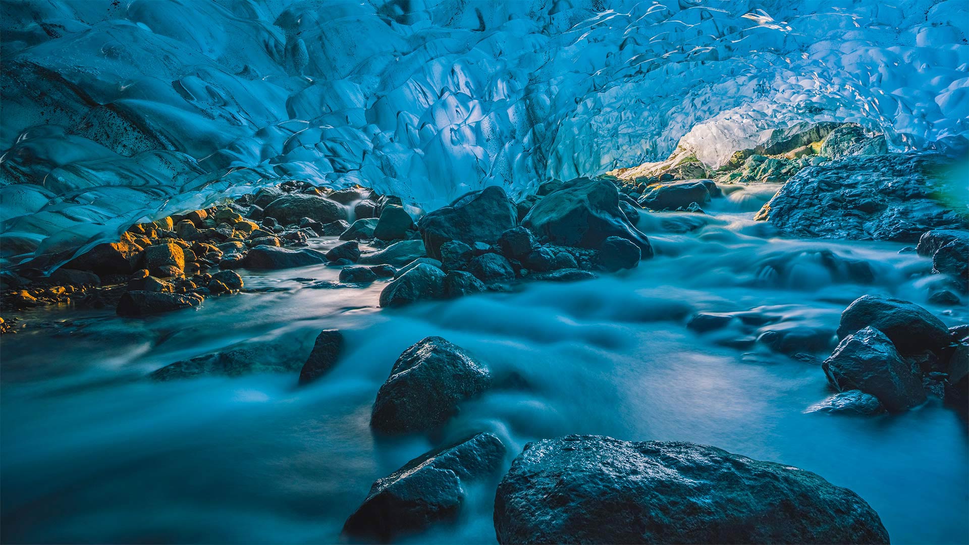
冰川洞穴里流动的河流,冰岛瓦特纳冰原 Flowing river inside a glacier cave, Vatnajökull, Iceland (© Marco Bottigelli/Getty Images)
冰,冰,正在坍塌 Ice, ice, caving
Glacier cave in Iceland
The land of fire and ice is home to countless natural wonders, like these brilliant blue caves formed within the ice of a glacier. (Glacier caves are often called ice caves, but the latter term is properly used to describe bedrock caves that contain year-round ice.) The majority of these glacier caves are on the southeastern edge of Iceland in Vatnajökull glacier, which covers about 8% of the island nation and is one of the largest glaciers in Europe.
Vatnajökull's caves, formed by the flowing rivers underneath the glacier, are famous for their blue corridors and eerie atmosphere. The caves are only accessible from November until March when temperatures are cold enough to strengthen the ice. The caves vary in size and shape each year, so enjoy the beauty of this one while you can, because it may not be around next winter.
冰岛冰川洞
这片冰雪之地拥有无数自然奇观,比如这些在冰川冰中形成的明亮的蓝色洞穴。(冰川洞穴通常被称为冰洞,但后一个术语被恰当地用来描述含有全年冰的基岩洞穴。)这些冰川洞穴大多位于冰岛东南边缘的瓦特纳库尔冰川(Vatnajökull glacier),该冰川覆盖了该岛国约8%的面积,是欧洲最大的冰川之一。
Vatnajökull的洞穴由冰川下流动的河流形成,以其蓝色的走廊和怪异的氛围而闻名。这些洞穴只有在11月至3月期间才能到达,那时的温度足够冷,足以强化冰。这些洞穴每年都有不同的大小和形状,所以尽可能地欣赏这座洞穴的美丽,因为它可能不会在明年冬天出现。
克卢恩国家公园保护区的山脉和冰川,加拿大育空地区 Saint Elias Mountains and Kaskawulsh Glacier in Kluane National Park and Reserve, Yukon, Canada (© Design Pics Inc/Alamy)
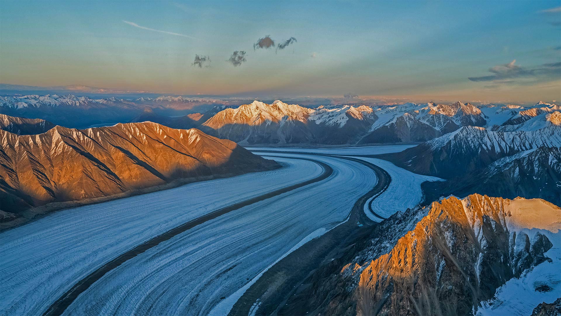
克卢恩国家公园保护区的山脉和冰川,加拿大育空地区 Saint Elias Mountains and Kaskawulsh Glacier in Kluane National Park and Reserve, Yukon, Canada (© Design Pics Inc/Alamy)
Kluane National Park
What looks here like an ice road for 50-foot-tall truckers is really Kaskawulsh Glacier in Canada's Kluane National Park. This corner of the Yukon is home to the largest ice field on Earth outside of the poles, with the slow, steady flow of more than 2,000 glaciers continually carving these vast canyons amid the peaks.
Speaking of peaks, glance up and you'll see the Yukon is also paradise for mountain lovers. And Kluane is its pinnacle, literally: Located within the park is Mount Logan, the highest mountain in Canada (and second-highest on the continent after Alaska's Denali).
库隆尼国家公园
对于50英尺高的卡车司机来说,这里看起来像是一条冰路,实际上是加拿大克鲁恩国家公园中的卡斯卡沃尔什冰川。育空地区的这个角落是地球上除极地以外最大的冰原的所在地,2000多条缓慢而稳定的冰川不断地在山峰之间雕刻着这些巨大的峡谷。
说到山峰,抬头一看,你会发现育空地区也是高山爱好者的天堂。Kluane是它的巅峰,字面意思是:位于公园内的是加拿大最高的山脉洛根山(仅次于阿拉斯加的德纳利山,是该大陆第二高的山)。
格林内尔湖,蒙大拿州冰川国家公园 Grinnell Lake, Glacier National Park, Montana (© Pung/Shutterstock)
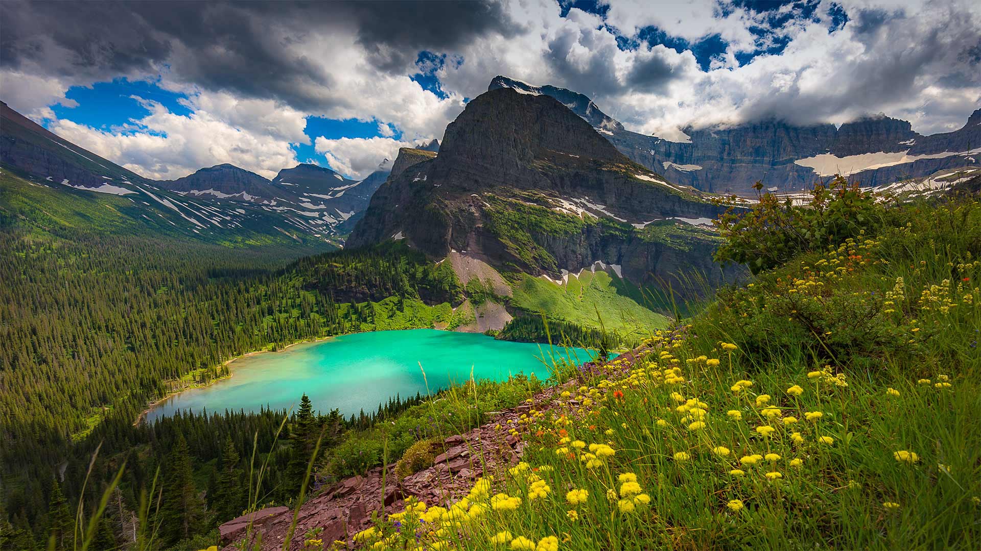
格林内尔湖,蒙大拿州冰川国家公园 Grinnell Lake, Glacier National Park, Montana (© Pung/Shutterstock)
'The Crown of the Continent'
With one million acres of rugged, northwestern Montana wilderness to explore, a trip to Glacier National Park could fill up an entire summer and more. But let's just take one day and virtually visit Grinnell Lake. A 7-mile loop trail, a relatively easy one in this rugged country, takes you to the shores of the lake turned emerald-green by glacial silt. Grinnell Lake—as well as Mount Grinnell and Grinnell Glacier—is named for the naturalist and Audubon Society founder George Bird Grinnell. For two decades, he lobbied for the creation of the park, and on May 11, 1910, the 'Crown of the Continent,' as Grinnell dubbed this area, became the nation's 10th national park.
“大陆之冠”
有一百万英亩崎岖不平的蒙大拿州西北部荒野可供探索,一次冰川国家公园之旅可能会填满整个夏天,甚至更多。但让我们花一天时间去参观格林内尔湖吧。在这个崎岖的国家,一条7英里长的环形小径相对容易,它会带你到达湖岸,湖岸被冰川淤泥染成翠绿。格林内尔湖以及格林内尔山和格林内尔冰川是以博物学家和奥杜邦协会创始人乔治·伯德·格林内尔命名的。二十年来,他一直在游说建立这个国家公园,1910年5月11日,格林内尔称之为“欧洲大陆之冠”的这个地区成为美国第十个国家公园。
冰川国家公园中的佩里托莫雷诺冰川,阿根廷 Perito Moreno Glacier in Patagonia's Los Glaciares National Park, Argentina (© Juergen Schonnop/Getty Images)
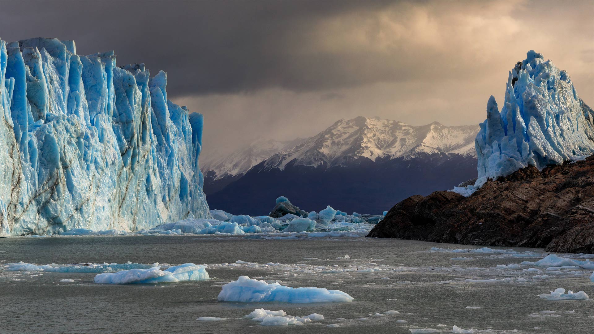
冰川国家公园中的佩里托莫雷诺冰川,阿根廷 Perito Moreno Glacier in Patagonia's Los Glaciares National Park, Argentina (© Juergen Schonnop/Getty Images)
The persistence of Perito Moreno
Yes, it's true that glaciers are shrinking, but not all of them. Perito Moreno, a low-lying glacier in southern Argentina, accumulates ice at about the same rate that it melts into chilly Argentino Lake. This equilibrium makes it one of the few glaciers worldwide that aren't losing mass to climate change.
Perito Moreno is an Argentine icon, partly for its unusual accessibility via the lake, the largest within the nation. Visitors to Los Glaciares National Park can boat or kayak out on ice-blue water for a better look—but they need to keep a safe distance as icebergs constantly calve from the glacier's face, creating huge splashes and waves.
佩里托·莫雷诺的坚持
是的,冰川确实在缩小,但不是全部。阿根廷南部的一座低洼冰川佩里托莫雷诺(Perito Moreno)积冰的速度与它融化到寒冷的阿根廷湖的速度差不多。这种平衡使它成为全球为数不多的不会因气候变化而失去质量的冰川之一。
佩里托·莫雷诺是阿根廷的一个标志,部分原因是它通过这个国家最大的湖泊不同寻常的可达性。到洛斯冰川国家公园的游客可以在冰蓝色的水面上划船或皮划艇,以获得更好的观赏效果,但他们需要保持安全距离,因为冰山不断地从冰川表面脱落,形成巨大的水花和海浪。