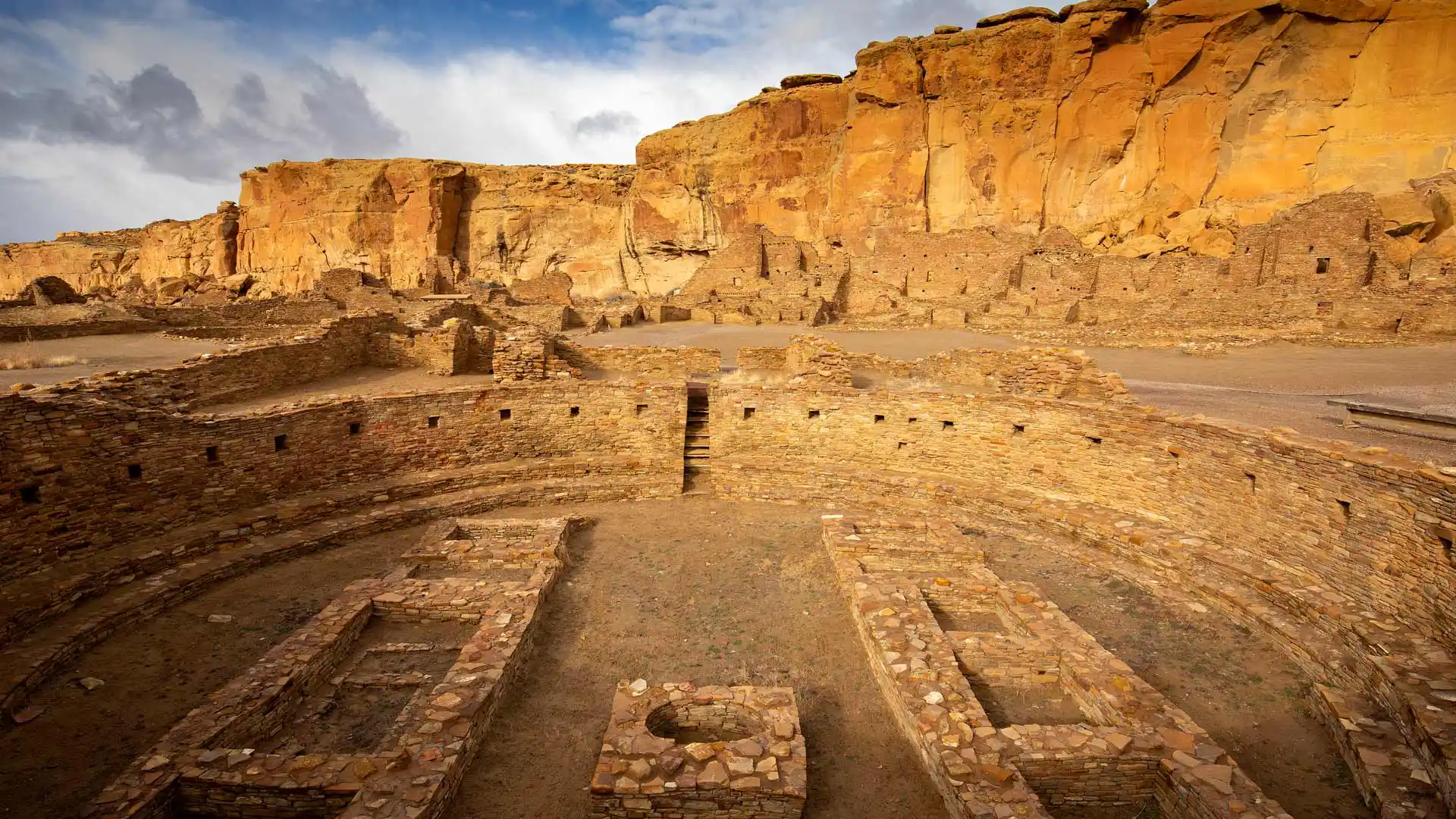
普韦布洛·博尼托镇,查科文化国家历史公园,美国新墨西哥州 Pueblo Bonito, Chaco Culture National Historical Park, New Mexico (© Ian Shive/Tandem Stills + Motion)
普韦布洛·博尼托镇,查科文化国家历史公园,美国新墨西哥州 Pueblo Bonito, Chaco Culture National Historical Park, New Mexico (© Ian Shive/Tandem Stills + Motion)
如果这些墙会说话······ If these walls could talk...
查科文化国家历史公园,美国新墨西哥州
数百年来,新墨西哥州的查科峡谷一直是普韦布洛人祖先的主要文化中心,他们的族群在这里扎根并繁荣起来。然而,由于高地沙漠冬季漫长、少雨且生长季节短暂,在这里生活并非易事。尽管面临这些挑战,普韦布洛人还是找到了在这个条件艰苦的地方繁荣发展的方法。今天,查科文化国家历史公园让我们得以窥见古老的普韦布洛人的文化、传统和价值观。该遗址是史前时代举办典礼的公共建筑的所在地,建筑风格具有普韦布洛文化的独特特征。这些建筑仿照古代的悬崖民居,由石灰石块或土坯砖建造而成。
Chaco Culture National Historical Park, New Mexico
These circular walls belong to Pueblo Bonito, one of the biggest great homes in Chaco Culture National Historical Park, New Mexico. Between around 850 CE and 1250 CE, Chaco Canyon became a major cultural center for the Ancestral Puebloans, who lived in what is now known as the Four Corners region.
With long winters, little rain, and short growing seasons, the high desert wasn't the easiest place to live but the Pueblo people found ways to thrive here. Today, the park offers a glimpse into an ancient culture's traditions and way of life. The site is home to remnants of prehistoric ceremonial and massive stone buildings, called great houses. Pueblo Bonito, pictured on our homepage, took decades to build and stood four or five stories tall with more than 600 rooms. It would have been used for ceremonies, commerce, astronomy, hospitality, and more. Eventually, Chaco's influence declined, and the people moved on. These ruins are a window onto its glorious past, at the heart of an ancient civilization.
怀阿纳帕纳帕州立公园的黑沙滩,茂宜岛,夏威夷,美国 Black sand beach at Wai'ānapanapa State Park, Maui, Hawaii (© Matt Anderson Photography/Getty Images)
怀阿纳帕纳帕州立公园的黑沙滩,茂宜岛,夏威夷,美国 Black sand beach at Wai'ānapanapa State Park, Maui, Hawaii (© Matt Anderson Photography/Getty Images)
热带天堂的黑沙滩 Black sands in a tropical paradise
怀阿纳帕纳帕州立公园,茂宜岛,夏威夷
黑色沙滩通常是怎样形成的?有两种情况:第一种情况,海浪冲刷海滩时,深色的、较重的矿物质留了下来;第二种情况则发生在怀阿纳帕纳帕州立公园的这片沙滩,玄武岩(一种黑色的火山岩)被海浪侵蚀成细小的颗粒,形成了令人惊叹的黑色沙滩。你可以在茂宜岛东侧,哈纳之路的尽头找到这个海滩。类似的黑沙滩遍布世界各地,包括阿拉斯加、加利福尼亚、希腊、哥斯达黎加、意大利、冰岛、印度尼西亚和新西兰等地。
Wai'ānapanapa State Park, Maui, Hawaii
Brooding black sand beaches are popular with photographers looking for something a little different, and Hawaii has plenty of them on offer. This famous beach at Wai'ānapanapa State Park on Maui was created when basalt, a dark volcanic rock, was eroded by waves into fine grains, creating a stunning shoreline. You'll find it on Maui's east side, toward the end of the legendary Road to Hana, a scenic 64-mile highway. You can also find black sand shores around the world, from Alaska to Greece, Costa Rica, Italy, Iceland, Indonesia, and New Zealand.
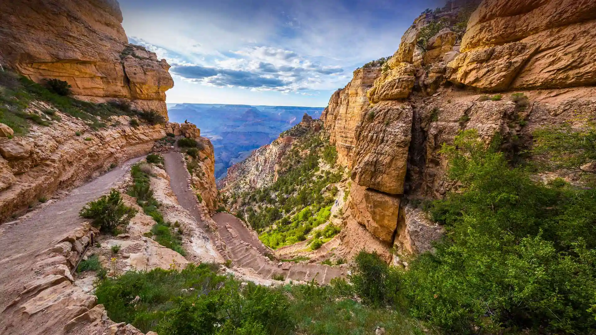
大峡谷国家公园的南凯巴布步道,亚利桑那州,美国 South Kaibab Trail in Grand Canyon National Park, Arizona (© Roman Khomlyak/Getty Images)
大峡谷国家公园的南凯巴布步道,亚利桑那州,美国 South Kaibab Trail in Grand Canyon National Park, Arizona (© Roman Khomlyak/Getty Images)
一睹最壮观的峡谷 A glimpse of the grandest of canyons
大峡谷国家公园,美国亚利桑那州
今天是美国国家步道日,也是远足的最佳时机,也提醒大家要保护远足路线,让每个人都能享受这份快乐。想找个绝佳的地方活动活动吗?今天照片里位于大峡谷的南凯巴布步道就是个好去处。这条路线从被称为“烟囱”的急转弯开始,通向一个陡峭狭窄的下坡路,等待你的将是一次令人振奋的旅程。新鲜空气和运动可以改善你的情绪和睡眠,增强体力和耐力,并降低患心脏病的风险。此外,环境的变化还可以激发创造力,启发新思路。
National Trails Day
Today is a great day to take a hike! Each year, National Trails Day brings together nature lovers, government agencies, and businesses to preserve hiking trails for everyone to enjoy. Looking for a stunning spot to stretch your legs? We suggest South Kaibab Trail in the Grand Canyon, seen here. The trail starts with a series of switchbacks known as 'The Chimney,' which leads to a steep, narrow descent—prepare for an invigorating workout! All that hard work will pay off though—fresh air and exertion can boost your mood, improve sleep, and reduce the risk of heart disease. Not to mention the panoramic views you can enjoy from the trail's scenic viewpoints.
在奥克弗诺基国家野生动物保护区划独木舟 Canoe paddling in Okefenokee National Wildlife Refuge, Georgia (© Brad Beck/Tandem Stills + Motion)
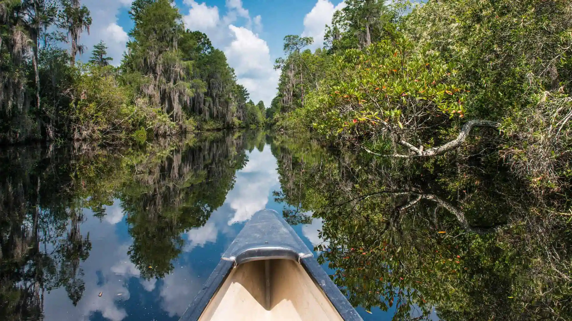
在奥克弗诺基国家野生动物保护区划独木舟 Canoe paddling in Okefenokee National Wildlife Refuge, Georgia (© Brad Beck/Tandem Stills + Motion)
一片平静的水域 Serene waters on a 'trembling earth'
美国湿地月
五月是美国湿地月,旨在关注湿地在当地和全球生态系统的重要性。湿地值得我们去关注,这些多样性生态系统有固碳功能,改善水质,并为至少三分之一的濒危物种提供栖息地。然而如今,湿地自身也面临威胁。美国本土48个州的2.21亿英亩湿地,超半数已遭到破坏。
奥克弗诺基沼泽是一个繁茂的湿地,也是北美现存最大的黑水生态系统。这里有几十种鸟类,还有许多两栖动物、爬行动物及其他小型生物。奥克弗诺基这个名字来自于原住民的语言,意思是“震颤的大地”。
American Wetlands Month
It's American Wetlands Month, a time to celebrate swamps, marshes, bogs, and other types of these important ecosystems. Wetlands play a vital role in storing carbon, improving water quality, and serving as habitat for many endangered plants and animals, including American crocodiles and whooping cranes. And yet, wetlands are threatened. Over the centuries, they have been drained to provide land for farming, industry, and housing. Pollution and invasive plants pose further threats. Since the late 1700s, more than half of the 221 million acres of wetlands that once existed in the 48 contiguous states have disappeared.
Georgia's Okefenokee Swamp, seen here, is a thriving wetland that is home to dozens of bird species, American alligators. and other critters. It is also the largest blackwater swamp in North America—the water appears almost black due to tannins from decaying vegetation. All looks calm in our homepage image, but the swamp gets its name from a Native American word that is often translated as 'trembling earth' or 'bubbling water.'
精致拱门,拱门国家公园,犹他州 Delicate Arch, Arches National Park, Utah (© Mark Brodkin Photography/Getty Images)
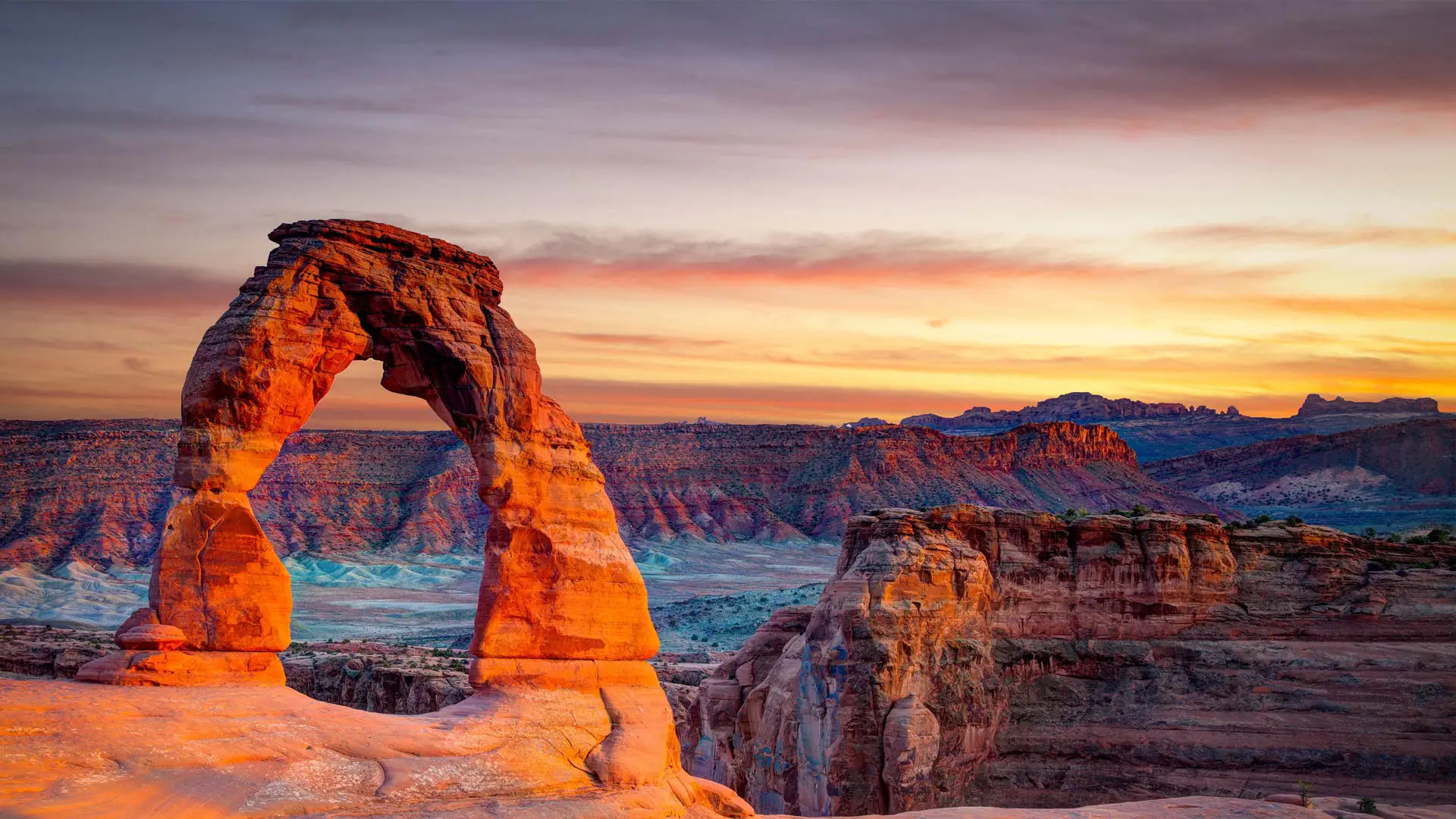
精致拱门,拱门国家公园,犹他州 Delicate Arch, Arches National Park, Utah (© Mark Brodkin Photography/Getty Images)
藏在精致拱门里的百年时光 Centuries of time in a Delicate Arch
拱门国家公园,美国犹他州
精致拱门是美国最受欢迎的地质景点之一。在犹他州拱门国家公园的2000个石拱门中,精致拱门是最有名的那一座,也是这里最大的岩石拱门。犹他州的车牌和邮票也有印有精致拱门。只需徒步三英里,就能到达这座拱门,这也是公园里最棒的徒步旅行路线之一。每年都有近140万人前往拱门国家公园,只为一睹精致拱门的全貌。
Arches National Park, Utah
This stunning structure is Delicate Arch, the most famous of 2,000 stone arches scattered around Arches National Park in Utah. It is made up of Entrada Sandstone, the grains of which once formed a massive desert. They were cemented together by minerals, forming sandstone riddled with tiny holes. Over millennia, the rain seeped in and slowly dissolved the rock from the inside, forming these eye-catching sculptures. Most of the arches in the national park are formed from Entrada Sandstone and were once buried by other rock layers. They won't last forever, but over time, new shapes will emerge from the layers of rock below to replace them. Every year, close to 1.4 million people visit the park to see Delicate Arch and this slowly shifting landscape for themselves.
市保护厅, 新奥尔良, 路易斯安那州 Preservation Hall, New Orleans, Louisiana (© Cosmo Condina North America/Alamy)

市保护厅, 新奥尔良, 路易斯安那州 Preservation Hall, New Orleans, Louisiana (© Cosmo Condina North America/Alamy)
挥杆庆祝的一天 A day of swing and celebration
国际爵士乐日
爵士乐诞生于新奥尔良的黑人社区,在Big Easy之外迅速流行起来,并在国际上引起轰动。由于其即兴创作的性质,爵士乐从未一成不变,与其他文化和流派融合,创造出非洲裔古巴人、拉丁人和印度裔爵士乐等风格。联合国教科文组织亲善大使兼爵士钢琴家赫比·汉考克创建了国际爵士乐日,以庆祝这一全球流派,该日于2012年首次在纽约、巴黎和新奥尔良举行。我们希望你能放上你最喜欢的爵士乐唱片来庆祝,或者如果你能摇摆它,可以参观新奥尔良传奇的爵士乐场地保护厅,如我们在这里的照片所示。
International Jazz Day
Born in the Black communities of New Orleans, jazz music quickly caught on outside the Big Easy and became an international sensation. Due to its improvisational nature, jazz never stays the same, fusing with other cultures and genres to create styles such as Afro-Cuban, Latin, and Indo Jazz. UNESCO Goodwill Ambassador and jazz pianist Herbie Hancock created International Jazz Day to celebrate the global genre, first held in 2012 with events in New York, Paris, and New Orleans. We hope you celebrate by putting on your favorite jazz record, or if you can swing it, visit New Orleans' legendary jazz venue, Preservation Hall, seen in our photo here.
约书亚树国家公园上空的银河,美国加利福尼亚州 Milky Way over Joshua Tree National Park, California (© Schroptschop/Getty Images)
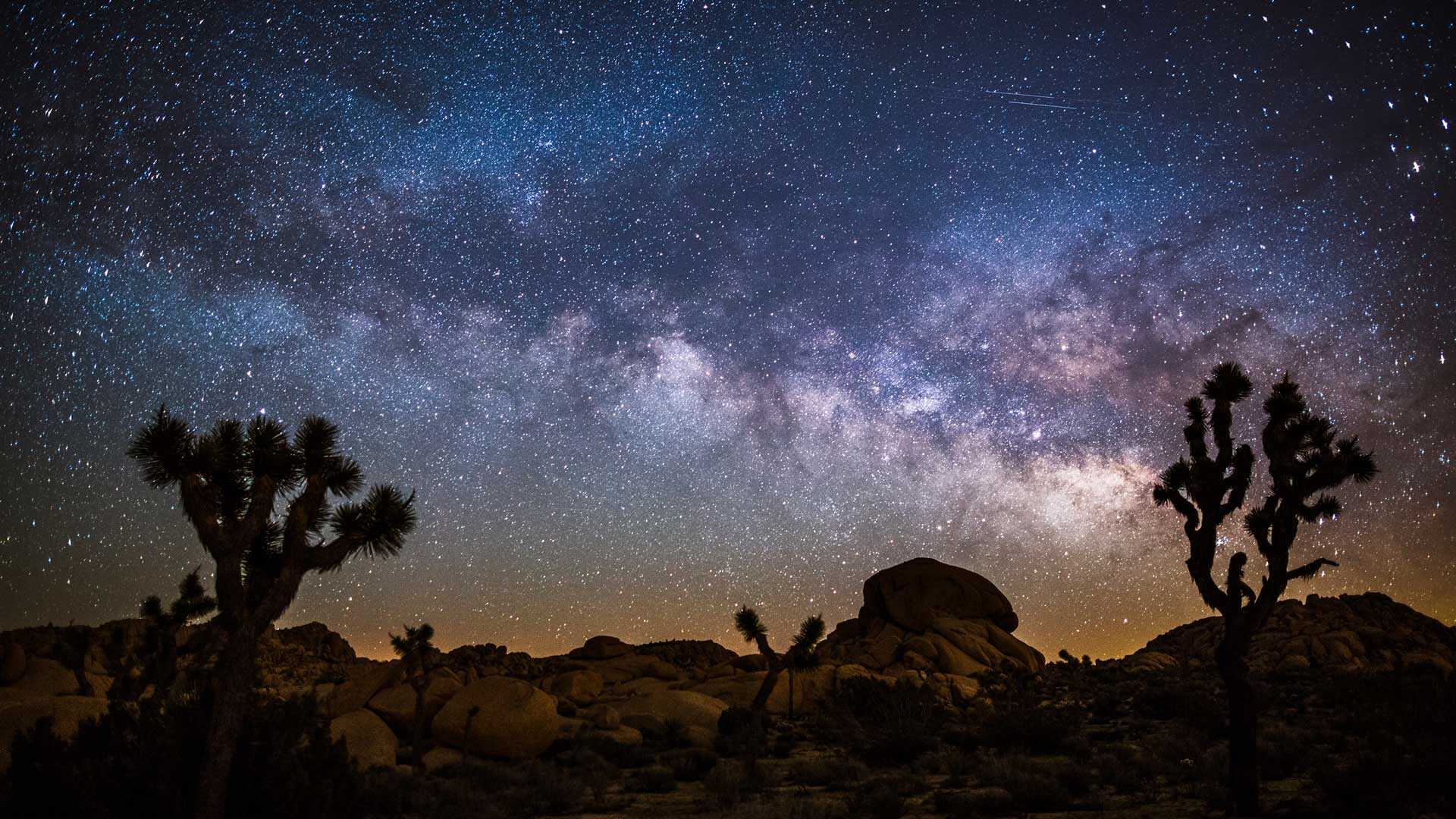
约书亚树国家公园上空的银河,美国加利福尼亚州 Milky Way over Joshua Tree National Park, California (© Schroptschop/Getty Images)
沙漠上空的星海 An ocean of stars above the desert
国际天文
今天是天文日,快准备好望远镜和星图APP去观星吧!为了让更多人对太空感兴趣,道格·伯杰于1973年创立了天文日,他在街角、商场和公园里架设了望远镜,让人们有机会亲眼看到星星。
早期的天文学家缺乏工具,只能凭肉眼观测天体,但他们仍然取得了重大的成就,例如计算月球的大小和距离,确认太阳是太阳系的中心,以及预测恒星运动和地球季节的关系。如今,我们拥有各种先进的望远镜,有詹姆斯韦伯太空望远镜,也有便携式望远镜,在国际黑暗天空公园里你都能看到有人在用这些先进的设备观星。
Astronomy Day
Get your telescope and star map app ready because it's Astronomy Day! Doug Berger, then president of the Astronomical Association of Northern California, created Astronomy Day in 1973 to get more people interested in the wonders of space. He set up telescopes on street corners, malls, and parks to give people a chance to see the stars firsthand.
Early astronomers lacked the means to view celestial objects beyond those which could be seen by the naked eye. But they still made major discoveries, such as calculating the size and distance of the moon, affirming the sun as the center of our solar system, and predicting the movement of stars relative to the seasons. Today we have sophisticated telescopes, from the orbiting James Webb Space Telescope to the portable ones you'll find in use at International Dark Sky Parks, including Joshua Tree National Park, seen in our photo. With such ground-breaking technology at our disposal, astronomers can boldly go where no human eyes have gone before.
优胜美地国家公园的马里波萨谷巨杉林,美国加利福尼亚州 Mariposa Grove in Yosemite National Park, California (© Orbon Alija/Getty Images)
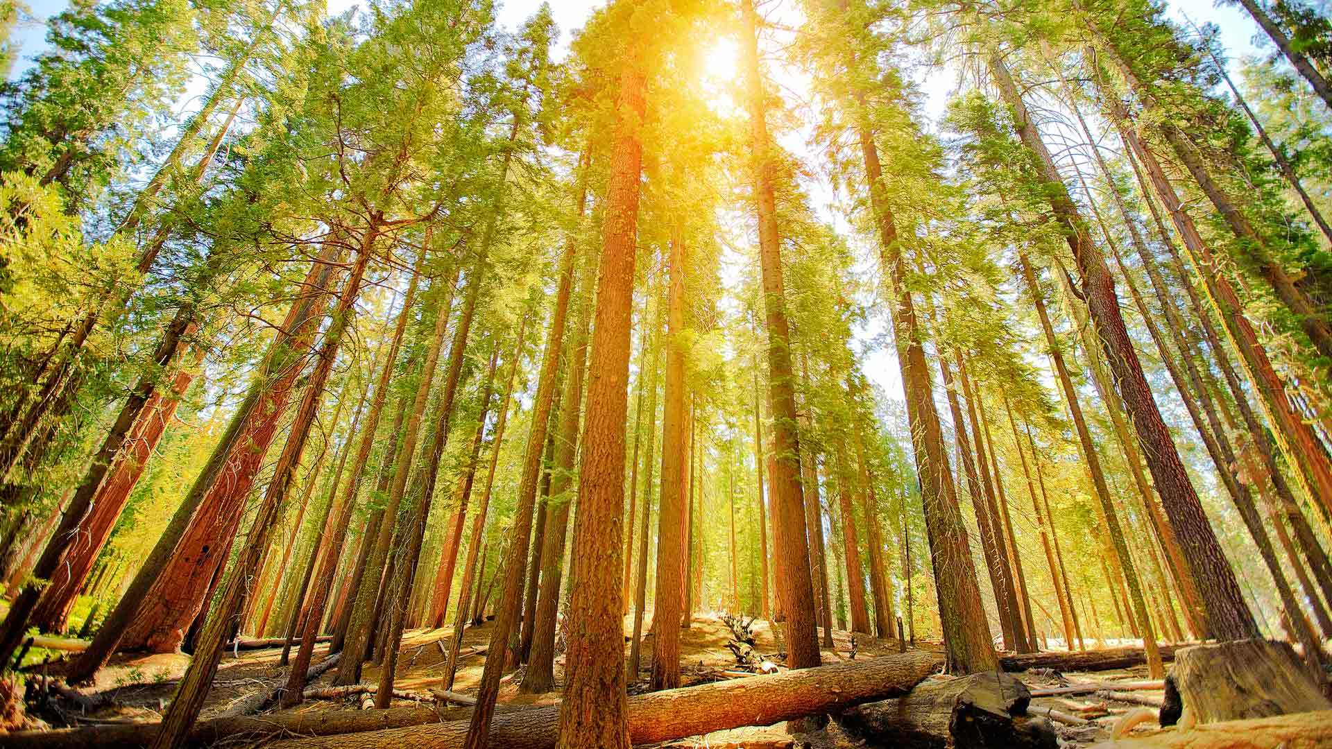
优胜美地国家公园的马里波萨谷巨杉林,美国加利福尼亚州 Mariposa Grove in Yosemite National Park, California (© Orbon Alija/Getty Images)
温暖的阳光穿过古老森林 Warm light through an ancient forest
马里波萨谷巨杉林
四月的最后一个星期五是美国的植树节,这一天,人们会庆祝植树成果、倡导保护树木。植树节最早起源于19世纪70年代初的内布拉斯加州,1872年,就职于《内布拉斯加州城市新闻》的记者朱利叶斯·斯特林·莫顿(Julius
Sterling Morton)在公共平台上发起了美国第一个植树节,并提议为内布拉斯加州人民设立一个种树日,于是植树节应运而生。
Arbor Day
We're celebrating Arbor Day with some of Yosemite's most famous residents, the giant sequoia trees of Mariposa Grove. The day champions the planting and preservation of trees and can trace its roots back more than 150 years. In 1872, Nebraska City News editor Julius Sterling Morton proposed a day for locals to plant trees, and the idea grew and grew. Today all 50 states celebrate Arbor Day, most commonly on the last Friday in April, although different states might observe it on the best dates for tree planting in their area.
Giant sequoias, like the ones on our homepage, have been around for a very long time. Geological evidence suggests that they are the third-longest-lived tree species in the world. There are hundreds of them in Yosemite's Mariposa Grove, including the famous Grizzly Giant, which is estimated to be about 3,000 years old. Let's hope it is around for thousands of Arbor Days to come.
南帕德里岛,美国得克萨斯州 South Padre Island, Texas (© Jeff R Clow/Getty Images)
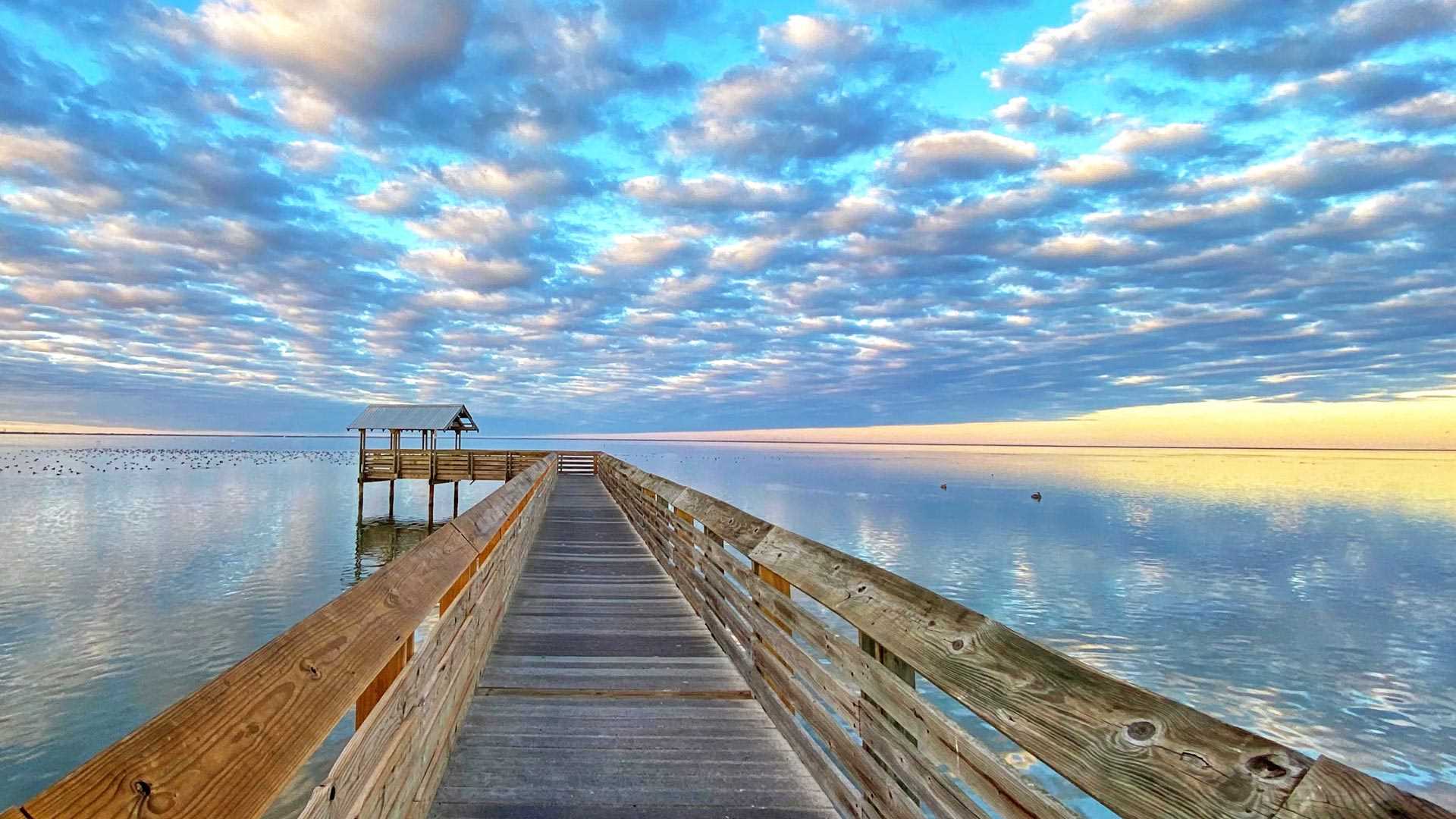
南帕德里岛,美国得克萨斯州 South Padre Island, Texas (© Jeff R Clow/Getty Images)
一望无际的天空 An endless stretch of sky
南帕德里岛,美国得克萨斯州
南帕德里岛位于得克萨斯州墨西哥湾海岸的近海几英里处,是该州最大、最长的堰洲岛。像南帕德里岛这样的堰洲岛通常与海岸平行,是大陆抵御风暴的第一道防线。南帕德里岛通过一座大桥和大陆相连,每年都有成千上万的游客来岛上游泳、划船、钓鱼、放风筝,或者惬意地躺在沙滩上晒太阳。另外,岛上还分布着各式各样的精致沙堡,这些引人注目的沙堡由世界各地的艺术家创作而成。
South Padre Island, Texas
Located a few miles offshore on the Texas Gulf Coast, Padre Island is the largest of the state's string of barrier islands. At 113 miles in length, it is also the longest barrier island in the world. Barrier islands usually run parallel to the coast and, as the name suggests, serve as the mainland's first line of defense against storms.
Since the Port Mansfield Channel was built in the early 1960s, Padre Island has been split into two parts, South Padre Island, pictured here, and North Padre Island. Connected by a bridge to the shore, the resort town of South Padre Island draws in thousands of visitors every year for swimming, boating, fishing, or simply lounging on the beach. Others come for the trail of elaborate sandcastles scattered across the island, created by professional artists.
克雷斯特德比特山上方的月食,科罗拉多州,美国 Lunar eclipse above Mount Crested Butte, Colorado (© Mengzhonghua Photography/Getty Images)
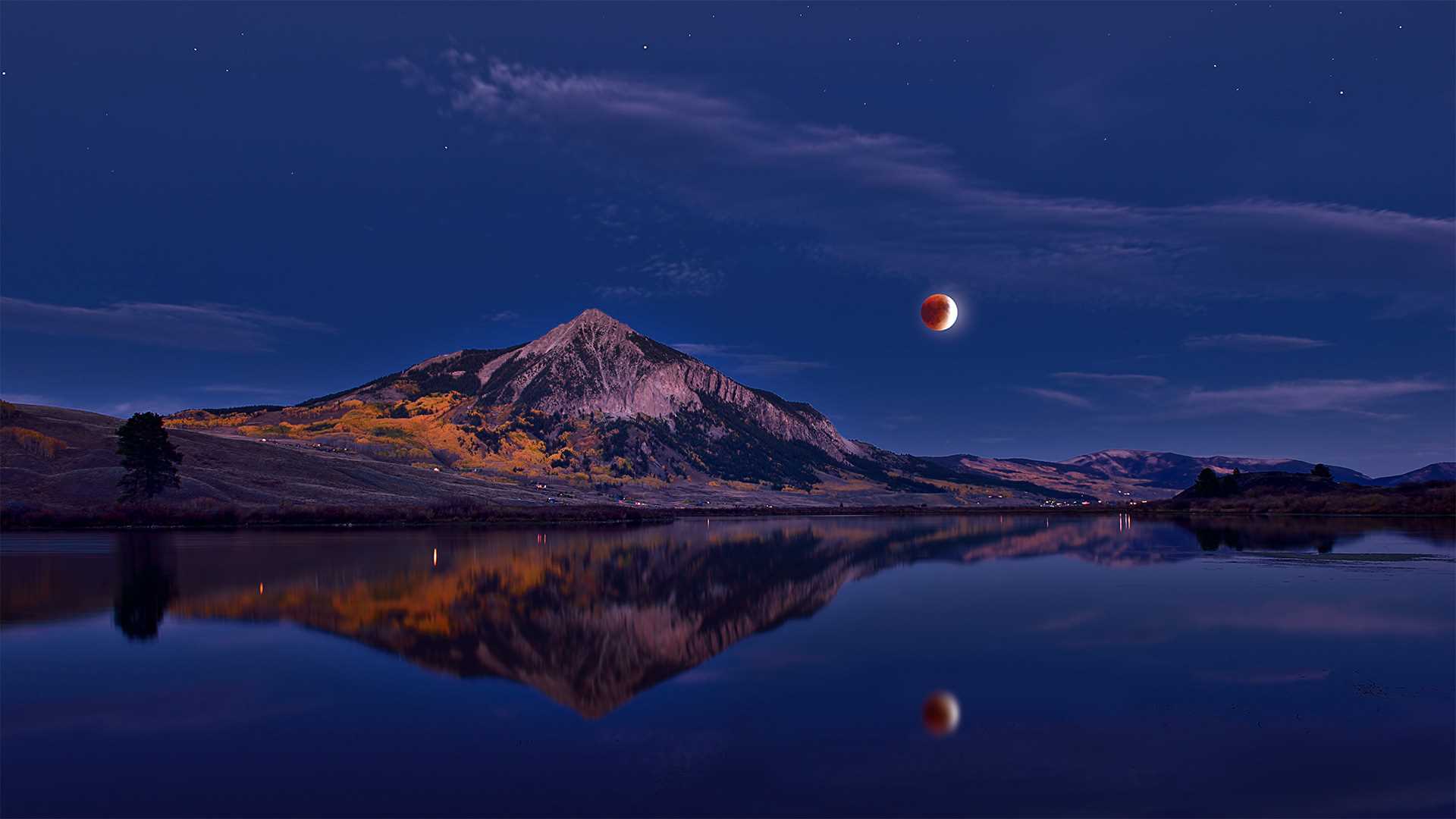
克雷斯特德比特山上方的月食,科罗拉多州,美国 Lunar eclipse above Mount Crested Butte, Colorado (© Mengzhonghua Photography/Getty Images)
宁静的夜空 Serene night sky
克雷斯特德比特山,科罗拉多州,美国
这张照片拍摄地位于克雷斯特德比特山,记录了纯净夜空中的月食现象。克雷斯特德比特山是北美落基山脉麋鹿山脉的一座著名山峰。这座12,168英尺(3,709
米)的山峰位于美国科罗拉多州甘尼森县 Crested
Butte镇附近的甘尼森国家森林。甘尼森国家森林是一座美国国家森林,占地2612.71平方英里,它与白河和圣伊莎贝尔国家森林共享Maroon
Bells-Snowmass荒野,与圣伊莎贝尔国家森林共享 Collegiate Peaks荒野地区。
