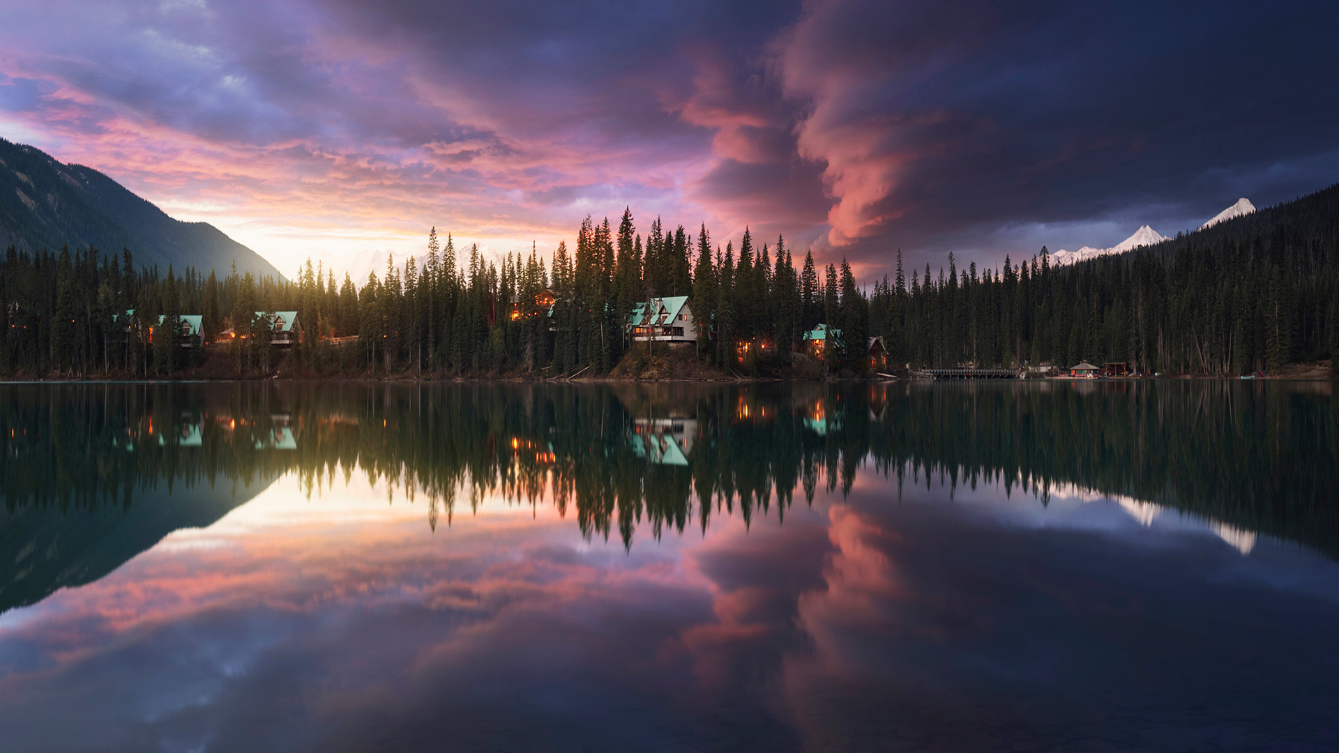
幽鹤国家公园的翡翠湖, 加拿大不列颠哥伦比亚省 (© Cavan Images/Offset)
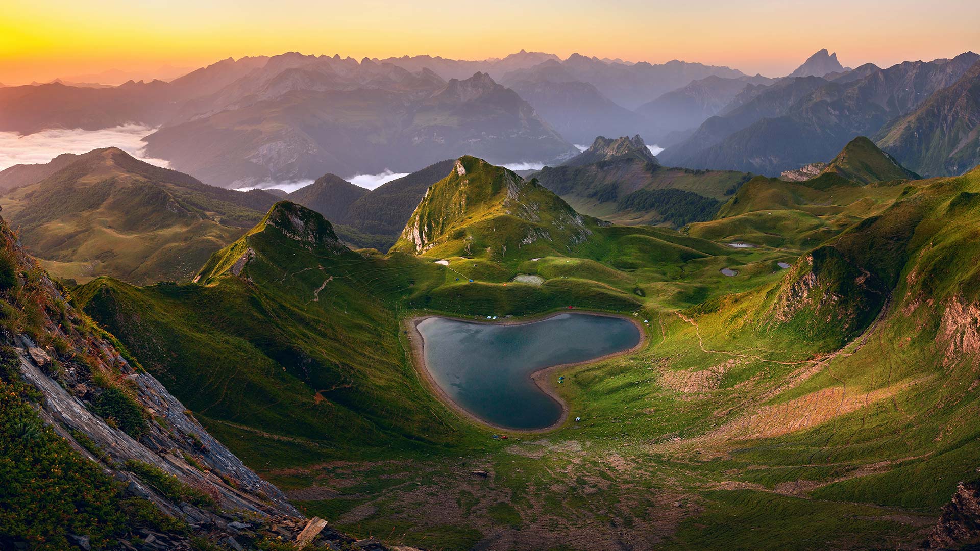
阿斯佩山谷中的蒙塔尼翁湖,法国 (© thieury/Adobe photo stock)
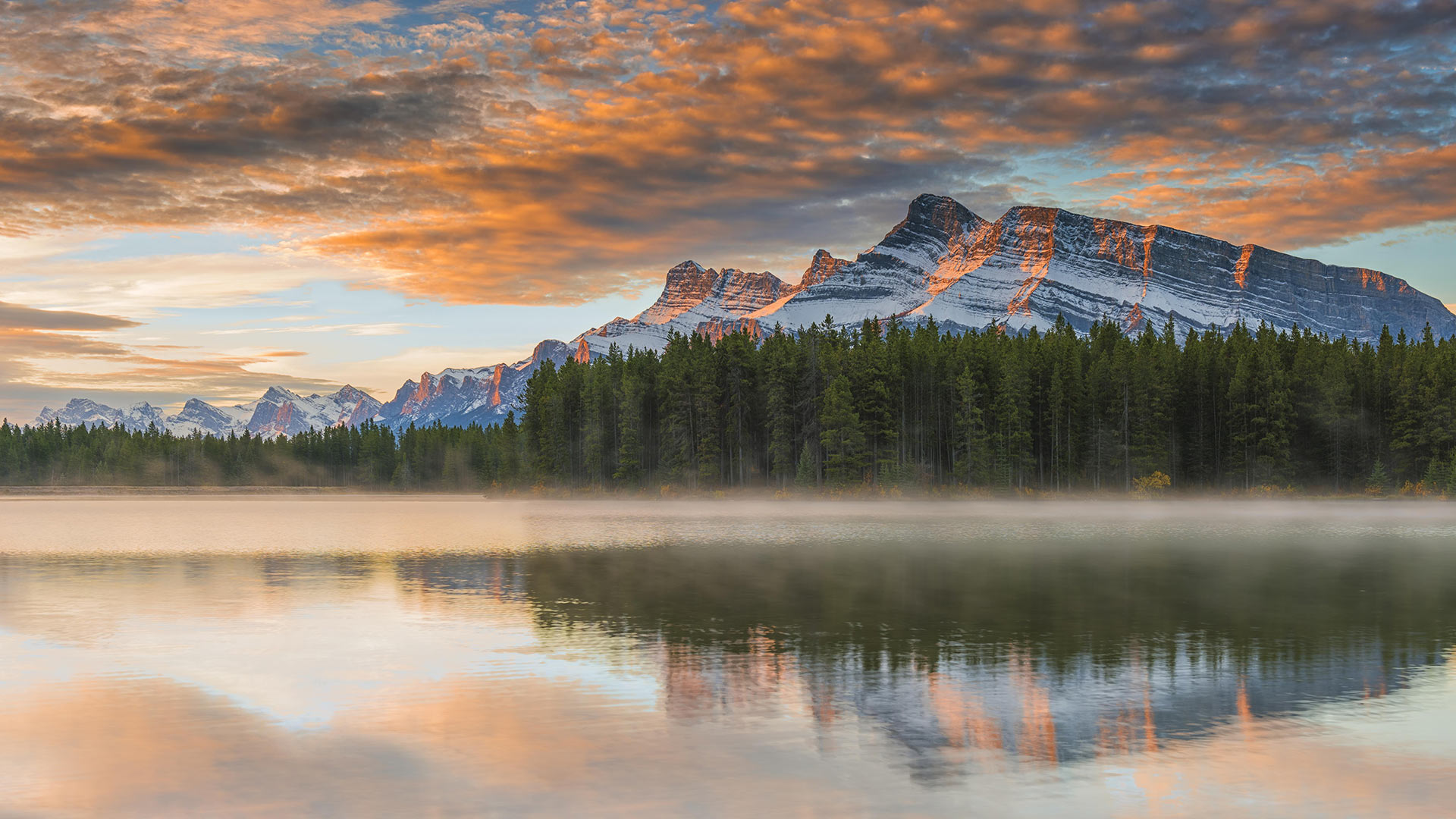
双杰克湖,班夫国家公园,艾伯塔省,加拿大 (© SnapRapid/Offset)
基姆湖上的淑女岛,德国巴伐利亚州 Aerial view of Fraueninsel island in Chiemsee, Bavaria, Germany (© Malorny/Getty Images)
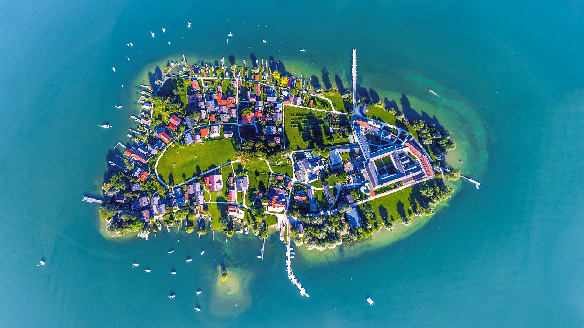
基姆湖上的淑女岛,德国巴伐利亚州 Aerial view of Fraueninsel island in Chiemsee, Bavaria, Germany (© Malorny/Getty Images)
“巴伐利亚海”中的岛屿 Island in the "Bavarian Sea"
Fraueninsel, Chiemsee, Bayern
Just 15.5 hectares in size, the Fraueninsel is still the second-largest island in the Chiemsee after the Herreninsel - admittedly, there are only three inland islands in total, and the tiny Krautinsel as the third in the group is also uninhabited. The car-free Fraueninsel, whose appearance is mainly characterized by the Benedictine monastery of Frauenchiemsee (also known as Frauenwörth), founded in 782, can be reached all year round with the passenger ships of the Chiemsee shipping company.
The only settlement on the Fraueninsel is called Frauenchiemsee. It consists of about 50 houses in which around 250 people live. The name of the place and the island are often used synonymously. Chiemsee, which covers almost 80 square kilometers, is Bavaria's largest lake and Germany's third-largest after Lake Constance and Müritz. In the absence of its own seashore, an affectionate nickname for Lake Chiemsee has emerged among the Bavarian population over time: it is very often referred to as the "Bavarian Sea".
Fraueninsel、切姆西、拜仁
面积只有15.5公顷的弗劳尼塞尔岛仍然是基姆塞岛上仅次于赫雷宁塞尔岛的第二大岛屿——不可否认,总共只有三个内陆岛屿,而作为该群岛第三大岛屿的小克劳蒂塞尔岛也无人居住。无车Fraueninsel的外观主要以建于782年的Frauenchiemsee(也称为Frauenwörth)本笃会修道院为特征,可以通过Chiemsee航运公司的客船全年到达。
关于Fraueninsel的唯一解决方案称为Frauenchiemsee。它由大约50座房屋组成,其中约有250人居住。这个地方和这个岛的名字通常是同义词。基姆塞湖占地近80平方公里,是巴伐利亚州最大的湖泊,也是德国仅次于康斯坦斯湖和缪里兹湖的第三大湖。由于没有自己的海岸,随着时间的推移,基姆塞湖在巴伐利亚人中出现了一个亲切的昵称:它通常被称为“巴伐利亚海”。
被翡翠湾环绕的芬尼特岛,太浩湖,加利福尼亚 Fannette Island surrounded by Emerald Bay, Lake Tahoe, California (© Rachid Dahnoun/Tandem Stills + Motion)
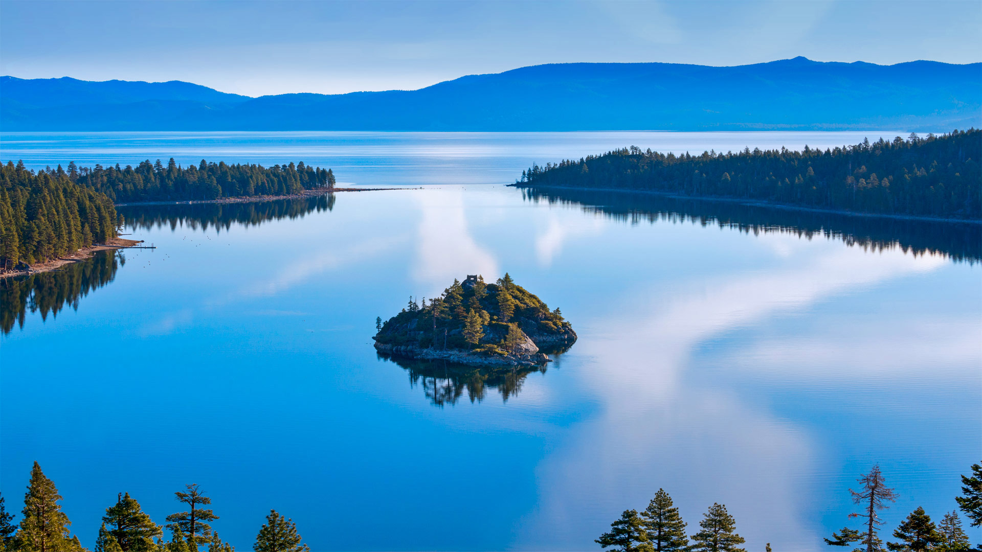
被翡翠湾环绕的芬尼特岛,太浩湖,加利福尼亚 Fannette Island surrounded by Emerald Bay, Lake Tahoe, California (© Rachid Dahnoun/Tandem Stills + Motion)
这座岛海拔超过一英里 This island is more than a mile high
Fannette Island, Lake Tahoe
Tucked into a tiny bay of a grand alpine lake is this granite bump called Fannette Island, the only island in Lake Tahoe. The massive lake lies in the Sierra Nevada at an altitude of 6,225 feet, straddling the state line between California to the west and Nevada to the east with near perfect symmetry. Fannette Island is in Emerald Bay, on the California side of Tahoe's southwest shore. A narrow inlet, seen here at the top center of this image, connects Emerald Bay to the rest of the lake, whose natural beauty draws visitors in all seasons of the year.
Lake Tahoe is known as a mecca for boaters and skiers. Its frigid alpine water is renowned for its clarity. Despite the cold winter temperatures that provide the surrounding ski resorts with ample snowpack, the lake never freezes. The largest alpine lake in North America, Tahoe rivals even the Great Lakes by volume because it is so deep.
Ice-Age glaciers, nature's master sculptors, carved out Emerald Bay eons ago, and for some reason left behind in its wake tiny Fannette Island. It has been known by a half dozen names over the last century, before Fannette finally stuck. A short hike to the top, 150 feet above the water, will take you to the ruins of an old stone building called the 'Tea House,' constructed in the 1920s by the former owner of the island as well as a nearby estate on Emerald Bay called Vikingsholm (the property is now owned by the state and is a popular feature of Emerald Bay State Park). The tea house was used for exactly that, intimate tea parties in surroundings that would be nearly impossible to duplicate in any other home. While tea is no longer served atop the island, the alpine vistas are still there for the taking.
芬尼特岛,太浩湖
在一个巨大的阿尔卑斯湖的一个小海湾里,有一个花岗岩突起,叫做范内特岛,它是太浩湖中唯一的一个岛。这个巨大的湖泊位于内华达山脉,海拔6225英尺,西跨加利福尼亚州,东临内华达州,几乎对称。范内特岛位于翡翠湾,在太浩岛西南海岸的加利福尼亚一侧。图中顶部中央有一个狭窄的小湾,将翡翠湾与湖的其余部分连接起来,湖的自然美景吸引了一年四季的游客。
太浩湖是著名的划船者和滑雪者的圣地。它寒冷的高山水以清澈见长。尽管寒冷的冬季为周围的滑雪场提供了充足的积雪,但湖面从未结冰。塔霍湖是北美最大的阿尔卑斯湖,其湖水如此之深,在容量上甚至可以与五大湖匹敌。
冰河时代的冰川,大自然的大师级雕塑家,在亿万年前就雕刻出了翡翠湾,出于某种原因,留下了小小的范内特岛。在范内特最终坚持之前,在过去的一个世纪里,人们已经知道了半打名字。登上海拔150英尺的山顶,你将看到一座名为“茶馆”的古老石头建筑的废墟,这座建筑是20世纪20年代由该岛的前主人建造的,附近还有一处位于翡翠湾的庄园,名为Vikingsholm(该庄园现在归国家所有,是翡翠湾国家公园的一个热门景点)。茶馆正是用来举办这种亲密的茶话会的,周围的环境几乎不可能在任何其他家庭中复制。虽然岛上不再供应茶,但阿尔卑斯山的景色仍然可以欣赏。
马罗沃泻湖中的珊瑚礁,所罗门群岛 Coral reef in Marovo Lagoon in the Solomon Islands (© WaterFrame/Alamy)
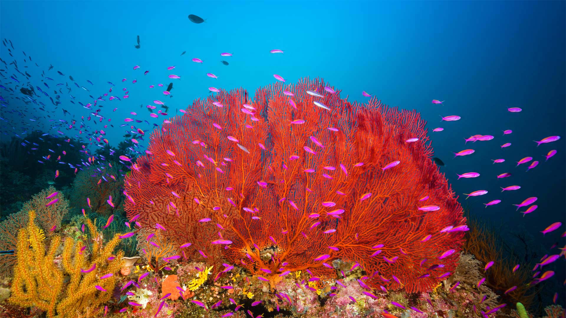
马罗沃泻湖中的珊瑚礁,所罗门群岛 Coral reef in Marovo Lagoon in the Solomon Islands (© WaterFrame/Alamy)
水下的奇妙景观 The beauty that lies below
World Reef Day
The Marovo Lagoon in the Solomon Islands is the largest saltwater lagoon in the world. Protected by a double barrier reef, it's home to unique marine life and coral, making it a bucket-list destination for divers. The beauty and diversity of life contained within its pristine, 270 square miles are the perfect inspiration for World Reef Day, observed every year on June 1 to bring awareness to this vital but largely unseen part of our natural world. Reef Day also kicks off World Oceans Month, a time to celebrate and learn more about these vital ecosystems.
Although coral reefs occupy less than 0.1% of the planet's oceans, they support up to 25% of the world's marine species. They have rightfully earned their nickname, 'Rainforests of the Sea.' Coral is not a plant, but part animal and part mineral, a marine invertebrate that secretes calcium carbonate to form a hard skeleton. They grow in colonies, usually in warm, shallow waters, and form vast colonies that we see as reefs, providing the basic platform for marine life to flourish around them. They even provide benefits to land, protecting shorelines from the forces of the ocean.
Unfortunately, coral reefs are under immense environmental pressure due to pollution, overfishing, and particularly from changing ocean temperatures. A warming ocean and acidification due to increased carbon dioxide have resulted in coral bleaching—when under stress, corals lose their color. The yellow whip and red gorgonian you see here are what healthy corals look like, but vibrant, hearty corals are swiftly becoming the exception rather than the rule. Recently, even the previously robust and thriving Marovo Lagoon began showing signs of bleaching, a sobering reminder that the beauty we see here is fragile and becoming more precious.
世界珊瑚礁日
所罗门群岛的马罗沃泻湖是世界上最大的咸水泻湖。受双堡礁保护,这里是独特海洋生物和珊瑚的家园,是潜水员的首选目的地。每年6月1日是世界珊瑚礁日,每年的6月1日是世界珊瑚礁日的纪念日,旨在让人们认识到这一自然世界中重要但基本上看不见的部分,其270平方英里的原貌中蕴含着美丽而多样的生命。珊瑚礁日也是世界海洋月的开始,是庆祝和了解这些重要生态系统的时候。
虽然珊瑚礁只占地球海洋的不到0.1%,但它们支持着世界上多达25%的海洋物种。他们理所当然地赢得了“海洋雨林”的绰号珊瑚不是植物,但部分是动物,部分是矿物,是一种海洋无脊椎动物,分泌碳酸钙形成坚硬的骨架。它们通常生长在温暖的浅水区,形成巨大的珊瑚礁群,为海洋生物在其周围繁衍生息提供了基本平台。它们甚至为陆地带来好处,保护海岸线不受海洋力量的影响。
不幸的是,由于污染、过度捕捞,尤其是海洋温度的变化,珊瑚礁面临着巨大的环境压力。海洋变暖和二氧化碳增加导致的酸化导致珊瑚白化。在压力下,珊瑚会失去颜色。你在这里看到的黄色鞭子和红色gorgonian珊瑚是健康的珊瑚的样子,但充满活力、饱满的珊瑚很快就会成为例外,而不是常规。最近,就连之前繁荣的马洛沃环礁湖也开始出现白化迹象,这提醒我们,我们在这里看到的美丽是脆弱的,越来越珍贵。
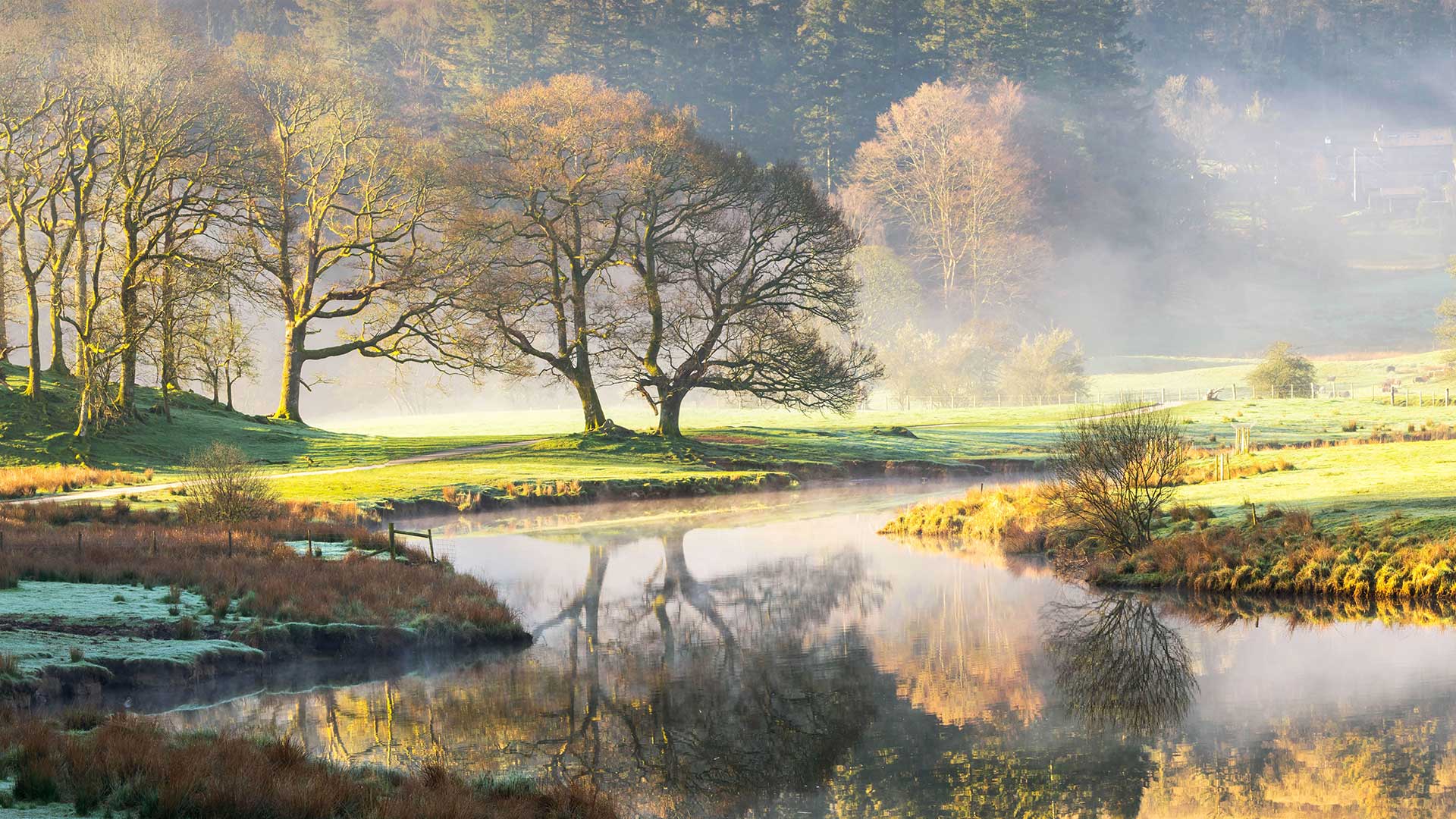
布拉塞河上的雾天黎明,英国湖区国家公园 (© fstopphotography/Getty Images)
十六湖国家公园,克罗地亚 Plitvice Lakes National Park, Croatia (© Janne Kahila/Getty Images)
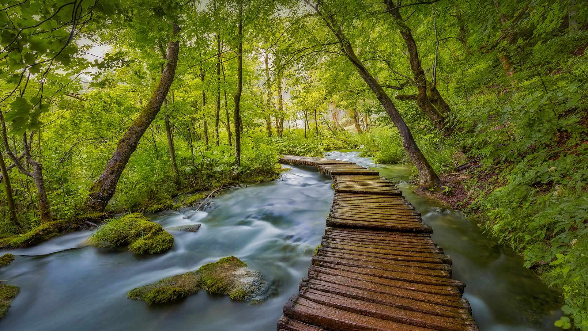
十六湖国家公园,克罗地亚 Plitvice Lakes National Park, Croatia (© Janne Kahila/Getty Images)
巴尔干湖上的木板路 Boardwalk over Balkan lakes
Plitvice Lakes National Park in Croatia
In a country more famous for its coastline, about a million visitors each year venture inland to amble along these boardwalks and marvel at spectacular lakes and mountains. Plitvice Lakes National Park is the oldest and largest of Croatia's national parks. The big attraction is the series of 16 descending, turquoise-colored lakes, connected by subterranean karst rivers, and above ground by streams and waterfalls. The lakes are separated by natural dams of travertine, which is deposited by moss, algae, and bacteria. The water changes color from green to azure to gray depending on the angle of the light and the density of minerals and organisms in the water. About 11 miles of wooden boardwalk make it easy for people to wander among the lakes, falls, and caves that are open to visitors year-round.
The 115-square-mile park was established in 1949 in what is now central Croatia, near the border of Bosnia and Herzegovina. In 1979, Plitvice's unique beauty put it on the list UNESCO World Heritage Sites. The lakes seem to magically disappear into the moss-covered earth, and then reappear downstream, proof enough that these woods are indeed enchanted.
克罗地亚的普利特维兹湖国家公园
在一个以海岸线闻名的国家,每年大约有100万游客冒险到内陆,沿着这些木板路漫步,欣赏壮观的湖泊和山脉。普利特维兹湖国家公园是克罗地亚最古老、最大的国家公园。最大的吸引力是16个下降的绿松石色湖泊,由地下喀斯特河流连接,地面上由溪流和瀑布连接。湖泊之间由苔藓、藻类和细菌沉积的钙华天然坝隔开。根据光线的角度以及水中矿物质和生物体的密度,水的颜色会从绿色变为蓝色再变为灰色。大约11英里长的木板路使人们可以轻松地在全年开放的湖泊、瀑布和洞穴中漫步。
这座115平方英里的公园建于1949年,位于现在的克罗地亚中部,靠近波斯尼亚和黑塞哥维那边境。1979年,普利特维奇独特的美景将其列入联合国教科文组织世界遗产名录。这些湖泊似乎神奇地消失在苔藓覆盖的土地上,然后再次出现在下游,这足以证明这些森林确实被施了魔法。
以新西兰南岛奥拉基/库克山国家公园为背景的特卡波湖 Lake Tekapo with Aoraki/Mount Cook National Park in the background on New Zealand's South Island (© Sophie Dover/Getty Images) (© Sophie Dover/Getty Images)
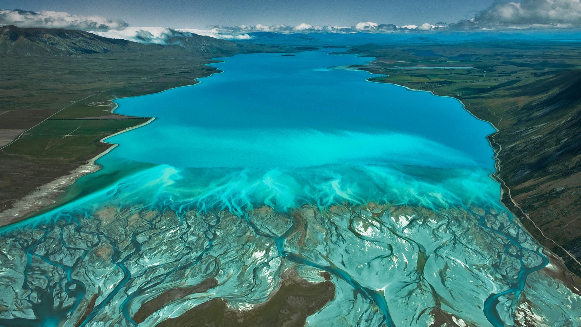
以新西兰南岛奥拉基/库克山国家公园为背景的特卡波湖 Lake Tekapo with Aoraki/Mount Cook National Park in the background on New Zealand's South Island (© Sophie Dover/Getty Images) (© Sophie Dover/Getty Images)
蓝色新西兰 Blue Zealand
Lake Tekapo, New Zealand
The striking electric-blue waters of Lake Tekapo are caused by extremely finely ground rock particles suspended in the melted waters of glaciers in the nearby Southern Alps. Snowmelt from the range feeds two similarly stunning lakes in the Mackenzie Basin of New Zealand's South Island, Lake Pukaki and Lake Ohau, which share their neighbor's remarkable turquoise color and mountainous backdrops. New Zealand's highest peak, Aoraki/Mount Cook, reigns in Mount Cook National Park, seen in the background of this image.
The name Tekapo is a misspelling of the Māori word Takapō, which means 'to leave in haste at night.' But if you are one of the region's many visitors, you may find the nighttime even more mesmerizing than the day. Lake Tekapo is a certified Dark Sky Reserve, one of the world's largest. With night skies almost completely free of light pollution, stargazing doesn't get much more vibrant, and tours cater to manuhiri (visitors) interested in astro-tourism. If that's not reason enough to stay the night, the area's abundant skiing and fishing opportunities might be. There's certainly no need to leave in a rush.
新西兰特卡波湖
特卡波湖惊人的电蓝色海水是由悬浮在附近南阿尔卑斯山冰川融化水中的极细的岩石颗粒造成的。来自该山脉的融雪为新西兰南岛麦肯齐盆地的两个同样令人惊叹的湖泊——普卡基湖和奥豪湖提供了水源,这两个湖泊共享着其邻居引人注目的绿松石色和多山的背景。新西兰最高峰奥拉基/库克山位于库克山国家公园,如图背景所示。
Tekapo这个名字是毛利人单词Takapō的拼错,意思是“晚上匆忙离开”但如果你是该地区众多游客中的一员,你可能会发现夜间比白天更迷人。特卡波湖是世界上最大的黑天空保护区之一。由于夜空几乎完全没有光污染,观星活动也没有变得更加活跃,旅游也迎合了对天文旅游感兴趣的游客。如果这还不足以作为过夜的理由,那么该地区丰富的滑雪和钓鱼机会可能会更大。当然没有必要匆忙离开。
莱达尔湖, 英格兰坎布里亚郡湖区 Rydal Water in the Lake District, Cumbria, England (© Tranquillian1/iStock/Getty Images Plus)
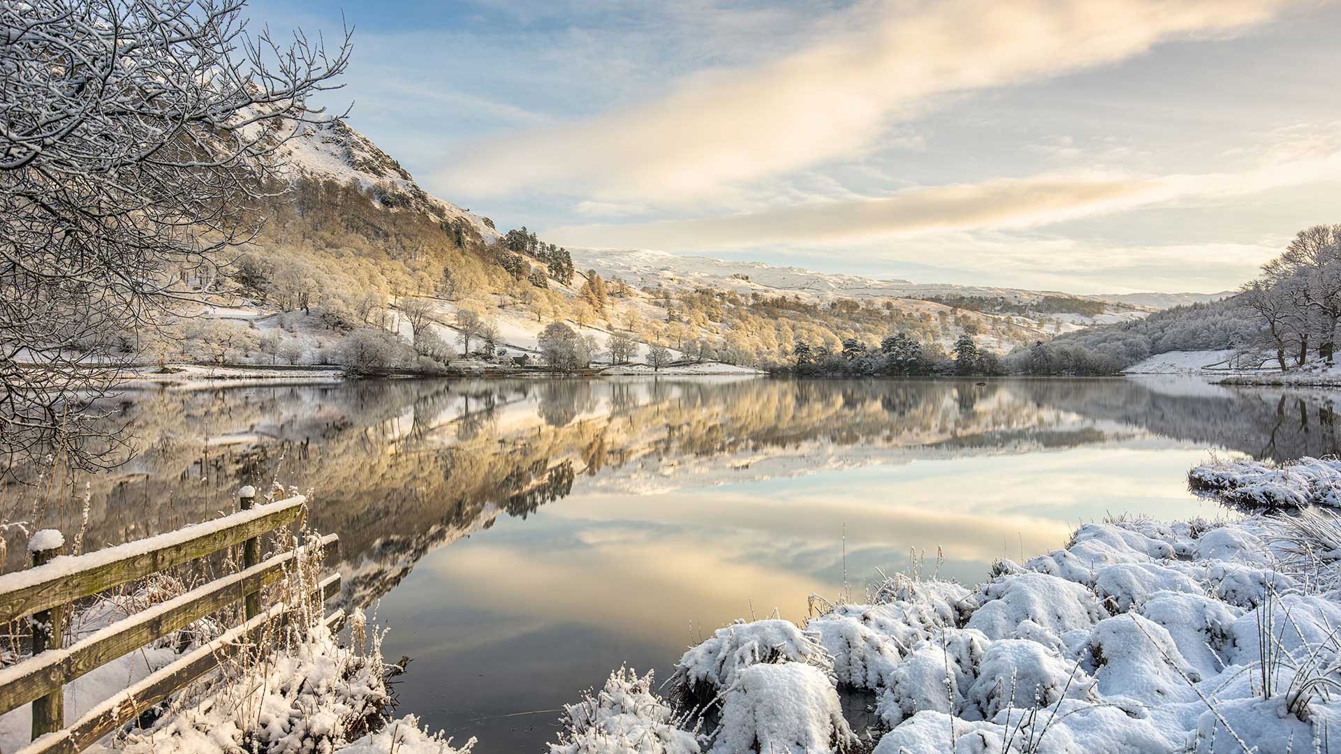
莱达尔湖, 英格兰坎布里亚郡湖区 Rydal Water in the Lake District, Cumbria, England (© Tranquillian1/iStock/Getty Images Plus)
Rydal Water in the Lake District, Cumbria, England
Reflecting winter skies and frozen fells in our homepage image is Rydal Water, one of the smallest but prettiest lakes in the Lake District. Rydal Water is one of the two lakes most associated with William Wordsworth, one of England’s greatest poets. (The other is neighbouring Grasmere, to which Rydal is connected by the River Rothay.) Wordsworth lived around these bodies of water, first at Dove Cottage and later Rydal Mount, between 1799 and 1850, writing some of his best-known works and hosting leading lights of the Romantic movement, including his friend, Samuel Taylor Coleridge. To the western edge of the lake is Wordsworth’s Seat, a rocky outcrop said to be the writer’s favourite spot.
Rydal Water is in a glacial valley, one of 13 valleys in the Lake District. Partly owned by the National Trust, it sits at the foot of Loughrigg Fell and has been known to freeze over on winter days like this one. You can walk around Rydal Water and take in Wordsworth’s former homes as well as passing by Rydal Cave in the hill above the lake. Surrounded by woodland, pasture and craggy fells, with several historic properties and beautifully designed landscapes, this is an inspiring place for aspiring poets, whatever the season.
英格兰坎布里亚湖区的赖德尔水
赖达尔湖是湖区最小但最美丽的湖泊之一,它反映了我们主页图像中冬季的天空和冰冻的森林。莱德尔湖是与英国最伟大的诗人之一威廉·华兹华斯联系最为密切的两个湖泊之一。(另一个是邻近的格拉斯米尔,莱德尔河与之相连。)1799年至1850年间,华兹华斯生活在这些水域周围,先是在多夫小屋,后是莱德尔山,他写了一些最著名的作品,并主持了浪漫主义运动的主要活动,包括他的朋友塞缪尔·泰勒·柯勒律治。湖的西边是华兹华斯的所在地,据说这是作家最喜欢的地方。
莱德尔河位于一个冰川峡谷中,是湖区13个山谷之一。部分归国家信托基金所有,坐落在Loughrigg Fall脚下,在像这样的冬天会结冰。你可以在莱达尔水边散步,参观华兹华斯的故居,也可以经过湖上小山上的莱达尔洞穴。这里被林地、牧场和崎岖的小林所环绕,有几处历史古迹和设计精美的景观,无论什么季节,这都是一个让有抱负的诗人感到振奋的地方。
