埃莫海滩,玛丽埃塔斯群岛,巴亚尔塔港,墨西哥 Playa del Amor in the Marietas Islands, off the coast of Puerto Vallarta, Mexico (© ferrantraite/Getty Images)
埃莫海滩,玛丽埃塔斯群岛,巴亚尔塔港,墨西哥 Playa del Amor in the Marietas Islands, off the coast of Puerto Vallarta, Mexico (© ferrantraite/Getty Images)
墨西哥的隐秘海滩 Secluded sands in Mexico
埃莫海滩,玛丽埃塔斯群岛,墨西哥
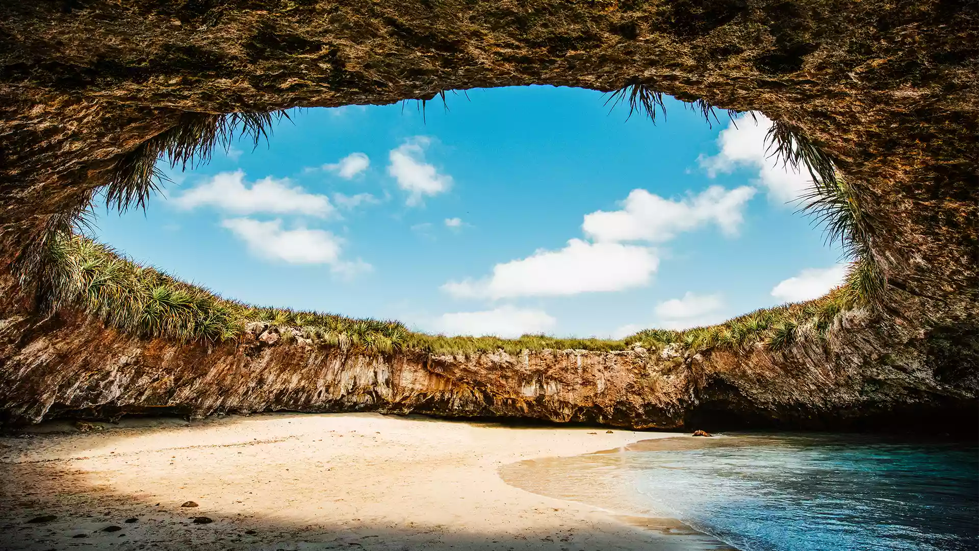
这张绝美的照片是在埃莫海滩拍摄的,这里又被称为“隐秘海滩”,位于墨西哥巴亚尔塔港西北处的偏远海岛,这里以其纯净的美景和独特的地貌而闻名。这处海滩只能通过一个自然侵蚀形成的隧道到达。沙滩和周围的岩壁组成了一个仰望天空的天窗,碧蓝的天空、绿松石色的海水、长满鲜花的崖壁相互映衬,景色独一无二。埃莫海滩又称“爱情海滩”,已经是一个热门的旅游目的地,但是为了保护这里的自然风景和生态环境,当地限制了游客数量。
Playa del Amor, Marietas Islands, Mexico
This gorgeous shot was taken at Playa del Amor—aka Hidden Beach—a remote destination off the coast of Puerto Vallarta, Mexico, known for its pristine beauty. To get to it, visitors need to take a boat toward the mouth of Banderas Bay at the base of the Marietas Islands. Once there, they swim through a tunnel at low tide to reach the beach. The walls hide a sandy cove, where the turquoise waters contrast with flora-laden cliffs that perfectly frame the blue sky overhead. Playa del Amor (Lovers' Beach) is popular among tourists, but the number of visitors is limited to preserve its natural beauty and ecosystem.
萨克马兰大湾,瓜德罗普岛国家公园,小安的列斯群岛 Grand Cul-de-Sac Marin, Guadeloupe National Park, Lesser Antilles (© Hemis/Alamy)
萨克马兰大湾,瓜德罗普岛国家公园,小安的列斯群岛 Grand Cul-de-Sac Marin, Guadeloupe National Park, Lesser Antilles (© Hemis/Alamy)
人间天堂 A veritable little paradise
瓜德罗普岛国家公园,小安的列斯群岛
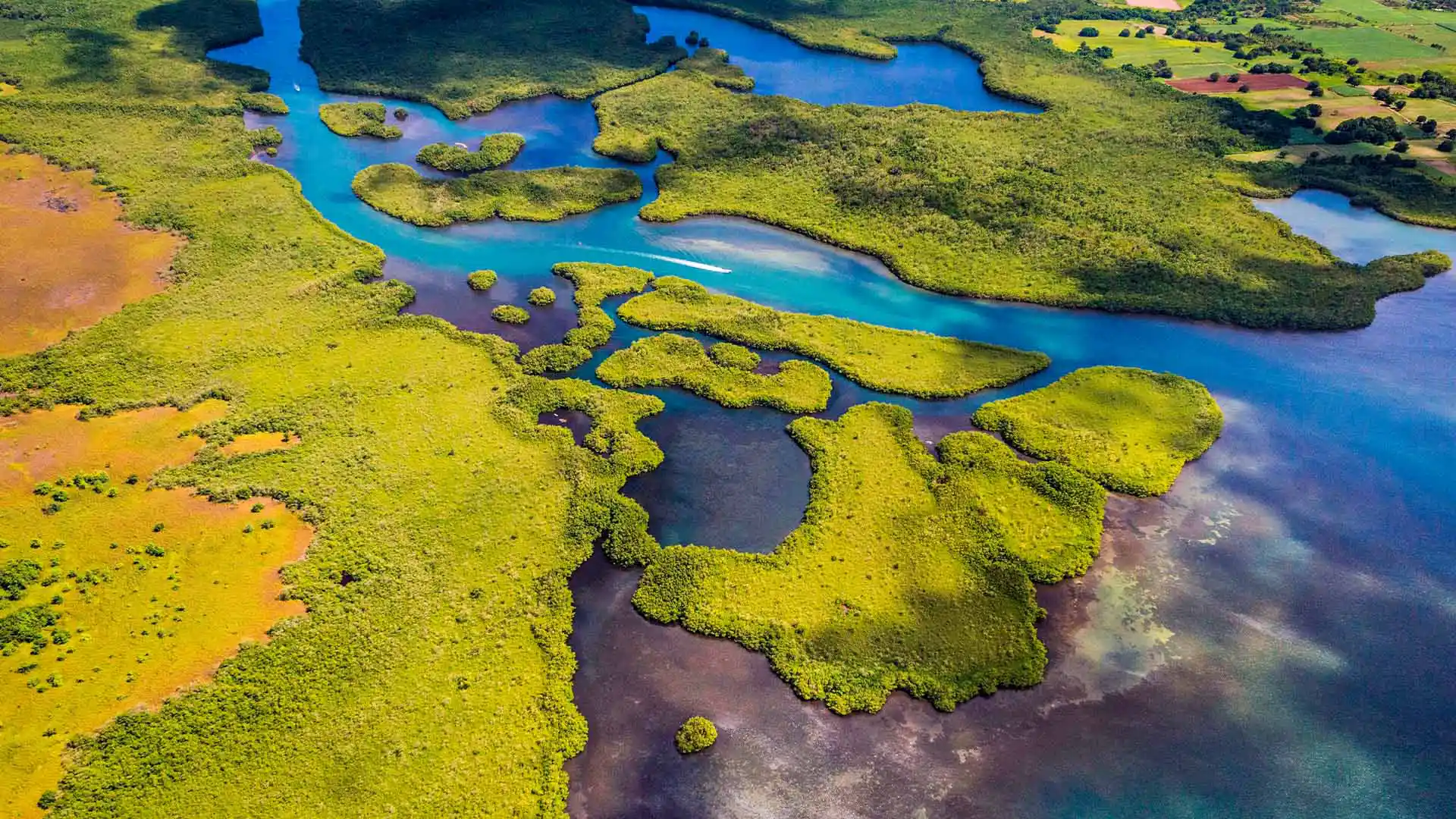
瓜德罗普是一个十多个洒满阳光的岛屿组成的群岛,可以提供各种各样的度假选择,有无人海滩也有丛林密布的高山。瓜德罗普国家公园是法国海外领地瓜德罗普的一处国家公园,位于东加勒比海地区的背风群岛。萨克马兰大湾自然保护区是与国家公园相邻的一处海洋保护区,和国家公园一起受统一管理。瓜德罗普国家公园大致可以被分成三种生态系统:热带雨林、海岸森林和红树林。
乌布的德格拉朗梯田,印度尼西亚 Tegallalang terrace farms in Ubud, Bali, Indonesia (© Cavan Images/Adobe Stock)
乌布的德格拉朗梯田,印度尼西亚 Tegallalang terrace farms in Ubud, Bali, Indonesia (© Cavan Images/Adobe Stock)
俯瞰层叠的梯田 Hovering over harmonious horticulture
德格拉朗梯田,巴厘岛,印度尼西亚
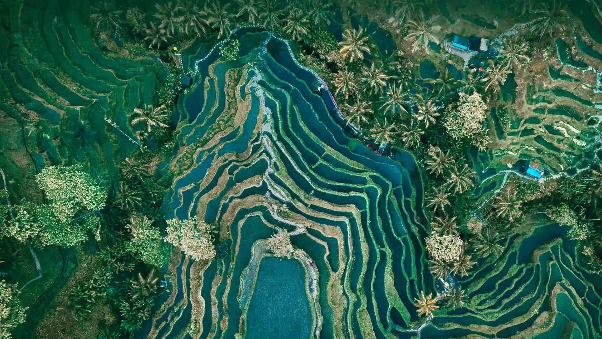
稻米在巴厘岛文化中扮演着重要角色,特加拉朗梯田是巴厘岛最著名的稻田之一。德格拉朗梯田利用独特的供水系统进行水稻种植,优化了水的配置及使用。传统的巴厘岛灌溉系统,被称为苏巴克(Subak),效率极高,目前已被联合国教科文组织列为世界遗产。从空中俯瞰特加拉朗梯田,田野风光令人惊叹。如果你要去巴厘岛,一定要去特加拉朗梯田看看。
Tegallalang terrace farms in Ubud, Bali, Indonesia
Sweeping downhill in our homepage image are the famous rice terraces of Tegallalang, one of Bali's most popular tourist attractions. They are carved into the side of a valley near the town of Ubud and use the traditional Subak irrigation system, which dates back to the 9th century. Bali's rivers and streams provide year-round water for its crops but here people work hand-in-hand with nature, and a network of irrigation channels distribute water to each paddy field. They carefully tend rice plants during the growing season, as generations have done before them, before harvesting and distributing the rice between the community. The Subak system is so important in Balinese culture, it has been recognised by UNESCO. These terraces offer visitors panoramic views over the surrounding rice fields and lush landscape, as well as a picturesque example of people living in harmony with nature.
纳米比亚的植物 Quiver trees in Namibia (© Fotofeeling/DEEPOL by plainpicture)
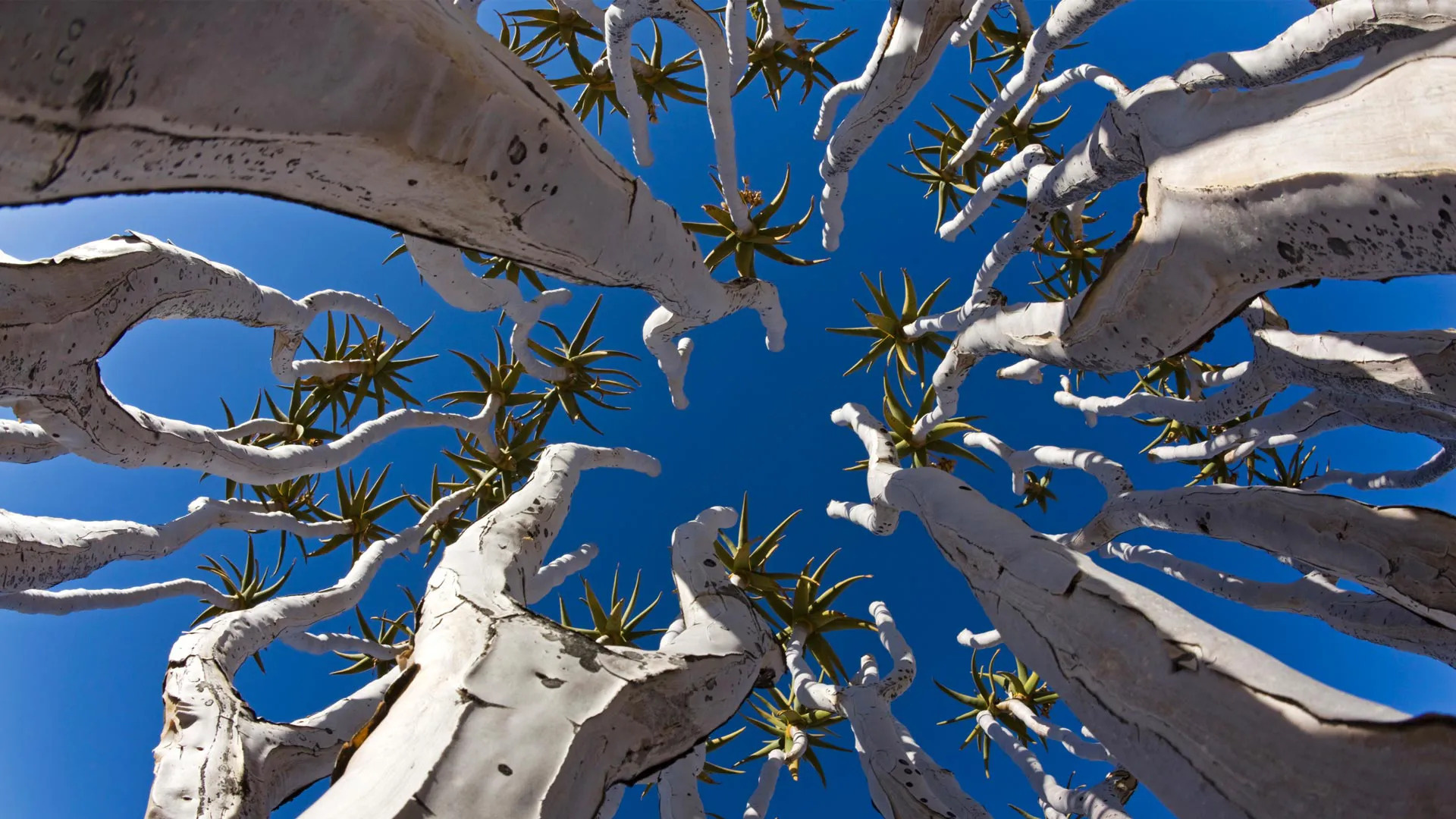
纳米比亚的植物 Quiver trees in Namibia (© Fotofeeling/DEEPOL by plainpicture)
伸向天空 Stretching to the sky
纳米比亚的箭袋树
箭袋树是一种罕见的植物,生长于气候恶劣干旱的纳米比亚。有趣的是,箭袋树其实根本不是树,而是一种高度濒危的芦荟植物,属于多肉植物。当地土著桑人会将箭袋树的枝干掏空,做成箭袋在狩猎时使用,故名箭袋树。如果你在纳米比亚的冬季(5月到7月)参观箭袋树森林,就能欣赏到这些独特的植物开出鲜黄的花朵。
Quiver trees in Namibia
The quiver trees pictured on our homepage are uniquely suited to Namibia's hot, dry climate. They are not trees at all, but an endangered species of aloe plant. These succulents can grow up to 30 feet tall and live for 200 years. The name comes from the Indigenous San people who made quivers out of the plant's tube-shaped branches to hold their arrows while hunting. You can see scattered quiver trees across southern Namibia, but for sheer numbers, head to the Quiver Tree Forest, where more than 200 of these distinctive plants grow among dolerite rock formations outside the city of Keetmanshoop. In June and July, during Namibia's winter, you can see the plant's flowers in bright, yellow bloom.
西沙瓦寺,素可泰历史公园,泰国 Wat Sri Sawai in Sukhothai Historical Park, Thailand (© Casper1774 Studio/Shutterstock)
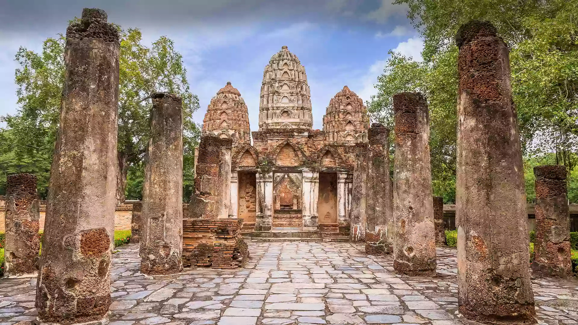
西沙瓦寺,素可泰历史公园,泰国 Wat Sri Sawai in Sukhothai Historical Park, Thailand (© Casper1774 Studio/Shutterstock)
在废墟中寻找美 Finding beauty in ruins
西沙瓦寺,素可泰历史公园里,泰国
历史悠久的素可泰镇是古代重要的大都市中心,也是泰国最迷人的目的地之一。素可泰(Sukhothai)意为“幸福的黎明”,是繁荣社区和建筑技艺完美融合的典范。历史公园周围环绕着湖泊、草坪和郁郁葱葱的树木。公园里有一座古代宫殿和26座雄伟寺庙的遗迹,包括今天这张照片中的西沙瓦寺。这座寺庙是公园的主要景点之一,融合了华富里的建筑设计和印度教的风格。素可泰镇及其周围建筑被联合国教科文组织列为世界遗产。如果你想体验泰国丰富的文化,那就去素可泰历史公园吧。
Wat Sri Sawai in Sukhothai Historical Park, Thailand
Welcome to Sukhothai Historical Park, one of Thailand's most spectacular UNESCO World Heritage sites. The park is dotted with ancient temples, the remains of a palace, and towering Buddha statues—within its boundaries is the historic town of Sukhothai, an important metropolitan hub in the 13th and 14th centuries. The name translates as 'the dawn of happiness' and you can spend many happy hours here, strolling among the beautiful lawns, trees, and lakes. The temple on our homepage is Wat Sri Sawai, one of the oldest on the site, founded in the late 12th or early 13th century. Sukhothai was the capital of the first Kingdom of Siam more than 700 years ago and this historic site continues to offer a window onto what is sometimes seen as a golden age of Thai civilization.
法罗群岛,丹麦 Saksun, Faroe Islands, Denmark (© miroslav_1/Getty Images)
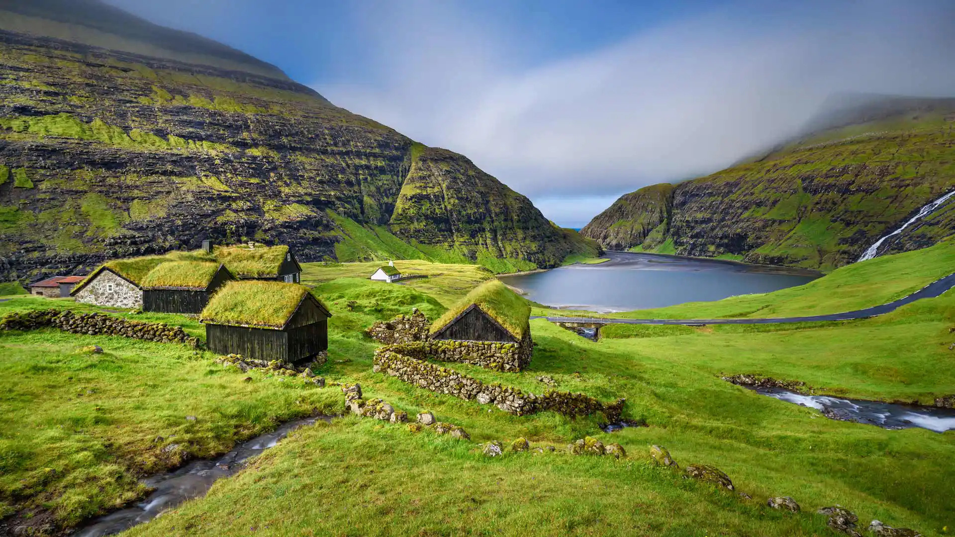
法罗群岛,丹麦 Saksun, Faroe Islands, Denmark (© miroslav_1/Getty Images)
童话照进现实 Straight out of a fairy tale
萨克森,法罗群岛,丹麦
萨克森位于法罗群岛的斯特雷莫伊海岸,是一个偏远的小村庄,以其童话般的美景而闻名。它坐落在风景如画的山谷中,旁边是清澈的泻湖,两侧群山环绕,屋顶覆盖着绿油油的草皮。萨克森人烟稀少,人口不到15人,甚至这里瀑布的数量都比常住人口数量多。
萨克森的美丽和宁静令人着迷。虽然没有法罗群岛首府托尔斯港的繁华热闹,但萨克森绿意盎然、宁静清幽,自有一番超凡脱俗的意境。
Saksun, Faroe Islands, Denmark
Nestled in a picturesque valley next to a lagoon flanked by mountains, Saksun is a small, remote village famous for its stunning vistas. It is situated on the coast of Streymoy in the remote Faroe Islands, which sit about halfway between Iceland and Scotland in the North Atlantic. Home to these iconic houses with turf roofs and a tiny population—estimates vary between 8 and 30—it is said that there are more waterfalls in Saksun, than houses.
There's something to be said about the beauty of Saksun and its power to hypnotize visitors with its peaceful atmosphere. It is a far cry from the relatively bustling streets of Tórshavn, the capital of the islands. With greenery as far as the eye can see, Saksun provides an almost otherworldly sense of solitude.
科孚岛旧城堡 The Old Fortress of Corfu, Greece (© Netfalls Remy Musser/Shutterstock)
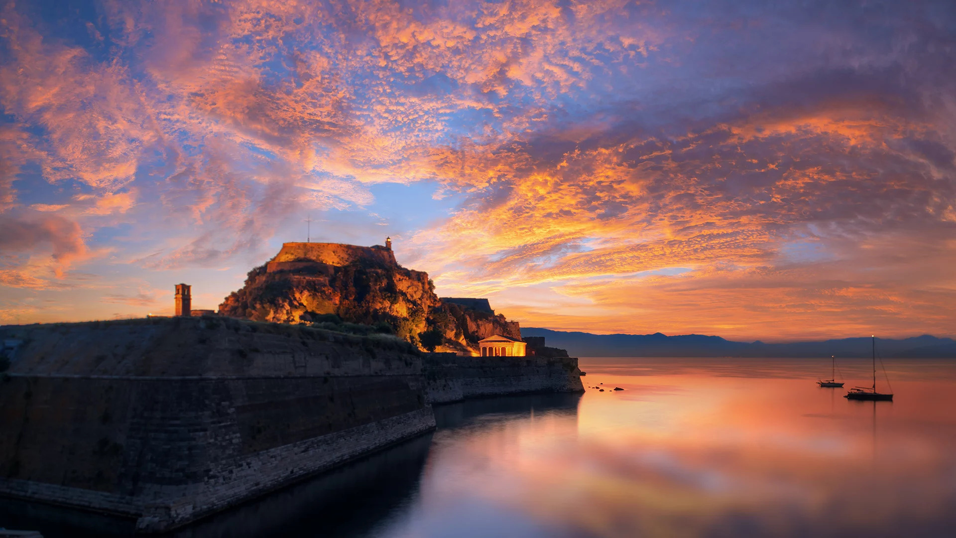
科孚岛旧城堡 The Old Fortress of Corfu, Greece (© Netfalls Remy Musser/Shutterstock)
历史在这里复活 Where history comes alive
旧城堡,科孚岛,希腊
希腊科孚岛的旧城堡矗立在半岛的尖端,现在是科孚公共图书馆和档案馆的所在地。这座城堡历史悠久,可以追溯到拜占庭时期。6世纪,入侵者袭击了科孚,促使幸存者建造了一个被城堡包围的新村庄。后来在威尼斯统治期间,城堡又经历了加固改建,以抵御奥斯曼军队的侵扰。数个世纪以来,这座希腊地标见证了当地的巨大变化以及几个帝国的兴衰。
Old Fortress, Corfu, Greece
This imposing structure is the Old Fortress on the Greek island of Corfu, off the western coasts of Greece and Albania. Situated in a strategic location between the Ionian and Adriatic seas, Corfu became one of the most fortified places in Europe amid successive sieges by the Ottoman Empire. The island was ruled by the Republic of Venice for 400 years until the late 18th century, which built forts in Corfu's Old Town to defend its maritime trading interests. They held off three Ottoman sieges in 1537, 1571, and 1716 but have been repaired, rebuilt, and added to over the centuries. The Old Fortress has witnessed the rise and fall of mighty empires for hundreds of years, from the tip of a rocky peninsula jutting into the sea. These days, however, it is home to the public library and Corfu's archives.
阿雷纳尔火山,蒙泰韦尔德,哥斯达黎加 Arenal Volcano seen from Monteverde, Costa Rica (© Kevin Wells/Getty Images)
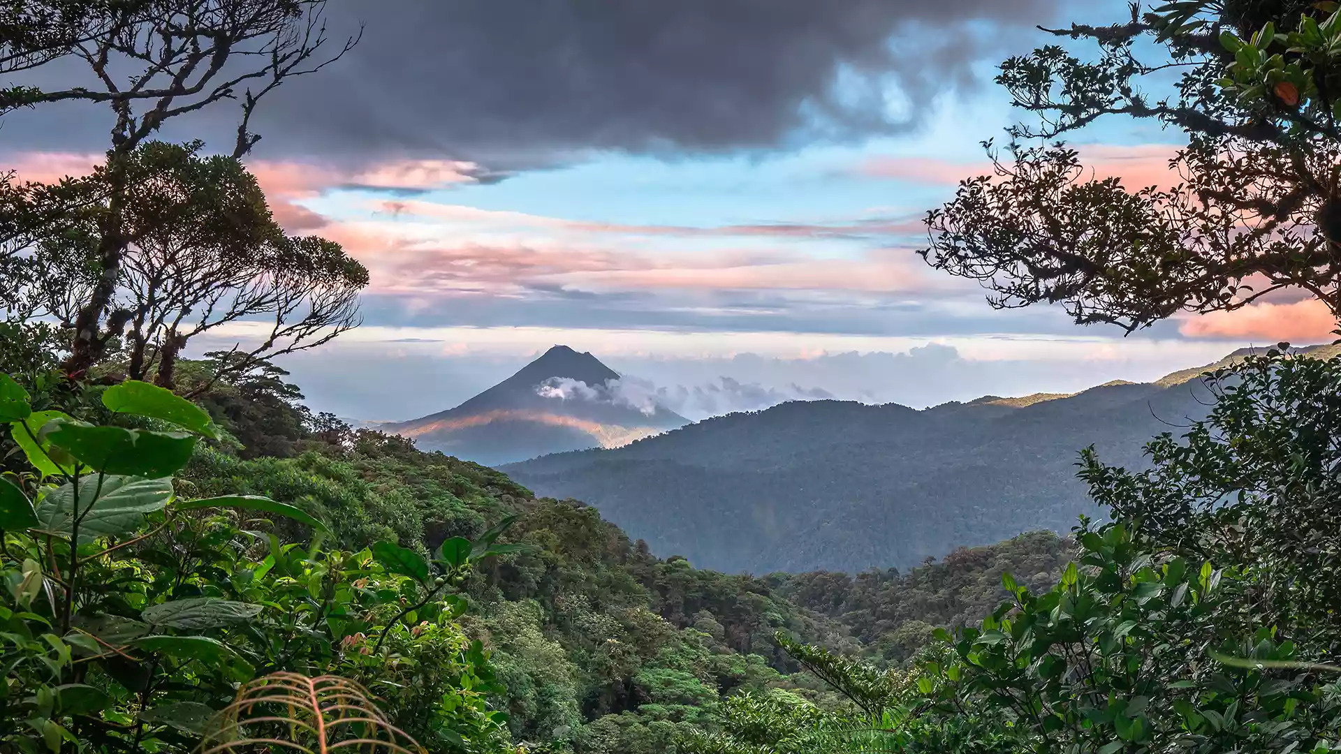
阿雷纳尔火山,蒙泰韦尔德,哥斯达黎加 Arenal Volcano seen from Monteverde, Costa Rica (© Kevin Wells/Getty Images)
为了每个人,保护地球的生物多样性 Protecting Earth's biodiversity for everyone
世界生物多样性日
今天是世界生物多样性日,也是个回顾生物多样性在人类历史发展和续存过程中的关键作用的机会。从细菌、基因到整个生态系统,生物多样性囊括所有形式的生命,包括珊瑚礁、雨林和海洋环境等。我们的水、食物、药品、衣服、住所和能源都依赖于健康的生态系统。
在地方生态系统对世界生物多样性的影响方面,哥斯达黎加的蒙特维多云雾森林是个完美范例。这片森林是哥斯达黎加约一半生物的家园,占世界生物多样性的2.5%。今天,我们可以认真思考人类与世界生态系统的关系,并努力成为更好的地球管家。
International Day for Biodiversity
It’s International Day for Biological Diversity, a day to celebrate the variety of life on Earth in all its forms, from bacteria, plants, and animals to entire ecosystems like coral reefs and rainforests. All living things within each ecosystem are interconnected, and we rely on healthy ecosystems for our water, food, medicines, clothes, energy, and shelter. But many species are threatened with extinction and ecosystems are being destroyed, which mean Earth’s rich biodiversity is in decline.
Our homepage image shows Costa Rica’s Monteverde Cloud Forest, home to about half of all species in the country, including more than 2,500 types of plants and 400 bird species. Here you’ll find jaguars and pumas living alongside sloths, howler monkeys, and the endangered resplendent quetzal. This forest alone represents about 2.5% of the world’s biodiversity, the perfect ambassador for today’s event, which calls on us to rethink our relationship with nature and work to be better stewards of the Earth.
塞纳河,巴黎,法国 River Seine, Paris, France (© StockByM/Getty Images)
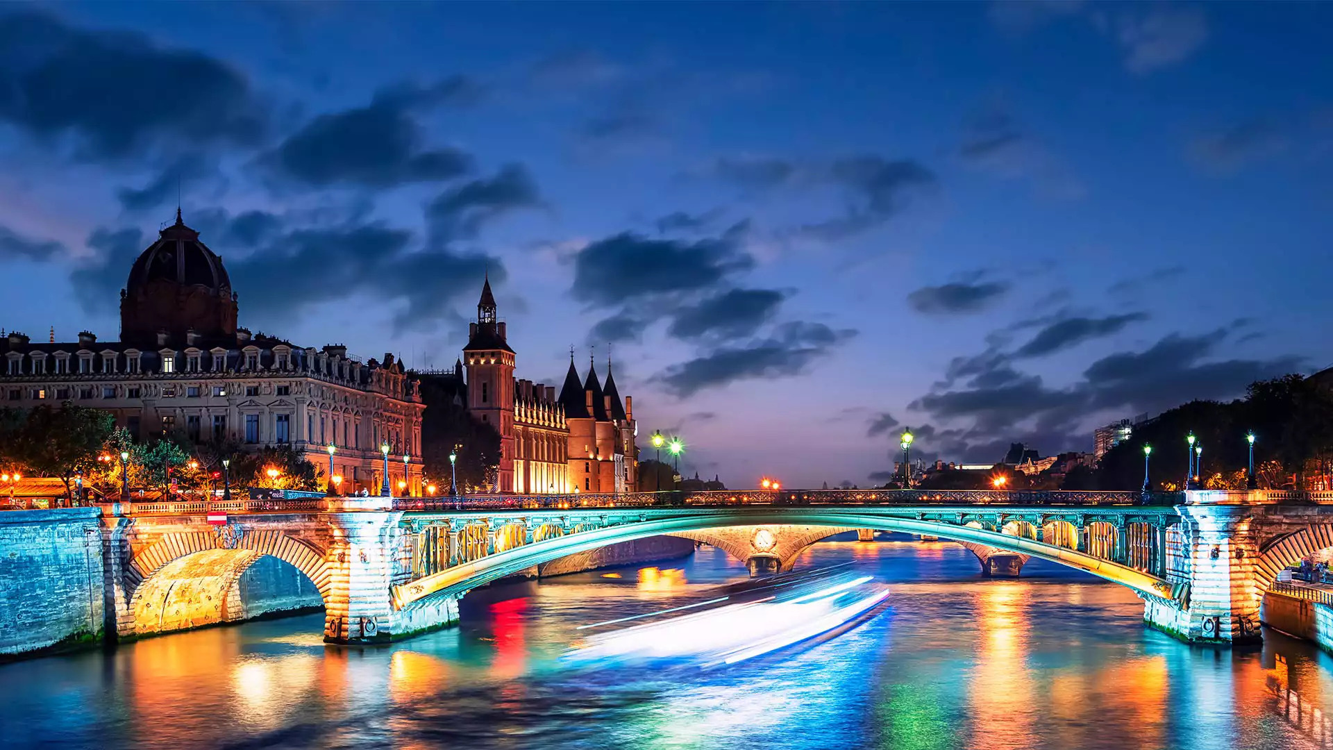
塞纳河,巴黎,法国 River Seine, Paris, France (© StockByM/Getty Images)
一座承载历史的桥 A bridge that holds up history
塞纳河上的桥,巴黎,法国
塞纳河流经法国巴黎,对这座古城的历史有着非比寻常的意义。公元前3世纪,一个名为帕里西人的凯尔特部落决定定居在塞纳河两岸之间的一座岛屿,即如今的西岱岛。在接下来的数个世纪里,塞纳河在巴黎发展成为全球商业和文化中心的过程中发挥了重要作用。
塞纳河穿过巴黎的河道十分辽阔,许多桥梁都横跨其间。巴黎共有37座普通桥梁和步行桥连接着城市的左右两岸。图中的映衬着落日的阿尔科勒桥在巴黎人心中占据着历史性地位,因为它在1944年为勒克莱尔将军解放巴黎的坦克提供了通道。
Pont d'Arcole over the Seine river, Paris, France
Welcome to Paris, France’s ancient capital city, through which flows one of the country’s longest rivers, the Seine. Human habitation here dates back to at least the 3rd century BCE, when a Gallic tribe called the Parisii settled on an island in the middle of the river. Today, that island is known as the Île de la Cité, seen on the left of our photo, and is home to Notre-Dame cathedral, as well as other striking buildings such as the medieval Conciergerie, pictured here.
It is linked to the Place de l'Hôtel-de-Ville by the Pont d’Arcole, one of 37 bridges connecting the city’s left and right banks. The Pont d’Arcole was built in the 1850s and holds a special place in Parisiennes’ hearts. In 1944, it supported General Jacques-Philippe Leclerc's tanks on their way to liberate Paris.
