大象岩,古城欧拉,沙特阿拉伯 Elephant Rock, Al-Ula, Saudi Arabia (© Lubo Ivanko/Shutterstock)
大象岩,古城欧拉,沙特阿拉伯 Elephant Rock, Al-Ula, Saudi Arabia (© Lubo Ivanko/Shutterstock)
温柔的“沙丘巨人” Gentle giant of the dunes
大象岩,古城欧拉,沙特阿拉伯
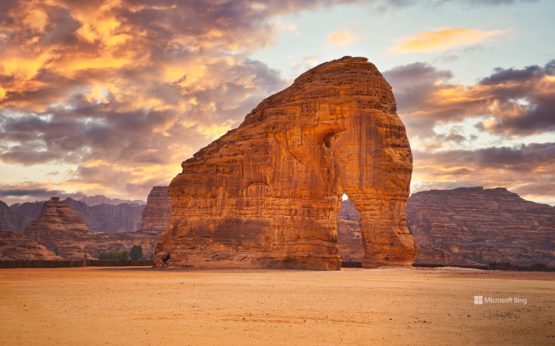
经过数百万年的时间,大自然雕琢出了这片耀眼夺目的砂岩地貌,名为大象岩。该岩石高达117英尺,位于沙特阿拉伯古城欧拉附近,由于风水的侵蚀,它呈现出大象的形状,并成为了该地区的著名地标。日落时,夕阳洒在这片沙漠上,为红色的“猛犸象”及其周围金色的沙子镀上一层温暖的光辉。
古城欧拉距离大象岩约7英里,其历史可追溯到公元前6世纪,它见证了商人、朝圣者和商队穿越这片干旱的土地的历史。其周边地区的岩层和赫格拉纳巴泰古王国陵墓有着岩画和碑文,其中一些碑文的历史可以追溯到公元644年。
Elephant Rock, Al-Ula, Saudi Arabia
Over millions of years, the dazzling sandstone formation known as Elephant Rock was carved by nature. Thanks to the wind and water erosion, this 117-foot-high rock near the city of Al-Ula in Saudi Arabia took on the shape of an elephant and has become a prominent landmark in the region. As the sun sets, it casts a warm glow upon the red-hued mammoth and the golden sand of the surrounding desert.
About 7 miles from the Elephant Rock, the city of Al-Ula traces its roots back to ancient civilizations and has witnessed the passage of traders, pilgrims, and caravans crossing its arid landscapes. The surrounding area, including rock formations and Hegra's Nabataean tombs, boasts petroglyphs and inscriptions, some dating as far back as 644 CE.
圣菲尼安湾,凯里郡,爱尔兰 St. Finian's Bay, County Kerry, Ireland (© Atlantide Phototravel/Getty Images)
圣菲尼安湾,凯里郡,爱尔兰 St. Finian's Bay, County Kerry, Ireland (© Atlantide Phototravel/Getty Images)
今天,让我们穿绿衣裳吧! Let's wear green today!
圣菲尼安湾,凯里郡,爱尔兰
今天,全球数百万具有爱尔兰血统的人都在庆祝圣帕特里克节。圣帕特里克是爱尔兰国家的守护神,大约在公元432年,他将基督教引入到爱尔兰。公元461年3月17日,圣帕特里克逝世,这一天成为了爱尔兰纪念他的日子。
而在美国,圣帕特里克节也具有重要的文化意义,那里有超过3000万人声称自己拥有爱尔兰血统,尤其是在波士顿、纽约和芝加哥等城市。美国第一次庆祝圣帕特里克节的活动是在1737年波士顿举办的,组织者是思乡的爱尔兰士兵,其目的是纪念和传承他们的爱尔兰文化。现代的庆祝活动通常包括游行、传统爱尔兰音乐和舞蹈表演、穿绿色的服装,享用爱尔兰美食和饮料。转眼又到了圣帕特里克节,喜欢爱尔兰文化的你,是否已在夹克上别上了三叶草?
St. Patrick's Day
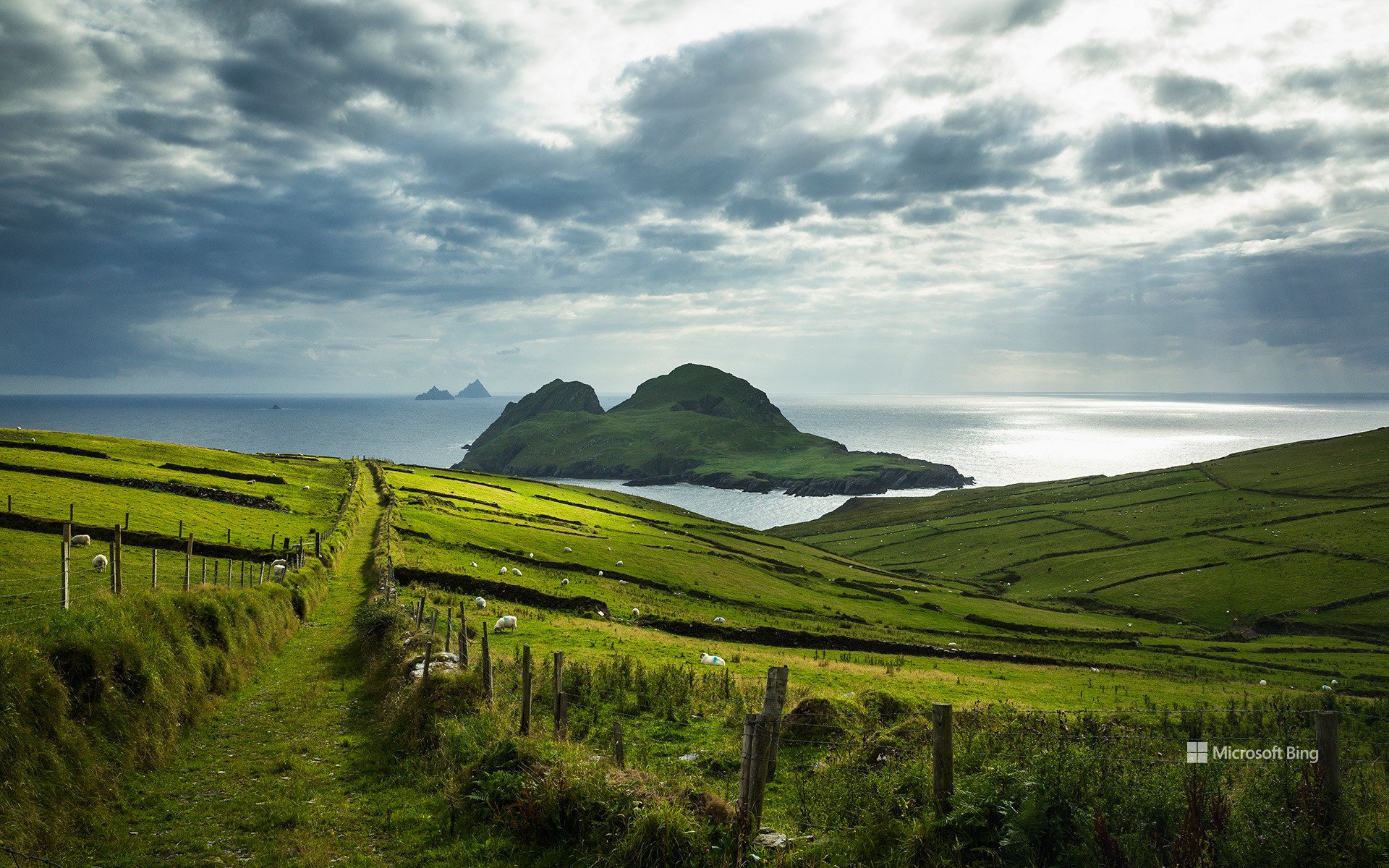
Today, we're looking out to sea from the green pastures of St Finian's Bay in County Kerry, Ireland, to celebrate St Patrick's Day. The country's patron saint introduced Christianity to Ireland around the year 432, and his passing on March 17, 461, became a day of commemoration in his homeland.
The holiday holds cultural significance in the United States, where there are over 30 million people who claim Irish ancestry, specifically in cities like Boston, New York, and Chicago. The first festivity in America took place in Boston in 1737, organized by homesick Irish soldiers to honor their heritage. The modern celebration typically includes parades, traditional Irish music, and dance performances, wearing green clothes, and indulging in Irish cuisine and beverages. Have you pinned a shamrock to your jacket yet?
安沙波利哥沙漠州立公园,美国加利福尼亚州 Anza-Borrego Desert State Park, California (© Stephen Matera/Tandem Stills + Motion)
安沙波利哥沙漠州立公园,美国加利福尼亚州 Anza-Borrego Desert State Park, California (© Stephen Matera/Tandem Stills + Motion)
一抹春色 Where is this colorful desert?
安沙波利哥沙漠州立公园,美国加利福尼亚州
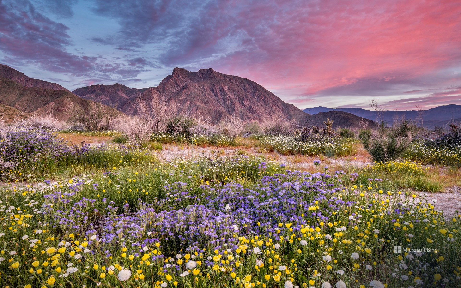
也许距离春天伊始还有好些天,但是加州最大的州立公园——安沙波利哥沙漠州立公园的野花已经在这里向你问好了!每年春天,这片贫瘠的沙漠都会经历一次戏剧性的改变。向日葵、沙漠菊和蒲公英等花朵竞相绽放,形成色彩斑斓的奇观。对于那些想要寻求更多冒险体验的游客来说,从半岛山脉仙人掌丛生的丘陵到峡谷、荒地和天然棕榈绿洲,这个公园有很多可供选择的地方。此外,作为指定的国际黑暗天空公园,这里还是绝佳的观星地点。除了自然奇观之外,占地超过60万英亩的公园还拥有丰富的文化和历史遗产,如古老的象形文字或岩画。
Anza-Borrego Desert State Park, California
The first day of spring may be just days away, but the season's wildflowers at California's largest state park—Anza-Borrego Desert State Park—are already here to say hello! Every spring, this barren desert floor undergoes a dramatic makeover. Flowers like heliotrope, brittlebush, and desert dandelion burst into a riot of bloom, creating a spectacle of color. For those seeking a more adventurous experience, this park has a lot to offer—from the mountains of the Peninsular Ranges and cactus-studded hills to slot canyons, badlands, and natural palm oases. In addition, as a designated International Dark Sky Park, it is an exceptional spot for stargazing. Beyond its natural wonders, the park, spanning over 600,000 acres, is also home to a rich cultural and historical legacy, including ancient pictographs, or rock paintings, from the Native American tribes that once lived here.
Wat Phra Ngam,大城府历史公园,泰国 Wat Phra Ngam, Ayutthaya Historical Park, Thailand (© boonchai wedmakawand/Alamy Stock Photo)
Wat Phra Ngam,大城府历史公园,泰国 Wat Phra Ngam, Ayutthaya Historical Park, Thailand (© boonchai wedmakawand/Alamy Stock Photo)
一个π A piece of pi
圆周率日快乐!
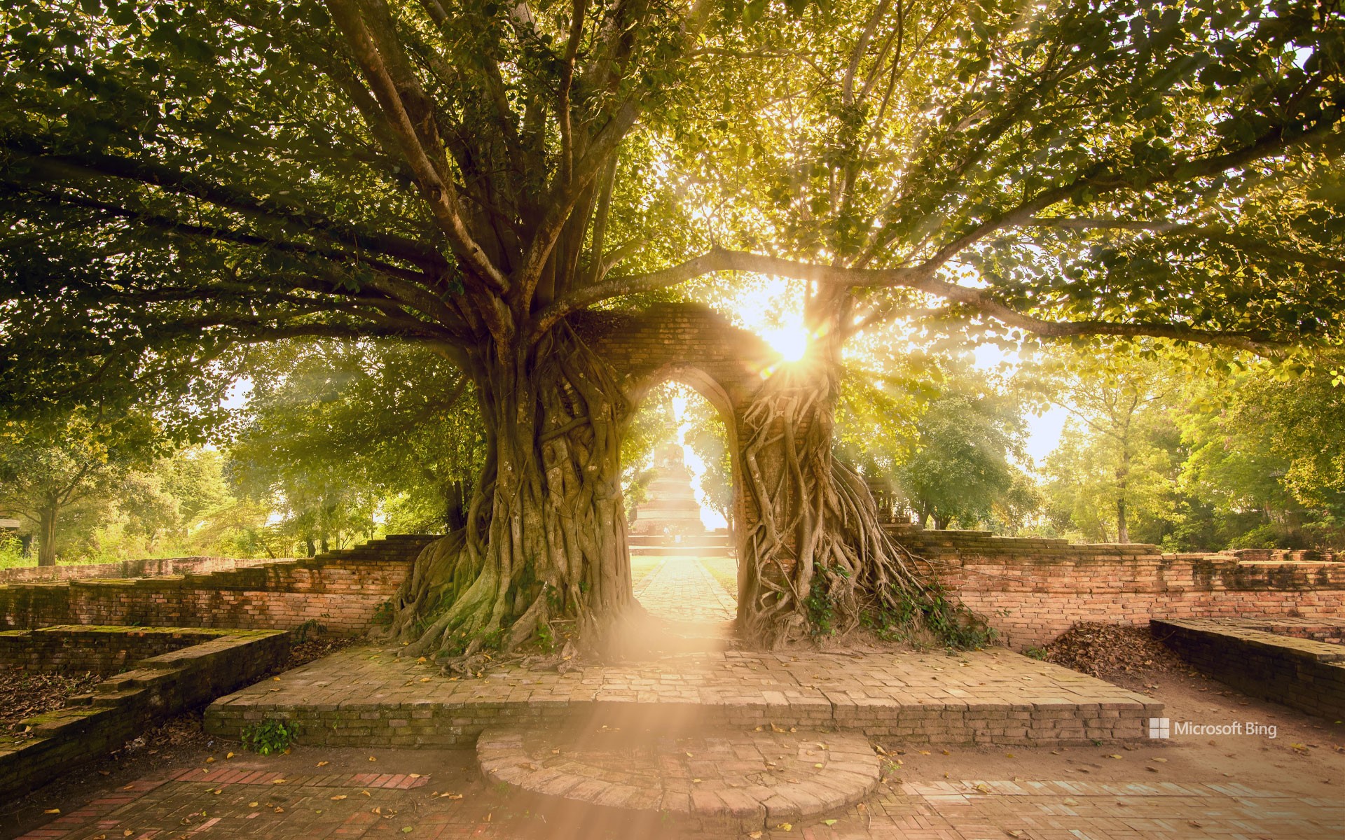
有人这样说过,世界上唯一不变的是变化。然而,在数学里却有许多固定不变的常数,今天,我们要庆祝的也许是其中最著名的一个:π。圆周率是圆的周长与直径之比,约为3.14159。每年的3月14日,全世界的数学爱好者都会用烘焙来庆祝圆周率π日——这既是对数学常数π的庆祝,也是对其同音字,美味的“派”的庆祝。它始于1988年,当时物理学家拉里·肖将日期(3/14)与这个常数的前三位数联系起来。今天,数学家和爱好者们用吃派和背诵π来庆祝圆周率日。你知道吗,当你的时钟敲响1:59时,表示你离圆周率的实际值又近了三位小数。圆周率无处不在,甚至在大自然中也是如此。图中是泰国大城府寺庙的一棵菩提树,其形状就像圆周率的符号。无论你是数学怪才,还是只是为了享受美食,每个人都可以享受“派”节!
Happy Pi Day!
They say the only constant in life is change. In mathematics, however, there are many constants and today, we're celebrating perhaps the most famous of them all: pi. Represented by the symbol π, this tasty-sounding number is the ratio of a circle's circumference to its diameter, approximately 3.14159. Every March 14, mathematics fans across the world get baking to mark Pi Day with a pie. It began in 1988, when physicist Larry Shaw connected the date (3/14) with the first three digits of π. Today, mathematicians and enthusiasts celebrate Pi Day with pie eating and pi reciting. Did you know that when your clock strikes 1:59 today, you will be three decimal places closer to the real value of pi? Pi is everywhere, even in nature. Pictured here is a bodhi tree which has grown over an arch into the shape of the pi symbol at Wat Phra Ngam, a temple in Ayutthaya, Thailand. Whether you're a math geek or just in it for the treats, Pi Day is for everyone to enjoy!
小红鹳飞越马加迪湖, 肯尼亚 Lesser flamingos flying over Lake Magadi, Kenya (© Vicki Jauron, Babylon and Beyond Photography/Getty Images)
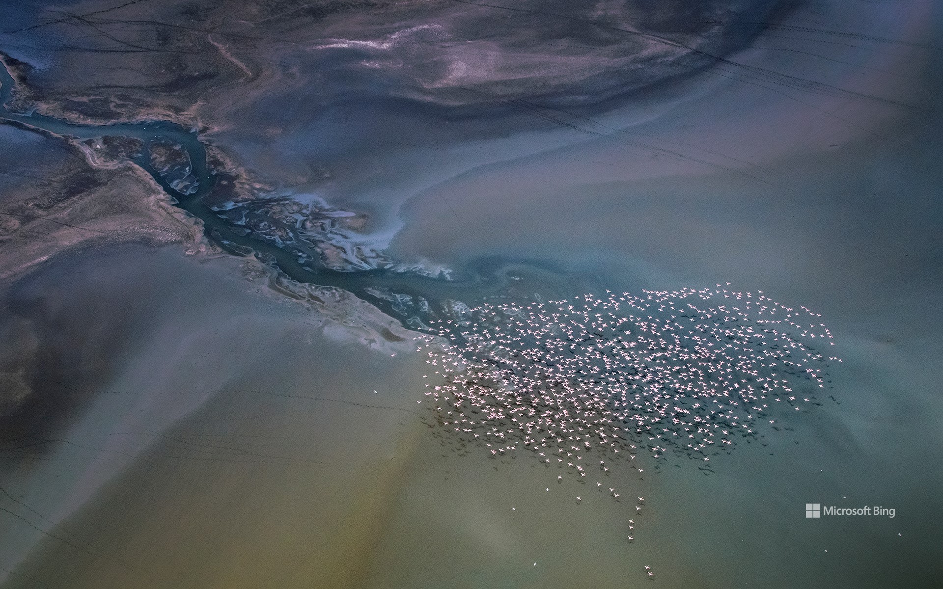
小红鹳飞越马加迪湖,肯尼亚 Lesser flamingos flying over Lake Magadi, Kenya (© Vicki Jauron, Babylon and Beyond Photography/Getty Images)
鸟瞰 Bird's-eye view
马加迪湖,肯尼亚
多么不可思议的景色啊!这张航拍照片展示了以肯尼亚马加迪湖为背景的小红鹳群。小红鹳是六种火烈鸟之一,以其鲜艳的粉红色羽毛和独特的觅食行为而闻名。由于喙的构造,这些鸟喜欢在水面附近进食。它们主要栖息在碳酸盐浓度较高的非洲苏打湖。马加迪湖就是这样一个充满蓝藻和海藻的苏打湖,为火烈鸟提供了充足的营养。成千上万只火烈鸟聚集在湖边的壮观景象揭示了这些独特生态系统的重要性。
Lake Magadi, Kenya
What an unearthly view! This aerial photograph shows a flamboyance of lesser flamingos against the backdrop of Lake Magadi in Kenya. The lesser flamingo is one of six species of flamingo, a bird known for its vibrant pink plumage and distinctive feeding behavior. They use their specialized beaks to filter algae near the water's surface and are often found in African soda lakes like Lake Magadi, which are brimming with cyanobacteria and algae for them to eat. The spectacle of thousands of these avian wonders congregating at the lake reveals the importance of these unique ecosystems.
布莱斯峡谷国家公园,犹他州,美国 Bryce Canyon National Park, Utah (© Jim Patterson/Tandem Stills + Motion)
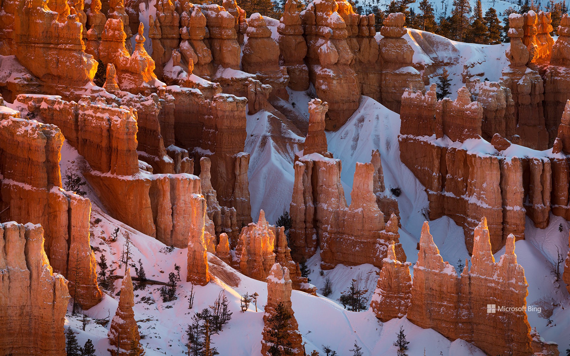
布莱斯峡谷国家公园,犹他州,美国 Bryce Canyon National Park, Utah (© Jim Patterson/Tandem Stills + Motion)
峡谷的守护者 Guardians of the canyo
布莱斯峡谷国家公园,犹他州
徒步是游览犹他州布莱斯峡谷国家公园这些迷人的红色石柱的最佳选择!公园里的徒步小径可以引导您穿行于世界上最大的石柱岩群之间,这些石柱是由侵蚀作用形成的岩石尖顶。这些马蹄形的天然露天剧场会随着阳光的照射而变化,营造出了一种超现实的景观。该地区最初居住着美洲原住民部落,包括派尤特人。虽然没有证据表明他们曾在此长期居住,但派尤特族印第安人曾利用庞沙冈特高原进行季节性狩猎和采集。布莱斯峡谷于1928年被指定为国家公园,峡谷内分布着多个观景点,如灵感点、约文帕点和彩虹点,可将周围的景致尽收眼底。
Bryce Canyon National Park, Utah
These fascinating red hoodoos of Bryce Canyon National Park in Utah are best explored on foot! The park's hiking trails guide you among the world's largest collection of hoodoos, which are rock spires formed by erosion. The horseshoe-shaped natural amphitheaters create a surreal landscape that changes with the play of sunlight. The area was initially inhabited by Native American tribes, including the Paiute people. Although there is no evidence of them having lived there permanently, Paiute Indians used the Paunsaugunt Plateau for seasonal hunting and gathering. Designated a national park in 1928, Bryce Canyon is dotted with several viewpoints like Inspiration Point, Yovimpa Point, and Rainbow Point, which offer panoramic vistas of the surrounding topography.
Prosecco山丘,科内利亚诺和瓦尔多比亚德内,威内托大区,意大利 (© Richard T. Nowitz/Getty Images)
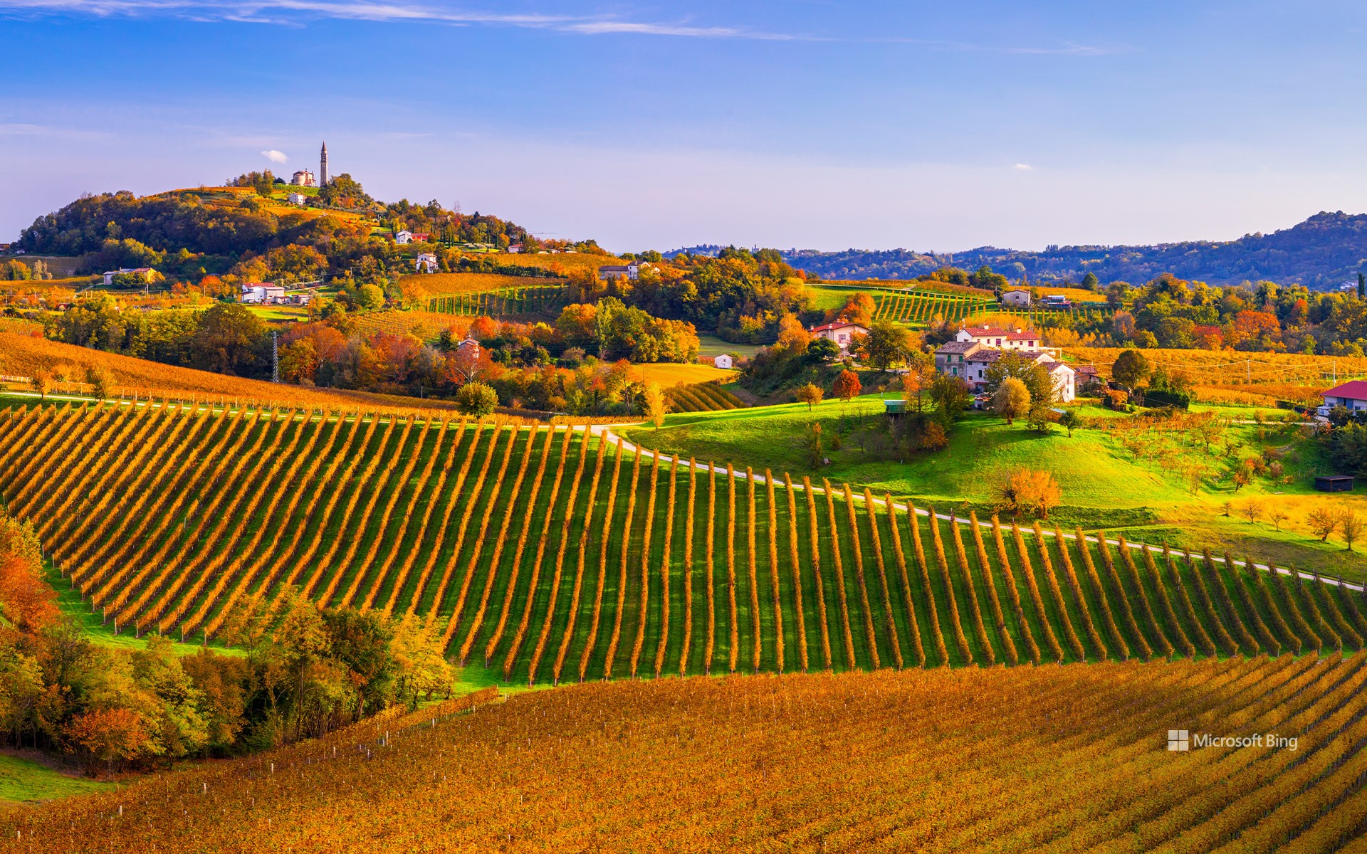
Prosecco山丘,科内利亚诺和瓦尔多比亚德内,威内托大区,意大利 (© Richard T. Nowitz/Getty Images)
醉人的山峦
Prosecco山丘,科内利亚诺和瓦尔多比亚德尼
科内利亚诺和瓦尔多比亚德内的Prosecco丘陵是大自然与人类智慧完美结合的地方。由于其独特性,这些山丘已被联合国教科文组织列入世界遗产名录。特殊的丘陵地带给该地带来了由葡萄园和树林构成的有机环境。而在马赛克般的景观中脱颖而出的小村庄和葡萄园,却只是让这个地方显得独一无二的部分因素。
如果您想领略这迷人的景色,又想进行一次远足,您可以选择Prosecco丘陵之旅。这是一条长达50公里的小路,周围的景色堪比童话世界。一路上,您可以欣赏到位于狭长的草地梯田上的小葡萄园、壮丽的山脊和富有特色的村庄。此外,您还可以品尝到著名的Prosecco葡萄酒,并参观17世纪乡村建筑的经典之作:克罗达水磨坊。
伊瓜苏大瀑布鸟瞰图,巴西 (© Nido Huebl/Shutterstock)
比斯第恶土,新墨西哥州,美国 Bisti/De-Na-Zin Wilderness Area, New Mexico (© Ian Shive/Tandem Stills + Motion)
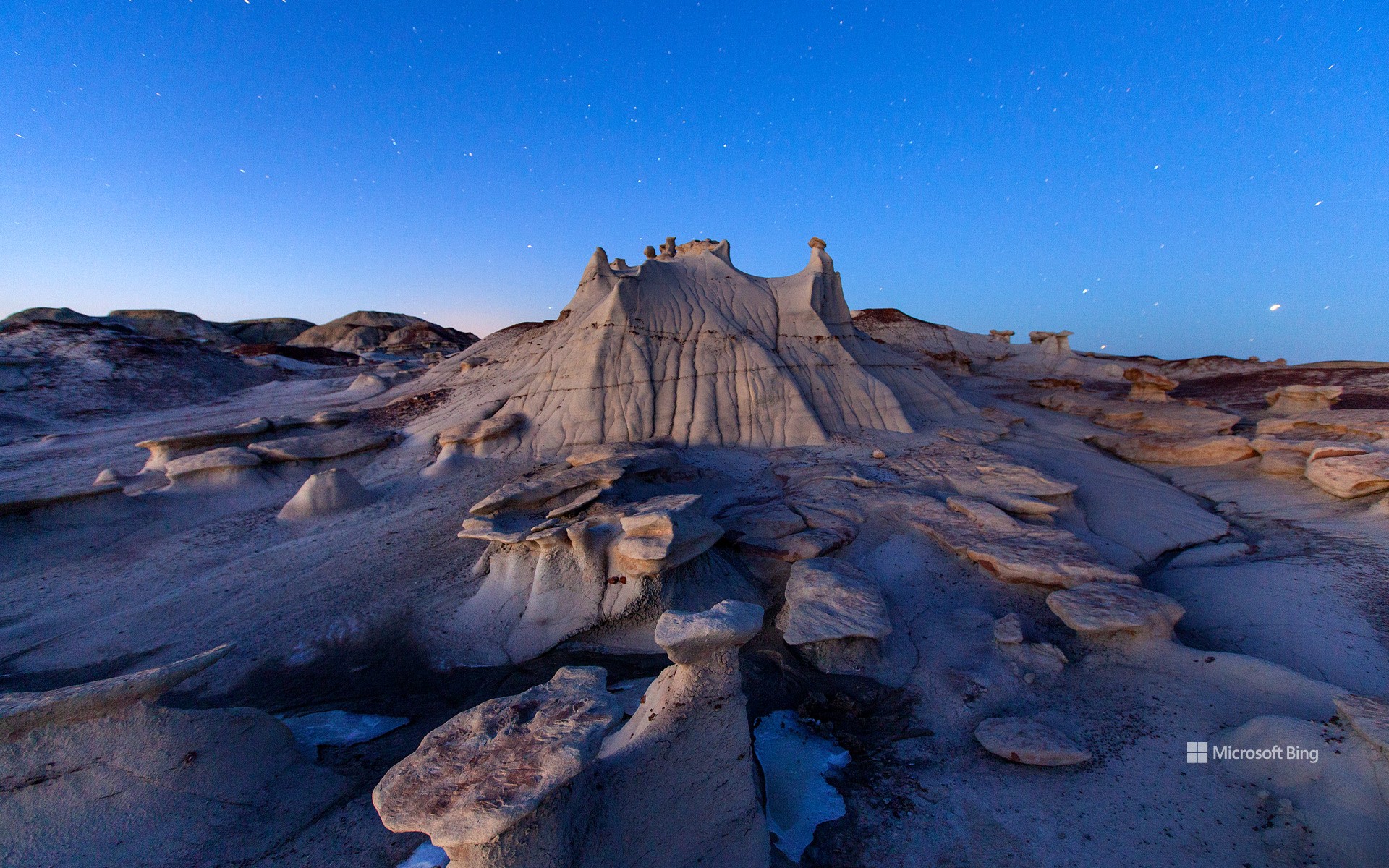
比斯第恶土,新墨西哥州,美国 Bisti/De-Na-Zin Wilderness Area, New Mexico (© Ian Shive/Tandem Stills + Motion)
因时间而改变 Transformed by time
新墨西哥州比斯第恶土
时间是伟大的变革者,它改变着世界,也改变着我们所有人。例如,新墨西哥州的这片名为比斯第恶土的荒地,曾经是一片郁郁葱葱的热带森林。近7000万年前,这里没有扭曲的地形和高耸的尖塔,而是一群白垩纪晚期恐龙的家园,包括甲龙、鸭嘴龙和强大的霸王龙。如今,这里到处都是另一种奇观,岩层看起来更像是雕塑,而不是自然现象。比斯第恶土的名字“Bisti/De-Na-Zin”是以纳瓦霍语命名的:“Bisti” 的意思是 "在土坯岩层中",“De-Na-Zin” 则来自附近的 "站立的仙起重机"石刻。来到四角地区的游客一定不要错过这片由页岩和砂岩组成的超凡脱俗的景观。
Bisti/De-Na-Zin Wilderness, New Mexico
Time is the great transformer, changing the world and all of us. For instance, this New Mexico badland—the Bisti/De-Na-Zin Wilderness—was once a lush, tropical forest. Nearly 70 million years ago, instead of twisted terrains and towering spires, this place was home to an array of Late Cretaceous dinosaurs, including armored Ankylosaurs, duck-billed Hadrosaurs, and mighty Tyrannosaurs. Today, the area is filled with wonders of a different kind, rock formations that look more like sculptures than natural phenomena. Bisti/De-Na-Zin is named after Navajo words: Bisti means 'among the adobe formations,' and De-Na-Zin means 'standing crane,' a reference to nearby rock carvings of the bird. Visitors to the Four Corners region shouldn't miss out on this otherworldly landscape of shale and sandstone.
Roques de Benet,埃尔斯港自然公园,加泰罗尼亚,西班牙 Roques de Benet, Els Ports Natural Park, Catalonia, Spain (© Sergi Boixader/Alamy Stock Photo)
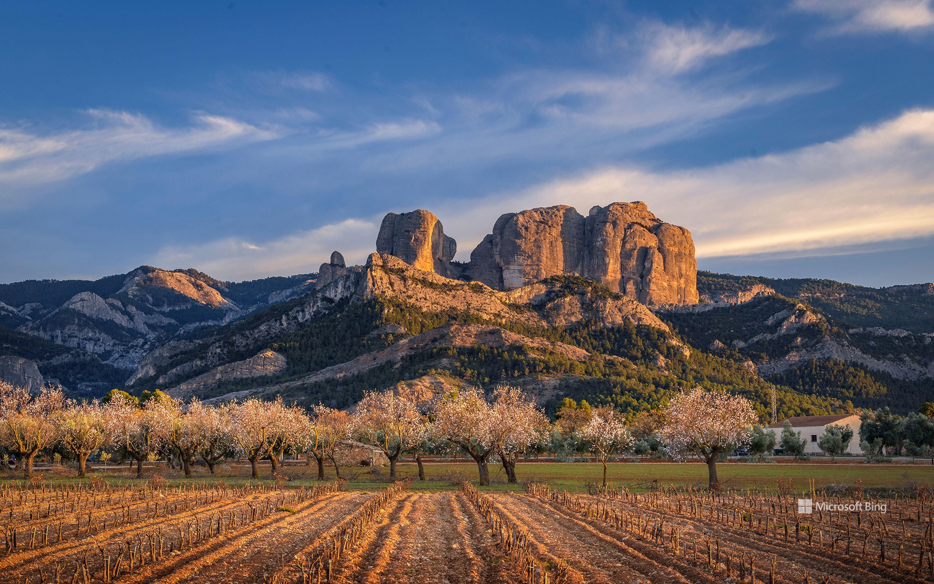
Roques de Benet,埃尔斯港自然公园,加泰罗尼亚,西班牙 Roques de Benet, Els Ports Natural Park, Catalonia, Spain (© Sergi Boixader/Alamy Stock Photo)
攀登新的高峰 Reaching new heights
Roques de Benet,埃尔斯港自然公园,西班牙
奇特的山峰耸立在埃尔斯港自然公园的上空,这是一组位于西班牙加泰罗尼亚地区波特斯德托尔托萨贝塞特山的岩石群。这组岩石群里最高的山峰海拔约3,330英尺,从山顶上俯瞰埃布罗三角洲,可以看到溪流和松树林,还有通往山中的小径。该山的名字中包含“Benet”一词,这个词源于阿拉伯语,暗示着该地区有着丰富多彩的过去。如今,埃尔斯港自然公园是各种动物的家园,从野生山羊和水獭到秃鹫和老鹰,园区内物种丰富。不过,动物并不是该地区唯一的“居民”。山脚下还坐落着一个具有社区意识的村庄,村民们仍然保持着共同的传统,例如使用植物纤维来制作篮子和厨房用具的古老工艺。
Roques de Benet, Els Ports Natural Park, Catalonia, Spain
Jutting into the sky above Els Ports Natural Park, the Roques de Benet are a cluster of rock formations in Catalonia, Spain, whose tallest peak stands about 3,330 feet above sea level. Overlooking the vast wetlands of the Ebro Delta, the peak offers views of streams and pine forests, with trails that lead into the mountains. The word 'Benet' comes from Arabic, hinting at the area's varied past, including both Arabic and Christian settlers. These days, the park is home to a variety of wildlife, from ibex and otters to vultures and eagles. Animals aren't the only inhabitants of the area. The villages nestled at the base of this massif still maintain their shared traditions, such as the age-old craft of using vegetable fibers to create baskets and kitchen utensils.
