2022年10月
克里斯蒂安王子之声,格陵兰岛 Prince Christian Sound in southern Greenland (© Posnov/Getty Images)
克里斯蒂安王子之声,格陵兰岛 Prince Christian Sound in southern Greenland (© Posnov/Getty Images)
一座北部岛屿的南端 Southern tip of a northern isle
格陵兰岛南部的克里斯蒂安王子湾
格陵兰岛的绝对面积很难预测。这个世界上最大的岛屿面积超过83.6万平方英里,是德克萨斯州的三倍多,比阿拉斯加大17万多平方英里。这是一片有着深邃峡湾和冰层的土地,这一定让一千年前登陆那里的挪威探险家们感到宾至如归。
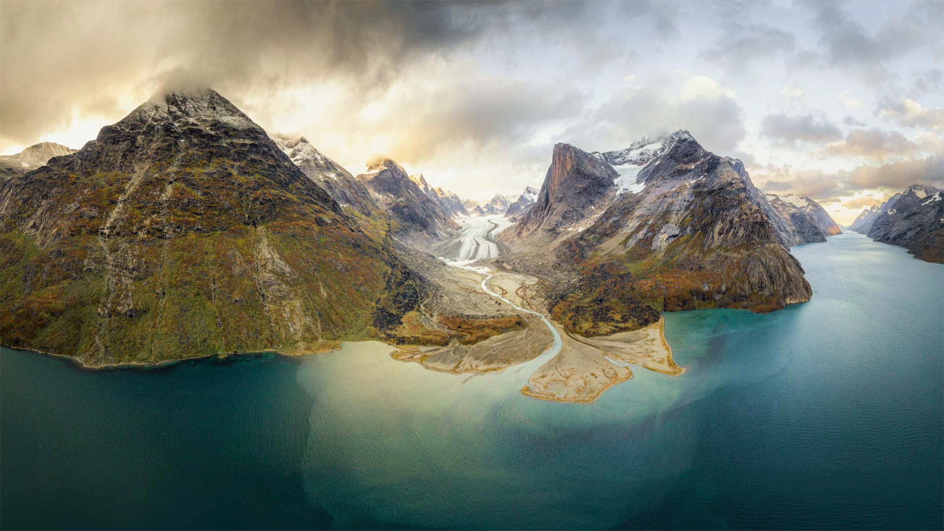
今天,我们发现自己身处格陵兰岛南端的克里斯蒂安王子湾,这是一个长60英里、宽1500英尺的狭长峡湾系统。它流经海拔1200英尺以上的花岗岩陡峭峡谷。冰河崩解、鲸鱼入侵以及游轮访问该地区,经常扰乱这些水域的平静。在这片冰冻的土地上,唯一的人类居住地是伊努伊特人居住的Aappilatoq村,该村约有100人。
Prince Christian Sound in southern Greenland
The sheer size of Greenland is hard to put in perspective. The world's largest island is more than 836,000 square miles—that's more than three times the size of Texas and more than 170,000 square miles larger than Alaska. It is a land of deep fjords and ice that must have made the Norse explorers who landed there a thousand years ago feel right at home.
Today we find ourselves at the southern tip of Greenland, in Prince Christian Sound, a long, narrow fjord system 60 miles long, at times as narrow as 1,500 feet across. It flows through steep canyons of granite that soar over 1,200 feet above. The placid calm of these waters is frequently disrupted by calving glaciers, breaching whales, and the cruise ships that visit the region. The only human habitation in this frozen landscape is the Inuit village of Aappilattoq, home to about 100 people.
纳克什鲁斯塔姆遗址,伊朗波斯波利斯 Naqsh-e Rustam archaeological site near Persepolis, Iran (© mshirani/Shutterstock)
纳克什鲁斯塔姆遗址,伊朗波斯波利斯 Naqsh-e Rustam archaeological site near Persepolis, Iran (© mshirani/Shutterstock)
国际考古日 International Archaeology Day
国际考古日
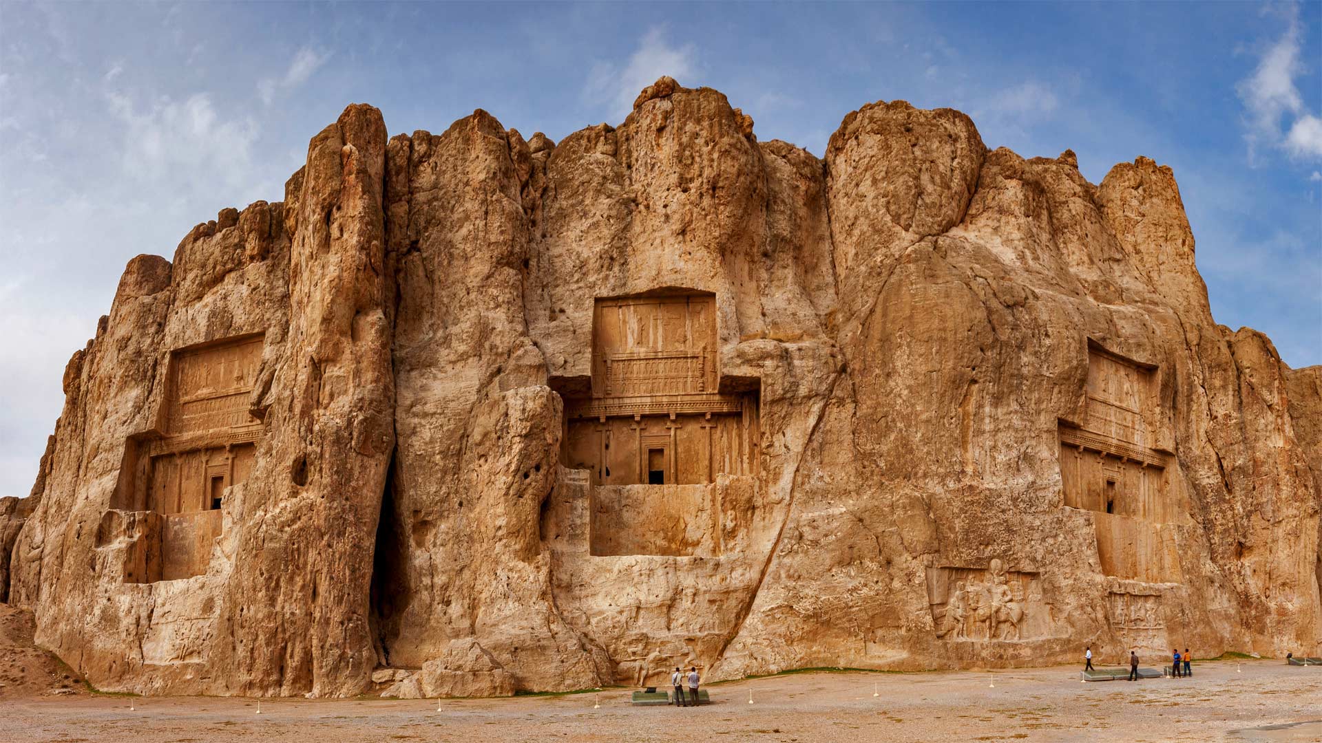
Naqsh-e Rostam是一座雕刻在伊朗西南部山区的古代墓地,是古代波斯最早繁荣的文明之一的门户。四位阿契美尼德国王的陵墓(你可以在这里看到其中三位)以高高地雕刻在悬崖表面的岩石浮雕为标志。这个遗址及其周围地区对伊朗及其人民的历史具有重大意义。它们也是考古学在理解我们的过去方面所起作用的光辉范例。每年10月的第三个星期六,我们都会停下来庆祝并表彰考古学家作为人类历史解释者的贡献。
墓地是由坟墓和墓地组成的综合体,字面意思是“死者之城”这家离法尔斯省的西拉市很近。其中一座坟墓被铭文确定为大流士一世(又名大流士大帝)的安息之地,其他坟墓被认为是大流士的儿子薛西斯一世、阿尔塔克西斯一世和大流士二世的坟墓,这些人是公元前522-330年阿契美尼德王朝的领导人。纳什赫·罗斯坦也是描绘后来萨珊帝国国王的浮雕之乡,萨珊王朝是7世纪和8世纪穆斯林征服之前的最后一个伊朗帝国。只有几百码远的地方是被称为Naqsh-e Rajab的考古遗址,更多的石雕描绘了三位萨珊王朝国王和一位大祭司。虽然这些文明已经消亡,但它们创造的东西是人类历史的永久记录。
International Archaeology Day
Naqsh-e Rostam is an ancient necropolis carved into the mountains of southwestern Iran, a porthole into one of the earliest civilizations to flourish in ancient Persia. The tombs of four Achaemenid kings (you can see three of them here) are marked by rock reliefs carved high above the ground into the cliff face. This site and the area around it are of huge significance to the history of Iran and its people. They're also a shining example of the role archaeology plays in understanding our past. On the third Saturday of every October, we pause to celebrate and recognize the contributions of archaeologists as interpreters of human history.
A necropolis is a complex of tombs and burial plots, literally translated as a 'city of the dead.' This one is close to the city of Shiraz in Fars Province. One of the tombs is identified by an inscription as being the resting place of Darius I, aka Darius the Great, and the others are believed to be the tombs of Darius' son, Xerxes I, Artaxerxes I, and Darius II, leaders during the Achaemenid dynasty from 522-330 BCE. Naqsh-e Rostam is also home to relief carvings depicting kings of the later Sassanian Empire, the last Iranian empire before the Muslim conquests of the 7th and 8th centuries. Only a few hundred yards away is the archaeological site known as Naqsh-e Rajab, with more rock carvings depicting three Sassanid kings and a high priest. While these civilizations have faded, what they created endures as a permanent record of human history.
奥尔德萨和佩尔迪多山国家公园里的瀑布,西班牙比利牛斯山脉 Waterfall on the Rio Arazas in Ordesa y Monte Perdido National Park, Pyrenees, Spain (© David Santiago Garcia/Cavan Images)
奥尔德萨和佩尔迪多山国家公园里的瀑布,西班牙比利牛斯山脉 Waterfall on the Rio Arazas in Ordesa y Monte Perdido National Park, Pyrenees, Spain (© David Santiago Garcia/Cavan Images)
通往伊比利亚的门户 Gateway to Iberia
西班牙比利牛斯山脉奥德萨和蒙特佩迪多国家公园的里奥·阿拉扎斯
比利牛斯山脉在任何季节都很引人注目,但在夏季温暖持续到秋季的年份尤其美丽,自最早的文明在那里扎根以来,比利牛斯半岛一直是伊比利亚半岛和欧洲其他地区之间的天然边界。位于山脉中心的Ordesa y Monte Perdido国家公园创建于1918年,并于1982年扩建。如今,它已成为联合国教科文组织的世界遗产。
该公园拥有陡峭的悬崖和深邃、翠绿的山谷,是摄影师的梦想,拥有由比利牛斯山脉剧烈的海拔变化形成的卓越地质地貌和多样生态。该地区是几个只能在这里找到的物种的家园,包括比利牛斯羚羊和比利牛斯山羚羊,或水鼹鼠。这种被认为是该地区最稀有和最重要的哺乳动物,布卡多山羊或比利牛斯山羊,尽管进行了保护工作,但于2000年1月灭绝。
Rio Arazas in Ordesa and Monte Perdido National Park, Pyrenees, Spain
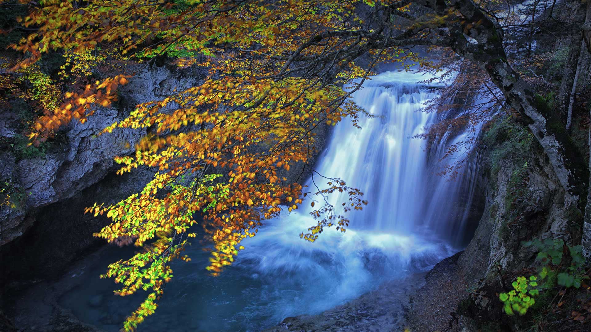
Striking in any season, but particularly beautiful in years when the warmth of summer stretches into fall, the Pyrenees have served as a natural border between the Iberian Peninsula and the rest of Europe since the earliest civilizations took root there. Located in the center of the range, the Ordesa y Monte Perdido National Park was created in 1918 and expanded in 1982. Today it is a UNESCO World Heritage Site.
Boasting sheer cliffs and deep, verdant valleys, the park is a photographer's dream, with a landscape marked by remarkable geological landforms and diverse ecologies shaped by the drastic elevation changes of the Pyrenees. The region is home to several species that can only be found here, including the Pyrenean chamois and the Pyrenean desman, or water mole. The mammal considered the most rare and important in the region, the bucardo or Pyrenean ibex, went extinct in January 2000 despite preservation efforts.
蒙茅斯海滩的菊石路面,英国多塞特侏罗纪海岸世界遗产地 Ammonite Pavement at Monmouth Beach, Jurassic Coast World Heritage Site, Dorset, England (© AWL Images/Danita Delimont)
蒙茅斯海滩的菊石路面,英国多塞特侏罗纪海岸世界遗产地 Ammonite Pavement at Monmouth Beach, Jurassic Coast World Heritage Site, Dorset, England (© AWL Images/Danita Delimont)
回到过去 Stepping back in time
侏罗纪海岸世界遗产地,英格兰
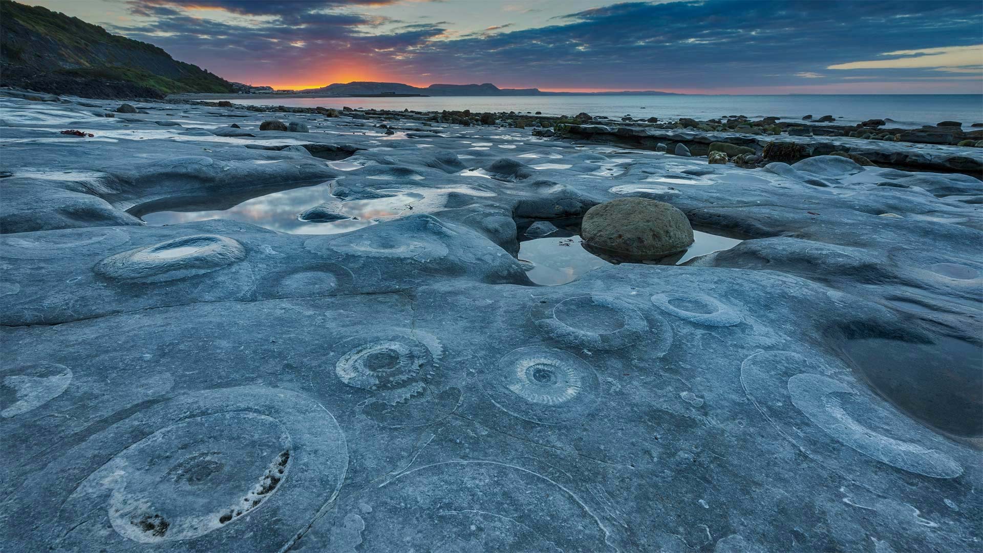
回溯1.99亿年,前往英国多塞特的侏罗纪海岸世界遗产地。这幅令人惊叹的化石展示图被称为“氨岩路面”,数千块化石被埋藏在蒙茅斯海滩西端的石灰岩岩架中。虽然菊石看起来很像蜗牛壳,但它们是已灭绝海洋生物的化石,与当今的章鱼或鱿鱼关系更为密切。英国自然历史博物馆(British’s Natural History Museum)指出,由于菊石的数量和大小,这个充满化石的岩架在世界上是独一无二的:化石直径高达27英寸。如果你想看看,时间就是低潮时岩壁出现的一切,附近的大岩石中也有更多的菊石。
今天是国家化石日,在这一天,我们庆祝着这个迷人的灭绝动植物世界。这并非巧合,它发生在地球科学周期间:我们可以从这个可见、可触摸的过去遗产中更多地了解我们的星球和所有生物。
Jurassic Coast World Heritage Site, England
Travel back 199 million years with a trip to the Jurassic Coast World Heritage Site in Dorset, England. This stunning fossil display is known as the Ammonite Pavement, and thousands of these fossils are embedded in a limestone ledge at the west end of Monmouth Beach. Although the ammonites look rather like snail shells, these are fossils of extinct sea creatures that are more closely related to today's octopus or squid. Britain's Natural History Museum notes that the fossil-filled ledge is unique in the world because of the sheer number and size of the ammonites: The fossils reach up to 27 inches in diameter. If you want to check them out, timing is everything—the ledge emerges at low tide, and there are more ammonites in large rocks nearby, too.
Today is National Fossil Day, when we celebrate the fascinating world of extinct creatures and plants. It's no coincidence that it falls during Earth Science Week: We can learn more about our planet and all living things from this visible, touchable legacy of our past.
瓦伦蒂诺大坝,意大利伦巴第大区布雷西亚省 Valvestino dam in the province of Brescia, Lombardy, Italy (© wmaster890/Getty Images)
瓦伦蒂诺大坝,意大利伦巴第大区布雷西亚省 Valvestino dam in the province of Brescia, Lombardy, Italy (© wmaster890/Getty Images)
穿越意大利峡湾之旅 Journey through the Italian fjords
加尔达湖附近的庞特可乐大坝
巴伦蒂诺公园(又称瓦伦蒂诺乐园)是意大利都灵市一个受欢迎的公共公园。它位于蒲江西岸。它占地面积500000平方米,是都灵第二大公园(都灵最大的公园,840000平方米的佩莱里纳公园,是意大利最广阔的城市绿地)。这个公园里有一个中世纪的村庄,是都灵最受当地人欢迎的。当你准备好在一个紧凑的区域内游览河流、树木和花园、皇家宫殿等时,前往位于波河左岸的巴伦蒂诺公园(Parco del Valentino)。
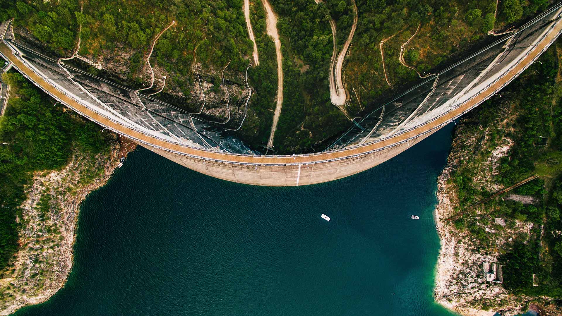
Ponte Cola Dam near Lake Garda
Parco del Valentino (also known as Valentino Park) is a popular public park in Turin, Italy. It is located along the west bank of the Po river. It covers an area of 500,000m², which makes it Turin's second largest park (Turin's largest park, the 840,000m² Pellerina Park, is Italy's most extended urban green area). There is a medieval village set in this park that is the most popular in Torino—amongst locals. When you’re ready for a river, trees and gardens, royal palaces, and more in a compact area, head for the Parco del Valentino on the left bank of the Po.
楚科奇海的浮游植物水华,美国阿拉斯加州海岸附近 Blooms of phytoplankton in the Chukchi Sea off the coast of Alaska (© Norman Kuring/Kathryn Hansen/U.S. Geological Survey/NASA)
楚科奇海的浮游植物水华,美国阿拉斯加州海岸附近 Blooms of phytoplankton in the Chukchi Sea off the coast of Alaska (© Norman Kuring/Kathryn Hansen/U.S. Geological Survey/NASA)
什么生长得这样茂盛? What's blooming so brightly?
楚科奇海浮游植物的大量繁殖
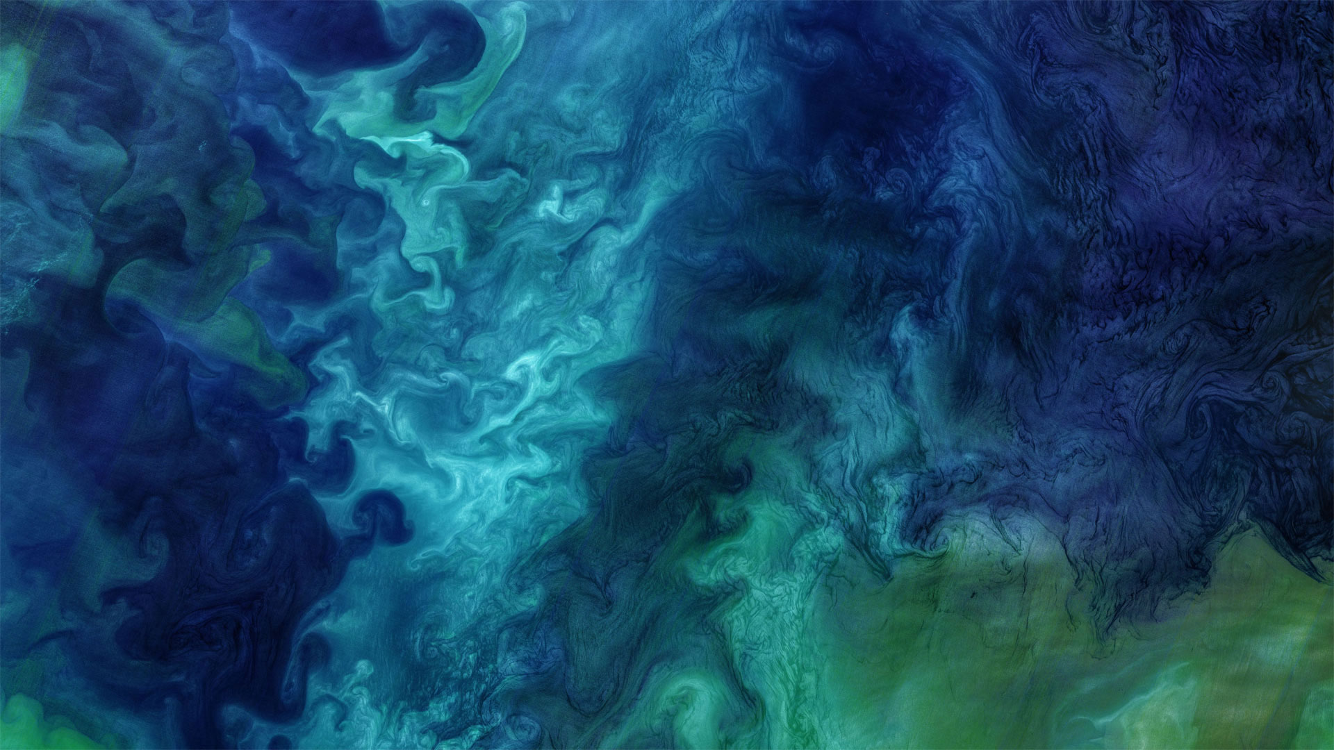
在这张酷酷的照片中,数百种深浅的蓝色被大理石镶嵌在一起。不,这不是一件现代艺术作品,它是大自然的杰作。这是一张卫星照片,照片中的浮游植物在阿拉斯加附近盛开,凉爽、咸的楚科奇海与靠近海岸的温暖、新鲜的海水混合在一起。
但究竟什么是浮游植物?它们是微小的太阳能生物,漂浮在海面附近,随洋流漂流。事实上,它们的名字来源于希腊语中植物的“phyton”和流浪者或漂泊者的“planktos”。对于生活在海洋和河口的各种生物来说,浮游植物既美味又营养,对地球上的每一个人都至关重要:浮游植物的光合作用约占世界光合作用的一半,是吸收二氧化碳和释放氧气的太阳能过程。
今天我们谈论浮游植物是为了纪念地球科学周,这是一个鼓励我们所有人学习甚至献身于地球科学的国际活动。今年的主题是“地球科学促进可持续发展世界”,强调科学在维持我们的星球上的作用。所以,是时候掸掉显微镜上的灰尘,参观当地的科学博物馆,或者也许只是了解更多关于美丽的旋转浮游植物的知识。
Blooms of phytoplankton in the Chukchi Sea
Hundreds of shades of blue are marbled together in this cool shot. No, it's not a work of modern art, it's right off the brush of nature. This is a satellite photo of phytoplankton blooming near Alaska as the cool, salty Chukchi Sea mingles with warmer, fresher water closer to shore.
But just what are phytoplankton? They're microscopic sun-powered organisms that float near the surface of the ocean, drifting with the currents. In fact, their name derives from the Greek 'phyton' for plant and 'planktos' for wanderer or drifter. Delicious and nutritious to various creatures living in oceans and estuaries, they're also vital to everyone on Earth: Phytoplankton are responsible for about half of the world's photosynthesis, the sun-powered process that takes in carbon dioxide and releases oxygen.
We're talking phytoplankton today in honor of Earth Science Week, an international event encouraging all of us to learn about or even devote our life to the Earth sciences. This year's theme is 'Earth Science for a Sustainable World,' emphasizing science's role in sustaining our planet. So, time to dust off that microscope, visit your local science museum, or perhaps just learn more about beautiful, swirling phytoplankton.
一年一度的灯光节期间,奥伯巴姆大桥上的设计方案, 德国柏林 Designs projected on the Oberbaum Bridge during the yearly Festival of Lights in Berlin, Germany (© John MacDougall/AFP via Getty Images)
一年一度的灯光节期间,奥伯巴姆大桥上的设计方案, 德国柏林 Designs projected on the Oberbaum Bridge during the yearly Festival of Lights in Berlin, Germany (© John MacDougall/AFP via Getty Images)
新光中的旧桥 An old bridge in a new light
柏林灯光节
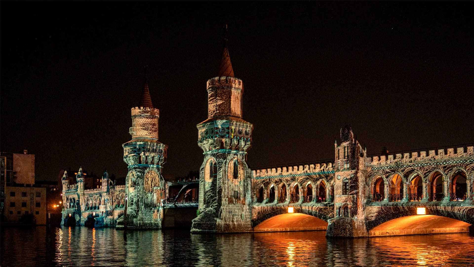
双层Oberbaum大桥是柏林最受欢迎的标志性建筑之一。这座有数百年历史的桥曾经连接了两个被柏林墙分隔开的行政区,1961年至1989年,柏林墙在物理上和思想上分隔了东柏林和西柏林。这里的第一座桥建于18世纪,尽管目前的公路和铁路奥伯巴姆是在19世纪末修建的。
它仍然是统一柏林的重要象征,也是该市一年一度为期一周的灯节的标志性建筑,从今天开始。这一国际艺术节已经举办了18年,随着颜色、图案和图像投射到整个城市的建筑上,柏林的建筑和地标都以巧妙的灯光展示方式进行了改造。在这里,我们看到Oberbaum灯火通明,迎接2020年的节日,这与冷战时期大不相同。近30年来,这座桥一直是东柏林和西柏林之间的过境点。随着检查站的安装和历史塔楼的拆除,它成为了铁路线的终点。但在1990年德国统一后,这座桥被重建,并恢复了昔日的辉煌——这对于一座标志性建筑来说是一个合适的命运,它随着它所服务的城市而改变。
Berlin Festival of Lights
The double-decker Oberbaum Bridge is one of Berlin's most beloved and iconic landmarks. This centuries-old span once connected two boroughs separated by the Berlin Wall, the barrier that physically and ideologically divided East and West Berlin from 1961 to 1989. The first bridge in this spot was built in the 1700s, although the current road-and-rail Oberbaum was constructed at the end of the 19th century.
It remains an important symbol of unified Berlin, and a prominently featured landmark in the city's annual, weeklong Festival of Lights, which begins today. The international festival, now in its 18th year, transforms Berlin's buildings and landmarks with artful displays of light, as colors, patterns, and images are projected onto structures across the city. Here we see the Oberbaum all lit up for the 2020 festival—a far cry from its Cold War days. For nearly 30 years, the bridge served as a border crossing between East and West Berlin. It became the end of the train lines as a checkpoint was installed and the historic towers were demolished. But after German reunification in 1990, the bridge was rebuilt and restored to its former glory—a fitting fate for a landmark that has transformed along with the city it serves.
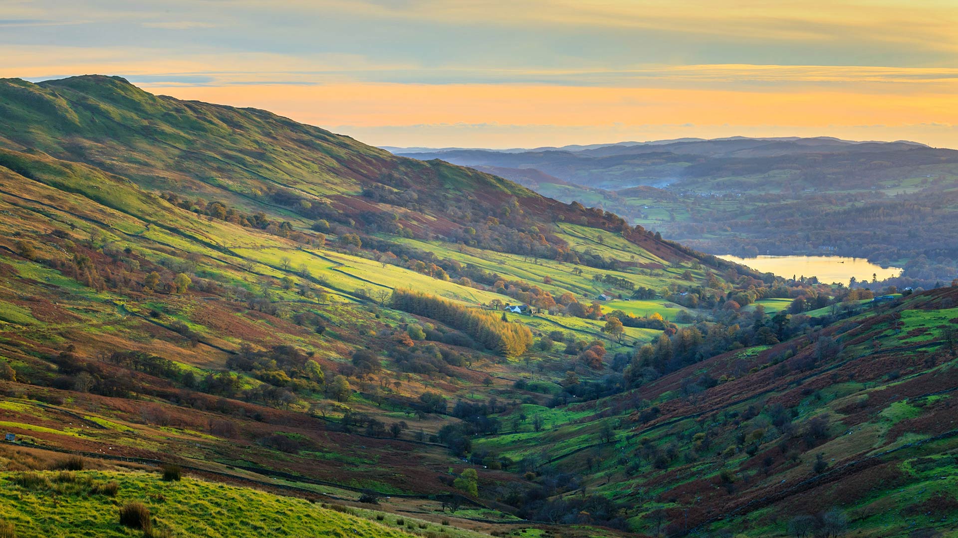
温德米尔湖的风景,坎布里亚湖区,英格兰 (© Chris Warren/eStock Photo)
巴斯克海岸世界地质公园的比斯开湾,西班牙 Bay of Biscay in the Basque Coast Geopark near Bilbao, Spain (© Olimpio Fantuz/eStock Photo)
巴斯克海岸世界地质公园的比斯开湾,西班牙 Bay of Biscay in the Basque Coast Geopark near Bilbao, Spain (© Olimpio Fantuz/eStock Photo)
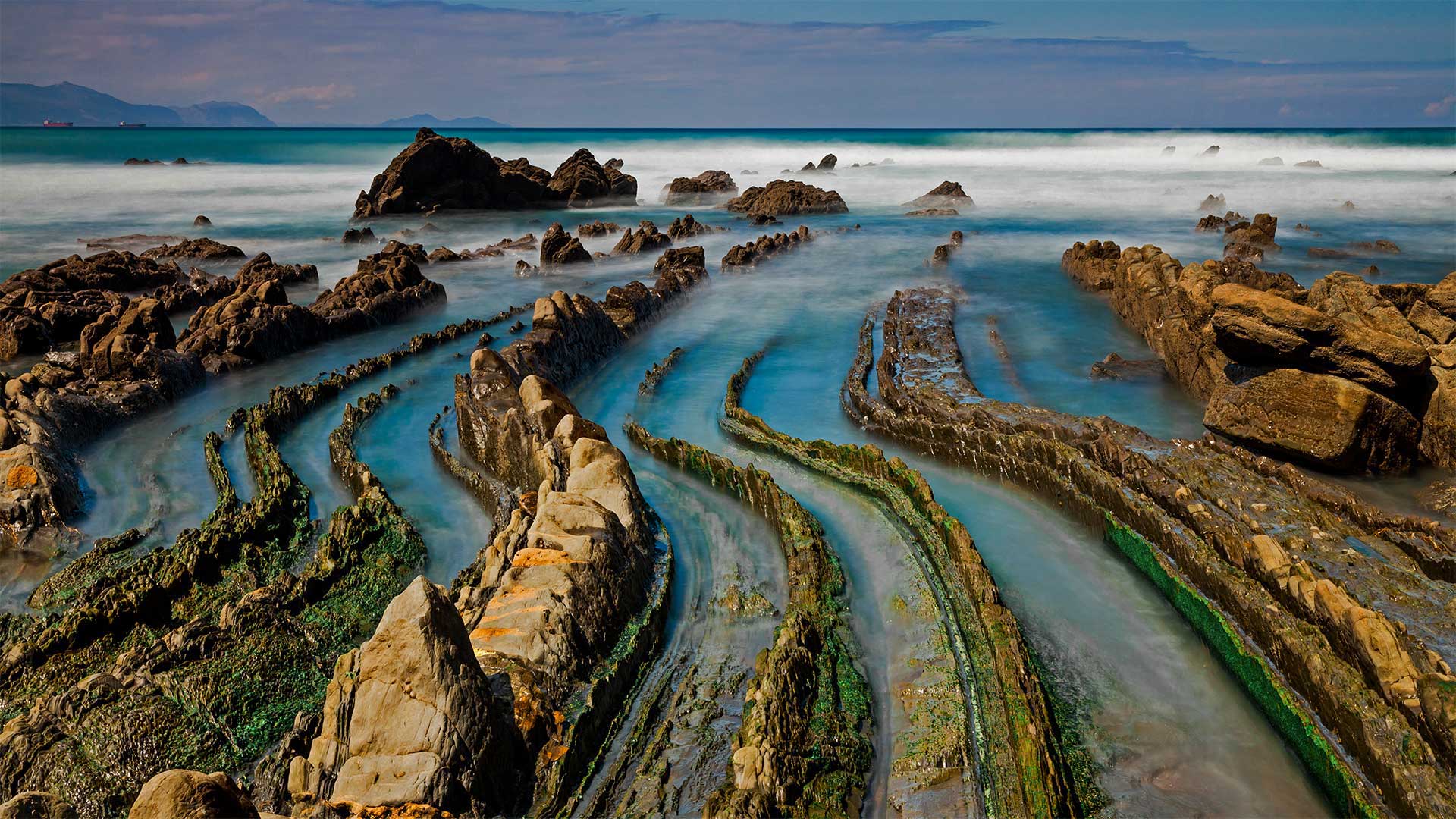
隐入大海的龙尾 Dragon tails trail to the sea
国际地理多样性日
这些龙尾巴状的结构延伸至西班牙北部巴斯克海岸的比斯开湾,是地球上最独特、最引人注目的地质构造之一。对于地质学家和喜欢看冰凉岩石的人来说,这是一个仙境。巴斯克海岸地质公园(Basque Coast Geopark)在导游的带领下,游客可以发现6000万年不间断的地质历史。
今天是国际地球多样性日,它揭示了地球科学在解决人类今天面临的重大挑战方面的重要性。这可以包括地质学、岩石圈、地球内部大规模结构以及大气、水圈和生物圈的研究。
International Geodiversity Day
These dragon tail-like structures that stretch into the Bay of Biscay on the Basque Coast of northern Spain are part of one of the most unique and remarkable geological formations on the planet. It's a wonderland for geologists, and for people who just like looking at cool rocks. Guided tours of the Basque Coast Geopark allow visitors to discover 60 million years of uninterrupted geological history.
Today is International Geodiversity Day, which brings to light the importance of geoscience in solving major challenges that humanity is facing today. This can include the study of geology, the lithosphere, and the large-scale structure of Earth's interior, as well as the atmosphere, hydrosphere, and biosphere.
黄山的日出,中国 The Mt. Huangshan sunrise, Anhui, China (© zhouyousifang/Getty Images)
黄山的日出,中国 The Mt. Huangshan sunrise, Anhui, China (© zhouyousifang/Getty Images)
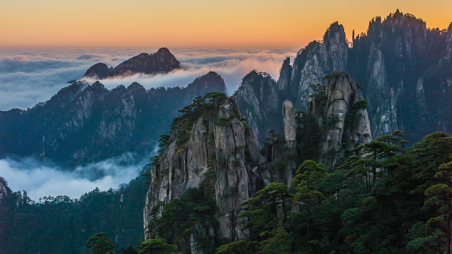
今天我们去爬山吧 Let ‘s climb the mountain today.
The Mt. Huangshan sunrise
Chongyang Festival is also called Double Ninth Festival. In Chinese, it is a day for people to eat Chongyang cake, drink chrysanthemum wine and climb mountains. Today we come to one of the most famous mountains in China.
Located in east China's Anhui Province, Mount Huangshan is renowned for its magnificent natural scenery including massive granitic boulders and ancient pine trees which are often further enhanced by cloud and mist effects. The property features numerous imposing peaks, many of which exceed an altitude of 1,000 meters, with the highest, the famous Lianhua Peak, reaching up to 1,864 meters.
黄山日出
重阳节也称重阳节。在中国,这是人们吃重阳饼、喝菊花酒和爬山的日子。今天我们来到中国最著名的山脉之一。
黄山位于中国东部的安徽省,以其壮丽的自然风光而闻名,其中包括巨大的花岗岩巨石和古老的松树,云雾效应往往会进一步增强这些景观。该地产拥有众多雄伟的山峰,其中许多山峰海拔超过1000米,其中最高的是著名的莲花峰,高达1864米。