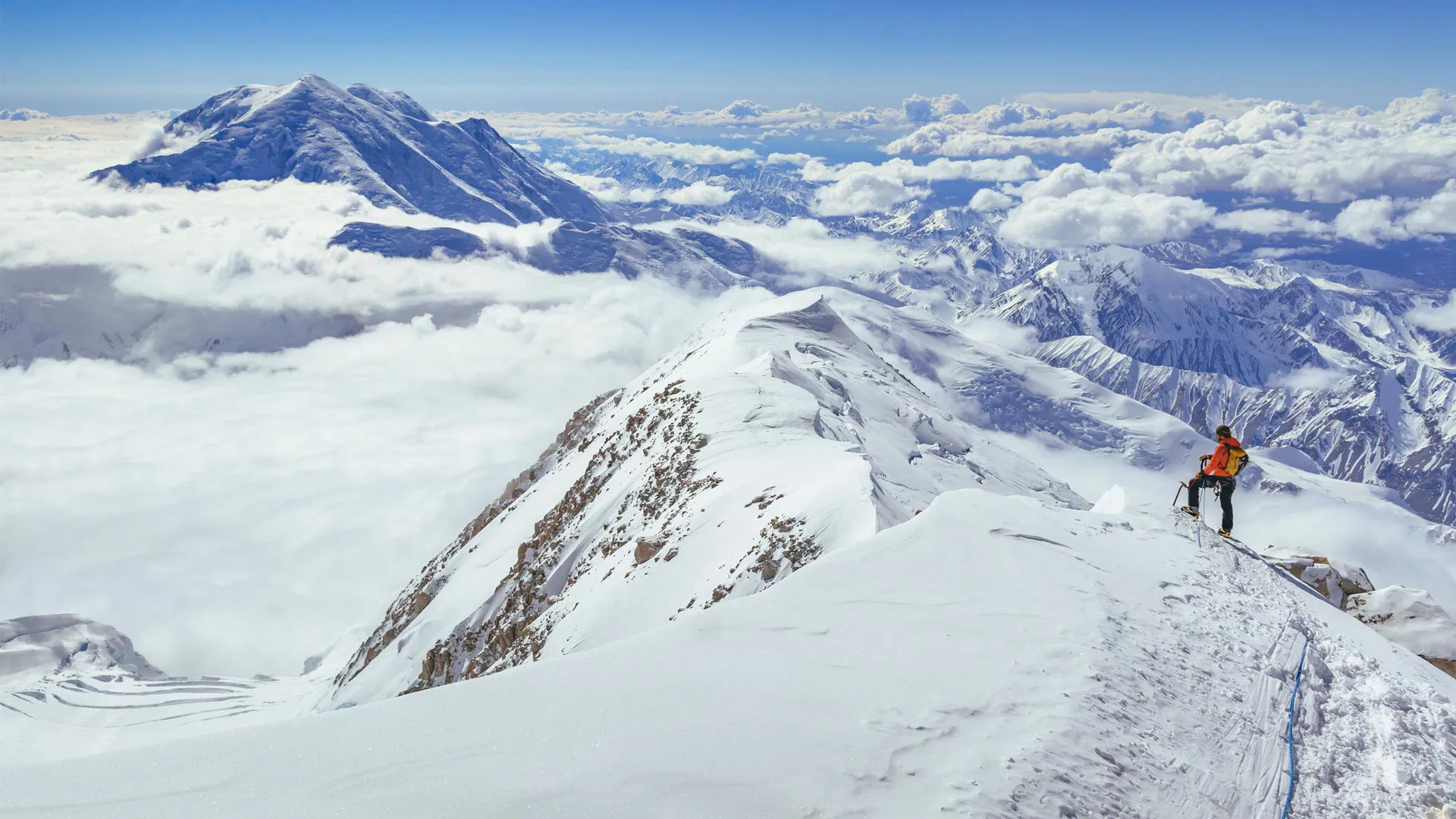
从德纳里山看福克拉山,德纳里国家公园,美国阿拉斯加州 Climber on Denali, Denali National Park, Alaska (© Andrew Peacock/Tandem Stills + Motion)
从德纳里山看福克拉山,德纳里国家公园,美国阿拉斯加州 Climber on Denali, Denali National Park, Alaska (© Andrew Peacock/Tandem Stills + Motion)
德纳里山的力量无可否认 There's no denying the power of Denali
美国登山日
今天是美国登山日。为了攀登高峰和征服困难地形,登山者们需要专业的训练和丰富的经验,登山途中更是一段艰辛的旅程。但是,登上山顶俯瞰山下风景的那一刻,所有的艰辛都是值得的。今天图片中展示的是北美最高峰德纳里山,海拔超2万英尺,位于阿拉斯加的德纳里国家公园和保护区。“德纳里”一词源于阿萨巴斯卡语,是“至高者”的意思。
National Mountain Climbing Day
Today is National Mountain Climbing Day, dedicated to celebrating the sport while highlighting its many risks and rewards. In a bid to scale the tallest peaks and conquer difficult terrain around the world, mountain climbers embark on physically strenuous journeys that demand exceptional training and experience. But the panoramic views and sense of achievement after reaching the summit makes the effort worthwhile. Our image today is that of Denali, North America's highest peak at 20,310 feet, in south-central Alaska. The name 'Denali' means 'the high one' in the native Athabascan language. Four climbers, Walter Harper, Harry Karstens, Robert Tatum, and Hudson Stuck, were the first to set foot on the top of the mountain in 1913.
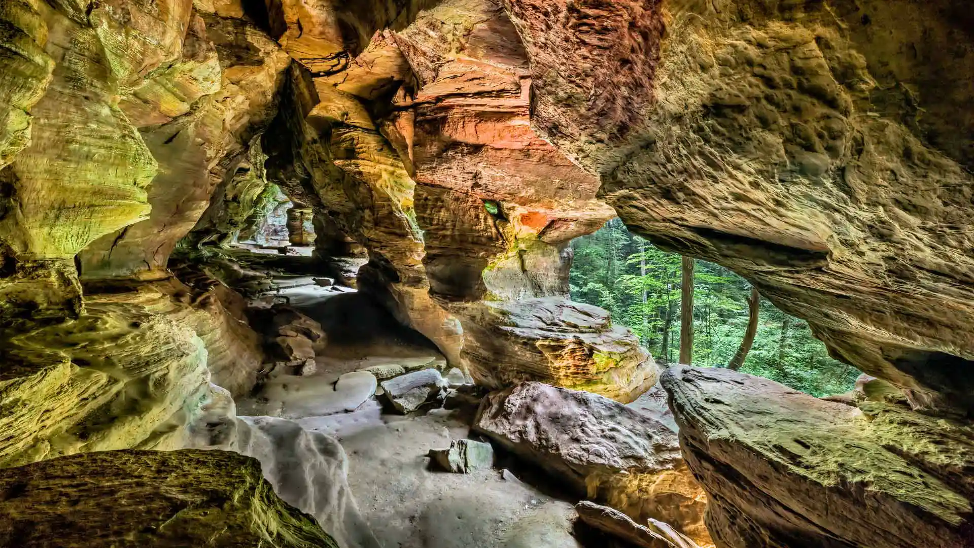
霍金山州立公园的岩石屋,俄亥俄州,美国 Rock House, Hocking Hills State Park, Ohio (© Kenneth Keifer/Getty Images)
霍金山州立公园的岩石屋,俄亥俄州,美国 Rock House, Hocking Hills State Park, Ohio (© Kenneth Keifer/Getty Images)
有人在家吗? Is anybody home?
霍金山州立公园的岩石屋,俄亥俄州,美国
美丽宽敞的岩石屋是霍金山州立公园唯一的真正洞穴。该洞穴之所以被命名为岩石屋,是因为它曾在不同时期被不同的居住者用作避难所。岩石屋坐落在悬崖半山腰处,便于防御。早在欧洲移民到来之前,这里常被美洲原住民用于避难和举行仪式。
岩石屋的墙壁上有七个侵蚀而成的开口。这些“窗户”创造了有趣的视觉效果,阳光透过“窗户”,在洞穴内投射出美丽的图案。考古证据表明,洞穴居民曾用岩壁上的凹槽当烤炉,用地面水槽收集水。
Rock House in Hocking Hills State Park, Ohio
Ancient and beautiful, Rock House is the only true cave in Ohio's Hocking Hills State Park. This corridor, halfway up a 150-foot cliff, was carved by erosion and has offered shelter to various dwellers over different periods. Long before European settlers arrived, the area's Native American people are believed to have used Rock House as a refuge. Small recesses in the rock walls are thought to have been used as baking ovens, while troughs gouged in the cave's floor helped them to collect water. The walls of Rock House have seven window-like openings, allowing sunlight to filter through, casting beautiful patterns inside the cave and offering cliffside views over the trees for generations of Rock House dwellers.
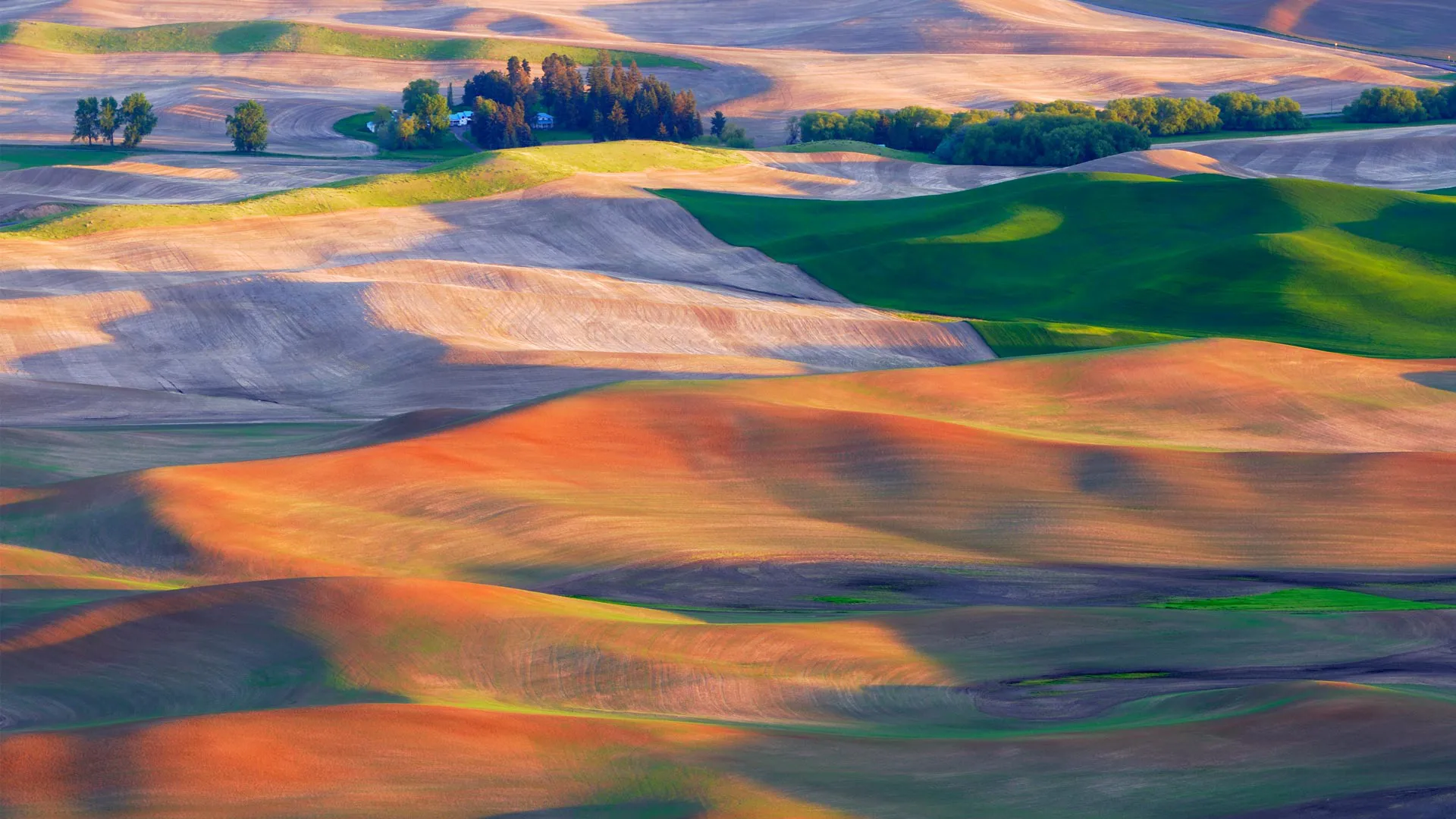
帕卢斯的农田,华盛顿州,美国 Farmland in the Palouse, Washington (© EJ-J/Getty Images)
帕卢斯的农田,华盛顿州,美国 Farmland in the Palouse, Washington (© EJ-J/Getty Images)
宛若仙境的帕卢斯田园 Perfect, pastoral Palouse
帕卢斯的农田,华盛顿,美国
美国的帕卢斯地区以风景如画的景观和独特的地质特征而闻名。延绵起伏的丘陵田原一望无际,错落有致、金绿相间的麦浪美不胜收,相比意大利的托斯卡纳和法国乡村也毫不逊色。帕卢斯是一个农业区,当地土壤肥沃和气候适宜,盛产小麦、大麦、豌豆和小扁豆等。
Palouse farmland, Washington state
The Palouse region in the Pacific Northwest is known for its picturesque landscapes, agricultural heritage, and unique geological features. Those stunning hills in our homepage image were formed over tens of thousands of years, from dust and silt blown by the wind, known as loess. The Palouse's fertile soil and climate make it ideal for farming and it is known for its wheat, barley, lentils, and other crops. With its beautiful rolling hills covered in patchworks of green and golden fields, it is often compared to Italy's Tuscany region or the French countryside.
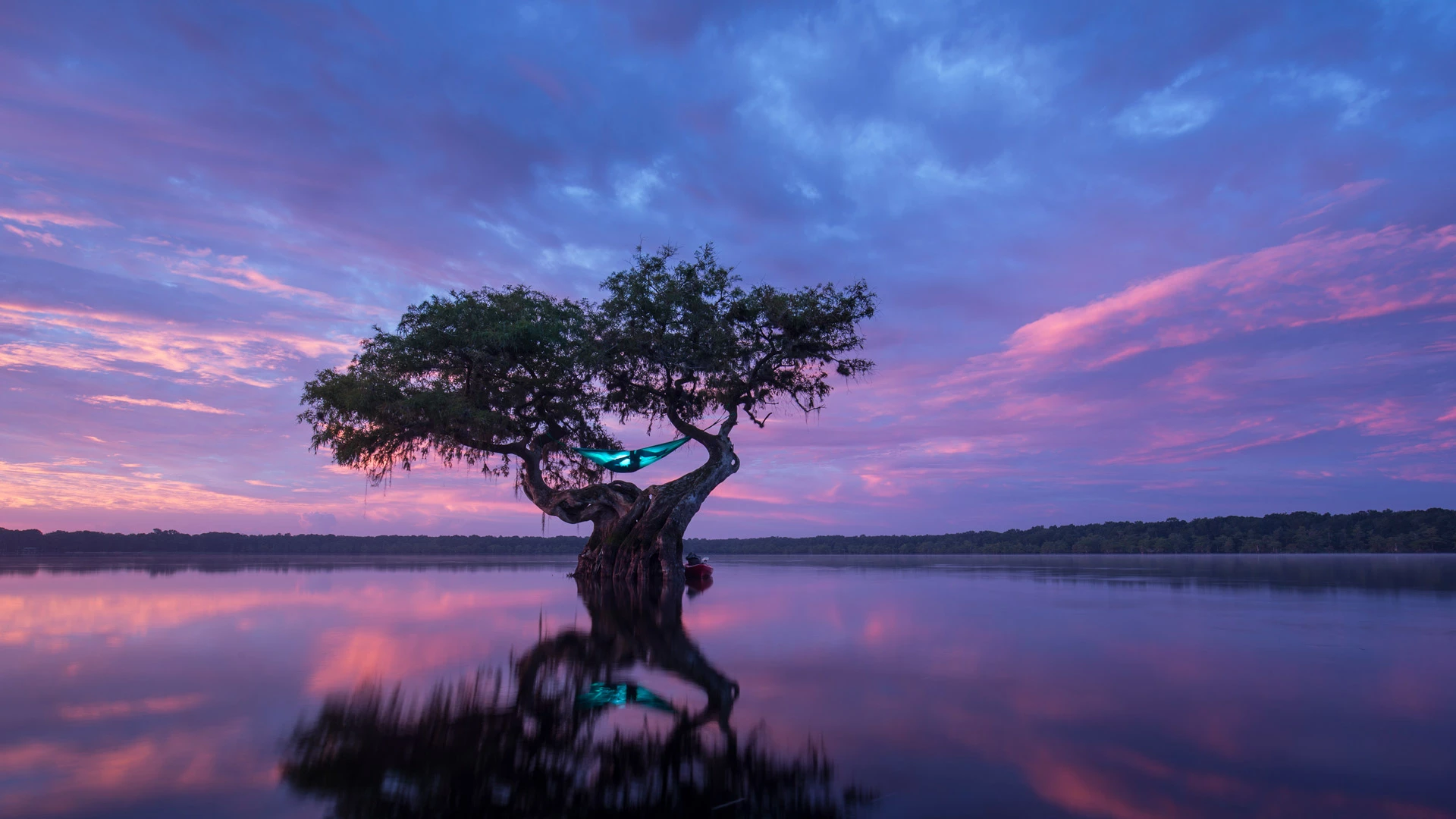
在一棵秃柏树上吊床露营,佛罗里达州,美国 Hammock camping in a bald cypress tree, Florida (© Mac Stone/Tandem Stills + Motion)
在一棵秃柏树上吊床露营,佛罗里达州,美国 Hammock camping in a bald cypress tree, Florida (© Mac Stone/Tandem Stills + Motion)
想出去玩吗? Want to hang out?
在一棵秃柏树上吊床露营,佛罗里达州
传统的吊床是由中美洲人发明的,最初是用来在睡觉时保护自己免受危险的昆虫和动物的袭击。如今,吊床是一个用来增添乐趣的工具。由布料、网或绳子等各种各样的材料制作而成的吊床,是旅行者最好的伙伴。在佛罗里达州,秃柏树就是一个挂吊床的绝佳去处。
National Hammock Day
It’s National Hammock Day! A day to slowly unwind while rocking gently from side to side. These days, hammocks are associated with summer relaxation, but they were originally developed by Central Americans to protect them from dangerous insects and animals. Today the hammock is a traveler's best buddy, made from a variety of materials like fabric, netting, or rope. But where best to hang it? Florida boasts some beautiful hammock hang-out spots, like the bald cypress tree pictured on our homepage. Have hammock, will travel and relax. It's just that simple.
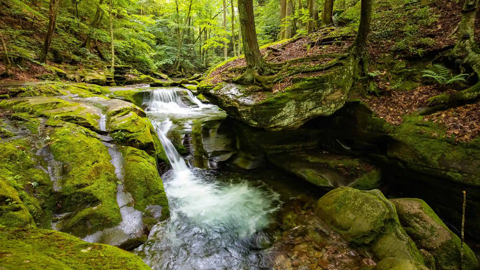
熊洞溪,卡茨基尔山脉,纽约,美国 Bear Hole Brook, Catskill Mountains, New York (© GummyBone/Getty Images)
熊洞溪,卡茨基尔山脉,纽约,美国 Bear Hole Brook, Catskill Mountains, New York (© GummyBone/Getty Images)
溪水潺潺 Babbling on and on
熊洞溪,卡茨基尔山脉,纽约
卡茨基尔山脉坐落在纽约州北部,面积超过4000平方英里,以令人惊叹的美景闻名。连绵不绝的山峰和古老的森林勾勒出迷人的背景,山谷孕育着蜿蜒流动的小溪,就像我们今天看到的熊洞溪。该地区拥有众多迂回曲折的徒步旅行路线,穿越茂密的林地,通向令人敬畏的壮丽景色。卡茨基尔在文化史上也占有重要地位,多年来一直吸引着世界各地的艺术家和梦想家。从标志性的度假胜地到迷人的小村庄,这里独特的魅力一直吸引着源源不断的游客到访。
Bear Hole Brook, Catskill Mountains, New York
Stretched over 4,000 square miles in upstate New York, the Catskill Mountains captivate visitors with their breathtaking beauty. Towering peaks cloaked in forests surround valleys filled with meandering streams like Bear Hole Brook, seen in today's image. The region boasts hiking trails that wind through enchanting woodlands, past waterfalls and lakes while motorists can enjoy scenic drives and spot the region's covered bridges, dating from the 1800s. The Catskills also hold a place in cultural history, attracting artists and dreamers and as the fictional setting for the movie 'Dirty Dancing'—which was actually filmed in Pembroke, Virginia. With other attractions including ski resorts and picturesque small towns and hamlets, visitors continue to flock to the Catskills, a huge wilderness within driving distance of more than 20 million Americans.
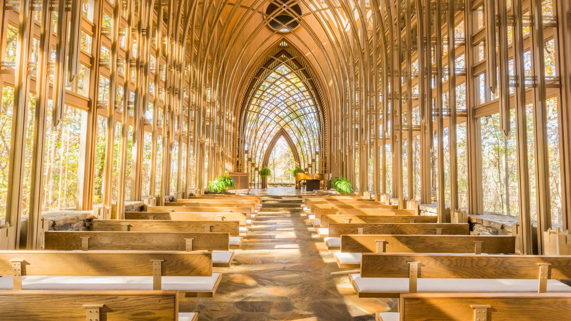
米尔德里德-B-库珀纪念教堂,贝拉维斯塔,阿肯色州 (© Eddie Brady/Getty Images)
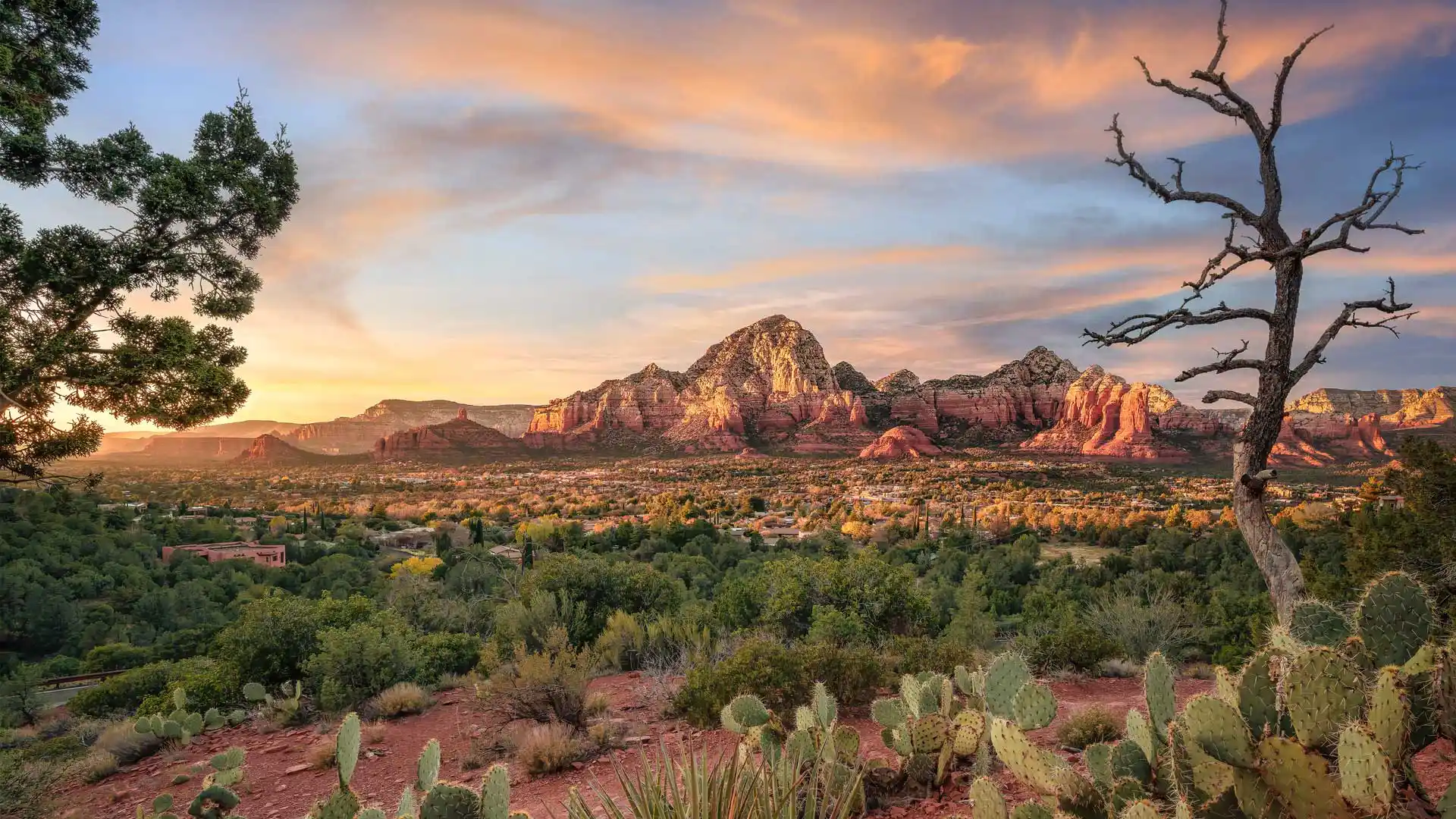
塞多纳,亚利桑那州,美国 Sedona, Arizona (© Jonathan Ross/Getty Images)
塞多纳,亚利桑那州,美国 Sedona, Arizona (© Jonathan Ross/Getty Images)
红石的土地 Red rock country
塞多纳,亚利桑那州,美国
从你踏入塞多纳的那一刻起,你将会震撼于其绝妙的景色和从沙漠中突兀而出的红色砂石悬崖。冒险爱好者热爱这里的美景和宁静。塞多纳还遍地是美洲原住民的历史。尽管由于缺少文字记述,我们对于这个地区最早的定居者知之甚少,他们被称为“祖先普韦布洛人”。普遍认为他们在1400年前在此定居。大部分有关这些古代先民的信息来自于考古遗迹和文物,包括大规模的普韦布洛人定居点遗址。
Sedona, Arizona
Stunning sandstone cliffs rise from the desert floor amid spectacular scenery here in Sedona, Arizona, also known as Red Rock Country. Adventure enthusiasts come to enjoy the beautiful trails that dot the region, which is also steeped in Native American history. The earliest settlers are believed to have been the Ancestral Puebloans, who inhabited the area around 1,400 years ago. Without any written history, most of the information about these ancient people comes from the archaeological ruins that remain, including cliff dwellings built under overhangs in the area's red sandstone rocks. Other Native American groups came to the area such as the Hakataya, the Hohokam, the Sinagua, and the modern-day tribes that live in Arizona today, the Tonto Apache and the Yavapai.
在加利福尼亚州圣地亚哥举行的“为团结划桨”活动 'Paddle Out for Unity' event in San Diego, California (© Brandon Colbert Photography/Getty Images)
在加利福尼亚州圣地亚哥举行的“为团结划桨”活动 'Paddle Out for Unity' event in San Diego, California (© Brandon Colbert Photography/Getty Images)
桨叶动力 Paddle power
国际冲浪日
国际冲浪日通过激发人们对冲浪的热情来促进对海洋的保护。 每年 6 月的第三个星期六,人们都会聚集在一起参加冲浪比赛、烧烤、海滩清理和其他活动,以帮助恢复和保护海洋环境。 为一项事业走到一起是全球冲浪社区的标志,无论是为了自然还是为了反对不公正,正如他们在 2020 年加利福尼亚州恩西尼塔斯举行的“为团结划桨”聚会上所做的那样,如图所示。
冲浪的历史可以追溯到12世纪的波利尼西亚,那里的人民将这项传统带到了夏威夷。冲浪运动于1885 年在加利福尼亚州圣克鲁斯附近首次在美国亮相,当时四位夏威夷王子在红木板上冲浪圣洛伦佐河。如今,冲浪运动已遍布全球。
International Surfing Day
International Surfing Day promotes the protection of the ocean alongside celebrating the sport itself, every year on the third Saturday in June. People gather for surfing contests, barbeques, beach cleanups, and other activities to help restore the ocean environment. Coming together for a cause is a hallmark of the global surfing community, whether campaigning for cleaner waters or standing together against injustice, as they did at the Paddle Out for Unity gathering in 2020 in Encinitas, California, pictured on our homepage.
Surfing traces back to 12th-century Polynesia, whose people carried the tradition to Hawaii. The sport made its US debut in 1885 near Santa Cruz, California, when four Hawaiian princes surfed the San Lorenzo River on redwood boards. Today, surfing has expanded around the world.
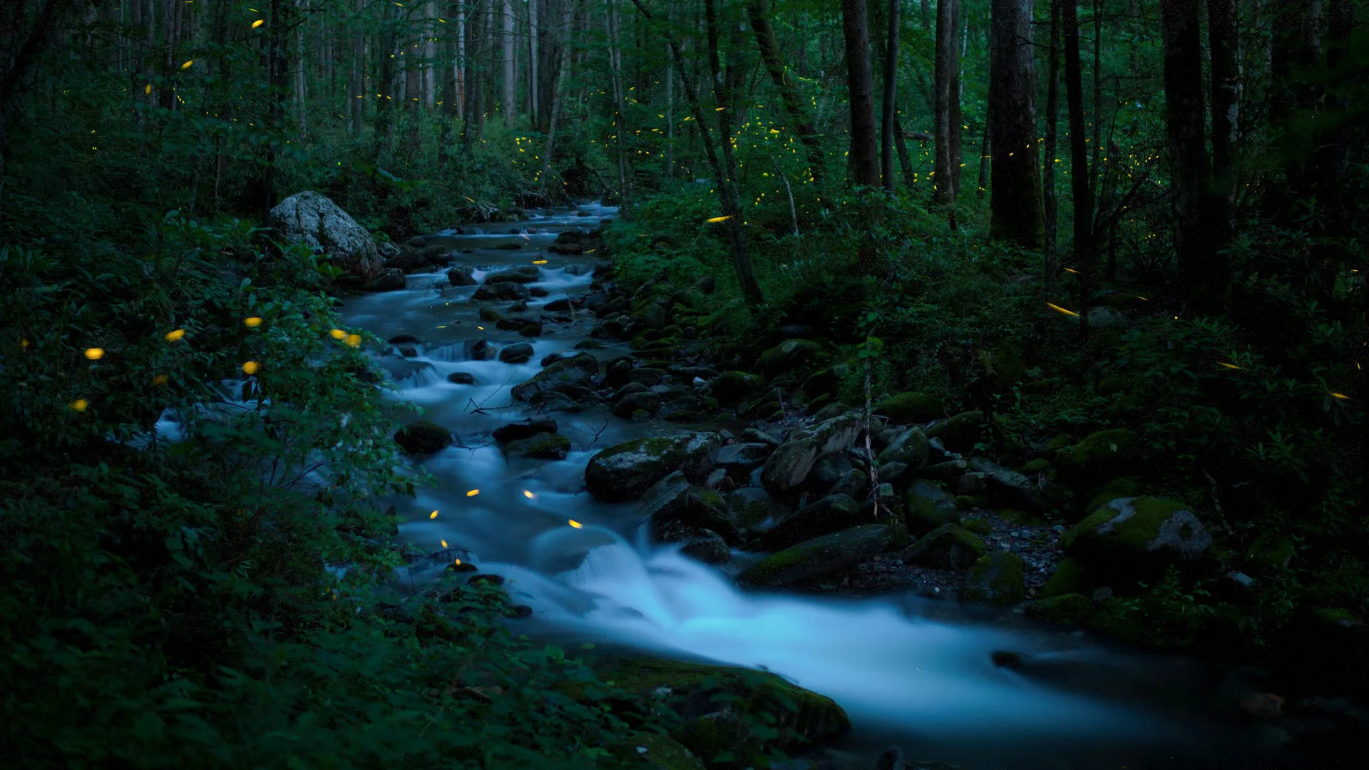
同步萤火虫,大烟山国家公园,田纳西州,美国 Synchronous fireflies, Great Smoky Mountains National Park, Tennessee (© Floris Van Bruegel/Minden Pictures)
同步萤火虫,大烟山国家公园,田纳西州,美国 Synchronous fireflies, Great Smoky Mountains National Park, Tennessee (© Floris Van Bruegel/Minden Pictures)
一闪一闪亮晶晶(的小虫子) Twinkle, twinkle, little bugs
自然摄影日
让自己沉浸在大自然中绝对是阴沉的一天的最佳解药。我们周围的动植物、景色、声音和气味可以安抚我们的精神、身体和灵魂。想象自己沉浸在若虚若幻的情境中,好像站在神秘森林里,被高耸树木、潺潺溪流还有闪烁的萤火虫环绕。这片神秘的森林就是大烟山国家公园,这里每年五月和六月是萤火虫季。今天是大烟山国家公园的创立日,也正好是自然摄影日,可能没有什么比在今天拍摄萤火虫更应景了。
Nature Photography Day
Towering trees, rushing streams, and luminous fireflies combine to create this magical landscape in Tennessee's Great Smoky Mountains National Park. The park is famous for its firefly season between May and June when these 'lightning bugs' gather to put on a light show as part of a mating display. Today, we celebrate the anniversary of this magnificent national park, as well as Nature Photography Day. There may be no better subject than the lightning bug to mark the day—as photography is the art of capturing light in lasting images.
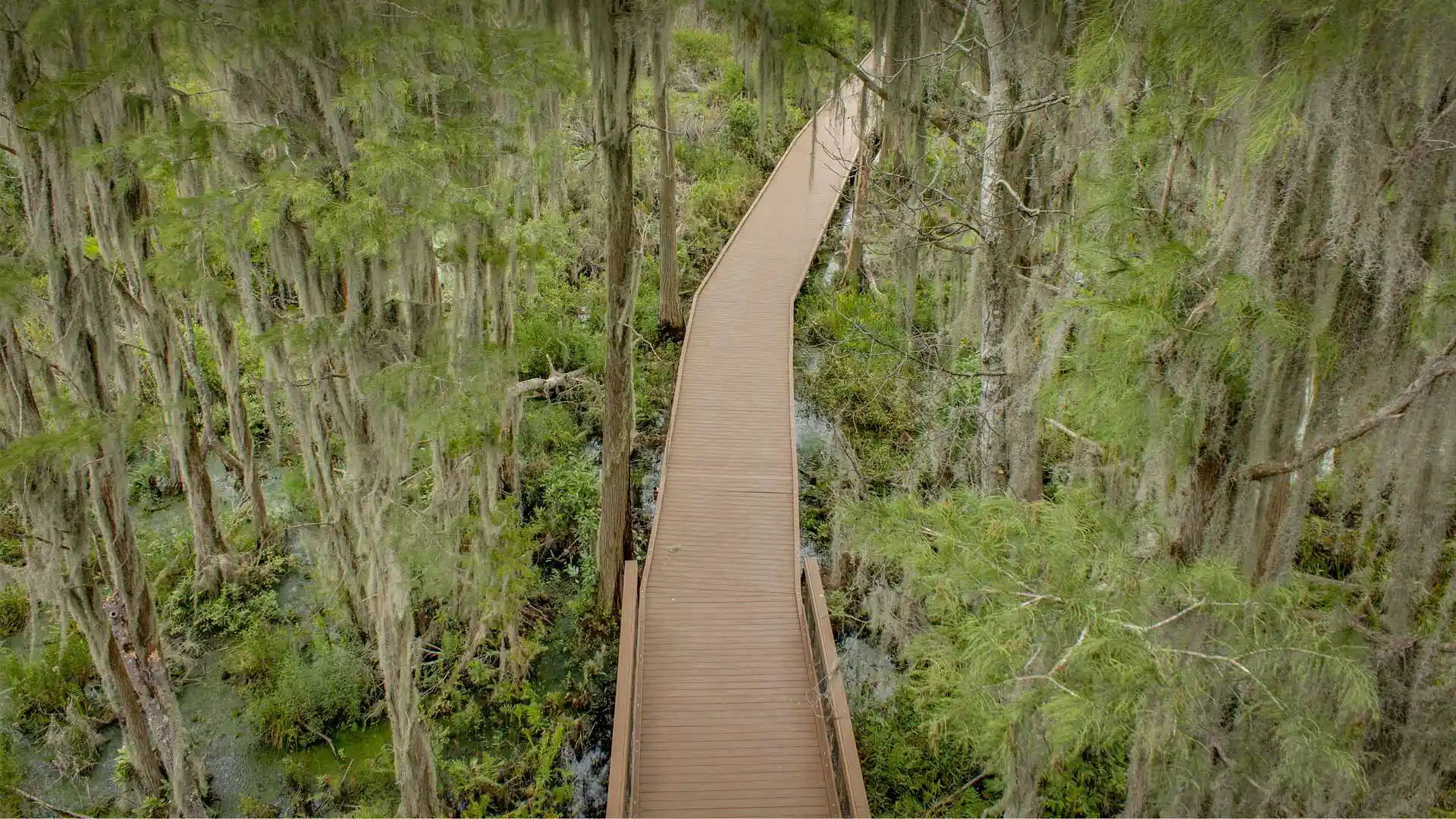
奥克弗诺基沼泽木板路上的西班牙苔藓,佐治亚州,美国 Spanish moss trees over a boardwalk in the Okefenokee Swamp, Folkston, Georgia (© Emmer Photo/Alamy)
奥克弗诺基沼泽木板路上的西班牙苔藓,佐治亚州,美国 Spanish moss trees over a boardwalk in the Okefenokee Swamp, Folkston, Georgia (© Emmer Photo/Alamy)
你是否有勇气进入这片茂密的沼泽 Dare to delve into this dense swamp
奥克弗诺基沼泽
奥克弗诺基沼泽大部分位于佐治亚州东南部,是全美最大的淡水沼泽地。这片巨大又独特的生态系统覆盖了700平方英里的土地,生活着各种各样的野生动物,比如鹭、鹤、麻鸦、美洲短吻鳄、啄木鸟、乌龟、蛇、青蛙等。宁静的水域被有机物腐烂产生的单宁染成棕色。这片区域曾经是塞米诺尔印第安人的领地。到了现代,这片沼泽的一大部分已经被商业化了,这里的泥煤矿藏被作为燃料开采。
Okefenokee Swamp
The Okefenokee Swamp, on the border of Georgia and Florida, is the largest intact freshwater swamp in the US. Its slow-moving blackwaters are stained by tannins from decaying organic matter and this vast ecosystem, covering 700 square miles, is packed with wildlife. Herons, cranes, bitterns, American alligators, turtles, snakes, frogs, and Florida black bears are among creatures who roam the swamp, which is largely protected by the Okefenokee National Wildlife Refuge. In the early years of the 20th century, part of the swamp was logged, and its peat deposits were mined for use as fuel. Remnants of railroad lines can still be seen crossing swamp waterways as well as other equipment dating from its time as a logging area.
