鸟瞰视角下的布雷阿岛,法国阿摩尔滨海省 Aerial view of Bréhat island, Côtes-d'Armor, France (© LECLERCQ Olivier/hemis.fr/Alamy)
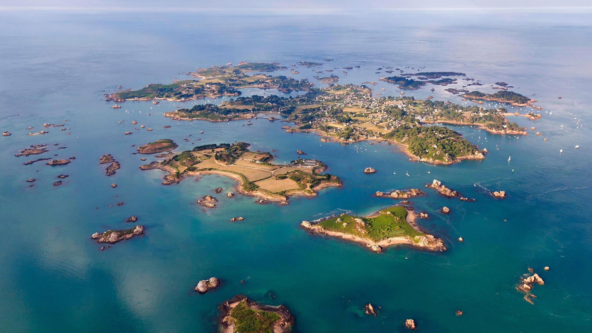
鸟瞰视角下的布雷阿岛,法国阿摩尔滨海省 Aerial view of Bréhat island, Côtes-d'Armor, France (© LECLERCQ Olivier/hemis.fr/Alamy)
布列塔尼!Brittany!
Bréhat island
Brittany wins us over! Today head to the Bréhat archipelago, made up of the main island and 86 neighboring islets and reefs. On July 13, 1907, Bréhat became the first natural site classified in France! 3.5 kilometers long and 1.5 kilometers wide, the island is accessible by boat and can be visited on foot or by bicycle. You will discover here a multitude of coves, beaches, and shelters for lost sailors. If you are planning a trip to the island, then we suggest you go in spring or autumn: there are fewer people, the weather remains mild and nature is lush.
All year round, the archipelago benefits from the influence of the Gulf Stream, which provides it with a particularly mild microclimate in winter. Many varieties of flowers color the island: exotic plants such as agave or echium; flowers like the hydrangea, the mimosa, the mulberry, the eucalyptus, the aloe, or the camellia… But the flower that most symbolizes Bréhat is the agapanthus which blooms from April to September and colors the paths with its hue blue-purple.
Traveling through Bréhat, you discover a rich and varied heritage that traces the maritime and military history that marked the island. In the past, Bréhat provided the crown of France with numerous corsairs that caused terror to reign over the Atlantic. Thus, there are monuments such as the Pont ar Prad built by Vauban, It was built to connect the two islands forming Bréhat and a citadel which today houses the Verreries de Bréhat.
布莱哈特岛
布列塔尼赢了我们!今天,前往布莱哈特群岛,该群岛由主岛和86个相邻的岛屿和珊瑚礁组成。1907年7月13日,布莱哈特成为法国第一个自然遗址!该岛长3.5公里,宽1.5公里,可乘船前往,可步行或骑自行车前往。你会在这里发现许多海湾、海滩和迷路水手的庇护所。如果你计划去这个岛旅行,那么我们建议你在春天或秋天去:那里的人少了,天气依然温和,自然繁茂。
该群岛全年都受益于墨西哥湾流的影响,这为它提供了一个特别温和的冬季小气候。岛上有许多不同种类的花:奇异的植物,如龙舌兰或刺五加;绣球花、含羞草、桑树、桉树、芦荟或茶花……但最能象征百日咳的花是阿伽潘托斯,它从4月到9月开花,并以蓝紫色将道路染成蓝色。
穿过布雷哈特,你会发现一个丰富多样的遗产,可以追溯该岛的海洋和军事历史。在过去,布莱哈特为法国王冠提供了无数海盗船,这些海盗船在大西洋上空制造了恐怖。因此,这里有一些纪念碑,比如沃班建造的阿尔普拉德桥,它是为了连接两个岛屿而建造的,形成了布雷哈特岛和一座城堡,今天这里有布雷哈特城堡。
蒂内河畔圣艾蒂安小镇,法国阿尔卑斯省 France, Alpes Maritimes Mercantour National Park, Tinée Vallée, Saint-Etienne-de-Tinée (© CAVALIER Michel/hemis.fr/Alamy Stock Photo)
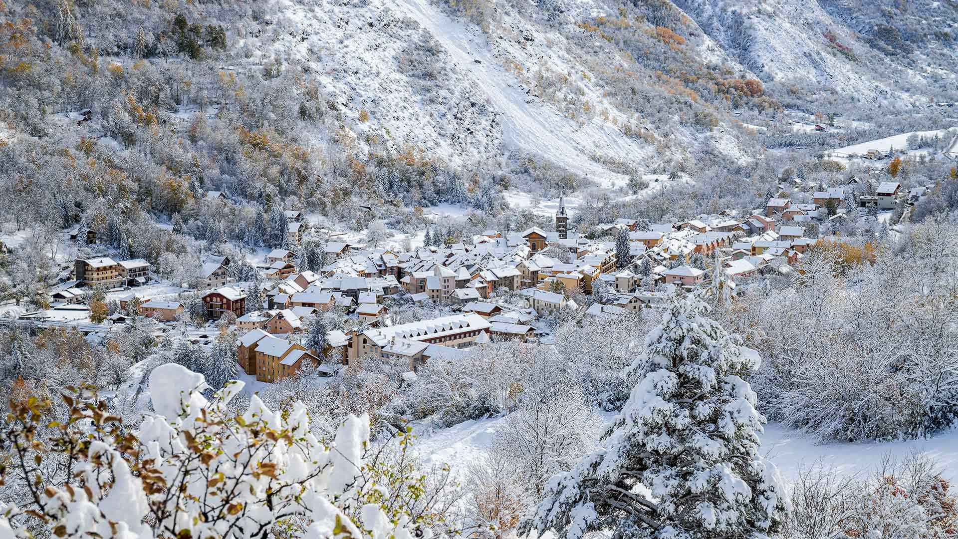
蒂内河畔圣艾蒂安小镇,法国阿尔卑斯省 France, Alpes Maritimes Mercantour National Park, Tinée Vallée, Saint-Etienne-de-Tinée (© CAVALIER Michel/hemis.fr/Alamy Stock Photo)
征服了世界的高山 The mountain wins us over
Saint-Étienne-de-Tinée
Today, head to the Alpes Maritime, in Saint-Etienne-de-Tinée. This small village in the Mercantour National Park, built on the banks of the river and in the hollow of a wide sunny valley, offers a pleasant and peaceful quality of life to residents and holidaymakers. As you stroll through the streets of the village, let yourself be guided by the testimonies of the past: pastel-colored facades, perspective wall paintings, sundials and fountains and much more. If you are lucky enough to be able to push the door of the parish church or the 7 listed chapels, you will discover a religious heritage of great beauty, in particular the murals that attract art lovers from all over the world.
Less than 10 kilometers away, you will find the village resort of Auron which offers a real change of scenery through its undeniable charm. Its beautiful residences, its luxurious chalets, or its traditional barns renovated into magnificent dwellings respect the architecture of its heritage jewel, the St Erige chapel, a listed building that is the pride of the inhabitants of the village. You will appreciate the central square that encircles the ice rink, the cradle of all entertainment and parties after skiing.
For lovers of mountain nature, whether summer or winter, exploring the entire Mercantour National Park is an absolute must. This territory shelters a space of harmony between protection, discovery, local development and respect for traditional activities. Nature deserves attention and respect everywhere: here we admire rather than pick, we observe discreetly without disturbing. The Tinée valley, where today's photo was taken, stretches for around 80 kilometers, from its confluence with the Var, to the sources of the Tinée at the foot of the Col de la Bonette.
圣埃蒂安·德蒂内
今天,前往圣艾蒂安·德·蒂涅的阿尔卑斯海岸。这座位于墨卡托国家公园的小村庄建在河岸上,坐落在一个阳光普照的宽阔山谷的山谷中,为居民和度假者提供了一种愉快而平和的生活质量。当你漫步在村庄的街道上时,让自己被过去的见证所引导:柔和的彩色外墙、透视壁画、日晷和喷泉等等。如果你足够幸运,能够推开教区教堂或列出的7座小教堂的门,你会发现一个非常美丽的宗教遗产,尤其是吸引世界各地艺术爱好者的壁画。
在不到10公里的地方,你会发现奥隆村度假村,它以其无可否认的魅力为你带来了真正的风景变化。它美丽的住宅、豪华的小屋,或被翻新成华丽住宅的传统谷仓,都尊重它的遗产珍宝圣埃里日教堂的建筑,这是一座名单上的建筑,是该村居民的骄傲。你会欣赏环绕着溜冰场的中央广场,它是滑雪后所有娱乐和派对的摇篮。
无论是夏天还是冬天,对于热爱山地自然的人来说,探索整个梅坎托国家公园绝对是必须的。这片土地在保护、发现、当地发展和尊重传统活动之间提供了一个和谐的空间。大自然在任何地方都值得关注和尊重:在这里,我们欣赏而不是挑选,我们谨慎地观察而不打扰。拍摄今天照片的蒂涅河谷绵延约80公里,从它与瓦尔河的交汇处,一直延伸到博内特山脚下的蒂涅源头。
圣米歇尔山,法国诺曼底 The island of Mont-Saint-Michel in Normandy, France (© DaLiu/Getty Images)

圣米歇尔山,法国诺曼底 The island of Mont-Saint-Michel in Normandy, France (© DaLiu/Getty Images)
一个神圣的愿望孕育了第一个小教堂 A saintly vision inspired the first chapel
Mont-Saint-Michel
The stunning sight of Mont-Saint-Michel rising out of the bay is unforgettable. And visiting the island will be too, if you time it right. The paved causeway is accessible only when the tide is out; otherwise, you're at the mercy of the muddy flats, dangerous quicksand, and the quickly rising tide.
Today's visitors are following in the footsteps of pilgrims who for centuries traversed Europe to pray at the sacred site. The local bishop of Avranches built a chapel on this rock in 708 after the archangel St. Michael visited him in a dream, and the rest, as they say, is history. Now the island, half a mile off the coast of Normandy in northwestern France, is a UNESCO World Heritage Site. Its permanent population is fewer than 50 people, including a dozen or so monks and nuns, but more than 3 million visitors cross over to the island most years.
圣米歇尔山
圣米歇尔山从海湾升起的壮观景象令人难忘。如果时间合适的话,去岛上游玩也会很愉快。铺砌的堤道只有在退潮时才能到达;否则,你将任由泥泞的平地、危险的流沙和快速上涨的潮水摆布。
今天的游客正追随几个世纪以来穿越欧洲、在圣地祈祷的朝圣者的脚步。公元708年,大天使圣迈克尔在梦中拜访了阿夫兰切斯的当地主教,之后他在这块岩石上修建了一座小教堂,其余的,正如他们所说的,已经成为历史。现在,这个岛距离法国西北部诺曼底海岸半英里,是联合国教科文组织的世界遗产。该岛的常住人口不到50人,其中包括十几名僧侣和尼姑,但大多数年份有300多万游客前往该岛。
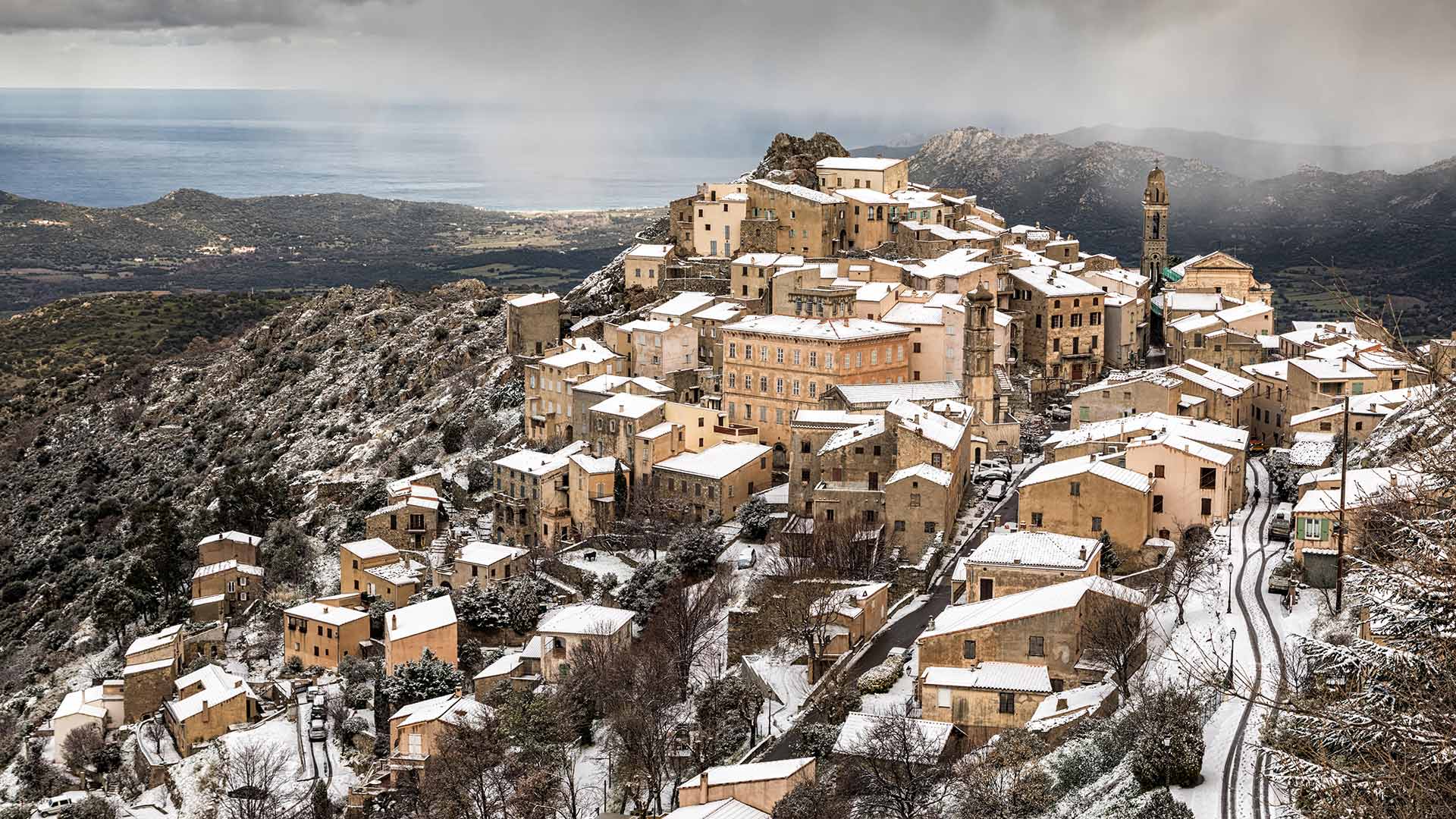
科西嘉岛上的Speloncato市,法国 (© Jon Ingall/Alamy)
投射在安纳西中皇岛墙上的雪景影像,法国上萨瓦省 Winter scene illuminated on the Palais de l'Isle in Annecy, Haute Savoie, France (© blickwinkel/Alamy)
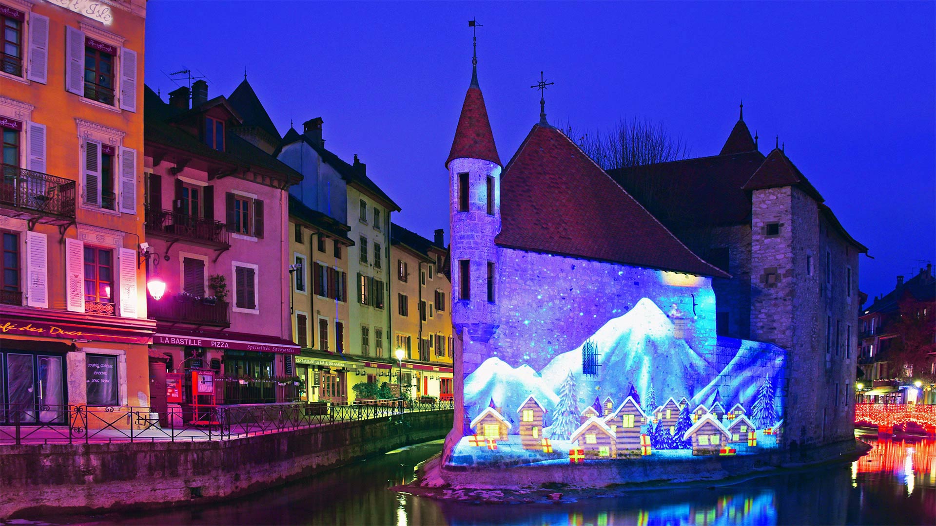
投射在安纳西中皇岛墙上的雪景影像,法国上萨瓦省 Winter scene illuminated on the Palais de l'Isle in Annecy, Haute Savoie, France (© blickwinkel/Alamy)
Illuminating Annecy
Who knew that an 800-year-old structure could look so festive? The pretty holiday illumination you see is adorning the side of the Palais de l'Ile, a distinctive historic building in the town of Annecy, France, high in the French Alps. Designated a historic monument in 1900, the medieval structure is perched on a small islet in the Canal du Thiou.
Over the years, this house 'in the shape of a ship' has served as a palace for local nobility, a prison, a courthouse, an administrative building for the regional government, and today is a museum of local history. The town of Annecy itself, dubbed 'the pearl of the French Alps,' was annexed during the French Revolution. Today it's the largest city in the Auvergne-Rhône-Alpes region of southeastern France. Near the border with Switzerland, the area is also home to Lake Annecy, the third-largest lake in France. It's a popular tourist draw for skiers in winter, and hikers and cyclists in summer.
发光退火
谁知道一座有800年历史的建筑会如此喜庆?你所看到的美丽的假日照明装饰着Palais de l'Ile的侧面,这是法国阿尔卑斯山高处的安纳西镇上一座独特的历史建筑。这座中世纪建筑于1900年被指定为历史遗迹,坐落在杜丘运河的一个小岛上。
多年来,这座“船形”的房子一直是当地贵族的宫殿、监狱、法院、地方政府的行政大楼,今天是当地历史博物馆。被称为“法国阿尔卑斯山明珠”的安纳西镇本身在法国大革命期间被吞并。今天,它是法国东南部奥弗涅-罗恩阿尔卑斯地区最大的城市。靠近瑞士边境,该地区也是法国第三大湖泊安纳西湖的所在地。它是冬季滑雪者、夏季徒步旅行者和骑自行车者的热门旅游景点。
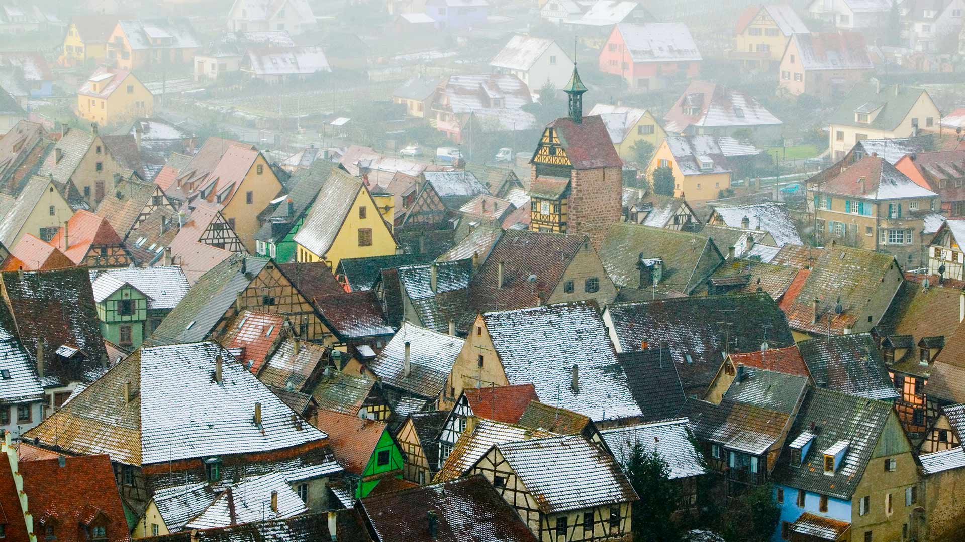
阿尔萨斯的葡萄酒村,法国上莱茵省 (© Walter Bibikow/eStock Photo)
孚日山脉上的国王城堡,法国阿尔萨斯 The Château du Haut-Kœnigsbourg in the Vosges mountains, Alsace, France (© Leonid Andronov/Shutterstock)
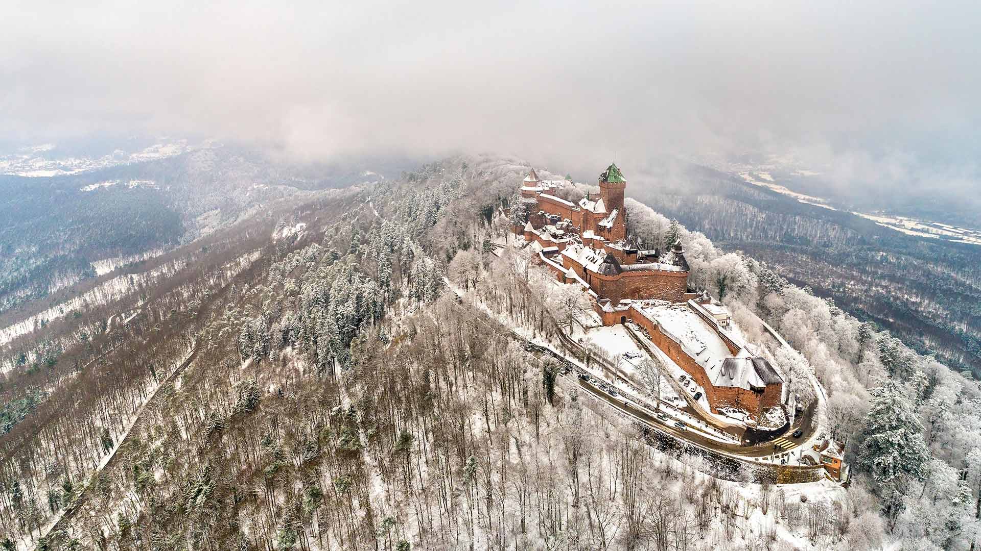
孚日山脉上的国王城堡,法国阿尔萨斯 The Château du Haut-Kœnigsbourg in the Vosges mountains, Alsace, France (© Leonid Andronov/Shutterstock)
Haut-Koenigsbourg Castle
Haut-Koenigsbourg Castle is an old medieval castle left over from the Vosges Mountains in the Alsace region of northeastern France. It has a history of 850 years, and due to its proper preservation, this allows us to see what it looked like back then. Also, you can have an overlook of the city of Alsace from the top of a hill...
The castle was built in the 12th century to monitor the trade routes of silver and wine. It was destroyed in the Thirty Years' War in the 17th century and rebuilt in the early 20th century. Today, it is a popular tourist destination, visited by 500,000 people every year, as a museum displaying medieval weapons and Renaissance frescoes.
上科尼斯堡城堡酒店
上科尼斯堡城堡是法国东北部阿尔萨斯地区沃斯山脉遗留下来的一座古老的中世纪城堡。它有850年的历史,由于它的妥善保存,这使我们能够看到它当时的样子。此外,你可以从山顶俯瞰阿尔萨斯市。。。
这座城堡建于12世纪,用于监控白银和葡萄酒的贸易路线。它在17世纪的30年战争中被摧毁,并在20世纪初重建。今天,它是一个受欢迎的旅游胜地,每年有50万人参观,是一个展示中世纪武器和文艺复兴时期壁画的博物馆。
布列塔尼大区的城市圣马洛,法国 Saint-Malo in Brittany, France (© Mathieu Rivrin/Moment/Getty Images)
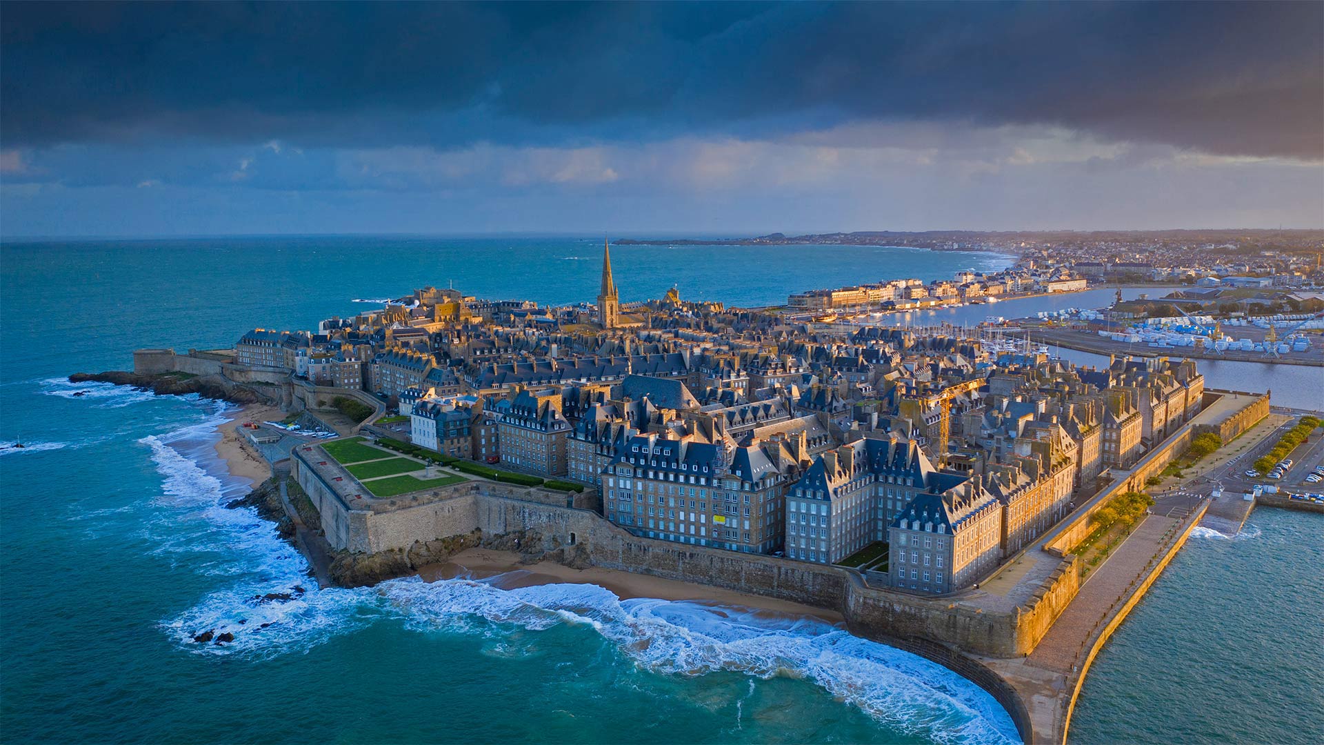
布列塔尼大区的城市圣马洛,法国 Saint-Malo in Brittany, France (© Mathieu Rivrin/Moment/Getty Images)
High tide at the walled city
Saint-Malo was founded by the Gauls more than 2,000 years ago and has an appropriately rich and storied history. Built on the Brittany coast of the English Channel, Saint-Malo became an important stop for ships coming into and out of Western Europe. And because of its strategic location, Saint-Malo was, for a time, a favorite spot for pirates, corsairs, and privateers—as ships made their way through the channel, pirates lurking off the Saint-Malo coast could pounce easily while French authorities looked the other way. Now it's a tourist spot where visitors can walk down the city's historic streets.
城墙上的涨潮
圣马洛由高卢人在2000多年前建立,有着相当丰富的历史。圣马洛位于英吉利海峡的布列塔尼海岸,成为进出西欧船只的重要停靠站。由于其战略位置,圣马洛曾一度是海盗、海盗和私掠者的最爱之地。当船只通过英吉利海峡时,潜伏在圣马洛海岸外的海盗可以轻易地突袭,而法国当局则另眼相看。现在它是一个旅游景点,游客可以在这里沿着城市的历史街区漫步。
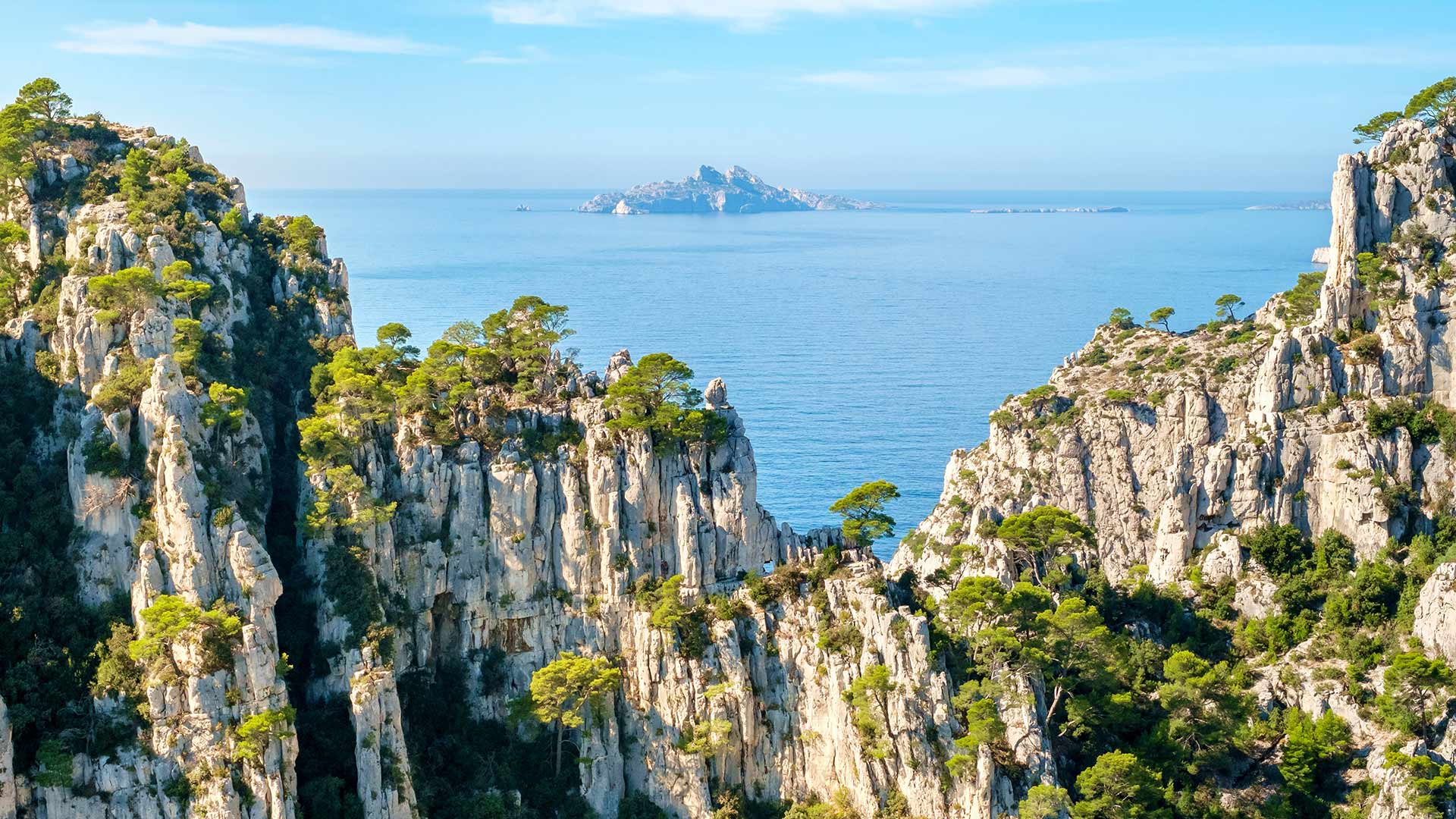
从昂沃峡湾眺望里欧岛,法国马赛 (© Jason Langley/AWL Images/Offset by Shutterstock)
港边的小米努灯塔,法国布雷斯特 Petit Minou Lighthouse in the roadstead of Brest, Finistère, France (© Mathieu Rivrin/Getty Images)
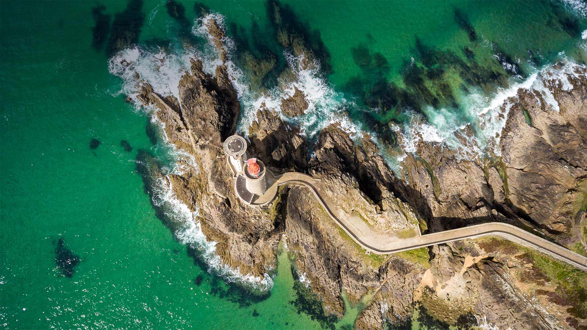
港边的小米努灯塔,法国布雷斯特 Petit Minou Lighthouse in the roadstead of Brest, Finistère, France (© Mathieu Rivrin/Getty Images)
Ambassadors of the airwaves
Today we're visiting the Petit Minou Lighthouse on the coast of northwest France to mark the relationship between lighthouses and the 20th-century technology of amateur radio, commonly known as 'ham' radio. The International Lighthouse and Lightship Weekend (ILLW) is an event set up every August by a group of amateur radio operators from nearly 100 countries. Events for this ILLW weekend are organized online with individual events held at various lighthouses around the world, where 'ham' radio operators gather to broadcast and engage with fellow enthusiasts. The aim of these gatherings is to not only foster goodwill for ham radio around the world, but also to promote awareness of lighthouse preservation and restoration, and to honor the legacy these solitary structures have had on our collective maritime heritage.
广播大使
今天,我们将参观位于法国西北部海岸的小米诺灯塔,以纪念灯塔与20世纪业余无线电技术(俗称“业余无线电”)之间的关系。国际灯塔和灯船周末(ILLW)是每年8月由来自近100个国家的业余无线电操作员组织的活动。本ILLW周末的活动在网上组织,在世界各地的灯塔举办个人活动,“火腿”电台运营商聚集在那里,与其他爱好者一起广播和参与。这些集会的目的不仅是为了在全世界培养对哈姆广播电台的善意,而且也是为了提高人们对灯塔保护和修复的认识,并纪念这些孤零零的建筑在我们的集体海洋遗产中留下的遗产。
