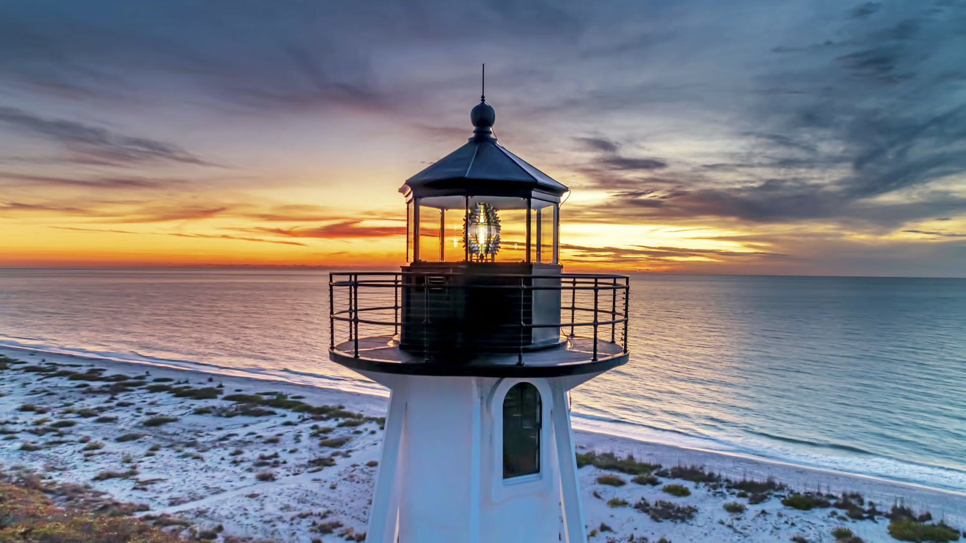
加斯帕里拉岛灯塔后导标灯, 博卡格兰德, 佛罗里达州, 美国 Gasparilla Island Rear Range Light, Boca Grande, Florida (© Wiltser/Getty Images)
加斯帕里拉岛灯塔后导标灯, 博卡格兰德, 佛罗里达州, 美国 Gasparilla Island Rear Range Light, Boca Grande, Florida (© Wiltser/Getty Images)
海岸的密码
国家灯塔日
在GPS尚未为船只导航之前,灯塔就是航海者的重要领航标。每座灯塔都拥有独特的闪光模式,即使在漆黑的夜晚,水手们也能凭此确定自身所处的位置。今天是美国国家灯塔日,正是向这些沿海守护者致敬的良机。1789年,美国国会通过法案,规定所有灯塔由联邦政府统一维护。不论你是历史爱好者、海岸探险者,还是单纯钟爱经典工程建筑的人,这一天都值得你去深入了解灯塔的故事,或与亲朋好友一同参观灯塔。
如同世界上许多灯塔一样,佛罗里达州的加斯帕里拉岛灯塔至今仍屹立于海岸。今日图片中所示的加斯帕里拉岛后方灯塔,有着一段曲折的历史。它最初在特拉华州组装,1927年迁至此地。然而在2014年,这座灯塔被美国海岸警卫队废弃。所幸,这座灯塔在2017年经过修复,2018年再次点亮。如今,它每六秒闪烁一次白光。这两座灯塔均已被列入美国国家史迹名录。灯塔周边区域及其博物馆在特定季节对外开放,向人们讲述这片海域的航运历史。
National Lighthouse Day
Before GPS told ships where to go, lighthouses lit the way—each with its own flash pattern so sailors could figure out where they were, even in total darkness. It's National Lighthouse Day, a perfect excuse to give these coastal workhorses some credit. In 1789, Congress passed a law to make sure all lighthouses were taken care of by the federal government. Whether you're a history buff, coastal explorer, or just into old engineering, today is a great day to learn more about lighthouses or visit one with your friends and family.
Like many lighthouses around the world, Florida's Gasparilla Island Lights still hold their ground. The Gasparilla Island Rear Range Light, seen in today's image, has had quite a journey. Originally assembled in Delaware, it found its forever home here in 1927 but was decommissioned by the Coast Guard in 2014. The lighthouse was restored to its former glory in 2017 and was switched on again in 2018. Today, it blinks white every six seconds. Both lights are listed on the National Register of Historic Places. The lighthouse grounds and museum are open to visitors seasonally, offering insights into the area's shipping past.
拉霍亚的潮汐池, 加利福尼亚州, 美国 Tide pools in La Jolla, California (© Andrew Shoemaker/DanitaDelimont.com)
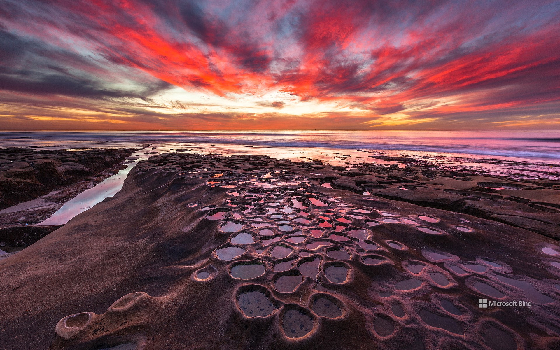
拉霍亚的潮汐池, 加利福尼亚州, 美国 Tide pools in La Jolla, California (© Andrew Shoemaker/DanitaDelimont.com)
潮起潮落 Tide and seek
拉霍亚的潮汐池, 加利福尼亚州
并非每堂科学课都需要在教室里进行。在加利福尼亚州的拉霍亚,退潮后形成的潮池就在你脚下,向你揭示海洋的奥秘。在圣地亚哥这个沿海社区的岩石海岸线上,当潮水退去,海水被困在天然的凹坑中,就形成了潮池。这些浅水池自然分布在拉霍亚的砂岩和礁石之间,尤以风之海海滩、贝壳海滩、南卡萨海滩和医院角附近最为典型。海水停留在这些岩石凹槽中,为海兔、脆皮海星等多样的海洋生物提供了独特的栖息地。潮池的形成要归功于长期的侵蚀作用。海浪日复一日拍击砂岩和石灰岩的海岸,逐渐雕刻出能够蓄水的小坑洼。每天两次,随着潮水的涨落,这些潮池不断被海水淹没又重新显露,内部的生物也因此必须适应极为多变的环境。冬季白天潮水最低,是探索潮池的最佳时机。需要注意的是,这些潮池受到加州《海洋生物保护法》的保护。你可以欣赏这里的美景、观察潮池中的居民并拍照留念,但请不要触碰或打扰其中的任何生物。这是一堂免费的海洋生物课程,正在你眼前生动上演。
Tide pools in La Jolla, California
Not every science lesson requires a classroom. In La Jolla, California, tide pools teach you about ocean life—right at your feet. Along the rocky shoreline of this San Diego coastal neighborhood, tide pools form during low tide as seawater gets trapped in natural depressions. These shallow pools form naturally along La Jolla's rocky shorelines, especially near Windansea Beach, Shell Beach, South Casa Beach, and Hospital Point. The water that remains trapped in sandstone and reef depressions creates habitats for everything from sea hares to brittle stars. Over time, the tide pools are created through the process of erosion—waves hit the sandstone and limestone coastlines until they carve out pockets that hold water. Twice a day, as the tide moves in and out, these spaces flood and drain, challenging the survival skills of everything inside. Winter months, when tides are lowest during daylight hours, are ideal for observing them.
圆顶礁国家公园弗鲁塔附近的岩画, 犹他州, 美国 Petroglyphs near Fruita in Capitol Reef National Park, Utah (© Nicolas VINCENT/Adobe Stock)
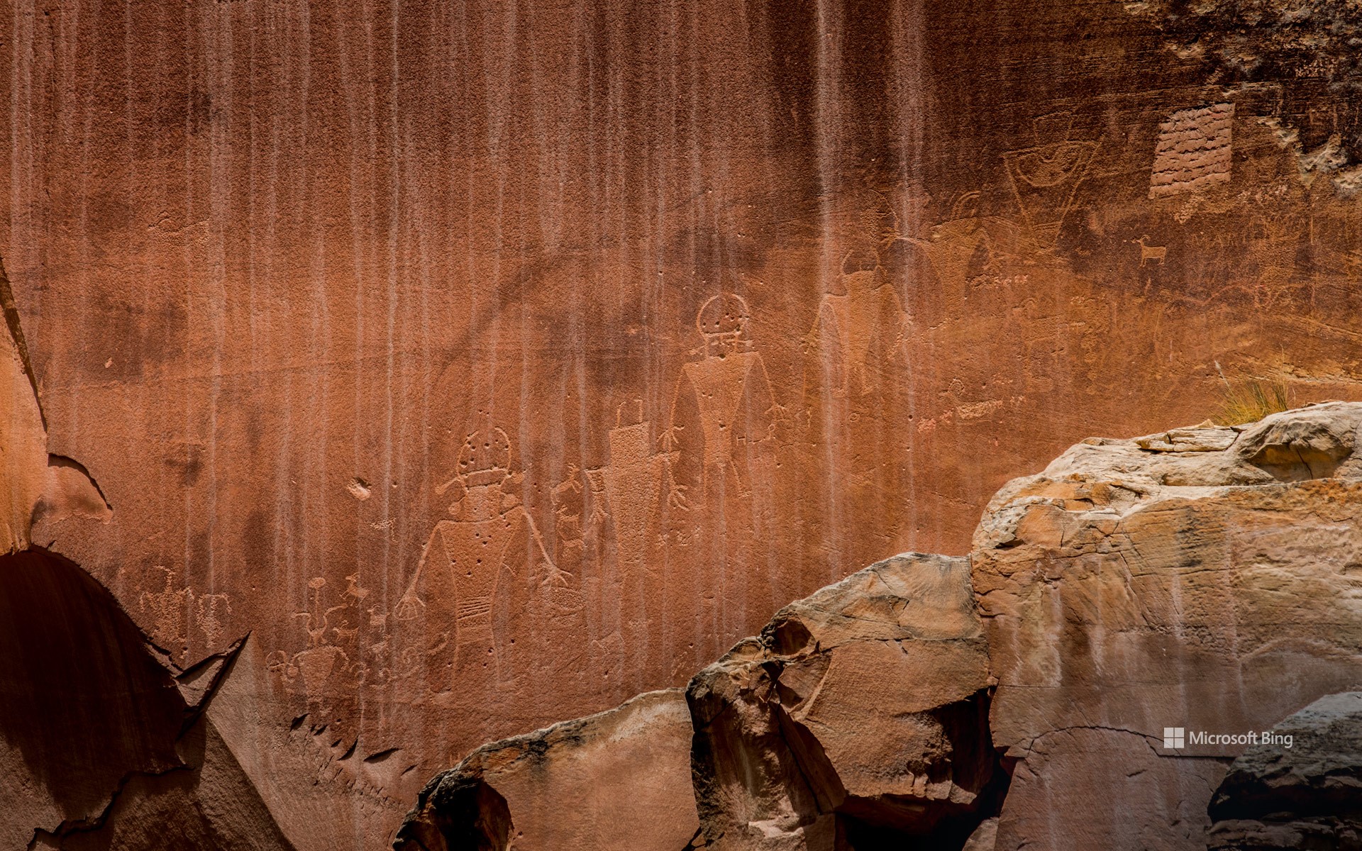
圆顶礁国家公园弗鲁塔附近的岩画, 犹他州, 美国 Petroglyphs near Fruita in Capitol Reef National Park, Utah (© Nicolas VINCENT/Adobe Stock)
古老的岩画 Age-old storyboard
圆顶礁国家公园弗鲁塔附近的岩画, 犹他州, 美国
圆顶礁国家公园拥有一种亘古不变的魅力。在这里,红色的岩石峭壁、蜿蜒的峡谷与古老的故事,在犹他州沙漠的天空下彼此交织。1971年,这里被正式指定为国家公园。它不仅因鲜明的地质景观而引人驻足,更因那刻印在大地上的古老叙事与文化遗产而让人驻足沉思。
早在游客们穿上徒步靴踏上圆顶礁的步道之前,弗里蒙特人和祖先普韦布洛人便已在此居住。从公元300年至1300年,他们在地穴屋和天然岩穴中生活,将农业巧妙地融入狩猎采集的日常。他们与这片土地的联系既具有精神层面的意义,也具备实际的生活用途。他们在此留下了公园最引人注目的遗迹之一:岩画,比如今日图片中在弗鲁塔地区发现的岩画。这些岩画展示了一种古老的视觉语言,刻画着戴头饰、佩珠宝的人形形象,旁边还有大角羊和蜥蜴等动物图案,以及象征仪式、迁徙和天文现象的抽象符号。这些共同构成了一座无声的档案库,记录着那些曾在这片非凡土地上生活、迁徙并赋予其意义的人们的故事。
Petroglyphs near Fruita in Capitol Reef National Park, Utah
There's something timeless about Capitol Reef National Park—a place where red rock cliffs, winding canyons, and ancient stories come together under Utah's desert sky. Designated a national park in 1971, Capitol Reef invites reflection—not just on its vivid geology, but on the ancient narratives and cultural heritage etched into its landscape.
Long before visitors laced up hiking boots and hit the trails at Capitol Reef, the Fremont and Ancestral Puebloan peoples called this place home. Between 300 and 1300 CE, they lived in pit houses and natural rock shelters, weaving farming into their hunter-gatherer lifestyle. Their connection to the land was both spiritual and practical—and they left behind some of the park's most captivating features, including petroglyphs like those found in Fruita, featured in today's image. These rock panels showcase an ancient visual language, featuring human figures adorned with headdresses and jewelry. Alongside them are animals like bighorn sheep and lizards, as well as abstract shapes alluding to ceremonies, migrations, and celestial events. Together, they form a silent archive—a timeless record of the people who lived, moved, and made meaning in this extraordinary landscape.
纳帕利海岸的卡拉劳海滩, 可爱岛, 夏威夷, 美国 Kalalau Beach on the Nā Pali Coast, Kauai, Hawaii (© Russ Bishop/DanitaDelimont.com)
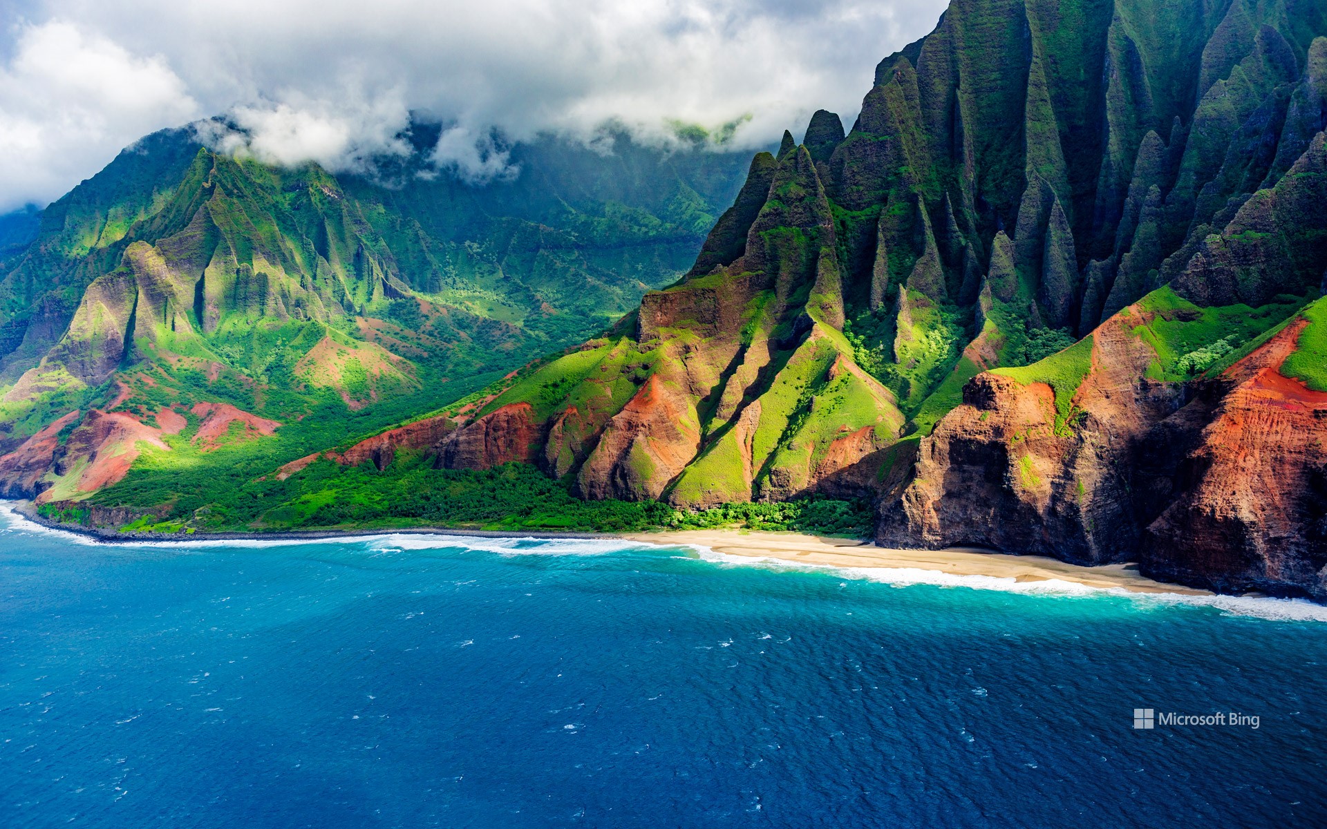
纳帕利海岸的卡拉劳海滩, 可爱岛, 夏威夷, 美国 Kalalau Beach on the Nā Pali Coast, Kauai, Hawaii (© Russ Bishop/DanitaDelimont.com)
远离尘嚣 Off the grid
纳帕利海岸的卡拉劳海滩, 可爱岛, 夏威夷
这里没有路标,也没有纪念品摊位,只有一条长达11英里的泥泞小径、险峻的峭壁以及开阔的视野,通向夏威夷最为偏远的海滩之一。卡拉劳海滩位于考艾岛卡拉劳步道的尽头,是所有辛苦徒步者最终踏上沙滩的奖赏。唯一的陆路就是这条小径,它穿越山谷,沿着海岸峭壁蜿蜒前行。夏季,一些游客会选择划皮划艇抵达,但无论采用哪种方式,所有在此停留的人都需要提前获得许可。
早在露营许可证和生态厕所出现之前,这片偏远的土地便已养育了世代的夏威夷原住民。依靠淡水溪流和肥沃的土壤,早期夏威夷人在这里修筑石砌梯田,种植芋头这种在热带和亚热带广泛栽培的块茎作物。捕鱼、耕作以及与土地之间深厚的精神联系构成了他们的日常生活。至今,神庙遗迹和住宅遗址仍隐藏在山谷的褶皱之中。到了20世纪20年代,由于疾病、西方接触以及土地用途的改变,大多数居民已迁离。近几十年来,一些向往离网生活的人曾来到此地寻求避世,直到州政府实行保护措施。如今的卡拉劳既神圣又迷人,每一波拍岸的海浪都仿佛在低语,诉说着历史的沧桑与传承。
英仙座流星雨和一棵古老刺果松,大盆地国家公园,内华达州,美国 Perseid meteor shower and an ancient bristlecone pine, Great Basin National Park, Nevada (© Wirestock Creators/Shutterstock)
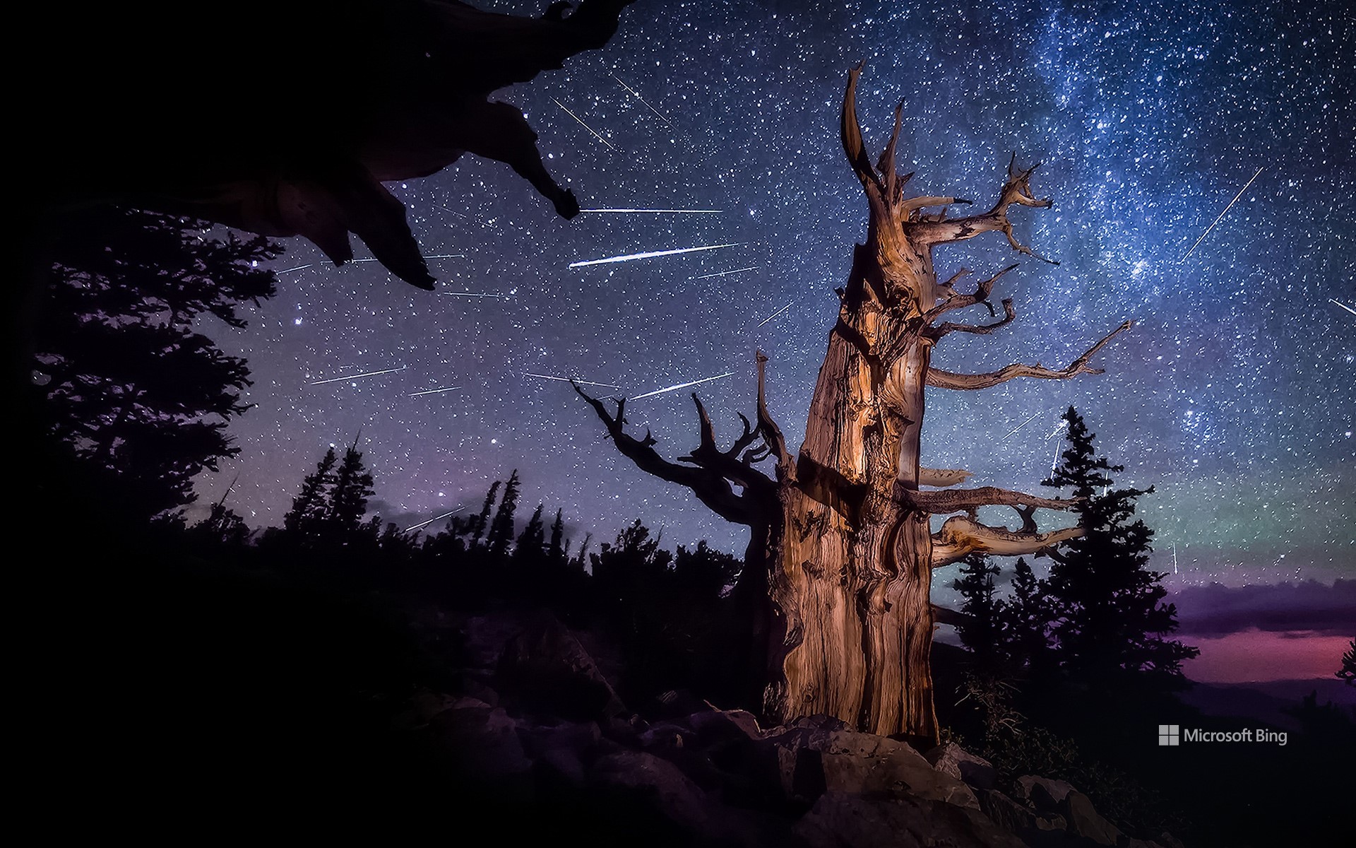
英仙座流星雨和一棵古老刺果松,大盆地国家公园,内华达州,美国 Perseid meteor shower and an ancient bristlecone pine, Great Basin National Park, Nevada (© Wirestock Creators/Shutterstock)
永恒的光芒 Timeless glow
英仙座流星雨照亮内华达
准备迎接一年中最耀眼的天文奇观之一英仙座流星雨吧!该流星雨每年活跃期为7月中旬至8月下旬,而今年的峰值将于8月12日夜间至13日凌晨上演璀璨盛景。当地球穿越彗星斯威夫特-塔特尔留下的冰岩碎片轨道时,形成了这一流星雨。这颗彗星上一次接近地球是在1992年。当这些尘埃颗粒以高速进入地球大气层时,会因摩擦而燃烧,划出一道道明亮的光痕。
若想尽情欣赏这场天文盛宴,北半球至中南纬度地区是最佳观测地点。今日图片所示地点为美国内华达州的大盆地国家公园。这里栖息着地球上最古老的非克隆植物狐尾松。这些树木在风雪与雨水的雕琢下,顽强生存了数千年,年复一年地守候着夜空中这场流星雨的盛会。
Perseid meteor shower over Nevada
Get ready for one of the most dazzling celestial displays of the year—the Perseid meteor shower. Active from mid-July through late August, this year it reaches its spectacular peak on the night of August 12 and into the early hours of August 13. The Perseids light up the skies when Earth passes through a trail of icy and rocky debris left behind by Comet Swift–Tuttle, which last passed close to our planet in 1992. These meteors are called the Perseids because they appear to streak from the direction of the constellation Perseus.
For those hoping to catch a glimpse of this breathtaking show, the Perseid meteor shower is best viewed from the Northern Hemisphere, extending down to the mid-southern latitudes. One such vantage point is Great Basin National Park in Nevada, seen in today's image, where ancient bristlecone pines stand beneath a sky ablaze with shooting stars. These remarkable trees are the oldest non-clonal species on Earth. Shaped by relentless wind, snow, and rain, they've endured for millennia—witnessing ice ages, volcanic eruptions, and the rise and fall of civilizations.
死亡谷国家公园的梅斯基特平原沙丘,加利福尼亚州,美国 Mesquite Flat Sand Dunes in Death Valley National Park, California (© Bryan Jolley/TANDEM Stills + Motion)
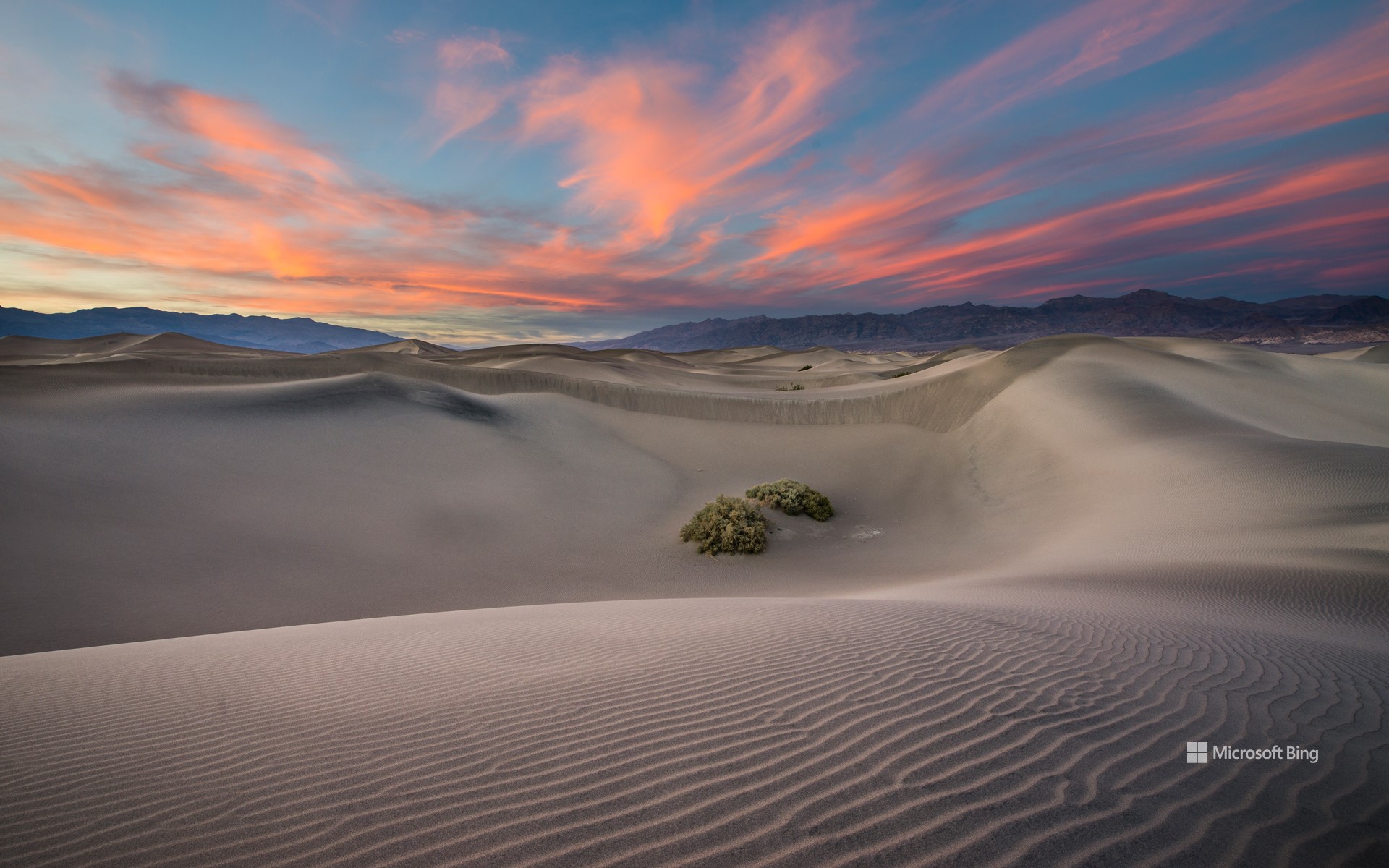
死亡谷国家公园的梅斯基特平原沙丘,加利福尼亚州,美国 Mesquite Flat Sand Dunes in Death Valley National Park, California (© Bryan Jolley/TANDEM Stills + Motion)
时光沙丘 Sands of time
梅斯基特平原沙丘,死亡谷国家公园
梅斯基特平原沙丘位于死亡谷国家公园内的斯托夫派普韦尔斯村附近,是公园内最易到达且最具标志性的沙丘。它们由北侧山脉风化提供的沙源、盛行风的搬运作用,以及南侧山脉的阻挡所共同作用形成,造就了这片波纹起伏的壮美景观。沙丘以在恶劣环境中依旧顽强生长的蜜荆树命名。在日出和日落时分,沙丘的纹理和棱线在光影映照下格外分明,是欣赏日照美景与星空观测的绝佳地点。
死亡谷国家公园占地超过340万英亩,是美国本土面积最大的国家公园。它以极端气温、广袤沙漠景观和多样地貌著称。超过93%的公园区域被指定为荒野保护地,适合进行深度探险,但游客需警惕高温、突发洪水及野生动物等潜在危险。尽管环境恶劣,这片土地却拥有丰富的自然美景与人文历史,包括与在此世代生活的廷比沙肖肖尼原住民深厚的文化渊源。
Mesquite Flat Sand Dunes in Death Valley National Park, California
The Mesquite Flat Sand Dunes, located near Stovepipe Wells Village in Death Valley National Park, are the most accessible and iconic dunes in the park. They are formed by a combination of eroding mountains to the north that supply sand, prevailing winds that move it, and surrounding mountains that trap it from the south—creating a stunning landscape of rippling sand hills. Named after the resilient mesquite trees that grow here, the dunes offer breathtaking views at sunrise and sunset, as well as exceptional stargazing opportunities.
Death Valley National Park, spanning more than 3.4 million acres, is the largest national park in the contiguous United States. It is known for its extreme temperatures, vast desert landscapes, and geological diversity. More than 93% of the park is designated wilderness, offering opportunities for backcountry exploration, though visitors must be cautious of hazards like extreme heat, flash floods, and wildlife. Despite its harsh environment, the park is rich in natural beauty and cultural history, including its deep ties to the Timbisha Shoshone people, who have lived in the region for generations.
彩虹泉州立公园的彩虹河,佛罗里达州,美国 Rainbow River in Rainbow Springs State Park, Florida (© Michel Roggo/Minden Pictures)
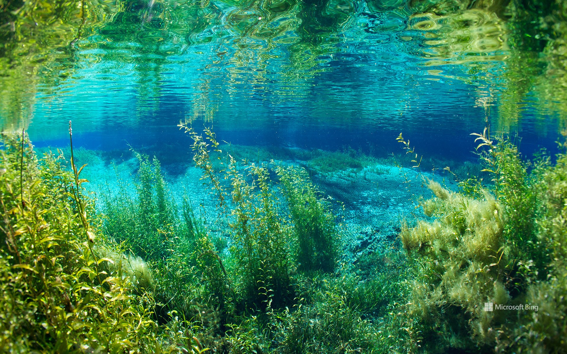
彩虹泉州立公园的彩虹河,佛罗里达州,美国 Rainbow River in Rainbow Springs State Park, Florida (© Michel Roggo/Minden Pictures)
彩虹河的清澈拥抱 The clear embrace of Rainbow River
彩虹泉州立公园的彩虹河,佛罗里达州,美国
坐落于佛罗里达州北部墨西哥湾沿岸的,是彩虹泉州立公园。数百年来,这片区域一直作为自然资源,为人类与动物所依赖。穿越公园蜿蜒流淌的彩虹河,正是其中的关键生态要素。河水源自佛罗里达州最大型的泉水之一彩虹泉,其水体汇集自770平方英里的广阔集水区,最终流入威特拉库奇河。
彩虹河清澈见底,全年水温恒定在72华氏度,非常适合游泳与浮潜。公园的历史可以追溯到19世纪80年代末,当时在该地区发现了硬岩磷矿,掀起了一场短暂而热烈的繁荣时期。受磷矿开采推动,一个名为朱丽叶的小型社区迅速在泉水周边发展起来。进入20世纪60年代,该地区逐渐转型为旅游胜地,推出了玻璃底船、单轨列车系统,甚至还有马术表演等游客娱乐项目。如今,游客可以探访这里的观赏花园、瀑布和步道,并近距离观察栖息于此的丰富野生动植物群落,感受这片水域的魅力。
Rainbow River, Rainbow Springs State Park, Florida
Nestled in the northern Gulf Coast of Florida, is Rainbow Springs State Park. This area has served as a natural resource for humans and animals for centuries, with the Rainbow River—flowing through the park—playing a major role. The gently winding waterway is fed by Rainbow Springs, one of Florida's largest springs. The water that bubbles up here comes from a 770-square-mile area and eventually flows into the Withlacoochee River.
The Rainbow River's transparent waters are perfect for swimming and snorkeling, and they maintain a constant temperature of 72°F year-round. The park's history dates to the late 1880s, when hard rock phosphate was discovered in the area, leading to a boomtown era. This period saw the rapid growth of a small community called Juliette near the springs, driven by the phosphate mining industry. During the 1960s, the park emerged as a popular tourist destination, featuring glass-bottom boat rides, a monorail system, and even a rodeo. Today, visitors can explore the ornamental gardens, waterfalls, and walking paths, and enjoy the diverse wildlife that calls Rainbow Springs home.
精致拱门, 拱门国家公园, 犹他州, 美国 Delicate Arch, Arches National Park, Utah (© mmac72/Getty Images)
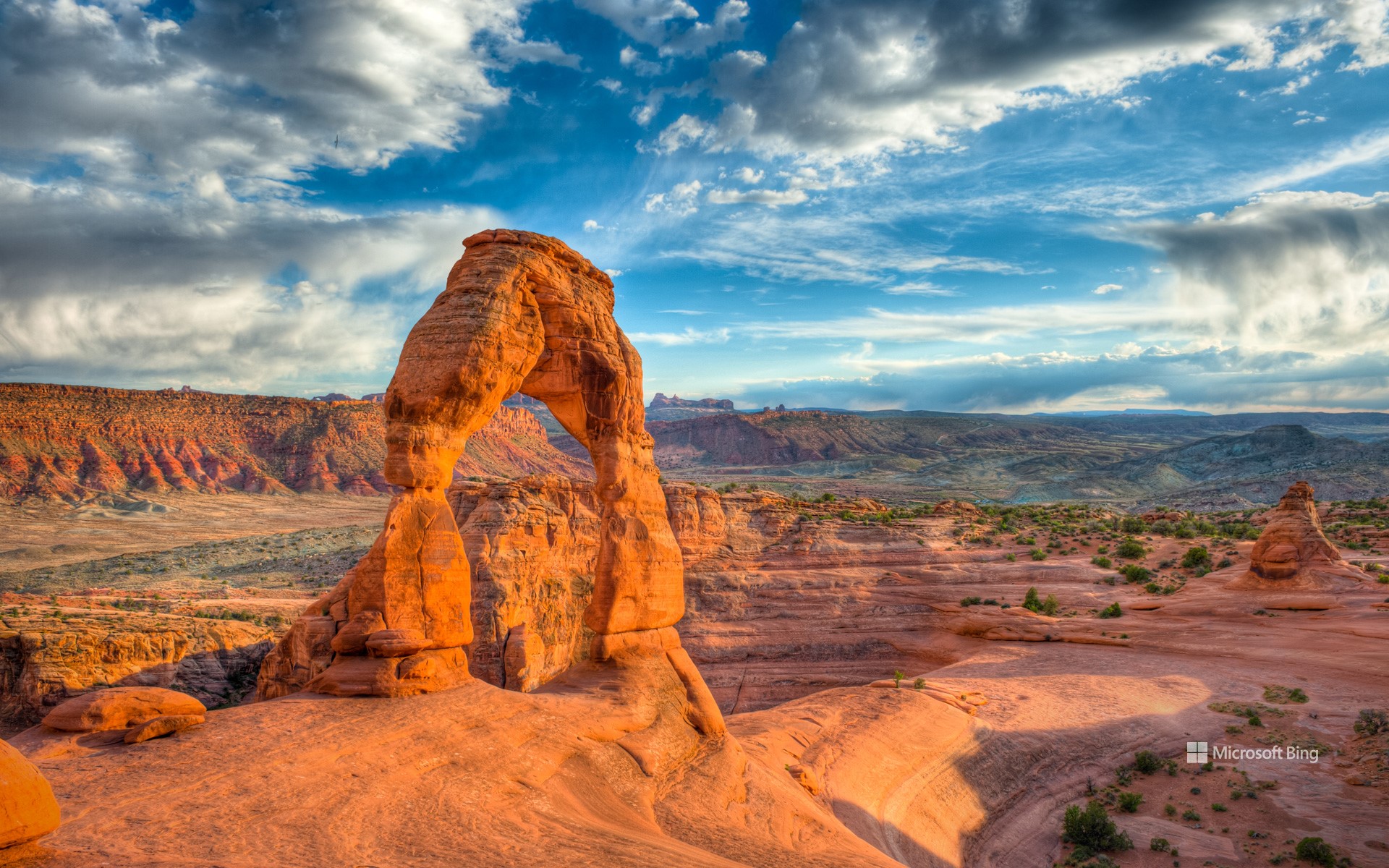
精致拱门, 拱门国家公园, 犹他州, 美国 Delicate Arch, Arches National Park, Utah (© mmac72/Getty Images)
大自然的耐心之作 Nature took its time
精致拱门, 拱门国家公园, 犹他州, 美国
这片景观并非一朝一夕形成,而是大自然历经漫长岁月的雕琢之作。你在美国犹他州拱门国家公园所见的一切,是3亿多年间地壳抬升、风化与侵蚀共同作用的结果。这些天然拱门最初由古海洋遗留下的盐层构成,在时间推移中,砂岩层开裂、位移并不断风化,最终形成了超过2000座天然拱门。这些地貌主要由恩特拉达砂岩与纳瓦霍砂岩构成。该地区于1929年被认定为国家纪念地,并于1971年正式升格为国家公园。
其中最著名的拱门,便是今日图像所展示的精致拱门。它是美国西南部最具代表性的天然拱门之一。早期曾被称为“马裤”或“盐溪拱门”,直到1930年代,一次科学考察团队将其描述为“外观精致”,从而得名“精致拱门”。如今,精致拱门已成为犹他州的非官方象征,频繁出现在该州车牌、广告宣传,甚至印在1996年为纪念犹他建州百年而发行的美国邮票上。前往精致拱门需完成一段中等难度的徒步路线,途中需攀登光滑岩面,贴近悬崖边缘前行。无论你是地质爱好者,还是寻求壮丽自然景观的旅行者,这座拱门都将为你带来难以忘怀的震撼体验。
Delicate Arch in Arches National Park, Utah
This landscape wasn't built overnight—nature took its time to craft it. What you see at Arches National Park in Utah, is the result of over 300 million years of erosion, uplift, and weathering. Over time, layers of sandstone cracked, shifted, and slowly wore away, revealing more than 2,000 natural arches. The formations are made mostly of Entrada and Navajo sandstone. The area was recognized as a national monument in 1929 and was upgraded to national park status in 1971.
The distinctive shape of Delicate Arch, seen here, has made it one of the most recognizable natural arches in the Southwest. Originally known by several other names—including the Chaps and Salt Wash Arch—it wasn't officially called Delicate Arch until the 1930s. It is Utah's unofficial mascot, appearing on everything from state license plates to a US postage stamp issued in 1996 to mark 100 years of Utah statehood. The arch is accessible via a moderately difficult hike that climbs over bare rock and skirts steep drop-offs. Whether you're a geology enthusiast or simply looking for a view worth the effort, Delicate Arch delivers.
坎伯兰岛国家海岸的海滨森林,乔治亚州,美国 Maritime forest in Cumberland Island National Seashore, Georgia (© Chris Moore/TANDEM Stills + Motion)
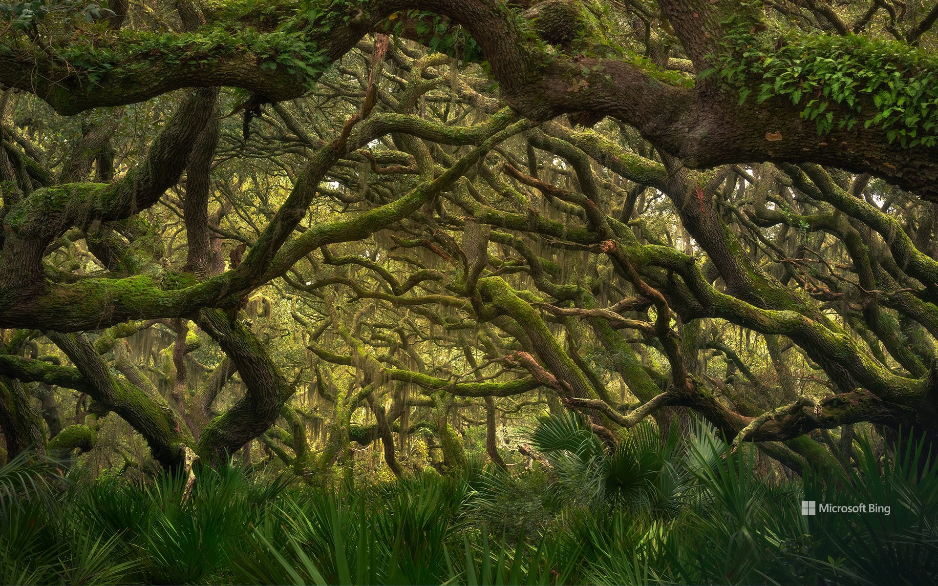
坎伯兰岛国家海岸的海滨森林,乔治亚州,美国 Maritime forest in Cumberland Island National Seashore, Georgia (© Chris Moore/TANDEM Stills + Motion)
海岸静谧,野性依旧 Coastal quiet, untamed life
坎伯兰岛国家海岸的海滨森林,乔治亚州,美国
在你踏上沙滩之前,便能听见海风中树叶的沙沙声、扭曲树干的嘎吱响,以及仿佛来自古老世界的低语。欢迎来到乔治亚州大西洋海岸最南端坎伯兰岛国家海岸的海滨森林。面对盐雾、沙土与飓风的挑战,这里的树木依旧坚定屹立。南方红橡树弯而不折,锯叶棕榈如同绿叶护卫般贴地而生,西班牙苔藓则似大自然的流苏垂挂于树枝之上。这片海洋森林是美国现存最完整的此类稀有生态系统之一。得益于坎伯兰岛被划定为国家海岸,其生态得以避免其他海岸地区常见的城市化侵蚀。
你眼前所见的,正是数百年来始终如一的森林景貌,仅留下苏格兰裔美籍工业家托马斯·卡内基当年的遗迹,以及偶尔穿行林间的野马。这些马匹是早期定居者留下的家畜后代,如今已成为岛上的“非官方吉祥物”。 除了野马之外,这片森林中还栖息着丰富的野生动物,例如在灌木丛中挖掘的犰狳、在树干上啄击的啄木鸟,以及在林下活动的浣熊。沿着南端步道或平行步道等小径穿行于茂密的植被之中,行进途中不时可见沼泽地貌或隐藏的历史遗迹。所以,下次当你想到海岸时,请记住:真正的故事未必发生在海浪边,有时,它就深藏在沙丘之后。
Maritime forest in Cumberland Island National Seashore, Georgia
Before you hit the beach, you'll hear it—the rustle of leaves in salty air, the creak of twisted trunks, the hush of an old world. Welcome to the maritime forest of Cumberland Island National Seashore on the southernmost stretch of Georgia's Atlantic coast. Salt spray, sandy soil, hurricanes? The trees here stand their ground. Live oaks bend but don't break. Saw palmettos crowd the ground like leafy bodyguards, while Spanish moss hangs from branches like nature's fringe. This maritime forest is one of the best remaining examples of this rare habitat in the United States. Thanks to its national seashore status, the island has been spared from the concrete creep seen on other coastlines.
What you see here is the forest as it's been for centuries—a few ruins from the days of Scottish American industrialist Thomas Carnegie and the occasional feral horses grazing through. The horses are descendants of animals left by settlers long gone, and they're now unofficial mascots of the area. Alongside them, you might spot armadillos digging through the undergrowth, woodpeckers hammering tree trunks, or raccoons engaging in tiny heists. Trails like the South End Trail or the Parallel Trail weave through dense foliage, sometimes giving glimpses of marshes or hidden historic sites. So next time you think of the coast, remember: the real drama isn't always on the shore. Sometimes, it's rooted just beyond the dunes.
奇索斯山脉,大弯国家公园,德克萨斯州,美国 Chisos Mountains, Big Bend National Park, Texas (© Dean Fikar/Getty Images)
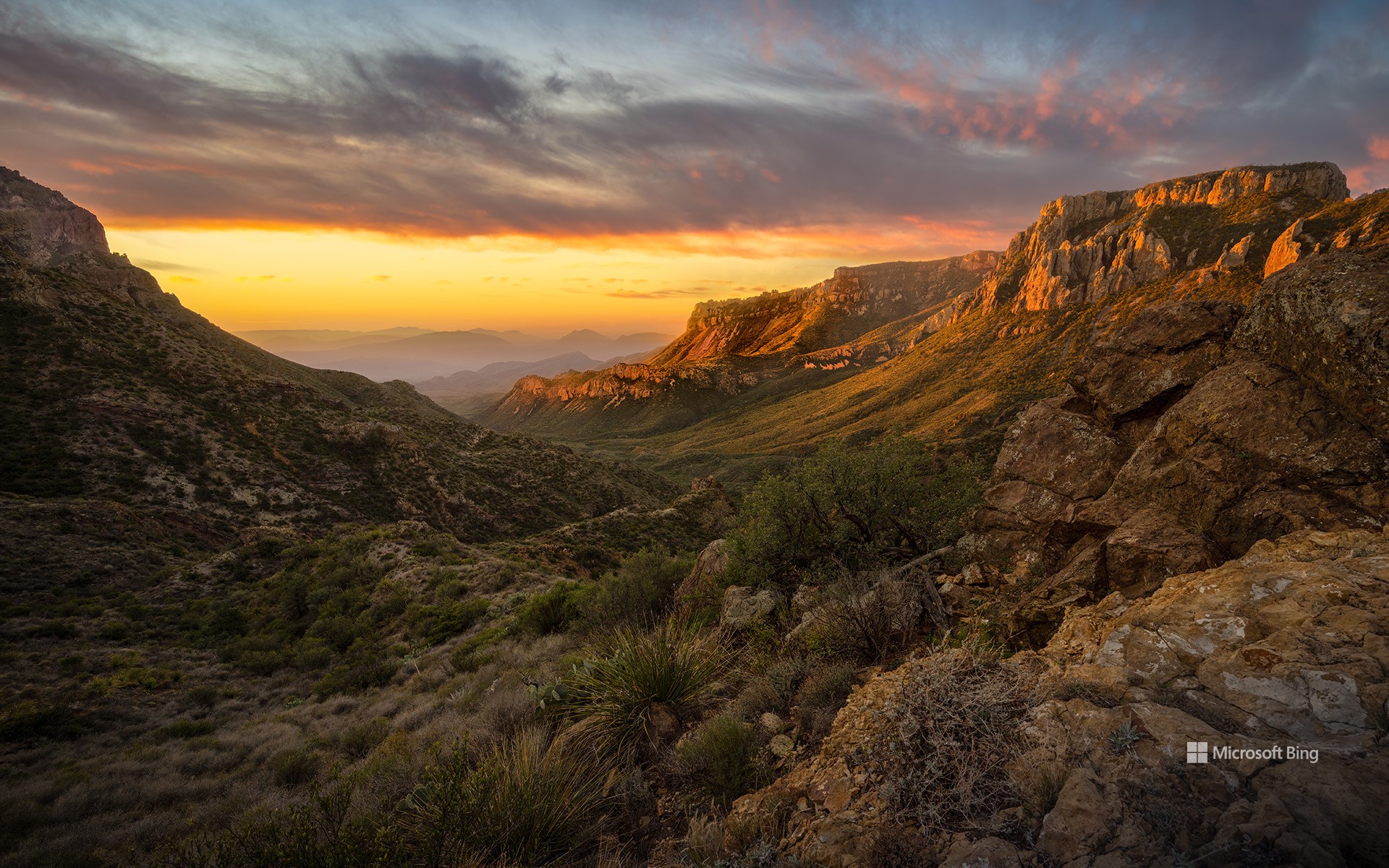
奇索斯山脉,大弯国家公园,德克萨斯州,美国 Chisos Mountains, Big Bend National Park, Texas (© Dean Fikar/Getty Images)
星空、岩石与孤寂 Stars, stone, and solitude
大弯国家公园迎来81周年
人们常说:“德州的一切都更大。”而大弯国家公园正是对这句话的最佳注解。这片占地801,163英亩的广袤区域,最初属于墨西哥领土,1848年并入美国。自20世纪30年代起,该地区的自然景观便受到保护,并于1944年6月12日正式被指定为国家公园。大弯国家公园是美国最偏远、游客最少的国家公园之一。它并非由单一地貌构成,而是三种景观的综合体:奇瓦瓦沙漠、奇索斯山脉和格兰德河。公园地处美墨边境,其历史也体现出文化交融的特征:原住民、西班牙探险者、牧场主、矿工和游客皆曾在此留下足迹。岩画、历史遗迹和古道见证了这片土地在成为国家公园之前就已拥有深厚历史。
公园内生物多样性极为丰富,记录有超过1,200种植物、超过450种鸟类,以及多种哺乳动物、爬行动物和两栖动物。你可能会看到一只走鹃迅速穿越沙尘,或是一只山猫悄然穿行于灌木之间。此外,大弯国家公园也被评为美国最佳暗夜公园之一。游客在此可观赏到银河、行星和满天繁星构成的璀璨星空。
Big Bend National Park in Texas turns 81
They say everything's bigger in Texas—and Big Bend National Park has been living up to the slogan since forever. Efforts to preserve this 801,163-acre area of West Texas began in the 1930s and culminated in its official designation as a park on June 12, 1944. Big Bend remains one of the most remote and least-visited national parks in the country. It's not just one landscape, it's three: the Chihuahuan Desert, the Chisos Mountains (pictured here), and the Rio Grande. Big Bend sits on the US–Mexico border, and its history reflects that blend. Indigenous peoples, Spanish explorers, ranchers, miners, and modern travelers have all left their footprints. Petroglyphs, ruins, and old trails show the land's story began long before it became a park.
The park is home to over 1,200 species of plants, more than 450 species of birds, and a wide variety of mammals, reptiles, and amphibians. You might spot a roadrunner zipping across the dirt, or a bobcat silently slipping through the underbrush. Additionally, it has been designated as one of the best dark-sky parks in America, offering views of the Milky Way, planets, and constellations.
