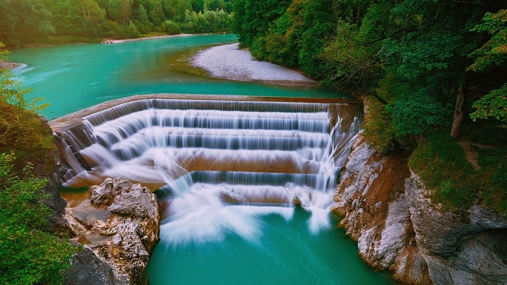
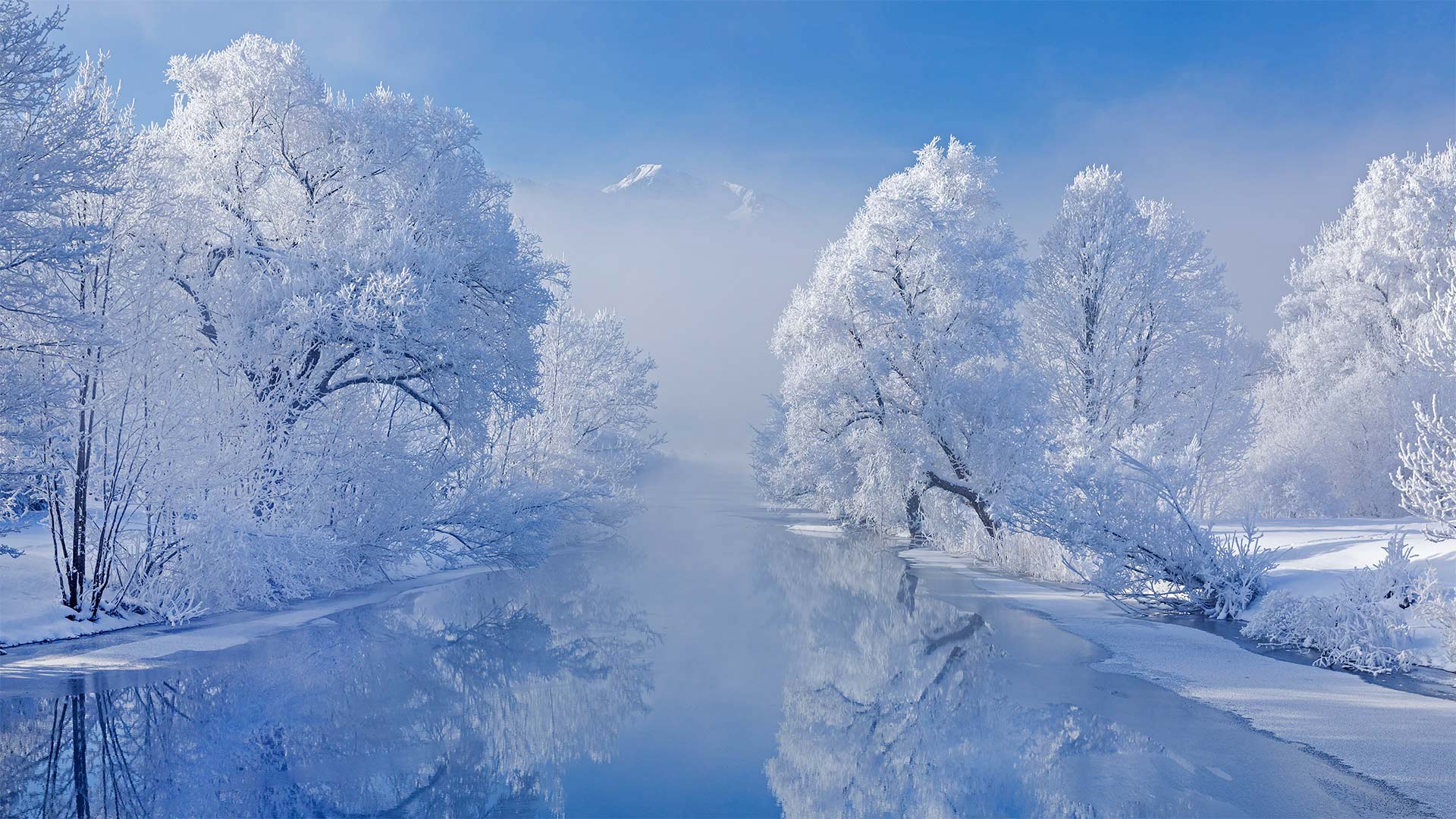
福森市的莱西瀑布,德国拜仁州 (© Sergej Razvod/agefotostock)
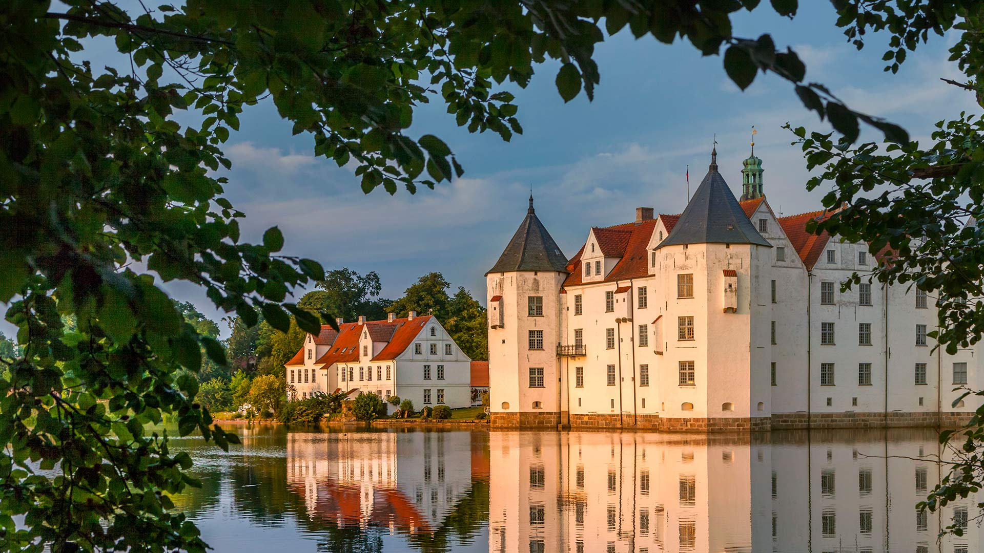
护城河边的格吕克斯堡城堡,德国 (© Christian Back/eStock Photo)
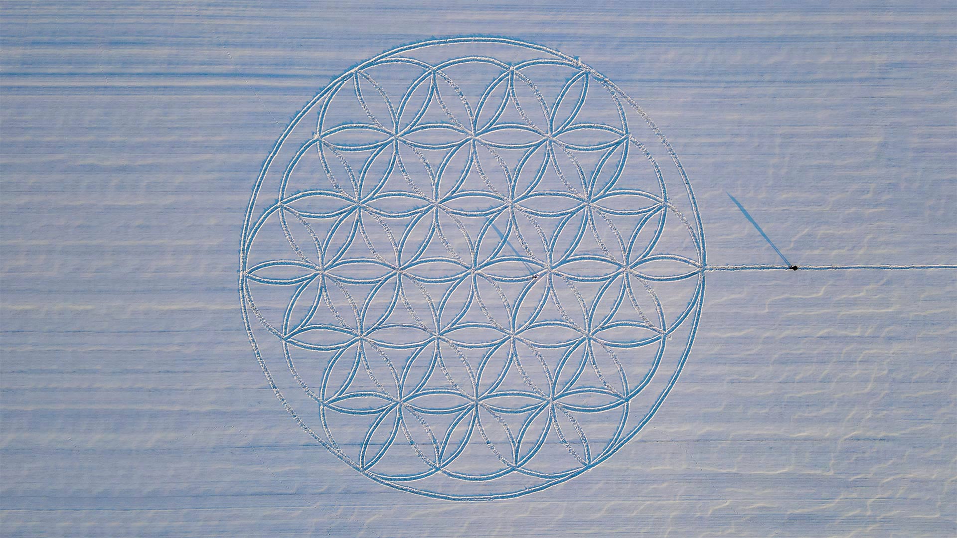
艺术家迈克尔·乌伊在雪地上绘制的“生命之花”符号, 德国勃兰登堡雅各布斯多夫 The 'Flower of Life' symbol drawn in the snow by artist Michael Uy, Jacobsdorf, Brandenburg, Germany (© Patrick Pleul/picture alliance via Getty Images)
艺术家迈克尔·乌伊在雪地上绘制的“生命之花”符号, 德国勃兰登堡雅各布斯多夫 The 'Flower of Life' symbol drawn in the snow by artist Michael Uy, Jacobsdorf, Brandenburg, Germany (© Patrick Pleul/picture alliance via Getty Images)
Flower of Life symbol drawn in snow
German artist Michael Uy created this 'Flower of Life' geometric pattern in the snow in Brandenburg. Preparations began about a week before the snow's arrival, when Uy hammered 19 wooden posts into a field, carefully measuring the space between each post. After the snowfall, he walked near-perfect circles around all 19 pillars, using a string to keep an equal distance from the posts. The artist then used a broom to further remove the snow from his footprints and reveal the lines of the flower nearly 200 feet across. Uy's piece was fully visible only when the sun was low. And only until the next snow or warm day. Luckily, a drone was dispatched to snap this photograph.
The 'Flower of Life' is an ancient symbol long revered by various cultures around the world, from ancient Assyrians to modern pagans. The pattern is believed by some to be a visual representation of interconnectivity, energy, and harmony, by others to be a key to unlocking secrets of the universe. And hey, it looks cool. Especially on ice.
生命之花的象征画在雪地上
德国艺术家迈克尔·乌伊(Michael Uy)在勃兰登堡(Brandenburg)的雪中创造了这种“生命之花”几何图案。准备工作在大雪到来前大约一周开始,Uy将19根木桩锤入一块场地,仔细测量每根木桩之间的间距。下雪后,他绕着所有19根柱子几乎完美地走了一圈,用绳子与柱子保持相等的距离。然后,艺术家用扫帚进一步清除脚印上的积雪,并展示了近200英尺宽的花朵线条。乌伊的作品只有在太阳很低的时候才完全可见。直到下一场雪或温暖的一天。幸运的是,一架无人机被派去拍这张照片。
“生命之花”是一种古老的象征,从古代亚述人到现代异教徒,世界各地的各种文化都长期尊崇它。一些人认为这种模式是互联、能量和和谐的视觉表现,另一些人则认为它是解开宇宙秘密的钥匙。嘿,看起来很酷。尤其是在冰上。
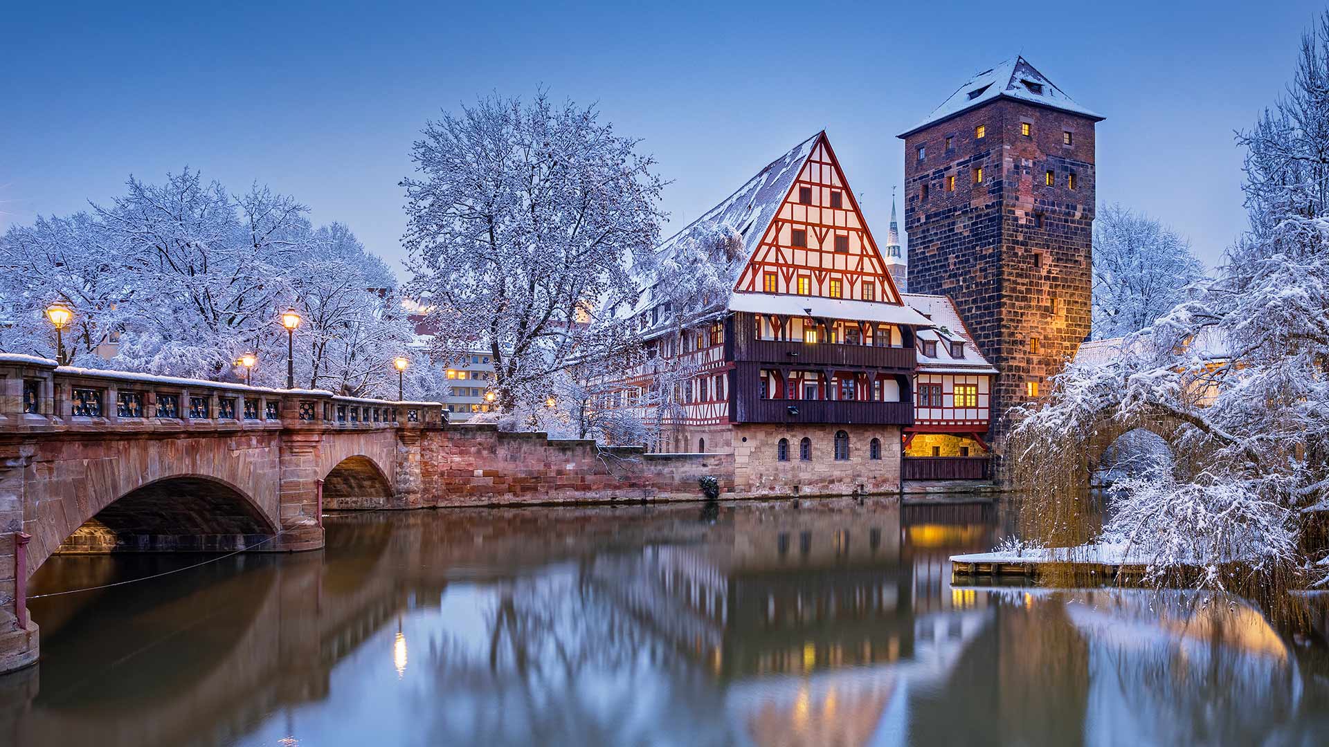
佩格尼茨河上的葡萄酒窖,德国纽伦堡 (© Reinhard Schmid/Huber/eStock Photo)
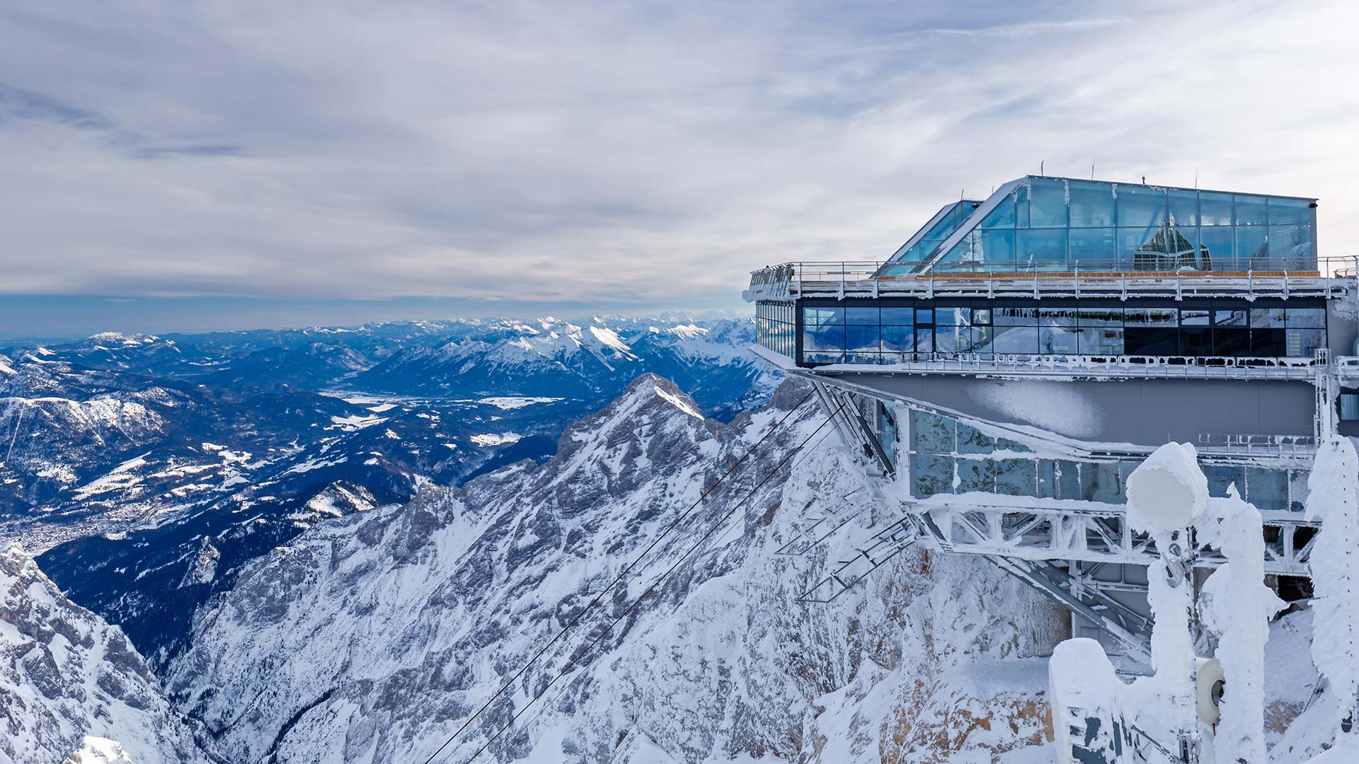
楚格峰山顶的缆车站,德国格赖瑙市 Cable car station at the summit of Zugspitze mountain in Grainau, Garmisch-Partenkirchen, Germany (© Robert Jank/Alamy)
楚格峰山顶的缆车站,德国格赖瑙市 Cable car station at the summit of Zugspitze mountain in Grainau, Garmisch-Partenkirchen, Germany (© Robert Jank/Alamy)
位于德国最高的山上 On the highest mountain in Germany
Cable car station of Zugspitze
A trip to the Zugspitze is currently still an icy pleasure, but those who decide to take the Zugspitze cable car to Germany's highest peak these days will be rewarded with a stunning Alpine panorama at 2,962 meters in clear weather. The cable car takes about 10 minutes from the valley station on the eastern bank of Eibsee to the mountain station on the Zugspitz summit.
The Zugspitze cable car is one of the most modern cable cars in the world. It opened on December 21, 2017 and replaced the Eibsee cable car, which operated on almost the same route until April of the same year. The new project was mainly decided to increase the transport capacity. While the old cable car took 300 people per hour to the summit, the new cable car takes 580 people.
祖格斯皮茨缆车站
到祖格斯皮茨山旅行目前仍然是一种冰上的乐趣,但那些决定在这些天乘坐祖格斯皮茨缆车前往德国最高峰的人,将在晴朗的天气下在2962米处欣赏到令人惊叹的阿尔卑斯山全景。缆车从Eibsee东岸的山谷站到祖格斯皮茨山顶的山站大约需要10分钟。
Zugspitze缆车是世界上最现代化的缆车之一。它于2017年12月21日开通,取代了Eibsee缆车,该缆车在几乎相同的路线上运行,直到同年4月。新项目主要是为了增加运输能力。旧的缆车每小时能载300人到达山顶,而新的缆车能载580人。
贝希特斯加登阿尔卑斯山脉全景,德国巴伐利亚州 Panoramic view of the Berchtesgaden Alps, Bavaria, Germany (© Spotcatch/Westend61/Offset)
贝希特斯加登阿尔卑斯山脉全景,德国巴伐利亚州 Panoramic view of the Berchtesgaden Alps, Bavaria, Germany (© Spotcatch/Westend61/Offset)
冬日阿尔卑斯山脉的高峰 Peak winter in the Alps
Berchtesgaden Alps, Germany
Rising out of the Bavarian mists near Germany’s border with Austrian are the Berchtesgaden Alps, which surround the market town of the same name. This pristine mountain landscape is popular with mountaineers and hikers, who have plenty of peaks to choose from. Berchtesgaden National Park, established in 1978, accommodates nine mountain ranges over 81 square miles, including the dominant Watzmann, one of Germany’s tallest mountains which reach 8,901ft (2,713m) at its highest point.
Berchtesgaden is the only Alpine national park in Germany and protects a varied landscape including deep forests, rugged cliffs, and glaciers as well as green valleys and pastures – complete with diverse plants and wildlife. Also hidden somewhere beneath that thick cloud lies the emerald-green Königssee, one of Germany’s highest and most photogenic lakes, nestled within steep mountain walls.
德国贝赫特斯加登阿尔卑斯山
从德国和奥地利边境附近的巴伐利亚薄雾中升起的是贝赫特斯加登阿尔卑斯山,它环绕着同名的集镇。这种原始的山景深受登山者和徒步旅行者的欢迎,他们有很多山峰可供选择。贝赫特斯加登国家公园建于1978年,共有九座山脉,面积超过81平方英里,其中包括占主导地位的瓦茨曼山脉,这是德国最高的山脉之一,最高点达8901英尺(2713米)。
Berchtesgaden是德国唯一的阿尔卑斯山国家公园,保护着各种各样的景观,包括深林、崎岖的悬崖、冰川、绿色的山谷和牧场,以及各种各样的植物和野生动物。在这片厚厚的云层下,还隐藏着翡翠绿色的克尼希湖,它是德国最高、最上镜的湖泊之一,坐落在陡峭的山墙内。
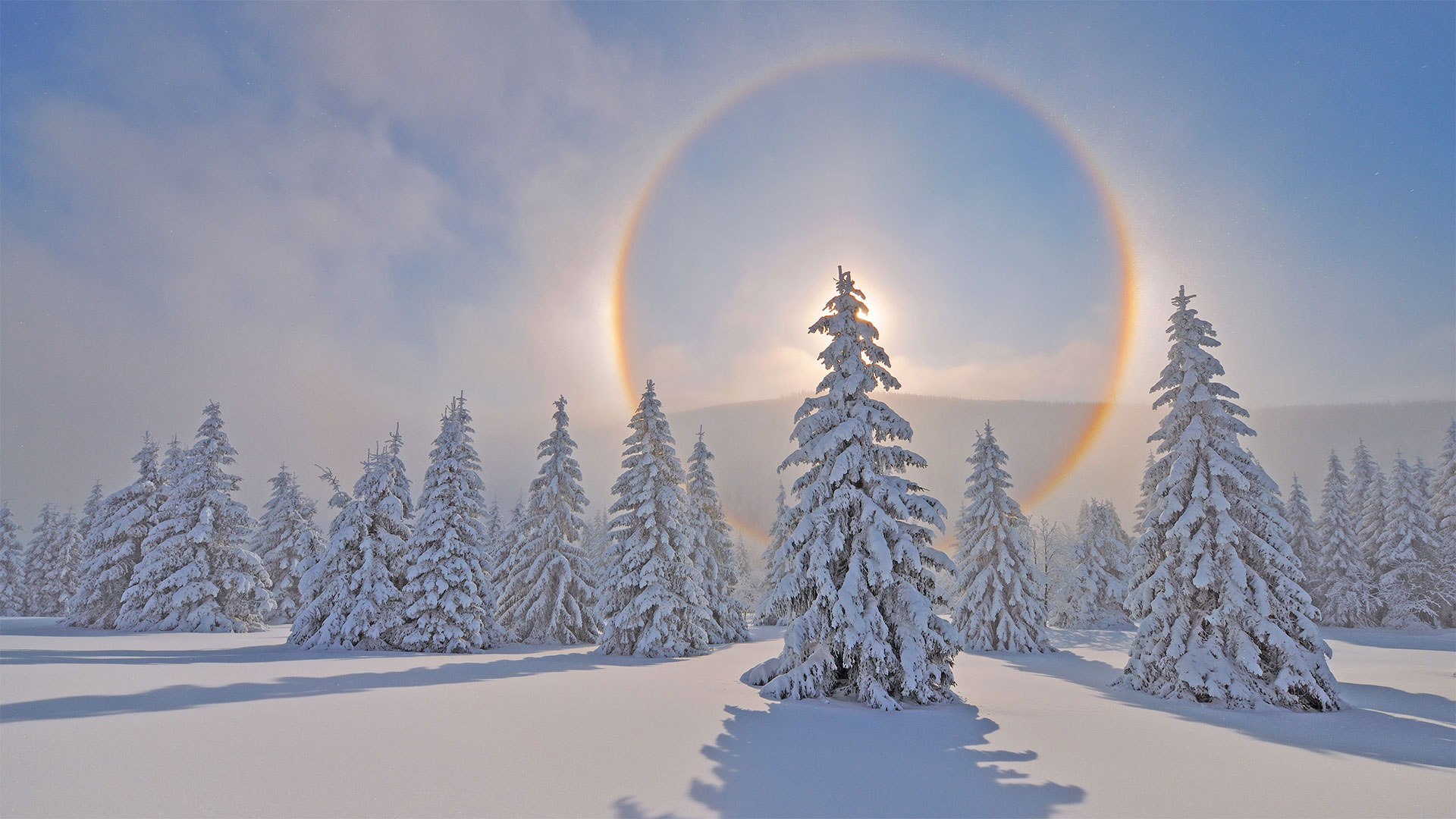
厄尔士山脉上的光晕,德国萨克森州 Halo around the sun in the Ore Mountains, Saxony, Germany (© Martin Ruegner/Getty Images)
厄尔士山脉上的光晕,德国萨克森州 Halo around the sun in the Ore Mountains, Saxony, Germany (© Martin Ruegner/Getty Images)
Halo around the sun
What do you call a rainbow formed by ice? An icebow, of course. Others call the phenomenon a halo, and we'll admit it does have a mystical aura. It happens in locales where the bitter cold persists despite the shining sun, like here in the Ore Mountains of Germany. When the conditions are just right, tiny ice crystals in the air will refract light into a colorful halo around the bright sun. It's a perfect complement to the snow angels you're yearning to make in this pristine blanket of white.
太阳周围的光晕
冰形成的彩虹叫什么?当然是冰山。其他人称这种现象为光环,我们承认它确实有神秘的光环。这种情况发生在尽管阳光灿烂,但严寒依然持续的地方,比如德国的俄勒冈州。当条件合适时,空气中的微小冰晶会在明亮的太阳周围折射出五颜六色的光晕。这是一个完美的补充雪天使,你渴望在这个原始的白色毯子。
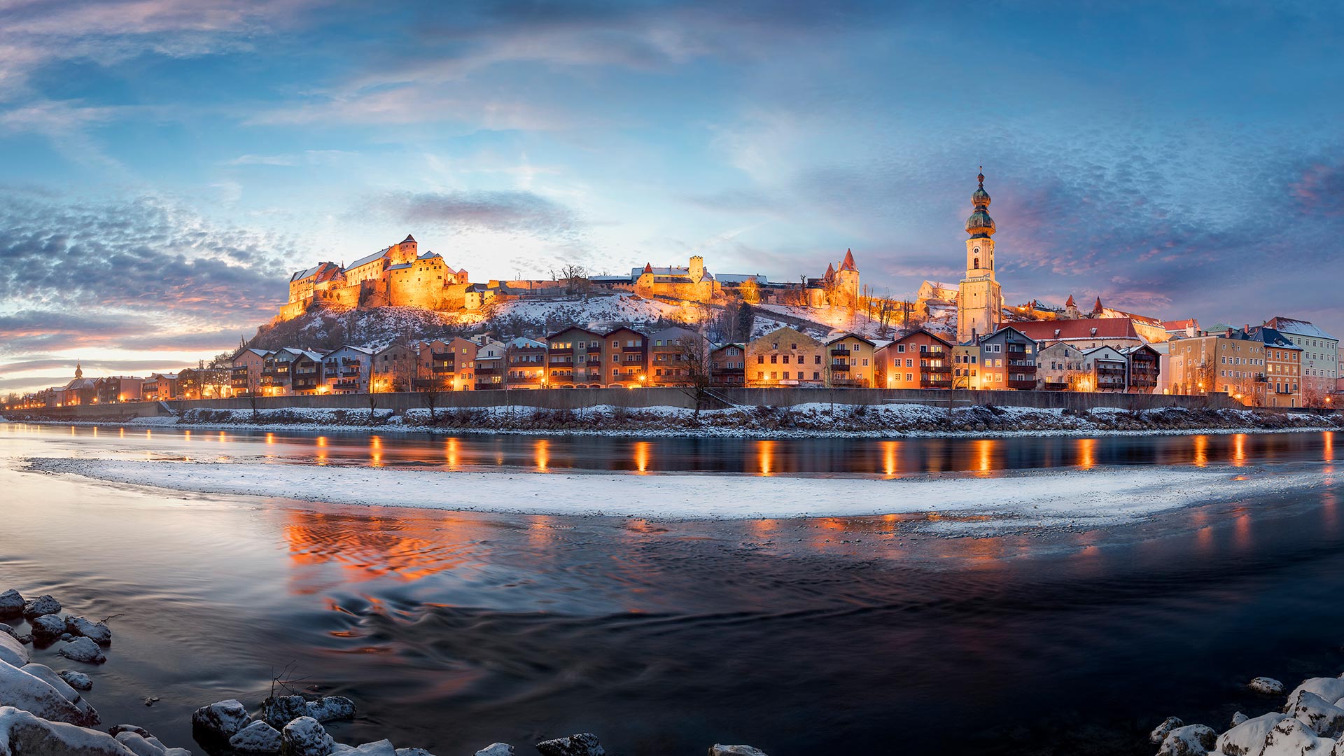
博格豪森镇和萨尔察赫河,德国巴伐利亚州 Burghausen town and Salzach river, Bavaria, Germany (© Harald Nachtmann/Moment/Getty Images)
博格豪森镇和萨尔察赫河,德国巴伐利亚州 Burghausen town and Salzach river, Bavaria, Germany (© Harald Nachtmann/Moment/Getty Images)
Burghausen town and Salzach river, Bavaria, Germany
The town of Borghausen is located on the banks of the Salchach, a large river in the Alps, which at 225 km. The name "castle" is rarely as specific as it is in upper Bavarian town, cause Borghausen boasts the world's longest castle complex at 1,051 meters.
The impressive defensive structure sits on a ridge above the old town, with a total of six courtyards. The oldest part dates back to the Middle Ages, with the first documentary mentioning around 1025. The main castle represents the oldest part of it, which can be seen clearly on the left side in the picture.
德国巴伐利亚州Burghausen镇和Salzach河
Borghausen镇位于阿尔卑斯山脉的一条大河Salchach河岸上,全长225公里。“城堡”这个名字很少像在上巴伐利亚镇那样具体,因为博格豪森拥有世界上最长的城堡建筑群,高1051米。
令人印象深刻的防御结构坐落在老城上方的山脊上,共有六个庭院。最古老的部分可以追溯到中世纪,第一部纪录片提到1025年左右。主城堡代表了它最古老的部分,在图片的左侧可以清楚地看到。
冬日里的科赫尔湖,德国巴伐利亚州 Kochelsee and Heimgarten Mountain in Bavaria, Germany (© Reinhard Schmid/eStock Photo)
冬日里的科赫尔湖,德国巴伐利亚州 Kochelsee and Heimgarten Mountain in Bavaria, Germany (© Reinhard Schmid/eStock Photo)
Kochelsee in Bavaria
To English speakers, this is Lake Kochel. To German speakers, it's Kochelsee. Whatever you call it, this popular recreation spot in Bavaria looks great all decked out in winter white. Imagine how quiet it must be when the lake is blanketed by snow. Now stretch your imagination further to the warm summer months when the shores of Kochelsee are busy with tourists out to get a dose of nature. The lake is just an hour's journey by car or train, south from the Munich. Visit during summer and you're likely to see windsurfers gliding across the surface of the lake.
巴伐利亚州的科切西
对说英语的人来说,这是科切尔湖。对说德语的人来说,这是科切西。不管你怎么称呼它,这个巴伐利亚州广受欢迎的娱乐场所穿上冬装,看起来很棒。想象一下,当湖面被雪覆盖时,一定是多么安静。现在,让你的想象力进一步延伸到温暖的夏季,科切西海岸正忙于吸引游客到这里来体验大自然。从慕尼黑以南,乘汽车或火车到这个湖只有一个小时的路程。夏季游览,你可能会看到风帆冲浪者滑过湖面。
星空下的灯塔,德国Westerhever镇 Westerheversand Lighthouse in Westerhever, Germany (© Sandra Bartocha/Minden Pictures)
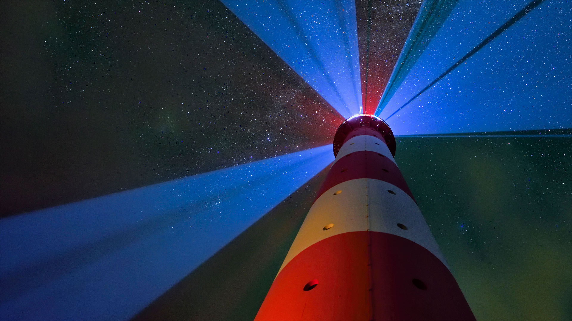
星空下的灯塔,德国Westerhever镇 Westerheversand Lighthouse in Westerhever, Germany (© Sandra Bartocha/Minden Pictures)
Westerheversand Lighthouse
Even in the places most altered by humans, nature seems to slip through, like the Milky Way shown here peeking between light beams from Germany's Westerheversand Lighthouse. This beacon lies along the Wadden Sea, which forms the world's largest tidal flat along the Dutch, German, and Danish coasts.
This soggy low country was once prone to deadly flooding, but over time, locals have moved earth and sea to reinvent the coastline with dikes, causeways, and artificial islands. You may not guess it by the thousands of species of seabirds, shellfish, and other lifeforms that thrive here, but this UNESCO-recognized biosphere is one of the most engineered locales on Earth.
韦斯特海尔桑灯塔
即使在那些被人类改变最多的地方,自然似乎也在悄悄溜走,就像图中所示的银河系在德国西部凡尔赛灯塔的光束之间窥视。这座灯塔位于瓦登海沿岸,瓦登海在荷兰、德国和丹麦海岸形成了世界上最大的潮坪。
这个潮湿低洼的国家曾经容易发生致命的洪水,但随着时间的推移,当地人已经移动了土地和海洋,用堤坝、堤道和人工岛屿重建了海岸线。你可能无法从这里繁衍生息的数千种海鸟、贝类和其他生命形式中猜到,但这个联合国教科文组织认可的生物圈是地球上最精心设计的地方之一。