分类 必应美图 下的文章
克里特岛上的海滩,希腊 Seitan Limania Beach in Crete, Greece (© Georgios Tsichlis/Alamy)
这个神奇的海滩值得一游 This magical beach is worth the hike
Seitan Limania beach, Crete
Crete is the largest and most populous of all the Greek islands, and also the farthest from the mainland (in fact, it's just about halfway to Turkey). This big little island is small enough to drive across in a few hours but full of wonders from mountain ranges to gorges to beautiful beaches. Take this jewel box of turquoise water near the port city of Chania for example. 'Set on the easternmost of three peninsulas that stick out like horns from the northwestern shoreline of Crete, Seitan Limania is one of the most photographed beaches on the island.
Seitan Limania is 'beautiful to behold from a distance but driving up close via the narrow switchback roads takes some nerve. And once you get to the parking lot, the rocky hike down is for only the most surefooted of beachgoers. On your way down, you'll likely meet some of the goats that populate the area. 'The narrow cove is flanked by steep rock walls that zig one way, then zag the other. When you reach the beach, you'll find yourself on one of the most unique spots on any coast—and a selfie here at Seitan Limania is hard to beat for bragging rights.
塞坦利马尼亚海滩,克里特岛
克里特岛是所有希腊岛屿中最大、人口最多的岛屿,也是离大陆最远的岛屿(事实上,它距离土耳其只有一半)。这个大大小小的岛屿很小,可以在几个小时内驾车穿过,但充满了从山脉到峡谷到美丽海滩的奇观。以港口城市查尼亚附近的绿松石水珠宝盒为例塞坦利马尼亚位于克里特岛西北海岸线三个半岛的最东端,这些半岛像角一样突出,是岛上拍照最多的海滩之一。
Seitan Limania“从远处看很美,但在狭窄的弯道上近距离开车需要一些勇气。”。一旦你到了停车场,只有最踏实的海滩游客才可以进行岩石徒步旅行。在你下山的路上,你很可能会遇到一些山羊,它们栖息在这个地区狭窄的海湾两侧是陡峭的岩壁,这些岩壁一路弯曲,另一路弯曲。当你到达海滩时,你会发现自己是任何海岸上最独特的景点之一,在Seitan Limania的自拍是很难被吹嘘的。
米利亚里诺自然公园,圣罗索尔,意大利马萨西犹可利 Regional Park of Migliarino, San Rossore, Massaciuccoli, Italy (© Stefano Valeri/Alamy)
比萨不仅有斜塔 There's more to Pisa than leaning towers
Natural Park of Migliarino, San Rossore, Massaciuccoli, Italy
This idyllic road is a path to one of Italy's magnificent natural gifts. Just outside of the ancient city of Pisa in Tuscany is the Natural Park of Migliarino, San Rossore, and Massaciuccoli. This immense and diverse park boasts numerous distinct environments. Seaside sand dunes, bird-filled marshlands, deep pine forests, and vast deciduous forests of oak and elm all exist next to each other. A wide array of birds can be found in the park, and there are ample wild boar, rabbits, red foxes, and the impressively antlered fallow deer to be found. It has been suggested that there are wolves living in the deep reaches of the woods.
While the park is popular for its beaches, hikes, and wildlife viewing, its attributes don't end with its natural amenities. There are Roman ruins to be explored here, along with working farms, and environmental education opportunities. It is also home to the Villa del Gomba, once the presidential palace of Italy, and before that the palace of the House of Savoy, one of Europe's oldest and most powerful dynasties. Today the facility hosts conferences and tourists.
米利亚里诺自然公园,圣罗索,马萨丘科利,意大利
这条田园诗般的道路是通往意大利宏伟的自然景观之一的道路。就在托斯卡纳古城比萨的外面,是米利亚里诺、圣罗索和马萨丘科利的自然公园。这个巨大而多样的公园拥有众多独特的环境。海边的沙丘、鸟类栖息的沼泽地、深深的松林、广阔的橡树和榆树落叶林都毗邻而生。公园里有各种各样的鸟类,还有大量的野猪、兔子、红狐和令人印象深刻的鹿角休养鹿。有人认为森林深处有狼。
虽然该公园因其海滩、徒步旅行和野生动物观赏而受欢迎,但它的属性并不以其自然设施而结束。这里有罗马遗址可供探索,还有工作农场和环境教育机会。它也是Villa del Gomba的所在地,它曾是意大利总统府,在此之前是欧洲最古老、最强大的王朝之一萨伏伊宫的所在地。今天,该设施举办会议和游客。
爱沙尼亚波罗的海 Baltic Sea in Estonia (© fotoman-kharkov/Getty Images)
像湖一样的大海 The sea that acts like a lake
Baltic Sea, Estonia
The Baltic Sea in northeast Europe is a peculiar body of water, possessing the characteristics of seas, lakes, and estuaries. Strictly speaking, it is in fact a sea and thus appropriately named, joined to the Atlantic Ocean through three straits in Denmark: the Oresund, Great Belt, and Little Belt. Technically, the Baltic is classified as a brackish sea, meaning it is not entirely fresh and not entirely saline. The Baltic Sea isn't landlocked, but it does border many countries, including Russia, Finland, Sweden, Denmark, Germany, Poland, Lithuania, Latvia, and Estonia—and it's the Estonian coast featured in today's image.
Like a lake, the Baltic is relatively shallow with an average depth of 150 feet. Its salinity is so low it nearly qualifies as freshwater. That's because hundreds of rivers empty into the sea, and more fresh water falls on the sea in the form of rain and snow than evaporates. The Baltic can also be described as a giant estuary, into which flow dozens of rivers. Sailors favor the Baltic because there is very little current and tide to contend with, and even when surface winds pick up, the seas remain relatively calm. Easy to navigate, gateway to so many lands—the Baltic has been integral to trade and commerce, and inevitable conflict, in the region for centuries. It has been known by many names, proof the Baltic is a true meeting place.
波罗的海,爱沙尼亚
欧洲东北部的波罗的海是一个独特的水体,具有海洋、湖泊和河口的特征。严格地说,它实际上是一个海洋,因此得名恰当,通过丹麦的三个海峡与大西洋相连:厄勒孙海峡、大海峡和小海峡。从技术上讲,波罗的海被归类为微咸海,这意味着它不完全是新鲜的,也不完全是咸的。波罗的海不是内陆,但它确实与许多国家接壤,包括俄罗斯、芬兰、瑞典、丹麦、德国、波兰、立陶宛、拉脱维亚和爱沙尼亚。今天的图片中是爱沙尼亚海岸。
波罗的海和湖泊一样,相对较浅,平均深度为150英尺。它的盐度很低,几乎可以称为淡水。这是因为数百条河流流入大海,更多的淡水以雨雪的形式流入大海,而不是蒸发。波罗的海也可以被描述为一个巨大的河口,数十条河流流入其中。水手们喜欢波罗的海,因为那里几乎没有水流和潮汐可供对抗,即使海面风力增强,海洋仍然相对平静。几个世纪以来,波罗的海一直是该地区贸易和商业的组成部分,也是不可避免的冲突。它有许多名字,证明波罗的海是一个真正的聚会场所。
圣海伦斯山国家火山纪念区的边界小径,美国华盛顿州 Boundary Trail in Mount St. Helens National Volcanic Monument, Washington (© Don Geyer/Alamy)
40年的休养生息 40 years of recovery
Mount St. Helens National Volcanic Monument, Washington
Today is an important day in American history. We're standing on the Boundary Trail at Johnston Ridge in the Mount St. Helens National Volcanic Monument. Forty years ago today, 110,000 acres within Gifford Pinchot National Forest was set aside to memorialize the deadliest and most destructive volcanic eruption in the United States. For nearly nine hours on May 18th, 1980, the Mount St. Helens erupted, forever changing the Washington landscape. The volcanic event started at roughly 8:30 on a Sunday morning with a 5.1 magnitude earthquake. This triggered what is known as a 'lateral eruption,' which means the lava blast comes out of the side of the volcano, rather than the top. The initial blast shaved more than a thousand feet off the mountain's elevation, resulting in a massive avalanche and the destruction of about 150 square miles of the surrounding forest. When the event ended, 57 people had died, 200 homes and almost 200 miles of nearby highway had been destroyed.
The monument was established by President Ronald Reagan in 1982 to preserve the area for research, recreation, and education. The land inside has been left to mostly recover naturally since the eruption. While it's believed that Mount St. Helens will erupt again sometime within the next few centuries, that has not deterred people from hiking and climbing at the monument, which has been allowed since 1986.
圣海伦山国家火山纪念碑,华盛顿
今天是美国历史上重要的一天。我们站在圣海伦斯山国家火山纪念碑的约翰斯顿山脊的边界小道上。四十年前的今天,吉福-平肖国家森林内的110000英亩土地被用来纪念美国最致命、破坏性最大的火山爆发。1980年5月18日,圣海伦斯山爆发了近9个小时,永远改变了华盛顿的景观。火山爆发于周日早上8点30分左右,发生了5.1级地震。这引发了所谓的“侧向喷发”,这意味着熔岩喷发从火山的侧面而不是顶部。最初的爆炸使山的海拔下降了一千多英尺,导致了一场大规模的雪崩,并摧毁了周围约150平方英里的森林。活动结束时,57人死亡,200所房屋和近200英里的附近公路被毁。
该纪念碑由罗纳德·里根总统于1982年建立,旨在保护该地区的研究、娱乐和教育。火山爆发后,火山内部的土地基本上自然恢复。虽然人们相信圣海伦斯山将在未来几个世纪的某个时候再次喷发,但这并没有阻止人们前往这座自1986年以来就被允许的纪念碑进行徒步旅行和攀登。
克罗地亚佩列沙茨半岛附近的风筝冲浪者和风帆冲浪者 Kitesurfers and windsurfers near the Pelješac Peninsula, Croatia (© helivideo/Getty Images)
既有风,又有水 Add wind, combine with water, and you'll get...
Kitesurfing and windsurfing in Croatia
Of the many ways people have invented to ride boards of one kind or another, the sport of kiteboarding or kitesurfing is one of the newest. It owes a debt to all the board sports that came before it, borrowing a little bit from snowboarding, water skiing, wakeboarding, and of course windsurfing. Like snowboarders and skiers, windsurfers and kitesurfers often share playspace, as they are doing here off the Peljesac Peninsula in Croatia, where you can count on a stiff afternoon breeze in the summer months when the land heats up and draws in the cool ocean air of the Adriatic.
Kiteboarding began to evolve in the 1990s. By separating the sail—in this case the kite, which is similar to a glider—from the board, kitesurfers gained more freedom to maneuver. The kites are inflated, giving them structure and the ability to float should they land on the water. Kiteboards meant to surf waves are pointed at one end; boards meant to ride over flat water are shaped the same at both ends.
克罗地亚的风筝冲浪和帆板运动
在人们发明的各种冲浪方式中,风筝冲浪运动是最新的一种。它欠了之前所有的滑板运动的债,从滑雪板、滑水、滑水板,当然还有帆板运动中借了一点。像滑雪板运动员和滑雪者一样,风帆冲浪者和风筝冲浪者经常共享游戏空间,就像他们在克罗地亚的Peljesac半岛附近所做的那样,在夏季,当陆地升温并吸入亚得里亚海凉爽的海洋空气时,你可以指望那里会有一股强劲的下午风。
风筝冲浪在20世纪90年代开始发展。通过将帆(在这种情况下是风筝,类似于滑翔机)从板上分离,风筝冲浪者获得了更多的机动自由。风筝是充气的,这样它们就有了结构,并能在降落到水面上时漂浮。用来冲浪的风筝板一端是尖的;用于在平坦水面上行驶的木板两端形状相同。
华盛顿州北瀑布国家公园,美国 North Cascades National Park, Washington (© Ethan Welty/Tandem Stills + Motion)
令人惊叹的后花园 Amazing backyard
North Cascades National Park
North Cascades is one of three national parks in Washington state (the others are Olympic and Mount Rainier). North Cascades is also the state's newest national park, created in 1968. It is perhaps the most rugged park in the lower 48 states, containing more than 500,000 acres of steep mountain peaks, vast forests, as well as the headwaters of many waterways. It boasts the most expansive system of glaciers in the US outside of Alaska. Most of the park is protected as wilderness so there are few roads, structures, or signs of human impact. It is relatively isolated even though it's within 100 miles (as the crow flies) from the metropolises of Seattle and Vancouver, Canada. This proximity of wilderness to human development reminds us why we created the NPS, to preserve some of the nation's most special places in their natural state.
北瀑布国家公园
北瀑布是华盛顿州的三个国家公园之一(其他两个是奥林匹克公园和雷尼尔山公园)。北喀斯特也是该州最新的国家公园,创建于1968年。它可能是48个州中最崎岖的公园,拥有50多万英亩陡峭的山峰、广阔的森林以及许多水道的源头。它拥有阿拉斯加以外美国最广阔的冰川系统。公园的大部分被保护为荒野,因此几乎没有道路、结构或人类影响的迹象。尽管它距离西雅图和加拿大温哥华的大都市不到100英里(就像乌鸦一样),但它还是相对孤立。荒野与人类发展的这种接近提醒我们,为什么我们创建了自然保护区,以保护国家一些最特殊的自然状态。
格洛里亚附近的码头和糖面包山,巴西里约热内卢 Marina da Glória and Sugarloaf Mountain, Rio de Janeiro, Brazil (© f11photo/Getty Images)
里约热内卢的象征 The symbols of Rio
Sugarloaf Mountain
Perhaps one of the most internationally recognized parts of Brazil, Sugarloaf Mountain overlooks the surrounding waters of Guanabara Bay and the bustling city of Rio de Janeiro. A famous cable car connects Urca – the first hill (215 metres) on the way up to Sugarloaf Mountain – with the mountain itself, which reaches a height of 396 metres above the harbour. Together they form the Sugarloaf Mountain and Urca Hill Natural Monument which, along with the Christ the Redeemer statue, are the city's most famous postcard images. The vehicle, which also connects the two hills to Praia Vermelha, was conceived in 1908 and opened in 1912. It was the first cable car in the country and the third in the world.
In today's image, the impressive mountain scenery and docked yachts are reflected in the waters of Marina da Glória. Nestled between Sugarloaf and Corcovado Mountains, Marina da Glória is one of the city’s most popular waterfront destinations. The venue hosted sailing competitions at the Rio 2016 Olympic and Paralympic Games and now receives around 1.3 million visitors a year. The marina is one of South America’s premier charter destinations and can accommodate yachts measuring up to 60 meters in length. From here you can explore Flamengo Park, the largest public park and recreation area within the city, as well as enjoy some of the best views of Sugarloaf Mountain.
糖面包山
糖面包山可能是巴西最受国际认可的地区之一,它可以俯瞰瓜纳巴拉湾周围的水域和繁华的里约热内卢市。一辆著名的缆车将乌尔卡(Urca)——通往糖面包山(Sugarloaf Mountain)的第一座山(215米)——与港口上方396米的山相连。它们一起形成了糖面包山和乌尔卡山自然纪念碑,与救世主基督雕像一起,是该市最著名的明信片图像。这辆车也连接了两座山和普拉亚·维梅尔哈(Praia Vermelha),设计于1908年,并于1912年投入使用。这是该国第一辆缆车,也是世界第三辆缆车。
在今天的图片中,令人印象深刻的山景和停靠的游艇反映在Marina da Glória的水域中。Marina da Glória位于Sugarloaf和Corcovado山脉之间,是该市最受欢迎的海滨目的地之一。该场馆举办了2016年里约奥运会和残奥会的帆船比赛,目前每年接待约130万游客。码头是南美洲主要的租船目的地之一,可容纳长达60米的游艇。从这里,您可以探索弗拉门戈公园,这是市内最大的公共公园和娱乐区,还可以欣赏到糖面包山的一些最佳景色。
芒通,法国 Menton, France (© Flavio Foglietta/Getty Images)
到了芒通,就来点柠檬汁吧 If given Menton, make lemonade
Menton, France
Anchoring the eastern end of the French Riviera near the Italian border is Menton, the so-called 'Pearl of France.' It's prized for its beauty and incredible weather that features an average of 316 days a year with full or partial sun. That climate enables Merton to enjoy amazing lemon yields that have given rise to the annual Fête du Citron, or Menton Lemon Festival, a 17-day extravaganza in February featuring floats and sculptures created out of lemons and oranges. More than 200,000 visitors marvel at the nearly 150 tons of fruit used in the festival.
Owing to its strategic location, Menton and its surrounding locale have been coveted by various powers for centuries. The princes of Monaco, Napoleon III, German Nazi forces, and the King of Sardinia among others have all held sway over this jewel of the Côte d'Azur. These days, Menton has something for everyone—gorgeous gardens, pastel-painted architecture, beaches, cafes, nightlife, and of course, lemons.
芒通,法国
芒通是法国里维埃拉的东端,靠近意大利边境,是所谓的“法国明珠”它以其美丽和令人难以置信的天气而闻名,一年平均有316天全天或部分阳光普照。这种气候使默顿能够享受到令人惊叹的柠檬产量,这也催生了一年一度的柠檬节,或称“芒通柠檬节”(Menton lemon Festival),这是一场在2月举行的为期17天的盛会,以柠檬和橘子为原料制作的花车和雕塑。超过20万名游客惊叹于节日期间使用的近150吨水果。
由于其战略位置,芒通及其周边地区几个世纪以来一直为各大国所觊觎。摩纳哥王子、拿破仑三世、德国纳粹部队和撒丁岛国王等都控制着这颗蔚蓝海岸的宝石。如今,芒通为每个人都提供了一些东西:华丽的花园、粉彩的建筑、海滩、咖啡馆、夜生活,当然还有柠檬。
加利西亚省科斯塔达莫尔特的灯塔,西班牙 Faro de Playa Lago, Costa da Morte, Muxia, Galicia, Spain (© Carlos Fernandez/Getty Images)
死亡海岸 The Coast of Death
International Lighthouse Day
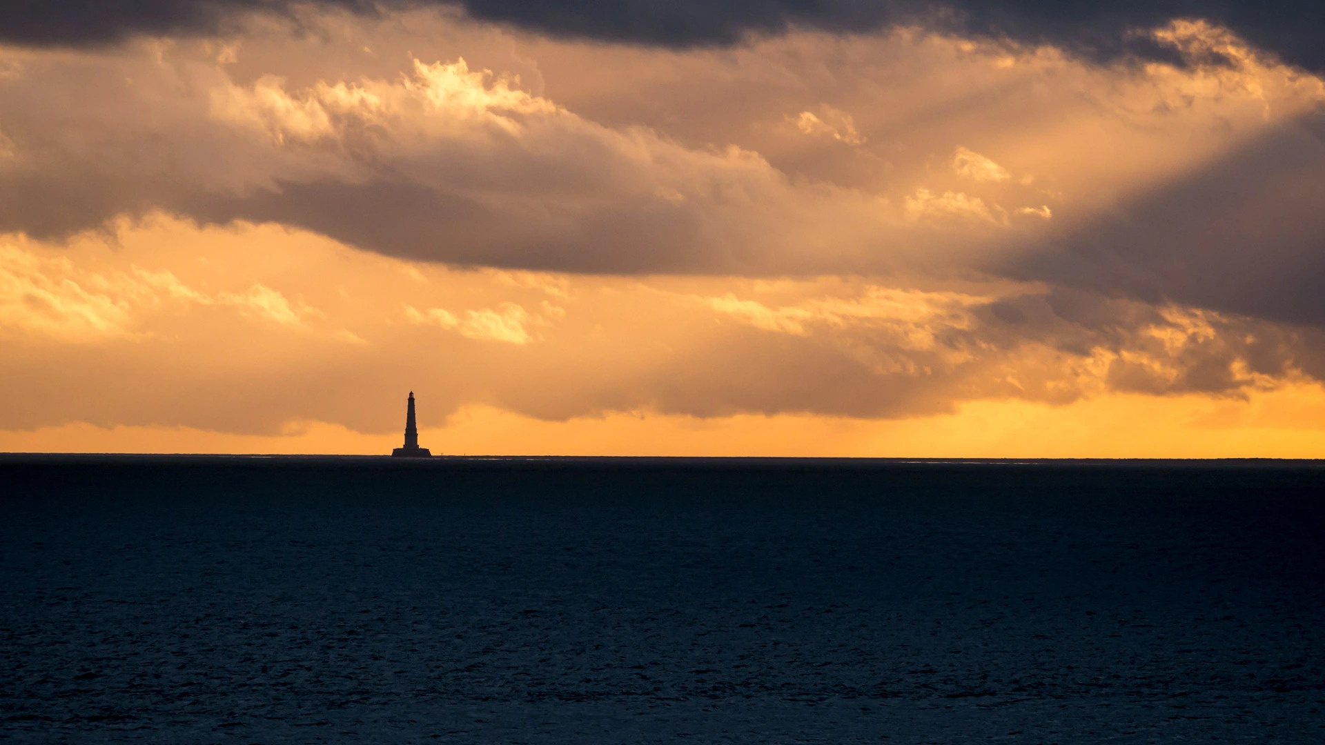
This solemn beacon set atop a rocky outcropping is in a country usually associated with sand and sun, making this a side of Spain many do not often see. We're looking out at the sea on the Costa da Morte, or Coast of Death, a nasty name for an equally nasty (but beautiful!) stretch of Galician coastline in the extreme northwest of Spain. We're featuring Costa da Morte on International Lighthouse Day because mariners are never happier to see a lighthouse than when they're sailing this coast, known as the Bermuda Triangle of the Eastern Atlantic.
The Costa da Morte is known for its lighthouses, like this one, called Faro de Playa Lago, one of many strung along 125 miles of coast from Finisterre in the south to Malpica in the north. As a devourer of ships, the Costa da Morte is prolific. Since the 14th century, more than 600 shipwrecks have been documented resulting in the loss of thousands of lives. This corner of Spain lies at the southern end of the Bay of Biscay, also known for its rough waters. The rocky Costa da Morte faces the open North Atlantic and takes the brunt of big ocean swells. (The famous big-wave surf break at Nazare, Portugal, is only a few hundred miles to the south.) Deep waters turn to shallow waters quickly near this rocky cliff-strewn coast, known for its strong currents and hidden rocks. The fog can roll in quickly. Storms form frequently. And hurricane-force winds are not uncommon.
Cool, rainy, and rocky, the Galicia region of Spain is more 'Lord of the Rings' than Club Med. Hiking along this coast, you might feel like you're Scotland rather than Spain, and is compounded by the fact that Galicians themselves are considered a Celtic ethnic group. To visit the lighthouses of Costa da Morte, you can walk a trail appropriately called Camino dos Faros (Road of the Lighthouses). While satellite technology and electronic instruments vastly changed how safely we can now navigate the seas, lighthouses are still vital to boating and the maritime industry. Plus, they're just darn good-looking.
国际灯塔日
这座庄严的灯塔矗立在岩石露头上,位于一个通常与沙子和太阳联系在一起的国家,这使它成为许多人不常看到的西班牙的一面。我们看到的是死亡海岸(Costa da Morte)上的大海,这是一个同样令人讨厌的名字(但很漂亮!)西班牙西北端的加利西亚海岸线。我们在国际灯塔日特别报道科斯塔·达·莫特,因为水手们在这个被称为东大西洋百慕大三角的海岸航行时,看到灯塔最开心。
Costa da Morte以其灯塔而闻名,比如这座被称为Faro de Playa Lago的灯塔,它是从南部的菲尼斯特尔到北部的马尔皮卡沿海岸线125英里的众多灯塔之一。作为船舶的吞噬者,科斯塔·达·莫特是多产的。自14世纪以来,已有600多艘沉船被记录在案,导致数千人丧生。西班牙的这个角落位于比斯开湾的南端,也因其汹涌的海水而闻名。多岩石的Costa da Morte面对开阔的北大西洋,首当其冲地承受着巨大的海浪冲击。(葡萄牙纳扎尔著名的巨浪冲浪场位于南面几百英里处。)在这片岩石峭壁遍布的海岸附近,深水迅速转变为浅水,以其强劲的水流和隐藏的岩石而闻名。雾很快就会卷进来。风暴经常形成。飓风强度的风并不罕见。
凉爽、多雨、多岩石的西班牙加利西亚地区与其说是地中海俱乐部,不如说是“指环王”。沿着这条海岸远足,你可能会觉得自己是苏格兰人而不是西班牙人,这是因为加利西亚人本身被视为凯尔特人。要参观Costa da Morte的灯塔,你可以走一条名为Camino dos Faros(灯塔之路)的小径。虽然卫星技术和电子仪器极大地改变了我们现在在海上航行的安全程度,但灯塔对划船和海运业仍然至关重要。而且,他们真是太漂亮了。
康沃尔郡的彭赞斯,英国 Penzance in Cornwall, England (© Murray Bosley Photography/Getty Images)
彭赞斯全景 Panoramic Penzance
Penzance
This bustling coastal town is Penzance in Cornwall, on England’s southwest coast, forever linked with pirates thanks to Gilbert and Sullivan’s famous comic opera. These days, visitors are more likely to be tourists attracted by the wide sandy beaches, rocky cliffs, and hidden coves once frequented by smugglers and wreckers. Jutting out from the seafront in our homepage photo is the UK’s largest seawater lido, the Jubilee Pool, which has been welcoming bathers since 1935. This triangular Art Deco pool offers a chilly dip for the brave, but for those who like it warmer, a separate saltwater pool is heated to a balmy 35C by pumping heat from a geothermal well 1,345ft (410m) below ground level.
Penzance sits just across Mount’s Bay from the tidal island of St Michael’s Mount, with its historic castle and chapel, linked to the mainland by a causeway that disappears at high tide. If you want a break from the beach, there’s plenty of history to explore here. The town’s name comes from “Pen Sans” in Cornish, meaning holy headland – early Christians established a chapel here over 1,000 years ago. It has been a commercial center since the 1600s and boomed thanks to the maritime trade of the 18th and 19th centuries and, since the 1860s, the Great Western Railway link to London. Ruins of old tin and copper mines dot the coastline, part of a wider Unesco World Heritage Site celebrating the mining landscape across Cornwall and neighboring West Devon.
But if you find you’ve eaten your fill of Cornish pasties in this tourist hotspot, you can always hop on a ferry from Penzance to explore the Isles of Scilly, the remote archipelago which sits 28 miles off Cornwall’s coast.
彭赞斯
这个熙熙攘攘的海滨小镇是英格兰西南海岸康沃尔郡的彭赞斯,由于吉尔伯特和沙利文著名的喜剧歌剧,它永远与海盗联系在一起。如今,游客更可能是被宽阔的沙滩、岩石峭壁和隐蔽的海湾所吸引的游客,这些海湾曾经是走私者和破坏者经常光顾的地方。在我们的主页照片中,从海滨突出的是英国最大的海水丽都,朱比利泳池,自1935年以来一直欢迎游泳者。这个三角形的装饰艺术泳池为勇敢者提供了一个寒冷的游泳池,但对于那些喜欢温暖的人来说,一个单独的盐水池通过从地下1345英尺(410米)的地热井中抽取热量加热到35摄氏度。
彭赞斯坐落在圣米歇尔山潮汐岛的山湾对面,其历史悠久的城堡和教堂通过一条在涨潮时消失的堤道与大陆相连。如果你想从海滩上休息一下,这里有大量的历史可供探索。该镇的名字来源于康沃尔语中的“Pen Sans”,意思是神圣的岬角——1000多年前,早期基督徒在这里建立了一座小教堂。自17世纪以来,它一直是一个商业中心,由于18世纪和19世纪的海上贸易以及19世纪60年代以来连接伦敦的大西部铁路而繁荣起来。旧锡矿和铜矿的废墟点缀着海岸线,这是一个更大的联合国教科文组织世界遗产地的一部分,庆祝康沃尔郡和邻近的西德文郡的采矿景观。
但是,如果你在这个旅游热点吃得饱饱的,你可以从彭赞斯乘渡轮去探索西利岛,这是一个距离康沃尔海岸28英里的偏远群岛。