标签 英格兰 下的文章
班堡城堡,诺森伯兰郡,英格兰 Bamburgh Castle, Northumberland, England (© Blackbeck/Getty Images)
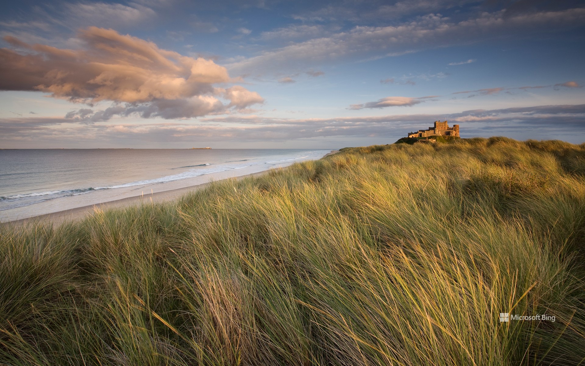
班堡城堡,诺森伯兰郡,英格兰 Bamburgh Castle, Northumberland, England (© Blackbeck/Getty Images)
随波逐流 Grow with the flow
班堡城堡,诺森伯兰郡,英格兰
班堡城堡坐落在英格兰诺森伯兰郡班堡地区,矗立在海岸旁边突出的黑色火山岩上。图中所展示的是班堡沙丘,班堡城堡和附近的海滩就掩映在该地区独特的沙质地貌中。班堡城堡曾经是盎格鲁-撒克逊人的战略要塞,经过几个世纪的演变,形成了如今这座宏伟的建筑。这座城堡在抵御维京人的入侵中曾发挥了关键作用。然而,北欧人摧毁了城堡最初的防御工事,之后在中世纪期间又对其进行了重大改造。城堡还是古代诺森伯兰王国的所在地,这是一个中世纪的盎格鲁-撒克逊王国,位于今天的英格兰北部和苏格兰东南部。班堡城堡面朝北海,被生机盎然的绿草所环绕,怀抱如此美景,班堡城堡成为了许多电影的取景地,比如《麦克白》、《夺宝奇兵:命运之盘》、《艾芬豪》等。
Bamburgh Castle, Northumberland, England
Bamburgh Castle perches on a crag of volcanic rock, overlooking sand dunes and the coast of Northumberland, England. The fortress, once a strategic Anglo-Saxon stronghold, evolved over centuries into the imposing structure seen today. The site was the seat of the ancient Northumbrian kingdom—an early medieval Anglo-Saxon kingdom covering present-day northern England and southeast Scotland. The original castle was destroyed by invading Vikings in 993 and a new castle was built here by the Normans. Today's castle is the result of various restorations in the 18th, 19th, and early 20th centuries. After surviving its share of attacks, Bamburgh Castle has made its way to the limelight due to its impressive silhouette against the North Sea, featuring in productions like 'Macbeth,' 'Indiana Jones and the Dial of Destiny,' and 'Ivanhoe.'
冬季日出,戴德姆,科尔切斯特,英格兰 Winter sunrise in Dedham, Colchester, England (© George W Johnson/Getty Images)
冬季日出,戴德姆,科尔切斯特,英格兰 Winter sunrise in Dedham, Colchester, England (© George W Johnson/Getty Images)
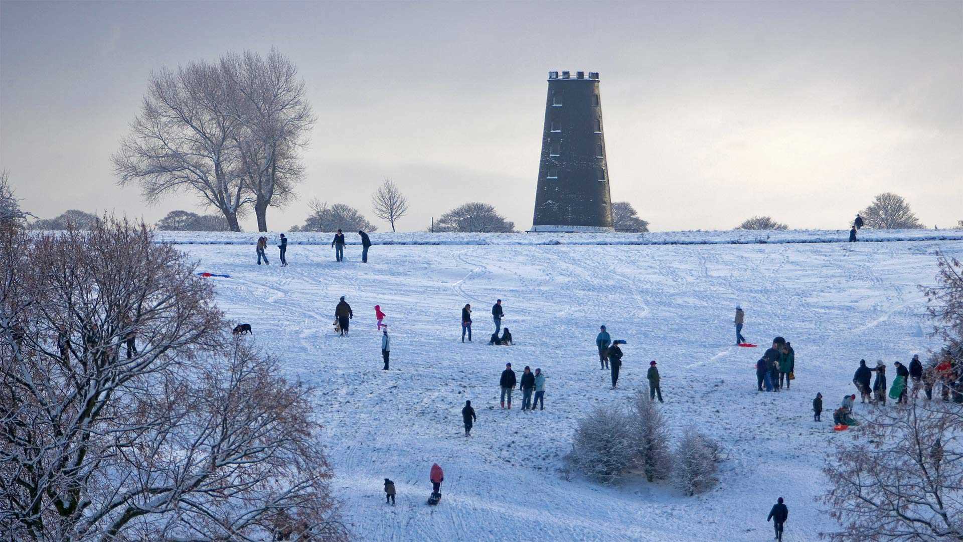
节礼日快乐 Happy Boxing Day!
节礼日快乐
节假日还没有完全结束!12月26日是节礼日——这是一个让节日气氛延续下去的时机,也是一个在大自然中享受冬日漫步的时机,图中的英格兰科尔切斯特的田野就是一个冬日漫步的好地方。英国和一些英联邦成员国,包括加拿大和澳大利亚,都会庆祝节礼日。节日的起源被认为来自一项古老的英国传统——送礼盒,即雇主在圣诞节的第二天给仆人送装满礼物的“盒子”。时光流转,今天的人们依然会把赠送礼物和节礼日联系在一起,但这个节日已经有了各种习俗。在英国,各地都会举办赛马活动,包括在肯普顿公园赛马场举办的历史悠久的乔治六世赛马大赛。而在加拿大,冰球爱好者会聚集在一起,为他们喜爱的球队加油助威。节假日就像冬天的阳光一样,结束得比你想象中更快,趁着一切还未结束,去尽情享受吧。
Happy Boxing Day!
The holiday season isn't quite over! December 26 marks Boxing Day—a popular day to get outside and enjoy a walk after a day of indulgence. Our homepage image shows a wintry sunrise over fields near the village of Dedham, in Colchester, England¬—perfect walking country.
Boxing Day is observed in the UK and some other countries including Canada and Australia. It's thought to have originated from the old British tradition of giving boxes filled with presents to servants on the day after Christmas. These days, Boxing Day is often associated with sporting events. It’s a big day for soccer in the UK and horse races are held across the country, including the historic King George VI Chase at Kempton Park Racecourse. Meanwhile in Canada, ice hockey fans gather to cheer on their favorite teams. Just like winter sunshine, the holiday season ends sooner than you think, so make the most of it!
英格兰湖区的Black Fell Black Fell, Lake District, England (© Daniel Kay/Shutterstock)
英格兰湖区的Black Fell Black Fell, Lake District, England (© Daniel Kay/Shutterstock)
“群山拥有抚慰和治愈的力量” 'The hills have a power to soothe and heal...'
英格兰湖区的黑山 (Black Fell)
今天照片中展示的美丽风景是位于英格兰湖区的黑山(Black Fell),“fell”一词源于古挪威语中的“山”,主要是指地势高且贫瘠的地区,而英格兰湖区的土地通常是未经开垦、用于放牧的。黑山(Black Fell)海拔约1000英尺,被评为英格兰湖区的最佳观景区。站在山顶上,无论望向哪个方向,你都能欣赏到美景。
Black Fell in England's Lake District
Today's lovely landscape requires a slight bit of explanation. We're at Black Fell, which can be found in the Lake District of England. The term 'fell' originates from the Old Norse term for mountain, but it mostly applies to high, barren areas and, in the Lake District specifically, the area was usually uncultivated and used for grazing. Black Fell, which is a little over 1000 feet high, has some acclaim having been mentioned in Alfred Wainwright's 'Pictorial Guide to the Lakeland Fells' as a prime viewing area. No matter which direction you gaze, you're sure to see something wonderful.
贝弗利·韦斯特伍德,东约克郡,英格兰 Beverley Westwood Common, East Yorkshire, England (© Les Gibbon/Alamy)
贝弗利·韦斯特伍德,东约克郡,英格兰 Beverley Westwood Common, East Yorkshire, England (© Les Gibbon/Alamy)
阖家欢乐的一天 Giddy family fun
Beverley Westwood Common,东约克郡,英国
我们照片中的滑雪者正在享受英国的节礼日,他们在东约克郡黑磨坊附近的贝弗利韦斯特伍德公馆(Beverley Westwood Common)裹着行囊,冲下一座小山。传统上,节礼日是圣诞节兴奋过后放松的一天。名字后面是什么?有几种说法,但最被广泛接受的说法是,这个名字来源于圣诞节后第二天向穷人赠送“盒子”(礼物)。也许我们今天都应该效仿这个例子,吃圣诞剩饭,听萦绕的颂歌。我们怎样才能给那些不幸的人一个小小的圣诞节呢?
Beverley Westwood Common, East Yorkshire, England
The sledders in our photo are enjoying Boxing Day in England, bundled up and hurtling down a hill at Beverley Westwood Common near Black Mill in East Yorkshire. Traditionally, Boxing Day is a day off to relax after the excitement of Christmas. What's behind the name? There are a few theories, but the most widely accepted one is that the name derives from the giving of 'boxes' (of gifts) to the poor the day after Christmas. Perhaps we should all follow that example today, as we eat Christmas leftovers and listen to lingering carols. How can we give a little Christmas to those who are less fortunate?
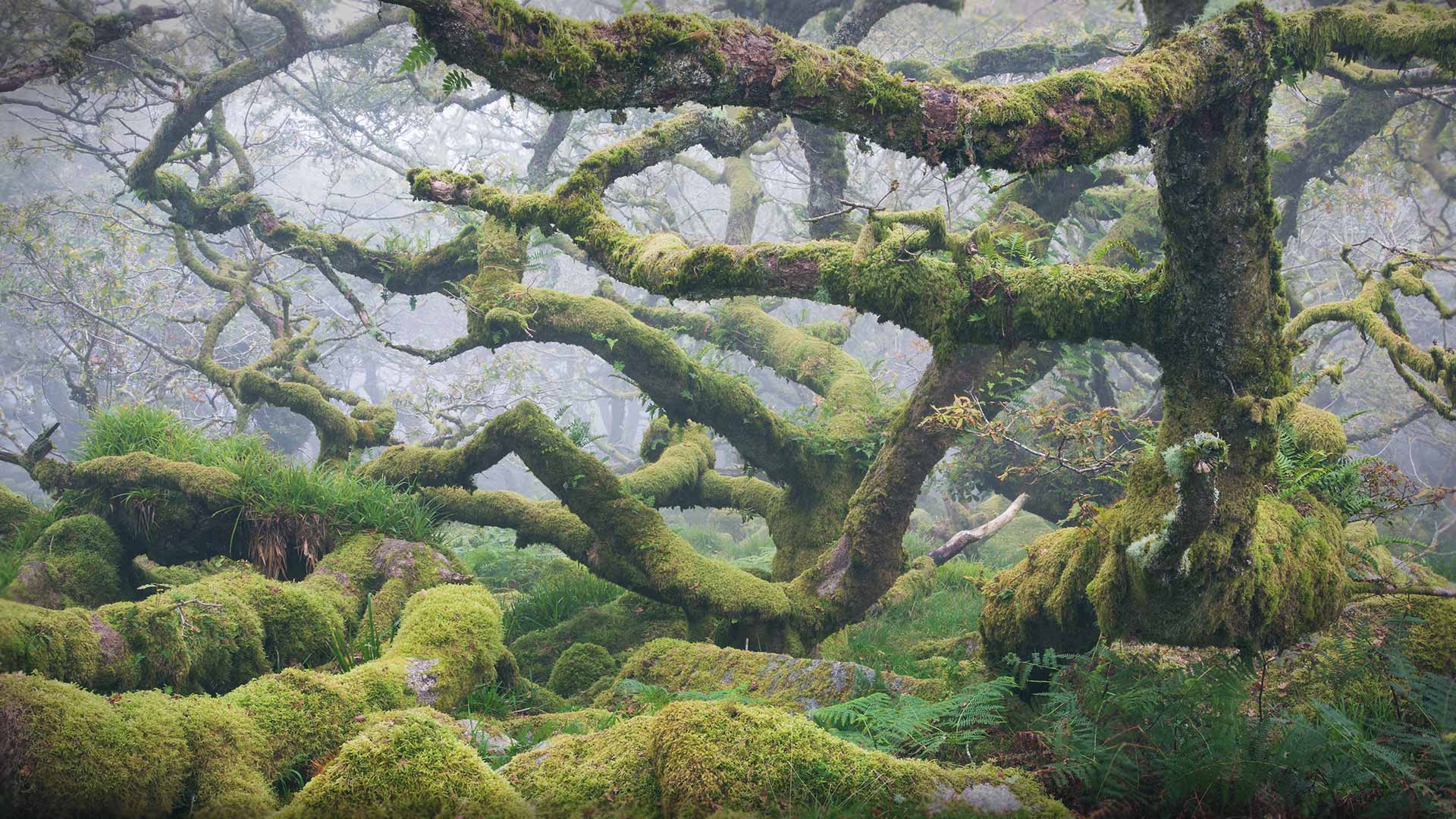
威斯特曼森林,达特穆尔国家公园,英格兰德文郡 (© Richard Garvey-Williams/Alamy)
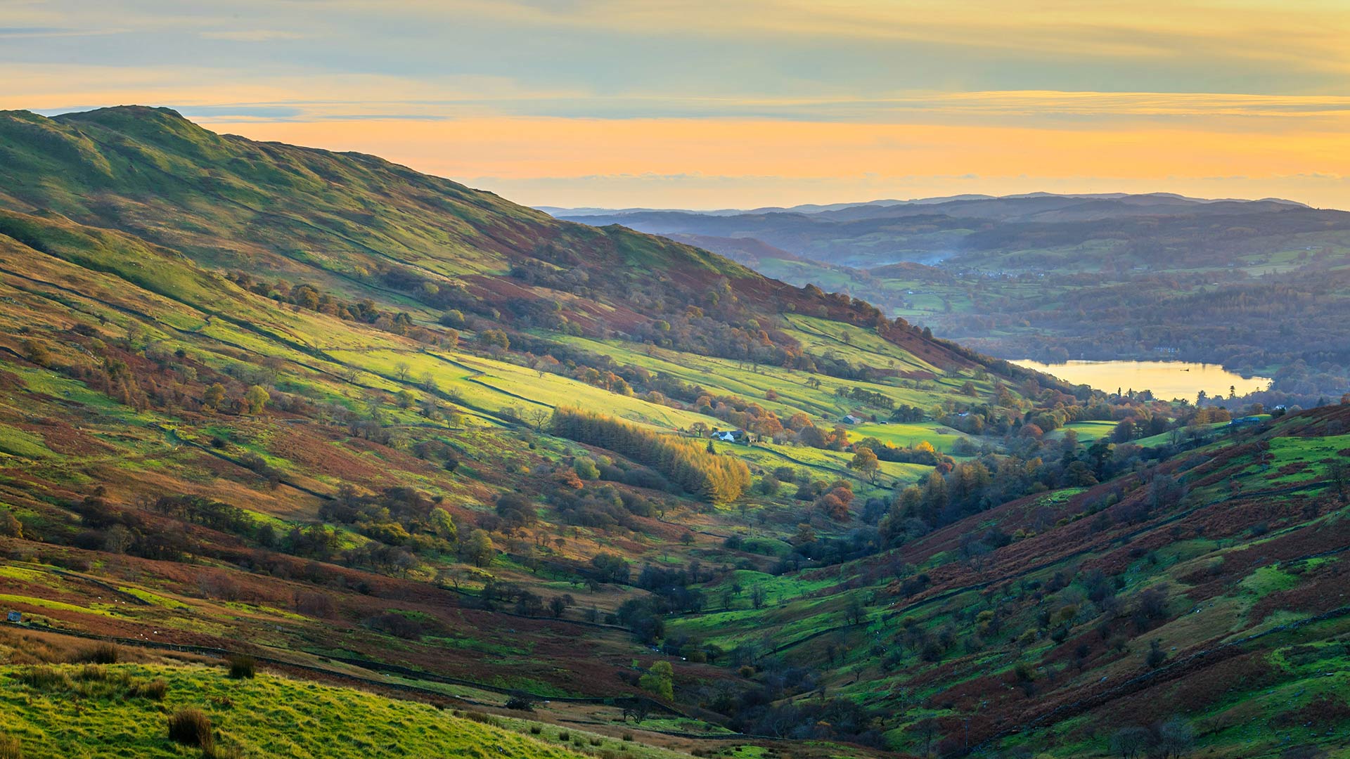
温德米尔湖的风景,坎布里亚湖区,英格兰 (© Chris Warren/eStock Photo)
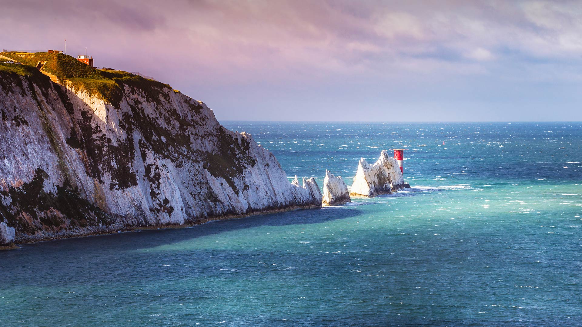
英格兰怀特岛上的尼德尔斯白垩岩石和19世纪的灯塔。 (© CBCK Christine/iStock/Getty Images Plus)
格拉斯顿伯里山丘上的日出,英格兰 View of Glastonbury Tor from Walton Hill, Somerset, England (© Guy Edwardes/Minden Pictures)
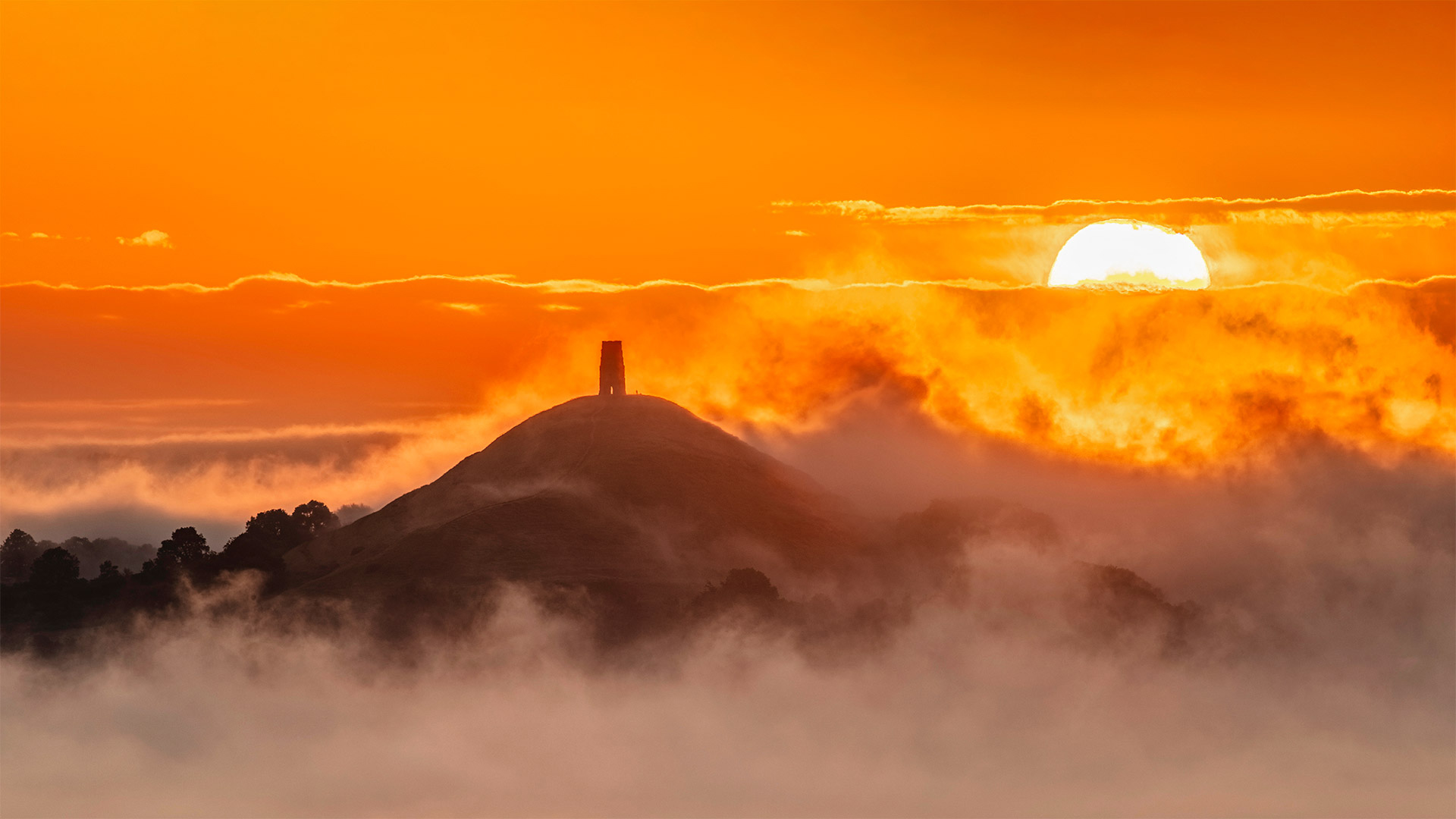
格拉斯顿伯里山丘上的日出,英格兰 View of Glastonbury Tor from Walton Hill, Somerset, England (© Guy Edwardes/Minden Pictures)
夏季来临 Summer a-rising
Summer solstice
The summer solstice, also known as an estival solstice or midsummer, occurs when one of Earth's poles has its maximum tilt toward the Sun. It happens twice yearly, once in each hemisphere (Northern and Southern). For that hemisphere, the summer solstice is when the Sun reaches its highest position in the sky (for areas outside of the tropics) and is the day with the longest period of daylight. Within the Arctic circle (for the northern hemisphere) or the Antarctic circle (for the southern hemisphere), there is continuous daylight around the summer solstice. On the summer solstice, Earth's maximum axial tilt toward the Sun is 23.44°. Likewise, the Sun's declination from the celestial equator is 23.44°.
Since prehistory, the summer solstice has been seen as a significant time of year in many cultures and has been marked by festivals and rituals. Traditionally, in many temperate regions (especially in Europe), the summer solstice is seen as the middle of summer and referred to as "midsummer". Today, however, in some countries and calendars it is seen as the beginning of summer.
夏至
夏至,也被称为夏至或仲夏,发生在地球的两极之一最大程度地向太阳倾斜的时候。每年发生两次,每个半球(北半球和南半球)一次。对于那个半球来说,夏至是太阳在天空中达到最高位置(对于热带以外的地区)的时候,也是日照时间最长的一天。在北极圈(北半球)或南极圈(南半球)内,夏至前后有连续的白天。夏至,地球对太阳的最大轴向倾斜为23.44°。同样,太阳从天球赤道的赤纬为23.44°。
自史前以来,在许多文化中,夏至一直被视为一年中重要的时间,并以节日和仪式为标志。传统上,在许多温带地区(尤其是欧洲),夏至被视为仲夏,被称为“仲夏”。然而,今天,在一些国家和日历中,这被视为夏季的开始。
一条蜿蜒穿过开满蓝铃花森林的小径,英格兰赫特福德郡 A path winding through a forest of bluebells in Hertfordshire, England (© JayKay57/Getty Images)
一条蜿蜒穿过开满蓝铃花森林的小径,英格兰赫特福德郡 A path winding through a forest of bluebells in Hertfordshire, England (© JayKay57/Getty Images)
是否有胆量穿过这片蓝铃花丛? Dare to tread through the fairy flower?
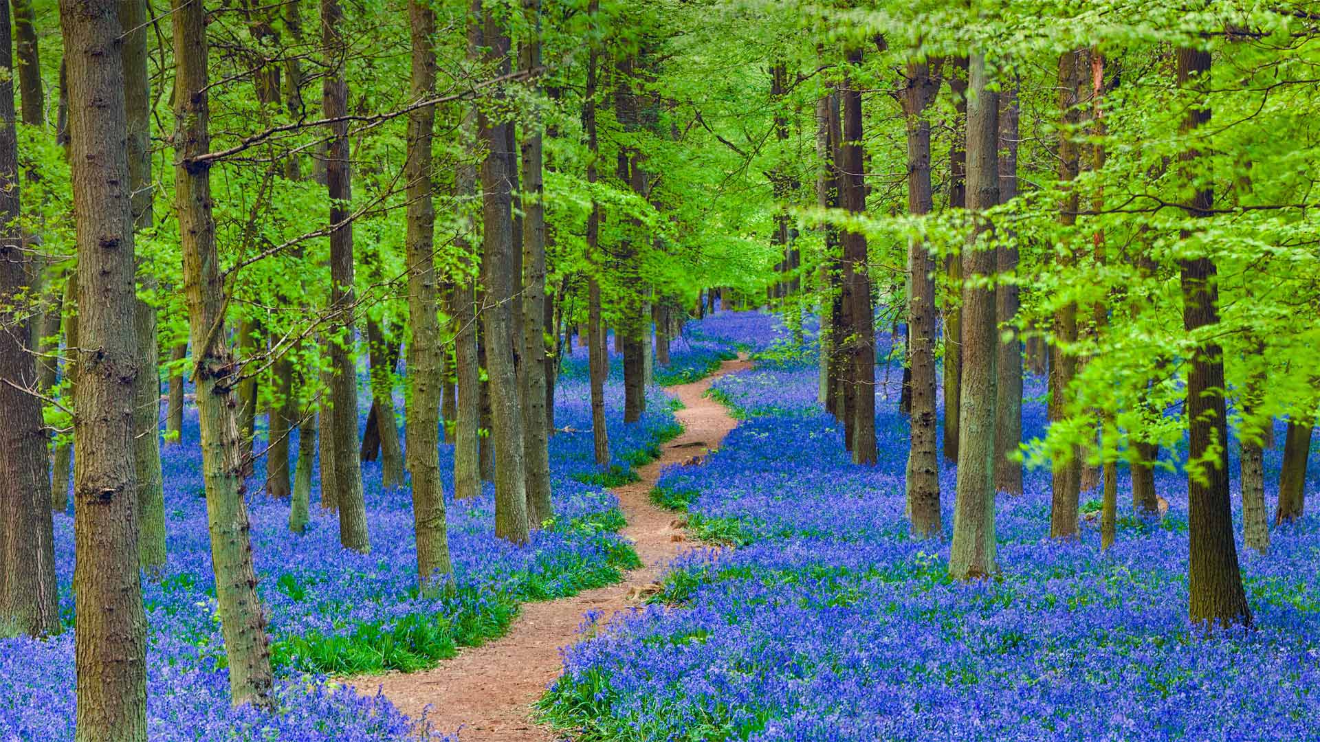
Bluebells in Hertfordshire, England
For just a few weeks every spring, across the pond in England and under the newly forming woodland canopy, one of the most enchanting flowers begins to bloom. The bluebell is known by many names but those who know it as the 'fairy flower' might be the most prepared to withstand its strong, sweetly scented allure. According to British folklore, a blooming bluebell carpet on the woodland floor is a mystical place where fairies live. The legends hold that fairies hang their spells on the flowers to dry, and disturbing them would unleash the magic. In earlier times, children were warned that picking bluebells would cause them to be spirited away. Even adults could fall victim to the flower, being doomed to wander the woods and never escape. And heaven forbid you ever happen to hear the fairies ring the bluebells for their gatherings—it means your death is imminent, a belief that inspired another name for bluebells: 'dead men's bells.'
The truth of the matter is that bluebells are considered toxic. Ancient folktales about fairies were a good way to make sure curious humans avoided handling them. But enjoying their beauty is a whole different matter. Walking through ancient woodland to catch a glimpse of these short-lived beauties is a popular activity throughout the United Kingdom where they are most often found, like those in today's photo of Hertfordshire, England. Rare in other parts of the world, there has been a success in transplanting them, should you want to want to tempt fate with the fairies.
英国赫特福德郡的风铃草
每年春天只有几个星期,在英格兰的池塘对面,在新形成的林地树冠下,一朵最迷人的花开始绽放。风铃草有很多名字,但那些知道它是“仙女花”的人可能最愿意忍受它强烈的、芳香的诱惑。根据英国民间传说,林地地板上盛开的蓝铃地毯是仙女们居住的神秘地方。传说中,仙女们把咒语挂在花朵上晾干,扰乱它们就会释放魔法。早些时候,孩子们被警告说,摘风铃草会导致他们被偷偷带走。即使是成年人也可能成为花朵的牺牲品,注定要在树林中徘徊,永远无法逃脱。天哪,你不会碰巧听到仙女们在聚会上敲响风铃,这意味着你的死亡即将来临,这一信念激发了风铃的另一个名字:“死人的铃铛”
事实上,风铃草被认为是有毒的。关于仙女的古代民间故事是确保好奇的人类避免接触它们的好方法。但享受它们的美丽是完全不同的事情。漫步在古老的林地,欣赏这些短暂的美女,是英国最常见的活动,就像今天英国赫特福德郡的照片一样。在世界其他地方很少见,如果你想和仙女们一起挑战命运,移植它们已经成功了。