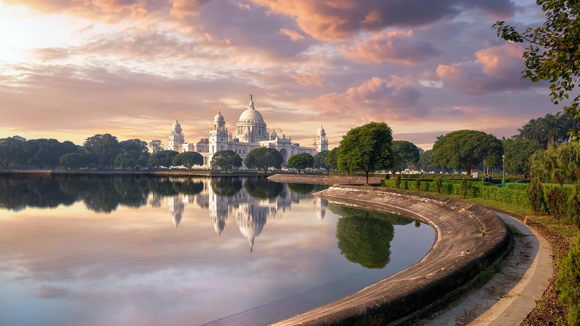
标签 印度 下的文章
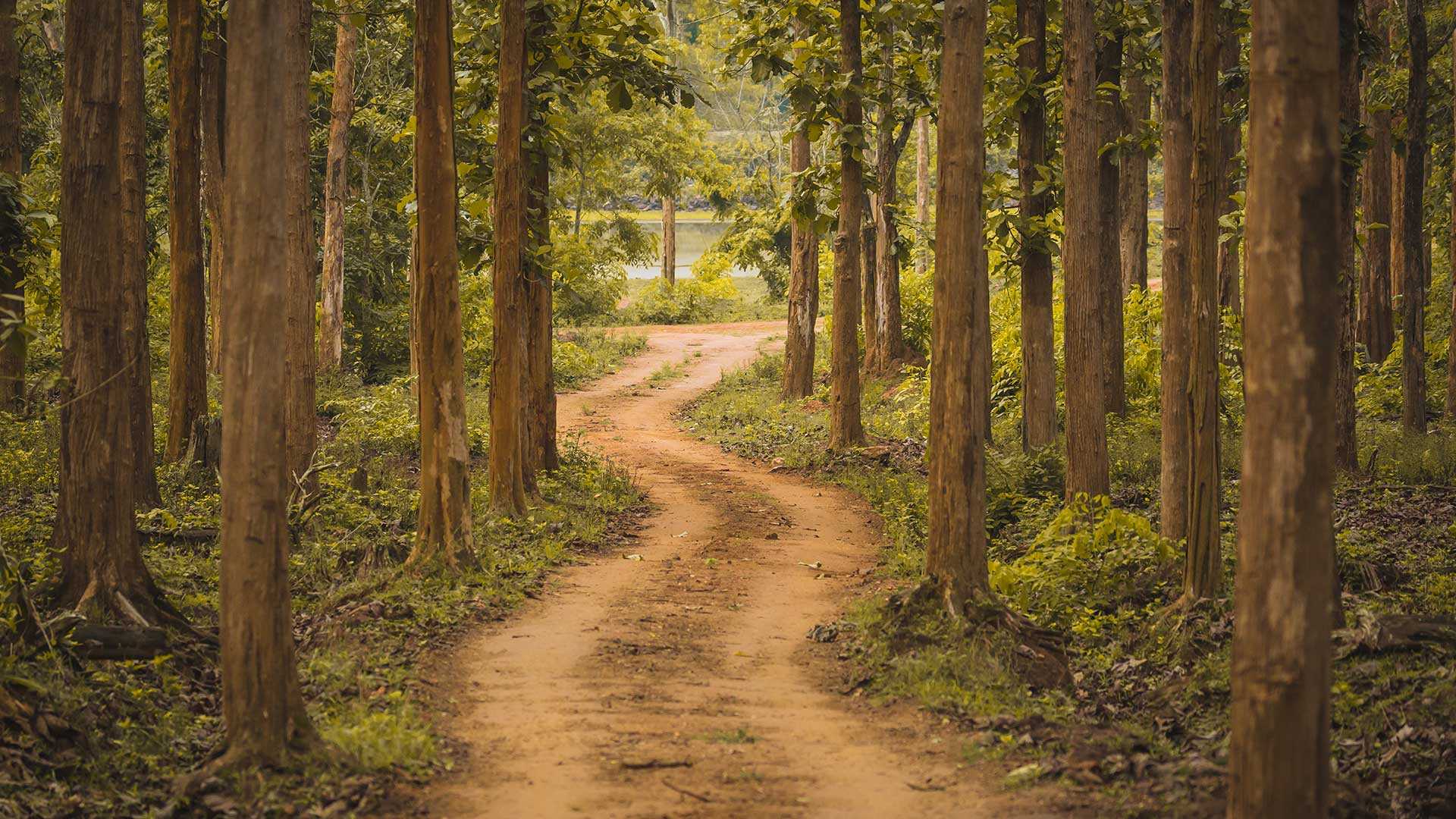
卡纳塔克邦的纳加尔霍雷国家公园,印度 (© Vivek BR/Shutterstock)
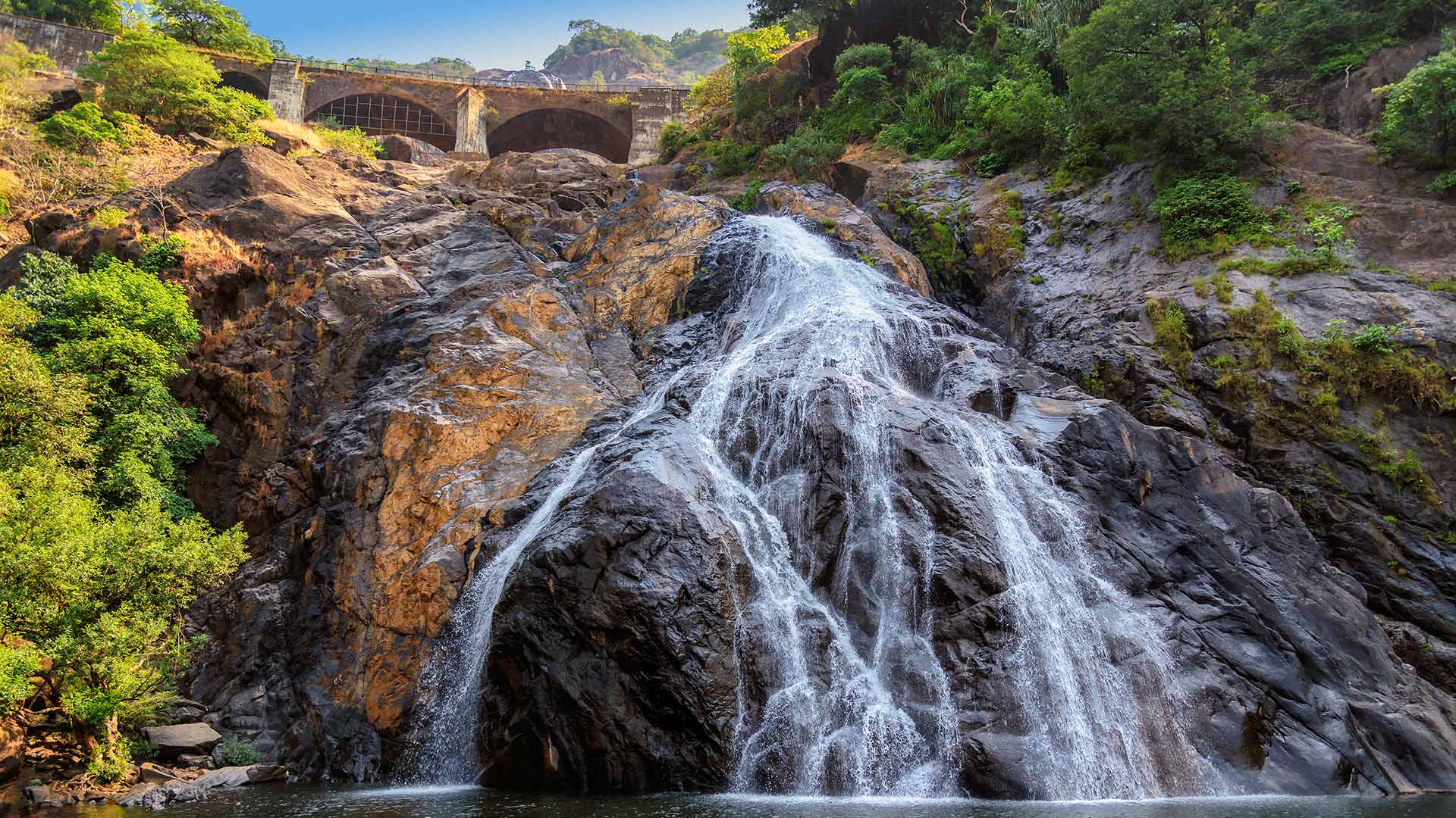
杜德萨加尔瀑布,印度果阿 (© Lucky-photographer/Getty Images)
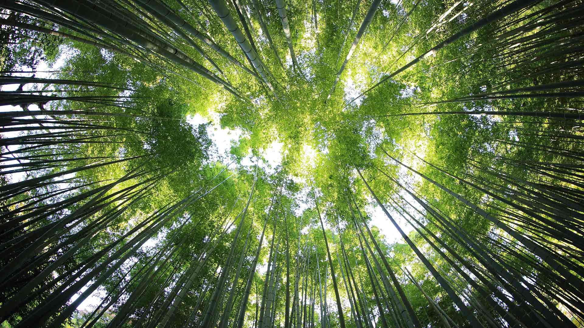
古瓦哈提的竹子,印度阿萨姆邦 (© Page Bazar/500px/Getty Images)
阿拉瓦利山脉的阿布山,印度拉贾斯坦邦 Mount Abu and the Aravalli Range in Rajasthan, India (© saiko3p/Shutterstock)
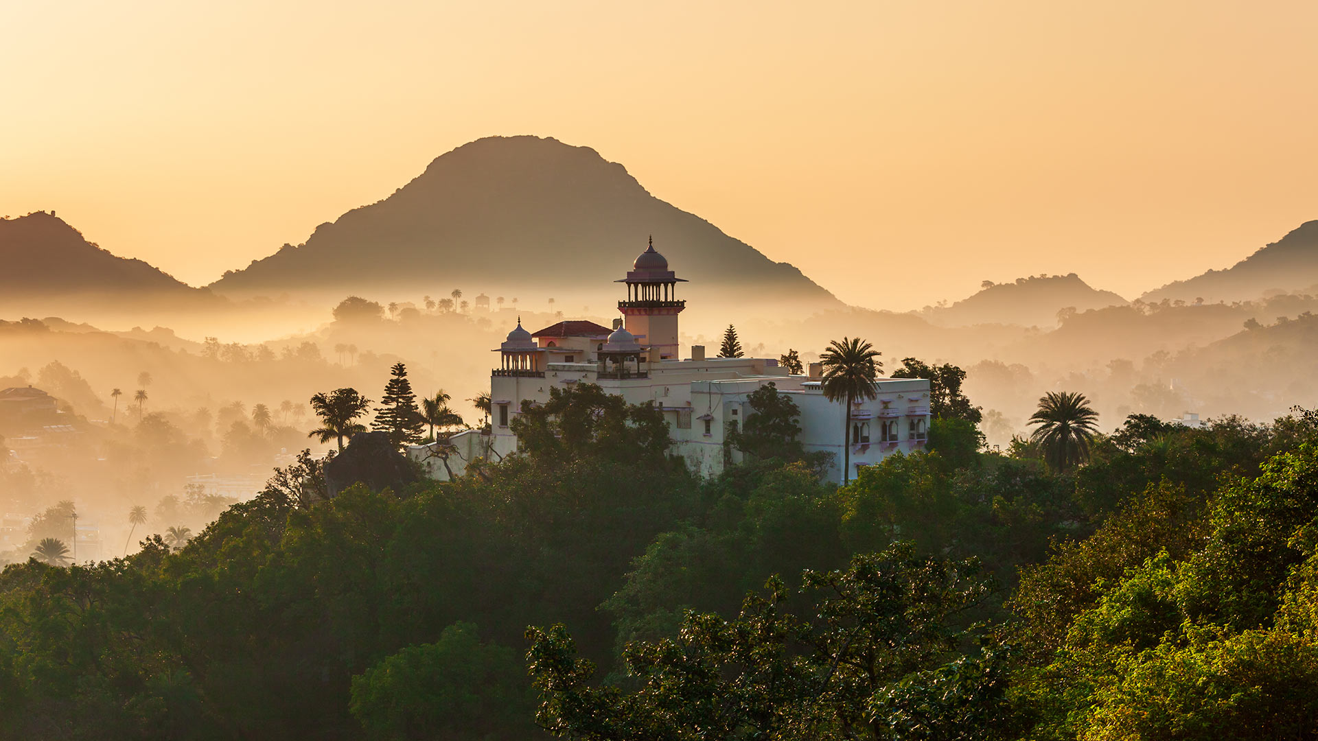
阿拉瓦利山脉的阿布山,印度拉贾斯坦邦 Mount Abu and the Aravalli Range in Rajasthan, India (© saiko3p/Shutterstock)
印度拉贾斯坦邦阿布山
阿布山(Mount Abu)是拉贾斯坦邦唯一的山地站,海拔1722米,被阿拉瓦利山脉(Aravalli Range)郁郁葱葱的绿色山丘环绕,为人们提供了急需的缓解拉贾斯坦斯坦酷热天气的方法。它被称为“沙漠中的绿洲”,因为它的高度是河流、湖泊、瀑布和常绿森林的家园。
阿布山由部落社区的乡村住宅和豪华住宅(包括英式平房和皇家度假屋)组成,五彩缤纷,在这个沙漠之州,阿布山似乎不亚于一个奇迹。除了风景优美之外,该地还有几座印度教和耆那教寺庙,包括Arbuda Devi Temple、Shri Raghunath Temple、Dilwara Temple等。您还可以参观附近的阿查尔加尔堡、纳基湖和德鲁迪亚瀑布。
Mount Abu, Rajasthan, India
Providing much-needed relief from the blazing heat of Rajasthan, Mount Abu, the state’s only hill station, stands at a height of 1,722 meters above sea level and is embraced by the lush green hills of the Aravalli Range. It is referred to as 'an oasis in the desert as its heights are home to rivers, lakes, waterfalls, and evergreen forests.
Studded with a colorful mix of rustic abodes of tribal communities and posh houses inclusive of British-style bungalows and royal holiday lodges, Mount Abu appears to be no less than a wonder in this desert state. Other than its scenic beauty, the place is home to several Hindu and Jain temples, including Arbuda Devi Temple, Shri Raghunath Temple, Dilwara Temple, and more. You can also visit the Achalgarh Fort, Nakki Lake, and Dhrudiya Waterfalls that are nearby.
慕纳尔的茶园,印度喀拉拉邦 Tea plantations in Munnar, Kerala, India (© Mazur Travel/Shutterstock)
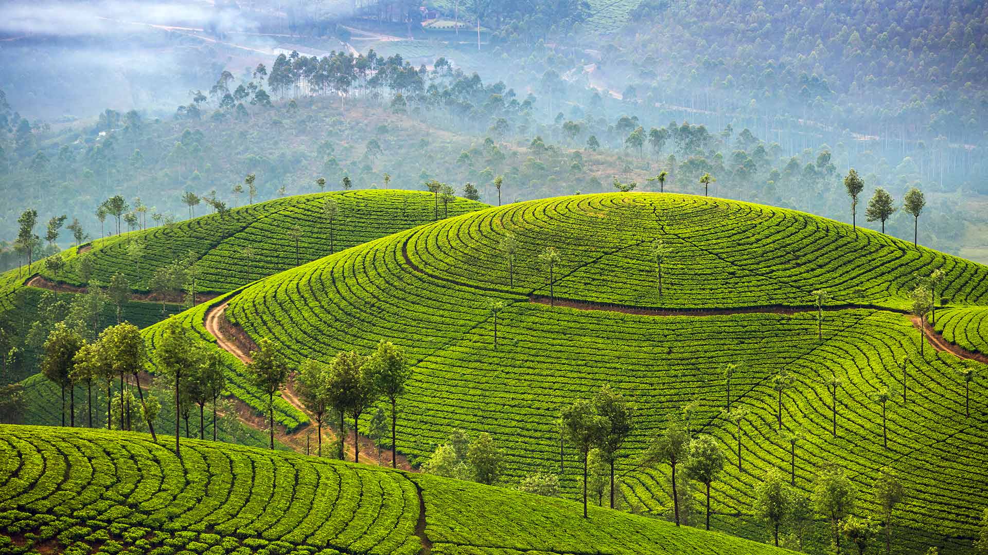
慕纳尔的茶园,印度喀拉拉邦 Tea plantations in Munnar, Kerala, India (© Mazur Travel/Shutterstock)
您喝的茶可能来自这里 Your TEA comes from here!
印度芒纳
蒙纳坐落在喀拉拉邦的伊杜基地区。众所周知,“南印度克什米尔”海拔1600米,曾是大英帝国的避暑胜地。今天,芒纳是一个受欢迎的蜜月和旅游目的地,它与铺满郁郁葱葱的茶园的连绵起伏的山丘是同义词——正如我们今天的主页所示!
芒纳尔被精心地安置在西高止山脉的高耸山丘和山脉中,是一个全年旅游的目的地。Munnar是一个拥有无尽茶园、美丽的山谷、弯弯曲曲的道路、奇异的动植物物种、风景秀丽的城镇和众多瀑布的山区车站,它吸引你在大自然的怀抱中休息,度过美好的时光,同时啜饮一杯美味的热茶。听起来不可错过,对吧?
Munnar, India
Munnar is nestled in the Idukki region of Kerala. The ‘Kashmir of South India’ as it is popularly known, lies at an elevation of 1600m above sea level and once served as a summer resort of the British Empire. Today Munnar is a popular honeymoon and travel destination and is synonymous with rolling hills carpeted with lush tea plantations – as seen on our homepage today!
Carefully placed amidst the towering hills and mountains of the Western Ghats, Munnar is a year-round tourist destination. A hill station with never-ending tea estates, gorgeous valleys, curvy roads, exotic species of flora and fauna, scenic towns, and many waterfalls, Munnar entices you to take a break and spend quality time in the lap of nature – all while sipping a nice hot tea. Sounds unmissable, right?
在喀拉拉邦河流中行驶的一艘小船,印度 Aerial view of a boat in Kerala, India (© Shutterstock)
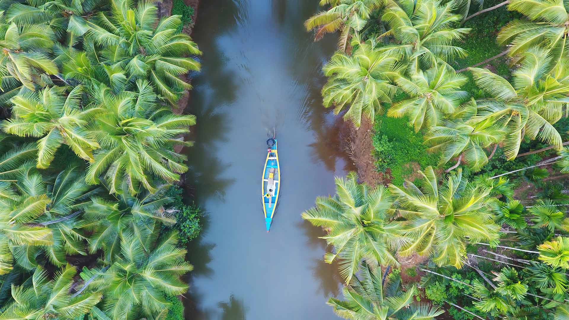
在喀拉拉邦河流中行驶的一艘小船,印度 Aerial view of a boat in Kerala, India (© Shutterstock)
椰林国 Coconut forest country
Kerala, India
Kerala, the southernmost state of India, is the spice hotspot of the world since ancient times. This beautiful land is rightly called God's Own Country, given to its lush green landscapes and crystal-clear beaches that will leave you awestruck. With all elements of nature in it, Kerala leads the country in various aspects like literacy rate, sex ratio, least population growth, and travel and tourism.
The name Kerala is derived from Kera, the local Malayalam word for coconut, and there is an abundance of palm trees across the state. The spiky dark green fronds act as natural parasols against the glare of the sun. The coconut doesn’t just lend its name to the place but also acts as a ubiquitous and adaptable natural resource from which countless products, such as coir, a versatile fiber, and toddy, a famous – and potent – local brew, are derived.
印度喀拉拉邦
印度最南端的喀拉拉邦自古以来就是世界香料热点。这片美丽的土地被正确地称为上帝的祖国,因其葱郁的绿色景观和水晶般清澈的海滩将让你惊叹不已。喀拉拉邦拥有自然的所有元素,在识字率、性别比、人口增长最少、旅游和旅游等各个方面都处于全国领先地位。
喀拉拉这个名字来源于当地马来语中椰子的意思Kera,整个州有大量的棕榈树。尖尖的深绿色复叶充当天然遮阳伞,抵御太阳的强光。椰子不仅是这个地方的名字,而且是一种无处不在、适应性强的自然资源,从中可以提炼出无数产品,如椰子皮(一种多用途纤维)和托迪酒(一种著名且有效的当地酿造酒)。
果阿邦的阿兰博尔海滩,印度 Arambol Beach in Goa, India (© Ben Pipe/Alamy)
果阿邦的阿兰博尔海滩,印度 Arambol Beach in Goa, India (© Ben Pipe/Alamy)
印度的里维埃拉 The Riviera of India
Arambol Beach, Goa, India
Known for its immense, densely populated cities, India also has a seemingly endless coastline. And no part of it is more languid and lovely than Arambol, in the small and special state of Goa on the southwestern coast. Arambol is a popular holiday town with the vibe of a sleepy fishing village—which it was once was. Now visitors from around the world drawn to its tropical climate, rainforest valleys, historic architecture, sandy beaches, blue waters, and swaying coconut palms bring a new energy to Arambol.
Goa is distinct from much of India as it was colonized by Portugal while Great Britain ruled the rest. The Portuguese Empire conquered Goa in the early 1500s and ruled it until 1961, when it was annexed by India. The influence of the Portuguese can be seen in Goa's Catholic churches and convents, as well as in the name of the state's largest city: Vasco da Gama, after the explorer who once governed Goa.
If history isn't your thing, Arambol is famous for a drum circle and flea market held on the beach a few hours before sunset. It's just as much a beach party as a market. Craftspeople sell handmade wares while musicians join impromptu performances. There's no better way to end your day in Goa, land of sand and spice and sun.
阿兰波海滩,果阿,印度
印度以其巨大而人口稠密的城市而闻名,其海岸线似乎无穷无尽。在西南海岸的小而特殊的果阿州,没有一个地方比Arambol更慵懒和可爱。Arambol是一个受欢迎的度假小镇,有着一个沉睡的渔村的氛围,它曾经是一个渔村。现在,来自世界各地的游客被其热带气候、雨林山谷、历史建筑、沙滩、蓝色水域和摇曳的椰子树所吸引,为Arambol带来了新的活力。
果阿不同于印度的大部分地区,因为它曾被葡萄牙殖民,而英国统治其余地区。15世纪初,葡萄牙帝国征服了果阿,并统治了它,直到1961年被印度吞并。葡萄牙人的影响可以在果阿的天主教教堂和修道院中看到,也可以在该国最大城市瓦斯科·达伽马(Vasco da Gama)的名字中看到,瓦斯科·达·伽马是曾经统治果阿的探险家。
如果你不喜欢历史,那幺Arambol以日落前几个小时在海滩上举行的鼓圈和跳蚤市场而闻名。这是一个海滩派对,也是一个市场。工匠们出售手工制品,音乐家们则参加即兴表演。在果阿,没有更好的方式来结束你的一天,这是一个充满沙子、香料和阳光的地方。
奇陶尔加尔堡,印度 Chittorgarh Fort, India (© Anand Purohit/Getty Images)
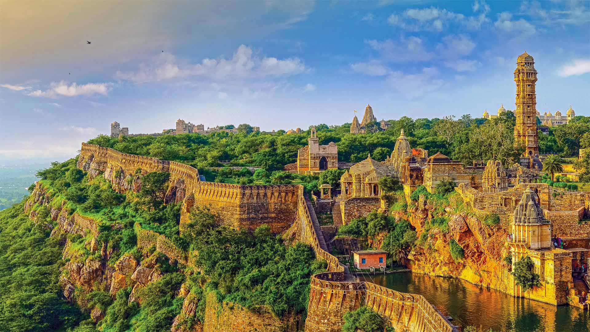
奇陶尔加尔堡,印度 Chittorgarh Fort, India (© Anand Purohit/Getty Images)
Chittorgarh Fort Rajasthan India
At 8 miles in circumference, the Chittorgarh Fort is one of the largest forts in India, a nation with scores of ancient and medieval fortresses. For starters there are seven massive gates from which to enter. Inside you'll find four palaces and 19 temples. At one time there were almost 100 bodies of water, most of them ponds fed by natural catchment and rainfall, although now there are only 20. Chittorgarh ('garh' means 'fort,' so it's also known as Chittor Fort) is so old, no one is sure exactly when it was built, although reports of its earliest capture go back to the 8th century. It is one of a cluster of six large forts in the northwestern state of Rajasthan referred to as the Hill Forts of Rajasthan, all of them collectively designated a UNESCO World Heritage Site. We're featuring this important and ancient complex on India's 75th Independence Day, one of India's three national holidays.
On August 15, 1947, India officially broke free of Great Britain and became a sovereign and democratic nation with the speedy passage of the Indian Independence Act. The paperwork might have been fast, but the struggle for independence from British rule lasted 90 years and cost many Indian lives. The British controlled the Indian subcontinent for nearly 200 years, after winning the decisive Battle of Plassey in 1757. The victory allowed the English East India Company to eventually exercise control over most of the rest of the Indian subcontinent, Burma, and Afghanistan. East India remained the supreme authority in India for a century until 1857 when a massive rebellion by civilians and Indian soldiers against the company was suppressed, resulting in direct British rule, referred to as the British raj.
The ensuing decades saw the formation of the Indian National Congress, the rise of Indian nationalism, various armed rebellions, and many acts of civil disobedience led by Mahatma Gandhi and others, before independence was finally achieved. While India as we know it is still a very young nation, the Chittor Fort reminds us the land and people that created modern India have endured and thrived for millennia.
印度拉贾斯坦邦的奇托加尔堡
奇托加尔要塞周长8英里,是印度最大的要塞之一,该国拥有数十座古代和中世纪要塞。首先,有七扇巨大的大门可以进入。里面有四座宫殿和19座寺庙。曾经有近100个水体,其中大部分是由自然集水和降雨形成的池塘,尽管现在只有20个。奇托加尔(Chittorgar,意为“堡垒”,所以也被称为奇托堡)非常古老,没有人确切知道它是何时建成的,尽管关于最早捕获的报道可以追溯到8世纪。它是西北部拉贾斯坦邦的六座大型堡垒群之一,被称为拉贾斯坦山的希尔堡垒,所有这些堡垒都被联合国教科文组织列为世界遗产。在印度的第75个独立日,印度的三个法定假日之一,我们将展示这座重要而古老的建筑群。
1947年8月15日,随着《印度独立法》的迅速通过,印度正式脱离英国,成为一个主权民主国家。文书工作可能很快,但脱离英国统治的独立斗争持续了90年,夺走了许多印度人的生命。1757年,英国人在普拉西决定性战役中获胜后,控制了印度次大陆近200年。这场胜利使英国东印度公司最终控制了印度次大陆的大部分其他地区,缅甸和阿富汗。一个世纪以来,东印度一直是印度的最高权力机构,直到1857年,平民和印度士兵对该公司的大规模叛乱被镇压,导致英国直接统治,称为英国统治。
随后的几十年见证了印度国民大会的成立、印度民族主义的兴起、各种武装叛乱以及圣雄甘地等人领导的许多公民不服从行为,最终实现了独立。虽然我们所知的印度仍然是一个非常年轻的国家,但奇托堡提醒我们,创造现代印度的土地和人民已经忍受并繁荣了数千年。
一列火车穿过卡纳塔克邦的沙拉瓦蒂桥,印度 A train crossing the Sharavati Bridge in Karnataka, India (© Amith Nag Photography/Getty Images)
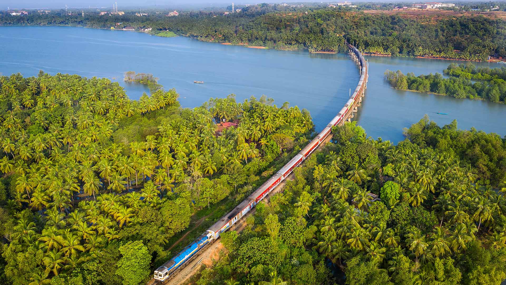
一列火车穿过卡纳塔克邦的沙拉瓦蒂桥,印度 A train crossing the Sharavati Bridge in Karnataka, India (© Amith Nag Photography/Getty Images)
工程奇迹 An engineering marvel
Sharavati Bridge
This bridge at Honnavar was awarded second prize in the competition for Most outstanding Bridge National Awards 1995 – Category I by Indian Institute of Bridge Engineers.
Here, we are looking at the Sharavati Bridge, the longest railway bridge in the Indian state of Karnataka. It is 2,060 metres long and it carries the Konkan Railway over the Sharavati river. Constructed in 1984, the bridge is recognised around the globe as an engineering wonder. During the 20th century, the project to construct this bridge was considered to be the biggest and perhaps the most complicated railway undertaking (at least in this part of the world). The Konkan Railway has over 2,000 bridges and 91 tunnels constructed through some of the toughest terrains.
沙拉瓦蒂桥
这座位于Honnavar的大桥在1995年印度桥梁工程师学会颁发的最杰出桥梁国家奖(I类)竞赛中获得二等奖。
在这里,我们看到的是印度卡纳塔克邦最长的铁路桥沙拉瓦蒂桥。它长2060米,通过萨拉瓦蒂河运送Konkan铁路。这座桥建于1984年,是全球公认的工程奇迹。在20世纪,建造这座桥的项目被认为是最大的,也许是最复杂的铁路工程(至少在世界这一地区)。Konkan铁路有2000多座桥梁和91条隧道,穿越一些最恶劣的地形。