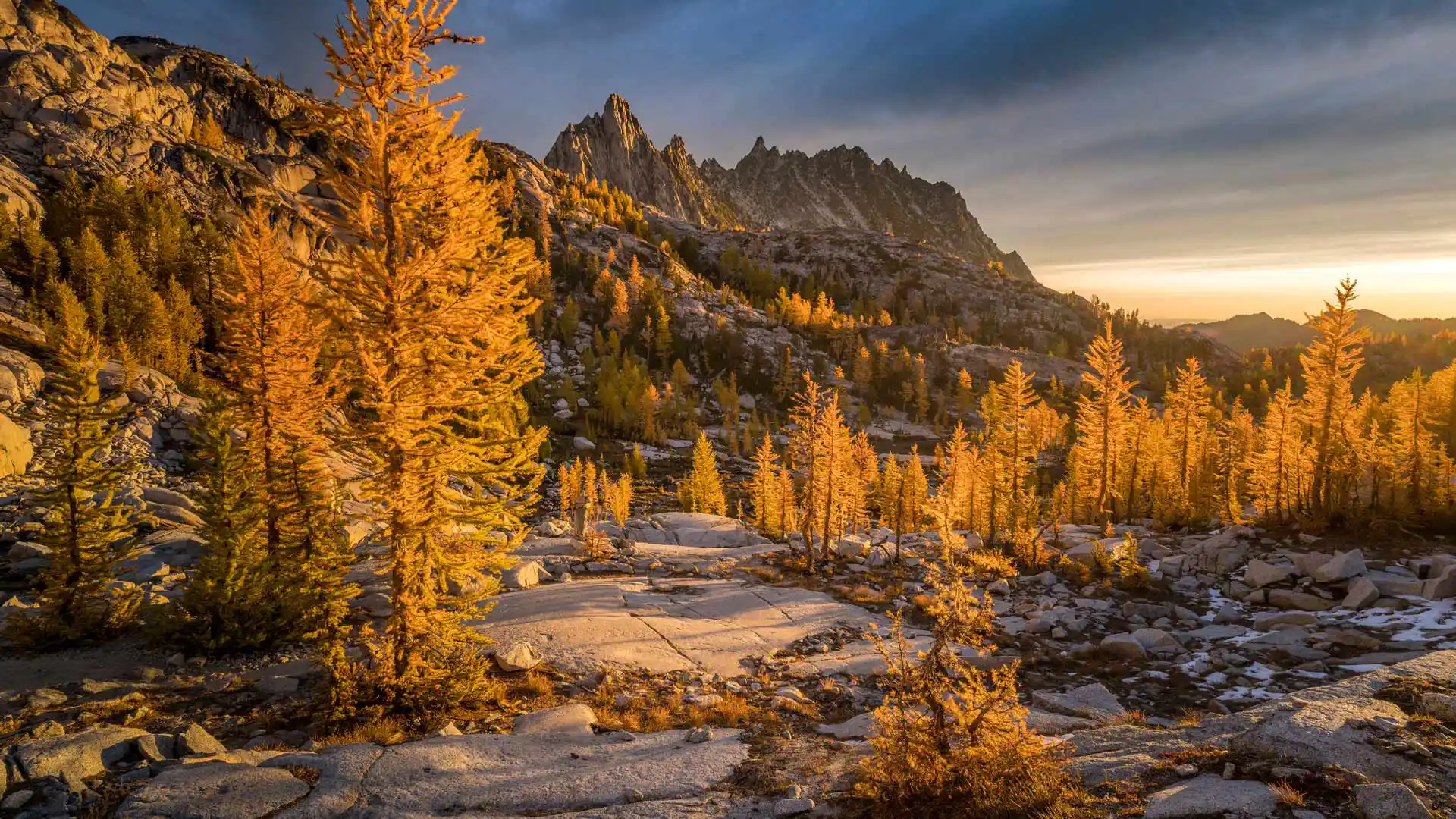
金色落叶松和普鲁西克峰,魔力地带,华盛顿州,美国 Golden larches and Prusik Peak, Enchantments, Washington (© Jim Patterson/Tandem Stills + Motion)
金色落叶松和普鲁西克峰,魔力地带,华盛顿州,美国 Golden larches and Prusik Peak, Enchantments, Washington (© Jim Patterson/Tandem Stills + Motion)
确实令人着迷 Enchanting indeed
金色落叶松和普鲁西克峰,魔力地带,华盛顿州
华盛顿州的魔力地带拥有700多个高山湖泊和池塘。早在欧洲定居者到来之前,魔力地带是美国原住民雅基马、奇努克和韦纳奇部落的家园。20世纪的伐木和采矿浪潮改变了这里的大部分地貌。如今,成群的山羊在公园里吃草,岩雷鸟在树上栖息。落叶松的针叶变成了金黄色,给岩石地形投下了温暖的光辉,这片土地也随之发生了变化。普鲁西克峰在魔力地带中脱颖而出,它不仅是华盛顿州喀斯喀特山脉阿尔卑斯湖荒野区的一颗璀璨明珠,也是该地区和魔力地带的象征。对于经验丰富的徒步旅行者和攀岩者来说,这是一个绝佳的地点,这里有各种难度的攀岩路线,吸引着熟练的登山者或冒险者一试身手。
Golden larches and Prusik Peak, the Enchantments, Washington
That jagged granite summit is Prusik Peak, an icon of Washington state's Enchantments region, high in the Cascade Mountain range. Getting here means a long, strenuous hike, and for much of the year it is covered in snow. But from midsummer through the fall, hikers and climbers arrive here as the larch trees turn golden. The granite peaks and autumnal colors are not the only attractions. The Enchantments boasts more than 700 alpine lakes and ponds, as well as herds of grazing mountain goats that roam this corner of the scenic Alpine Lakes Wilderness.
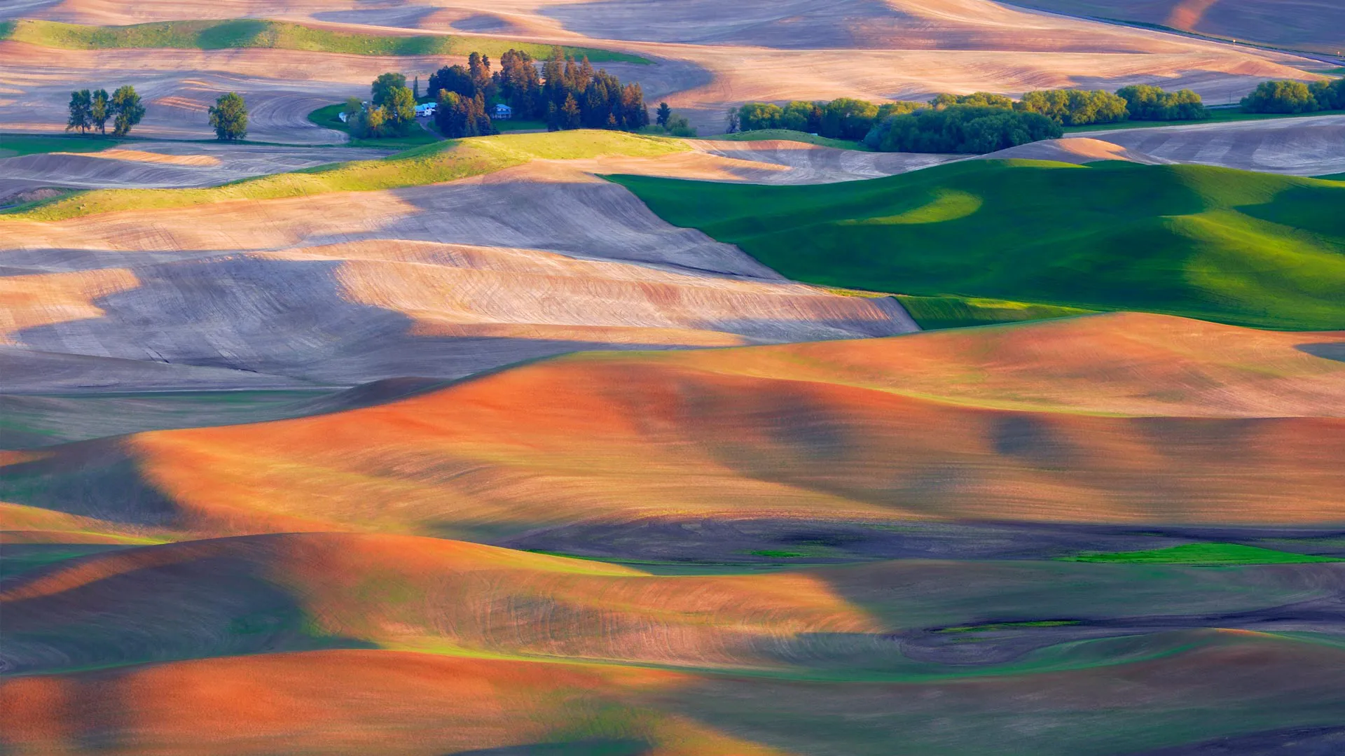
帕卢斯的农田,华盛顿州,美国 Farmland in the Palouse, Washington (© EJ-J/Getty Images)
帕卢斯的农田,华盛顿州,美国 Farmland in the Palouse, Washington (© EJ-J/Getty Images)
宛若仙境的帕卢斯田园 Perfect, pastoral Palouse
帕卢斯的农田,华盛顿,美国
美国的帕卢斯地区以风景如画的景观和独特的地质特征而闻名。延绵起伏的丘陵田原一望无际,错落有致、金绿相间的麦浪美不胜收,相比意大利的托斯卡纳和法国乡村也毫不逊色。帕卢斯是一个农业区,当地土壤肥沃和气候适宜,盛产小麦、大麦、豌豆和小扁豆等。
Palouse farmland, Washington state
The Palouse region in the Pacific Northwest is known for its picturesque landscapes, agricultural heritage, and unique geological features. Those stunning hills in our homepage image were formed over tens of thousands of years, from dust and silt blown by the wind, known as loess. The Palouse's fertile soil and climate make it ideal for farming and it is known for its wheat, barley, lentils, and other crops. With its beautiful rolling hills covered in patchworks of green and golden fields, it is often compared to Italy's Tuscany region or the French countryside.
圣海伦斯山国家火山纪念区的边界小径,美国华盛顿州 Boundary Trail in Mount St. Helens National Volcanic Monument, Washington (© Don Geyer/Alamy)
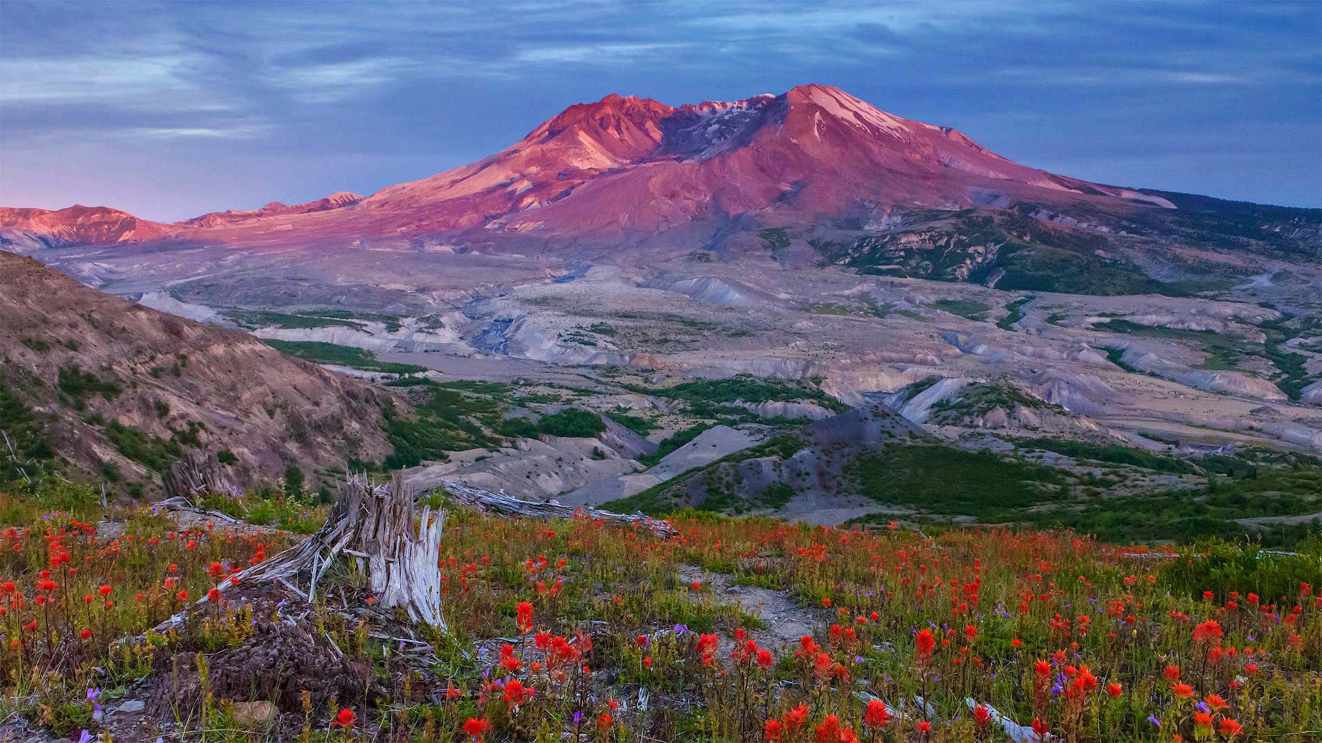
圣海伦斯山国家火山纪念区的边界小径,美国华盛顿州 Boundary Trail in Mount St. Helens National Volcanic Monument, Washington (© Don Geyer/Alamy)
40年的休养生息 40 years of recovery
Mount St. Helens National Volcanic Monument, Washington
Today is an important day in American history. We're standing on the Boundary Trail at Johnston Ridge in the Mount St. Helens National Volcanic Monument. Forty years ago today, 110,000 acres within Gifford Pinchot National Forest was set aside to memorialize the deadliest and most destructive volcanic eruption in the United States. For nearly nine hours on May 18th, 1980, the Mount St. Helens erupted, forever changing the Washington landscape. The volcanic event started at roughly 8:30 on a Sunday morning with a 5.1 magnitude earthquake. This triggered what is known as a 'lateral eruption,' which means the lava blast comes out of the side of the volcano, rather than the top. The initial blast shaved more than a thousand feet off the mountain's elevation, resulting in a massive avalanche and the destruction of about 150 square miles of the surrounding forest. When the event ended, 57 people had died, 200 homes and almost 200 miles of nearby highway had been destroyed.
The monument was established by President Ronald Reagan in 1982 to preserve the area for research, recreation, and education. The land inside has been left to mostly recover naturally since the eruption. While it's believed that Mount St. Helens will erupt again sometime within the next few centuries, that has not deterred people from hiking and climbing at the monument, which has been allowed since 1986.
圣海伦山国家火山纪念碑,华盛顿
今天是美国历史上重要的一天。我们站在圣海伦斯山国家火山纪念碑的约翰斯顿山脊的边界小道上。四十年前的今天,吉福-平肖国家森林内的110000英亩土地被用来纪念美国最致命、破坏性最大的火山爆发。1980年5月18日,圣海伦斯山爆发了近9个小时,永远改变了华盛顿的景观。火山爆发于周日早上8点30分左右,发生了5.1级地震。这引发了所谓的“侧向喷发”,这意味着熔岩喷发从火山的侧面而不是顶部。最初的爆炸使山的海拔下降了一千多英尺,导致了一场大规模的雪崩,并摧毁了周围约150平方英里的森林。活动结束时,57人死亡,200所房屋和近200英里的附近公路被毁。
该纪念碑由罗纳德·里根总统于1982年建立,旨在保护该地区的研究、娱乐和教育。火山爆发后,火山内部的土地基本上自然恢复。虽然人们相信圣海伦斯山将在未来几个世纪的某个时候再次喷发,但这并没有阻止人们前往这座自1986年以来就被允许的纪念碑进行徒步旅行和攀登。
雷尼尔山上空的银河星系,美国华盛顿州 Moonlight and the Milky Way over Mount Rainier in Mount Rainier National Park, Washington (© Brad Goldpaint/Cavan)
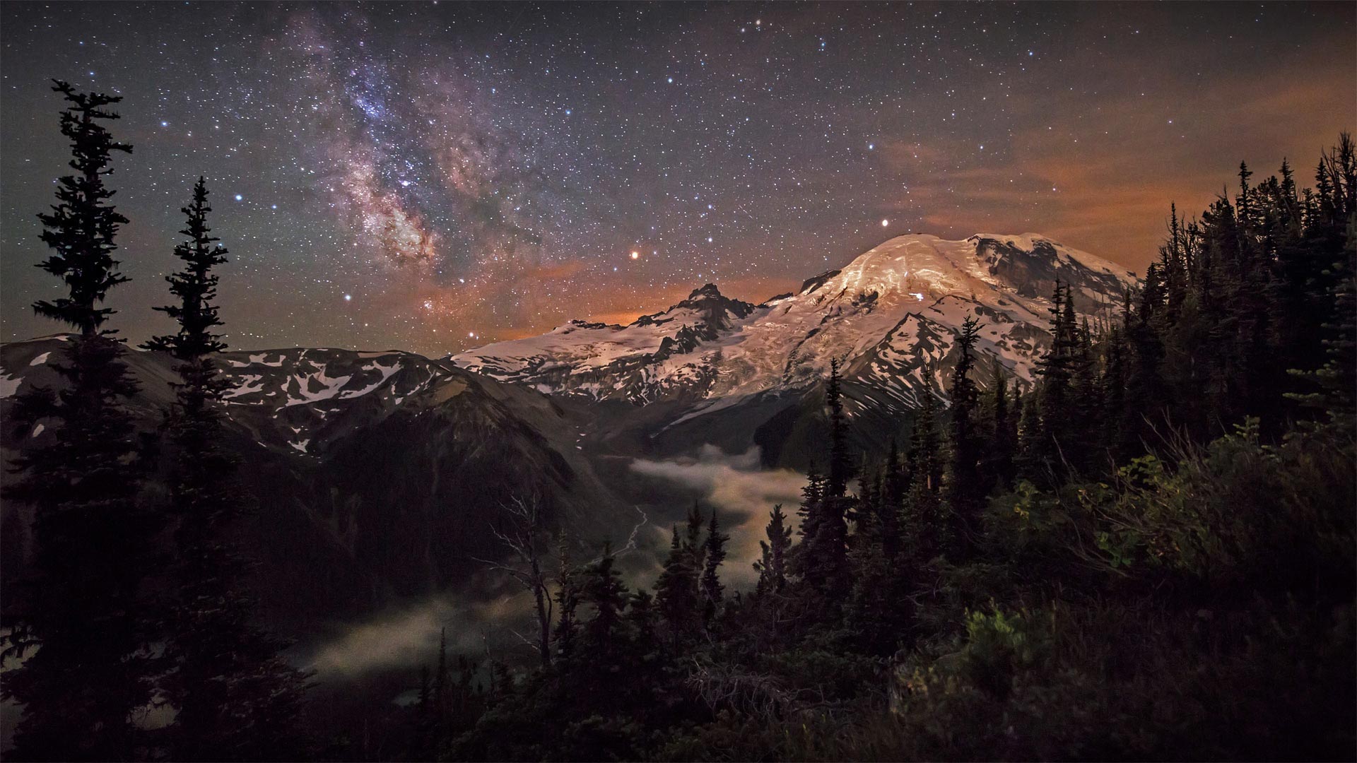
雷尼尔山上空的银河星系,美国华盛顿州 Moonlight and the Milky Way over Mount Rainier in Mount Rainier National Park, Washington (© Brad Goldpaint/Cavan)
123岁生日快乐! Happy 123rd birthday
Mount Rainier National Park
Mount Rainier is the crown jewel of its namesake national park, designated March 2, 1899, by President William McKinley. It was just the fifth national park in the United States. Beyond the mountain, the 369-square-mile park also includes valleys, waterfalls, old-growth forests, and pristine alpine meadows famous for summer wildflowers.
Rainier is considered the most glaciated peak in the contiguous US. Native Americans named it Tahoma, which translates to mother of waters. Indeed, the mountain spawns five major rivers, and to this day, its snowmelt provides much of the water for the region.
Although beautiful, Rainier is also one of the most dangerous volcanoes in the world. Scientists consider an eruption in the near future to be highly probable. In addition to spewing ash and triggering landslides, a major eruption would likely trigger massive mudflows, called lahars, that would send a tsunami of mud, boulders, and debris toward the cities of Tacoma and Seattle, only 100 miles away. For now, we'll just admire the majesty of this sleeping giant and be thankful that the national park protects so much pristine northwest wilderness.
雷尼尔山国家公园
雷尼尔山是威廉·麦金利总统于1899年3月2日指定的同名国家公园的皇冠明珠。它只是美国的第五个国家公园。在山的另一边,369平方英里的公园还包括山谷、瀑布、古老的森林和以夏季野花闻名的原始高山草甸。
雷尼尔峰被认为是美国周边冰川最为严重的山峰。美洲原住民将其命名为Tahoma,意为“水之母”。事实上,这座山孕育了五条主要河流,直到今天,它的融雪为该地区提供了大量的水。
雷尼尔火山虽然美丽,但也是世界上最危险的火山之一。科学家认为在不久的将来爆发是极有可能的。除了喷发火山灰和引发山体滑坡外,一次大的火山喷发可能会引发大规模的泥流,称为lahars,这将向仅100英里外的塔科马和西雅图两座城市带来一场由泥浆、巨石和碎片组成的海啸。现在,我们只想欣赏这位沉睡巨人的威严,感谢国家公园保护了如此多原始的西北荒野。
圣胡安群岛,华盛顿州 San Juan Islands, Washington (© Stephen Matera/Tandem Stills + Motion)
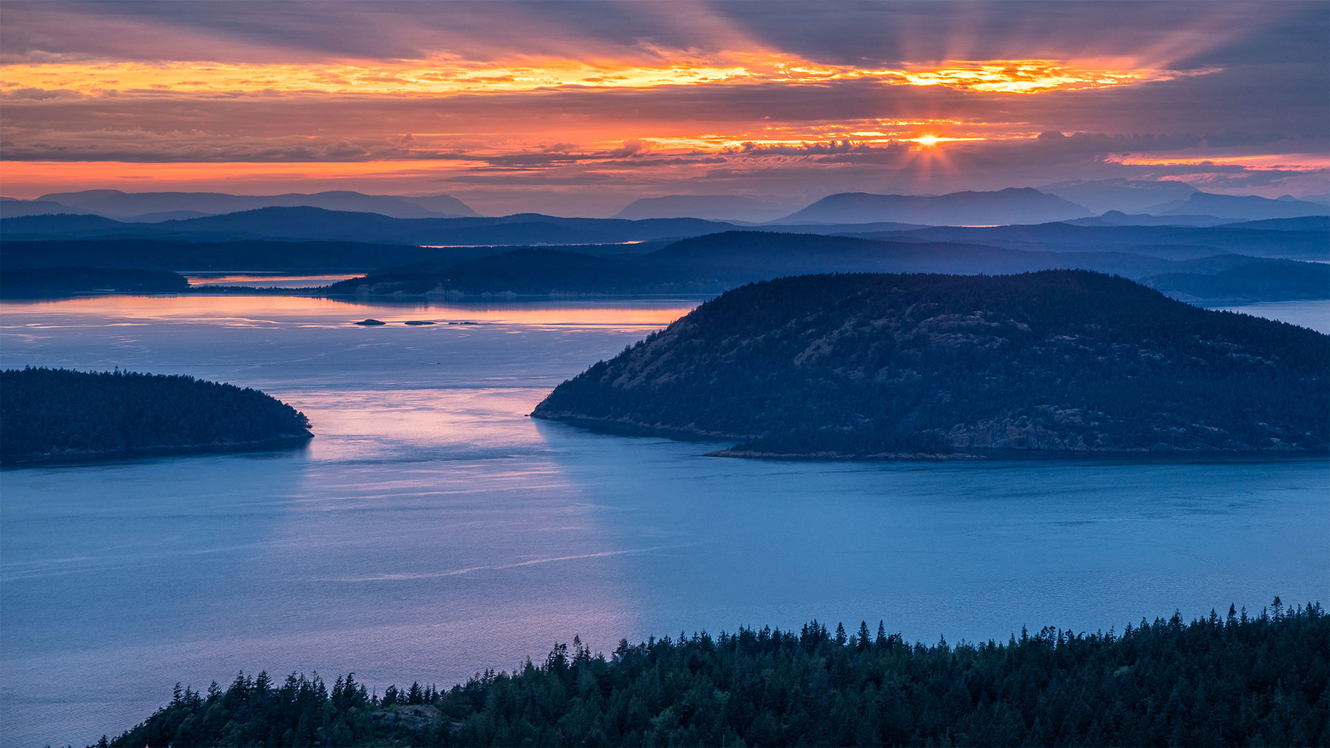
圣胡安群岛,华盛顿州 San Juan Islands, Washington (© Stephen Matera/Tandem Stills + Motion)
Islands of the Salish Sea
The San Juan archipelago is made up of over 400 islands and rocks, some only visible during low tide, in the Salish Sea between Washington state and Vancouver Island, British Columbia. No bridges connect the San Juans to the mainland, but four of the largest islands—San Juan, Orcas, Lopez, and Shaw—are accessible via the Washington State Ferries. Tourists come to the islands to take in the stunning coastal views, catch a glimpse of resident orcas, and partake in many outdoor activities, such as sea kayaking, biking, and hiking. One popular destination is the San Juan Island National Historical Park, which was established on September 9, 1966, to commemorate the Pig War. That strangely named confrontation between the US and the UK was sparked, in part, by the killing of a pig in 1859. But it was really a dispute over ownership of the islands.
萨利什海岛屿
圣胡安群岛由400多个岛屿和岩石组成,其中一些只有在退潮时才能看到,位于华盛顿州和不列颠哥伦比亚省温哥华岛之间的萨利什海。圣胡安岛与大陆之间没有桥梁连接,但圣胡安岛、奥卡斯岛、洛佩兹岛和肖岛四个最大的岛屿可以通过华盛顿州的渡轮到达。游客来到这些岛屿是为了欣赏美丽的海岸风光,欣赏当地的虎鲸,并参与许多户外活动,如海上皮划艇、骑自行车和徒步旅行。圣胡安岛国家历史公园(San Juan Island National Historical Park)是一个受欢迎的目的地,它建于1966年9月9日,是为了纪念猪战争。美英之间那场奇怪的对峙,部分是由1859年一头猪被杀引发的。但这确实是一场关于岛屿所有权的争端。
奥林匹克海岸国家海洋保护区的海岸线,美国华盛顿州 The shoreline of Olympic Coast National Marine Sanctuary, Washington state (© Chris Moore/Tandem Stills + Motion)
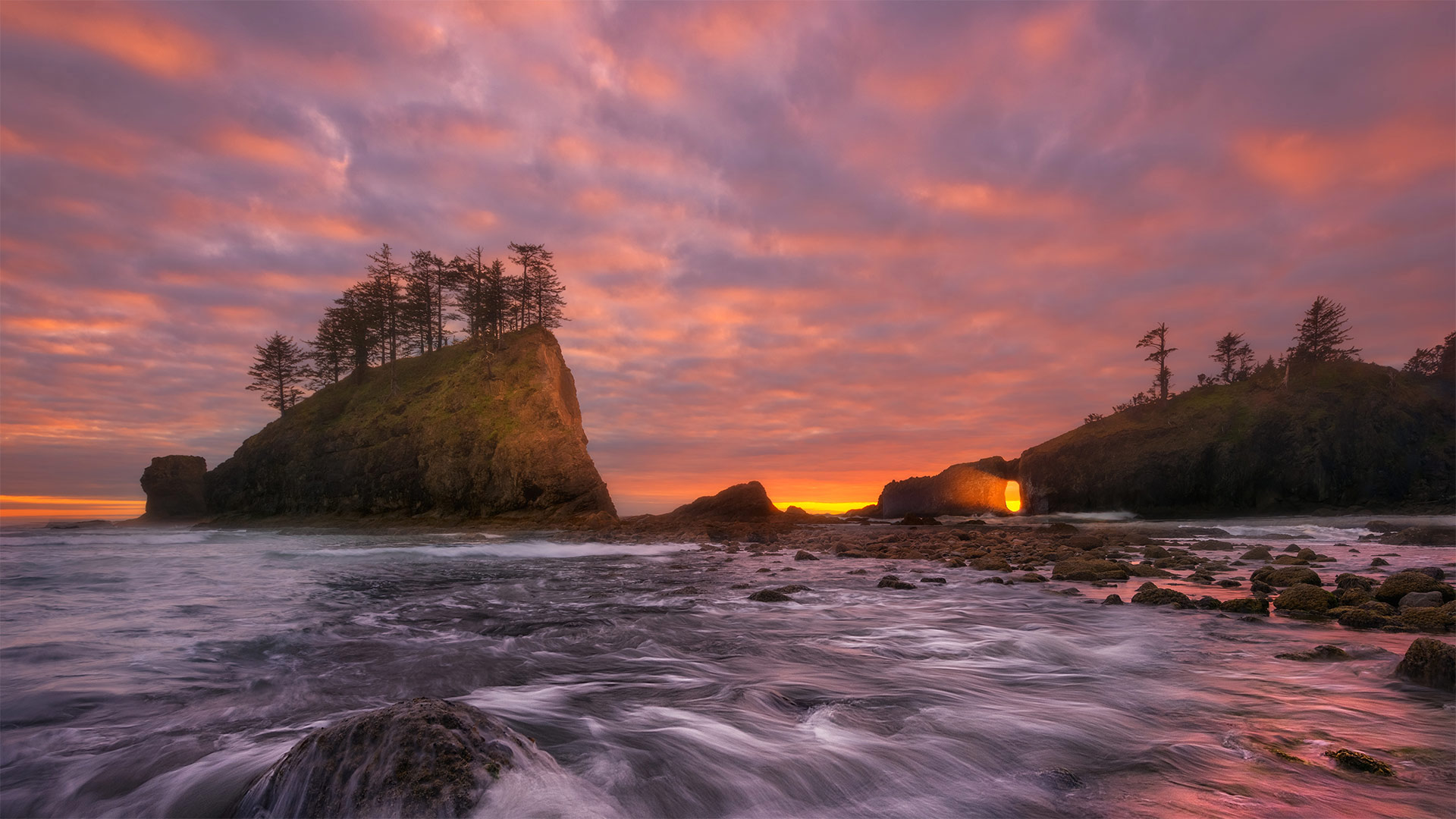
奥林匹克海岸国家海洋保护区的海岸线,美国华盛顿州 The shoreline of Olympic Coast National Marine Sanctuary, Washington state (© Chris Moore/Tandem Stills + Motion)
A wild, craggy corner of the United States
The sun is setting here on the west coast of Washington state's rugged Olympic Peninsula, where more than 3,000 square miles of marine waters are protected as part of the Olympic Coast National Marine Sanctuary. Wondering where exactly we are? Look at a map of the United States and draw your finger up the west coast until it ends where the Strait of Juan de Fuca meets the Pacific Ocean. Those final 135 miles of shoreline form the landward boundary of the sanctuary, which also extends seaward 25 to 50 miles.
This area attracts more than 3 million visitors a year. Many come to catch glimpses of the 29 species of marine mammals that reside in or migrate through this area, like humpback, gray, and orca whales, plus seals, sea lions, and sea otters. Salmon and halibut thrive here, as do any number of seabirds that make their nests in the craggy rock walls, seagrass, and treetops. At low tide, visitors explore tidepools teeming with life. This sanctuary is more than ecological resource, it's also home to vibrant Native American tribes. The Makah, Quileute, Hoh, and Quinault have been here for centuries, long before the first English sea captains spotted the coast and gave it its current name.
美国的一个荒凉、崎岖的角落
太阳落在华盛顿州崎岖不平的奥林匹克半岛西海岸,这里有3000多平方英里的海洋水域作为奥林匹克海岸国家海洋保护区的一部分受到保护。想知道我们到底在哪里?看一张美国地图,把手指指向西海岸,直到胡安·德富卡海峡与太平洋交汇处为止。最后135英里的海岸线形成了保护区的陆地边界,也向海延伸了25到50英里。
这个地区每年吸引300多万游客。许多人来这里是为了瞥见居住在该地区或迁徙经过该地区的29种海洋哺乳动物,如座头鲸、灰鲸和虎鲸,以及海豹、海狮和海獭。鲑鱼和大比目鱼在这里繁衍生息,许多海鸟也在峭壁、海草和树梢筑巢。在退潮时,游客们探索充满生命的潮滩。这个保护区不仅仅是生态资源,它还是充满活力的美洲土著部落的家园。早在第一批英国船长发现海岸并给它起了现在的名字之前,Makah、Quileute、Hoh和Quinault就已经在这里生活了几个世纪。
华盛顿特区史密森艺术与工业大厦 The Smithsonian Arts and Industries Building in Washington DC (© Ron Blunt/Courtesy Smithsonian)
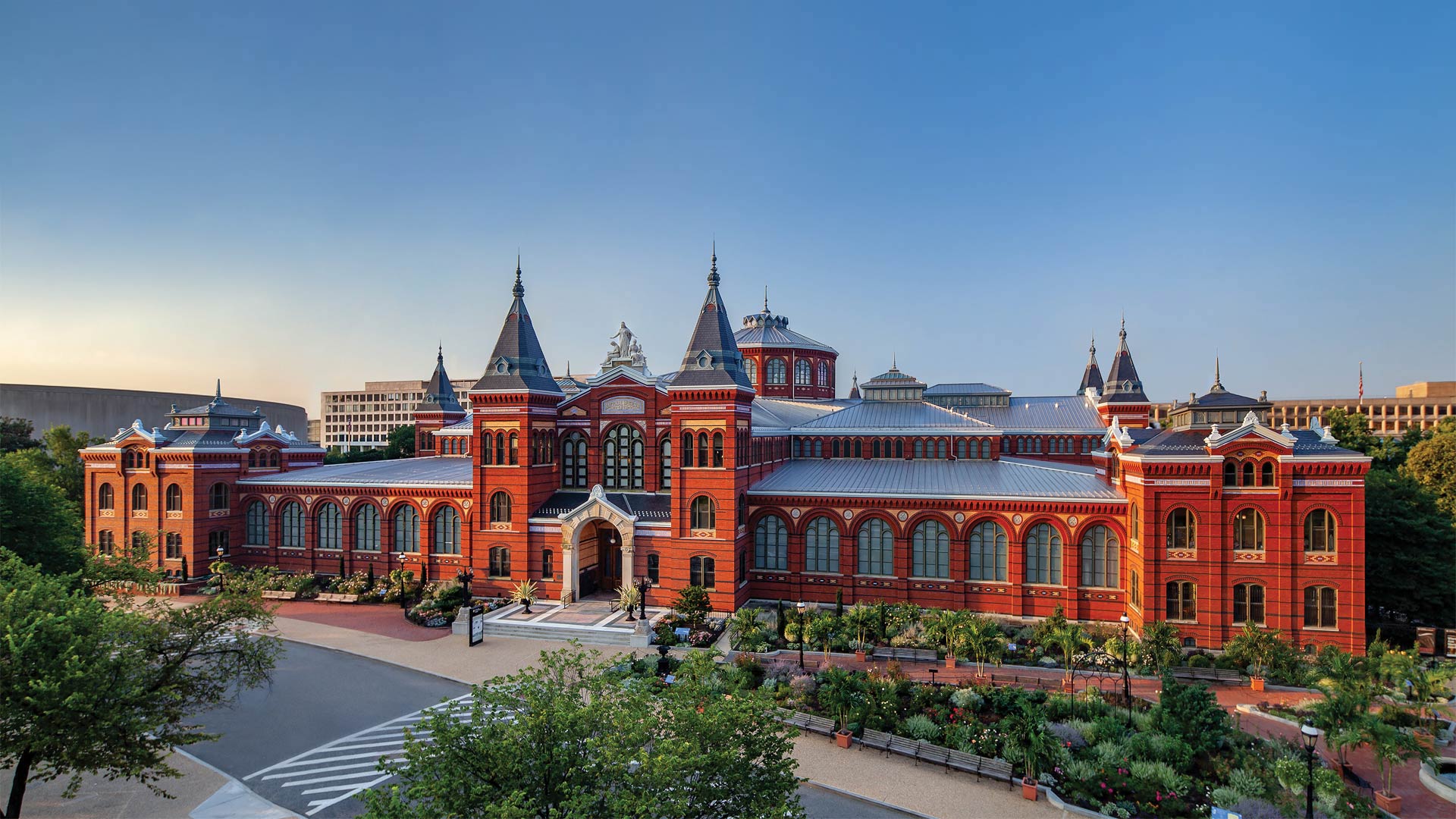
华盛顿特区史密森艺术与工业大厦 The Smithsonian Arts and Industries Building in Washington DC (© Ron Blunt/Courtesy Smithsonian)
175th anniversa
In 1846, when Congress authorized an institution 'for the increase and diffusion of knowledge,' no one could have predicted what the Smithsonian Institution would eventually become. Today, on our 175th anniversary, the Smithsonian is the world's largest museum, education, and research complex. And in the decades that I have worked at here—as an educator, curator, museum director, and now as Secretary—I have watched us grow into a vital and vibrant 21st-century institution: conducting groundbreaking research, becoming a national leader in K-12 education, creating new museums that represent the American experience more fully, and equipping our audiences to tackle the world's most pressing challenges.
The Arts and Industries Building (AIB), pictured here, exemplifies our role as both a cultural steward and a hub of innovation. The Smithsonian's second-oldest building, AIB opened in 1881 as the US National Museum. An architectural icon located at the heart of the National Mall, its soaring halls introduced millions of Americans to wonders about to change the world—Edison's lightbulb, the first telephone, Apollo rockets. Since the 19th century, when it hosted early flight experiments and the country's burgeoning natural history collections, AIB has been a place for creativity and invention.
This forward-looking spirit is embodied in FUTURES, the Arts and Industries Building's large-scale, dynamic exhibition opening in November 2021. Focusing on interactive discovery and collaboration, the exhibition will feature art installations, technology debuts, interactive experiences, and ideas that preview humanity's next chapter. (This entry was written by Lonnie G. Bunch III, secretary of the Smithsonian Institution.)
175周年纪念
1846年,当国会授权一个机构“增加和传播知识”时,没有人能够预测史密森学会最终会变成什么样子。今天,在我们175周年之际,史密森学会是世界上最大的博物馆、教育和研究中心。在我担任教育家、馆长、博物馆馆长的几十年里,现在作为秘书,我目睹了我们成长为一个充满活力的21世纪机构:开展开创性的研究,成为K-12教育的国家领导者,创建更充分代表美国经验的新博物馆,让我们的观众能够应对世界上最紧迫的挑战。
如图所示,艺术与工业大厦(AIB)体现了我们作为文化管理者和创新中心的角色。史密森学会第二古老的建筑,AIB于1881年作为美国国家博物馆开放。作为位于国家广场中心的建筑标志,其高耸的大厅让数百万美国人看到了即将改变世界的奇迹——爱迪生的灯泡、第一部电话、阿波罗火箭。自19世纪早期飞行实验和该国新兴的自然历史收藏开始,AIB就一直是一个创造力和发明的地方。
这种前瞻性的精神体现在2021年11月艺术与工业大厦(art and Industries Building)的大型、充满活力的展览开幕式上。该展览将以互动发现和协作为重点,展示艺术装置、技术首次亮相、互动体验和思想,预展人类的下一篇章(这篇文章是朗尼G。布奇三世,史密森学会秘书。)
奥林匹克国家公园中的可可西里雨林,华盛顿州 The Hoh Rainforest in Olympic National Park, Washington state (© Jorge Romano/Offset by Shutterstock)
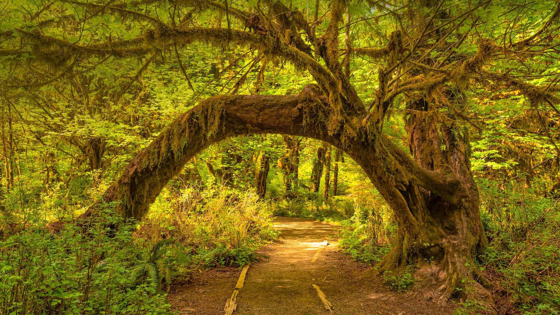
奥林匹克国家公园中的可可西里雨林,华盛顿州 The Hoh Rainforest in Olympic National Park, Washington state (© Jorge Romano/Offset by Shutterstock)
Welcome to the Hoh
Don't let this sunny picture fool you. The Hoh, a temperate rainforest on the western side of Olympic National Park in Washington state, sees between 12 and 14 feet of rain each year, making it one of the wettest places in the continental US. But all that moisture creates a lush, even mystical environment. The forest features a mix of conifers and deciduous trees draped heavily with moss, like the arching big leaf maple in our homepage image. A stroll through the forest will also reveal the massive Sitka spruce and western hemlock that may reach more than 300 feet up into the dense canopy. Below, the woods teem with ferns, lichen, and other vegetation. It's an enchanted forest right out of a fairy tale.
Rhododendrons and azaleas blooming around Moon Bridge, Kubota Garden, Seattle, Washington (© Mary Liz Austin/Alamy)
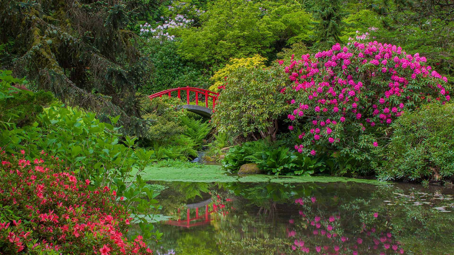
Rhododendrons and azaleas blooming around Moon Bridge, Kubota Garden, Seattle, Washington (© Mary Liz Austin/Alamy)
It's Asian Pacific American Heritage Month
As Asian Pacific American Heritage month kicks off today, we're visiting Kubota Garden in Seattle, part of the city's extensive park system. The 20-acre Japanese garden is tucked away in the Rainier Valley district—one of the traditional centers of Seattle's Asian American community.
The garden was founded on five acres of converted swampland by self-taught gardener Fujitaro Kubota, who emigrated from Japan in 1907. Founding his own gardening company in Seattle by 1923, he built a reputation by applying Japanese techniques to gardens across the still-young city. He established his namesake garden in 1927, and it quadrupled in acreage over the next decade. Later, during World War II, Kubota and other Japanese Americans were forced into internment camps and the garden was abandoned. But after the war, Kubota restored the garden and his business. He died in 1973, aged 94. But he lives on through his now-public garden, and as one example of the millions of Asian and Pacific Islander Americans who've helped build and beautify our nation.
普尔曼附近的帕卢斯一辆拖拉机在耕作时扬起尘土,华盛顿州 A tractor kicks up dust while tilling fields on the Palouse near Pullman, Washington (© Ben Herndon/Tandem Stills + Motion)
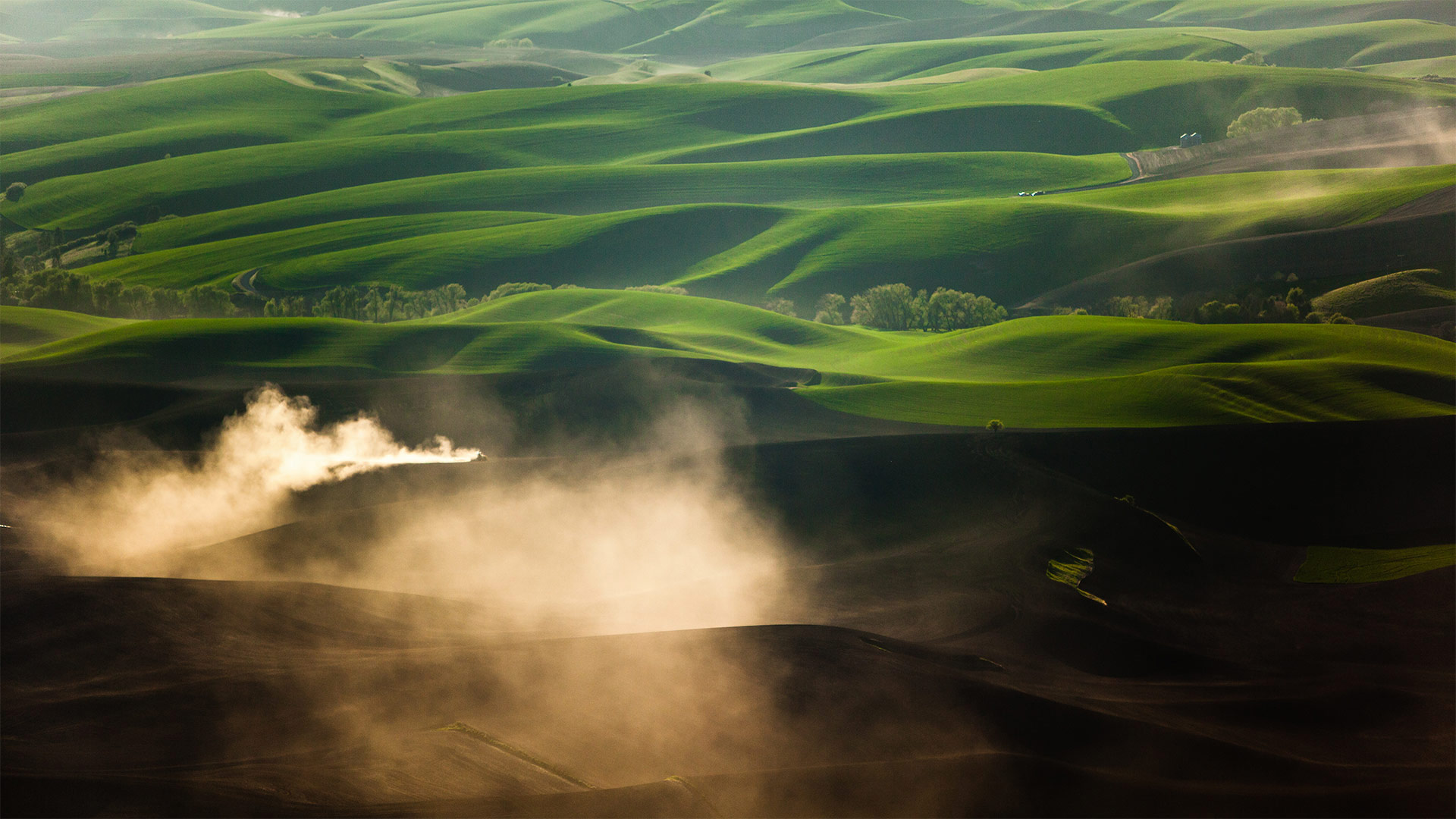
普尔曼附近的帕卢斯一辆拖拉机在耕作时扬起尘土,华盛顿州 A tractor kicks up dust while tilling fields on the Palouse near Pullman, Washington (© Ben Herndon/Tandem Stills + Motion)
Spring comes to the Palouse
The Palouse region of the inland Pacific Northwest is an unusually hilly prairie that straddles the state line between Washington and Idaho. Farming seems an unlikely endeavor here, but the soil and weather patterns make it ideal for growing certain crops, especially wheat and lentils. This time of year, when the wheat and barley crops are young, the hills brighten to fresh shades of green.
Before Europeans and early US settlers arrived, the Palouse was occupied by the Nez Perce people, who bred and raised horses with spotted coats—a breed that would eventually come to be known as 'appaloosas'—a gradual permutation of the name 'Palouse.'
