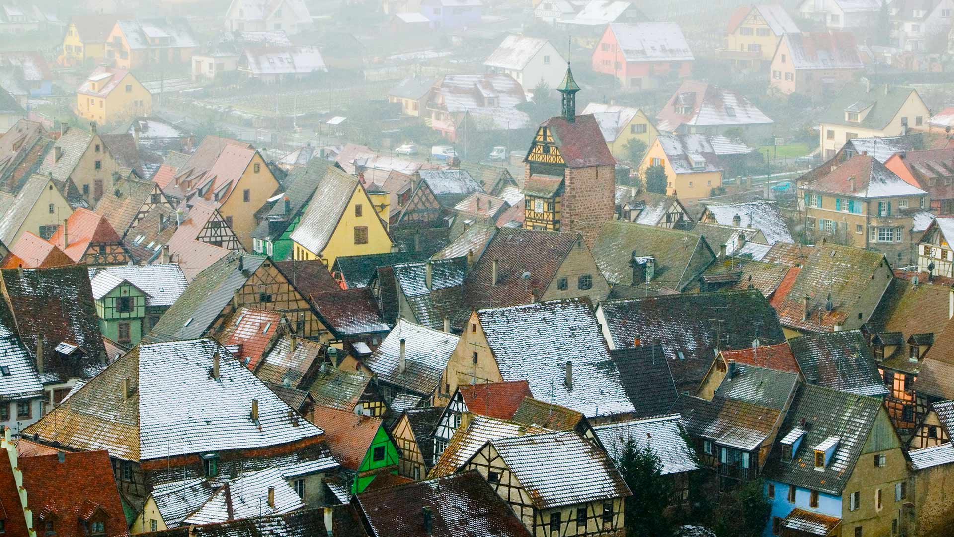
阿尔萨斯的葡萄酒村,法国上莱茵省 (© Walter Bibikow/eStock Photo)
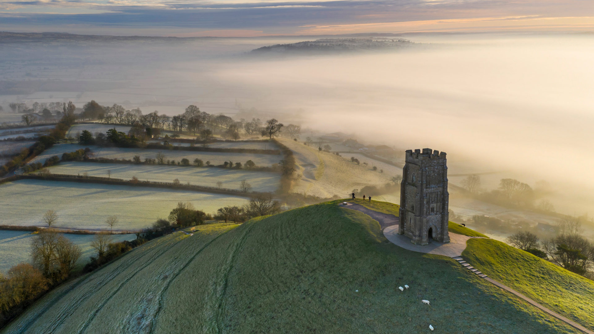
韦尼格罗德的圣诞市场,德国萨克森-安哈尔特州 (© Krzysztof Baranowski/Moment/Getty Images)
坎塔布里亚的小教堂,西班牙 The chapel and hermitage of Santa Justa in Cantabria, Spain (© Luis Miguel Martin/Getty Images)
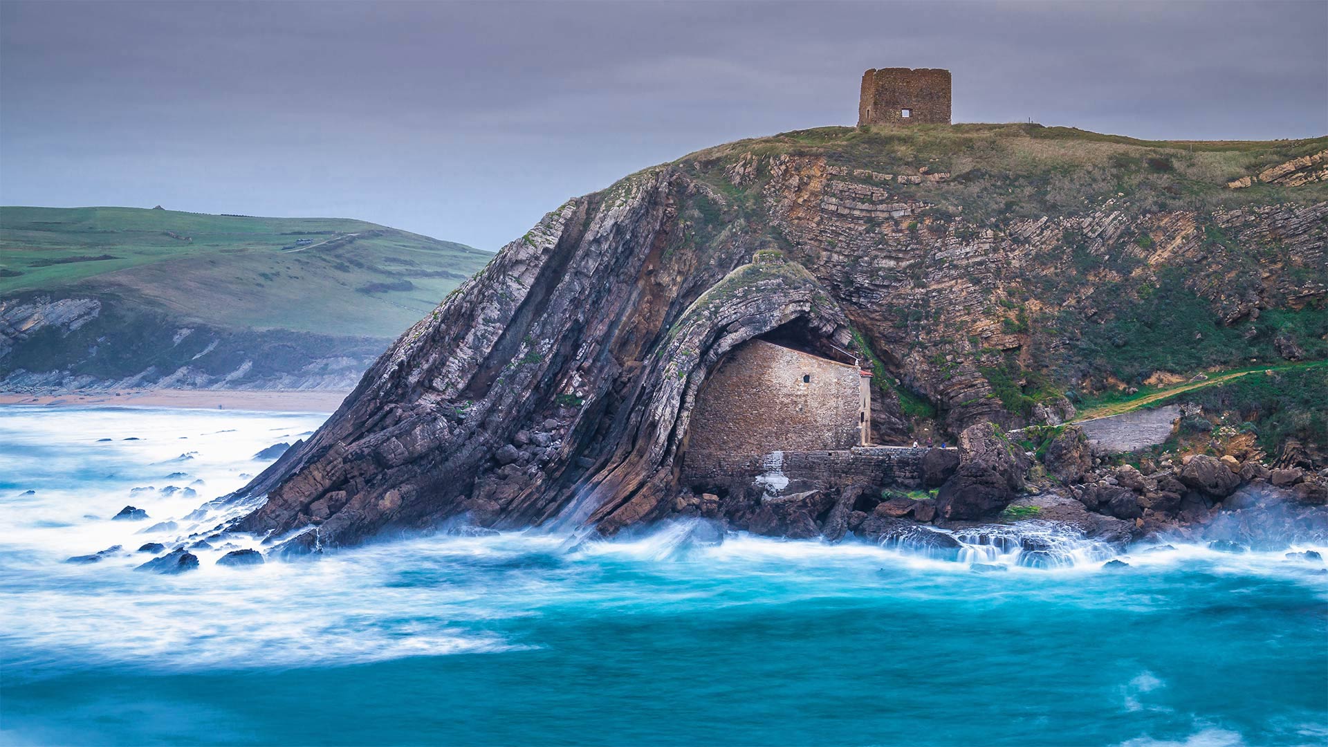
坎塔布里亚的小教堂,西班牙 The chapel and hermitage of Santa Justa in Cantabria, Spain (© Luis Miguel Martin/Getty Images)
The Hermitage of Santa Justa
Today's image brings us to Cantabria, a rugged region on the north coast of Spain. To reach this isolated stone hut, you'll need to wait until the frothing waters of the Bay of Biscay hit low tide, then traverse a silty path to the structure's façade. Peering in the windows, you'll see a cavernous room adorned with shrines—the long-abandoned living quarters of a religious hermit who dwelt here in the 8th century. Not your typical waterfront condo, but hey, it's cozy.
圣胡斯塔的隐居地
今天的图片带我们来到坎塔布里亚,一个位于西班牙北海岸的崎岖地区。要到达这座孤零零的石头小屋,你需要等到比斯开湾的泡沫水达到低潮,然后穿过一条粉土小路到达建筑物的正面。从窗户往里看,你会看到一个洞穴般的房间,里面装饰着神龛——一位8世纪居住在这里的宗教隐士长期被遗弃的居住区。这不是你典型的海滨公寓,但它很舒适。
暮色中的面包山和老城区,厄瓜多尔基多 Old Town and El Panecillo Hill in Quito, Ecuador (© Karol Kozlowski/plainpicture)
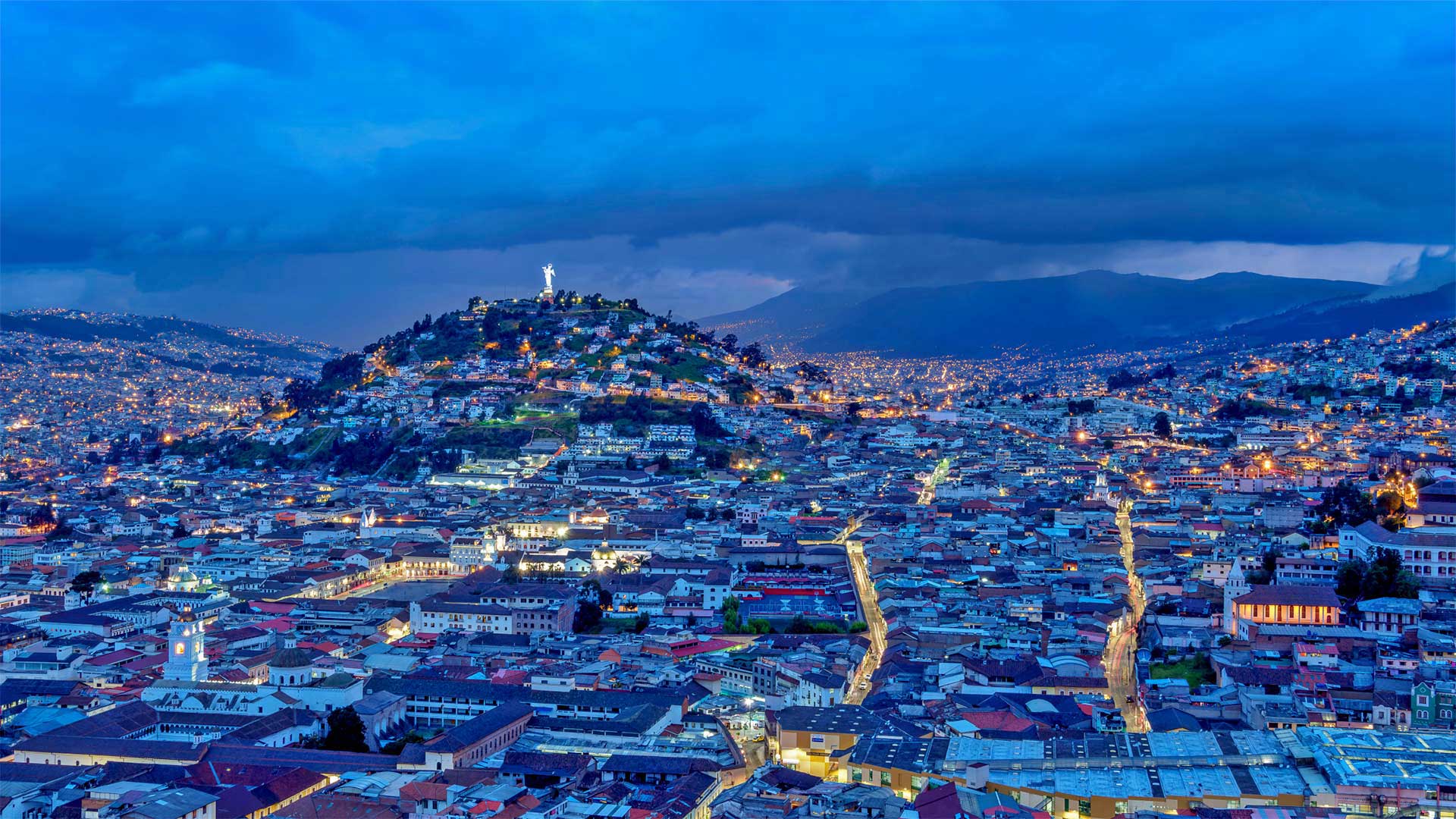
暮色中的面包山和老城区,厄瓜多尔基多 Old Town and El Panecillo Hill in Quito, Ecuador (© Karol Kozlowski/plainpicture)
Old Town Quito
If Ecuador's capital city Quito wasn't high up enough for you at 9,350 feet above sea level, you can elevate your experience even further with a journey up El Panecillo. Translated to English, 'El Panecillo' means 'The Dinner Roll'. Rising 600 feet above the old city center in the foreground, this rotund volcanic hill offers perhaps the best possible panorama Quito. Though our viewpoint here, looking south through Quito's vast valley, makes for a nice twilight shot, too.
基多老城
如果厄瓜多尔首都基多在海拔9350英尺的地方还不够高,那么你可以到埃尔帕内切洛去旅行,进一步提升你的体验。翻译成英语,“El Panecillo”的意思是“晚餐卷”。这座圆形的火山山在前景中高出老市中心600英尺,可能是基多最好的全景。虽然我们在这里的观点是,透过基多广袤的山谷向南看,也是一个不错的黄昏拍摄。
别致的柳条田野,西班牙 Cañamares Wicker fields in Cañamares, Spain (© David Santiago Garcia/Alamy)
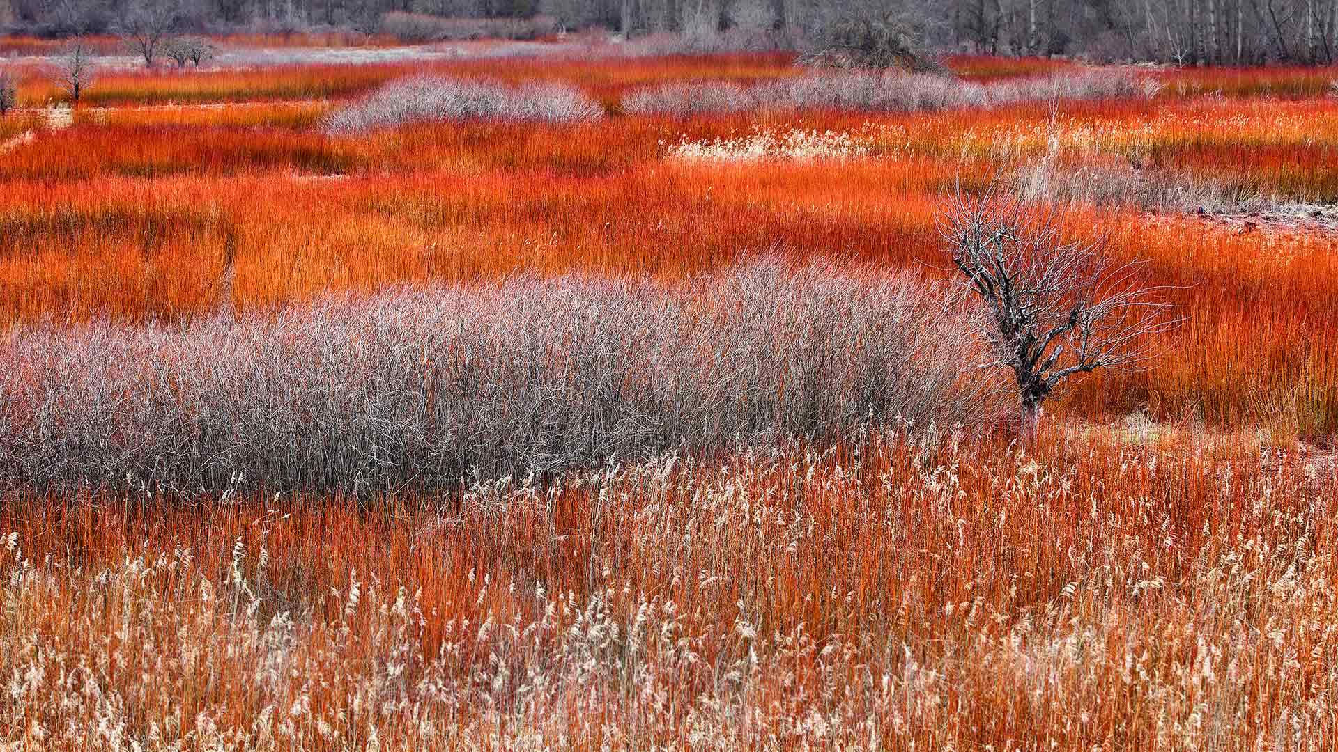
别致的柳条田野,西班牙 Cañamares Wicker fields in Cañamares, Spain (© David Santiago Garcia/Alamy)
Wicker fields in Cañamares, Spain
The summer swaths of green in this field have transformed by wintertime to a harvest-ready red—but it's not a harvest you can eat. Just what's being grown here?
Soon these reeds will be cut, bundled, and cured to become wicker. The blood-hued brush growing naturally by riverbanks near the central Spanish village of Cañamares is gathered each year by locals. The people of Cañamares maintain a centuries-old tradition of weaving with their locally harvested wicker. They create baskets, furniture, sculptures, and more from the coveted stalks.
西班牙卡尼亚马雷斯的柳条田
到了冬天,这片土地上的夏季大片绿色已经变成了可以收割的红色,但这不是你可以吃的收成。这里种的是什么?
很快,这些芦苇将被切割、捆扎并固化成柳条。每年当地人都会在靠近西班牙中部村庄卡尼亚马雷斯的河岸边采集这种自然生长的血色灌木。卡尼阿马尔人保持着用当地收获的柳条织布的悠久传统。他们用令人垂涎的秸秆制作篮子、家具、雕塑等。
珠穆朗玛峰的影子,尼泊尔喜马拉雅西部 The shadow of Mount Everest over the western Himalayas in Nepal (© Kent Karvey/KH Films, Inc./Tandem Stills + Motion)
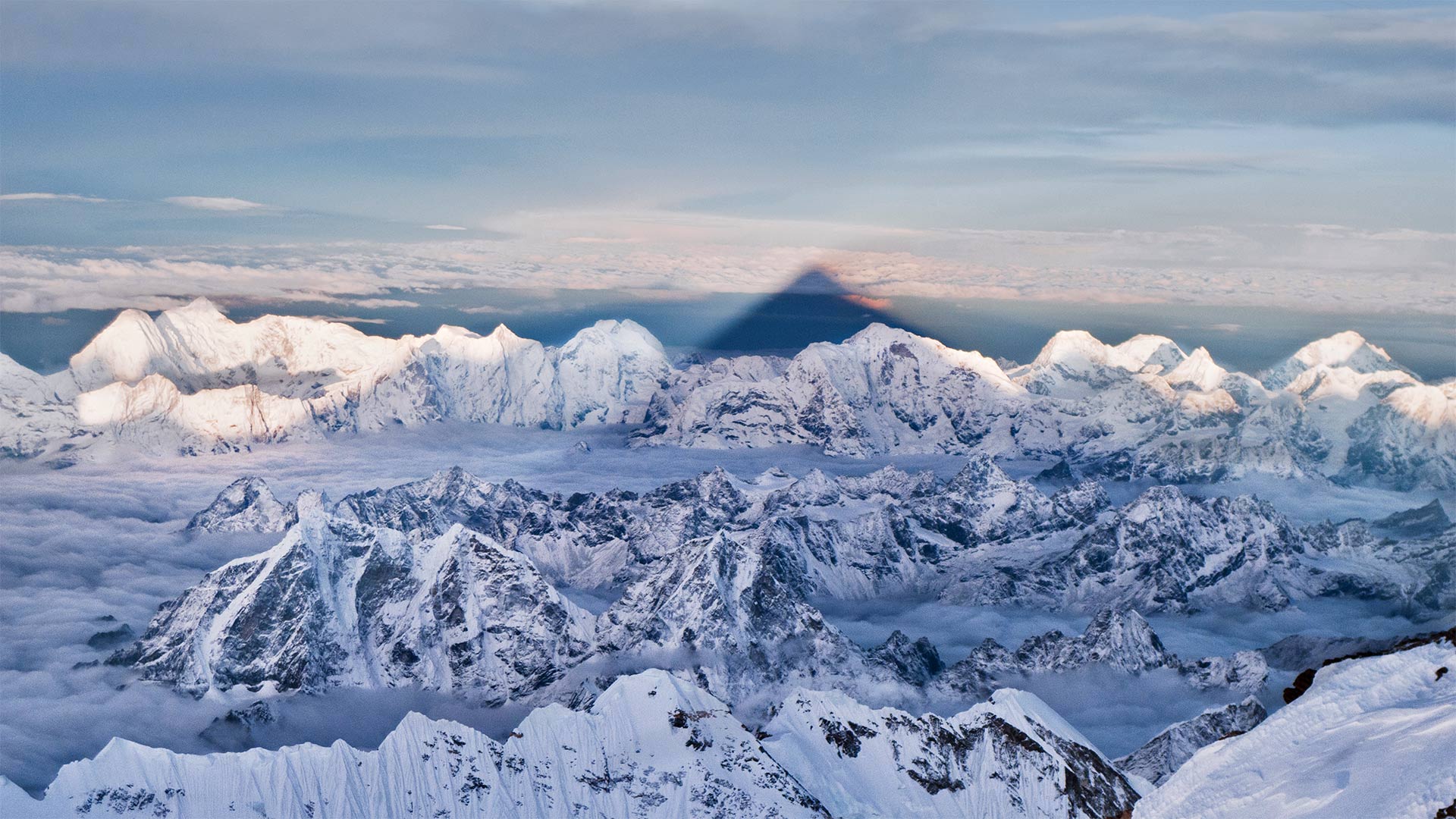
珠穆朗玛峰的影子,尼泊尔喜马拉雅西部 The shadow of Mount Everest over the western Himalayas in Nepal (© Kent Karvey/KH Films, Inc./Tandem Stills + Motion)
Everest's shadow on the Himalayas
In honor of International Mountain Day, breathe as much of that sweet, crisp mountain air as you can. See that shadow stretching past the Himalayas' craggy skyline? That's cast by Mount Everest, the tallest peak of them all, rising to 29,032 feet above sea level.
Everest is the ideal peak to pair with 2021's Mountain Day theme of sustainable tourism, albeit for regrettable reasons. As the literal top mountaineering destination on Earth, it hosts as many as 600 climbers a season—and also many seasons' worth of trash, discarded gear, and other waste. When Nepal launched a program to remove a staggering 10 tons of garbage in 2019, they found 3 tons in just the first two weeks.
The case of Everest is a standout reminder that wherever in the wilderness we go, it's our responsibility to leave no trace—or as eco-conscious climbers say: 'What goes up must come down.' Let's do our part to keep our beautiful mountains clean, no matter how tall, and maybe someday Everest will cast its shadow over a land free of trash.
喜马拉雅山上的珠穆朗玛峰阴影
为了纪念国际山地日,尽可能多地呼吸那甜美、清新的山地空气。看到那阴影从喜马拉雅山崎岖的天际线延伸过去了吗?这是由珠穆朗玛峰铸造的,珠穆朗玛峰是所有山峰中最高的,海拔29032英尺。
珠穆朗玛峰是与2021年可持续旅游的山日主题相匹配的理想山峰,尽管出于令人遗憾的原因。作为地球上名副其实的顶级登山目的地,它一个季节接待多达600名登山者,也接待了许多季节价值的垃圾、废弃装备和其他废物。2019年,尼泊尔启动了一项清除10吨垃圾的计划,在头两周内就发现了3吨垃圾。
珠穆朗玛峰的例子突出地提醒我们,无论我们在荒野中走到哪里,我们都有责任不留下任何痕迹,或者就像有生态意识的登山者所说的那样:“上升的东西一定会下降。”让我们尽自己的一份力量保持我们美丽的山脉清洁,不管它有多高,也许有一天珠穆朗玛峰会在一片没有垃圾的土地上投下它的影子。
蓝山国家公园里的萤火虫,澳大利亚 Glowworms in Blue Mountains National Park, Australia (© Leelakajonkij/Getty Images)
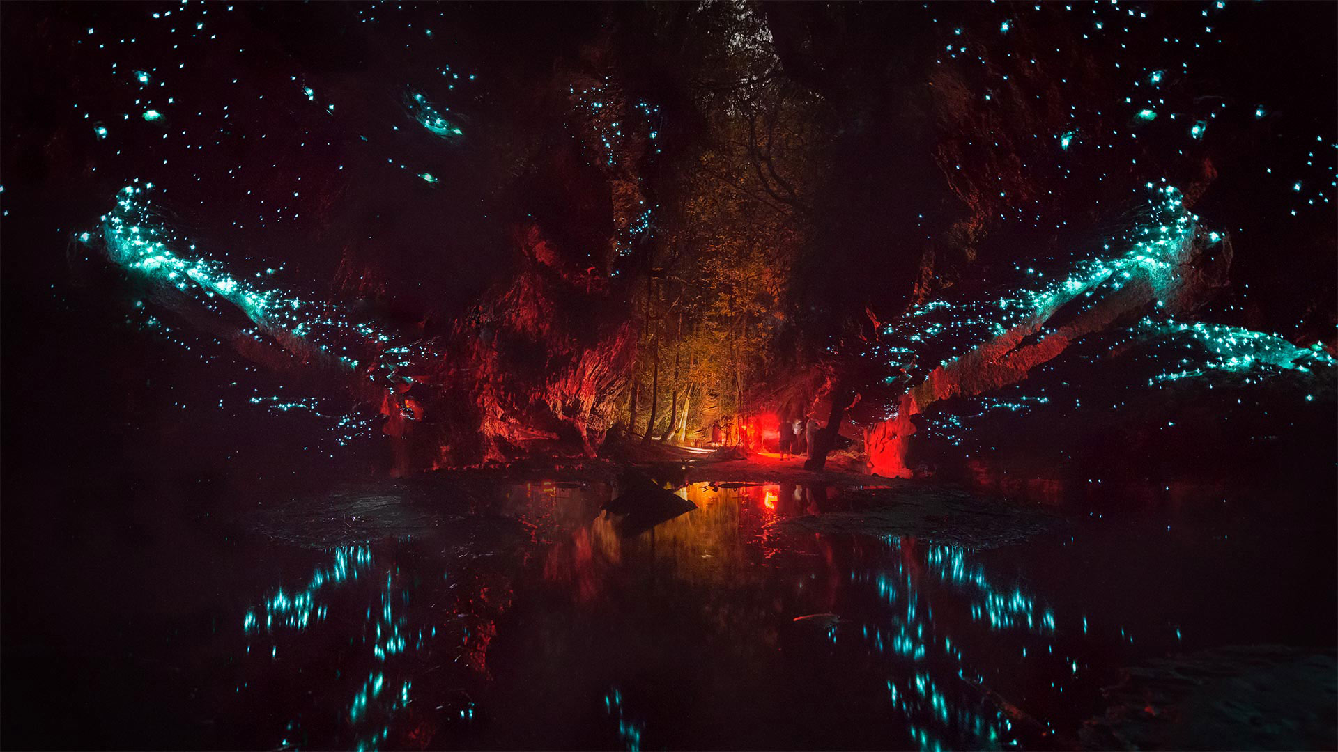
蓝山国家公园里的萤火虫,澳大利亚 Glowworms in Blue Mountains National Park, Australia (© Leelakajonkij/Getty Images)
Glowworm caves in Australia
Down under the land in the Land Down Under, cave explorers may find these subterranean spaces illuminated by an unlikely light source. Fungus gnat larvae—more affectionately known as glowworms—speckle the walls and ceilings of caverns here in Australia during the warm season from December to March. To humans they're hypnotizingly harmless and add a little otherworldly charm to the caves in such places as Blue Mountains National Park, as seen in our photo. But if you're a fly or mosquito, beware! Glowworms dangle tiny, sticky silk strands that ensnare winged insects flying toward what looks like a starry night sky, but is in fact the cave ceiling, covered in glowworms, patiently waiting to reel in a deceived fly.
澳大利亚的萤火虫洞穴
在地下,洞穴探险家可能会发现这些地下空间被一种不太可能的光源照亮。在12月至3月的温暖季节,真菌小昆虫幼虫(更亲切地称为萤火虫)在澳大利亚洞穴的墙壁和天花板上散布斑点。在我们的照片中可以看到,对人类来说,它们无害得令人着迷,为蓝山国家公园等地的洞穴增添了一点超凡脱俗的魅力。但如果你是一只苍蝇或蚊子,小心!萤火虫悬挂着细小的、粘乎乎的丝线,诱捕着飞向星空的有翼昆虫,但事实上是洞穴的天花板,上面覆盖着萤火虫,耐心地等待着一只受骗的苍蝇。
有着丰富石化木材的石化林国家公园,美国亚利桑那州 Petrified Forest National Park, Arizona (© Ian Shive/Tandem Stills + Motion)
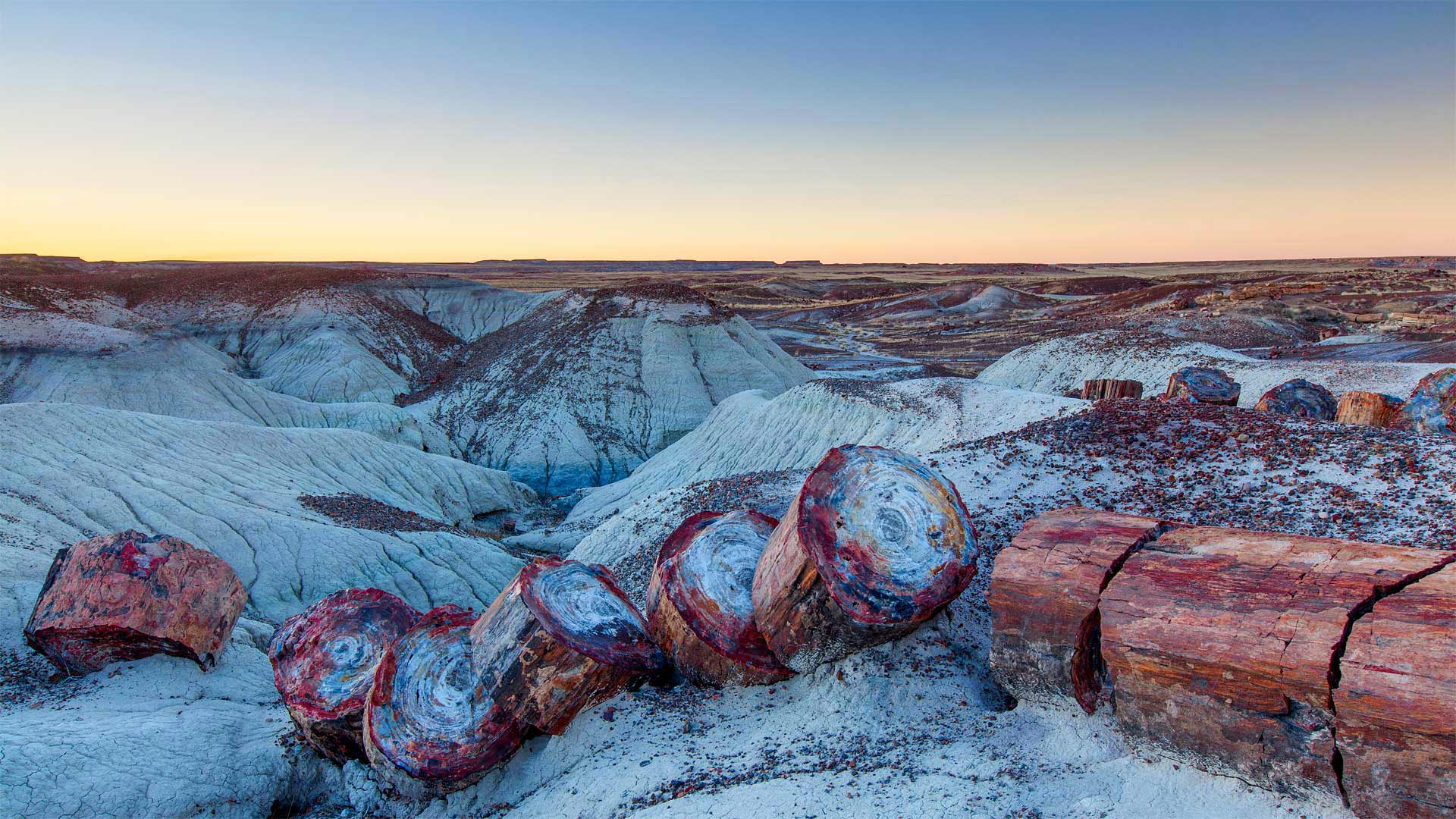
有着丰富石化木材的石化林国家公园,美国亚利桑那州 Petrified Forest National Park, Arizona (© Ian Shive/Tandem Stills + Motion)
Petrified Forest National Park
The burliest lumberjack with the best-oiled chainsaw couldn't slice the massive 'timbers' found in Petrified Forest National Park. So why are these giant stone logs segmented in such symmetrical stumps?
Each of these smooth splits occurred in an instant as the brittle quartz cracked under geologic pressure. But each of those instants was eons in the making. First, 225 million years ago, the trees were buried by torrents of river silt. Then mineral deposits slowly seeped into the trees and replaced the decaying wood. Much later, around 60 million years ago, the entire Colorado Plateau began shifting, generating crushing forces that finally divided the petrified logs.
The fossilized trees, surrounding land, and the many plants and animals that live here have enjoyed protection since December 8, 1906, when President Theodore Roosevelt created Petrified Forest National Monument. It was designated as a national park in 1962, lending still greater protection.
石化森林国家公园
最结实的伐木工人和最好的油锯无法切割石化森林国家公园中发现的巨大“木材”。那么,为什么这些巨石原木被分割成如此对称的树桩呢?
当脆性石英在地质压力下破裂时,每一个光滑的裂缝都会在瞬间发生。但是,每一个瞬间都在酝酿中。首先,2.25亿年前,这些树木被河流淤泥的洪流所掩埋。然后,矿物质慢慢渗入树木,取代了腐烂的木材。很久以后,大约6000万年前,整个科罗拉多高原开始移动,产生了最终分裂石化原木的压碎力。
自1906年12月8日西奥多·罗斯福总统创建石化森林国家纪念碑以来,这里的树木化石、周围的土地和许多动植物一直受到保护。1962年,它被指定为国家公园,提供了更大的保护。
孚日山脉上的国王城堡,法国阿尔萨斯 The Château du Haut-Kœnigsbourg in the Vosges mountains, Alsace, France (© Leonid Andronov/Shutterstock)
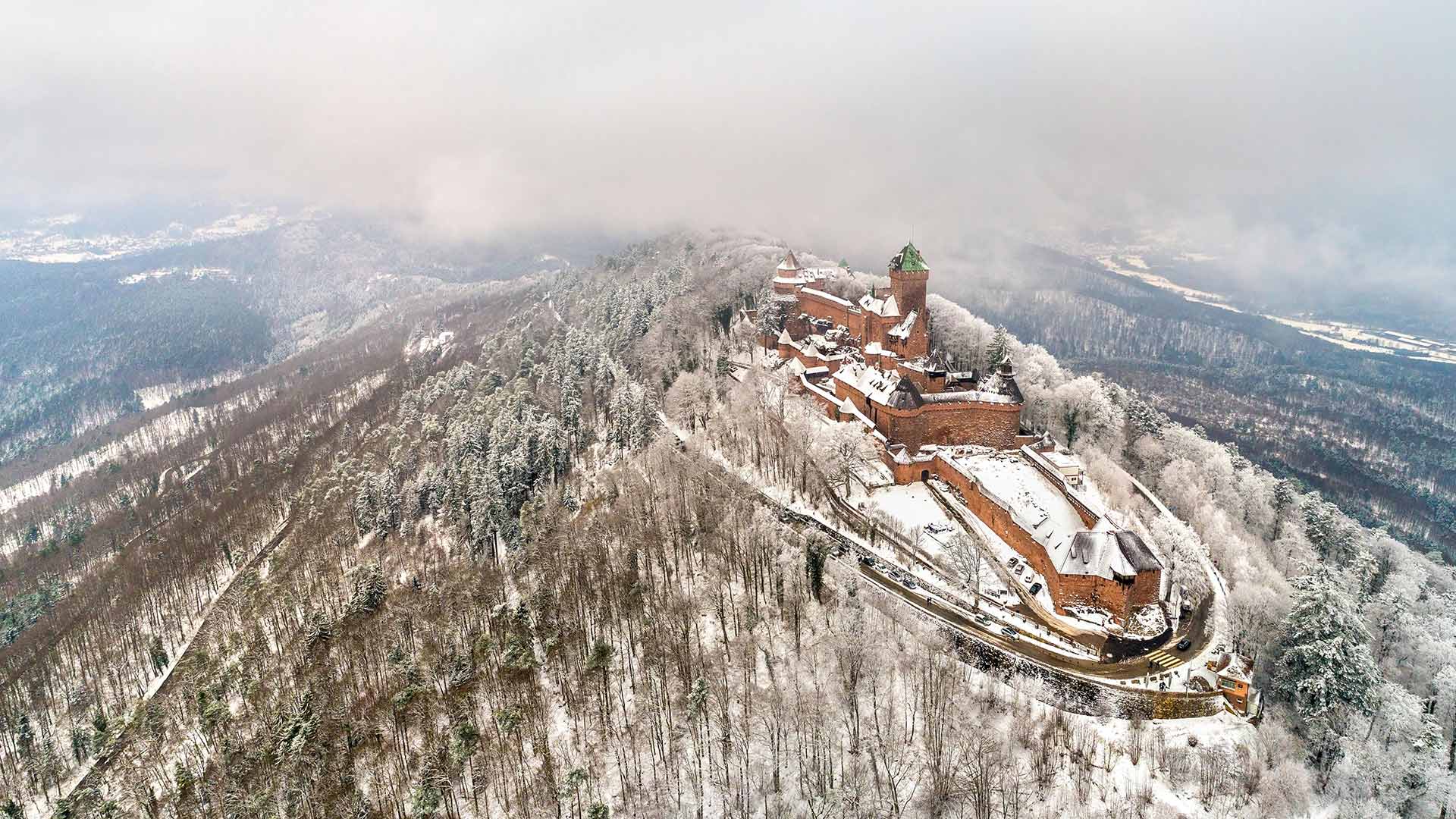
孚日山脉上的国王城堡,法国阿尔萨斯 The Château du Haut-Kœnigsbourg in the Vosges mountains, Alsace, France (© Leonid Andronov/Shutterstock)
Haut-Koenigsbourg Castle
Haut-Koenigsbourg Castle is an old medieval castle left over from the Vosges Mountains in the Alsace region of northeastern France. It has a history of 850 years, and due to its proper preservation, this allows us to see what it looked like back then. Also, you can have an overlook of the city of Alsace from the top of a hill...
The castle was built in the 12th century to monitor the trade routes of silver and wine. It was destroyed in the Thirty Years' War in the 17th century and rebuilt in the early 20th century. Today, it is a popular tourist destination, visited by 500,000 people every year, as a museum displaying medieval weapons and Renaissance frescoes.
上科尼斯堡城堡酒店
上科尼斯堡城堡是法国东北部阿尔萨斯地区沃斯山脉遗留下来的一座古老的中世纪城堡。它有850年的历史,由于它的妥善保存,这使我们能够看到它当时的样子。此外,你可以从山顶俯瞰阿尔萨斯市。。。
这座城堡建于12世纪,用于监控白银和葡萄酒的贸易路线。它在17世纪的30年战争中被摧毁,并在20世纪初重建。今天,它是一个受欢迎的旅游胜地,每年有50万人参观,是一个展示中世纪武器和文艺复兴时期壁画的博物馆。
