标签 火山 下的文章
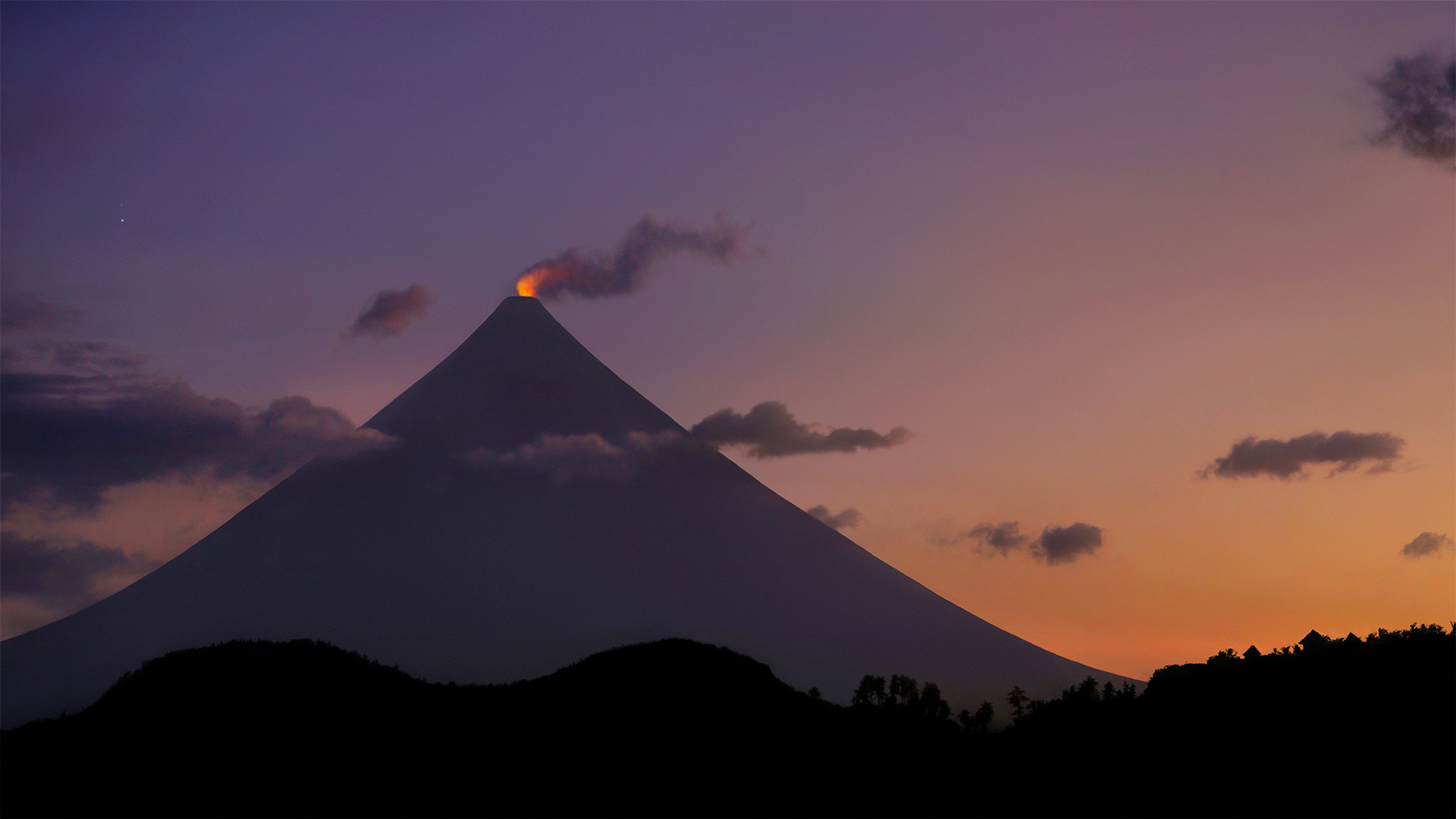
菲律宾马荣山的火山口冒烟 Crater glow from Mount Mayon in the Philippines (© Per-Andre Hoffmann/Cavan)
菲律宾马荣山的火山口冒烟 Crater glow from Mount Mayon in the Philippines (© Per-Andre Hoffmann/Cavan)
Behold the 'perfect' cone
How far would you have to travel for the 'perfect cone'? Well, probably not too far if you're talking ice cream. But if volcanoes are what you're looking for, you'll have to make your way to Mount Mayon on the Philippine island of Luzon. The glowing lava you see is on the tip of the world's most perfectly shaped, symmetrical volcanic cone, which formed after years of eruptions from what is still an active stratovolcano. Mount Mayon has erupted dozens of times in the past 400 years, and there was a significant eruption as recently as 2018. Even this year, smaller white steam plume emissions and faint crater glow are sometimes visible. Mayon is the most active volcano in an island nation full of active volcanos, and is located inside the UNESCO Albay Biosphere Reserve, as well as the Philippine's Mayon Volcano Natural Park. Despite its active status, tourists still flock to the park to view the unique beauty of this cone shaped spectacle.
请看“完美”圆锥体
为了“完美的圆锥体”,你需要走多远?嗯,如果你说的是冰淇淋,可能不会太远。但是如果你要找的是火山,你就得去菲律宾吕宋岛上的马荣山。你所看到的炽热的熔岩位于世界上形状最完美、对称的火山锥的顶端,这座火山锥是在多年的喷发后形成的,它仍然是一座活跃的层火山。在过去的400年中,马荣山已经喷发了几十次,最近在2018年发生了一次重大喷发。即使在今年,也可以看到较小的白色蒸汽羽流排放和微弱的火山口辉光。马荣火山位于联合国教科文组织阿尔拜生物圈保护区以及菲律宾的马荣火山自然公园内,是一个充满活火山的岛国中最活跃的火山。尽管公园处于活跃状态,游客仍然蜂拥而至,欣赏这一锥形景观的独特之美。
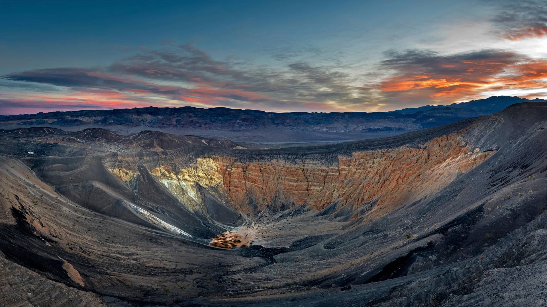
死亡谷国家公园里的优比喜比火山口,加利福尼亚州 Ubehebe Crater in Death Valley National Park, California (© Albert Knapp/Alamy)
死亡谷国家公园里的优比喜比火山口,加利福尼亚州 Ubehebe Crater in Death Valley National Park, California (© Albert Knapp/Alamy)
When Death Valley blew its top
Deep below Death Valley's charred surface, blazing hot magma once gushed up through a geologic fault until it hit groundwater. The magma quickly turned the water to steam, and like a defective subterranean pressure cooker, the Earth's crust blew its top in a ferocious explosion. The hydrovolcanic eruption sent up a mushroom cloud of steam and spewed burnt volcanic cinders for miles. It also left the giant crater seen in this photo and 12 smaller ones spread across the surface.
The Ubehebe Crater (pronounced you-bee-HEE-bee) is a half-mile across and more than 700 feet deep. Geologically speaking, Ubehebe and the other craters here are quite young. A 2016 study concluded that the craters were all formed in a relatively brief series of explosions—a period of days or weeks—about 2,100 years ago. Another eruption could happen, but visitors need not worry about the ground below their feet—seismometers in the region will alert geologists in advance of any future volcanic unrest. A trail around the rim of the crater offers views of the colorful layers of stone along the walls. Adventurous hikers can descend to the bottom, but it's a long slog back out again, especially on a sweltering summer day.
当死亡谷爆发时
在死亡谷烧焦的地表深处,炽热的岩浆曾经通过地质断层喷涌而出,直到触及地下水。岩浆很快将水变成蒸汽,就像一个有缺陷的地下压力锅,地壳在猛烈的爆炸中炸开了顶部。水火山喷发喷出蘑菇状的蒸汽云,喷出燃烧的火山灰数英里。它还留下了这张照片中看到的巨大陨石坑,12个较小的陨石坑散布在地表。
Ubehebe火山口(发音为you bee HEE bee)宽半英里,深700多英尺。从地质学的角度来说,乌贝赫比和这里的其他陨石坑都很年轻。2016年的一项研究得出结论,这些陨石坑都是在相对短暂的一系列爆炸中形成的——大约2100年前的几天或几周时间。另一次火山喷发可能会发生,但游客不必担心脚下的地面。该地区的地震仪将在未来的火山动荡之前提醒地质学家。沿着火山口边缘的小径可以看到沿着墙壁的彩色石层。喜欢冒险的徒步旅行者可以爬到水底,但要想再次爬出来还需要很长时间,尤其是在炎热的夏天。
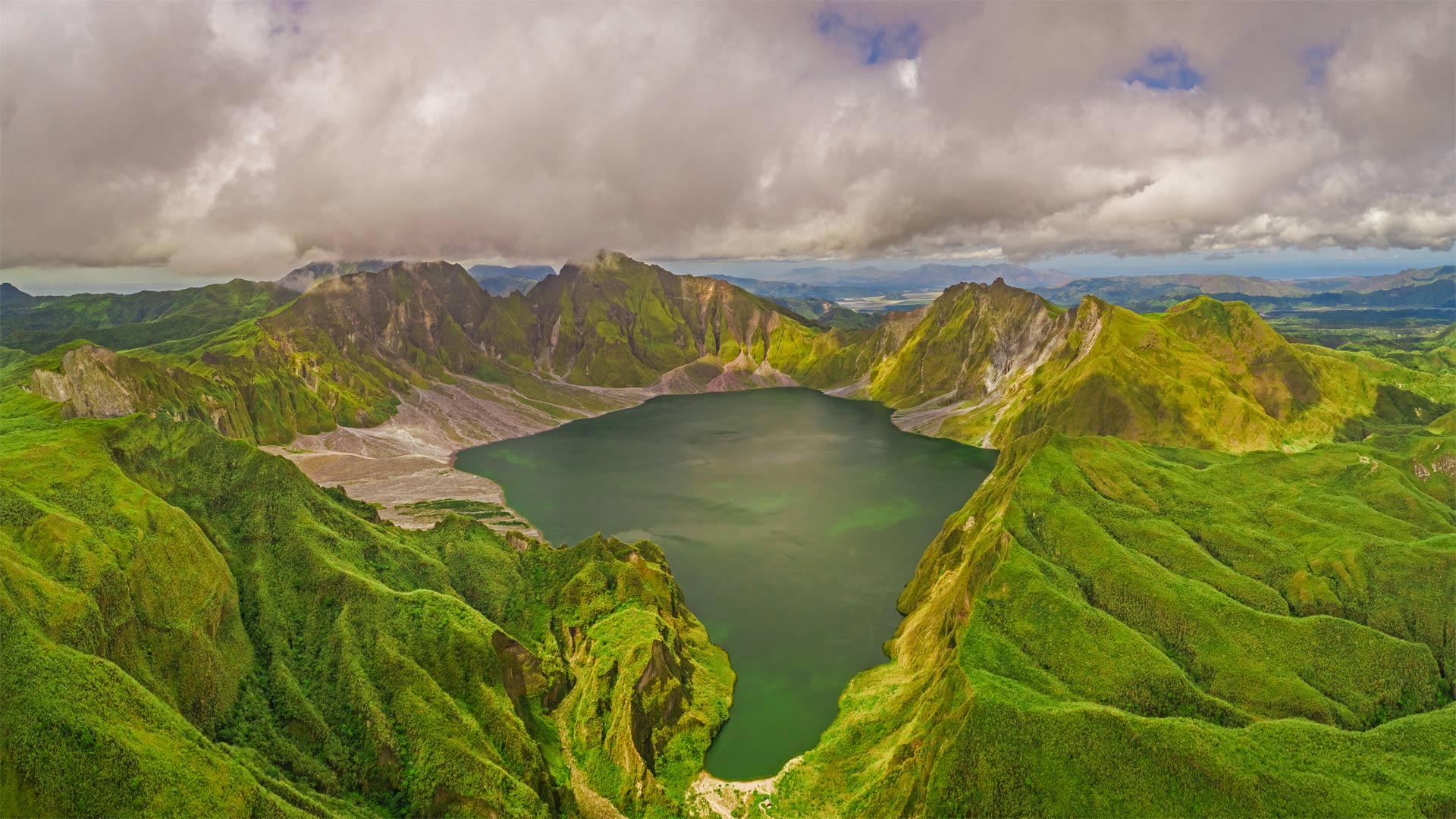
鸟瞰皮纳图博火山湖和山脉,菲律宾波拉克 Aerial view of volcanic Lake Pinatubo and mountains, Porac, Philippines (© Amazing Aerial Agency/Offset by Shutterstock)
鸟瞰皮纳图博火山湖和山脉,菲律宾波拉克 Aerial view of volcanic Lake Pinatubo and mountains, Porac, Philippines (© Amazing Aerial Agency/Offset by Shutterstock)
Are you older than this lake?
If you were born before summer 1991, the answer is yes. Sorry if you already felt a bit long in the tooth, but it's true: Before 30 years ago, Lake Pinatubo was just a rumble in Mount Pinatubo's magma-filled belly. It was a calamitous eruption on June 15, 1991—one of the 20th century's most powerful—that blew off Pinatubo's original summit and formed a vast crater, which gradually filled with water as greenery reclaimed the summit.
Located about 50 miles from the Philippines' capital of Manila, the crater was for many years a niche destination for hardy hikers, requiring days of travel to reach. More recently, a 4x4 road and tended hiking trail were added, reducing the rugged journey to a day trip.
你比这个湖大吗?
如果你出生在1991年夏天之前,答案是肯定的。抱歉,如果你已经觉得牙齿有点长了,但这是真的:30年前,皮纳图博湖只是皮纳图博火山充满岩浆的肚子里的隆隆声。这是1991年6月15日的一次灾难性喷发,是20世纪最强大的喷发之一,它把皮纳图博最初的山顶吹走,形成了一个巨大的火山口,随着绿色植物对山顶的再生,火山口逐渐充满了水。
这个陨石坑距离菲律宾首都马尼拉大约50英里,多年来一直是耐寒徒步旅行者的利基目的地,需要数天的旅行才能到达。最近,增加了一条4x4公路和徒步小径,将崎岖的旅程缩短为一日游。
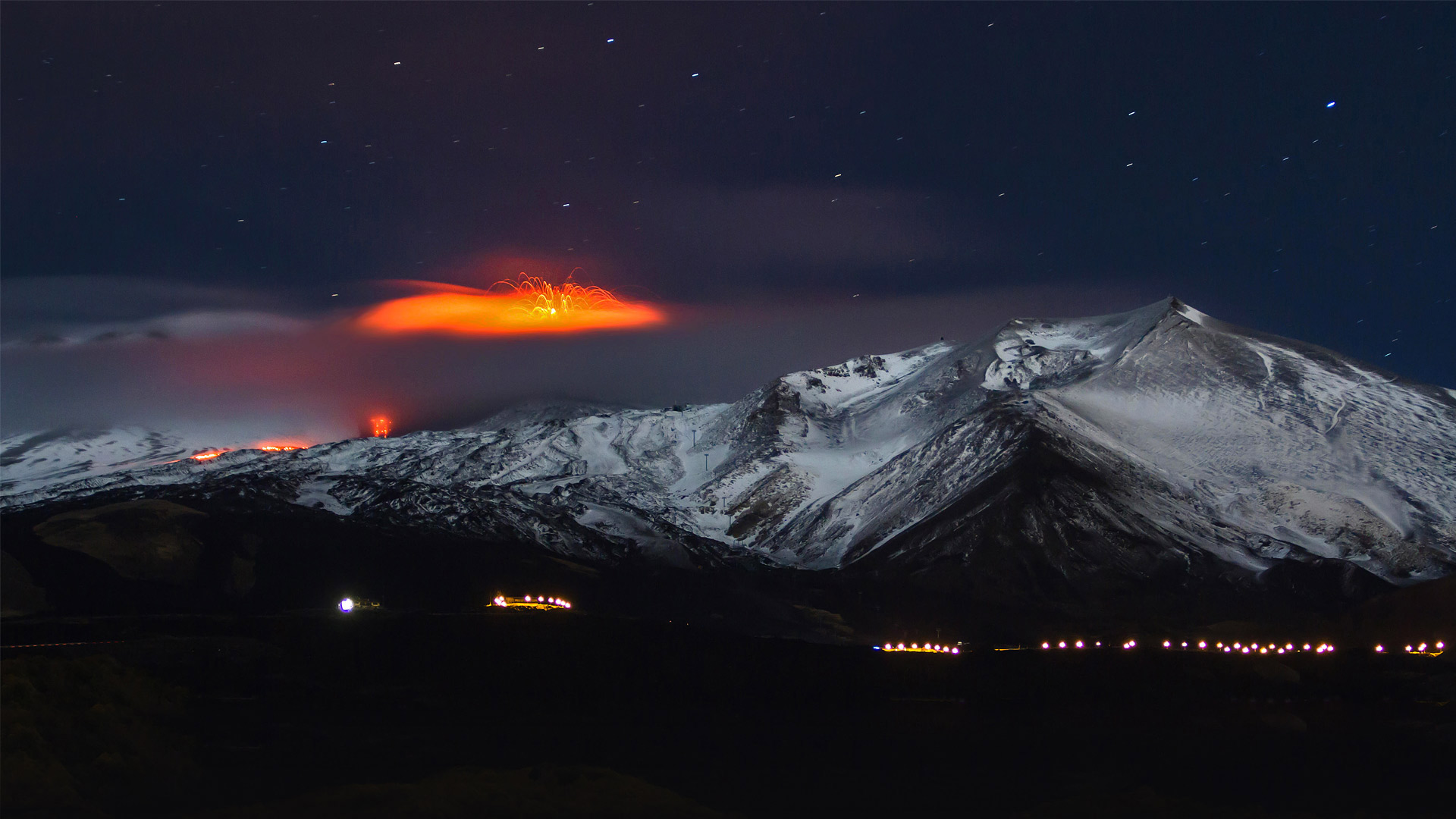
2013年正在喷发的埃特纳火山,意大利西西里岛 Mount Etna erupting in 2013, Sicily, Italy (© Wead/Alamy Live News)
2013年正在喷发的埃特纳火山,意大利西西里岛 Mount Etna erupting in 2013, Sicily, Italy (© Wead/Alamy Live News)
A sizzling summit hides in the clouds
Seen here with its explosive summit socked away in the clouds, Mount Etna towers over the Italian isle of Sicily as the tallest volcano in Europe—and maybe the crankiest, given its near-constant eruptions. The island peak has been highly active for perhaps half a million years and can still be counted on for a spectacular eruption every few years. This photograph shows Etna erupting in 2013.
云层中隐藏着一座炙热的山峰
埃特纳火山在意大利西西里岛上空耸立,是欧洲最高的火山,可能是最古怪的火山,因为它几乎一直在喷发。岛上的山峰已经高度活跃了大约50万年,仍然可以指望每隔几年就有一次壮观的喷发。这张照片显示埃特纳火山在2013年喷发。
亚伊马火山与前景中的智利南洋杉,智利孔吉利奥国家公园 Volcano Llaima with Araucaria trees in the foreground, Conguillío National Park, Chile (© Fotografías Jorge León Cabello/Getty Images)
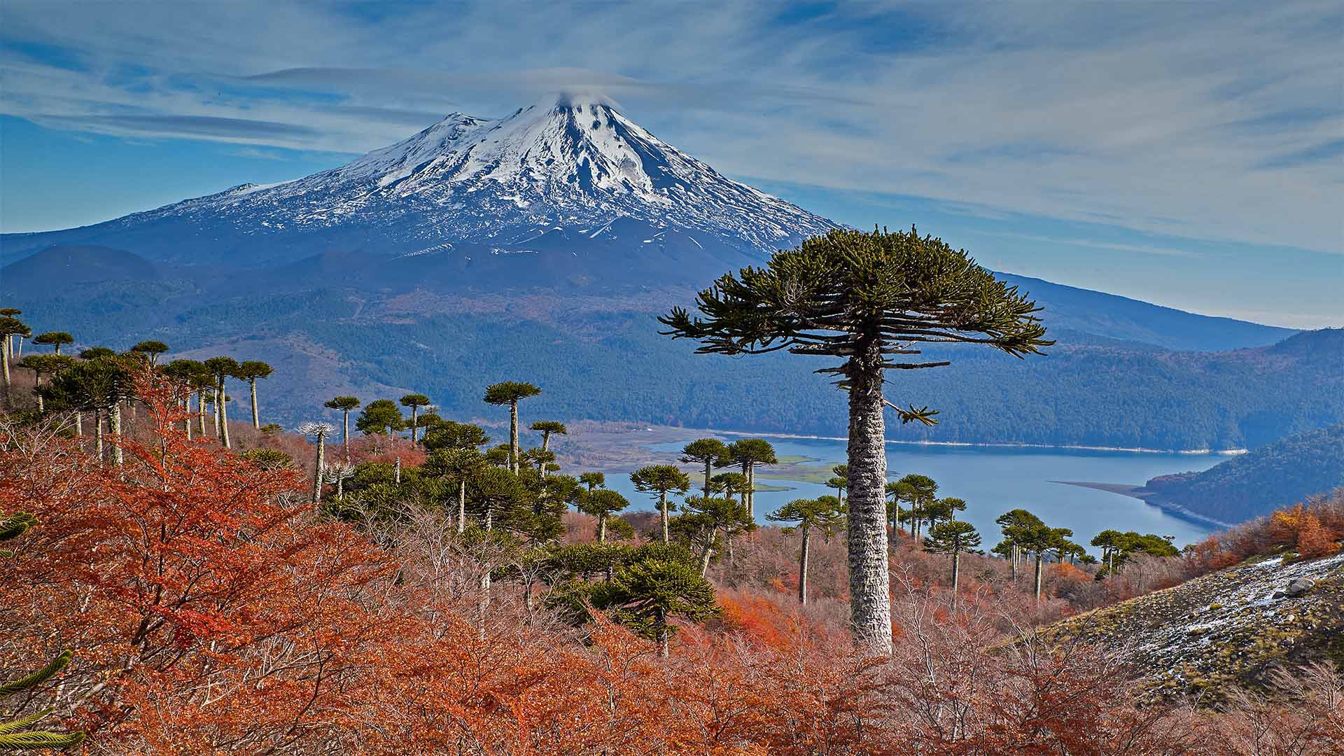
亚伊马火山与前景中的智利南洋杉,智利孔吉利奥国家公园 Volcano Llaima with Araucaria trees in the foreground, Conguillío National Park, Chile (© Fotografías Jorge León Cabello/Getty Images)
Fall for Chile
Autumn in Chile varies widely as one travels from the Atacama Desert in the north more than 2,600 miles south to the tip of Tierra del Fuego. Around halfway between these two extremes you can find Conguillío National Park and the volcano Llaima at Chile's center. In March, at the start of the Southern Hemisphere's autumn, the leaves of the deciduous forest begin to turn color and fall, and the native Chilean pine trees (Araucarias) stand out even more strikingly.
Because of their distinctive appearance and the fact that they thrive in a wide range of climates, the trees became a favorite of botanists in the 19th century, who transported and cultivated them in many temperate climates around the world. The 'monkey puzzle' trees got their common English name in the 1850s when English barrister Charles Austin observed that 'It would be a puzzle for a monkey to climb that.' Even more amazing is that these trees can live over a thousand years and are themselves living fossils, descended from a lineage stretching back 260 million years to the time of the dinosaurs.
爱上智利
智利的秋天变化很大,人们从北部的阿塔卡马沙漠向南行驶2600多英里,到达火地岛的顶端。在这两个极端的中间,你可以看到智利国家公园和智利中心的拉伊马火山。今年3月,南半球秋季伊始,落叶林的树叶开始变色、飘落,智利本土的松树(Araucarias)更加引人注目。
由于其独特的外观和在各种气候条件下茁壮成长的事实,这些树在19世纪成为植物学家的最爱,他们在世界各地的许多温带气候条件下运输和栽培它们。19世纪50年代,英国大律师查尔斯·奥斯汀(Charles Austin)指出,猴子爬上那棵树将是一个谜,于是“猴子拼图”树就有了共同的英文名称。更令人惊奇的是,这些树能活上一千多年,而且本身就是活化石,其世系可追溯到公元前2.6亿年恐龙。
波来古市附近的Chu Dang Ya火山,越南嘉来 Chu Dang Ya near Pleiku in Gia Lai Province, Vietnam (© Quang Ngoc Nguyen/Alamy)
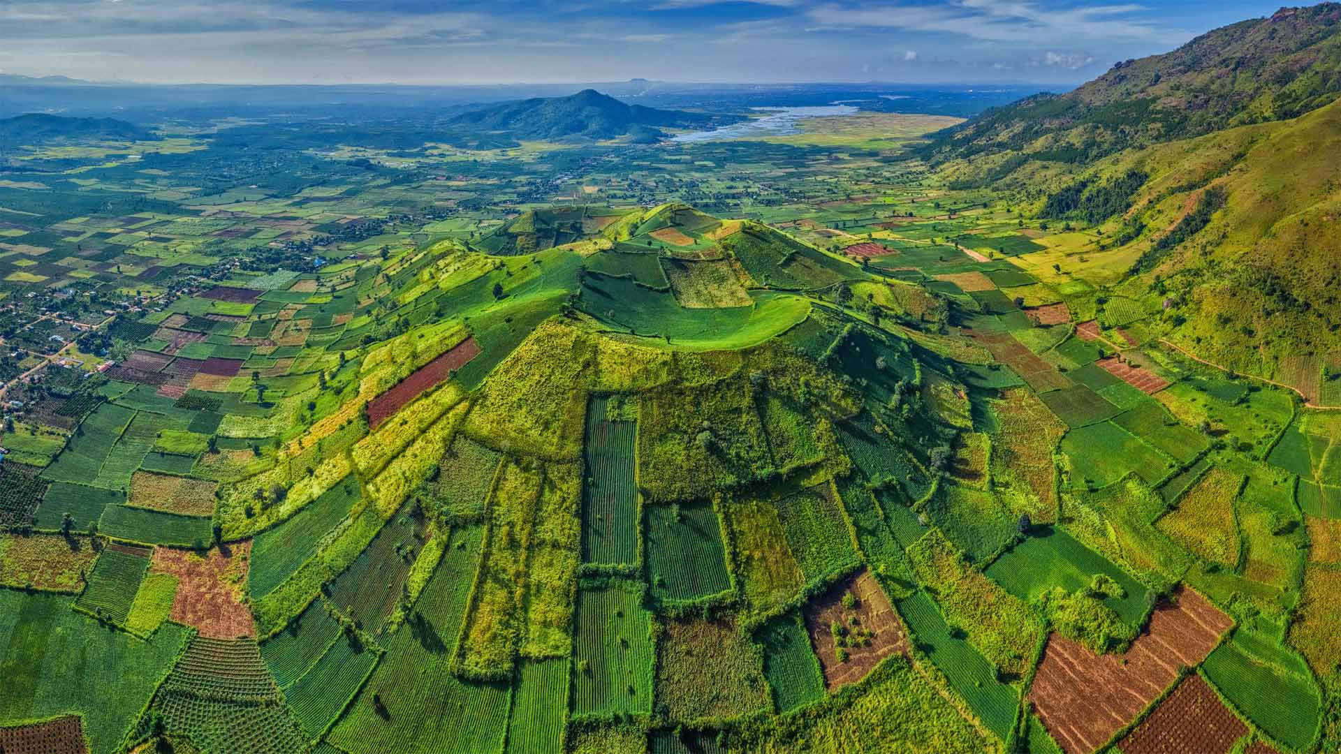
波来古市附近的Chu Dang Ya火山,越南嘉来 Chu Dang Ya near Pleiku in Gia Lai Province, Vietnam (© Quang Ngoc Nguyen/Alamy)
A sleeping green giant
We're looking down on Chu Dang Ya, an extinct volcano that last erupted millions of years ago. Located in the Gia Lai Province in the Central Highlands of Vietnam, Chu Dang Ya, means 'wild ginger' or perhaps 'tough ginger root' in the local Jarai language. The volcano provides fertile soil for crops such as pumpkins, sweet potatoes, taro, and more. Among the best times to visit this rural gem is at the beginning of the rainy season, in late April and early May, and as the rains wind down in November. That's when Chu Dang Ya takes it up a notch—its hillsides erupt with sunflower and other wildflower blooms along roadways, dirt paths, and fields.
一个沉睡的绿色巨人
我们正在俯瞰楚荡崖,一座上一次喷发于数百万年前的死火山。楚当崖位于越南中部高地的嘉莱省,在当地的加莱语中,意思是“野姜”或“坚韧的姜根”。火山为南瓜、红薯、芋头等作物提供了肥沃的土壤。在雨季的开始、4月下旬和5月初,以及11月的雨季,参观这块乡村宝石的最佳时机之一。就在这时,楚当崖把它带上了一个台阶,山坡上开满了向日葵和其他野花,它们沿着公路、土路和田野盛开。
一艘游船经过时熔岩流撞击水面产生爆炸,夏威夷火山国家公园 A lava flow hits water to create an explosion as a tourist boat passes, Hawaii Volcanoes National Park (© Patrick Kelley/Getty Images)
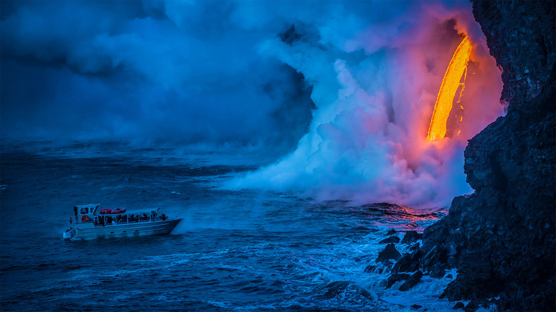
一艘游船经过时熔岩流撞击水面产生爆炸,夏威夷火山国家公园 A lava flow hits water to create an explosion as a tourist boat passes, Hawaii Volcanoes National Park (© Patrick Kelley/Getty Images)
Where fire meets water
'Keep your distance' might be the mantra for 2020, but here at Hawaii Volcanoes National Park on the 50th state's 'Big Island,' it's always been good advice. Especially so for the passengers on this tour boat as they witness a red-hot lava flow hitting the chilly ocean with a tremendous explosion of steam.
We're visiting to mark the anniversary of the park's founding on August 1, 1916. Established some 34 years before Hawaii statehood, Hawaii Volcanoes was the first national park in a US territory. It's centered around two volcanic systems: Mauna Loa, one of the world's most massive volcanoes, and the highly active Kīlauea, which erupted continually from 1983 until an explosive 2018 eruption that calmed it for the time being.
堪察加半岛上的扎尔巴奇克火山,俄罗斯 Tolbachik volcanic complex on the Kamchatka Peninsula, Russia (© Egor Vlasov/Shutterstock)
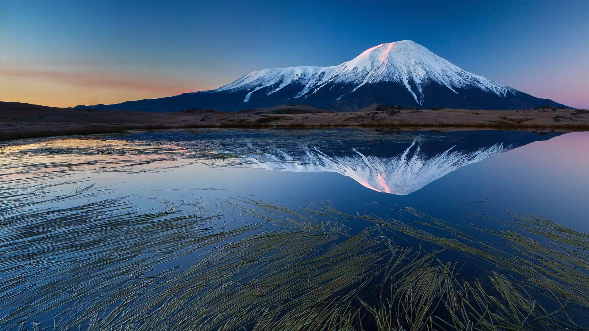
堪察加半岛上的扎尔巴奇克火山,俄罗斯 Tolbachik volcanic complex on the Kamchatka Peninsula, Russia (© Egor Vlasov/Shutterstock)
Welcome to the Ring of Fire
Today we're visiting the pair of volcanoes known as Tolbachik—the flat-topped Plosky (Flat) Tolbachik on the left of our image, and the majestic Ostry (Sharp) Tolbachik on the right, which soars 12,080 feet above the Kamchatka Peninsula in far eastern Russia. These are just two of approximately 160 volcanoes that dot the region; 29 of them, including the Tolbachik complex, are still active. In fact, there is so much volcanic activity here that UNESCO calls the peninsula 'one of the most outstanding volcanic regions in the world,' and has designated it a World Heritage Site.
The Kamchatka Peninsula juts out from the Russian mainland between the Sea of Okhotsk to the east and the Pacific Ocean and Bering Sea to the west. The sparsely populated peninsula makes up the western edge of the Ring of Fire, a chain of volcanoes along the Pacific Ocean that account for 90% of the world's seismic activity. Wild, remote, and primal, Kamchatka is home to an abundance of wildlife: arctic fox, tundra wolves, reindeer, lynx, huge Chukotka moose, and the Kamchatka brown bear that can tip the scales at 1,400 pounds.