鸟瞰皮纳图博火山湖和山脉,菲律宾波拉克 Aerial view of volcanic Lake Pinatubo and mountains, Porac, Philippines (© Amazing Aerial Agency/Offset by Shutterstock)
鸟瞰皮纳图博火山湖和山脉,菲律宾波拉克 Aerial view of volcanic Lake Pinatubo and mountains, Porac, Philippines (© Amazing Aerial Agency/Offset by Shutterstock)
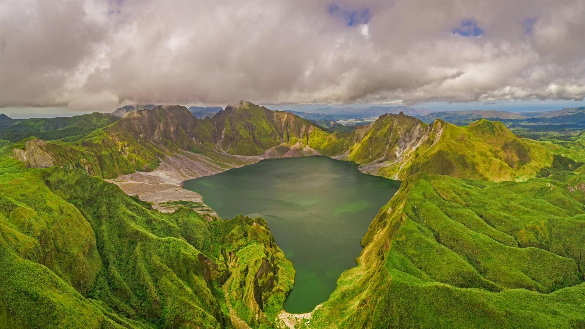
Are you older than this lake?
If you were born before summer 1991, the answer is yes. Sorry if you already felt a bit long in the tooth, but it's true: Before 30 years ago, Lake Pinatubo was just a rumble in Mount Pinatubo's magma-filled belly. It was a calamitous eruption on June 15, 1991—one of the 20th century's most powerful—that blew off Pinatubo's original summit and formed a vast crater, which gradually filled with water as greenery reclaimed the summit.
Located about 50 miles from the Philippines' capital of Manila, the crater was for many years a niche destination for hardy hikers, requiring days of travel to reach. More recently, a 4x4 road and tended hiking trail were added, reducing the rugged journey to a day trip.
你比这个湖大吗?
如果你出生在1991年夏天之前,答案是肯定的。抱歉,如果你已经觉得牙齿有点长了,但这是真的:30年前,皮纳图博湖只是皮纳图博火山充满岩浆的肚子里的隆隆声。这是1991年6月15日的一次灾难性喷发,是20世纪最强大的喷发之一,它把皮纳图博最初的山顶吹走,形成了一个巨大的火山口,随着绿色植物对山顶的再生,火山口逐渐充满了水。
这个陨石坑距离菲律宾首都马尼拉大约50英里,多年来一直是耐寒徒步旅行者的利基目的地,需要数天的旅行才能到达。最近,增加了一条4x4公路和徒步小径,将崎岖的旅程缩短为一日游。
评论已关闭