奥伊米亚康的冬天,俄罗斯 Winter in Oymyakon, Russia (© Alexandr Berdicevschi/Getty Images)
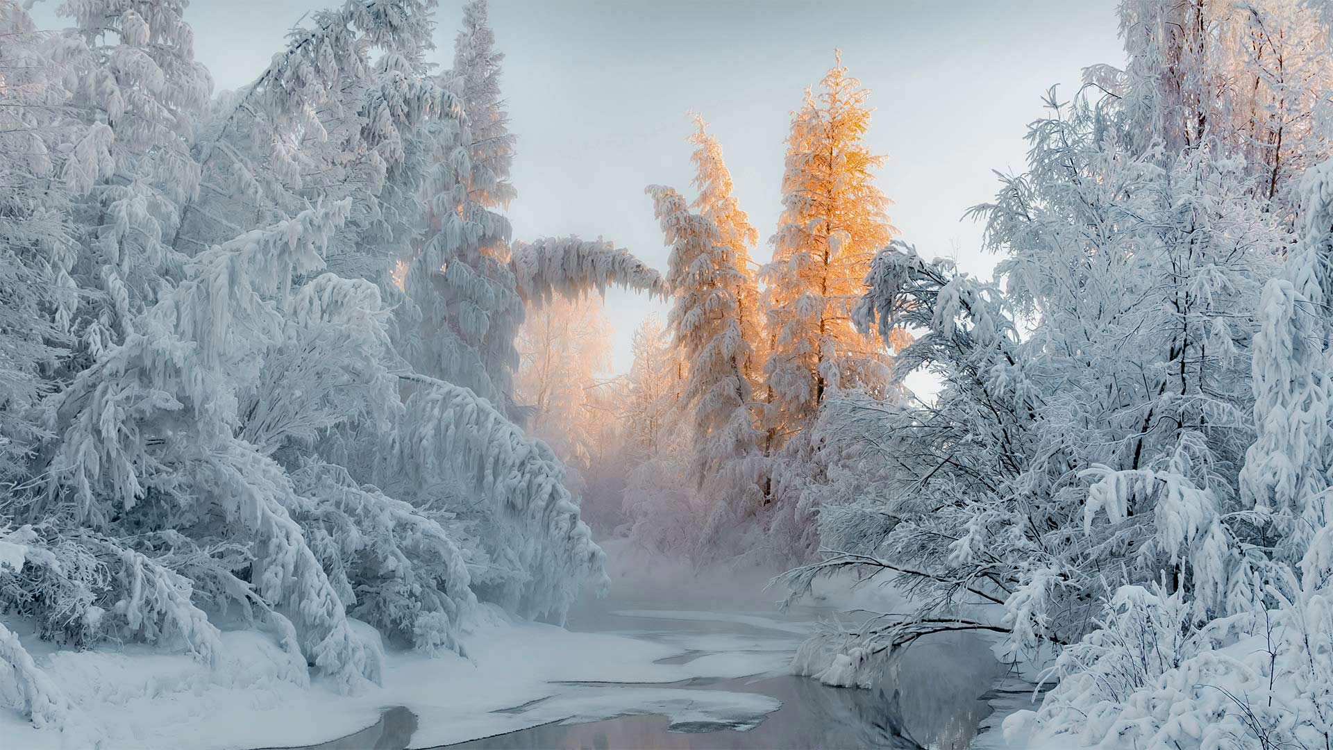
奥伊米亚康的冬天,俄罗斯 Winter in Oymyakon, Russia (© Alexandr Berdicevschi/Getty Images)
Oymyakon, Russia
Oymyakon, Russia, is one of a few places claiming to be the coldest spot in the Northern Hemisphere, a northern 'Pole of Cold.' Centuries of evolving meteorological technology means some historic cold temperatures are considered more accurate than others. The record for ultimate cold is a hot debate.
Oymyakon's claim may be strongest, though. The Siberian town has a verified low-temperature record of minus 89.9 degrees Fahrenheit in 1933—though if local lore and a Soviet-era monument are accurate, the true low was notched a decade earlier at minus 96.2.
By the way, the southern Pole of Cold blows all claimants to the northern record away like fresh-fallen snow: Russia's Vostok Station, in Antarctica, once recorded a low of minus 128.6! Think the Russians brought the cold with them?
俄罗斯Oymyakon
俄罗斯的Oymyakon是少数几个声称是北半球最冷的地方之一,是北方的“冷极”几个世纪以来不断发展的气象技术意味着一些历史上的低温被认为比其他温度更准确。关于终极感冒的记录是一场激烈的辩论。
不过,奥米亚康的说法可能最为强烈。这座西伯利亚小镇在1933年的低温记录已被证实为零下89.9华氏度,但如果当地的传说和苏联时期的纪念碑是准确的,那么真正的低温在十年前就达到了零下96.2华氏度。
顺便说一句,寒冷的南极把所有的求偿者都吹到了北方的记录上,就像刚刚下过雪一样:位于南极洲的俄罗斯沃斯托克站曾记录到负128.6的低点!你认为是俄罗斯人带来了寒冷吗?
西西伯利亚森林中的阳光,俄罗斯拉杜日内市附近 Sunlight in the forest of Western Siberia, near the city of Raduzhny, Russia (© Leonid Ikan/Shutterstock)
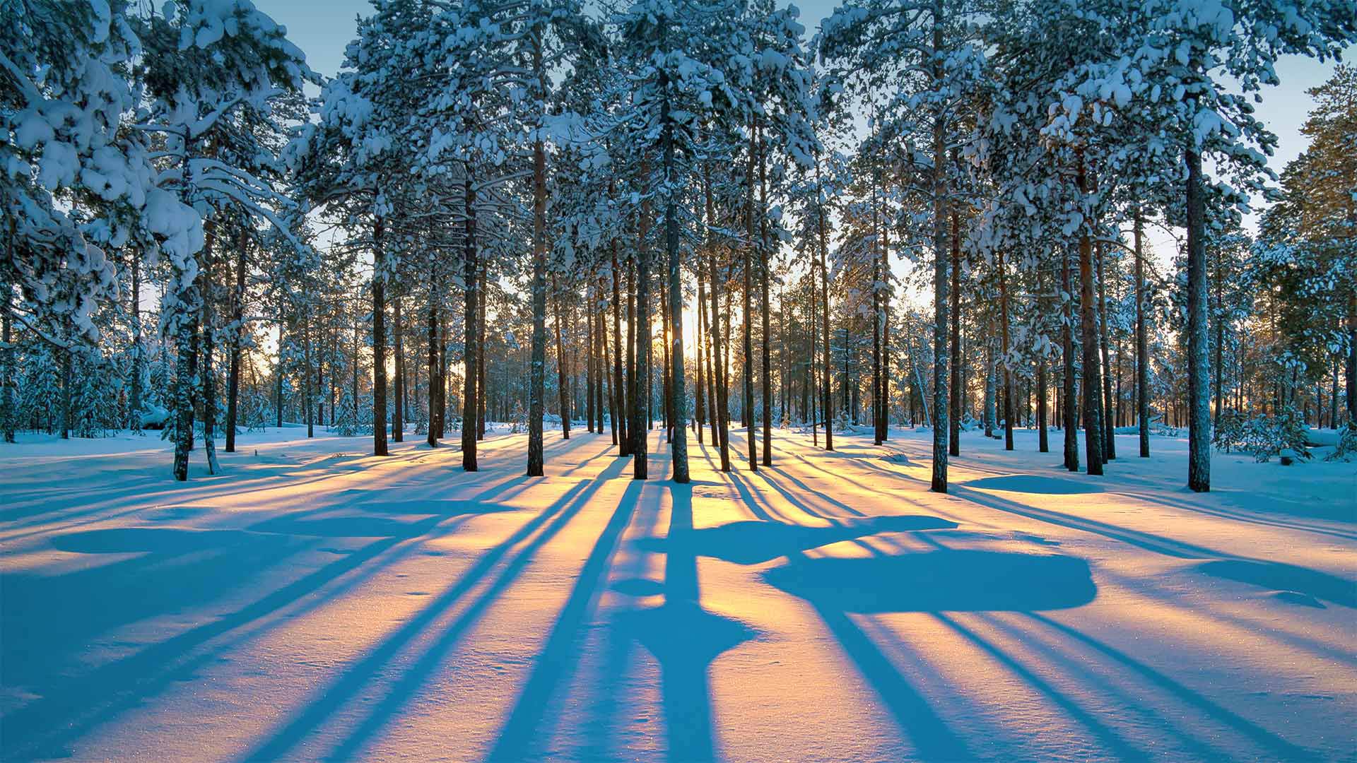
西西伯利亚森林中的阳光,俄罗斯拉杜日内市附近 Sunlight in the forest of Western Siberia, near the city of Raduzhny, Russia (© Leonid Ikan/Shutterstock)
Winter solstice
The whole Northern Hemisphere will experience the winter solstice today, but the farther north you get, the more obvious it'll be. In high-latitude areas like here in Siberia, the sun's arc cuts especially low across the sky as winter sets in. Today, this spot near the city of Raduzhny will barely get 5 hours' daylight.
Of course, even in the hotter climes of Earth's northern half, today is the shortest day of the year. So, while you wait for the long night to set in, make those daylight hours count!
冬至
今天整个北半球都将经历冬至,但你越往北走,冬至就越明显。在西伯利亚这样的高纬度地区,冬天来临时,太阳的弧线划破天空的距离特别低。今天,拉杜兹尼市附近的这一地区几乎没有5小时的日照。
当然,即使在地球北半球的炎热气候中,今天也是一年中最短的一天。所以,当你等待漫漫长夜来临的时候,让那些白天变得有意义!
北奥塞梯-阿兰共和国的一片墓地,俄罗斯 Necropolis near Dargavs, North Ossetia, Russia (© Yakov Oskanov/Shutterstock)
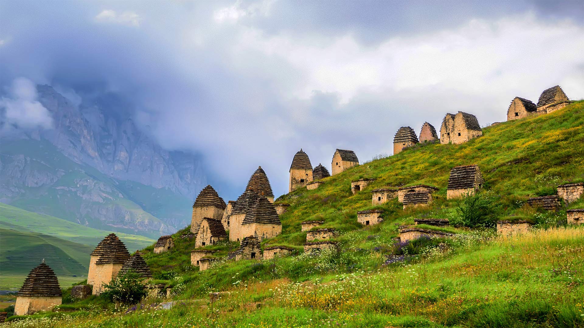
北奥塞梯-阿兰共和国的一片墓地,俄罗斯 Necropolis near Dargavs, North Ossetia, Russia (© Yakov Oskanov/Shutterstock)
Necropolis Near Dargavs
Be glad we're merely paying a virtual visit to this 'City of the Dead' outside Dargavs, Russia. Local folklore warns that if you set foot here, you won't escape with your life. We're not sure the dead pose such a mortal danger, but what's certain is that this is a dead-quiet village. These vaulted-roof huts are not homes—they're crypts.
Were you here, you might peer into the sole window of any of these huts and see the inhabitants, some entombed with their earthly possessions, others laid to rest in rowboats to paddle into the afterlife. Many of the remains are preserved unsettlingly well—and they more than outnumber you. In use from at least the 16th to 18th centuries, this necropolis is populated by about 10,000 departed ancestors.
Spooked enough yet? If not, try today's quiz about cemeteries, tombstones, and other grave matters…if you dare.
达尔加夫附近的墓地
很高兴我们只是虚拟地参观了俄罗斯达尔加夫郊外的这座“死亡之城”。当地民间传说警告说,如果你踏上这里,你将无法逃命。我们不确定死者是否会构成致命的危险,但可以肯定的是,这是一个死寂的村庄。这些拱形屋顶小屋不是家,而是地窖。
如果你在这里,你可能会从这些小屋的唯一窗户望出去,看到里面的居民,有些人被埋在地上,有些人躺在划艇上,准备划入来世。许多遗骸保存得令人不安,数量超过你。至少从16世纪到18世纪,这个墓地居住着大约10000名逝去的祖先。
够吓人了吗?如果不是的话,试试今天关于墓地、墓碑和其他坟墓的小测验……如果你敢的话。
Ruskeala山地公园的地下湖, 俄罗斯卡累利阿 Underground lake in Ruskeala Mountain Park, Karelia, Russia (© Konstantin Trubavin/Offset by Shutterstock)
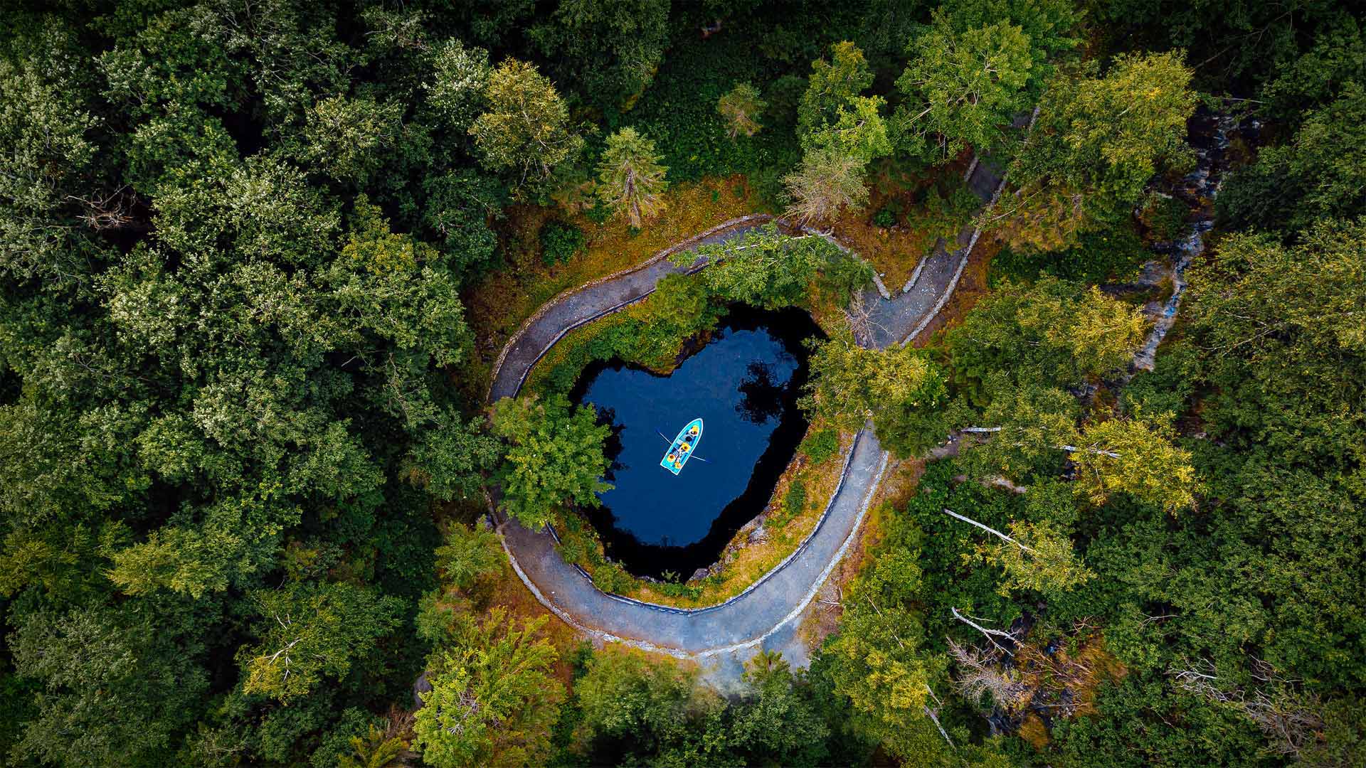
Ruskeala山地公园的地下湖, 俄罗斯卡累利阿 Underground lake in Ruskeala Mountain Park, Karelia, Russia (© Konstantin Trubavin/Offset by Shutterstock)
Notes from an underground lake
The Ruskeala Mountain Park is an eerily beautiful reminder of the booming mining industry that thrived for centuries in this area of Russia near the border with Finland. Constructed on top of an abandoned marble quarry, the park opened to the public in 2005. A centuries-old quarry that's been flooded with groundwater since the end of World War II is the park's centerpiece, although some old buildings and kilns from the mines are still intact.
Quarries in this area once extracted and exported limestone, and more importantly, marble, for use in large building projects in Russia. Catherine the Great is said to have had an affinity for the white marble that came from Ruskeala and urged its use in the construction of many of the beautiful buildings in St. Petersburgh during her 18th century reign as empress. Marble from the mines eventually ended up in famous landmarks of the city, including St. Isaac's Cathedral, St. Michael's Castle and the Marble Palace, among others. While the mines finally stopped operations in the 1990s, the park is now a popular day trip for tourists who want to learn more about the history of mining in the region.
地下湖笔记
Ruskeala山公园是一个奇异美丽的地方,它让人想起了几个世纪以来在俄罗斯与芬兰接壤的这个地区蓬勃发展的采矿业。该公园建于一个废弃的大理石采石场之上,于2005年向公众开放。一个自二战结束以来被地下水淹没的有数百年历史的采石场是该公园的核心,尽管一些旧建筑和矿山的窑炉仍然完好无损。
该地区的采石场曾经开采并出口石灰石,更重要的是大理石,用于俄罗斯的大型建筑项目。据说,凯瑟琳大帝对来自罗斯凯拉的白色大理石有着深厚的感情,在她18世纪担任皇后期间,她极力主张在圣彼得堡建造许多美丽的建筑。矿场中的大理石最终出现在城市的著名地标建筑中,包括圣艾萨克大教堂、圣迈克尔城堡和大理石宫殿等。虽然这些矿山在20世纪90年代最终停止了运营,但对于那些想更多了解该地区采矿历史的游客来说,该公园现在是一次受欢迎的一日游。
阿尼瓦角的灯塔,俄罗斯萨哈林岛 Lighthouse at Cape Aniva, Sakhalin Island, Russia (© Amazing Aerial Agency/Offset by Shutterstock)
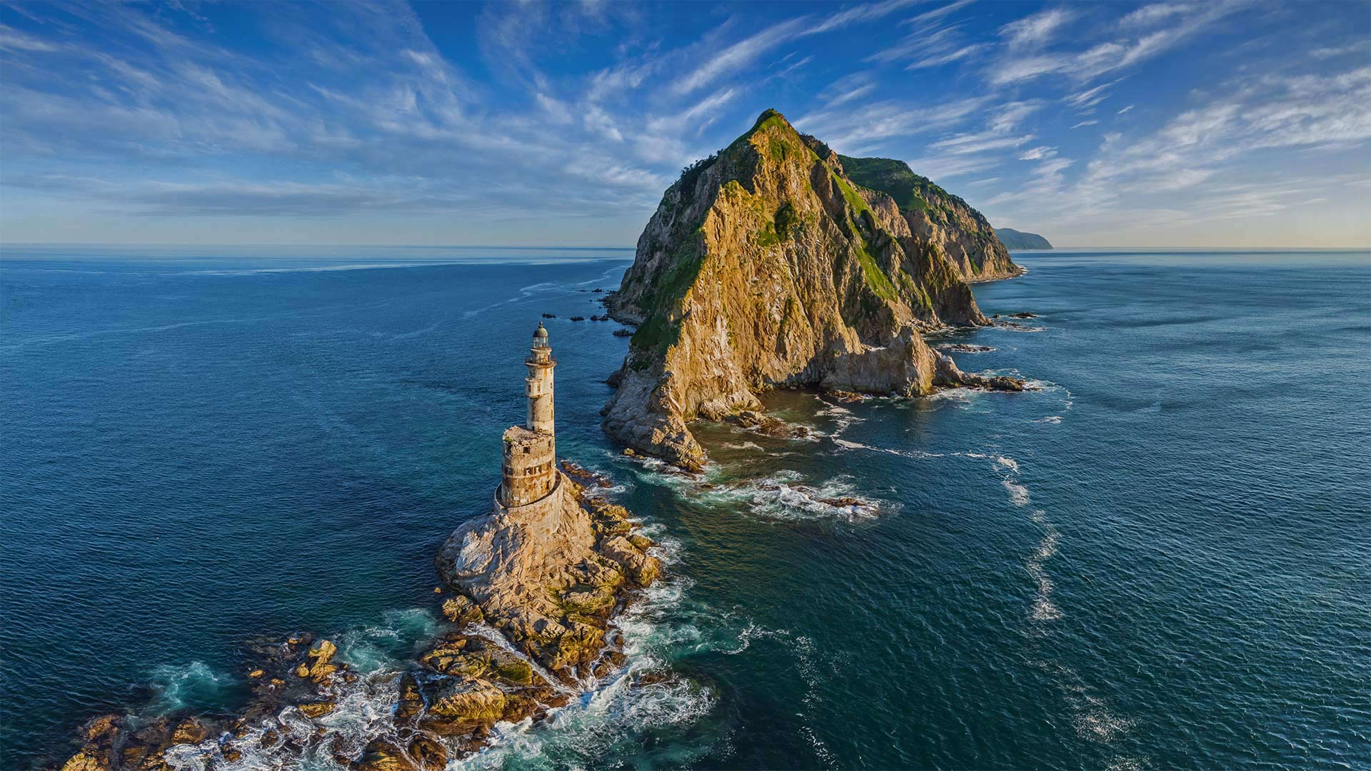
阿尼瓦角的灯塔,俄罗斯萨哈林岛 Lighthouse at Cape Aniva, Sakhalin Island, Russia (© Amazing Aerial Agency/Offset by Shutterstock)
A light at the edge of the world
Seemingly against all odds, the Aniva Lighthouse stands atop this rocky outcrop where it once lit the way for vessels navigating the fierce currents, hidden rocks, and frequent fogs of Cape Aniva on the island of Sakhalin. Russia's largest island, Sakhalin lies off the mainland's Far East coast, due north of the Japanese island of Hokkaido. The island was hotly contested by both Russia and Japan in the 19th and early 20th centuries. In the late 1930s, when the Aniva Lighthouse was built, Russia controlled the northern half of Sakhalin while...
世界边缘的一盏灯
阿尼瓦灯塔似乎与所有的可能性背道而驰,它矗立在这块岩石露头之上,曾经为船只在萨哈林岛上的阿尼瓦角激流、暗礁和频繁的浓雾中航行照亮了道路。萨哈林岛是俄罗斯最大的岛屿,位于大陆远东海岸,日本北海道岛正北。在19世纪和20世纪初,这个岛屿受到俄罗斯和日本的激烈争夺。上世纪30年代末,阿尼瓦灯塔建成后,俄罗斯控制了萨哈林岛的北半部,而。。。
堪察加半岛上的扎尔巴奇克火山,俄罗斯 Tolbachik volcanic complex on the Kamchatka Peninsula, Russia (© Egor Vlasov/Shutterstock)
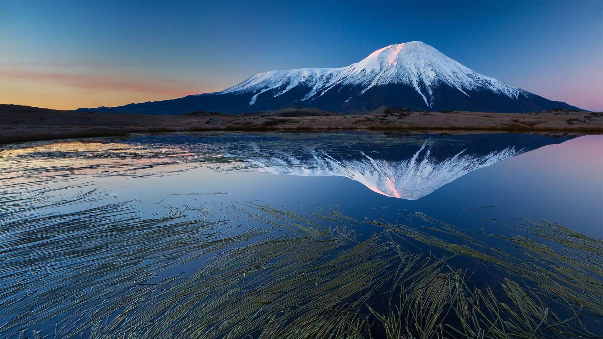
堪察加半岛上的扎尔巴奇克火山,俄罗斯 Tolbachik volcanic complex on the Kamchatka Peninsula, Russia (© Egor Vlasov/Shutterstock)
Welcome to the Ring of Fire
Today we're visiting the pair of volcanoes known as Tolbachik—the flat-topped Plosky (Flat) Tolbachik on the left of our image, and the majestic Ostry (Sharp) Tolbachik on the right, which soars 12,080 feet above the Kamchatka Peninsula in far eastern Russia. These are just two of approximately 160 volcanoes that dot the region; 29 of them, including the Tolbachik complex, are still active. In fact, there is so much volcanic activity here that UNESCO calls the peninsula 'one of the most outstanding volcanic regions in the world,' and has designated it a World Heritage Site.
The Kamchatka Peninsula juts out from the Russian mainland between the Sea of Okhotsk to the east and the Pacific Ocean and Bering Sea to the west. The sparsely populated peninsula makes up the western edge of the Ring of Fire, a chain of volcanoes along the Pacific Ocean that account for 90% of the world's seismic activity. Wild, remote, and primal, Kamchatka is home to an abundance of wildlife: arctic fox, tundra wolves, reindeer, lynx, huge Chukotka moose, and the Kamchatka brown bear that can tip the scales at 1,400 pounds.
格里博耶多夫运河和滴血救世主教堂,俄罗斯圣彼得堡 Griboyedov Canal and the Church of the Savior on Spilled Blood in Saint Petersburg, Russia (© Tomas Sereda/Getty Images)
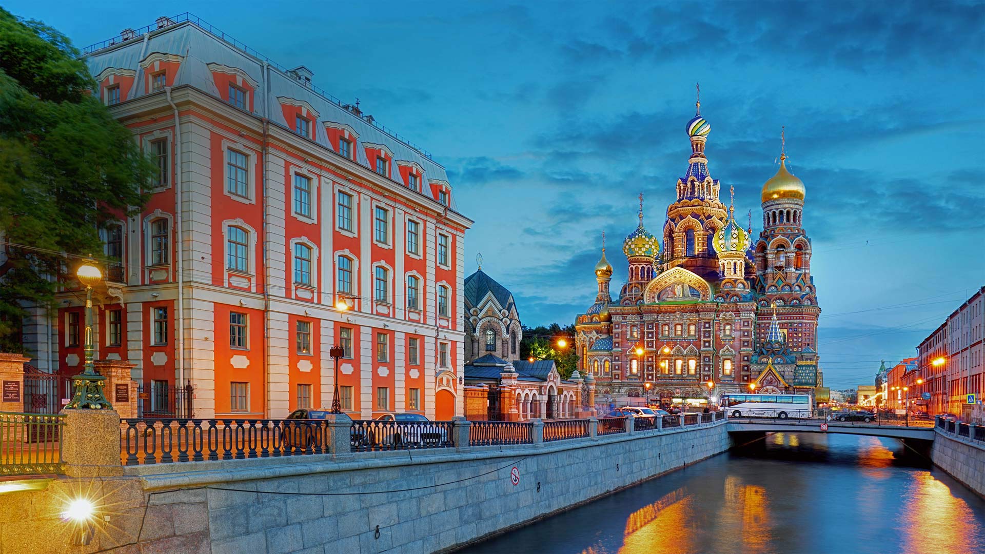
格里博耶多夫运河和滴血救世主教堂,俄罗斯圣彼得堡 Griboyedov Canal and the Church of the Savior on Spilled Blood in Saint Petersburg, Russia (© Tomas Sereda/Getty Images)
A midsummer twilight's dream
The Russian language classifies light and dark shades of blue as separate colors—which comes in especially handy if you venture north to Saint Petersburg in midsummer. The seaport metropolis sits less than 500 miles outside the Arctic Circle, so at the height of summer, the twilit 'blue hour' coveted by photographers lasts virtually all night long as the sun hovers just below the horizon. It's a phenomenon dubbed the 'White Nights' and it usually lasts from mid-June 11 to early July.
This particular view peers past the dark blue ('siniy') waters of the Griboyedov Canal at the dramatically named Church of the Savior on Spilled Blood. Framed against a light blue ('goluboi') sky, the church's colorful exterior is almost as dazzling as the motley mosaics covering the walls inside. The Griboyedov Canal, cutting south and west through a district dense with museums, theaters, and parks, is part of Saint Petersburg's intricate system of man-made waterways that earn the city one of its nicknames: 'Venice of the North.'
汽车穿过贝加尔湖冰面的鸟瞰图,俄罗斯 Aerial view of car crossing over the frozen surface of Lake Baikal, Russia (© Amazing Aerial Agency/Offset)
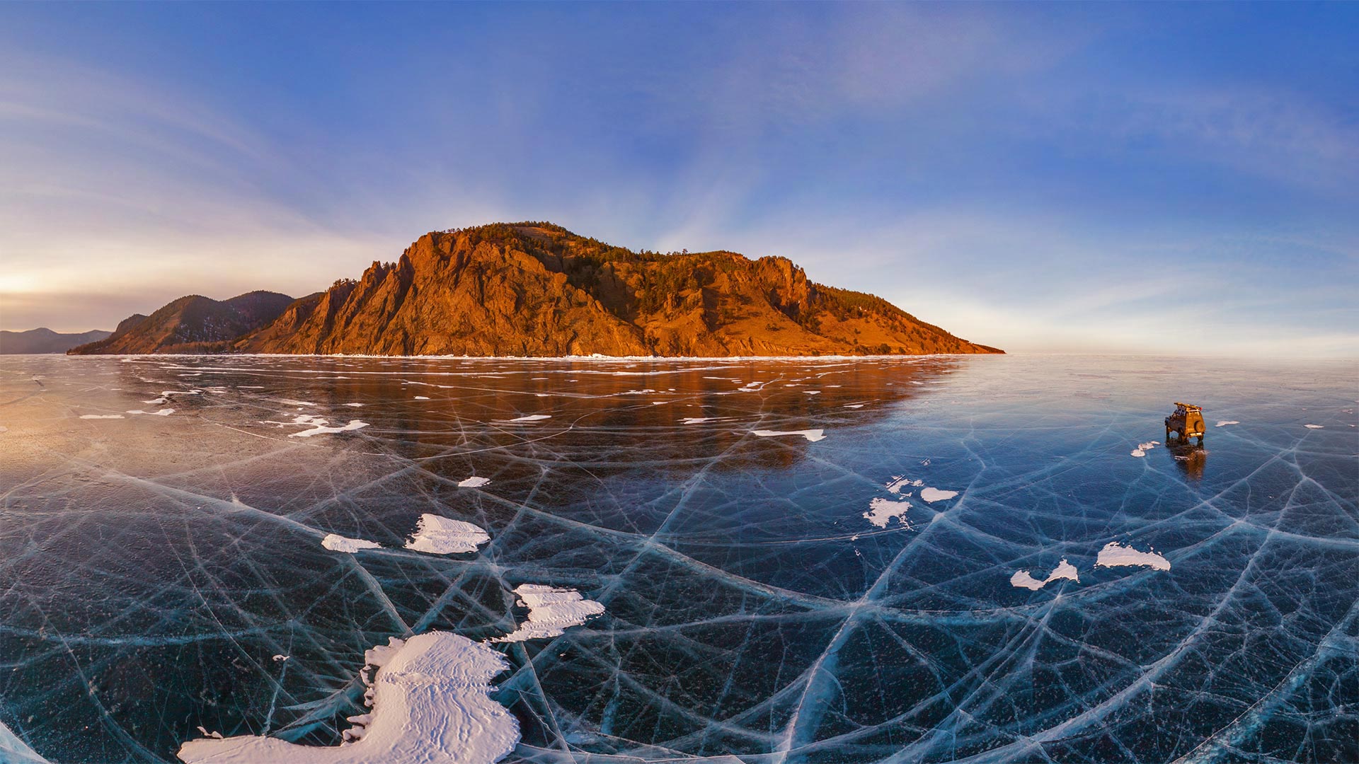
汽车穿过贝加尔湖冰面的鸟瞰图,俄罗斯 Aerial view of car crossing over the frozen surface of Lake Baikal, Russia (© Amazing Aerial Agency/Offset)
The Pearl of Siberia
Lake Baikal is a record-holding wonder: It's the world's oldest (25 million years), deepest (over 5,000 feet in some parts), and largest freshwater lake (more than 20 percent of the Earth's fresh surface water by volume). Baikal lies in the deepest continental rift on Earth, and because the rift is geologically active, the tectonic plates continue to move farther apart.
Fairweather tourists visit the 'Pearl of Siberia' in warmer months, but the brave and hearty show up in January when the lake surface freezes over. The ice makes an excellent playground for winter athletes competing in everything from skating marathons to the Baikal Ice Golf Tournament. And when the frozen expanse is at its thickest, an ice road opens between the mainland and Olkhon Island, pictured here, allowing people to drive across another superlative: turquoise ice so clear it's transparent to depths of 100 feet.
