蓝色龙舌兰田,墨西哥哈利斯科州龙舌兰酒产区 Tree in blue agave field in the tequila producing region near Atotonilco, Jalisco, Mexico (© Brian Overcast/Alamy)
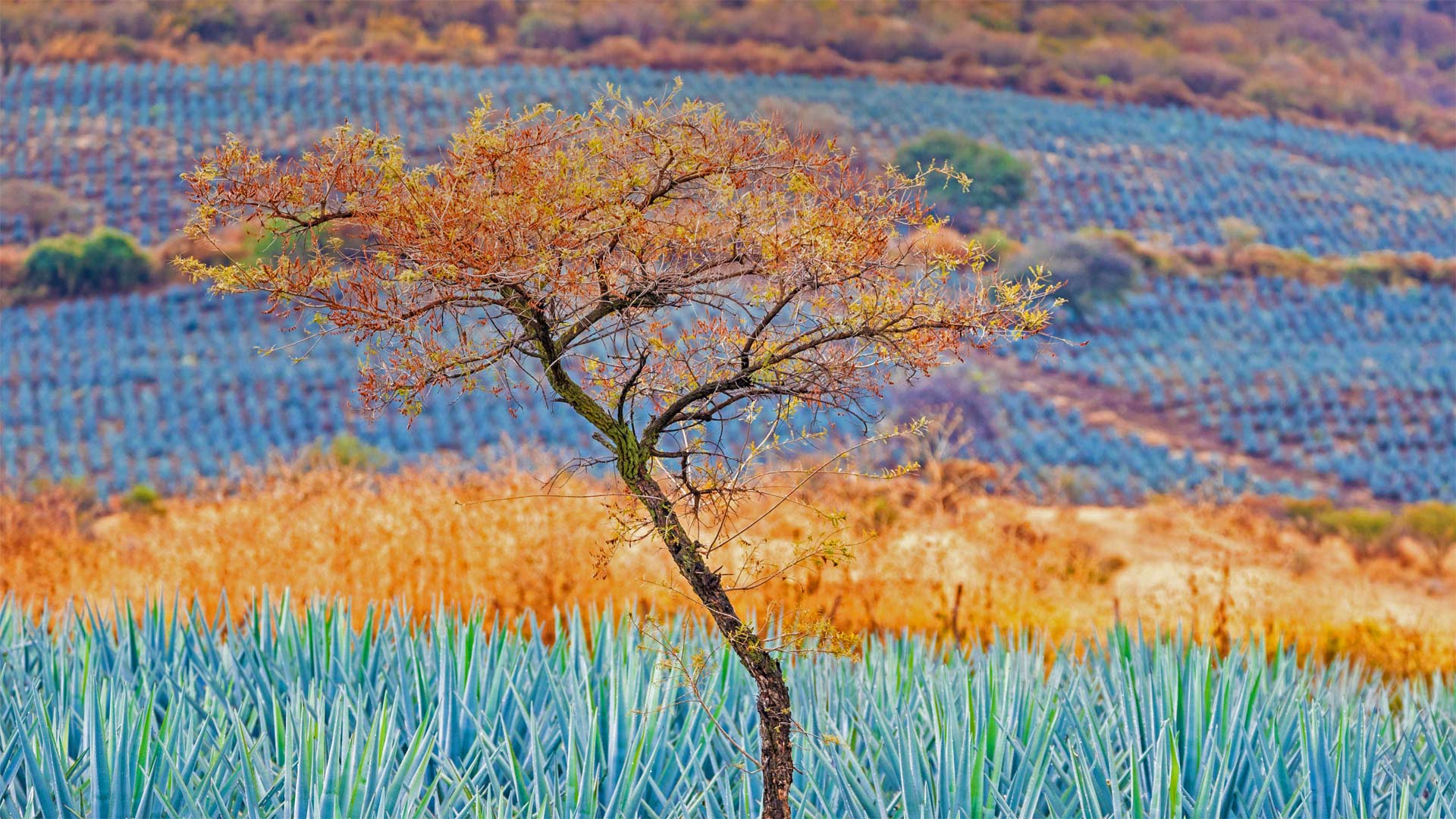
蓝色龙舌兰田,墨西哥哈利斯科州龙舌兰酒产区 Tree in blue agave field in the tequila producing region near Atotonilco, Jalisco, Mexico (© Brian Overcast/Alamy)
这种蓝色多汁的植物就像黄金一样珍贵 This blue succulent is as good as gold here
Cinco de Mayo
Many celebrations of Cinco de Mayo, or May 5, owe a debt to these rolling fields of blue agave, or agave Azul, the source material required to make genuine tequila. The distilled spirit is to Mexico what Scotch whisky is to Scotland and sake to Japan. Tequila is also the base ingredient in the beloved margarita cocktail certain to be served in abundance today.
Blue agave is native to Jalisco, a coastal state of Mexico, where it grows head-high in the rich sandy soils of Jalisco's highlands. Its flowers are pollinated, not by bees or birds, but by the Mexican long-nosed bat, adding to this succulent's mystique. The bat's favorite food is the pollen and nectar of agave. Tequila is made by roasting the heart of the plant and then crushing or squeezing it to release a sugary, clear liquid called aguamiel, which translates to honey water. That liquid is distilled to produce tequila. Authentic tequila, by law, can be made only in Jalisco and a few municipalities outside it, and its authenticity is protected by trade agreements.
Tequila's association with Cinco de Mayo in the US probably owes to the fact that Americans observe the day with an upbeat celebration of Mexican culture in general. Cinco de Mayo is sometimes mistaken for Mexico's Independence Day, which is actually on September 16. In Mexico, the holiday commemorates the Mexican army's victory over the French Empire in the Battle of Puebla in 1862. Whatever side of the border you're on today, if you toast the table with a glass of tequila, take a moment to remember the azure fields where it all started.
五月五日节
许多庆祝五月五日(Cinco de Mayo)的活动都要归功于这些蓝色龙舌兰(又称龙舌兰蓝)的滚滚田野,这是制作真正龙舌兰酒所需的原料。蒸馏酒之于墨西哥,就像苏格兰威士忌之于苏格兰,日本清酒之于日本。龙舌兰酒也是深受喜爱的玛格丽塔鸡尾酒的基本成分,今天一定会有大量的玛格丽塔鸡尾酒供应。
蓝色龙舌兰原产于墨西哥沿海州哈利斯科,生长在哈利斯科高地肥沃的沙质土壤中。它的花不是由蜜蜂或鸟类授粉,而是由墨西哥长鼻蝙蝠授粉,这增加了这种多汁植物的神秘性。蝙蝠最喜欢的食物是龙舌兰的花粉和花蜜。龙舌兰酒的制作方法是将植物的心脏烘烤,然后压碎或挤压,释放出一种称为aguamiel的含糖透明液体,转化为蜂蜜水。这种液体经过蒸馏制成龙舌兰酒。根据法律规定,正宗的龙舌兰酒只能在哈利斯科和其他几个城市生产,其真实性受到贸易协议的保护。
龙舌兰酒与美国的Cinco de Mayo酒的联系可能要归功于这样一个事实:美国人在庆祝这一天时,通常都会对墨西哥文化进行乐观的庆祝。Cinco de Mayo有时被误认为是墨西哥的独立日,实际上是9月16日。在墨西哥,这个节日是为了纪念墨西哥军队在1862年普埃布拉战役中战胜法兰西帝国。无论你今天身处何方,如果你用一杯龙舌兰酒来敬酒,花点时间回忆一下这一切开始的蔚蓝田野。
瓦迪拉姆, 约旦 Wadi Rum, Jordan (© Thomas Coex/AFP via Getty Images)
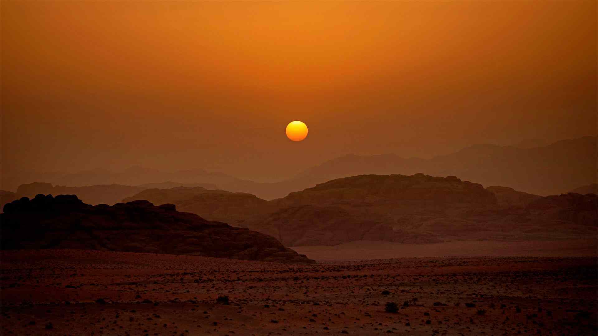
瓦迪拉姆, 约旦 Wadi Rum, Jordan (© Thomas Coex/AFP via Getty Images)
太阳落在月亮谷上 The sun sets on the Valley of the Moon
Star Wars Day
This otherworldly desert landscape in Jordan might look familiar to fans of the 'Star Wars' films, especially today on Star Wars Day, an annual celebration every May 4 of all things 'Star Wars.' Wadi Rum, aka Valley of the Moon, in southern Jordan, stood in for the moon Jedha in 'Rogue One,' and for the planet Pasaana in 'Star Wars: The Rise of Skywalker.' It is easy to see why this desolate landscape was chosen to mimic an alien world.
Wadi Rum ('wadi' means 'valley' in Arabic) is the largest valley in Jordan, cut through sandstone and granite formations. A UNESCO World Heritage protected area, Wadi Rum is singled out for its ancient rock carvings and archeological remains. Various human cultures have lived in this valley since prehistoric times.
Today, the valley is one of the most popular destinations in Jordan for tourists, particularly rock climbers and hikers. Summer temperatures routinely reach the 90s, but this being the desert, temperatures cool considerably at night. The Zalabieh tribe of Bedouins call the valley home. They act as guides for tourists and coordinate activities like camel rides, horseback rides, and camping. A major coastal city, Aqaba, is less than 40 miles away, so if you'd like to visit Wadi Rum, put away your hyperdrive—you don't have to leave the galaxy.
星球大战日
对于《星球大战》电影的粉丝来说,约旦这片超凡脱俗的沙漠景观可能看起来很熟悉,尤其是今天的《星球大战日》,每年5月4日都是《星球大战》的年度庆典约旦南部的Wadi Rum又名月球谷,在《侠盗一号》中代表月球杰达,在《星球大战:天行者的崛起》中代表行星帕萨纳很容易理解为什么选择这片荒凉的土地来模拟外星世界。
Wadi Rum(“Wadi”在阿拉伯语中的意思是“山谷”)是约旦最大的山谷,穿过砂岩和花岗岩地层。Wadi Rum是联合国教科文组织世界遗产保护区,因其古老的石刻和考古遗迹而被选中。从史前时代起,各种人类文化就生活在这个山谷里。
今天,河谷是约旦最受游客欢迎的目的地之一,尤其是攀岩者和徒步旅行者。夏季气温通常会达到90年代,但这里是沙漠,夜间气温会相当低。贝多因人的萨拉比耶部落称山谷为家。他们充当游客的向导,协调骑骆驼、骑马和露营等活动。一个主要的沿海城市亚喀巴离这里不到40英里,所以如果你想去Wadi Rum,把你的超光速引擎收起来,你不必离开银河系。
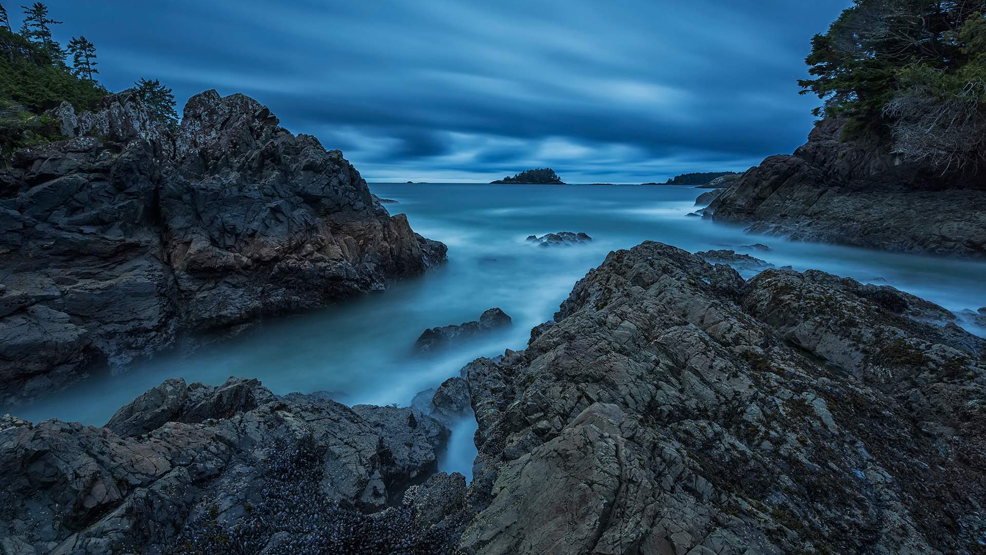
托菲诺的麦肯齐海滩,加拿大不列颠哥伦比亚省 (© Robert Postma/Plainpicture/Design Pics)
土耳其棉花堡的石灰华梯田 Travertine terraces of Pamukkale, Turkey (© bybostanci/Getty Images)
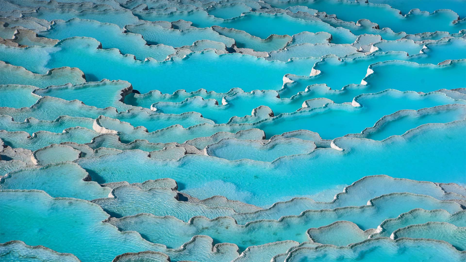
土耳其棉花堡的石灰华梯田 Travertine terraces of Pamukkale, Turkey (© bybostanci/Getty Images)
天堂般的温泉 Heavenly hot springs
Pamukkale, Turkey
The stunning travertine terraces and hot pools of Pamukkale, Turkey, have dazzled visitors since at least the end of the 2nd century BCE and the founding of the Greco-Roman thermal spa of Hierapolis. Since then, people have enjoyed a relaxing soak in the 97-degree Fahrenheit water, claiming curative powers for many ailments.
It makes sense that Pamukkale is also known as the 'Cotton Palace,' in a nod to the fluffy-looking white formations that cover the hillside. That 'cotton' is travertine, a soft limestone that is formed over centuries as calcite-laden water drops from springs on a cliff high above. Here it's a stunning white, but travertine can be found in many different colors, ranging from gray to gold.
The terraces and the ancient ruins of Hierapolis are so unique that they were named a UNESCO World Heritage Site. New restrictions to protect the pools include a cap on the number of bathers, so you may not be allowed to take a dip. But there's plenty to marvel at here. Walk around the ruins of the theater and necropolis, the ancient temples, and bath houses in Hierapolis. You'll be in good company: The hot springs and Hierapolis draw more than 2 million visitors a year, making them one of Turkey's most visited attractions.
帕穆卡莱,土耳其
至少从公元前2世纪末和希拉波里斯希腊罗马温泉浴场的建立起,土耳其帕穆卡勒令人惊叹的石灰华露台和热水池就让游客们眼花缭乱。从那时起,人们在华氏97度的水中享受着放松的浸泡,声称对许多疾病都有疗效。
Pamukkale也被称为“棉花宫”,这是有道理的,因为它与覆盖在山坡上的蓬松的白色地层相呼应。这种“棉花”是石灰华,一种柔软的石灰岩,几个世纪以来,富含方解石的水从悬崖上方的泉水中滴落而成。这是一种令人惊叹的白色,但石灰华有许多不同的颜色,从灰色到金色不等。
Hierapolis的梯田和古代遗址非常独特,因此被联合国教科文组织命名为世界遗产。保护游泳池的新限制包括对游泳人数的限制,因此你可能不被允许游泳。但这里有很多值得惊叹的地方。在希拉波里斯的剧院和墓地遗址、古庙和澡堂周围走走。你会有很好的同伴:温泉和希拉波利斯每年吸引200多万游客,使其成为土耳其游客最多的景点之一。
盛开的金链花树和紫色葱属植物,加拿大温哥华范度森植物园 Laburnum (golden chain) trees and purple alliums in bloom at VanDusen Botanical Garden, Vancouver, Canada (© Greg Vaughn/Alamy)
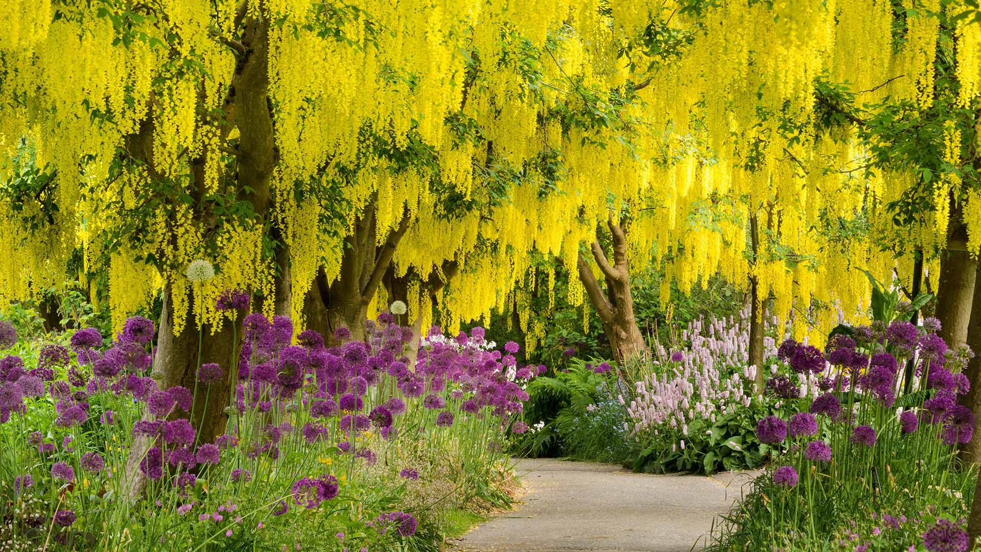
盛开的金链花树和紫色葱属植物,加拿大温哥华范度森植物园 Laburnum (golden chain) trees and purple alliums in bloom at VanDusen Botanical Garden, Vancouver, Canada (© Greg Vaughn/Alamy)
一张来自春天的快照 A snapshot of Spring
Laburnum trees and purple alliums
This snapshot of Spring is from VanDusen Botanical Garden located in Vancouver, British Columbia. Approximately 7,500 species and varieties of plants can be spotted here. Visitors are encouraged to take self-guided tours which are updated almost every month, as new plants take centre stage. Pictured here are the laburnum trees in full bloom. Despite requiring little maintenance, these trees can grow fast, surpassing close to 40 centimeters of growth each year. Given their gorgeous golden arch and walkways, laburnums easily draw visitors to VanDusen Botanical Gardens this time of the year. And if you miss their narrow period of full bloom, you could likely take a stroll through the Rhododendron Walk or take in the numerous flowers in vibrant colors spread across the garden.
唇形树和紫色葱
这张春天的快照来自不列颠哥伦比亚省温哥华的范杜森植物园。这里可以看到大约7500种植物。随着新工厂占据中心舞台,游客们被鼓励参加几乎每个月都会更新的自助游。图中是盛开的唇瓣树。尽管几乎不需要维护,但这些树木生长速度很快,每年的生长量超过近40厘米。由于其华丽的金色拱门和人行道,每年的这个时候,拉布努姆很容易吸引游客来到范杜森植物园。如果你错过了杜鹃花盛开的短暂时期,你很可能会在杜鹃花道上漫步,或者欣赏花园里铺开的无数色彩鲜艳的花朵。
巨型红杉的小萌芽,加利福尼亚州 A young giant sequoia sprouting out of an old log in Prairie Creek Redwoods State Park, California (© Hutch Axilrod/Getty Images)
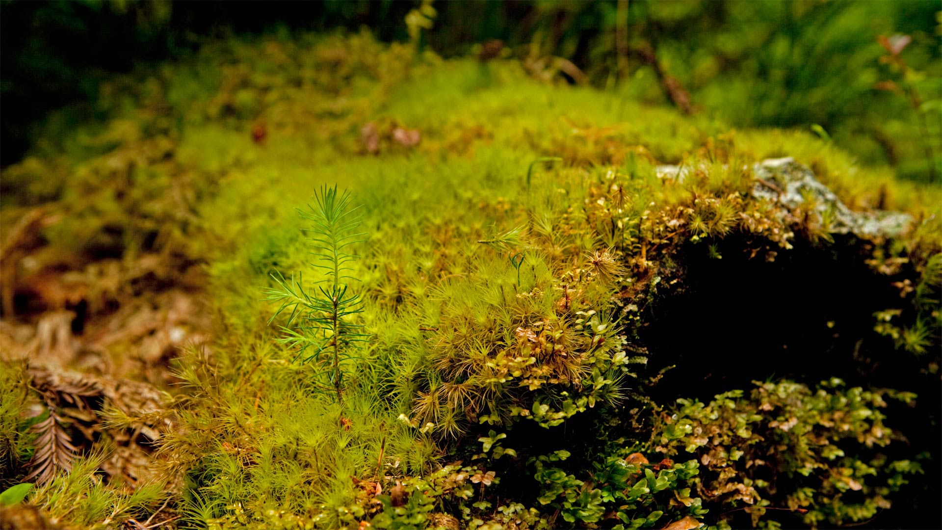
巨型红杉的小萌芽,加利福尼亚州 A young giant sequoia sprouting out of an old log in Prairie Creek Redwoods State Park, California (© Hutch Axilrod/Getty Images)
潜力惊人的萌芽 The sprout with amazing potential
Arbor Day
With a little love and support, this little sprout at Prairie Creek Redwoods State Park in California has a big future ahead of it. It has the potential to one day be the tallest tree on the planet, or at least close to it. Its 'big brother,' Hyperion, currently holds the record at 380 feet. They're giant sequoias, aka giant redwood trees. They often grow upwards of 300 feet tall and can live for thousands of years. They're heroes of nature, affecting the weather and climate, while housing and protecting other plants and animals. But all of this little sprout's potential is at risk because the giant sequoia is an endangered species. Fewer than 80,000 of them remain. That's why today is an important day for it and all trees.
That's right, today is Arbor Day, the day where we stop a moment to think about the trees (and hopefully even plant a few). The first American Arbor Day occurred 150 years ago when an estimated one million trees were planted in Nebraska in 1872. This year, America's Arbor Day Foundation is celebrating its 50th year of dedication to tree planting. They've planted over 350 million of them over the years, but the mission never ends. Trees are vital to the health of our planet, which means they're important for our own health as well. Why not do a little to make the future a better place and take a moment to nurture or plant a new tree today?
植树节
有了一点爱和支持,加利福尼亚州大草原溪红杉州立公园的这棵小豆芽就有了一个广阔的未来。它有可能有一天成为地球上最高的树,或者至少离它很近。它的“老大哥”海伯龙目前保持着380英尺的纪录。它们是巨大的红杉,又名巨大的红杉。它们通常能长到300英尺高,可以存活数千年。他们是大自然的英雄,影响天气和气候,同时居住和保护其他动植物。但由于巨型红杉是一种濒危物种,这种小豆芽的所有潜力都面临风险。剩下的不到8万人。这就是为什么今天对它和所有树木来说都是重要的一天。
没错,今天是植树节,这一天我们会停下来想一想那些树(希望还能种一些)。美国第一个植树节发生在150年前,1872年内布拉斯加州种植了大约100万棵树。今年,美国植树节基金会将庆祝植树50周年。多年来,他们已经种植了超过3.5亿株,但任务从未结束。树木对我们星球的健康至关重要,这意味着它们对我们自身的健康也很重要。为什么不做一点事情,让未来变得更好,今天花点时间培育或种植一棵新树呢?
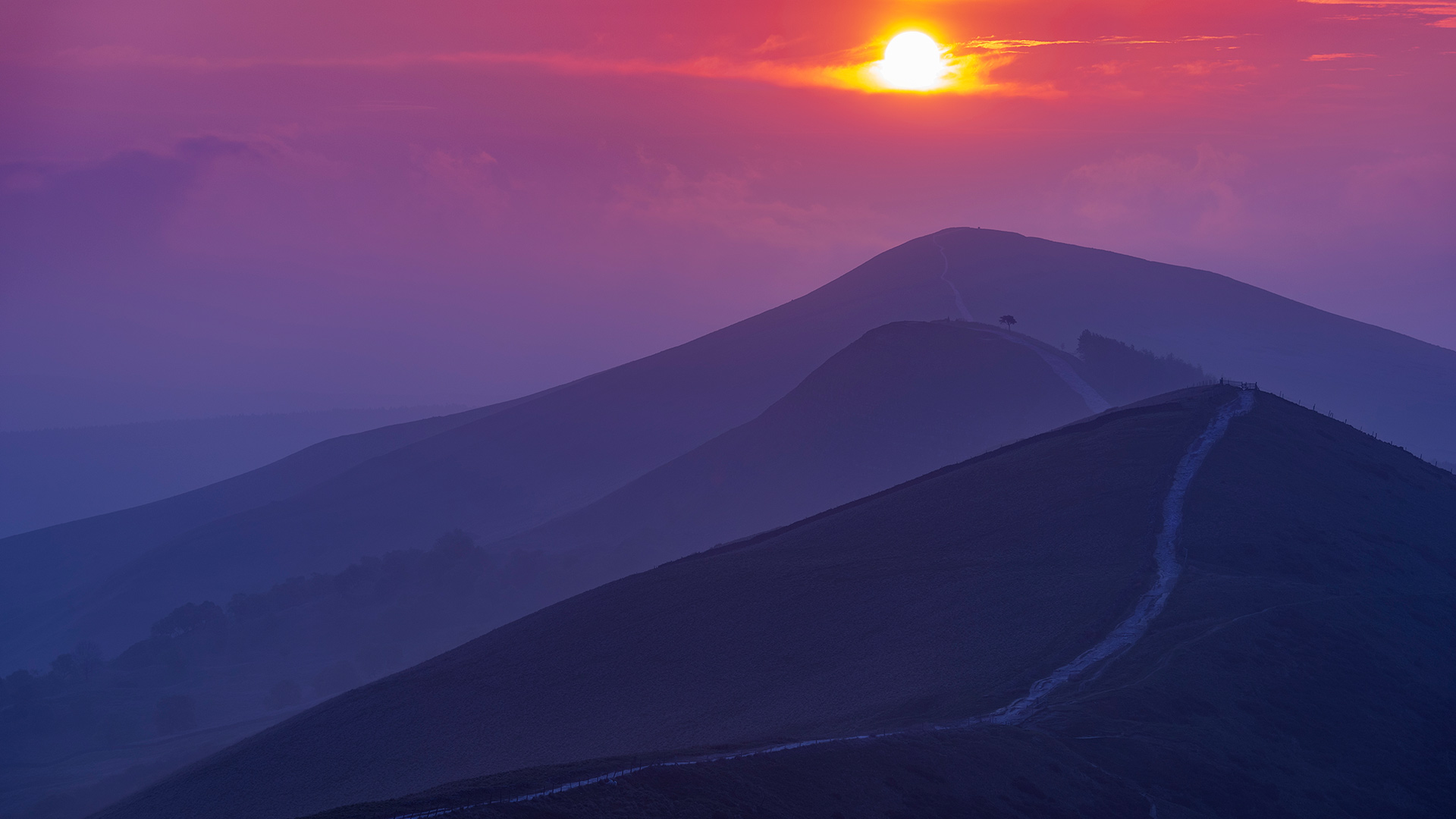
大脊山,英格兰峰区国家公园 (© John Finney Photography/Moment/Getty Images)
午夜的太阳,挪威斯瓦尔巴群岛 Midnight sun in Svalbard, Norway (© Nature Picture Library/Alamy)
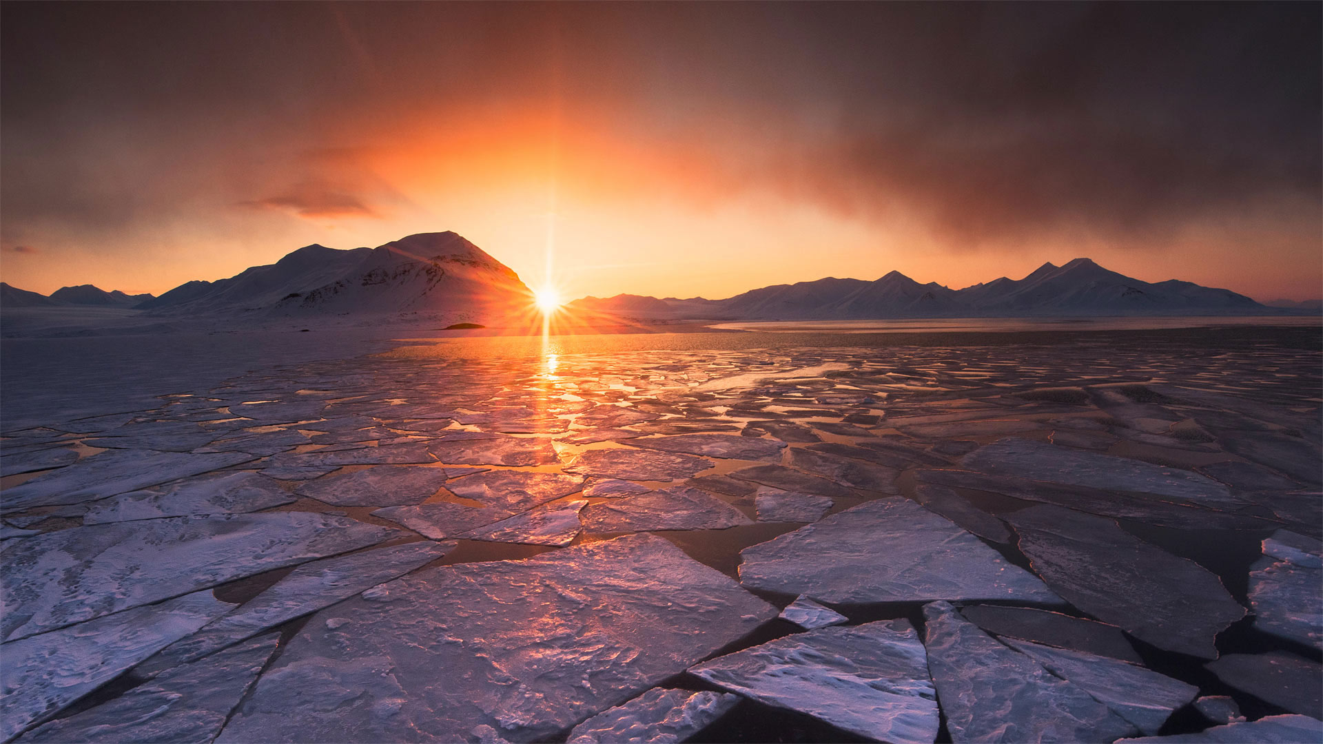
午夜的太阳,挪威斯瓦尔巴群岛 Midnight sun in Svalbard, Norway (© Nature Picture Library/Alamy)
无尽的夏夜 Endless summer
Midnight sun
Don't lose your sunglasses! At least not during this time of year in Svalbard, Norway, when the sun crests the horizon and never dips below it again for more than five months. From about April 19 to August 23, it's nothing but sunshine on this island above the Arctic Circle, more than 500 miles north of mainland Norway. It's not quite a day at the beach, with average summertime high temps of 39 to 45 degrees Fahrenheit (toasty compared to average wintertime temps of 5 to 9 degrees). And who knows how far it is to the nearest Ray-Ban store?
Norway is one of eight nations in the Northern Hemisphere that experience the phenomenon known as the 'midnight sun' (but the only one that lays claim to the name 'Land of the Midnight Sun'). Parts of the United States (Alaska), Canada, Iceland, Finland, Sweden, Russia, and the Kingdom of Denmark (Greenland) also see the sun at local midnight during the summer months. In these northernmost climes the path of the sun is often cause for celebration. Svalbard celebrates Sun Festival Week when the sun first emerges in early March. St. Petersburg, Russia, is renowned for its White Nights of endless twilight, and Midsummer is a huge outdoor party in many northern nations. You'll want to get your sunshine while you can, because the endless dark of the polar winter lasts just as long.
午夜的太阳
别把太阳镜弄丢了!至少在挪威斯瓦尔巴特岛每年的这个时候,太阳升到地平线上,并且在五个多月内再也不会下降到地平线以下。从大约4月19日到8月23日,在挪威大陆以北500多英里的北极圈上空的这个岛屿上,除了阳光什么都没有。海滩上的天气不太好,夏季的平均高温为39到45华氏度(相比之下,冬季的平均温度为5到9华氏度)。谁知道离最近的Ray Ban商店有多远?
挪威是北半球经历“午夜太阳”现象的八个国家之一(但也是唯一一个声称拥有“午夜太阳之地”名称的国家)。美国(阿拉斯加)、加拿大、冰岛、芬兰、瑞典、俄罗斯和丹麦王国(格陵兰岛)的部分地区在夏季也会在当地午夜看到太阳。在这些最北端的气候中,太阳的路径往往值得庆祝。斯瓦尔巴特庆祝太阳节周,太阳在3月初首次出现。俄罗斯圣彼得堡以其无尽暮色的白夜而闻名,而仲夏是许多北方国家的大型户外派对。你会希望尽可能地享受阳光,因为极地冬天无尽的黑暗也会持续同样长的时间。
下莱茵省的胡内城堡,法国阿尔萨斯大区 Château de Hunebourg, Bas-Rhin, Alsace, France (© Leonid Andronov/Alamy)
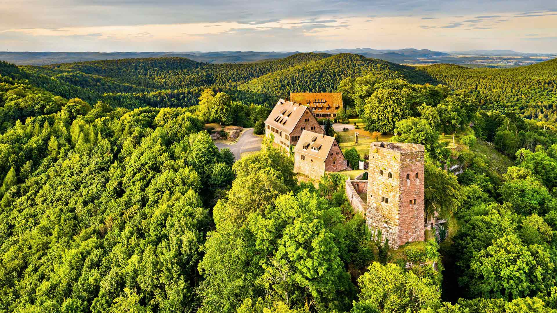
下莱茵省的胡内城堡,法国阿尔萨斯大区 Château de Hunebourg, Bas-Rhin, Alsace, France (© Leonid Andronov/Alamy)
12世纪的历史遗迹 The castle of a thousand and one lives
Château de Hunebourg
Today, we take a breath of fresh air, nature and history with this view of the Alsatian castle of Hunenbourg, located west of Neuwiller-lès-Saverne, in the Bas-Rhin, in Alsace. The castle of Hunebourg, listed as a Historic Monument since June 2007, is installed on a sandstone rock 425 meters above sea level and accessible by the Zinsel valley.
Formerly owned by the Counts of Hunebourg, the castle was built in the 12th century. Years after years, it passed from hand to hand. In the second half of the 20th century, the castle became what it still is today, a hotel.
The site welcomes its visitors in an exceptional natural setting where you can still admire the remains of the original building such as the floors and furniture, the cave of Love, which was used as a place for romantic dates, reconstructed by Spieser, or the markers of divided areas.
胡内堡城堡酒店
今天,我们在阿尔萨斯下莱茵河畔的纽威勒-莱斯-萨维恩以西的胡嫩堡阿尔萨斯城堡中呼吸新鲜空气、自然和历史。Huneburg城堡自2007年6月起被列为历史遗迹,它坐落在海拔425米的砂岩上,可通过Zinsel山谷进入。
这座城堡曾为胡内堡伯爵所有,建于12世纪。年复一年,它从一个手传到另一个手。在20世纪下半叶,城堡变成了今天的酒店。
该景点以独特的自然环境欢迎游客,在这里,你仍然可以欣赏原始建筑的遗迹,如地板和家具、被斯皮泽重建的爱情洞穴,或分割区域的标记。
半穹顶景观点上空的银河,优胜美地国家公园,加利福尼亚州 Milky Way rising above Half Dome in Yosemite National Park, California (© Cory Marshall/Tandem Stills + Motion)
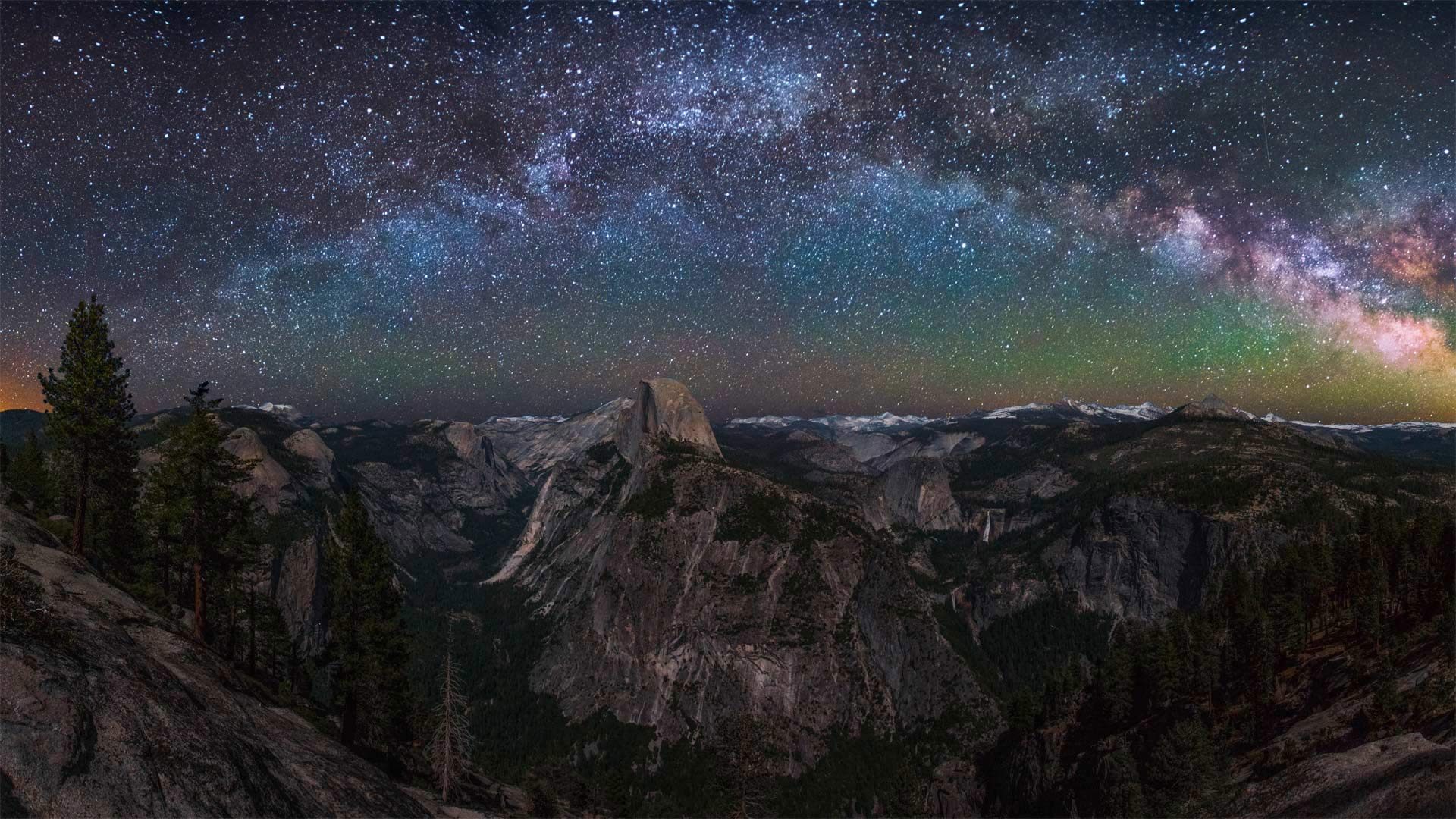
半穹顶景观点上空的银河,优胜美地国家公园,加利福尼亚州 Milky Way rising above Half Dome in Yosemite National Park, California (© Cory Marshall/Tandem Stills + Motion)
你能把灯关掉吗? Could you turn off the lights?
Dark Sky Week
During International Dark Sky Week, we're counting ourselves lucky to have this spectacular nighttime view, considering the astonishing fact that 83% of the global population lives under a light-polluted sky. Unneeded artificial light is classified as a pollutant and has been proven to have harmful side effects. Not only does it waste money and energy, it also disrupts plants and animals, is believed to impact the climate, and blocks our view of the universe.
Encouraging people to get away from artificial light is one of the goals of International Dark Sky Week, and today's photo shows just how magnificent that can be. Here, we're treated to a beautiful view of the Milky Way from Yosemite National Park in California. Yosemite is part of a network of national parks monitoring dark night skies to gather a complete data set of light pollution. They've learned that 'two-thirds of Americans cannot see the Milky Way from their backyard, and if current light pollution trends continue, there will be almost no dark skies left in the contiguous United States by 2025.'
Luckily, dark sky is a recoverable resource. There are ways to reduce our light use and improve the view of the night sky for everyone. Think about it over the course of the next week, preferably while gazing at a night sky undisturbed by light pollution—or at least a beautiful photo of one.
黑暗天空周
在国际黑暗天空周期间,考虑到全球83%的人口生活在轻度污染的天空下这一令人震惊的事实,我们认为自己有幸拥有这一壮观的夜景。不需要的人造光被归类为污染物,并已被证明具有有害的副作用。它不仅浪费金钱和能源,还扰乱动植物,被认为会影响气候,阻碍我们对宇宙的看法。
鼓励人们远离人造光是国际黑暗天空周的目标之一,今天的照片展示了这是多么壮观。在这里,我们可以在加利福尼亚州约塞米蒂国家公园欣赏到银河系的美景。约塞米蒂是国家公园网络的一部分,该网络监测黑夜天空,以收集光污染的完整数据集。他们了解到,“三分之二的美国人无法从自家后院看到银河系,如果目前的光污染趋势继续下去,到2025年,毗邻的美国将几乎没有黑暗的天空。”
幸运的是,黑暗的天空是一种可回收的资源。有一些方法可以减少我们的光线使用,改善每个人的夜空视野。在接下来的一周里好好想想,最好是在凝视没有光污染的夜空时,或者至少是一张美丽的照片。
