白沙漠中的岩石,埃及 Rock formations in the White Desert, Egypt (© Anton Petrus/Getty Images)
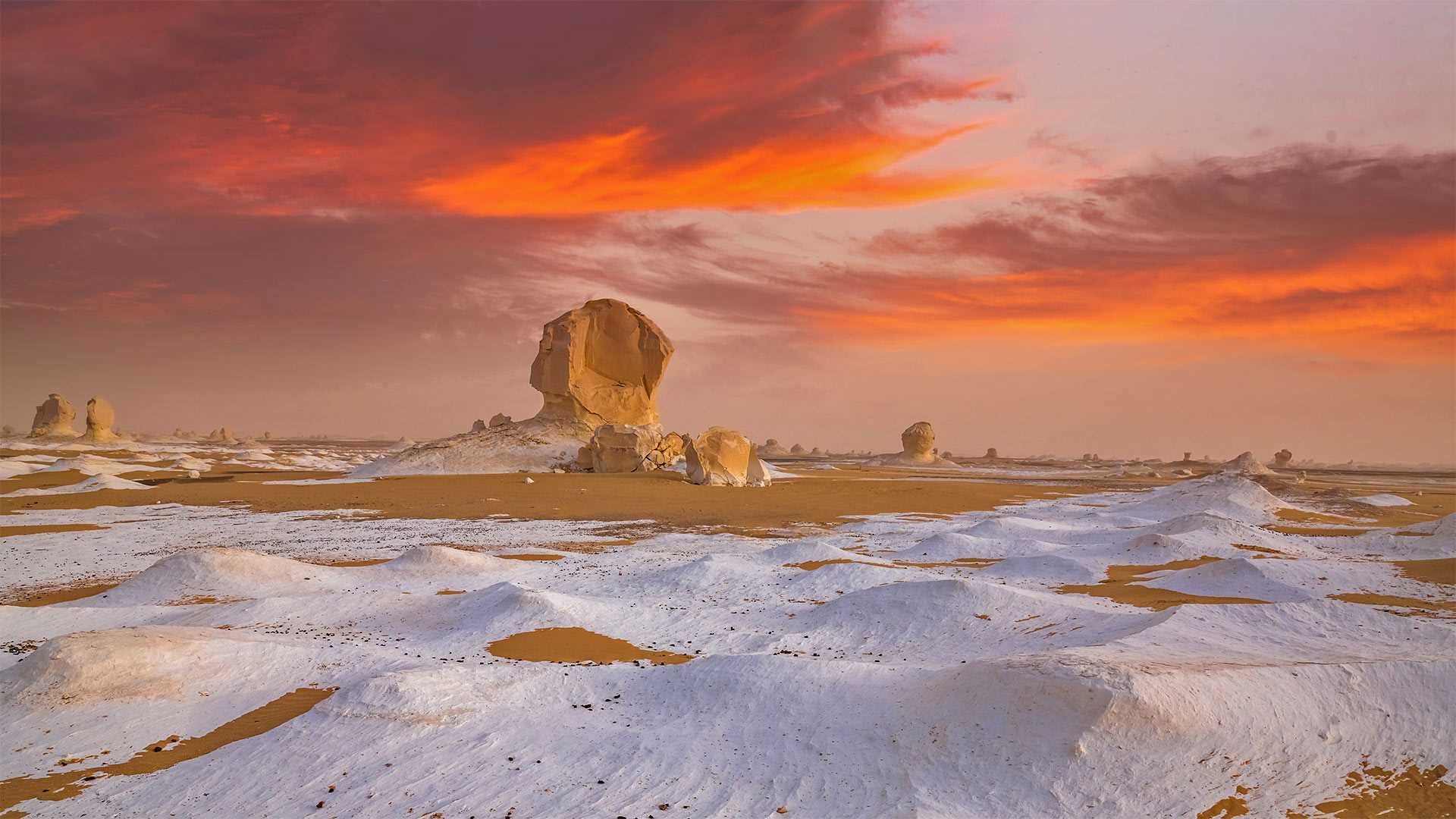
白沙漠中的岩石,埃及 Rock formations in the White Desert, Egypt (© Anton Petrus/Getty Images)
这些雪永远不会融化 This snow will never melt
白沙漠国家公园,埃及
这是沙漠中的雪吗?其实不是。这里是埃及的白沙漠,当地丰富的白垩岩、石灰岩、石英岩以及长年累月的风化作用造就了这些白色的沙子和形状奇特的岩石,白沙漠也因此得名。游客们蜂拥而至,来欣赏这些大自然的奇观。白沙国家公园距离开罗约5小时车程,这里不仅有白沙和怪石,还有多种濒危保护动物。
White Desert National Park, Egypt
Snow, in the desert? Not quite. Today we're in Egypt's White Desert, which gets its colorful name from an abundance of chalk, limestone, and quartz rock formations that give the sand its special hue. Tourists flock to this place to see these naturally occurring structures, honed over thousands of years into unique shapes through a process known as 'differential weathering.' Located about five hours to the southwest of Cairo, White Desert National Park is a lot more than just deteriorating rocks—it's also a protected refuge for several endangered animal species.
安沙波利哥沙漠州立公园,美国加利福尼亚州 Borrego Badlands in Anza-Borrego Desert State Park, California (© Tom Hogan/plainpicture)
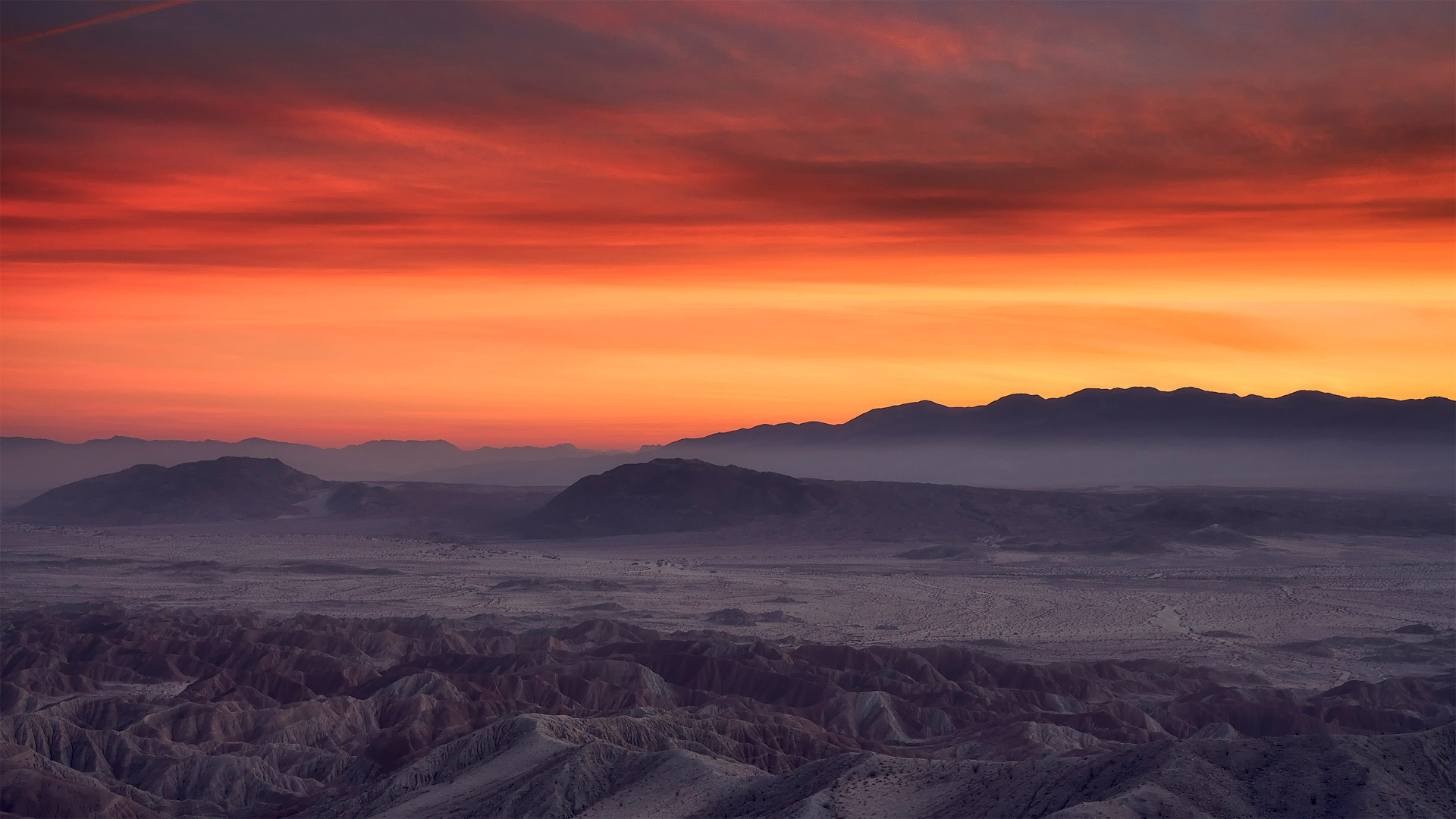
安沙波利哥沙漠州立公园,美国加利福尼亚州 Borrego Badlands in Anza-Borrego Desert State Park, California (© Tom Hogan/plainpicture)
Borrego Badlands
If you're looking to take in a beautiful sunset over some exotic terrain, you could do worse than the Borrego Badlands, a 20-mile stretch of desert in southeastern California's Anza-Borrego Desert State Park. This arid landscape is not the kind of dune-filled terrain t you might visualize when you think of a desert, but a series of rolling hills, canyons, gullies, and arroyos, speckled with sparse but hardy vegetation. It makes for a surreal and beautiful view.
Fossilized seashells found in the area reveal that this arid landscape was once submerged under the waters of the Gulf of California and the Colorado River. The terrain was shaped over time by water and wind erosion into its current form. Today, the Borrego Badlands is a favorite spot for campers, while photographers are drawn by the picture-perfect sunsets.
博雷戈荒地
如果你想在异国情调的地形上欣赏美丽的日落,你可能会比博雷戈荒地(Borrego Badlands)更糟糕。博雷戈荒地位于加利福尼亚州东南部的安扎博雷戈沙漠州立公园(Anza Borrego desert State Park),是一片20英里长的沙漠。这片干旱的土地并不是你想象中的那种布满沙丘的土地,而是一系列起伏的丘陵、峡谷、沟壑和荒野,点缀着稀疏但耐寒的植被。这是一个超现实主义和美丽的景色。
在该地区发现的贝壳化石表明,这片干旱的土地曾被淹没在加利福尼亚湾和科罗拉多河的水域之下。随着时间的推移,地形被水和风侵蚀成现在的形状。今天,博雷戈荒地是露营者最喜欢的地方,而摄影师则被完美的日落所吸引。
位于阿曼和迪拜酋长国边界的鲁卜哈利沙漠 Rub' al Khali desert on the border of Oman and the Emirate of Dubai (© Daniel Schoenen/Offset by Shutterstock)
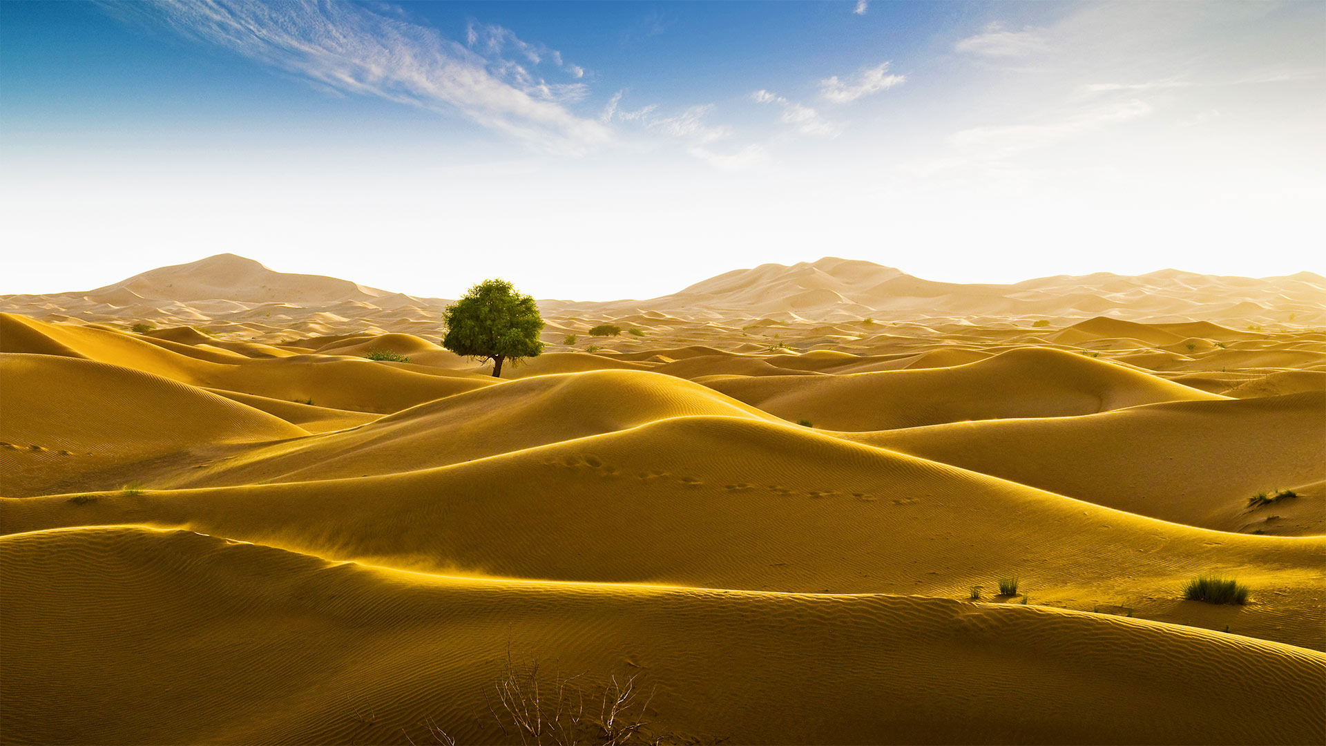
位于阿曼和迪拜酋长国边界的鲁卜哈利沙漠 Rub' al Khali desert on the border of Oman and the Emirate of Dubai (© Daniel Schoenen/Offset by Shutterstock)
Signs of life in the 'Empty Quarter'
An unlikely tree stands amid the seemingly endless dunes of the Rub' al Khali desert in the Arabian Peninsula. The Rub' al Khali, meaning the 'Empty Quarter,' is a vast sea of sand. Spreading across 250,000 square miles, it's the largest contiguous sand desert in the world, covering most of southeastern Saudi Arabia, with smaller portions in Yemen, Oman, and the United Arab Emirates. One of the driest places on Earth, almost no one lives in Rub' al Khali, and much of the desert remains unexplored. Some of the dunes tower more than 800 feet, and the depressions in between—called sabkhas—can be so soft that vehicles, camels, and people can easily become stuck.
The Rub' al Khali wasn't always so forbiddingly dry. At various times between 2,000 and 6,000 years ago, 'cataclysmic rainfall,' like modern-day monsoons, formed shallow lakes in the spaces between the dunes. Most of these lakes were temporary, but some lasted hundreds of years and supported a variety of plants and animals, even large creatures like hippopotamuses, water buffalo, and long-horned cattle. Rain isn't unheard of today, either. In May 2018, Cyclone Mekunu brought enough rain to once again form lakes in the Rub' al Khali, reportedly the first time that had happened in about 20 years—it was the rare occasion when the 'Empty Quarter' wasn't looking so empty after all.
“空旷地区”的生命迹象
阿拉伯半岛的鲁布阿勒哈利沙漠看似无边无际的沙丘中矗立着一棵不太可能的树。“鲁布”阿勒哈利,意思是“空区”,是一片广阔的沙海。它横跨250000平方英里,是世界上最大的连片沙漠,覆盖沙特阿拉伯东南部大部分地区,也门、阿曼和阿拉伯联合酋长国的面积较小。作为地球上最干燥的地方之一,鲁巴勒哈利几乎无人居住,而大部分沙漠仍未被勘探。有些沙丘高达800英尺以上,中间的洼地称为沙布喀,非常柔软,车辆、骆驼和人很容易被卡住。
阿勒哈利河并不总是那么干燥。在2000年至6000年前的不同时期,“灾难性降雨”就像现代季风一样,在沙丘之间形成了浅湖。这些湖泊大多是临时性的,但也有一些持续了数百年,供养着各种动植物,甚至还有河马、水牛和长角牛等大型动物。今天下雨也并非闻所未闻。2018年5月,梅库努气旋带来了足够的雨水,再次在鲁布阿勒哈利形成湖泊,据报道这是大约20年来首次发生,这是罕见的“空旷区”看起来不再那么空旷的情况。
帕瑞纳天文台的望远镜和星迹,智利阿塔卡马沙漠 Telescopes and star trails at Paranal Observatory, Atacama Desert, Chile (© Matteo Omied/Alamy)
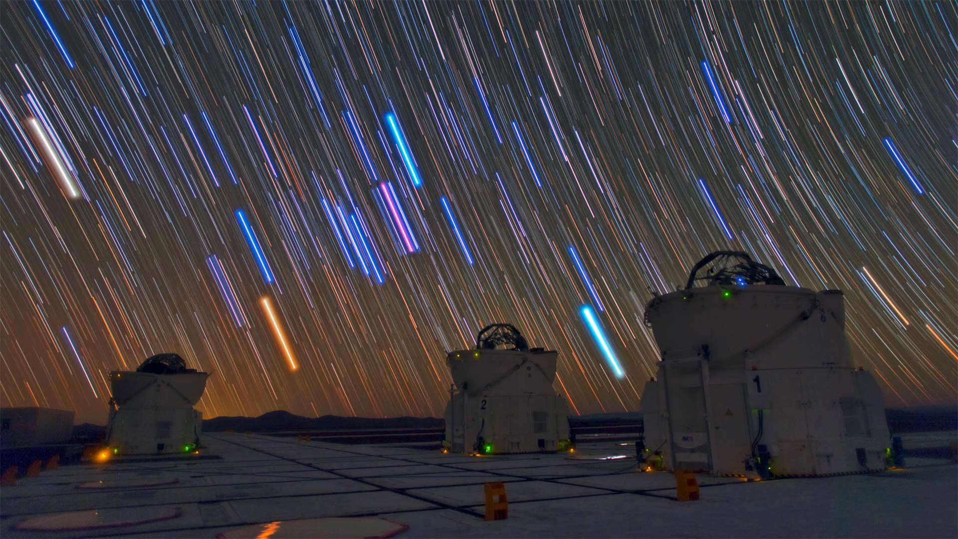
帕瑞纳天文台的望远镜和星迹,智利阿塔卡马沙漠 Telescopes and star trails at Paranal Observatory, Atacama Desert, Chile (© Matteo Omied/Alamy)
Happy Astronomy Day!
No, that's not a downpour of lightsabers—but it's no typical night sky either. Stargazing here at Paranal Observatory, on a mountaintop in Chile's desolate Atacama Desert, you'll get one of the clearest possible naked-eye views of the southern skies. This 'lightsaber' effect comes from the photo's long exposure: What we're seeing is these stars' paths as they track across the night sky due to our planet's rotation. The dazzling colors indicate temperature, from chilly red (5,000-ish degrees Fahrenheit) to balmy blue (temps in the tens of thousands).
What about those structures beneath the starry sky? They're three of the eight telescopes making up the Very Large Telescope, an aptly named project of the European Southern Observatory. Together the telescopes compose photographs of astronomically fine focus: If you were to drive a car on the surface of the moon (which we don't advise trying), the VLT could snap a crystal-clear shot of your headlights.
天文学节快乐!
不,那不是一场光剑雨,但也不是典型的夜空。在智利荒凉的阿塔卡马沙漠的山顶上,你可以用肉眼看到最清晰的南方天空。这种“光剑”效应来自于照片的长时间曝光:我们看到的是由于我们星球的自转,这些恒星在夜空中的轨迹。耀眼的颜色表示温度,从冷红色(5000华氏度)到温和的蓝色(数万华氏度)。
星空下的那些建筑呢?它们是组成超大型望远镜的八个望远镜中的三个,这是欧洲南方天文台的一个恰当命名的项目。这些望远镜一起组成了天文上精细聚焦的照片:如果你在月球表面驾驶一辆汽车(我们不建议你尝试),VLT可以拍下你的头灯的清晰照片。
图森北部托托利塔山麓上空的雷暴,亚利桑那州索诺拉沙漠 Lightning storm in the Tortolita Mountain foothills, north of Tucson, Arizona, in the Sonoran Desert (© Jack Dykinga/Minden Pictures)
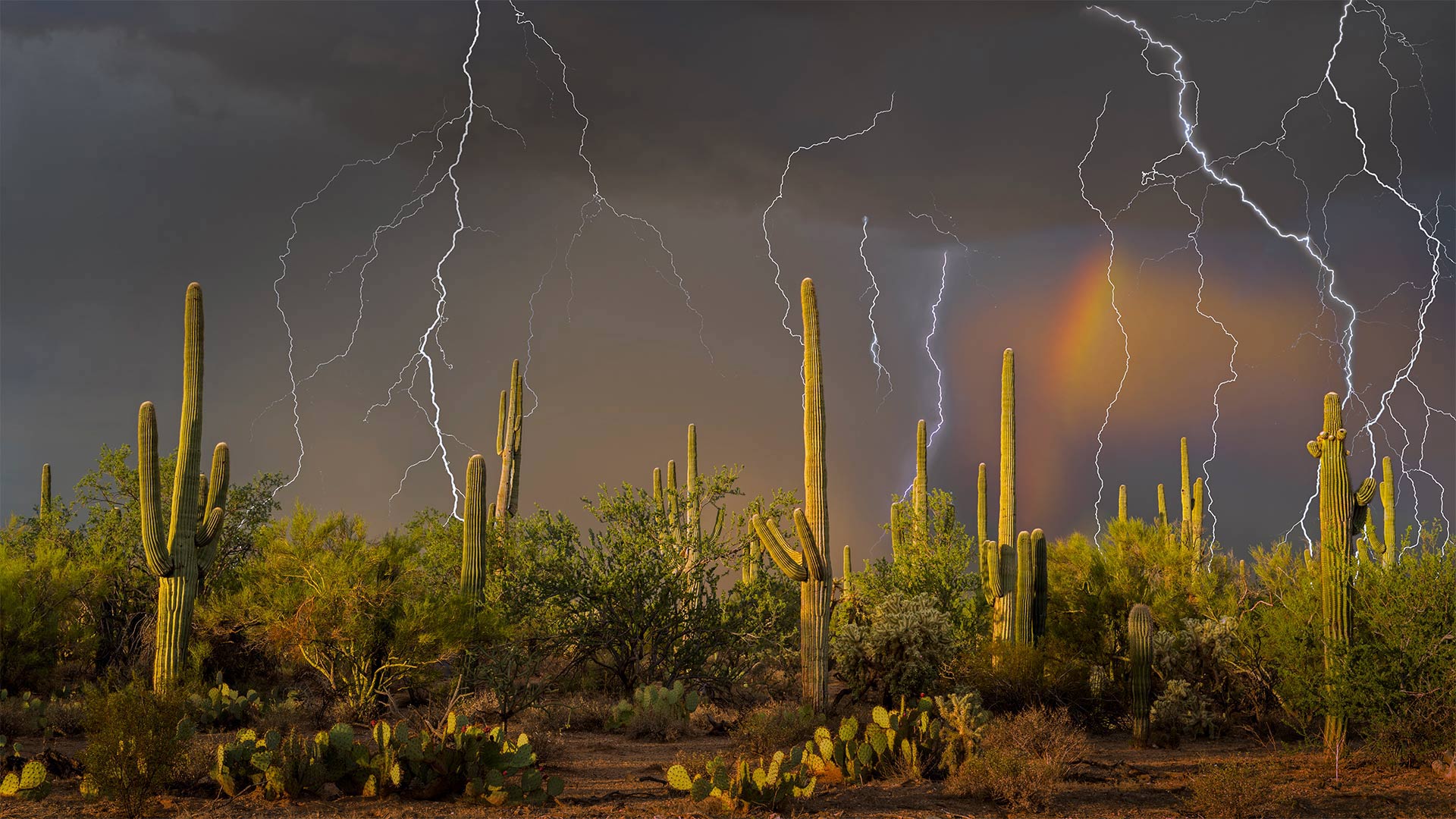
图森北部托托利塔山麓上空的雷暴,亚利桑那州索诺拉沙漠 Lightning storm in the Tortolita Mountain foothills, north of Tucson, Arizona, in the Sonoran Desert (© Jack Dykinga/Minden Pictures)
The monsoon arrives in the desert
Lightning strikes are common during the summer monsoon of the American Southwest. In Arizona and New Mexico, powerful thunderstorms roll in most every afternoon from early July until mid-September. Here, in the Sonoran Desert north of Tucson, Arizona, the severe weather over the saguaro cactus makes for a dramatic scene.
The monsoon–which refers to the entire season and not just a single storm—is caused by intense daytime heat, which drives shifts in wind patterns that bring moist air to the generally arid Southwest. Mornings typically begin fair, but as temperatures rise throughout the day, precipitation gathers into clouds that finally burst in periods of heavy rain during the late afternoon and evening. The monsoon storms also bring huge dust storms called 'haboobs,' borrowing the name from similar storms in Sudan.
In Arizona, the monsoon can account for nearly half the state's annual rainfall, which averages little more than 7 inches. Water is precious in the desert, and the region relies on this weather pattern to fill reservoirs and maintain the fragile ecosystem. While dry lightning early in the season can spark wildfires, as the monsoon rain starts to fall, it helps reduce local fire danger.
Sheep flock in the Gobi Desert © Patrick Baz/Getty Images
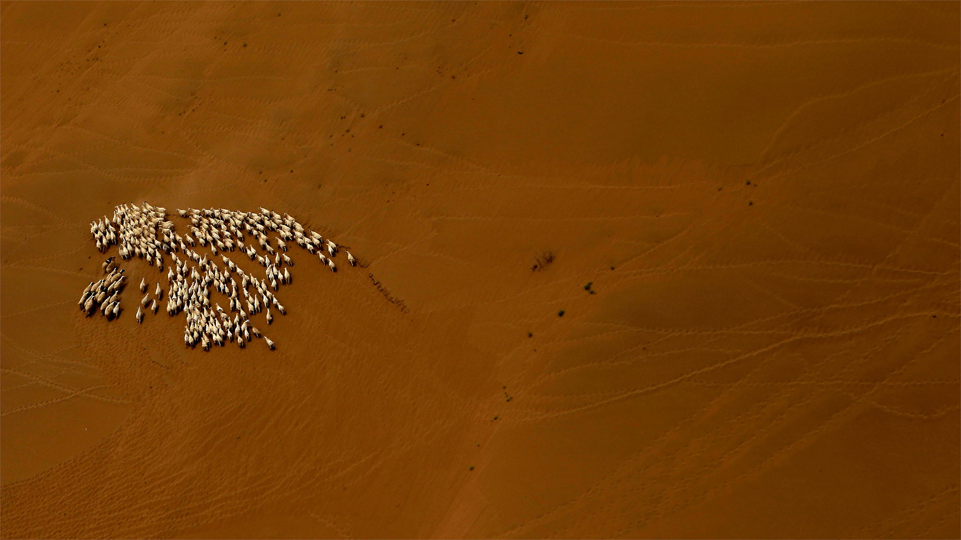
Sheep flock in the Gobi Desert © Patrick Baz/Getty Images
Nomads of the Gobi
The Gobi Desert stretches across 500,000 square miles, covering parts of northern China and Mongolia. Due to the Gobi's high elevation and high latitude, it's a cold desert. And while we tend to think of deserts as endless sand dunes, most of the Gobi's topography is exposed rock.
Despite these harsh conditions, the Gobi is teeming with life—some of it human. Nearly one third of the population in the Gobi Desert leads a pastoral nomadic life. Small communities of people drive their livestock herds—like the sheep seen in our photo today—across the landscape in search of fresh grazing territory. Both herd and herders rarely settle anywhere for long.