奇索斯山脉,大弯国家公园,德克萨斯州,美国 Chisos Mountains, Big Bend National Park, Texas (© Dean Fikar/Getty Images)
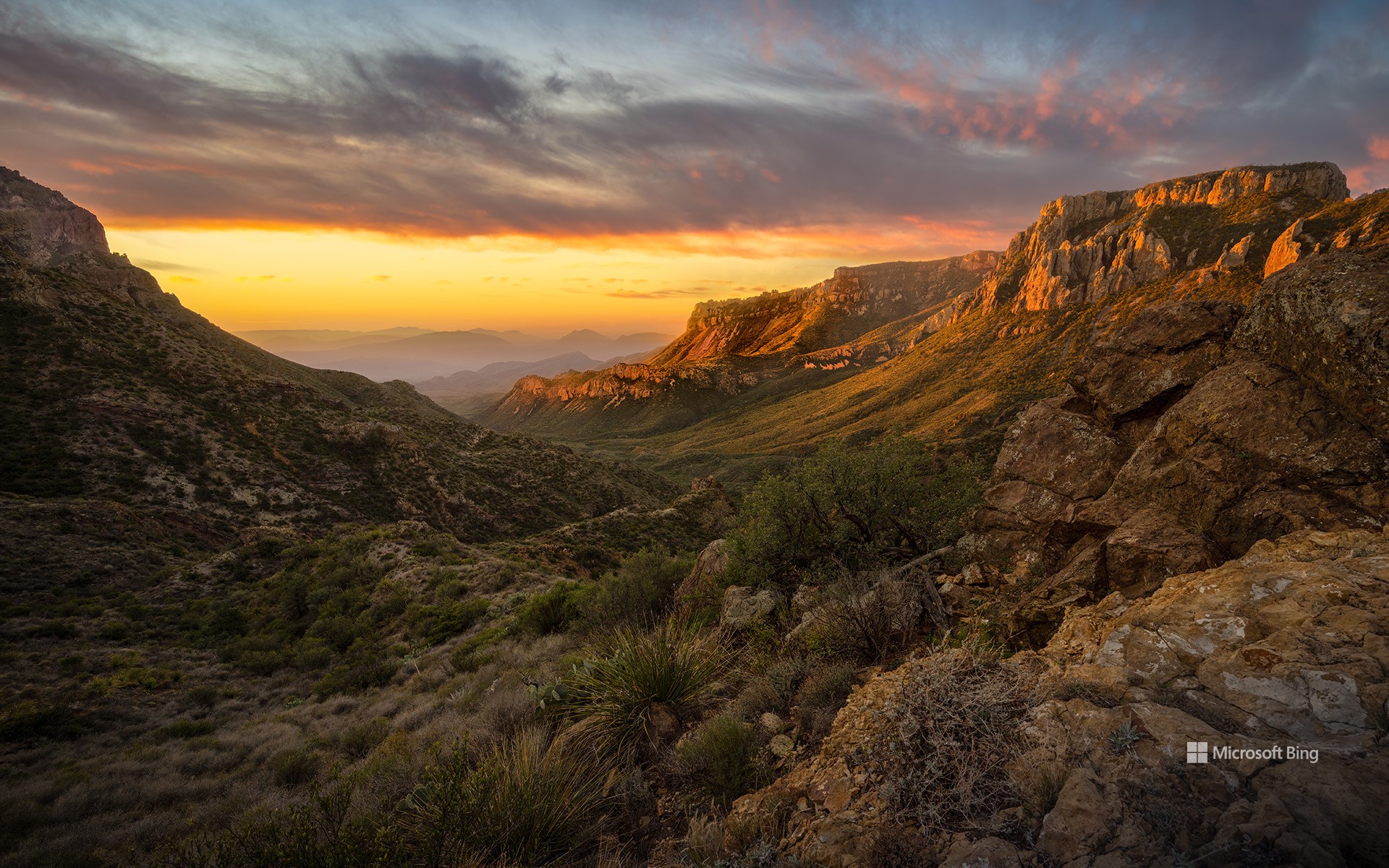
奇索斯山脉,大弯国家公园,德克萨斯州,美国 Chisos Mountains, Big Bend National Park, Texas (© Dean Fikar/Getty Images)
星空、岩石与孤寂 Stars, stone, and solitude
大弯国家公园迎来81周年
人们常说:“德州的一切都更大。”而大弯国家公园正是对这句话的最佳注解。这片占地801,163英亩的广袤区域,最初属于墨西哥领土,1848年并入美国。自20世纪30年代起,该地区的自然景观便受到保护,并于1944年6月12日正式被指定为国家公园。大弯国家公园是美国最偏远、游客最少的国家公园之一。它并非由单一地貌构成,而是三种景观的综合体:奇瓦瓦沙漠、奇索斯山脉和格兰德河。公园地处美墨边境,其历史也体现出文化交融的特征:原住民、西班牙探险者、牧场主、矿工和游客皆曾在此留下足迹。岩画、历史遗迹和古道见证了这片土地在成为国家公园之前就已拥有深厚历史。
公园内生物多样性极为丰富,记录有超过1,200种植物、超过450种鸟类,以及多种哺乳动物、爬行动物和两栖动物。你可能会看到一只走鹃迅速穿越沙尘,或是一只山猫悄然穿行于灌木之间。此外,大弯国家公园也被评为美国最佳暗夜公园之一。游客在此可观赏到银河、行星和满天繁星构成的璀璨星空。
Big Bend National Park in Texas turns 81
They say everything's bigger in Texas—and Big Bend National Park has been living up to the slogan since forever. Efforts to preserve this 801,163-acre area of West Texas began in the 1930s and culminated in its official designation as a park on June 12, 1944. Big Bend remains one of the most remote and least-visited national parks in the country. It's not just one landscape, it's three: the Chihuahuan Desert, the Chisos Mountains (pictured here), and the Rio Grande. Big Bend sits on the US–Mexico border, and its history reflects that blend. Indigenous peoples, Spanish explorers, ranchers, miners, and modern travelers have all left their footprints. Petroglyphs, ruins, and old trails show the land's story began long before it became a park.
The park is home to over 1,200 species of plants, more than 450 species of birds, and a wide variety of mammals, reptiles, and amphibians. You might spot a roadrunner zipping across the dirt, or a bobcat silently slipping through the underbrush. Additionally, it has been designated as one of the best dark-sky parks in America, offering views of the Milky Way, planets, and constellations.
大弯国家公园上空的银河,得克萨斯州,美国 Milky Way over Big Bend National Park, Texas (© wisanuboonrawd/Adobe Stock)
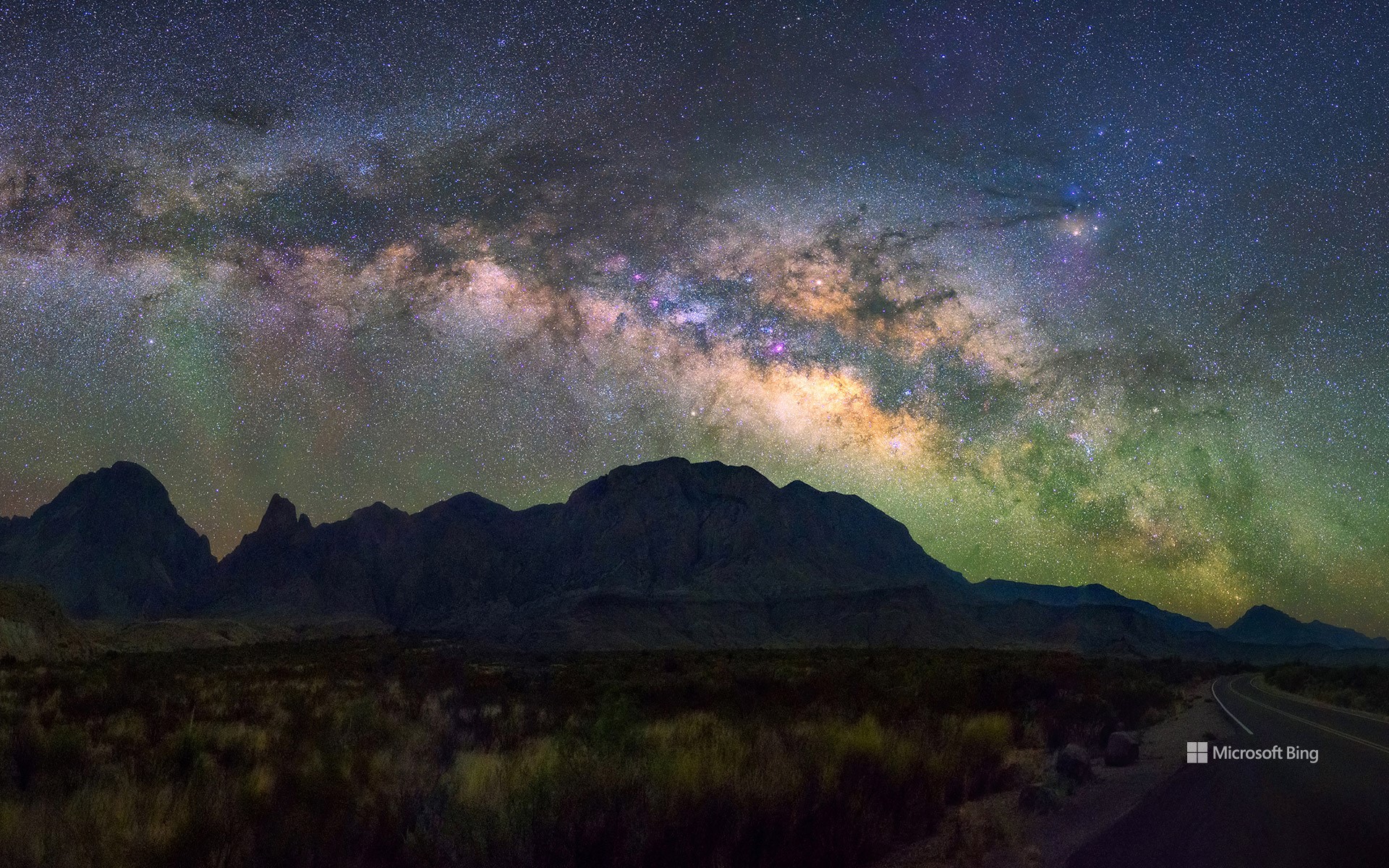
大弯国家公园上空的银河,得克萨斯州,美国 Milky Way over Big Bend National Park, Texas (© wisanuboonrawd/Adobe Stock)
星光盛宴 A galactic gig
大弯国家公园周年纪念日
准备好探索大自然了吗?让我们走进西得克萨斯的大弯国家公园,今天正好是它的80周年纪念日。它于1944年6月12日成立,当时德克萨斯州将这片土地转让给了联邦政府。该公园占地超过1,250平方英里,是奇瓦瓦沙漠最大的保护区。
大弯国家公园是“发现”历史的好去处,里面不仅有古老的历史性地标,如卡斯托隆历史街区、温泉城历史街区,还有近代拓荒者、牧场主以及矿工的活动印记。除此之外,这片土地还是北美首屈一指的观星胜地。由于周边地区没有人类活动,因此大弯国家公园光污染较少,拥有最黑暗的夜空。如果您是观星爱好者,不妨带上您的双筒望远镜,去享受一个充满银河美景、流星雨、星空奇观的夜晚,不要忘记为迷人的夜空拍照留念哦。
Big Bend National Park turns 80
Ready to channel your inner nature enthusiast? Let's explore Big Bend National Park in West Texas, which is celebrating its 80th birthday today. The park is the largest protected area in the Chihuahuan Desert, covering over 1,250 square miles. It was established on June 12, 1944, when the state of Texas transferred this land to the federal government.
Within the park lie landmarks like the Castolon Historic District, where US and Mexican cultures met in one rural border community, and the Hot Springs Historic District, developed in the early 1900s, but with evidence of human occupation dating back thousands of years. Here you can walk in the footprints of modern pioneers, ranchers, and miners. This land is also one of North America's premier destinations for stargazing. With little light pollution from the surrounding areas, it has some of the darkest night skies in the area. Bring your binoculars and enjoy an evening full of Milky Way vistas, meteor showers, and taking pictures of the stunning night sky.
瓜达卢佩山脉国家公园日出时的埃尔卡皮坦山,德克萨斯州,美国 El Capitan at sunrise in Guadalupe Mountains National Park, Texas (© Adam Mowery/Tandem Stills + Motion)
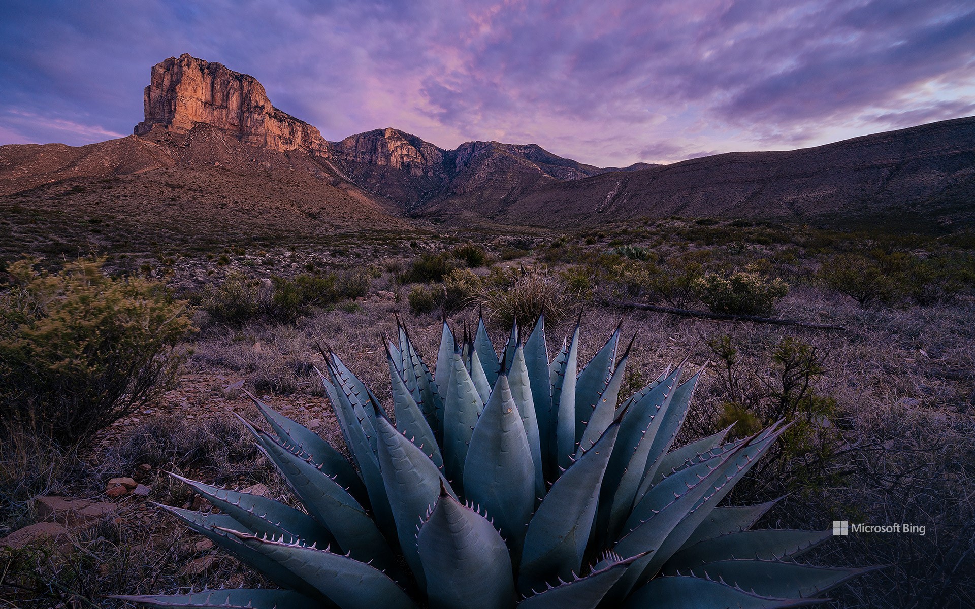
瓜达卢佩山脉国家公园日出时的埃尔卡皮坦山,德克萨斯州,美国 El Capitan at sunrise in Guadalupe Mountains National Park, Texas (© Adam Mowery/Tandem Stills + Motion)
去公园走走吧! Let's park here
国家公园周最后一天
好好利用国家公园周的最后一天吧!如果你还没有时间参加为期九天的庆祝活动,请看过来!让我们带你去德克萨斯州西部的瓜达卢佩山脉国家公园看看。该公园于1972年正式成立,占地86,416英亩。在这里,瓜达卢佩山脉耸立在奇瓦瓦沙漠的盐丘之上。海拔8751英尺的瓜达卢佩峰是该山脉的最高点,也是德克萨斯州的最高点。当地另一个突出的地标是8085英尺高的酋长岩,经常被旅行者当作路标。而加利福尼亚州也有一个约3000英尺高的同名“酋长岩”,可别将二者混淆了。即使国家公园周结束了,一年中仍有很多日子可以参观这个国家丰富的自然风光。
Last day of National Park Week
Take advantage of the last day of National Park Week! If you haven't had time to take part, we've got your back. Let us take you to Guadalupe Mountains National Park in West Texas. The park, officially established in 1972, covers 86,416 acres. Here, the Guadalupe Mountains rise over the salt dunes of the Chihuahuan Desert and include the highest point in Texas, the 8,751-foot Guadalupe Peak. Pictured on today's homepage is another iconic landmark, El Capitan. Not to be confused with its famous namesake in California, this limestone cliff towers 8,085 feet high and is often used as a waymark for travelers. Even if National Park Week is over, there are plenty of days in the year to visit the country's abundant natural splendor.
南帕德里岛,美国得克萨斯州 South Padre Island, Texas (© Jeff R Clow/Getty Images)
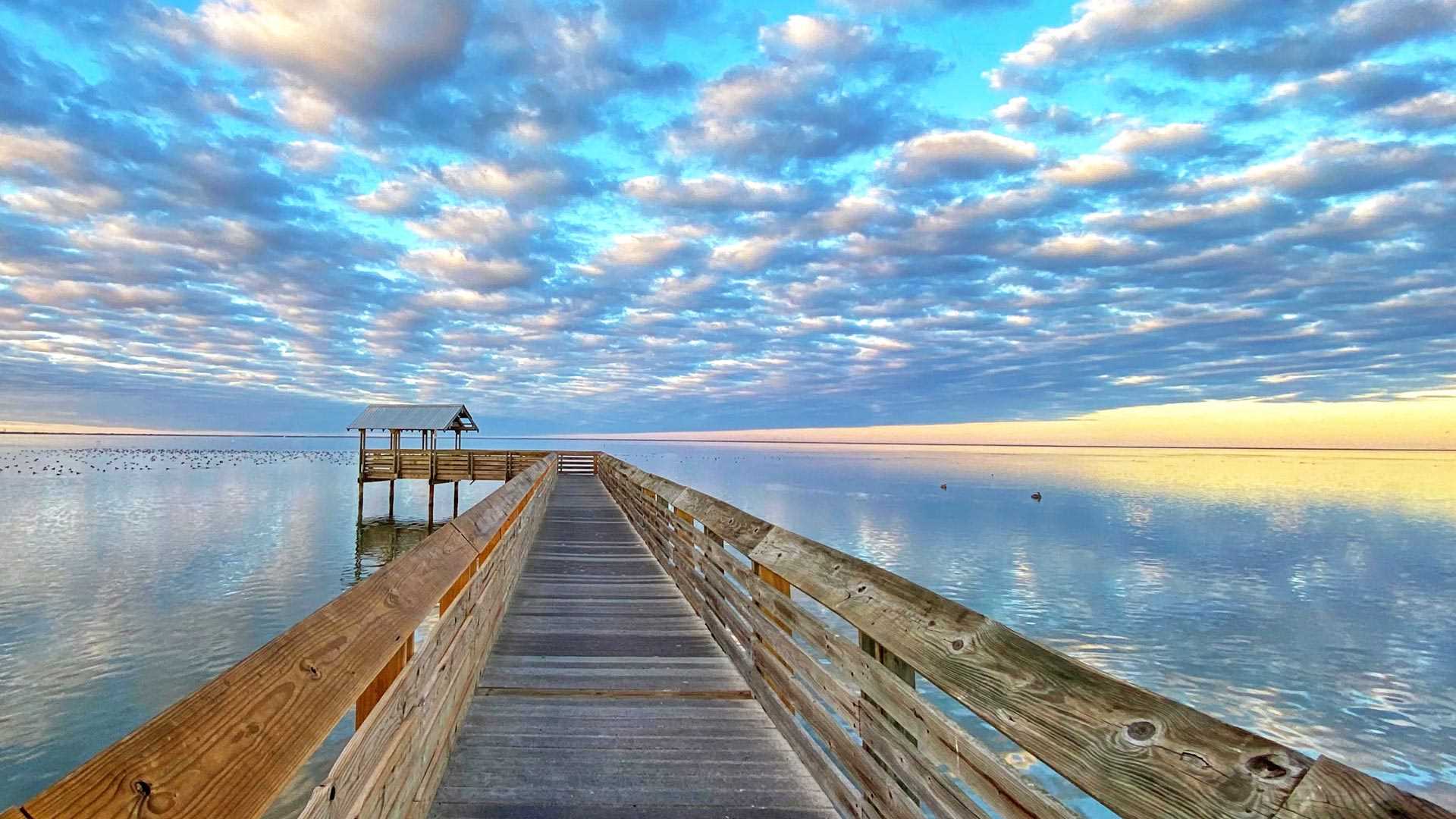
南帕德里岛,美国得克萨斯州 South Padre Island, Texas (© Jeff R Clow/Getty Images)
一望无际的天空 An endless stretch of sky
南帕德里岛,美国得克萨斯州
南帕德里岛位于得克萨斯州墨西哥湾海岸的近海几英里处,是该州最大、最长的堰洲岛。像南帕德里岛这样的堰洲岛通常与海岸平行,是大陆抵御风暴的第一道防线。南帕德里岛通过一座大桥和大陆相连,每年都有成千上万的游客来岛上游泳、划船、钓鱼、放风筝,或者惬意地躺在沙滩上晒太阳。另外,岛上还分布着各式各样的精致沙堡,这些引人注目的沙堡由世界各地的艺术家创作而成。
South Padre Island, Texas
Located a few miles offshore on the Texas Gulf Coast, Padre Island is the largest of the state's string of barrier islands. At 113 miles in length, it is also the longest barrier island in the world. Barrier islands usually run parallel to the coast and, as the name suggests, serve as the mainland's first line of defense against storms.
Since the Port Mansfield Channel was built in the early 1960s, Padre Island has been split into two parts, South Padre Island, pictured here, and North Padre Island. Connected by a bridge to the shore, the resort town of South Padre Island draws in thousands of visitors every year for swimming, boating, fishing, or simply lounging on the beach. Others come for the trail of elaborate sandcastles scattered across the island, created by professional artists.
大弯国家公园中里奥格兰德河的景色,德克萨斯州 View of the Rio Grande River in Big Bend National Park, Texas (© Ian Shive/Tandem Stills + Motion)
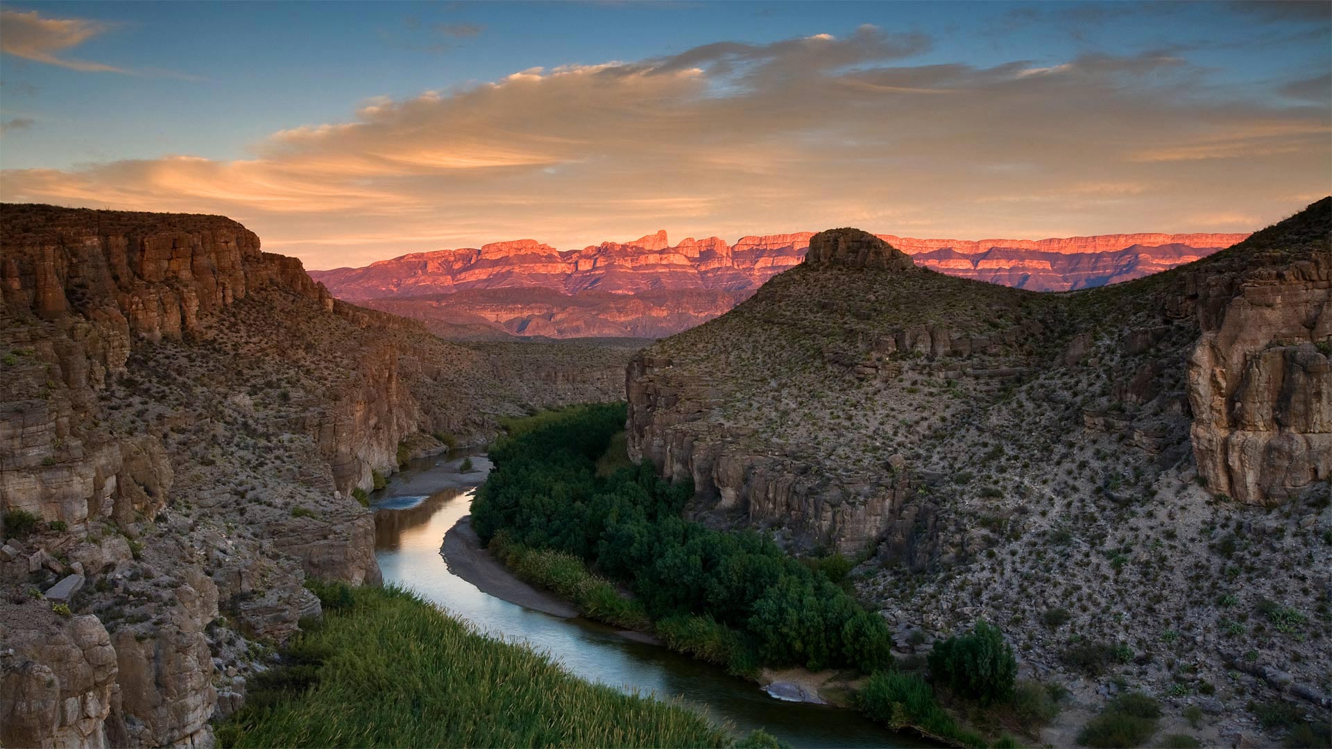
大弯国家公园中里奥格兰德河的景色,德克萨斯州 View of the Rio Grande River in Big Bend National Park, Texas (© Ian Shive/Tandem Stills + Motion)
In Texas, even the riverbend is big
We're celebrating the 77th birthday of Big Bend National Park, the place the National Park Service calls 'one of the last remaining wild corners of the United States.' To get here, you have to be committed. This rugged terrain, which covers almost a million acres, is one of the most remote spots in the country—it's hours from the nearest towns or the closest airport, making it one of the least-visited national parks in the country. Those who do make the effort to get to Big Bend are rewarded with an undeveloped natural beauty, and silence, two things that seem to be in short supply these days.
At Big Bend you'll find craggy hiking trails, red mountain vistas, limestone canyons, and hot springs alongside the famous Rio Grande. There's also the wildlife you'd expect to find in the Wild, Wild West, including rattlesnakes, packs of javelinas, and 20 species of bats. But it's the huge night sky unencumbered by light pollution that draws stargazers to Big Bend from all over the world. After all, everything, as they say, is bigger in Texas.
在德克萨斯州,连河湾都很大
我们正在庆祝大弯国家公园77岁生日,国家公园管理局称之为“美国仅存的野生角落之一”。要到这里,你必须全力以赴。这片崎岖不平的土地占地近百万英亩,是美国最偏远的地区之一,距离最近的城镇或最近的机场只有几个小时的路程,使它成为美国游客最少的国家公园之一。那些努力到达大弯的人得到的回报是未开发的自然美景和沉默,这两样东西现在似乎供不应求。
在大弯,你会发现崎岖的徒步小径、红色的山景、石灰岩峡谷和著名的格兰德河旁的温泉。在野生的西部,你也会发现野生动物,包括响尾蛇,标枪和20种蝙蝠。但正是没有光污染的巨大夜空吸引着来自世界各地的天文爱好者来到大弯。毕竟,正如他们所说,德克萨斯的一切都更大。
银河下的圣埃伦娜峡谷,德克萨斯州大弯国家公园 Santa Elena Canyon under the Milky Way in Big Bend National Park, Texas (© Stanley Ford/Shutterstock)
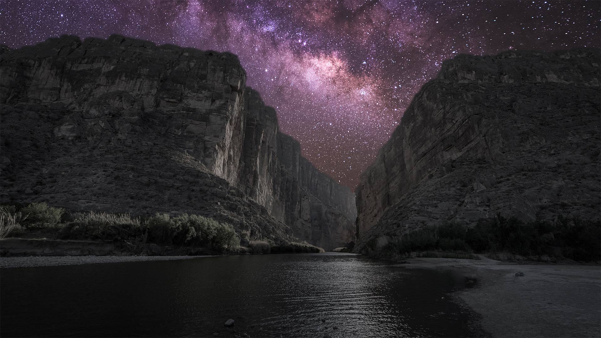
银河下的圣埃伦娜峡谷,德克萨斯州大弯国家公园 Santa Elena Canyon under the Milky Way in Big Bend National Park, Texas (© Stanley Ford/Shutterstock)
Big sky at Big Bend
Seventy-six years ago today, on June 12, 1944, Big Bend officially became a US national park. The park covers more than 800,000 acres in West Texas along the Mexico border. This vast area—big enough to swallow Rhode Island—contains mountain, river, and desert ecosystems, including the largest protected area of the Chihuahuan Desert in the United States. Far removed from any urban centers and the light pollution that comes with them, Big Bend boasts some of the darkest skies you'll find in the lower 48, earning it a designation as an International Dark Sky Park. Even after 76 years, Big Bend still glows.
印克斯湖国家公园中的德克萨斯矢车菊,德克萨斯州 Bluebonnets growing alongside an old road in the Texas Hill Country (© Inge Johnsson/Alamy)
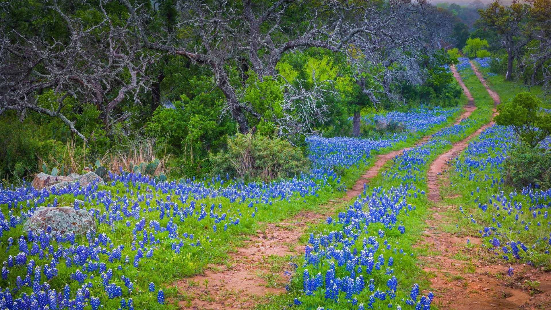
印克斯湖国家公园中的德克萨斯矢车菊,德克萨斯州 Bluebonnets growing alongside an old road in the Texas Hill Country (© Inge Johnsson/Alamy)
Where the wildflowers grow
In honor of National Wildflower Week, we're looking at a field of blooming bluebonnets, the state flower of Texas. If you notice bluebonnets and other blooms while traveling down Texas highways, thank the state's Department of Transportation, which sows tens of thousands of pounds of wildflower seeds along roadways each year.
But wildflowers aren't just pretty to look at. Most of these native plants grow on their own—without the need for cultivation—helping preserve water, protect against erosion, and provide habitat for birds, butterflies, and other critters. Plus, they have a restorative quality for the mind, just as wildflower-lover Lady Bird Johnson once said: 'Where flowers bloom, so does hope.'