黄石国家公园的大棱镜泉鸟瞰图,美国怀俄明州 Aerial view of Grand Prismatic Spring, Yellowstone National Park, Wyoming (© AirPano LLC/Amazing Aerial Agency)
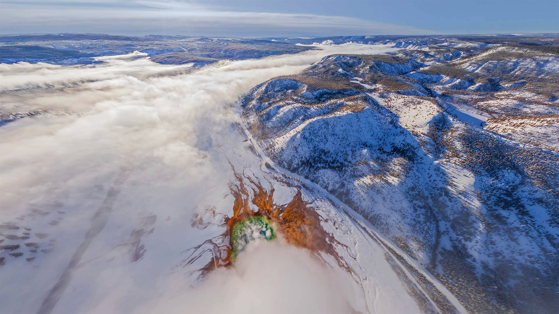
黄石国家公园的大棱镜泉鸟瞰图,美国怀俄明州 Aerial view of Grand Prismatic Spring, Yellowstone National Park, Wyoming (© AirPano LLC/Amazing Aerial Agency)
“美国最好的想法”起源于此 'America's best idea' began here
National Park Week begins
Only a very small percentage of Yellowstone's total visitors see the park when it looks like this. In winter, when the park grows quiet, its hydrothermal features really stand out, like the rainbow-hued Grand Prismatic Spring near the center of this image, the most photographed feature in Yellowstone.
Just the inspiration we need as we start National Park Week, an occasion to celebrate the splendor of our park system and turn to thoughts of hiking, paddling, and camping. The 'Week' is actually a bit longer, starting today and running through Sunday, April 24. Yellowstone was established by congress 150 years ago as the nation's first national park. Today, there are 63, and they include the volcanoes of Hawaii, the giant sequoias of California, the Grand Canyon, and the desolate moonscape of the Badlands.
Perhaps no national park better captures the American landscape than Yellowstone, 3,500 square miles of lakes, canyons, rivers, mountains, waterfalls, hot springs, and its charismatic megafauna—bison, wolves, elk, and grizzly bears. But it's Yellowstone's hydrothermal sites that really set it apart. Old Faithful might be the most famous, but it's only one of 10,000 around here. Although the park is still chilly in April, you'll have the place mostly to yourselves. Only about 44,000 visit Yellowstone in April, compared to the nearly 1 million who gather each July. If you need more incentive, entrance fees today, in honor of National Park Week, are on the house.
国家公园周开始
当黄石公园看起来像这样时,只有很小比例的游客参观了它。在冬天,当公园变得安静时,它的热液特征真的很突出,比如这张图片中心附近彩虹色的大棱柱形泉水,这是黄石公园拍摄最多的特征。
这正是我们开始国家公园周时所需要的灵感。国家公园周是一个庆祝我们公园系统辉煌的时刻,我们可以考虑徒步旅行、划船和露营。“一周”实际上要长一点,从今天开始,一直持续到4月24日周日。黄石公园是美国国会在150年前建立的第一个国家公园。如今,这里有63座火山,其中包括夏威夷的火山、加利福尼亚州的巨大红杉、大峡谷和荒地荒凉的月球景观。
也许没有哪个国家公园能比黄石公园更好地捕捉到美国的风景。黄石公园有3500平方英里的湖泊、峡谷、河流、山脉、瀑布、温泉,以及迷人的大型动物群——野牛、狼、麋鹿和灰熊。但真正让它与众不同的是黄石公园的热液遗址。老忠实可能是最有名的,但它只是这里一万个中的一个。虽然四月份公园里仍然很冷,但你可以独处。4月份只有大约4.4万人参观黄石公园,而每年7月有近100万人聚集在这里。如果你需要更多的奖励,为了纪念国家公园周,今天的入场费是免费的。
科罗拉多河上的马蹄湾,美国亚利桑那州 Horseshoe Bend, Arizona (© Michael Dunn/Getty Images)
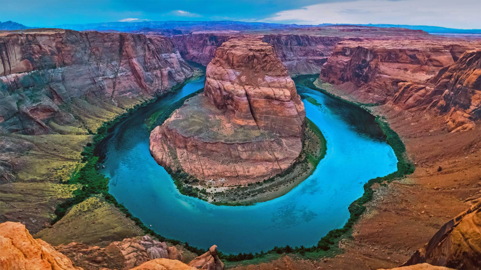
科罗拉多河上的马蹄湾,美国亚利桑那州 Horseshoe Bend, Arizona (© Michael Dunn/Getty Images)
打卡马蹄湾会带来好运吗? Does this horseshoe bring good luck?
Horseshoe Bend, Arizona
Grab your boots and gear, today we're heading to Arizona to hike out to Horseshoe Bend. Known as the 'east rim of the Grand Canyon,' it's actually about 140 miles from the other rims and is really more a part of nearby Glen Canyon. Scientifically, the beautiful view exists thanks to something called an 'entrenched meander.' Around six million years ago, the area was closer to sea level. The Colorado River, following the path of least resistance, meandered and became trapped when the Colorado Plateau uplifted around five million years ago. Over time, the river water cut through exposed sandstone, forming the thousand-foot-deep, 270-degree horseshoe-shaped bend.
Horseshoe Bend used to be a locally loved gem until social media came around to spread photos like this one. Now, nearly two million tourists a year hike to this national splendor. It's believed that, eventually, the Colorado River will cut through the neck of the bend. So, if you want your selfie with the horseshoe, you only have another million years, give or take.
亚利桑那州马蹄湾
带上你们的靴子和装备,今天我们要去亚利桑那州徒步去马蹄弯。它被称为“大峡谷的东边缘”,实际上距离其他边缘约140英里,实际上更像是附近格伦峡谷的一部分。从科学角度讲,这美丽的景色之所以存在,是因为有一种叫做“根深蒂固的曲流”的东西大约600万年前,该地区接近海平面。科罗拉多河沿着阻力最小的路径蜿蜒而行,在大约500万年前科罗拉多高原抬升时陷入困境。随着时间的推移,河水穿过裸露的砂岩,形成了千英尺深、270度马蹄形的弯曲。
马蹄弯曾经是当地人喜爱的珍宝,直到社交媒体开始传播像这样的照片。现在,每年有近200万游客徒步前往这个国家的辉煌。据信,科罗拉多河最终将穿过弯道的颈部。所以,如果你想在马蹄铁上自拍,你只能再活一百万年,不管付出与否。
光绘摄影下的滑板公园,美国阿瓦达市 Arvada Skatepark, Arvada, Colorado (© Jon Paciaroni/Getty Images)
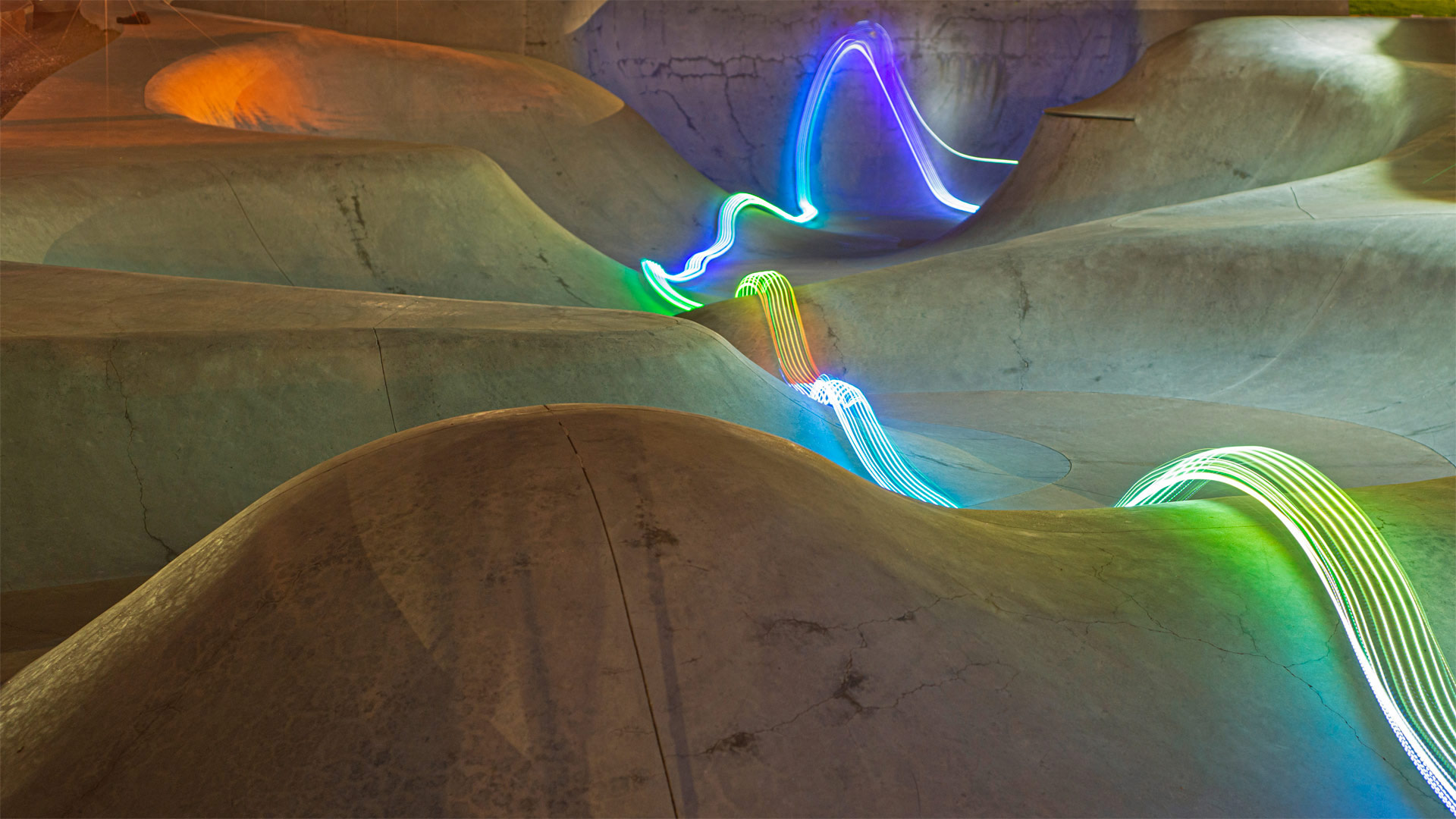
光绘摄影下的滑板公园,美国阿瓦达市 Arvada Skatepark, Arvada, Colorado (© Jon Paciaroni/Getty Images)
与光同行 Go with the glow
Light show at the skatepark
The art of light painting combines with the artistry of skateboarding to bring you this provocative image from Arvada Skatepark in Colorado. At 40,000 square feet, the park, which opened in 2012, is the third-largest in the country. The massive park includes a snake run, large bowl, medium bowl, street plaza with manual pads, banks, granite pieces, ledges, rails, step ups, stair set, benches, Jersey barrier, brick stamped china bank, and a pyramid. And if you know what all those things are, you're probably a steezy sk8r.
This image was created using a technique called 'light painting,' a photographic technique that involves moving a light source while taking a long-exposure photograph. In this way, the artist can 'draw' with light on the photo. How would you imagine the artist created this image?
滑板公园灯光秀
光绘艺术与滑板艺术相结合,为您带来这张来自科罗拉多州阿瓦达滑板公园的挑衅性图片。该公园占地40000平方英尺,于2012年开放,是美国第三大公园。这座大型公园包括一条蛇径、大碗、中碗、带手动垫的街道广场、银行、花岗岩块、壁架、栏杆、台阶、楼梯组、长凳、球衣护栏、砖印中国银行和金字塔。如果你知道这些都是什么,你很可能就是steezy sk8r。
这张照片是用一种叫做“光绘”的技术拍摄的,这是一种摄影技术,在拍摄长曝光照片时移动光源。这样,艺术家就可以在照片上用光线“画画”。你认为艺术家是如何创造这幅图像的?
千泉州立公园的瀑布,美国爱达荷州 Waterfall in Thousand Springs State Park, Hagerman Valley, Idaho (© knowlesgallery/Getty Images)
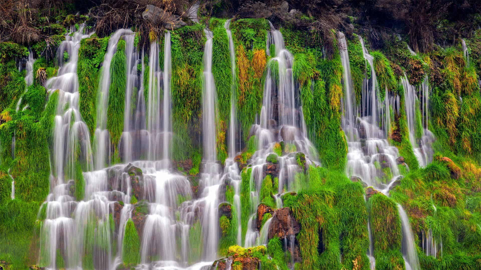
千泉州立公园的瀑布,美国爱达荷州 Waterfall in Thousand Springs State Park, Hagerman Valley, Idaho (© knowlesgallery/Getty Images)
什么是地球上最珍贵的资源? Earth's most precious resource?
World Water Day
You can almost hear the crash and feel the spray of this pristine cluster of waterfalls in southern Idaho. Could there be a better place to celebrate World Water Day? Since 1993, the UN has dedicated March 22 to advocate for sustainable management of freshwater resources and bring attention to topics relevant to clean water, sanitation, and hygiene. Each year has emphasized a different aspect of this critical resource, with themes like 'Valuing Water,' 'Water and Climate Change,' 'Water and Jobs,' and 'Why Waste Water?' This year's theme is 'Groundwater—Making the Invisible Visible.'
Groundwater surfaces in spectacular fashion here at Thousand Springs State Park, located in a beautiful corner of Idaho—the aptly named Magic Valley. The springs here are fed by the Eastern Snake Plain Aquifer, one of the largest aquifers in the United States, about the size of Lake Erie. The groundwater in the aquifer travels from its source just 1 to 10 feet per day and can take 150 to 250 years to flow into Thousand Springs and the Snake River.
世界水日
你几乎可以听到撞击声,感受到爱达荷州南部这片原始瀑布群的喷射声。有更好的地方庆祝世界水日吗?自1993年以来,联合国一直致力于3月22日倡导淡水资源的可持续管理,并提请人们注意与清洁水、卫生和个人卫生相关的话题。每年都会强调这一关键资源的不同方面,主题包括“重视水”、“水与气候变化”、“水与就业”以及“为什么要浪费水?”今年的主题是“地下水让看不见的东西看得见”
千泉州立公园位于爱达荷州一个美丽的角落,名字恰如其分的魔法谷,这里的地下水以壮观的方式浮出水面。这里的泉水来自东部蛇平原含水层,这是美国最大的含水层之一,大约有伊利湖那么大。含水层中的地下水每天从源头流出仅1至10英尺,需要150至250年才能流入千泉和蛇河。
日落时的悬日现象,美国芝加哥 Chicagohenge sunset, Chicago, Illinois (© Razvan Sera/Amazing Aerial Agency)

日落时的悬日现象,美国芝加哥 Chicagohenge sunset, Chicago, Illinois (© Razvan Sera/Amazing Aerial Agency)
城市网格传递了这一天象 The city grid delivers this celestial phenomenon
Chicagohenge
During the fall and spring equinox, the celestial phenomenon known as Chicagohenge occurs when the sun rises or sets directly between the buildings lining Chicago's west- and east-facing streets. The city's almost perfectly aligned grid is responsible for the event.
During the equinox, the northern and southern hemispheres receive an equal amount of sunlight, and the sun rises and sets directly to the east and west. As it happens, Chicago's grid is aligned with the cardinal directions on a compass, a handy fact to know anytime you're walking in the city.
It might be easy to lose touch with the natural cycles of the planet when you live in a concrete jungle, but at least twice a year, Chicagohenge reminds city dwellers exactly where this third rock from the sun is spinning.
芝加哥城
在秋分和春分期间,当太阳在芝加哥西面和东面街道两旁的建筑之间直接升起或落下时,就会出现被称为芝加哥柱的天象。这座城市几乎完全对齐的网格是这次活动的主因。
在春分期间,南北半球接收等量的阳光,太阳从东到西直接升起和落下。碰巧的是,芝加哥的网格与指南针上的基本方向对齐,这是一个方便的事实,你在城市中行走的任何时候都可以知道。
当你生活在混凝土丛林中时,可能很容易与地球的自然循环失去联系,但芝加哥恒河每年至少两次提醒城市居民,太阳的第三块岩石正在旋转的确切位置。
生机盎然的酢浆草和红杉树,美国大草原溪红杉州立公园 Coastal redwoods and wood sorrel, Prairie Creek Redwoods State Park, California (© Jack Dykinga/Minden Pictures)
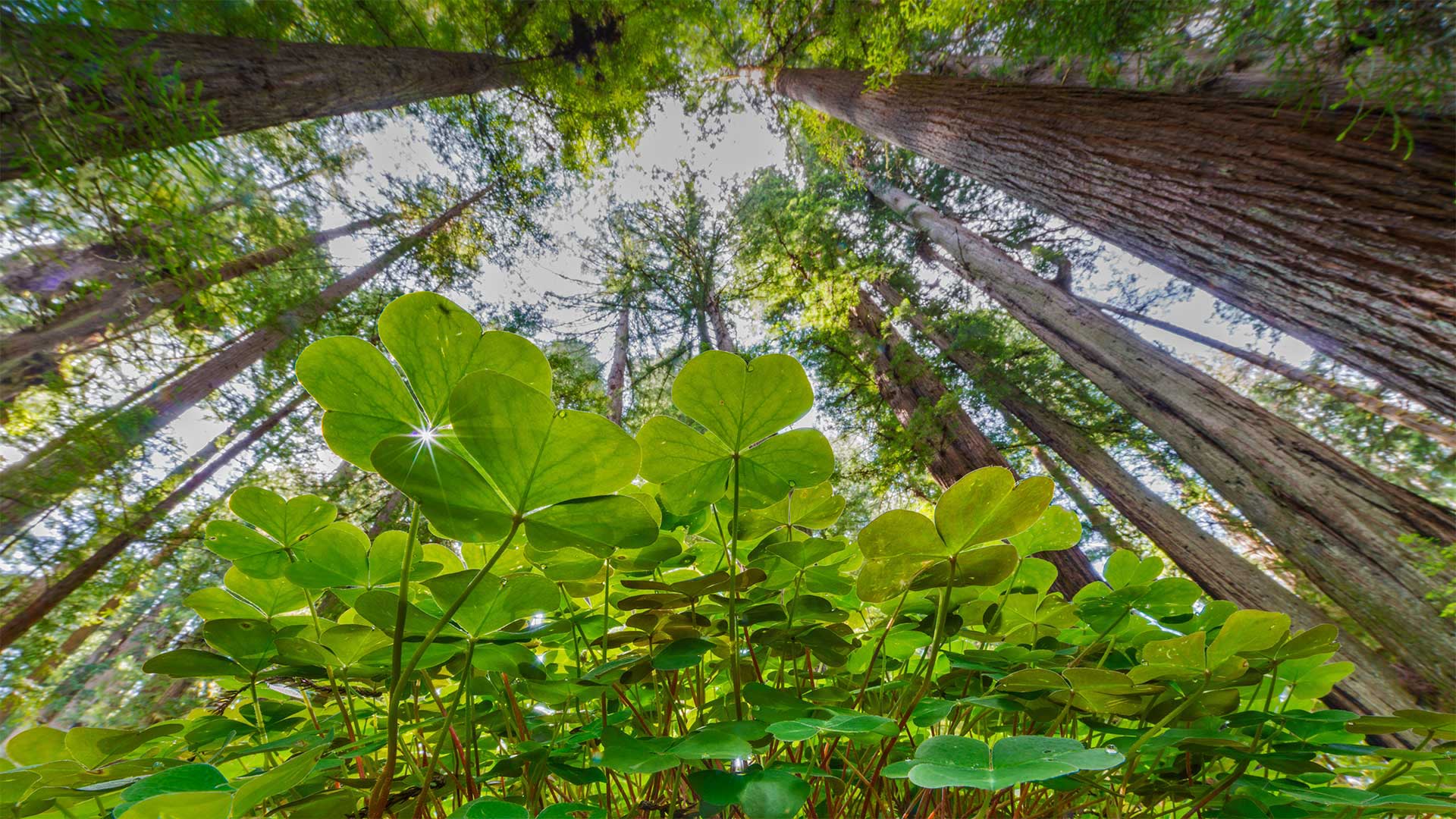
生机盎然的酢浆草和红杉树,美国大草原溪红杉州立公园 Coastal redwoods and wood sorrel, Prairie Creek Redwoods State Park, California (© Jack Dykinga/Minden Pictures)
有四叶草吗? Any with four leaves?
St. Patrick's Day
Ireland has been called the land of '40 shades of green,' but this green leprechaun's-eye view comes from the feet of California's giant sequoias. Today we celebrate St. Patrick, the patron saint of Ireland, who famously never traveled to California. St. Patrick is often depicted holding a shamrock, which he purportedly used to spread Christianity in Ireland by saying the leaves illustrated the Father, Son, and the Holy Spirit of the Holy Trinity. Never mind that Celtic druids had revered the sacred shamrock and its three leaves long before Patrick's arrival. Coins depicting St. Patrick with a shamrock date back as far as 1675.
Legends of St. Patrick abound. For example, he's said to have driven the snakes out of Ireland, but most experts would suggest it was the cool, damp weather that kept the serpents from ever arriving there in the first place. Tradition has it that he died on March 17 of the year 461 CE, and one can only assume that a year later the first green beer was served.
Whether you find yourself in Dublin, the California coast, or any point in between today, we leave you with a traditional Irish toast: 'May your glass be ever full. May the roof over your head be always strong. And may you be in heaven half an hour before the devil knows you're dead.'
圣帕特里克节
爱尔兰被称为“40种绿荫之地”,但这张绿色小妖精的视线来自加利福尼亚州巨大红杉的脚下。今天,我们庆祝爱尔兰的守护神圣帕特里克,他以从未去过加利福尼亚而闻名。圣帕特里克经常被描绘成手持三叶草,据说他用三叶草在爱尔兰传播基督教,说三叶草描绘了圣父、圣子和三位一体的圣灵。在帕特里克到来之前很久,凯尔特德鲁伊就已经崇敬了神圣的三叶草和它的三片叶子。描绘圣帕特里克和三叶草的硬币可以追溯到1675年。
圣帕特里克的传说比比皆是。例如,据说他把蛇赶出了爱尔兰,但大多数专家认为,正是凉爽潮湿的天气阻止了蛇从一开始就到达那里。按照传统,他于公元461年3月17日去世,人们只能假设一年后,第一瓶绿色啤酒出现了。
无论你是在都柏林、加利福尼亚海岸,还是在这两者之间的任何时刻,我们都会给你一个传统的爱尔兰祝酒词:“愿你的酒杯永远充满。”。愿你头上的屋顶永远坚固。愿你在魔鬼知道你死前半小时就到了天堂。
奥卡拉国家森林中的杜松泉,美国佛罗里达州 Juniper Springs in Ocala National Forest, Florida (© Michael Warren/Getty Images)
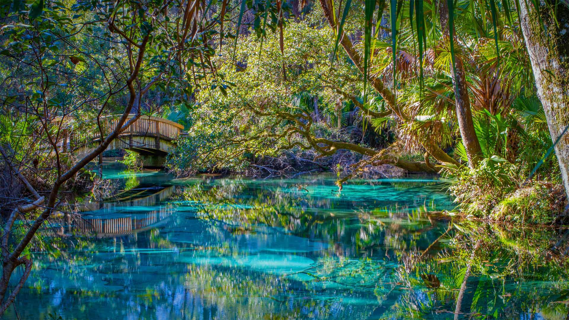
奥卡拉国家森林中的杜松泉,美国佛罗里达州 Juniper Springs in Ocala National Forest, Florida (© Michael Warren/Getty Images)
全年均可在此畅游 You can take a refreshing dip here any day of the year
Juniper Springs, Florida
Yes, the water here is as inviting as it looks: clear as glass, the shade of a precious gem, and a perfect 73 degrees every day of the year. Set within a subtropical forest, it is a veritable Garden of Eden. Long before Disney arrived in the Sunshine State, natural springs like this one were what visitors flocked to. Juniper Springs, seen here, is one of Florida's oldest and best-known recreation areas, established in the 1930s as a place to camp, hike, paddle, and, of course, swim.
Florida is home to the largest concentration of freshwater springs in the world, with more than 1,000 of them scattered mostly across the upper part of the state, where the massive Floridan aquifer breaks through the surface. This underground reservoir hides beneath the entire state and parts of neighboring states. Under constant pressure, the water sometimes reaches voids in the surface, and a spring is created. This aquifer provides Florida with almost all its drinking water.
Like so many of our natural resources, Florida's springs are under threat. Overextraction and pollution from fertilizers and septic systems have put some springs in peril. Luckily for anyone visiting Juniper Springs, these jewel-toned waters are protected by the Ocala National Forest, so it's likely to look like this for a long time.
佛罗里达州杜松斯普林斯
是的,这里的水和它看起来一样诱人:清澈如玻璃,宝石般的阴影,一年中每天都有完美的73度。它坐落在亚热带森林中,是名副其实的伊甸园。早在迪士尼抵达阳光之州之前,像这样的天然泉水就是游客们蜂拥而来的地方。这里所见的刺柏泉是佛罗里达州最古老、最著名的休闲区之一,建于20世纪30年代,是露营、徒步旅行、划桨,当然还有游泳的地方。
佛罗里达州是世界上淡水泉最集中的地方,其中1000多处主要分布在佛罗里达州的上半部分,那里巨大的弗洛里丹含水层穿透地表。这个地下水库隐藏在整个州和邻近州的部分地区之下。在恒定的压力下,水有时会到达表面的空隙,从而产生一个弹簧。该含水层为佛罗里达州提供了几乎所有的饮用水。
和我们的许多自然资源一样,佛罗里达州的泉水也受到威胁。肥料和化粪池系统的过度抽取和污染已经使一些泉水处于危险之中。幸运的是,对于任何参观Juniper Springs的人来说,这些宝石色的水域都受到奥卡拉国家森林的保护,所以很可能很长一段时间都是这样。
雷尼尔山上空的银河星系,美国华盛顿州 Moonlight and the Milky Way over Mount Rainier in Mount Rainier National Park, Washington (© Brad Goldpaint/Cavan)
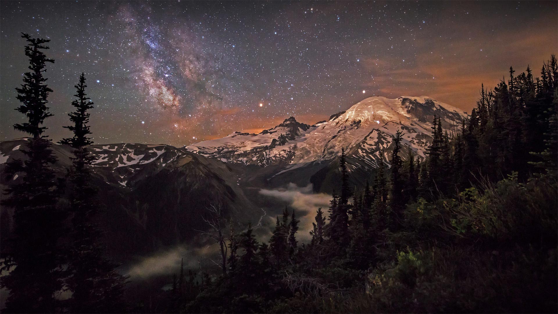
雷尼尔山上空的银河星系,美国华盛顿州 Moonlight and the Milky Way over Mount Rainier in Mount Rainier National Park, Washington (© Brad Goldpaint/Cavan)
123岁生日快乐! Happy 123rd birthday
Mount Rainier National Park
Mount Rainier is the crown jewel of its namesake national park, designated March 2, 1899, by President William McKinley. It was just the fifth national park in the United States. Beyond the mountain, the 369-square-mile park also includes valleys, waterfalls, old-growth forests, and pristine alpine meadows famous for summer wildflowers.
Rainier is considered the most glaciated peak in the contiguous US. Native Americans named it Tahoma, which translates to mother of waters. Indeed, the mountain spawns five major rivers, and to this day, its snowmelt provides much of the water for the region.
Although beautiful, Rainier is also one of the most dangerous volcanoes in the world. Scientists consider an eruption in the near future to be highly probable. In addition to spewing ash and triggering landslides, a major eruption would likely trigger massive mudflows, called lahars, that would send a tsunami of mud, boulders, and debris toward the cities of Tacoma and Seattle, only 100 miles away. For now, we'll just admire the majesty of this sleeping giant and be thankful that the national park protects so much pristine northwest wilderness.
雷尼尔山国家公园
雷尼尔山是威廉·麦金利总统于1899年3月2日指定的同名国家公园的皇冠明珠。它只是美国的第五个国家公园。在山的另一边,369平方英里的公园还包括山谷、瀑布、古老的森林和以夏季野花闻名的原始高山草甸。
雷尼尔峰被认为是美国周边冰川最为严重的山峰。美洲原住民将其命名为Tahoma,意为“水之母”。事实上,这座山孕育了五条主要河流,直到今天,它的融雪为该地区提供了大量的水。
雷尼尔火山虽然美丽,但也是世界上最危险的火山之一。科学家认为在不久的将来爆发是极有可能的。除了喷发火山灰和引发山体滑坡外,一次大的火山喷发可能会引发大规模的泥流,称为lahars,这将向仅100英里外的塔科马和西雅图两座城市带来一场由泥浆、巨石和碎片组成的海啸。现在,我们只想欣赏这位沉睡巨人的威严,感谢国家公园保护了如此多原始的西北荒野。
冰川湾国家公园里的兰普鲁冰川,美国阿拉斯加州 Lamplugh Glacier in Glacier Bay National Park, Alaska (© Andrew Peacock/Getty Images)
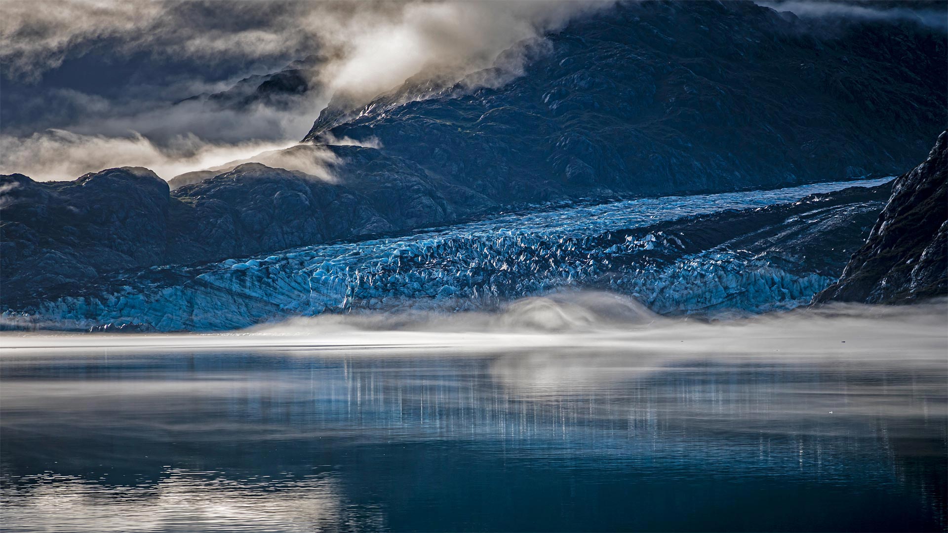
冰川湾国家公园里的兰普鲁冰川,美国阿拉斯加州 Lamplugh Glacier in Glacier Bay National Park, Alaska (© Andrew Peacock/Getty Images)
古老的冰川与大海相遇的地方 Where ancient ice meets the sea
Glacier Bay National Park and Preserve
Think of this special spot as the place where two different Alaskas meet—its vast icy north and its verdant maritime south. Glacier Bay is named for this area's dominant feature, the rivers of ice that carve the landscape and periodically calve icebergs into the sea. On February 26, 1925, President Calvin Coolidge declared much of the land around the bay a national monument. But the protected area was greatly expanded in 1980, when a 3.3-million-acre expanse of glaciers, fjords, rainforest, coastline, and mountain peaks was named a national park and preserve.
Pictured here is Lamplugh Glacier, one of the relatively few tidewater glaciers in the park; the vast majority are found inland. Lamplugh is known for its intense blue color—ice and water absorb the red wavelength of white light and transmit blue light, which is what we end up seeing. The thicker and more pure the ice, the more blue it appears.
冰川湾国家公园
把这个特殊的地方想象成两个不同的阿拉斯加人在广阔的冰雪覆盖的北方和苍翠的海洋南面相遇的地方。冰川湾是以该地区的主要特征命名的,冰的河流切割景观,并周期性地将冰山崩解入海中。1925年2月26日,卡尔文·柯立芝总统宣布海湾周围的大部分土地为国家纪念碑。但1980年,保护区得到了极大的扩展,当时一片330万英亩的冰川、峡湾、雨林、海岸线和山峰被命名为国家公园和保护区。
这里的图片是兰普卢冰川,公园里相对较少的潮水冰川之一;绝大多数是在内陆发现的。Lamplugh以其强烈的蓝色而闻名,冰和水吸收白光的红色波长并传输蓝光,这就是我们最终看到的。冰越纯,越厚。
雷斯岬国家海岸公园里的柏树隧道,美国加利福尼亚州 The cypress tunnel at Point Reyes National Seashore in California (© Spondylolithesis/Getty Images)
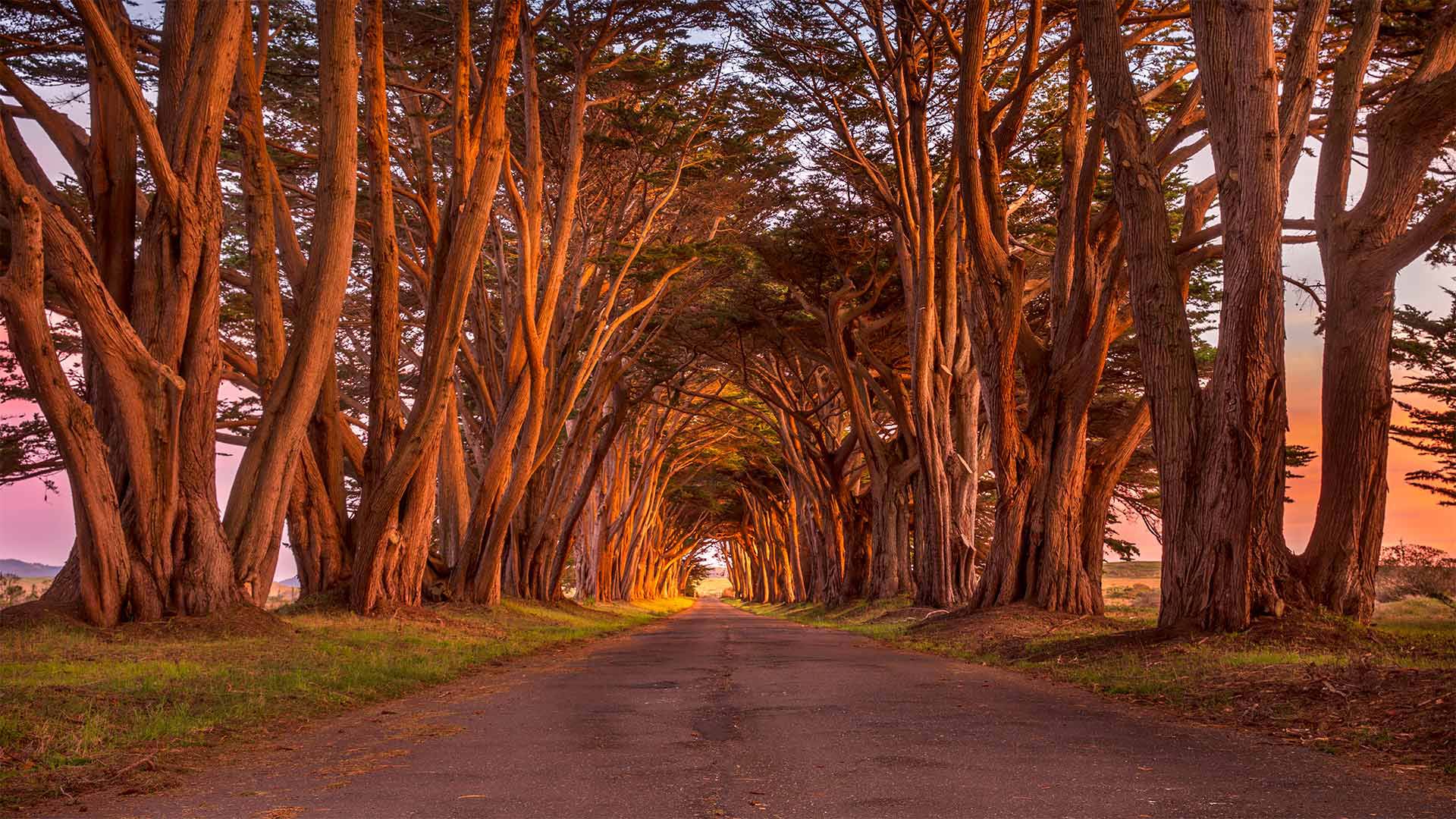
雷斯岬国家海岸公园里的柏树隧道,美国加利福尼亚州 The cypress tunnel at Point Reyes National Seashore in California (© Spondylolithesis/Getty Images)
通往过去的隧道 A tunnel to the past
Point Reyes National Seashore
This evocative photo of a cypress-lined road was taken in Point Reyes National Seashore, a marine and coastal reserve under the care of the National Park Service. A portion of the park preserves the marine habitat in the harbors along the coast of the Point Reyes Peninsula on California's central coast. Inland, the area's grasslands, marshlands, and wooded uplands present a notably diverse collection of landscapes—including the cypress tunnel.
It's worth noting that at the end of this tree-lined cul-de-sac is an old ship-to-shore radio station known as KPH. It's mostly a historic site that still broadcasts locally but was once a vital communications relay for the many ships that passed by Point Reyes, especially during World War II.
雷耶斯角国家海岸酒店
这张令人想起的柏树林立的道路照片是在雷耶斯角国家海岸拍摄的,这是一个由国家公园管理局管理的海洋和海岸保护区。公园的一部分保留了加州中央海岸雷耶斯角半岛沿岸港口的海洋栖息地。在内陆地区,该地区的草原、沼泽地和树木繁茂的高地呈现出明显多样的景观,包括柏树隧道。
值得注意的是,在这条绿树成荫的死胡同的尽头,有一个名为KPH的老式船对岸电台。它主要是一个历史遗址,仍然在当地广播,但曾经是许多经过雷耶斯角的船只的重要通信中继,尤其是在第二次世界大战期间。