标签 河 下的文章
大弯国家公园中里奥格兰德河的景色,德克萨斯州 View of the Rio Grande River in Big Bend National Park, Texas (© Ian Shive/Tandem Stills + Motion)
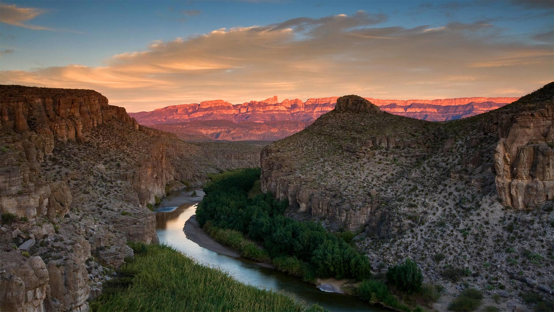
大弯国家公园中里奥格兰德河的景色,德克萨斯州 View of the Rio Grande River in Big Bend National Park, Texas (© Ian Shive/Tandem Stills + Motion)
In Texas, even the riverbend is big
We're celebrating the 77th birthday of Big Bend National Park, the place the National Park Service calls 'one of the last remaining wild corners of the United States.' To get here, you have to be committed. This rugged terrain, which covers almost a million acres, is one of the most remote spots in the country—it's hours from the nearest towns or the closest airport, making it one of the least-visited national parks in the country. Those who do make the effort to get to Big Bend are rewarded with an undeveloped natural beauty, and silence, two things that seem to be in short supply these days.
At Big Bend you'll find craggy hiking trails, red mountain vistas, limestone canyons, and hot springs alongside the famous Rio Grande. There's also the wildlife you'd expect to find in the Wild, Wild West, including rattlesnakes, packs of javelinas, and 20 species of bats. But it's the huge night sky unencumbered by light pollution that draws stargazers to Big Bend from all over the world. After all, everything, as they say, is bigger in Texas.
在德克萨斯州,连河湾都很大
我们正在庆祝大弯国家公园77岁生日,国家公园管理局称之为“美国仅存的野生角落之一”。要到这里,你必须全力以赴。这片崎岖不平的土地占地近百万英亩,是美国最偏远的地区之一,距离最近的城镇或最近的机场只有几个小时的路程,使它成为美国游客最少的国家公园之一。那些努力到达大弯的人得到的回报是未开发的自然美景和沉默,这两样东西现在似乎供不应求。
在大弯,你会发现崎岖的徒步小径、红色的山景、石灰岩峡谷和著名的格兰德河旁的温泉。在野生的西部,你也会发现野生动物,包括响尾蛇,标枪和20种蝙蝠。但正是没有光污染的巨大夜空吸引着来自世界各地的天文爱好者来到大弯。毕竟,正如他们所说,德克萨斯的一切都更大。
斯洛文尼亚索奇河上的木制吊桥上骑自行车的人的鸟瞰图 Aerial view of cyclists on a wooden suspension bridge over the river Soča in Slovenia (© Amazing Aerial Agency/Offset by Shutterstock)
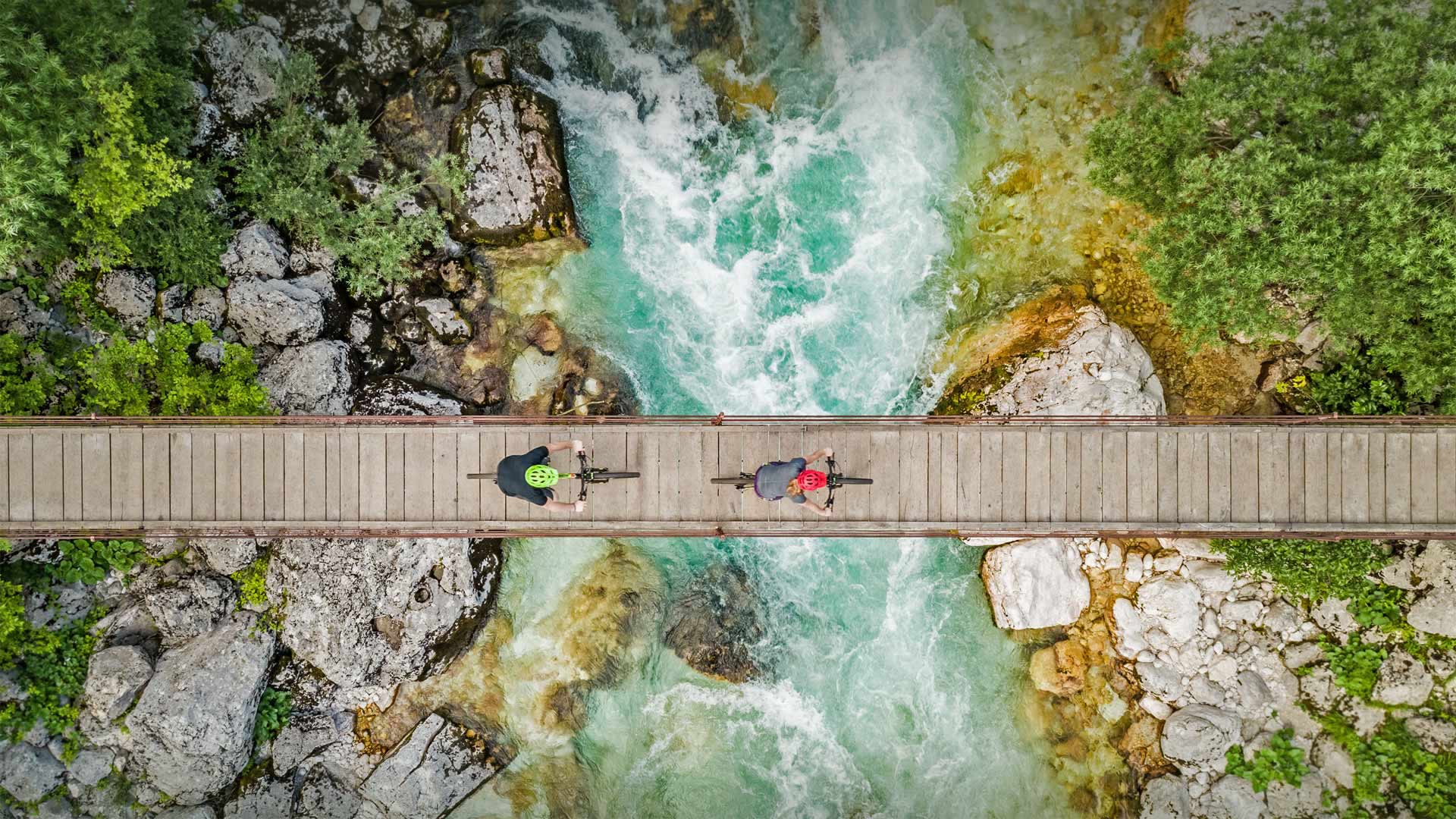
斯洛文尼亚索奇河上的木制吊桥上骑自行车的人的鸟瞰图 Aerial view of cyclists on a wooden suspension bridge over the river Soča in Slovenia (© Amazing Aerial Agency/Offset by Shutterstock)
Get on your bike and ride
In honor of the UN's World Bicycle Day, we're at Triglav National Park in Slovenia, with a birds-eye view of riders crossing this dubious-looking wooden suspension bridge over the glacial blue water of the river called Soča. Protecting some of the most magnificent mountain landscapes of the Julian Alps, Triglav is the country's only national park, but it's a stunner. Running along Slovenia's northwestern border with Italy, Triglav was first protected as a 'conservation park' in 1924, then made a national park in 1981. The park gets its name from the mountain at its heart, Triglav, long considered a symbol of Slovenia and of Slovene identity.
Since 2018, the UN General Assembly has recognized June 3 as World Bicycle Day to honor 'the uniqueness, longevity, and versatility of the bicycle, which has been in use for two centuries.' The bicycle has gone through many iterations since Karl Drais created the brake-less, pedal-less bike forerunner called a 'velocipede' in 1817. The German inventor would likely be floored by today's variety of bike options, from new lightweight road bikes to heavier mountain bikes with fatter, knobby tires designed to handle rougher terrain. More than 200 years after von Drais introduced his two-wheeled contraption, bicycles remain as popular as ever. Chances are there's one just waiting for you to take it for a spin, and what better day to do so than World Bicycle Day?
骑上你的自行车
为了纪念联合国的世界自行车日,我们来到了斯洛文尼亚的特里格拉夫国家公园,鸟瞰着骑手们穿过这座看起来可疑的木制吊桥,桥上是一条蓝色的冰川河,这条河被称为Soča。特里格拉夫保护着朱利安阿尔卑斯山上一些最壮丽的山景,是这个国家唯一的国家公园,但它是一个惊人的奇迹。特里格拉夫位于斯洛文尼亚西北部与意大利交界处,1924年首次作为“保护公园”受到保护,1981年被列为国家公园。该公园的名字来源于其核心山脉特里格拉夫,长期以来被认为是斯洛文尼亚和斯洛文尼亚人身份的象征。
自2018年以来,联合国大会将6月3日定为世界自行车日,以纪念自行车的独特性、长寿性和多功能性,这种自行车已经使用了两个世纪。自从卡尔·德赖斯发明了无刹车自行车以来,自行车经历了多次迭代,1817年被称为“velocipede”的无踏板自行车的先驱。这位德国发明家很可能会被今天各种各样的自行车选择所打倒,从新的轻型公路自行车到更重的山地自行车,这些自行车的轮胎设计得更胖、多节,以适应更崎岖的地形。在冯·德赖斯发明了他的双轮装置200多年后,自行车仍然像以前一样流行。很有可能有一天你正等着去兜风呢,还有什么日子比世界自行车日更好呢?
香浓河对岸的景色,爱尔兰利默里克 A view across the River Shannon in Limerick, County Limerick, Ireland (© Piotr Machowczyk/Shutterstock)
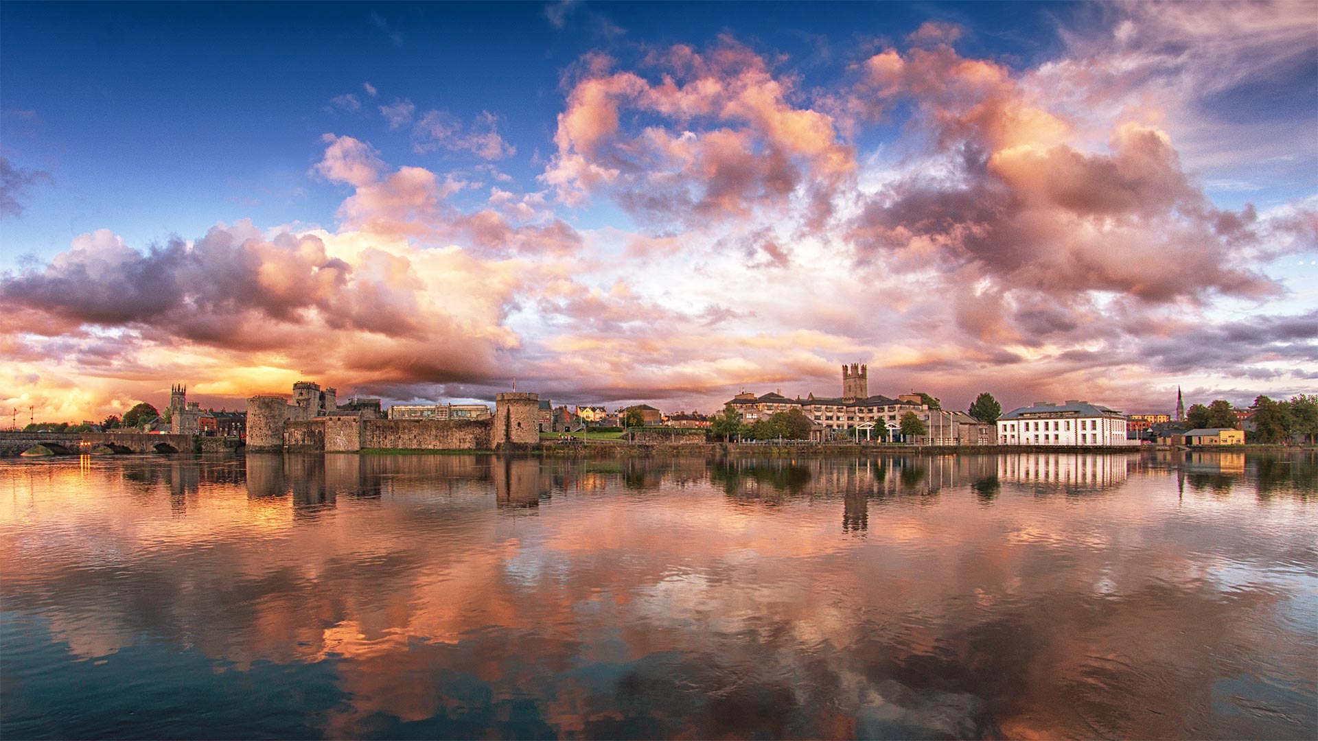
香浓河对岸的景色,爱尔兰利默里克 A view across the River Shannon in Limerick, County Limerick, Ireland (© Piotr Machowczyk/Shutterstock)
A visit to Limerick on Limerick
Today is Limerick Day, and what better place to celebrate this unofficial holiday than in Limerick, Ireland. The connection between the historic city and the humorous, five-line verse is unclear. Several theories have been purported, none of them definitive. But the city of Limerick has embraced its namesake poetry style and in recent years the Limerick Writers' Centre has hosted an annual competition called Bring Your Limericks to Limerick.
We're looking across the River Shannon at the historic part of the city, a medieval section once walled off by the Vikings around 812 and known today as King's Island. That's King John's Castle on the left, built on the order of King John in 1200. Over on the right is St. Mary's Cathedral, which dates from 1168 and is the oldest building in Limerick still in use. History suggests the area was settled long before the Vikings conquered it and set about destroying Irish public records. The earliest map of Ireland, produced in 150 CE by historian and overall polymath Ptolemy, shows a place called 'Regia' at the same site as King's Island.
利默里克之旅
今天是利默里克日,还有什么比在爱尔兰利默里克更好的地方来庆祝这个非官方节日呢。这座历史名城与幽默的五行诗之间的联系尚不清楚。有几个理论被提出,没有一个是确定的。但利默里克市已经接受了同名的诗歌风格,近年来,利默里克作家中心举办了一个名为“把你的利默里克带到利默里克”的年度比赛。
我们在香农河对岸眺望这座城市的历史部分,这是一个中世纪的部分,812年左右曾被维京人围住,今天被称为国王岛。左边是约翰国王的城堡,1200年按照约翰国王的命令建造。右边是圣玛丽大教堂,建于1168年,是利默里克至今仍在使用的最古老的建筑。历史表明,早在维京人征服该地区并着手销毁爱尔兰公共记录之前,该地区就已定居。最早的爱尔兰地图是由历史学家兼托勒密全才于公元150年绘制的,图中显示了一个与国王岛位于同一地点的名为“里加”的地方。
秋季迁徙时正在游过科伯克河的驯鹿,阿拉斯加 Caribou swimming across Alaska's Kobuk River during fall migration (© Michio Hoshino/Minden Pictures)
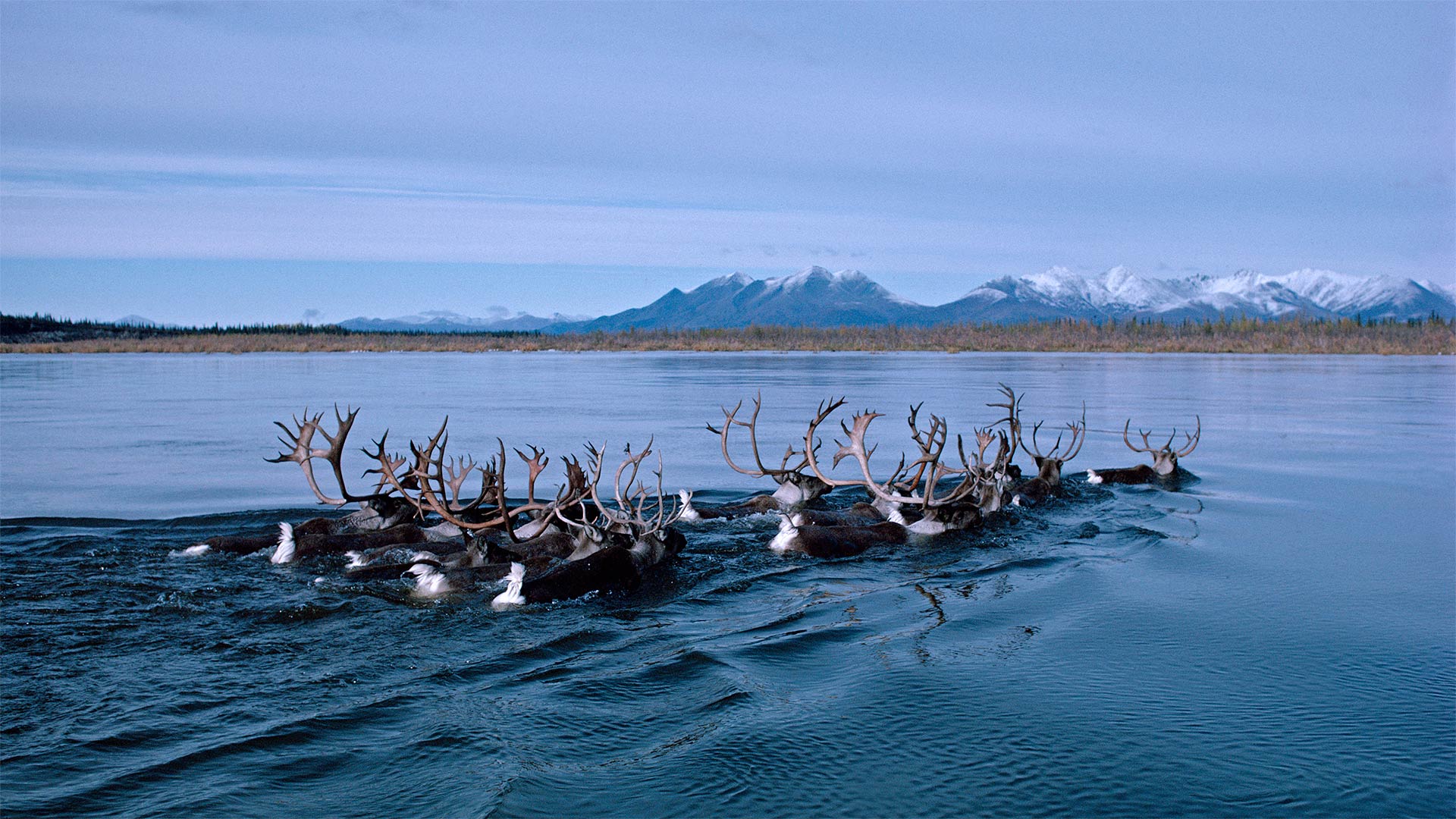
秋季迁徙时正在游过科伯克河的驯鹿,阿拉斯加 Caribou swimming across Alaska's Kobuk River during fall migration (© Michio Hoshino/Minden Pictures)
Caribou on the move
Each fall a quarter million caribou come together to form the Western Arctic Caribou Herd, a group that makes an epic migration through northwest Alaska. In great numbers they move south from their calving grounds in the Utukok River Uplands to their winter range on the Seward Peninsula. Fall is also the time when scientists attach radio collars to members of the herd, to track their location and health, and to gain information that will help conserve the species. When spring arrives, they'll complete the trip again in reverse, covering a total of 2,000 miles each year, give or take.
One of the best spots to see the herd on the move is where the great masses of animals cross this river, the Kobuk, at Onion Portage. The name of the portage derives from an Inupiaq (Inuit) word meaning 'wild onions' for the many wild onions that grow here. But the native Inuit people don't come here just to forage for onions. For millennia, the caribou crossing has drawn native peoples who rely on caribou meat, a tradition that continues to this day.
马卡雷纳山脉中的卡诺克里斯塔尔斯河,哥伦比亚 The Caño Cristales river in the Serranía de la Macarena mountains of Colombia (© Jorge Iván Vásquez Cuartas/Getty Images)
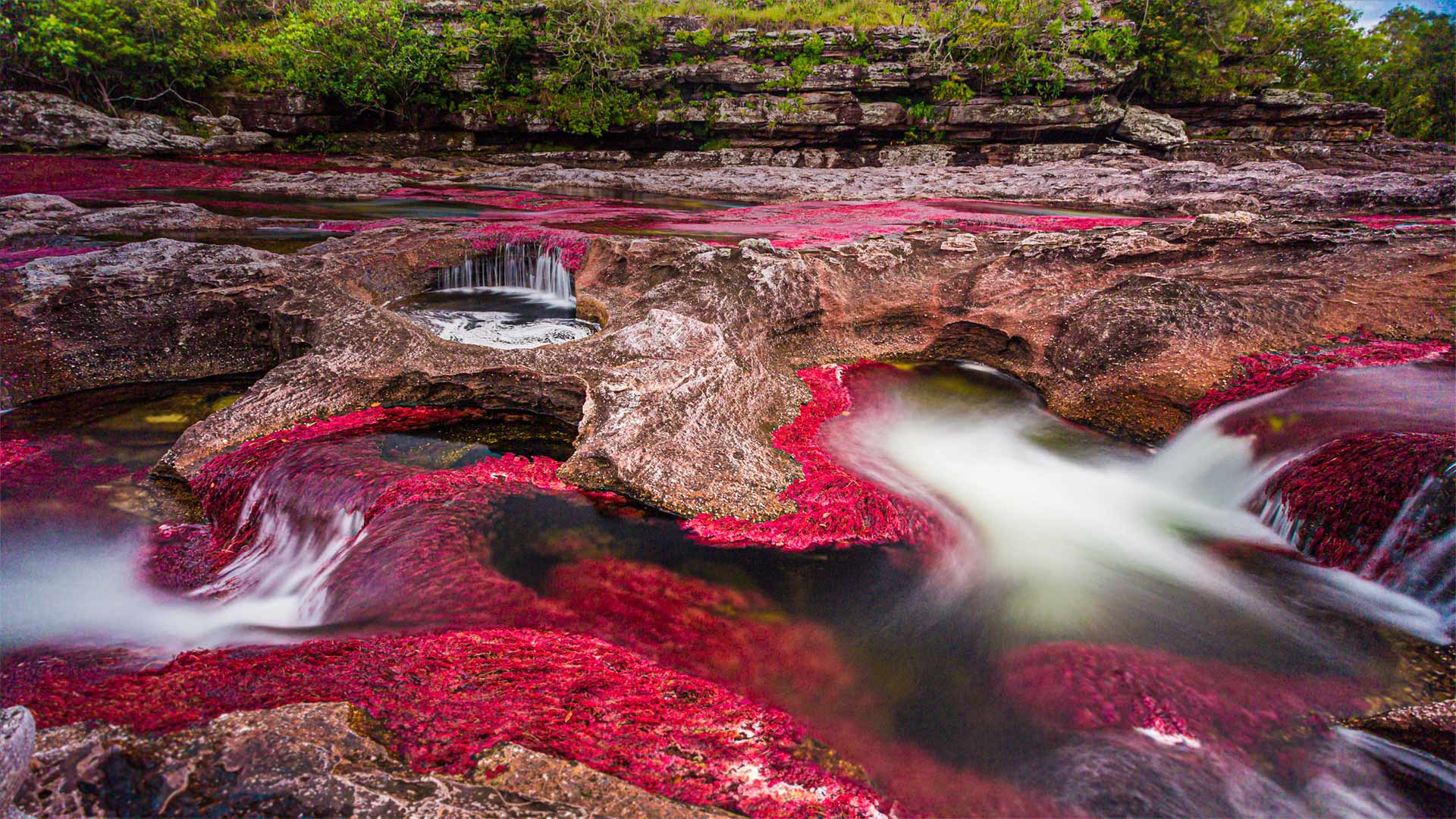
马卡雷纳山脉中的卡诺克里斯塔尔斯河,哥伦比亚 The Caño Cristales river in the Serranía de la Macarena mountains of Colombia (© Jorge Iván Vásquez Cuartas/Getty Images)
Go with the rainbow flow
Today's photo brings us to the banks of Caño Cristales, the 'liquid rainbow' that cuts a prismatic path through the heart of Colombia. From June through November, when the clear water is low, the abundant underwater plants that cover the riverbed show off their red, yellow, green, and blue hues. The star of the show—especially in this photo—is Macarenia clavigera, a riverweed that ranges from bright red to deep crimson or purple depending on its intake of sun rays. In August and September, when the florid flora are at their peak, it's a coveted nature excursion: Because the river's ecosystem is so fragile, visits are limited to guided tours.