挂在锦里街上的红灯笼,中国成都 Red lanterns hanging in Jinli Street, Chengdu, China (© Philippe LEJEANVRE/Getty Images)

挂在锦里街上的红灯笼,中国成都 Red lanterns hanging in Jinli Street, Chengdu, China (© Philippe LEJEANVRE/Getty Images)
Lighting the way to a new year
The Lantern Festival marks the final day of Lunar (aka Chinese) New Year celebrations, which began this year on February 12 when we ushered in the Year of the Ox. Traditionally, the day of the festival is filled with dancing, firecrackers, children's games, and food—including tangyuan, a desert made from balls of rice flour and generally loaded with sweet fillings. After sundown, celebrants gather to light or observe lanterns like the ones we see here in Chengdu, China.
俯瞰着特雷维的扁桃花,意大利佩鲁贾 Almond blossoms overlooking Trevi, Perugia district, Umbria, Italy (© Maurizio Rellini/eStock Photo)
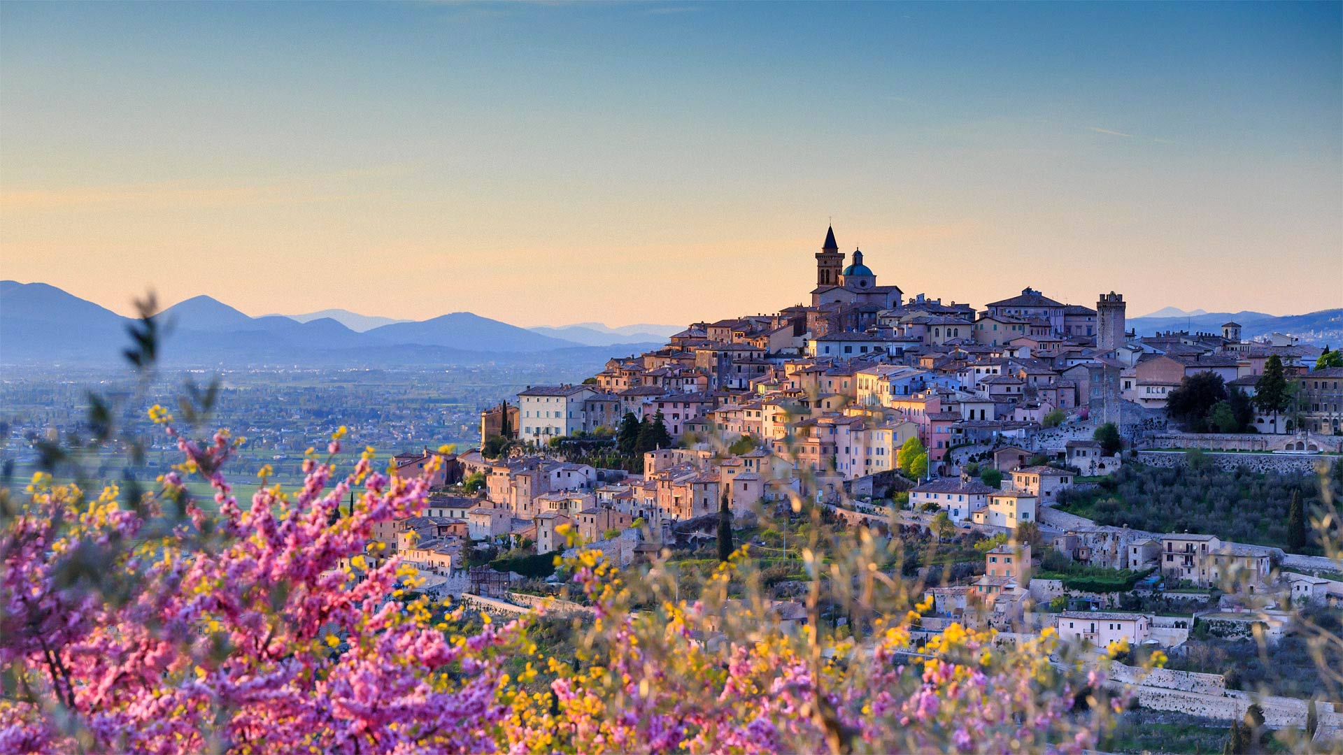
俯瞰着特雷维的扁桃花,意大利佩鲁贾 Almond blossoms overlooking Trevi, Perugia district, Umbria, Italy (© Maurizio Rellini/eStock Photo)
Trevi in bloom
Perched high above the lush Italian countryside is Trevi, a great medieval hill town. Trevi is considered one of the prettiest and most authentic of the medieval towns that dot the Umbria region. Counts and cardinals built these communities to show off their wealth and they built them up high to keep them safe from rivals.
Surrounding Trevi is a rock wall built around 2,000 years ago. From there, it's a winding walk up through cobblestone streets and squares lined with churches and other buildings from the Romanesque, Gothic, and Renaissance eras. Flowers spill from window boxes and markets fill with local goods, including black truffles, black celery, asparagus, and olive oil, said to be among the best in all of Italy. We recommend stopping for a classic Umbrian meal (with a local red wine) before making your way to the top of Trevi to take in views of the lush countryside below. Francis of Assisi loved this area so much, he wandered it by foot for years. And is it any wonder? From here, you can see olive groves covering the mountainsides and dense forests where the elusive black truffles grow.
盛开的树
特雷维坐落在茂盛的意大利乡村上空,是一个伟大的中世纪山镇。特雷维被认为是中世纪城镇中最漂亮和最真实的城镇之一,遍布翁布里亚地区。伯爵和红衣主教建立这些社区是为了炫耀他们的财富,他们把社区建得很高是为了保护他们不受竞争对手的伤害。
特雷维周围是一堵建于2000年前的岩墙。从那里开始,这是一条蜿蜒的小路,穿过鹅卵石街道和广场,广场两旁是罗马式、哥特式和文艺复兴时期的教堂和其他建筑。鲜花从橱窗里洒了出来,市场上摆满了当地的商品,包括黑松露、黑芹菜、芦笋和橄榄油,据说这些都是意大利最好的。我们建议您在前往特雷维山顶欣赏下面郁郁葱葱的乡村景色之前,先停下来享用一顿经典的翁布里亚大餐(配上当地的红酒)。阿西西的弗朗西斯非常喜欢这个地区,他步行在那里徘徊了好几年。有什么奇怪的吗?从这里,你可以看到覆盖在山坡上的橄榄林和密林,那里生长着难以捉摸的黑松露。
莫纳布拉班特山,毛里求斯 Le Morne Brabant, Mauritius (© Hemis/Alamy)
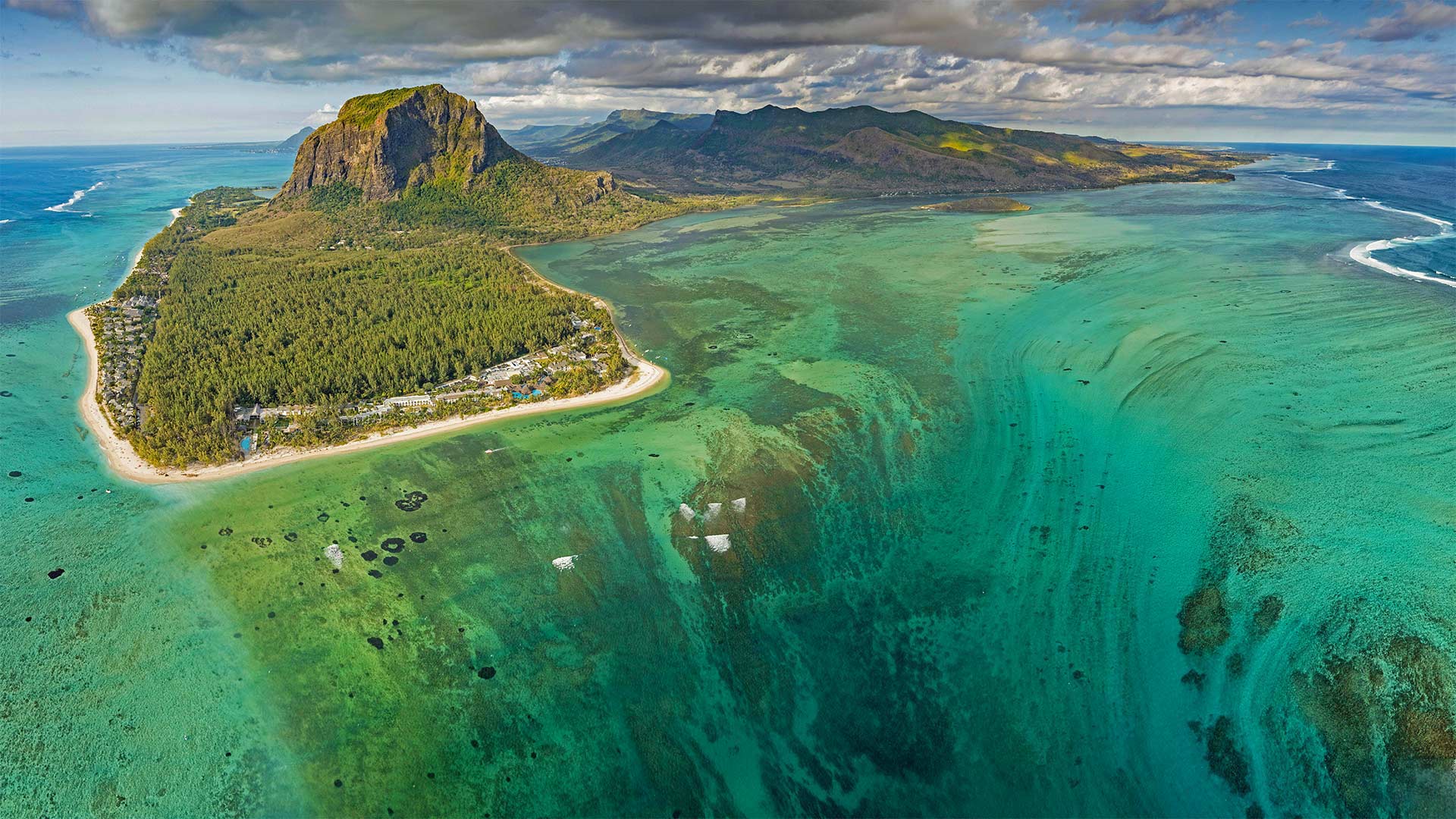
莫纳布拉班特山,毛里求斯 Le Morne Brabant, Mauritius (© Hemis/Alamy)
Getting to the bottom of the underwater waterfall
From this vantage point high over the Indian Ocean, we have a spectacular view of the 'underwater waterfall' formed off the coast of Mauritius. Not a true waterfall, this is an optical illusion—it's really the trails of sand and silt deposits on the seafloor being washed by ocean currents through an opening between coral reefs. But we're probably not alone in thinking at first glance that the ocean is pouring into some massive unseen drainpipe.
Our viewpoint also offers a clear look at the huge basalt monolith in the distance towering over the peninsula called Le Morne Brabant. Originally uninhabited by humans, the island of Mauritius became an important stopover in the slave trade by the 18th century. Some slaves managed to escape while on the island and made their way to the many caves and overhangs on the steep slopes of Le Morne. There, these 'maroons' hid from slave traders and eventually formed enough settlements that Mauritius became popularly known as the Maroon Republic, and Le Morne a symbol of the slaves' resistance, suffering, and sacrifice.
到达水下瀑布的底部
从印度洋上空的这一有利位置,我们可以看到毛里求斯海岸形成的“水下瀑布”的壮观景色。这不是一个真正的瀑布,这是一种视觉错觉,它实际上是海床上的沙子和淤泥沉积的痕迹被洋流通过珊瑚礁之间的开口冲刷。但我们可能不是唯一一个第一眼就认为海洋正在涌入一些看不见的巨大排水管的人。
我们的观点也提供了一个巨大的玄武岩巨石在远处高耸在半岛称为勒莫恩布拉班特清晰的看法。毛里求斯岛原本无人居住,到18世纪成为奴隶贸易的重要中转站。一些奴隶在岛上逃走了,他们来到了勒芒陡坡上的许多洞穴和悬垂处。在那里,这些“马龙人”躲避奴隶贩子,最终形成了足够多的定居点,使得毛里求斯成为众所周知的马龙共和国,而勒芒则是奴隶抵抗、苦难和牺牲的象征。
莱姆里杰斯的Cobb防波堤,英格兰多塞特 The Cobb breakwater, Lyme Regis, Dorset, England (© Ross Hoddinott/Offset by Shutterstock)

莱姆里杰斯的Cobb防波堤,英格兰多塞特 The Cobb breakwater, Lyme Regis, Dorset, England (© Ross Hoddinott/Offset by Shutterstock)
Holding back the tide
Shrugging off choppy waters on England’s south-west coast is the historic harbour and breakwater known as the Cobb. There has been one man-made structure or another in the waters off Lyme Regis since medieval times, without which much of this Dorset town may have been washed away. While its harbour seems small to modern eyes, Lyme Regis grew as a major port and shipbuilding centre from the 13th century onwards, thanks to the Cobb and the protection it offered from fierce south-westerly gales.
The long, curving High Wall featured in our homepage image offers a great lookout spot from which to enjoy panoramic views of this stretch of the Jurassic Coast, a World Heritage Site famous for its fossils. This section, built in Portland Stone, dates back to the 1820s and famously features in a scene with Meryl Streep’s character in The French Lieutenant’s Woman. If you choose to follow in her footsteps, be warned: The Cobb can be as treacherous as it is breathtaking, even when waves are not crashing against it. Algae can make its surface slippery and there is no handrail to grab if you lose your footing, so choose a calm day to enjoy a stroll along the top and even then, tread carefully.
抑制潮流
在英格兰西南海岸的波涛汹涌的海面上耸肩的是历史悠久的港口和被称为科布的防波堤。自中世纪以来,莱姆里吉斯附近的水域就有这样或那样的人造建筑,如果没有这些建筑,多塞特镇的大部分地区可能会被冲走。在现代人看来,莱姆雷吉斯的港口似乎很小,但从13世纪起,由于科布和它所提供的抵御西南狂风的保护,莱姆雷吉斯逐渐成为一个主要的港口和造船中心。
在我们的主页图片中,长而弯曲的高墙提供了一个绝佳的了望点,从这里可以欣赏侏罗纪海岸的全景,侏罗纪海岸是一个以化石闻名的世界遗产地。这一部分建于波特兰石,可以追溯到19世纪20年代,以梅丽尔·斯特里普在《法国中尉的女人》中的角色而闻名。如果你选择跟随她的脚步,要注意的是:柯布可能是危险的,因为它是惊人的,即使海浪没有撞击它。藻类会使它的表面很滑,如果你失去了你的脚,没有扶手可以抓住,所以选择一个平静的一天享受漫步沿顶部,即使这样,踏步小心。
波尔图,葡萄牙 Porto, Portugal (© Kanuman/Shutterstock)
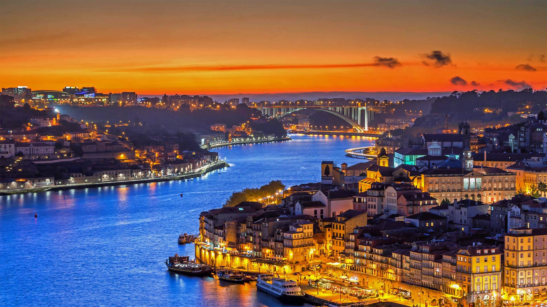
波尔图,葡萄牙 Porto, Portugal (© Kanuman/Shutterstock)
An important port of Portugal
Welcome to Porto, the second city of Portugal. Known on some English-language maps as Oporto (the Portuguese call it 'o Porto' in conversation, meaning simply 'the Port'), this attractive, ancient city is most famous today not for the port itself but for what's shipped out of it.
Follow this river, the Douro, east out of the city and you'll soon enter a valley flanked by vineyard-covered embankments. This long, narrow wine country is where world-renowned port wine is produced: A smooth, typically red wine fortified with a grape brandy to halt fermentation, resulting in a sweeter beverage. Douro valley vintners send their product downriver to Porto, from which it ships off to dessert tables worldwide. To be called port, the wine must come from the Douro valley—a stipulation dating to the 1750s—making the area one of the world's oldest protected wine regions.
葡萄牙的一个重要港口
欢迎来到葡萄牙第二大城市波尔图。在一些英文地图上被称为“波尔图”(葡萄牙人在对话中称之为“波尔图”,意思简单地说就是“港口”),这座迷人的古城今天最著名的不是港口本身,而是从港口运出的东西。
沿着这条河,杜罗河,向东出城,你很快就会进入一个山谷,山谷两侧是葡萄园覆盖的堤岸。这个狭长的葡萄酒之乡出产世界闻名的波尔图葡萄酒:一种光滑的,典型的红酒,用葡萄白兰地强化以停止发酵,从而得到更甜的饮料。杜罗谷葡萄酒商把他们的产品送到下游的波尔图,从那里运到世界各地的甜点桌上。要被称为港口,葡萄酒必须来自杜罗河谷——这一规定可以追溯到1750年代,使该地区成为世界上最古老的葡萄酒保护区之一。
暴风雪散去,加利福尼亚优胜美地国家公园 Clearing snowstorm, Yosemite National Park, California (© Jeff Lewis/Tandem Stills + Motion)
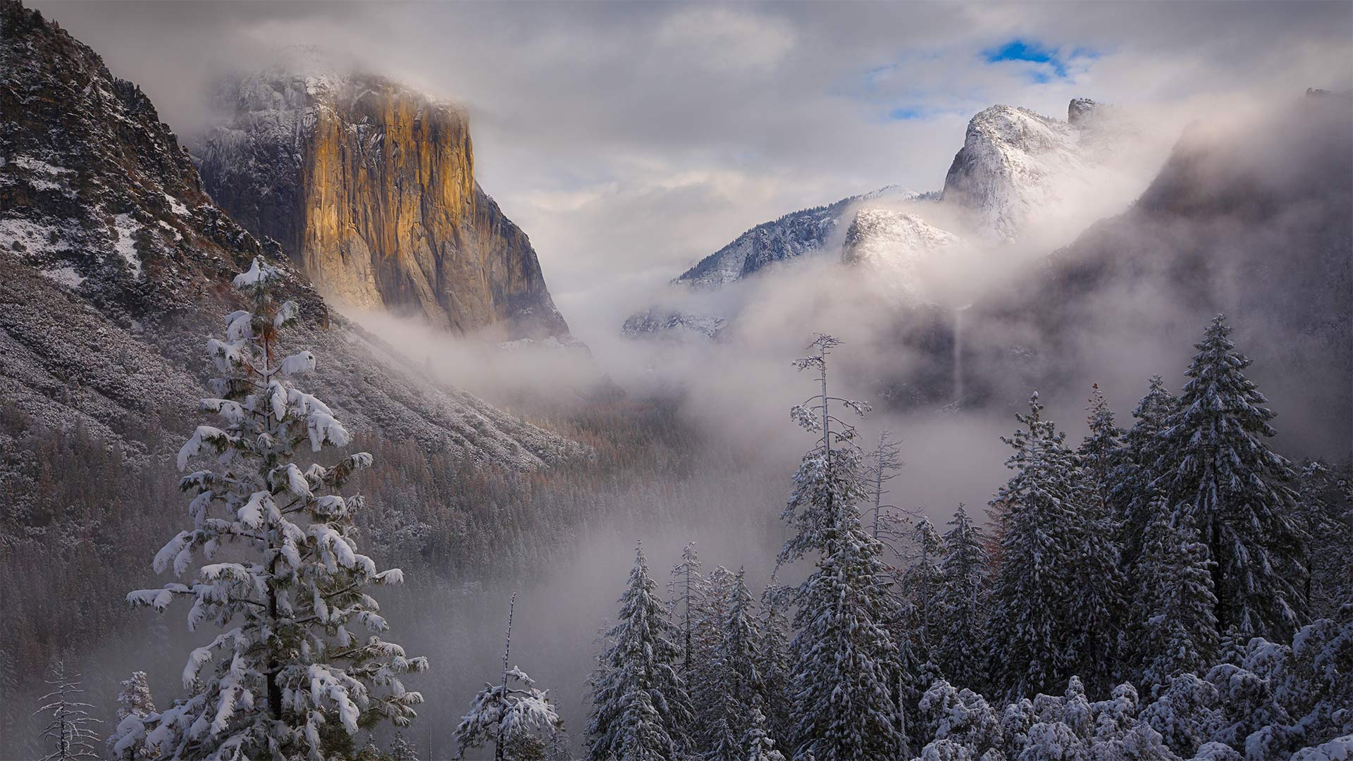
暴风雪散去,加利福尼亚优胜美地国家公园 Clearing snowstorm, Yosemite National Park, California (© Jeff Lewis/Tandem Stills + Motion)
Ansel Adams' enduring vision
Of all the camera-wielding luminaries who've snapped this eastward view of Yosemite Valley, few can hold a 'candela' to Ansel Adams, born this day in 1902. The legendary photographer of Western landscapes was given his first camera here in Yosemite as a boy. The national park was his favorite place in the world, and he returned every year for the rest of his life.
Adams' style is one of the most recognizable in photography: Bright whites against deep blacks, with high horizon lines that leave most of the frame filled with landscape, a narrow lens aperture placing every tiny detail in biting focus. Unlike many photographers of the day who considered themselves more journalist than artist, Adams was a visionary: Instead of plainly documenting what he saw, Adams aimed to convey the enchantment, awe, and terror his beloved landscapes made him feel, spending hours in the darkroom fine-tuning exposures to match what he visualized. 'Clearing Winter Storm'—the photo that today's image pays tribute to—was taken around 1937, depicting ominous clouds gathering around El Capitan and Bridalveil Fall, whiting out the distant peak of Half Dome.
While Adams had to lug bulky box cameras and light meters into the wilderness to capture his vision, chances are you've got the whole setup in your pocket. Why not grab that phone of yours, venture outside, and celebrate this legendary shutterbug's birthday with some masterful nature snaps of your own?
安塞尔·亚当斯的不朽愿景
在所有手持相机拍摄到约塞米蒂山谷东面景色的名人中,很少有人能为1902年出生的安塞尔·亚当斯(Ansel Adams)奉上“烛台”。这位西方风景的传奇摄影师小时候在约塞米蒂得到了他的第一台相机。国家公园是他在世界上最喜欢的地方,他余生每年都会回来。
亚当斯的风格是摄影界公认的最具代表性的风格之一:明亮的白色与深黑的对比,高水平的线条让大部分画面充满了风景,狭窄的镜头光圈将每一个微小的细节都置于扣人心弦的焦点。与当时许多认为自己更像记者而不是艺术家的摄影师不同,亚当斯是一个有远见的人:他没有简单地记录他所看到的一切,而是致力于传达他所钟爱的风景带给他的魅力、敬畏和恐惧,他花了数小时在暗室微调曝光,以符合他所想象的《清冬风暴》(Clearing Winter Storm)——这张今天的照片是在1937年左右拍摄的,描绘了不祥的云层聚集在埃尔卡皮坦(El Capitan)和布里达尔维尔瀑布(Bridalveil Fall)周围,使远处的半圆顶峰黯然失色。
虽然亚当斯不得不拖着笨重的盒式摄像机和测光表到荒野中捕捉他的视野,但你很可能已经把整个设置都放在口袋里了。为什么不拿起你的手机,到外面去冒险,用你自己掌握的自然快照来庆祝这个传奇的shutterbug的生日呢?
冰川国家公园中的佩里托莫雷诺冰川,阿根廷 Perito Moreno Glacier in Patagonia's Los Glaciares National Park, Argentina (© Juergen Schonnop/Getty Images)
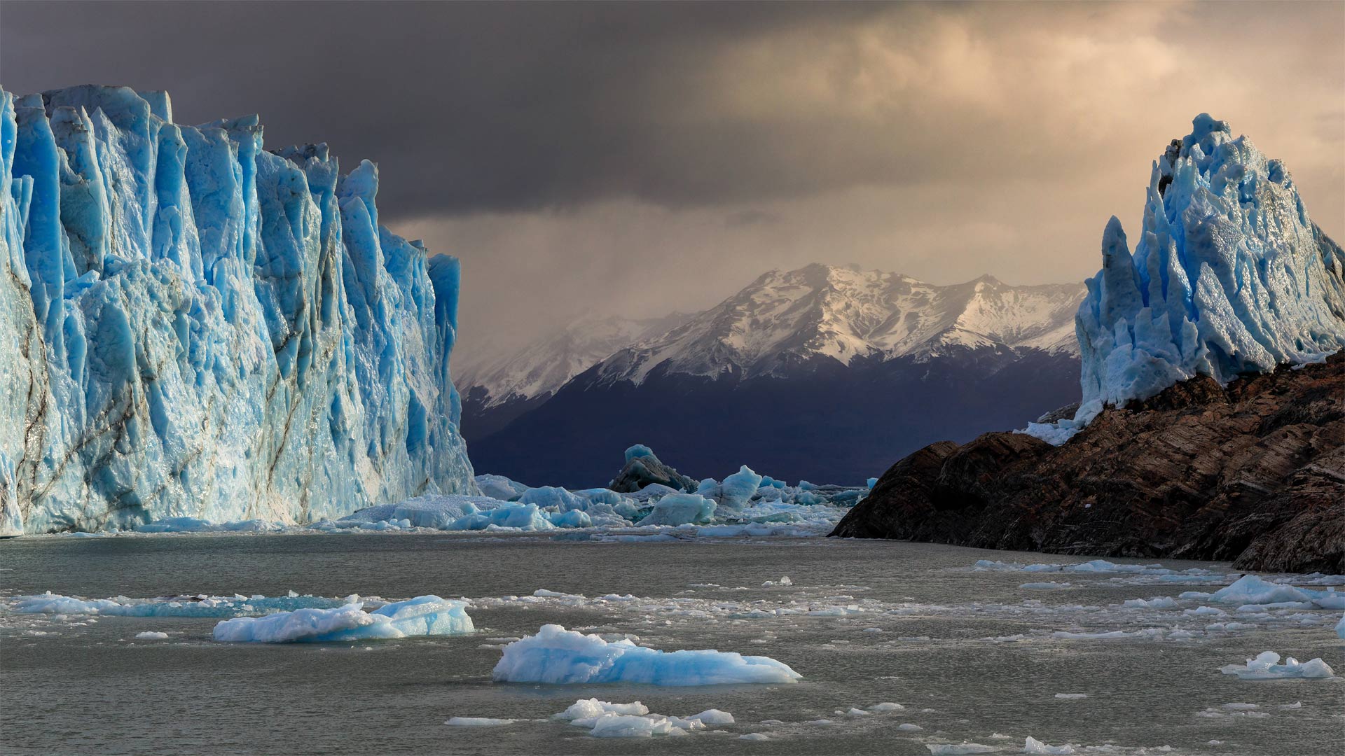
冰川国家公园中的佩里托莫雷诺冰川,阿根廷 Perito Moreno Glacier in Patagonia's Los Glaciares National Park, Argentina (© Juergen Schonnop/Getty Images)
The persistence of Perito Moreno
Yes, it's true that glaciers are shrinking, but not all of them. Perito Moreno, a low-lying glacier in southern Argentina, accumulates ice at about the same rate that it melts into chilly Argentino Lake. This equilibrium makes it one of the few glaciers worldwide that aren't losing mass to climate change.
Perito Moreno is an Argentine icon, partly for its unusual accessibility via the lake, the largest within the nation. Visitors to Los Glaciares National Park can boat or kayak out on ice-blue water for a better look—but they need to keep a safe distance as icebergs constantly calve from the glacier's face, creating huge splashes and waves.
佩里托·莫雷诺的坚持
是的,冰川确实在缩小,但不是全部。阿根廷南部的一座低洼冰川佩里托莫雷诺(Perito Moreno)积冰的速度与它融化到寒冷的阿根廷湖的速度差不多。这种平衡使它成为全球为数不多的不会因气候变化而失去质量的冰川之一。
佩里托·莫雷诺是阿根廷的一个标志,部分原因是它通过这个国家最大的湖泊不同寻常的可达性。到洛斯冰川国家公园的游客可以在冰蓝色的水面上划船或皮划艇,以获得更好的观赏效果,但他们需要保持安全距离,因为冰山不断地从冰川表面脱落,形成巨大的水花和海浪。
拉韦尔泰佐附近一条河里的石头,瑞士塞斯卡山谷 Stones in a river near the hamlet of Lavertezzo, in the Valle Verzasca of Switzerland (© Robert Seitz/Offset by Shutterstock)
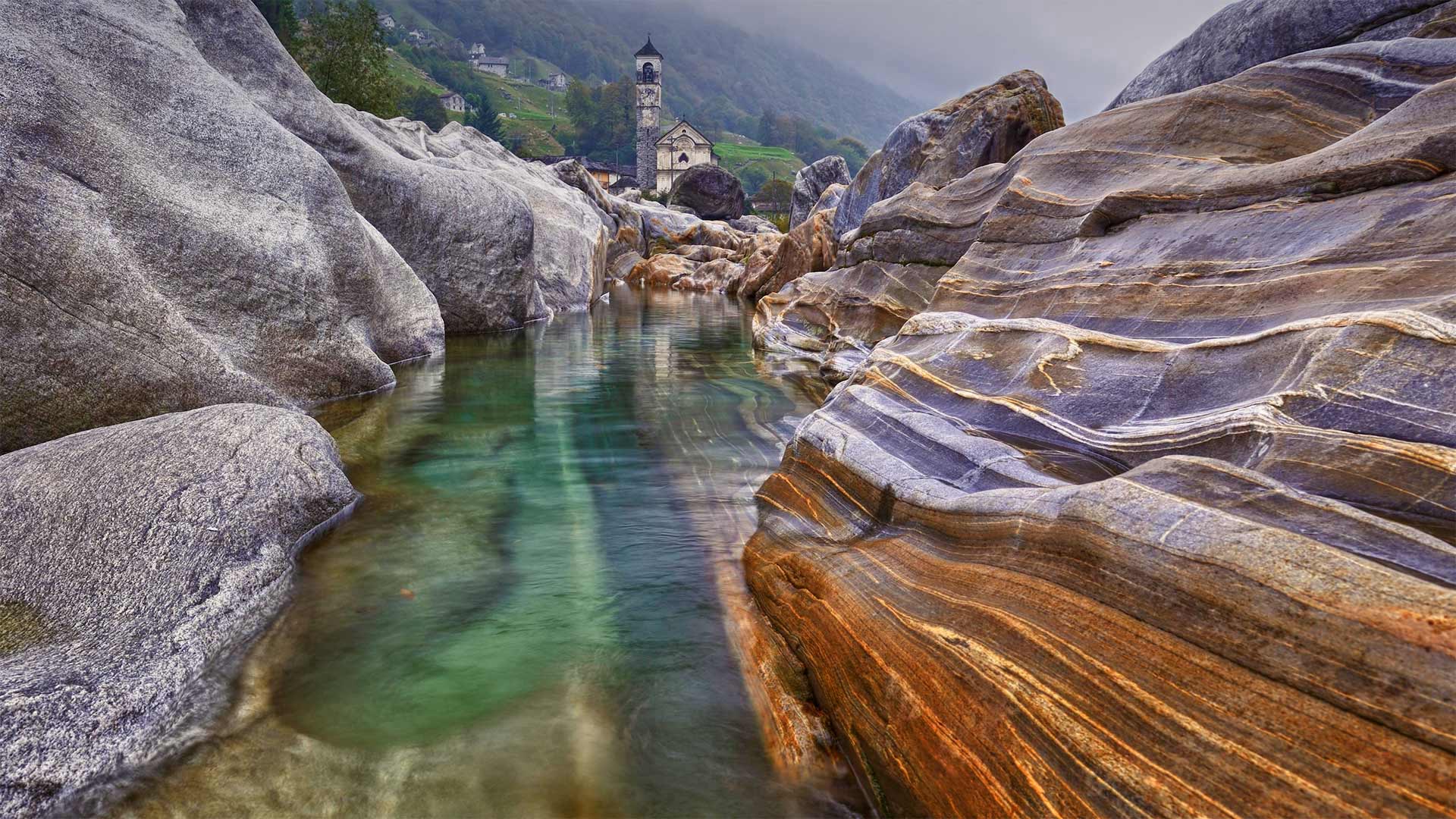
拉韦尔泰佐附近一条河里的石头,瑞士塞斯卡山谷 Stones in a river near the hamlet of Lavertezzo, in the Valle Verzasca of Switzerland (© Robert Seitz/Offset by Shutterstock)
A river runs through it
In just a few months it'll be warm enough to perch for a while on this smooth river rock, dangle your feet into the water, and take in this gorgeous Swiss scenery. We're here in the Valle Verzasca, a valley in Ticino, Switzerland, close to the Italian border. There in the near distance is the tiny hamlet of Lavertezzo, where most everyone speaks Italian. Tourists normally flock to this area in warm summer months to swim and snorkel in the river's famous turquoise waters and to jump off the 17th century double-arched bridge known as the Ponte dei Salti (Bridge of Jumps). The very, very brave bungee jump off the nearby Contra dam, made famous in the 1995 James Bond film 'GoldenEye.'
一条河穿过它
再过几个月,这里就会暖和起来,可以在这光滑的河石上栖息一会儿,把你的脚吊入水中,欣赏这美丽的瑞士景色。我们现在在瑞士提契诺的一个山谷,靠近意大利边境。在不远处有一个小村庄拉维特佐,那里大多数人都说意大利语。游客通常在温暖的夏季涌向这一地区,在著名的绿松石河水中游泳和浮潜,并从被称为Ponte dei Salti(跳跃桥)的17世纪双拱桥上跳下。从附近的康特拉水坝上非常非常勇敢的蹦极跳下,在1995年詹姆斯·邦德的电影《黄金眼》中成名
屋前的鲜花和铁艺围栏,路易斯安那州新奥尔良 Flowers and ironwork fence in front of a house in New Orleans, Louisiana (© Lauren Mitchell/Offset by Shutterstock)

屋前的鲜花和铁艺围栏,路易斯安那州新奥尔良 Flowers and ironwork fence in front of a house in New Orleans, Louisiana (© Lauren Mitchell/Offset by Shutterstock)
Mardi Gras flower power
While the purple flowers and green ironwork may not look overly festive to the untrained eye, residents of New Orleans will no doubt spot the significance of both, especially today, on Mardi Gras, the final day of Carnival. Purple and green are two of the three official colors of Mardi Gras, together with gold, and in a normal year the streets would be full of revelers decked out in all three colors as they dance and parade down the streets of the city. Due to COVID-19, there won't be any parades this year, but the colors will still be on full display in the city's famous French Quarter and elsewhere, including as colorful icing atop king cakes, a beloved treat that's associated with the Carnival season.
The colors themselves have officially been part of Mardi Gras since 1872, when they were introduced by the newly formed Krewe of Rex, one of the private social clubs ('krewes') that stage parades and other Carnival festivities. The krewe's ceremonial King of Carnival ('Rex') proclaimed that gold represents power, green represents faith, and purple stands for justice.
The ironwork seen here is a characteristic feature of homes and buildings in the region. It traces back to the early 18th century, when slaves and freemen from West Africa, influenced by French and Spanish styles, crafted fences, gates, and railings from cast iron. The often elaborately ornamented designs adorn verandas and balconies, giving residents a pleasant place to cool off in the muggy Louisiana heat. In true New Orleans fashion, even the architecture reflects a blend of cultural influences that make the city so wonderful and unique.
狂欢节花的力量
虽然紫色的花朵和绿色的铁艺在未经训练的人看来可能不会显得过于喜庆,但新奥尔良的居民无疑会发现两者的意义,尤其是今天,在狂欢节的最后一天——狂欢节。紫色和绿色是狂欢节的三种官方颜色中的两种,再加上金色,在正常年份,街道上会挤满穿着这三种颜色的狂欢者,他们在城市的街道上跳舞游行。由于COVID-19,今年将不会有任何游行,但颜色仍将在该市著名的法国区和其他地方充分展示,包括作为国王蛋糕上的彩色糖衣,这是一种与狂欢节相关的受人喜爱的待遇。
自1872年起,颜色本身就正式成为狂欢节的一部分,当时新成立的雷克斯克鲁俱乐部(Krewe of Rex)推出了这种颜色,这是一家私人社交俱乐部(“krewes”),负责举办游行和其他狂欢节。克鲁的嘉年华仪式之王(“雷克斯”)宣称,黄金代表权力,绿色代表信仰,紫色代表正义。
这里看到的铁制品是该地区住宅和建筑的一个特色。它可以追溯到18世纪初,当时来自西非的奴隶和自由人受法国和西班牙风格的影响,用铸铁制作栅栏、大门和栏杆。这些经常精心装饰的设计装饰在阳台和阳台上,给居民一个舒适的地方在闷热的路易斯安那州凉爽。在真正的新奥尔良时尚,甚至建筑反映了文化的影响,使城市如此美妙和独特的融合。
安加白令嘉河与诺朗加港,南澳大利亚州 Onkaparinga River, Port Noarlunga, South Australia (© plainpicture/AWL/Marco Bottigelli)
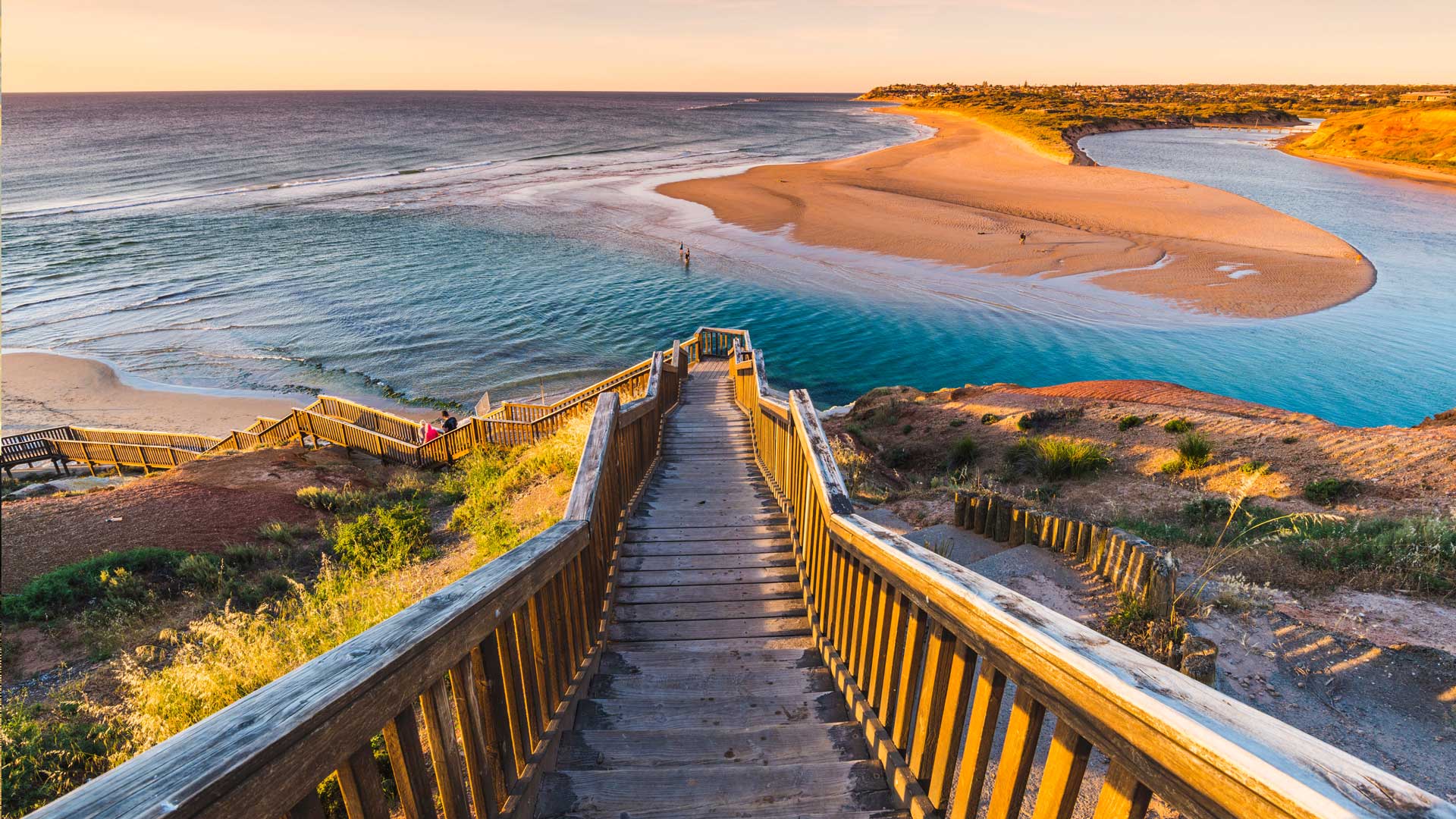
安加白令嘉河与诺朗加港,南澳大利亚州 Onkaparinga River, Port Noarlunga, South Australia (© plainpicture/AWL/Marco Bottigelli)
Stairway to heaven?
Where does this seemingly endless staircase lead? To the mighty Onkaparinga River, of course – a true South Australian highlight. The river itself is crucially important to the area’s ecosystem, acting as a beautiful home to a variety of fish that breed here, as well as hundreds of native plants and animal species. The Onkaparinga River estuary is even seen a habitat for endangered migratory birds.
It’s also a great place for us humans to visit as well. Between both Onkaparinga River Recreation Park and Onkaparinga River National Park there is no shortage of activities to take part in or sights to see. Many locals often stroll along the wetland boardwalks, hike up to the cliff tops or find a cosy spot to camp the night. If the weather is as stunning as is looks in today’s image, kayaking is also a popular choice – providing the perfect opportunity to escape the hustle and bustle of life. Sounds peaceful, doesn’t it?
通往天堂的阶梯?
这看似无尽的楼梯通向何方?到浩瀚的翁卡帕林加河,当然-一个真正的南澳大利亚亮点。这条河本身对该地区的生态系统至关重要,是这里繁殖的各种鱼类以及数百种本地动植物的美丽家园。Onkaparinga河口甚至被视为濒危候鸟的栖息地。
这也是一个伟大的地方,我们人类参观以及。在昂卡帕林加河休闲公园和昂卡帕林加河国家公园之间,不乏可参加的活动或可观赏的景点。许多当地人经常沿着湿地木板路漫步,徒步走上悬崖顶,或者找个舒适的地方过夜。如果天气像今天的图片一样令人惊叹的话,皮划艇也是一个流行的选择——提供了一个逃离生活喧嚣的绝佳机会。听起来很平静,不是吗?