瓦莱塔,马耳他 Valletta, Malta (© Deejpilot/GettyImages)
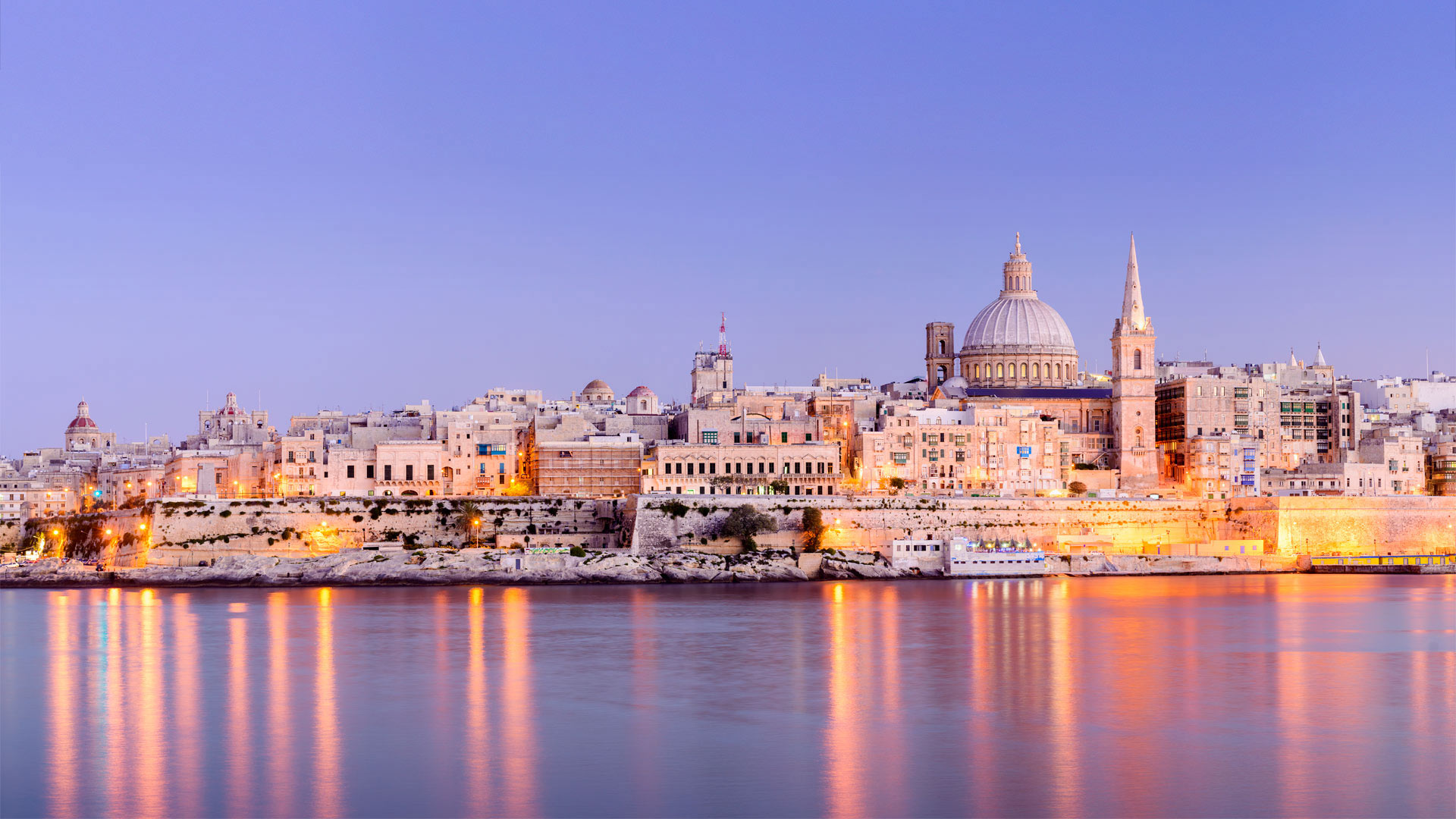
瓦莱塔,马耳他 Valletta, Malta (© Deejpilot/GettyImages)
Victory Day in Valletta
Today we're visiting Valletta, the capital of Malta, where the Maltese people are celebrating Victory Day. The national holiday commemorates the end of three historical sieges made on the Maltese archipelago—the Great Siege of Malta, which took place in 1565; the Siege of Valletta by the French Blockade, which ended in 1800; and the Siege of Malta during the Second World War by Italian and German forces. After nearly two and a half years of devastating air attacks, the WWII Siege of Malta finally ended in 1942. King George VI of the United Kingdom, which then ruled the island, awarded Malta the George Cross 'for the heroism and devotion of its people' during the great siege. The George Cross was incorporated into the flag of Malta in 1943 and remains there today.
The Maltese people typically celebrate Victory Day with cultural activities like literary readings, music, theatrical performances, and a regatta in the Grand Harbour, seen here. The armed forces parade on Republic Street in Valletta, ending at St. John's Co-Cathedral, where they salute the prime minister and the Maltese anthem is performed. The cathedral holds a mass for the highest-ranking officers and the president places a symbolic garland at the foot of the monument of the Siege of Malta to commemorate the victims of World War II.
莫尼博克湾的芦苇岛,纽约长岛 Reedy Island in Moneyboque Bay, Long Island, New York (© Claudia Uripos/eStock Photo)
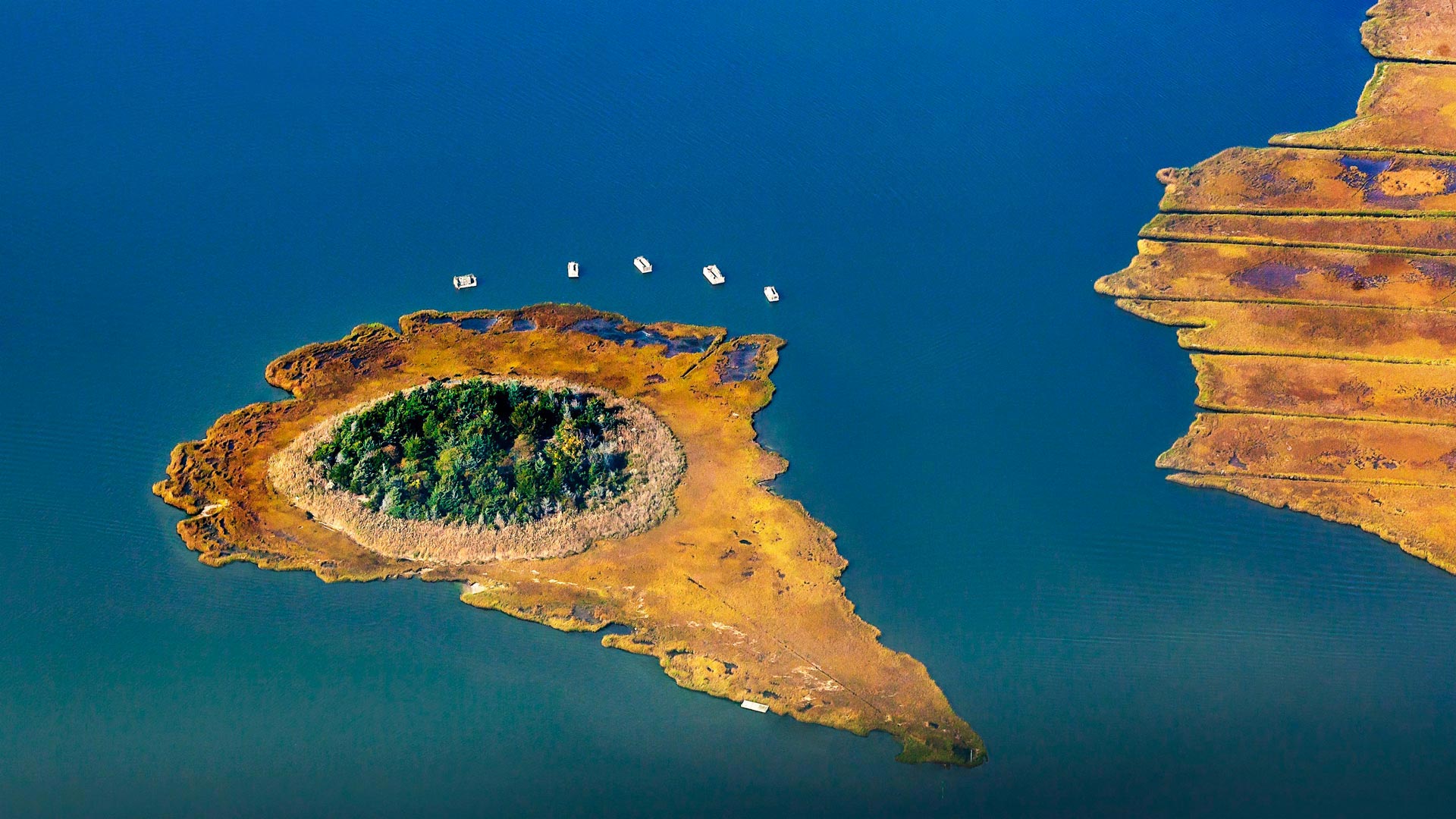
莫尼博克湾的芦苇岛,纽约长岛 Reedy Island in Moneyboque Bay, Long Island, New York (© Claudia Uripos/eStock Photo)
Summer winds down in the Hamptons
As summer unofficially wraps up, we're looking at Reedy Island, an islet that sits in Moneyboque Bay, across from Westhampton Beach on Long Island, New York. The Hamptons is a collection of villages and hamlets with plenty of sandy beachfront that have long been a popular upscale summer destination for New Yorkers looking to escape the city. This year, that migration started early, as city dwellers headed east in the spring in search of space to social distance. In summer, the beaches, of course, are the main attraction, but the area is also known for dining and nightlife (complete with celebrity spotting), wineries, and family-owned farms and farm stands. And the end of summer isn't all bad news, at least for the local economy. As temperatures cool and crowds (usually) thin out, the farms shift gears to apple cider and pumpkins, and by November, the harvesting of Peconic Bay scallops begins.
锯齿国家森林里的海狸坝,爱达荷州 Beaver dam in the Sawtooth National Forest, Idaho (© Charles Knowles/Alamy)
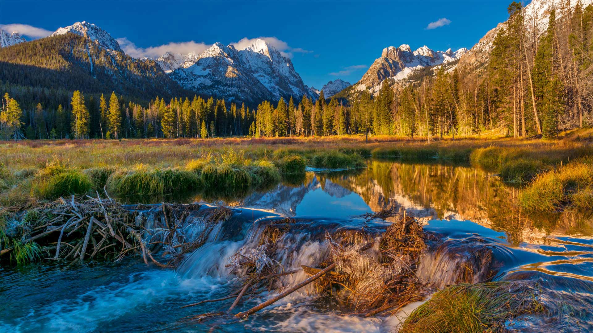
锯齿国家森林里的海狸坝,爱达荷州 Beaver dam in the Sawtooth National Forest, Idaho (© Charles Knowles/Alamy)
Beaver achievers
Don't get distracted by the awesome top half of today's photo. The postcard appeal of Idaho's Sawtooth Range is undeniable, but our focus today is on the humble structure at the bottom.
Beaver dams like this can be found coast to coast in the United States and Canada, and now is the time of year when these industrious rodents put in extra time to reinforce their dams. Listening closely for trickles of running water, they patch compromised sections with logs and mud, securing their habitat for the chilly winter. And their efforts have important downstream effects: Beaver dams help prevent floods by slowing water flows, and also filter out sediment to create cleaner streams and rivers.
一头公牛站在皮库山前的田野中,亚速尔群岛皮科岛 A bull stands in a field under the gaze of Mount Pico, Pico Island, Azores (© Atmo-Sphere/Getty Images)
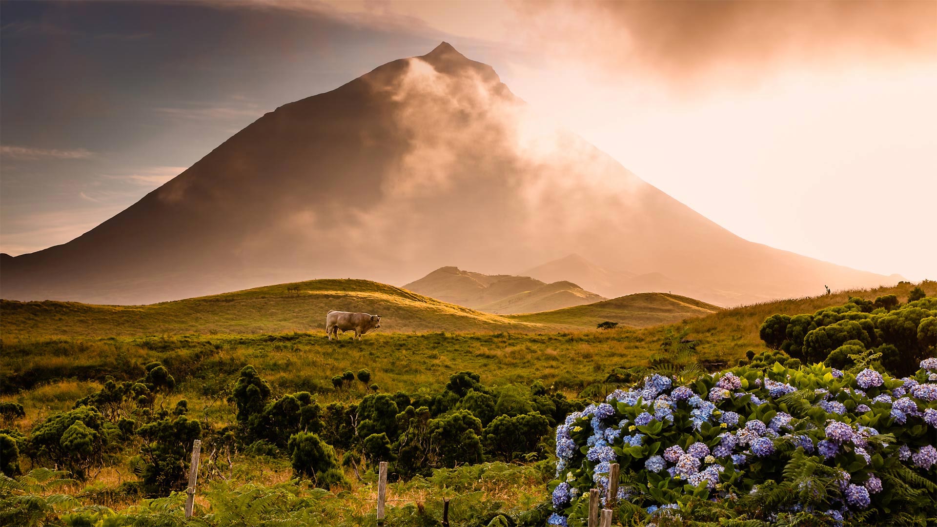
一头公牛站在皮库山前的田野中,亚速尔群岛皮科岛 A bull stands in a field under the gaze of Mount Pico, Pico Island, Azores (© Atmo-Sphere/Getty Images)
A bull, some flowers, and a stratovolcano
It's grape-harvesting time on Pico, a centuries-old tradition that kicks off in early September. Pico is one of nine islands comprising an autonomous region of Portugal called the Azores archipelago. The islands themselves are peaks of vast volcanic mountains that rise high above the Atlantic Ocean. Looming in the background of today's photo is Mount Pico, a stratovolcano partly responsible for the island's flourishing wine industry. The mineral-rich volcanic earth and warm temperate climate call for unique methods for growing grapes. Fields of vines run along the ground, resting on top of black basalt rocks the locals call 'biscoitos' (biscuits). These rock biscuits serve a purpose: During the day, the rocks absorb and give back heat, which in turn helps ripen the grapes. The bull, while picturesque, is merely a bystander enjoying the flowers and the view, and perhaps musing about mysteries of viticulture on a far-flung volcanic island.
陆家嘴金融贸易区,中国上海 Lujiazui Financial District, Shanghai, China (© Jackal Pan/Getty Images)

陆家嘴金融贸易区,中国上海 Lujiazui Financial District, Shanghai, China (© Jackal Pan/Getty Images)
Tall, taller, tallest
Piercing the clouds above Shanghai as we celebrate National Skyscraper Day, each of these three supertall spires could be seen as a freeze-frame of China's swift economic growth in the past couple of decades. Jin Mao Tower (right, 1,380 feet) was China's tallest building from 1999 until the Shanghai World Financial Center (left, 1,614 feet) opened in 2007 and took the title. Shanghai Tower (center, 2,139 feet) topped out in 2013, besting the SWFC and becoming the second-tallest skyscraper in the world (behind Dubai's Burj Khalifa).
史密斯洛克州立公园,俄勒冈 Smith Rock State Park, Oregon (© Manuela Durson/Getty Images)
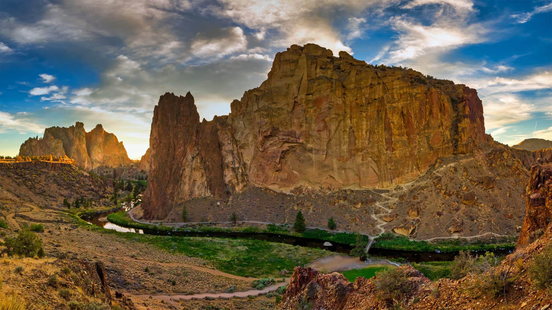
史密斯洛克州立公园,俄勒冈 Smith Rock State Park, Oregon (© Manuela Durson/Getty Images)
A rock in a wild place
Here in the high desert of Central Oregon, Smith Rock beckons rock climbers from around the world with its cliffs of tuff and basalt. Considered by many to be the birthplace of American sport climbing, it's home to nearly 2,000 climbing routes of all levels of difficulty. For those happier with their feet firmly planted on the ground, Smith Rock State Park offers the usual range of outdoor activities, including biking, hiking, and watching for wildlife including prairie falcons, golden eagles, and mule deer.
阳光穿透加拉霍奈国家公园中的森林,西班牙戈梅拉岛 Sunlight piercing a forest in Garajonay National Park, La Gomera, Spain (© Martin Siepmann/Westend61/Offset by Shutterstock)
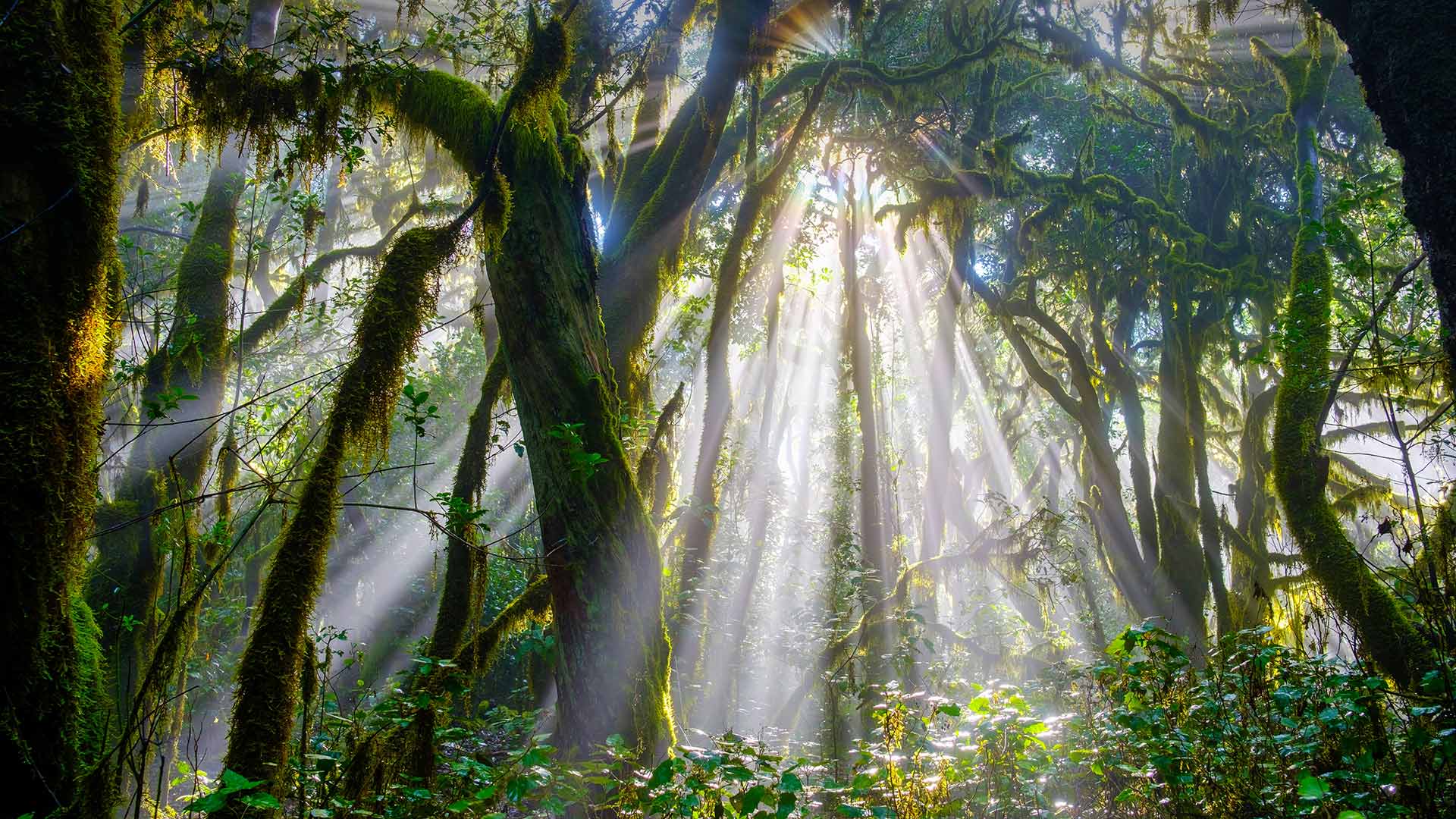
阳光穿透加拉霍奈国家公园中的森林,西班牙戈梅拉岛 Sunlight piercing a forest in Garajonay National Park, La Gomera, Spain (© Martin Siepmann/Westend61/Offset by Shutterstock)
20 million years ago…
Let’s go back 20 million years ago. The forest that you see in our image today and that looks like a tropical jungle is one of the oldest in Europe. It is located in Garajonay National Park, on the Canary Island of La Gomera, Spain. And it represents the best example that exists in the Old World of the Cenozoic flora that once covered all the Mediterranean basin.
This is a laurissilva or laurel forest. And if it has survived to our days, it is because of the special conditions of temperature and humidity of this fascinating volcanic island, where the mist tangles around the trees covered by lichens and ferns, creating a dreamlike atmosphere that seems to be taken from a fairies tale. In fact, the name Garajonay comes from a popular legend that also names the highest peak in La Gomera, “Alto de Garajonay”, which is almost 1,500 meters high.
田里的干草捆,丹麦日德兰 Hay bales in a field in Jutland, Denmark (© Nick Brundle Photography/Getty Images)
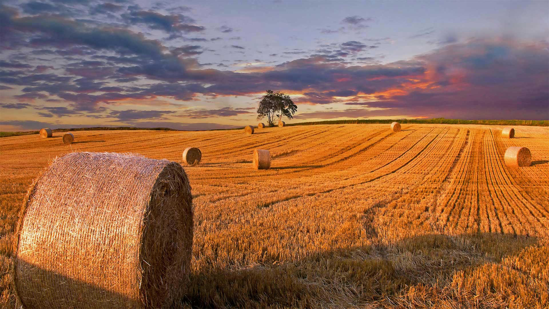
田里的干草捆,丹麦日德兰 Hay bales in a field in Jutland, Denmark (© Nick Brundle Photography/Getty Images)
Hay, what's up?
Whenever summer turns to autumn, the hay harvest is at the front of farmers' minds. To mark the occasion, we're ambling through this hayfield full of beautifully rolled bales. This particular pastoral patch is in Jutland, the agrarian mainland of Denmark that 'juts' into the North Sea. But if you could—hay presto—snap your fingers and teleport to any hayfield at sunset, you'd surely see similar neat rows of dry, amber-tinted grass.
The art of drying nutritious grasses as animal fodder is nearly as old and widespread as Jutland's gently rolling hills. And it's a delicate one, especially in places with four distinct seasons: Those precious few fall days when the sun is bright, the air is low in moisture, and the grass is mature might make for a farmer's only chance all year to harvest, dry, and bale up the nutrient-rich vegetation. So, the pithy proverb, 'Make hay while the sun shines' is the golden rule to those who tend these golden fields.
Bicycle sculptures at the Col d'Aubisque, Hautes Pyrenees, France (© Fco. Javier Sobrino/age fotostock)
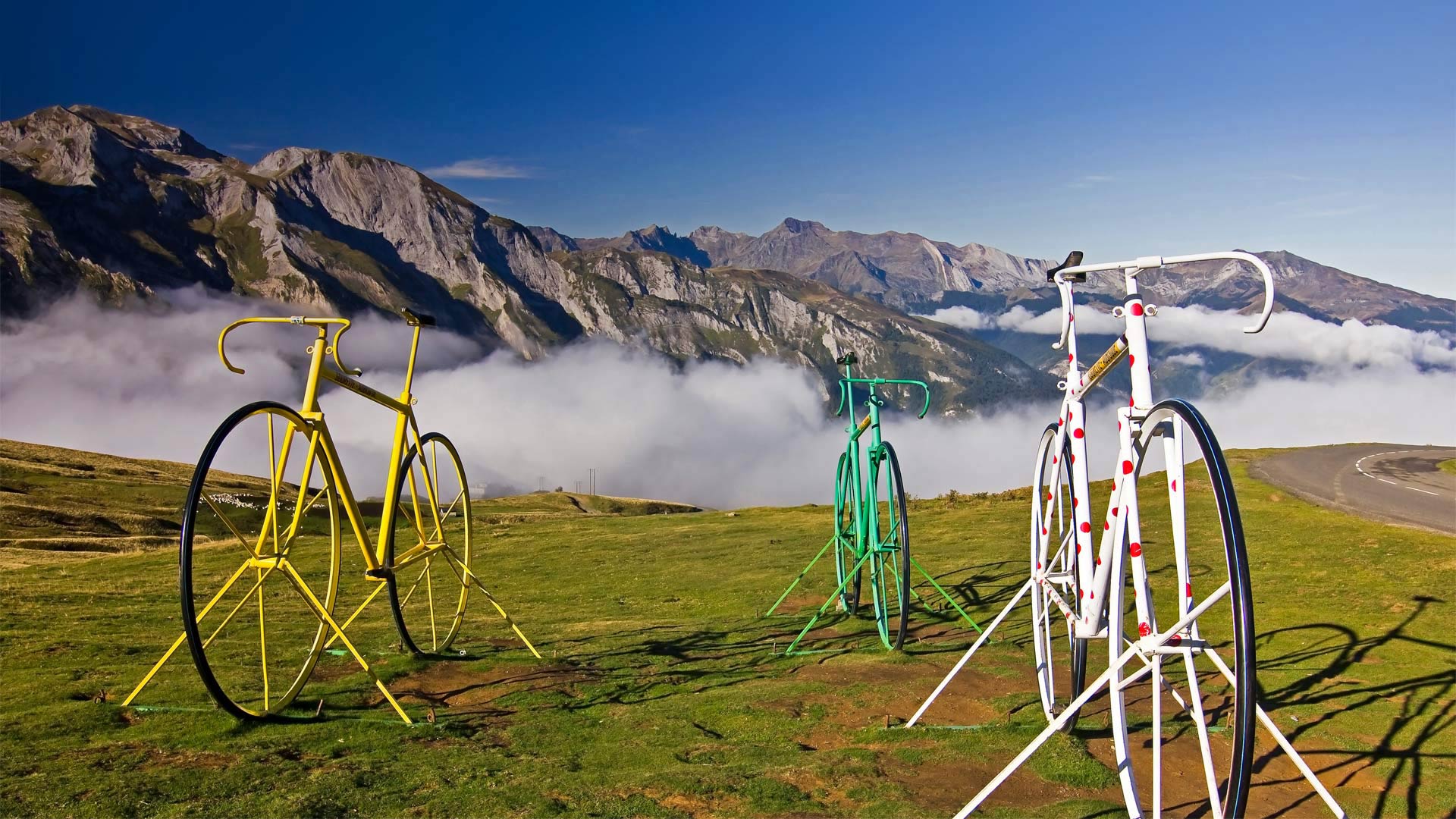
Bicycle sculptures at the Col d'Aubisque, Hautes Pyrenees, France (© Fco. Javier Sobrino/age fotostock)
Big wheels on a big mountain
Today we're high in the French Pyrenees at the Col D'Aubisque, a beautiful mountain pass topping out at 5,607 feet above sea level. It has special significance to riders and followers of the Tour de France, which starts today in Nice: The Col D'Aubisque is one of the most famous climbs on the 23-day Tour (21 days of racing), with riders clocking around 2,200 miles overall. The road up the pass has grades in either direction that can tilt past 10%. This epic mountain stage was first added to the 1910 race and it's since appeared in more than half the annual Tours, though not this year as it happens.
Just off to the side of the road at the pass, these three giant bicycle sculptures are painted in colors that correspond to the colorful jerseys worn by Tour de France riders. The yellow bike represents the overall time leader's yellow jersey; the green jersey is for the leader in stage points; and the white polka-dot jersey is for the best climber, or the 'King of the Mountains.' It's an apt name for anyone who conquers the Col D'Aubisque, which is an 'Hors Categorie' climb, meaning it is beyond categorization. In other words, it's really, really, hard. While climbing the Col in 1910, French rider Octave Lapize famously yelled at Tour officials, “You are murderers!” Today, motorists can drive over the pass without breaking a sweat, but cyclists still have their work cut out for them.