冰川湾国家公园里的兰普鲁冰川,美国阿拉斯加州 Lamplugh Glacier in Glacier Bay National Park, Alaska (© Andrew Peacock/Getty Images)
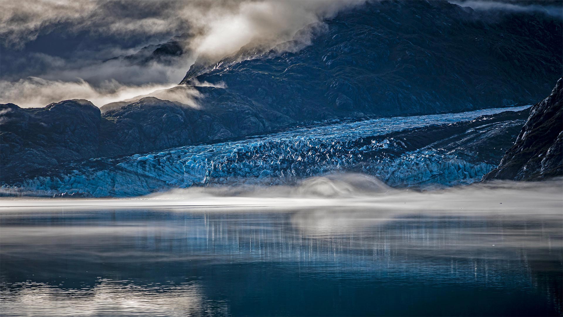
冰川湾国家公园里的兰普鲁冰川,美国阿拉斯加州 Lamplugh Glacier in Glacier Bay National Park, Alaska (© Andrew Peacock/Getty Images)
古老的冰川与大海相遇的地方 Where ancient ice meets the sea
Glacier Bay National Park and Preserve
Think of this special spot as the place where two different Alaskas meet—its vast icy north and its verdant maritime south. Glacier Bay is named for this area's dominant feature, the rivers of ice that carve the landscape and periodically calve icebergs into the sea. On February 26, 1925, President Calvin Coolidge declared much of the land around the bay a national monument. But the protected area was greatly expanded in 1980, when a 3.3-million-acre expanse of glaciers, fjords, rainforest, coastline, and mountain peaks was named a national park and preserve.
Pictured here is Lamplugh Glacier, one of the relatively few tidewater glaciers in the park; the vast majority are found inland. Lamplugh is known for its intense blue color—ice and water absorb the red wavelength of white light and transmit blue light, which is what we end up seeing. The thicker and more pure the ice, the more blue it appears.
冰川湾国家公园
把这个特殊的地方想象成两个不同的阿拉斯加人在广阔的冰雪覆盖的北方和苍翠的海洋南面相遇的地方。冰川湾是以该地区的主要特征命名的,冰的河流切割景观,并周期性地将冰山崩解入海中。1925年2月26日,卡尔文·柯立芝总统宣布海湾周围的大部分土地为国家纪念碑。但1980年,保护区得到了极大的扩展,当时一片330万英亩的冰川、峡湾、雨林、海岸线和山峰被命名为国家公园和保护区。
这里的图片是兰普卢冰川,公园里相对较少的潮水冰川之一;绝大多数是在内陆发现的。Lamplugh以其强烈的蓝色而闻名,冰和水吸收白光的红色波长并传输蓝光,这就是我们最终看到的。冰越纯,越厚。
布鲁克斯山脉上空的极光,美国阿拉斯加州 Aurora borealis above the Brooks Range in Alaska (© Noppawat Tom Charoensinphon/Getty Images)
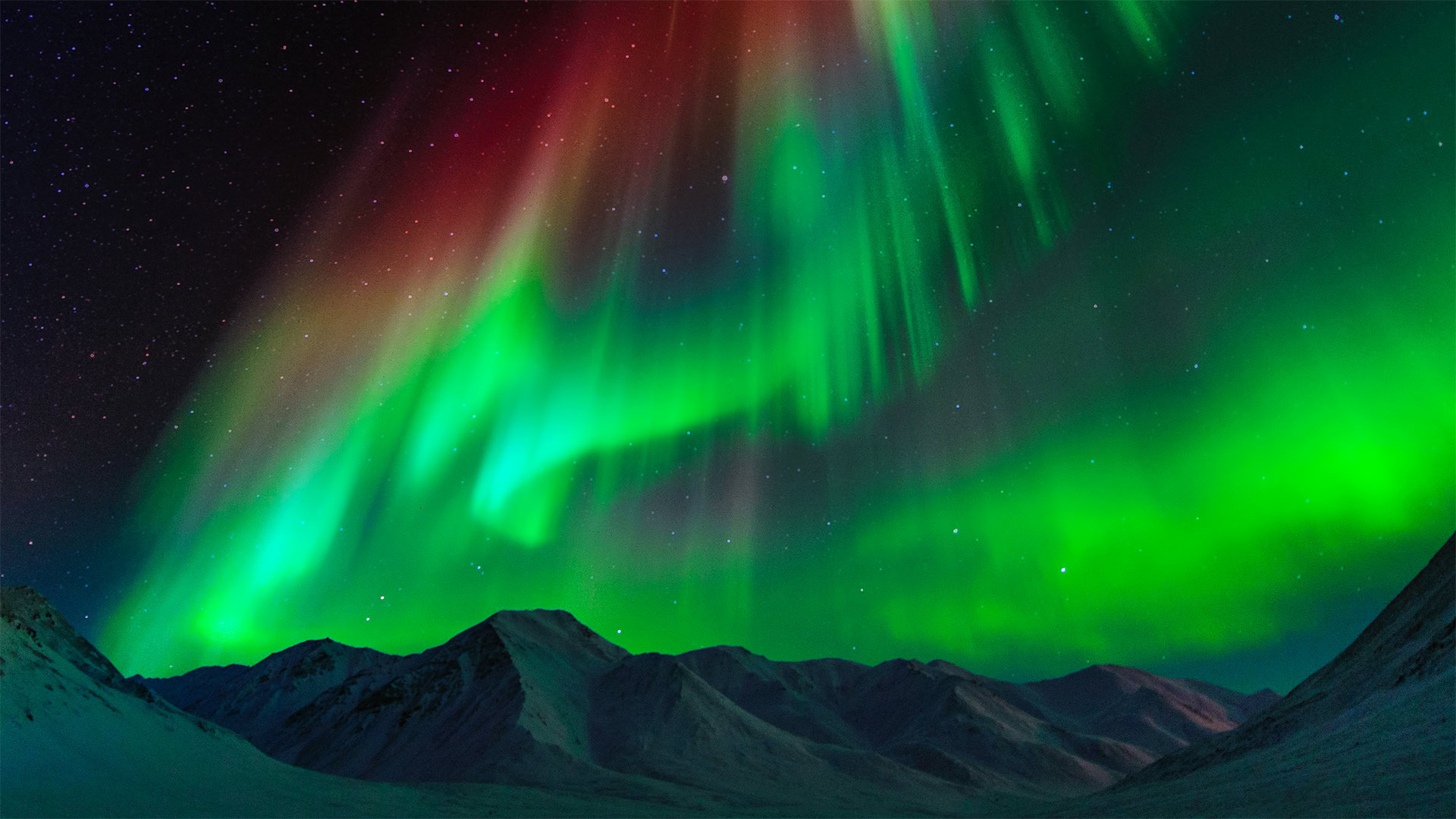
布鲁克斯山脉上空的极光,美国阿拉斯加州 Aurora borealis above the Brooks Range in Alaska (© Noppawat Tom Charoensinphon/Getty Images)
Aurora borealis
You don't have to go all the way to Alaska to see the northern lights (they've been spotted as far south as Hawaii). But based on this stunner of a photo, we recommend it. And the farther north the better: auroras are more frequent and intense the closer you are to the North Pole.
This intense aurora borealis was captured over the Brooks Range, the stretch of mountains that forms the North Slope of Alaska. Journey hundreds of lonely miles northward via the Dalton Highway and you'll descend into a vast coastal plain before finally reaching the Beaufort Sea coast, where nothing but icy water lies between you and the North Pole.
北极光
你不必一路跑到阿拉斯加去看北极光(北极光在南至夏威夷都被发现)。但是基于这张照片的惊人之处,我们推荐它。越北越好:极光越频繁,强度越大,离北极越近。
这种强烈的北极光是在布鲁克斯山脉(Brooks Range)上空拍摄的,布鲁克斯山脉是形成阿拉斯加北坡的山脉。沿着道尔顿公路向北行驶数百英里,你将进入一片广阔的海岸平原,最后到达波弗特海岸,在那里你和北极之间只有冰冷的海水。
迪纳利国家公园里的白大角羊,阿拉斯加 Dall sheep rams at Polychrome Pass, Denali National Park, Alaska (© Patrick J. Endres/Getty Images)
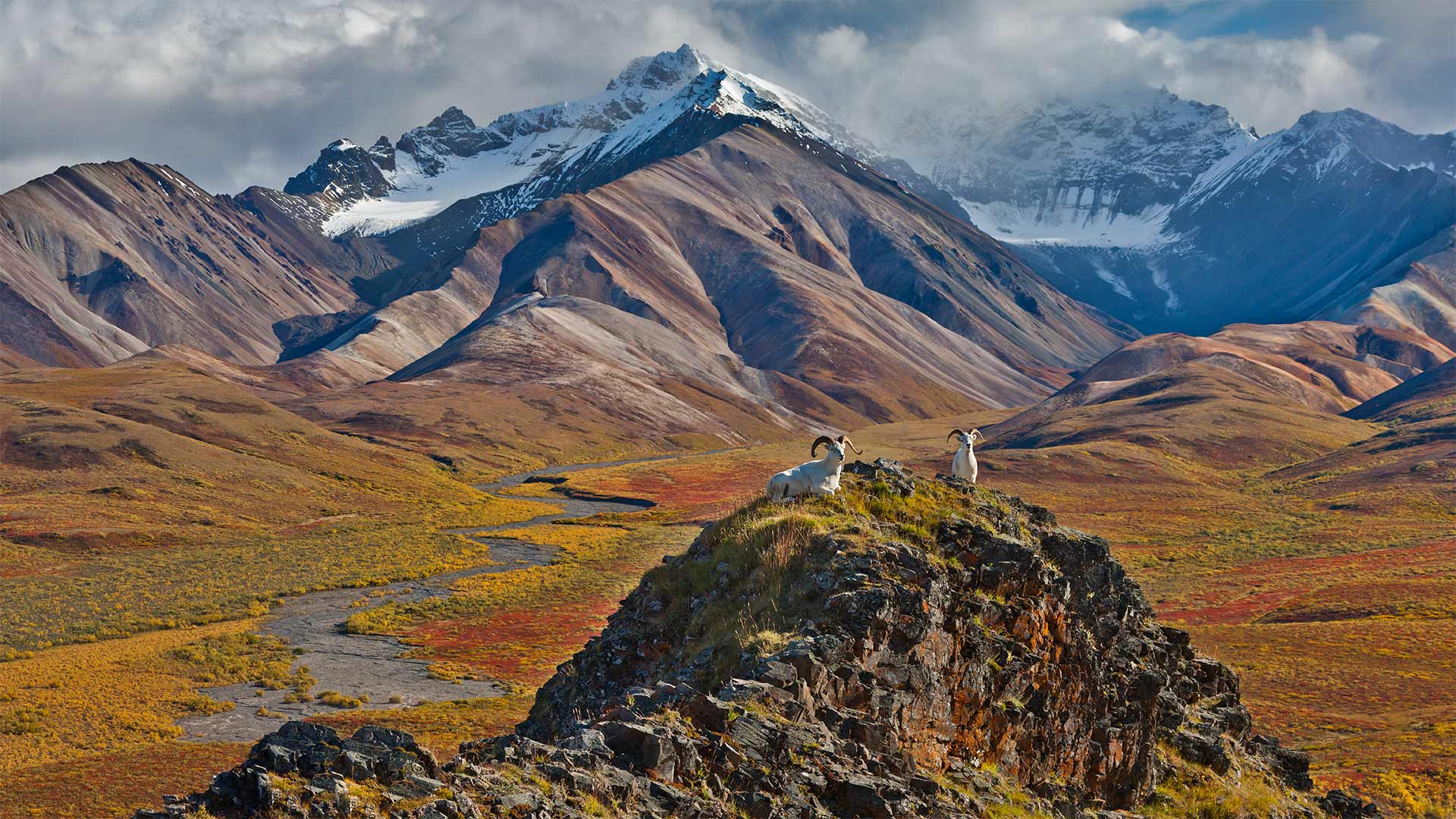
迪纳利国家公园里的白大角羊,阿拉斯加 Dall sheep rams at Polychrome Pass, Denali National Park, Alaska (© Patrick J. Endres/Getty Images)
Denali National Park
Someone ought to tell these Dall sheep they don't blend in here at Polychrome Pass. Their white coats may be great camouflage against the Alaskan snows, but the warm tones of this tundra make them stick out a bit. And they aren't the only thing sticking out in this national park: It's home to the tallest mountain in North America.
Denali National Park and Preserve encompasses not only its namesake peak but more than 6 million acres of parkland like Polychrome Pass. And even this massive park is part of something bigger: The federal Alaska National Interest Lands Conservation Act, established on December 2, 1980, protected almost a quarter-million square miles of wilderness all over Alaska. As of today, 65% of the state consists of public lands.
德纳利国家公园
应该有人告诉这些达尔羊,他们不在多色山口混在这里。他们的白色外套可能是抵御阿拉斯加大雪的绝佳伪装,但这片冻土带温暖的色调让他们显得有些突出。它们不是这个国家公园里唯一突出的东西:它是北美最高山峰的所在地。
德纳利国家公园和保护区不仅包括其同名的山峰,还包括超过600万英亩的公园,如多色山口。甚至这个巨大的公园也是更大的东西的一部分:1980年12月2日制定的《联邦阿拉斯加国家利益土地保护法》保护了阿拉斯加全境近25万平方英里的荒野。截至今天,该州65%的土地为公共土地。
北坡自治市镇的伊维沙克河,阿拉斯加州 The Ivishak River in the North Slope Borough, Alaska (© Don Paulson/Danita Delimont)
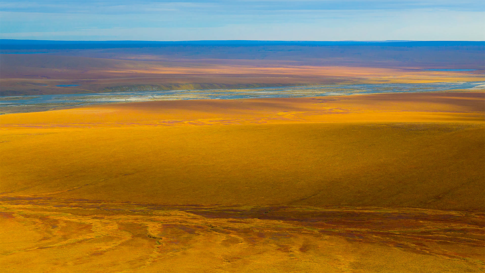
北坡自治市镇的伊维沙克河,阿拉斯加州 The Ivishak River in the North Slope Borough, Alaska (© Don Paulson/Danita Delimont)
A river on the tundra
This mesmerizing expanse captures a small stretch of the 95-mile-long Ivishak River in northern Alaska. The Ivishak flows in the Philip Smith Mountains and the foothills of the Arctic National Wildlife Refuge. The entire run of the river is in a region called the North Slope Borough, Alaska's northernmost borough (Alaska is divided into boroughs, not counties). Look at the magnificent colors and textures this photo captures—it's a view that's preserved and protected by the Wild and Scenic Rivers Act.
The act was signed into law on October 2, 1968. The main purpose of the bill was to identify 'certain selected rivers of the [US] which, with their immediate environments, possess outstandingly remarkable scenic, recreational, geologic, fish and wildlife, historic, cultural or other similar values, shall be preserved in free-flowing condition…' Sure, we could have summed it up for you, but instead quoted the exact text from the Wild and Scenic Rivers Act to show how all-encompassing the intent of the protection is.
冻土带上的河流
这片迷人的广袤土地捕捉到了阿拉斯加北部95英里长的伊维沙克河的一小段。Ivishak河流经菲利普史密斯山脉和北极国家野生动物保护区的山麓。整条河流都在一个叫做北坡区(North Slope Bourough)的区域内,这是阿拉斯加最北端的一个自治区(阿拉斯加分为自治区,而不是县)。看看这张照片捕捉到的壮丽色彩和纹理,这是一幅受《野生和风景河流法》保护的风景画。
该法案于1968年10月2日签署成为法律。该法案的主要目的是确定“某些选定的[美国]河流及其周围环境,具有显著的风景、娱乐、地质、鱼类和野生动物、历史、文化或其他类似价值,应在自由流动的条件下予以保护……”当然,我们可以为您总结一下,而是引用了《野生和风景河流法》的确切文本,以表明保护的意图是多么全面。
德纳利国家公园和自然保护区的驯鹿,阿拉斯加 Caribou in Denali National Park and Preserve, Alaska (© Design Pics/Danita Delimont)
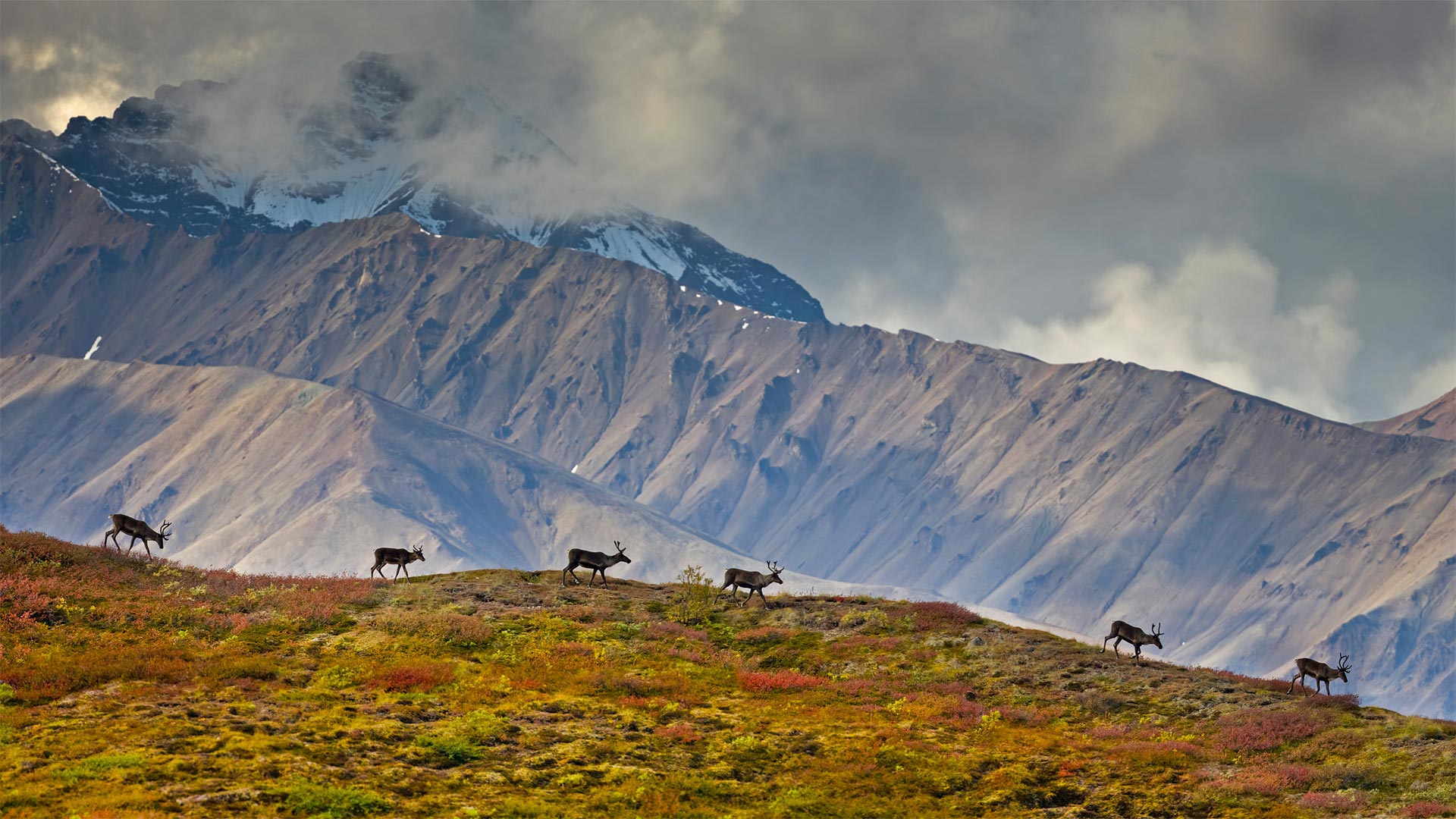
德纳利国家公园和自然保护区的驯鹿,阿拉斯加 Caribou in Denali National Park and Preserve, Alaska (© Design Pics/Danita Delimont)
The call of the wild in Alaska
Most visitors to Denali National Park and Preserve in Alaska come with a checklist for the 'big five' mammals that live here: Grizzly bears, moose, wolves, Dall sheep, and caribou like this small group walking along a ridge. These are barren-ground caribou, a migratory subspecies of caribou found across the arctic band of North America to western Greenland. Barren-ground caribou migrate in large herds, some traveling over 600 miles one way, between their summer and winter ranges. But the Denali herd, today which numbers around 3,000 animals, generally stay on the park's 6 million acres. For good reason, too—they're the only large herd that aren't hunted.
阿拉斯加野性的呼唤
大多数到德纳利国家公园和阿拉斯加自然保护区的游客都会带上一份居住在这里的“五大”哺乳动物的清单:灰熊、驼鹿、狼、大头羊和驯鹿,就像这一小群沿着山脊行走的动物一样。这些是贫瘠的地面驯鹿,驯鹿的一个迁徙亚种,发现于北美洲北极带到格陵兰岛西部。贫瘠的地面驯鹿成群结队地迁徙,有些驯鹿在夏季和冬季之间单程旅行600英里。但如今的德纳利兽群大约有3000头,它们一般都生活在公园的600万英亩土地上。也有很好的理由,它们是唯一没有被猎杀的大型兽群。
基奈峡湾国家公园的尖顶湾,阿拉斯加 Cove of Spires in Kenai Fjords National Park, Alaska (© Sekar B/Shutterstock)
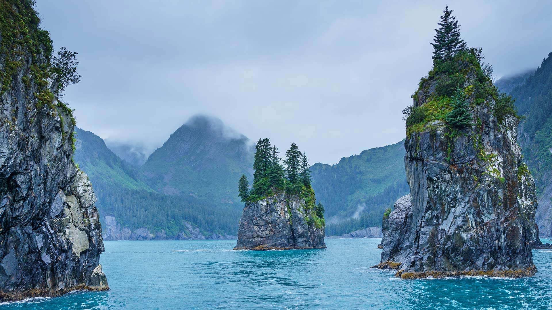
基奈峡湾国家公园的尖顶湾,阿拉斯加 Cove of Spires in Kenai Fjords National Park, Alaska (© Sekar B/Shutterstock)
Protecting Alaska
On this day in 1980, President Jimmy Carter signed into law the Alaska National Interest Lands Conservation Act, which converted massive tracts of Alaskan wilderness into protected land. That single act 40 years ago doubled the size of the entire national park system. Alaska's eight national parks cover more than 54 million acres. The Cove of Spires, shown here, is just one of the dramatic glacial landscapes that you can experience in Kenai Fjords National Park. Located near Seward, Alaska, the park is home to 38 glaciers which cover over half the park's area in ice—though climate change has reduced that drastically over the last decades.
秋季迁徙时正在游过科伯克河的驯鹿,阿拉斯加 Caribou swimming across Alaska's Kobuk River during fall migration (© Michio Hoshino/Minden Pictures)
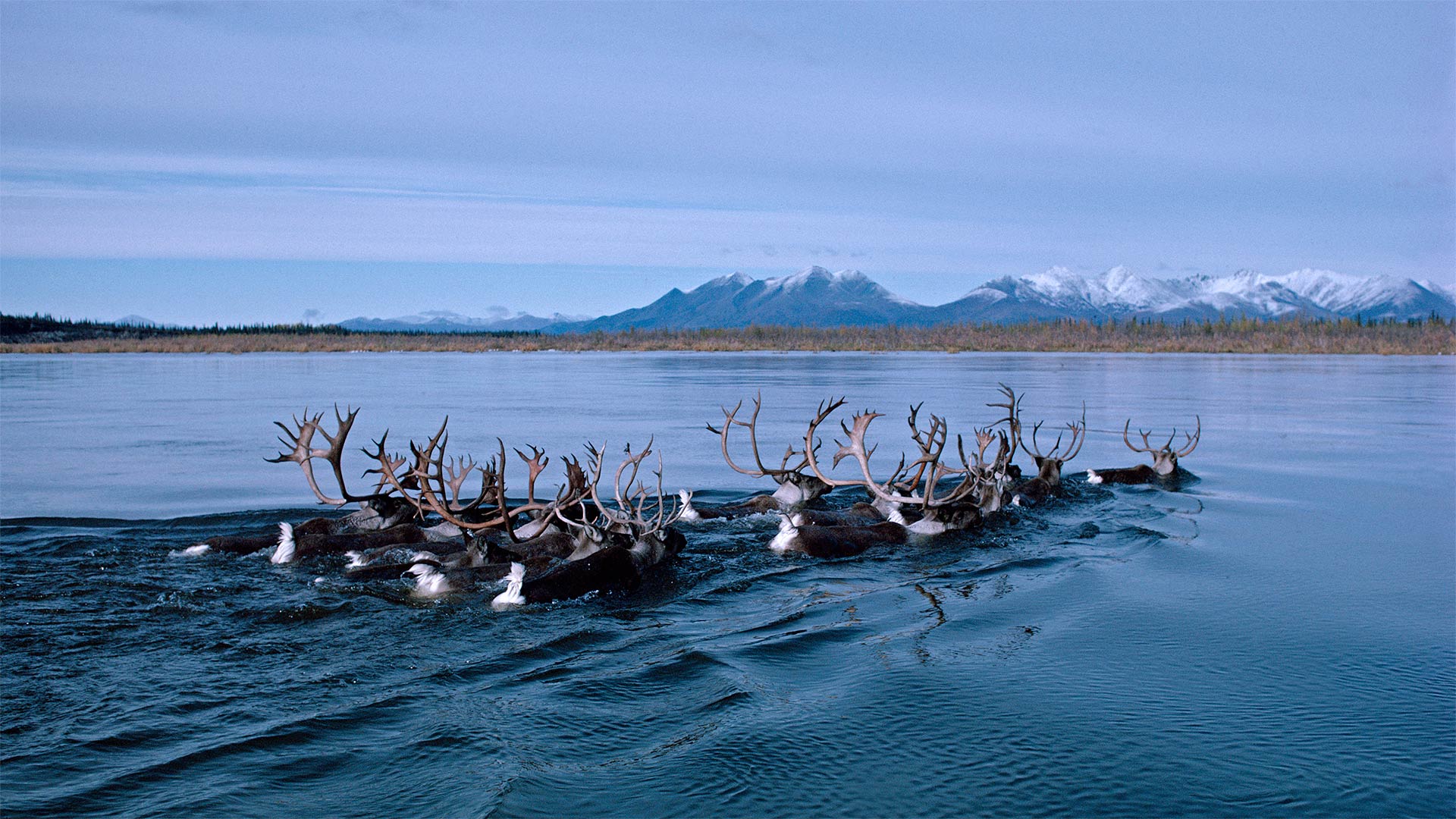
秋季迁徙时正在游过科伯克河的驯鹿,阿拉斯加 Caribou swimming across Alaska's Kobuk River during fall migration (© Michio Hoshino/Minden Pictures)
Caribou on the move
Each fall a quarter million caribou come together to form the Western Arctic Caribou Herd, a group that makes an epic migration through northwest Alaska. In great numbers they move south from their calving grounds in the Utukok River Uplands to their winter range on the Seward Peninsula. Fall is also the time when scientists attach radio collars to members of the herd, to track their location and health, and to gain information that will help conserve the species. When spring arrives, they'll complete the trip again in reverse, covering a total of 2,000 miles each year, give or take.
One of the best spots to see the herd on the move is where the great masses of animals cross this river, the Kobuk, at Onion Portage. The name of the portage derives from an Inupiaq (Inuit) word meaning 'wild onions' for the many wild onions that grow here. But the native Inuit people don't come here just to forage for onions. For millennia, the caribou crossing has drawn native peoples who rely on caribou meat, a tradition that continues to this day.
锡特卡的港口,阿拉斯加 View of the harbor in Sitka, Alaska (© Blaine Harrington III/Alamy)
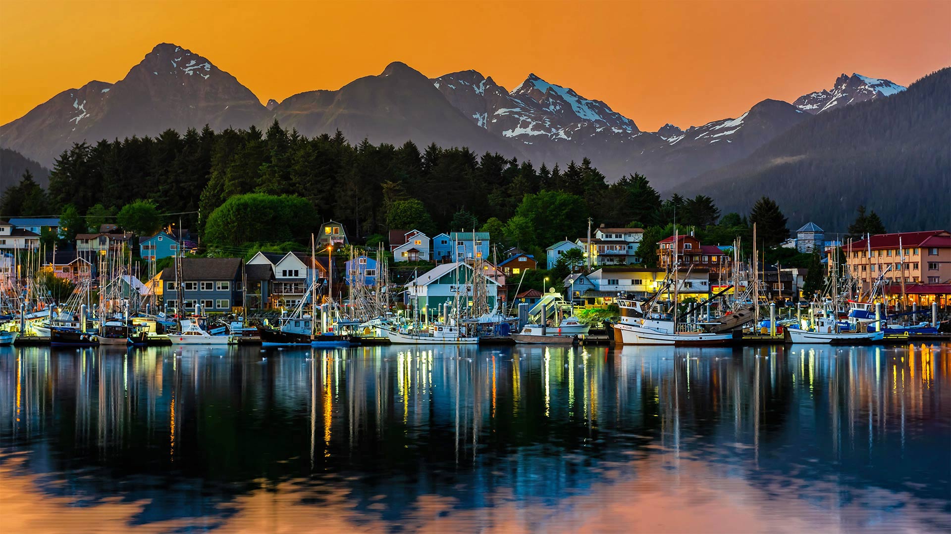
锡特卡的港口,阿拉斯加 View of the harbor in Sitka, Alaska (© Blaine Harrington III/Alamy)
Sitka shines on Alaska Day
In honor of Alaska Day, we're in the harbor of Sitka, Alaska, the former capital of Russian America in the early 19th century, when it was called Novo-Arkhangelsk. It was here on this day in 1867 that officials of the Russian Empire formally transferred the Territory of Alaska to the United States in a sale for $7.2 million, or just around 2 cents per acre. It seems an astonishingly small price today, but at the time, opponents called it 'Seward's Folly' after then-Secretary of State William H. Seward, who negotiated the deal. Few Americans moved to the 'Last Frontier' at first, but in the 1890s, when gold was discovered in the Yukon and Alaska, a rush of prospectors and others began a wave of settlers in the territory. Ever since, Alaska, with its vast natural resources and staggering beauty, has been a prized American domain and an enduring symbol of American wilderness.
北太平洋弗雷德里克海峡中的座头鲸冲出海面,阿拉斯加 North Pacific humpback whale breaching in Frederick Sound, Alaska (© Tony Wu/Minden Pictures)
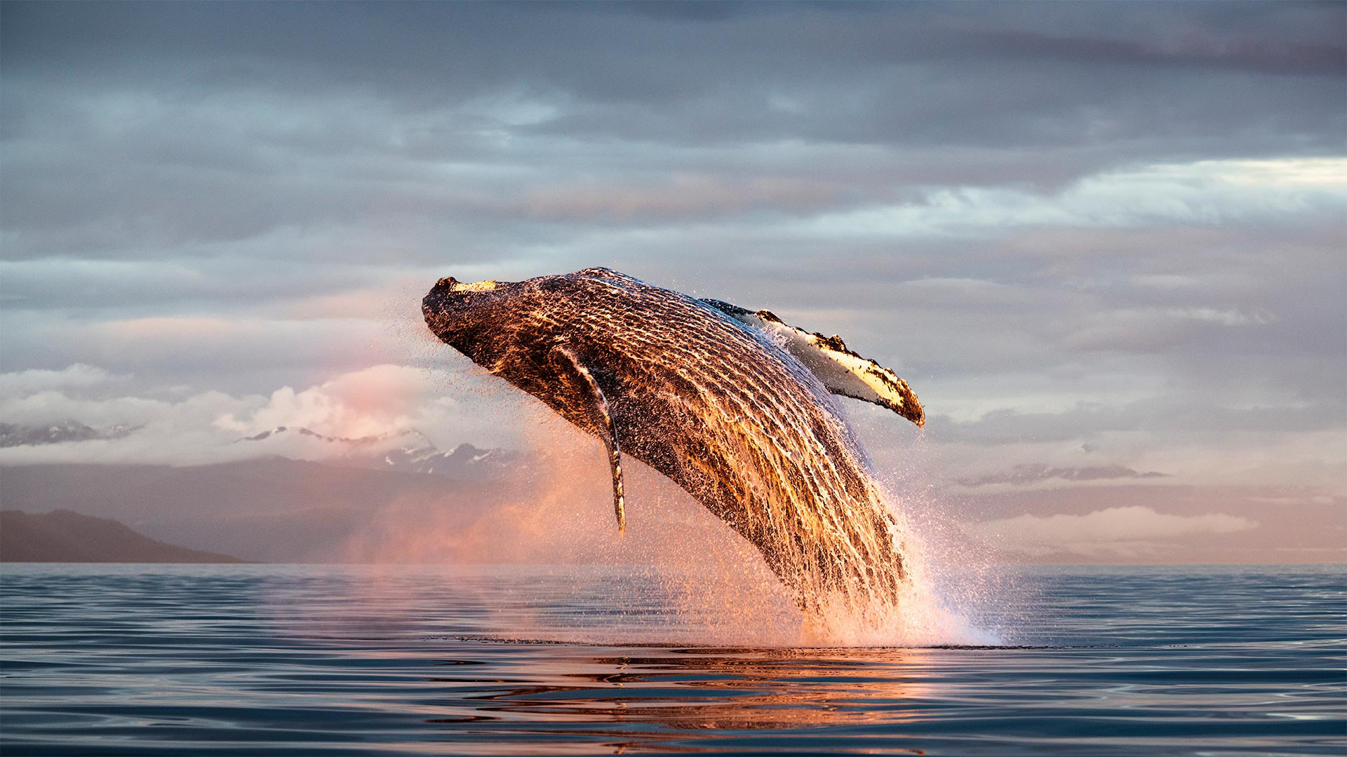
北太平洋弗雷德里克海峡中的座头鲸冲出海面,阿拉斯加 North Pacific humpback whale breaching in Frederick Sound, Alaska (© Tony Wu/Minden Pictures)
Summertime in Alaska
Humpback whales are famous for breaching—leaping out of the water in a spectacular display of size and power. Even though they can weigh more than a house and stretch to 50 feet in length, they still manage aquatic acrobatics that are amazing to behold, as the picture on our homepage captures so beautifully. Scientists don't know why some whales breach but speculate it's a form of communication or a mating display. Or maybe they're just having fun.
Our homepage image comes from Frederick Sound in Southeast Alaska, one of the best places to see humpbacks in July. The whales return to the area in summer to dine on krill, herring, and other delicacies in the cool waters. But as fall approaches, they'll start their long journey south to spend the winter in tropical environs, as would any sensible mammal with the means to travel.
Exit Glacier at Kenai Fjords National Park in Alaska (© Nathaniel Gonzales/Alamy)
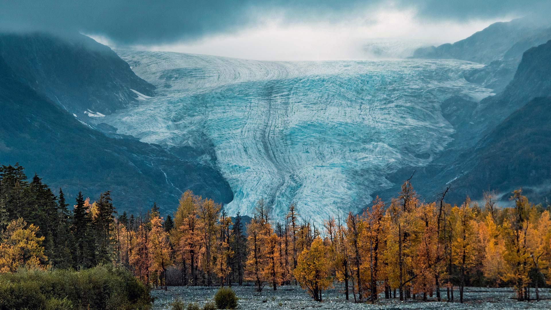
Exit Glacier at Kenai Fjords National Park in Alaska (© Nathaniel Gonzales/Alamy)
Wild and beautiful Alaska
In honor of Alaska National Parks Day, we're traveling to Kenai Fjords National Park—home of the awe-inspiring Exit Glacier seen here. The park sits at the edge of the North Pacific Ocean where frequent winter storms dump the snow that feeds this land of ice. The Harding Icefield crowns the park with at least 38 flowing glaciers—one of which is Exit Glacier. Exit Glacier is known for being one of the most-visited of Alaska's glaciers, likely because it’s accessible via the Seward Highway. In mid-November, the road to the glacier closes due to heavy snowfall, so visitors can only get there via snow-friendly transportation like dogsled or cross-country skis.
Kenai Fjords is just one of Alaska's eight national parks, which together boast the nation’s largest glacial system, incredible wildlife viewing, and North America’s tallest peak. These parks exist in part because of the Alaska National Interest Lands Conservation Act, which President Jimmy Carter signed into law on this day in 1980. It converted massive tracts of Alaskan wilderness into protected land, doubling the amount of national park land in the state. For that, we are grateful. Alaska may be cold, but it sure is beautiful and worth protecting.