2019年7月
Waterperry花园,英国牛津郡 Waterperry Gardens in Oxfordshire, England (© Lauren Hibbit/Danita Delimont)
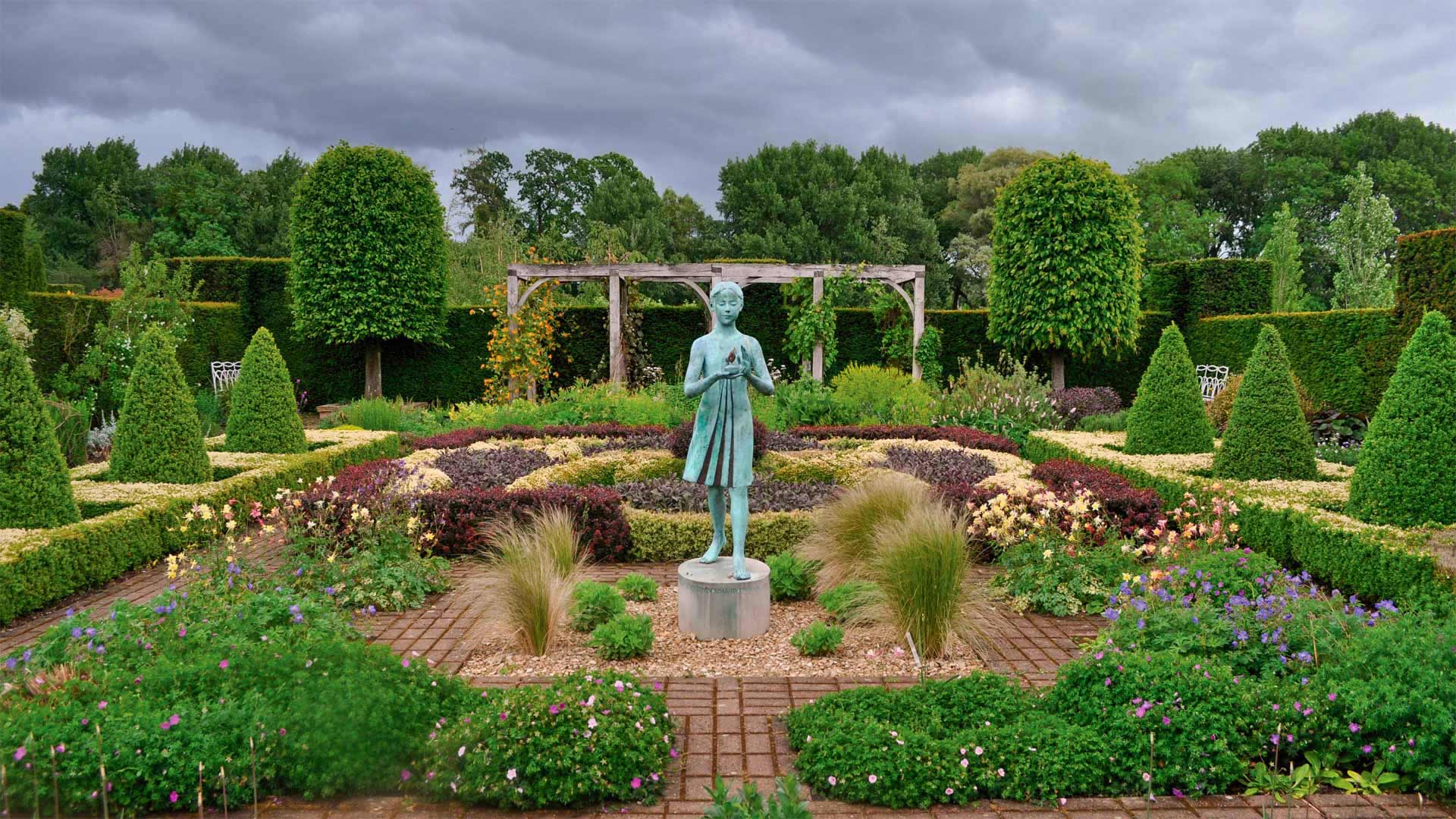
Waterperry花园,英国牛津郡 Waterperry Gardens in Oxfordshire, England (© Lauren Hibbit/Danita Delimont)
A learning garden
Today we're in Waterperry Gardens in Oxfordshire, England. The gardens have gone through many changes since 1931, when Beatrix Havergal and Avice Sanders first began turning the grounds of a country house into an educational public garden. (Waterperry grew much-needed produce during World War II.) The gardening school at Waterperry closed in 1971, and now the land is owned and operated by the School of Economic Science, which uses some of the buildings for study projects and retreats. Waterperry is a wonderful example of classic English gardening. Visitors can stroll through the aromatic ‘knot garden' seen on our homepage today, or explore other parts of the gardens, including orchards, a nursery, and a museum.
夜晚的地球 (© NASA)

"国王的小路"上的游客,西班牙马拉加 Visitors on El Caminito del Rey in the province of Málaga, Spain (© Ken Welsh/Alamy)
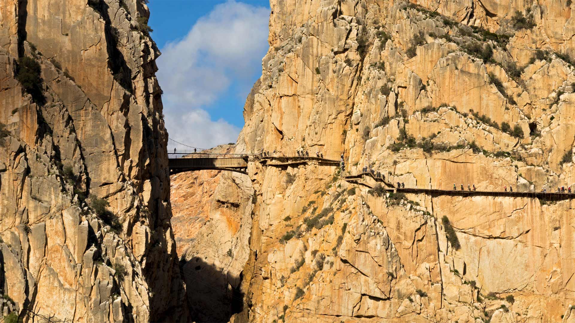
"国王的小路"上的游客,西班牙马拉加 Visitors on El Caminito del Rey in the province of Málaga, Spain (© Ken Welsh/Alamy)
Put your helmet on, we're going on a hike
You'll need to wear a safety helmet before stepping onto the cliff-hanging path that passes above the Gorge of Gaitanes. Look around, but don't forget to look down whenever the floors are replaced with thick glass. This is your opportunity to fully appreciate the 325-foot drop below and consider what life must be like as a mountain goat. The renovated path is far less dangerous than the original which, for many years, had no guard rails. Made for workers back in 1905, the first walkway provided access between the Chorro and Gaitanejo hydroelectric power plants. After King Alfonso XIII visited in 1921, the walkway was given its nickname, ‘The King's Little Pathway.' But after years of use and lack of upkeep, the nickname was updated to ‘The world's most dangerous walkway.' By 2001, the trail was closed, riddled with gaping holes, crumbling cement, and missing entire sections. Luckily for thrill seekers, El Caminito del Rey is no longer off limits. In 2015, after extensive renovations, o
舍夫沙万的蓝色墙壁,摩洛哥 Blue walls of Chefchaouen, Morocco (© Tatsuya Ohinata/Getty Images)
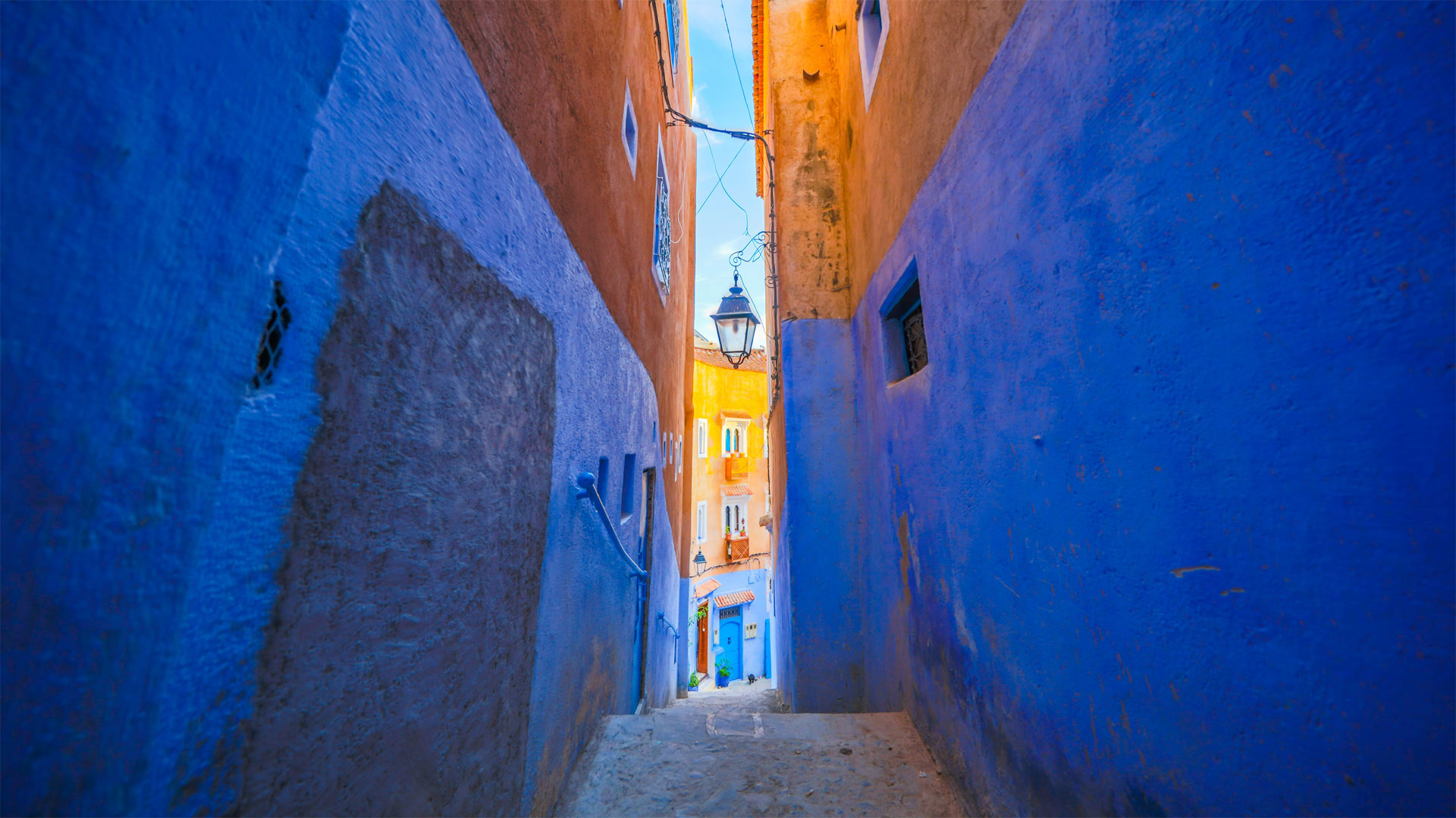
舍夫沙万的蓝色墙壁,摩洛哥 Blue walls of Chefchaouen, Morocco (© Tatsuya Ohinata/Getty Images)
Make your way up a picturesque passageway of Chefchaouen
You may not be familiar with the name Chefchaouen but its blue beauty is immediately recognizable. Nestled against the Rif Mountains, the city is well-known for the medieval walls washed in a hue that mimics the sky on a summer day. There are many theories as to why the walls are this color—some suggest it was thought to repel mosquitos; others say it follows religious beliefs that associate blue with heaven. No matter the reason, the blue creates photogenic passageways, one of which we are admiring here. As you wander through the city, you'll find the market filled with handmade textiles and other colorful local goods. The locals are mostly Berber, Jewish, and Muslim people who are famously friendly and laid back. Chefchaouen is also brimming with aromatic cuisine that draws visitors from their explorations to the many popular bakeries and restaurants.
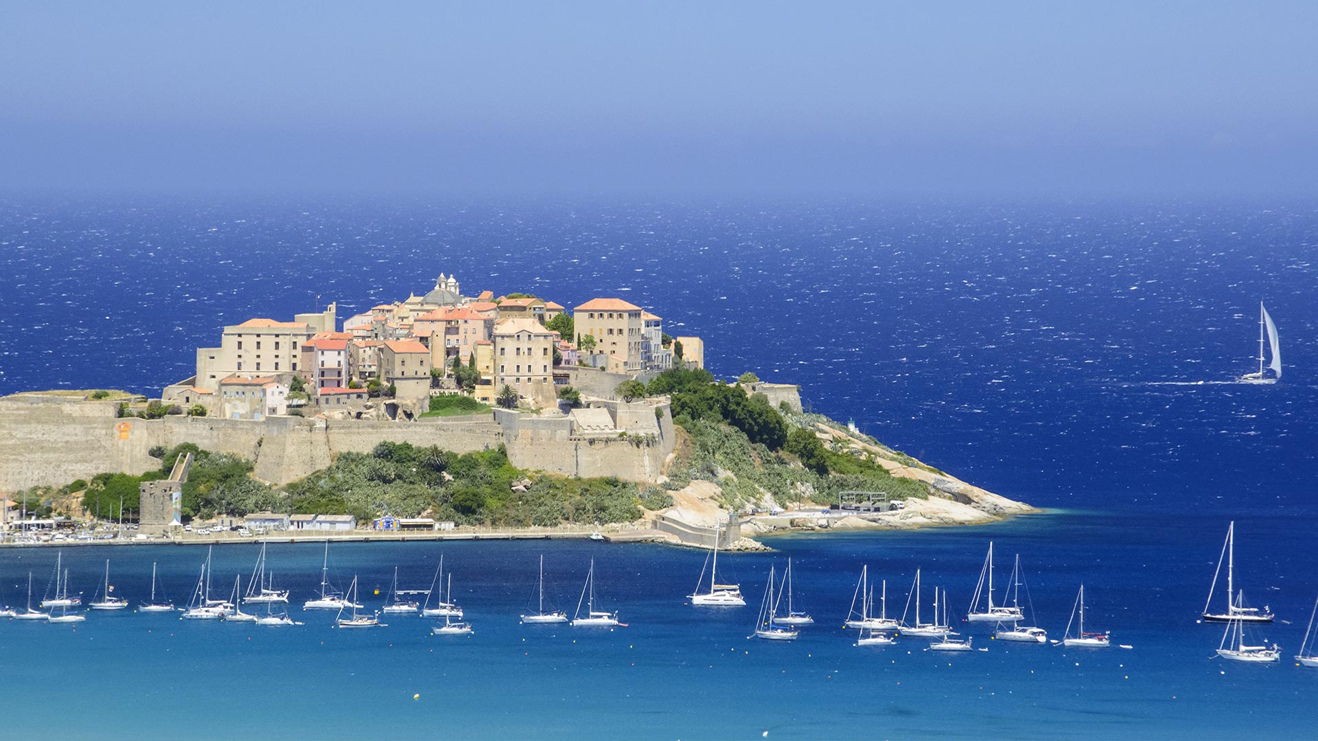
巴拉涅卡尔维湾的城堡和要塞,法国科西嘉岛 (© Siephoto/Masterfile)
Peloton during the 2018 Tour de France in Valence, France © Justin Setterfield/Getty Images
Peloton during the 2018 Tour de France in Valence, France © Justin Setterfield/Getty Images
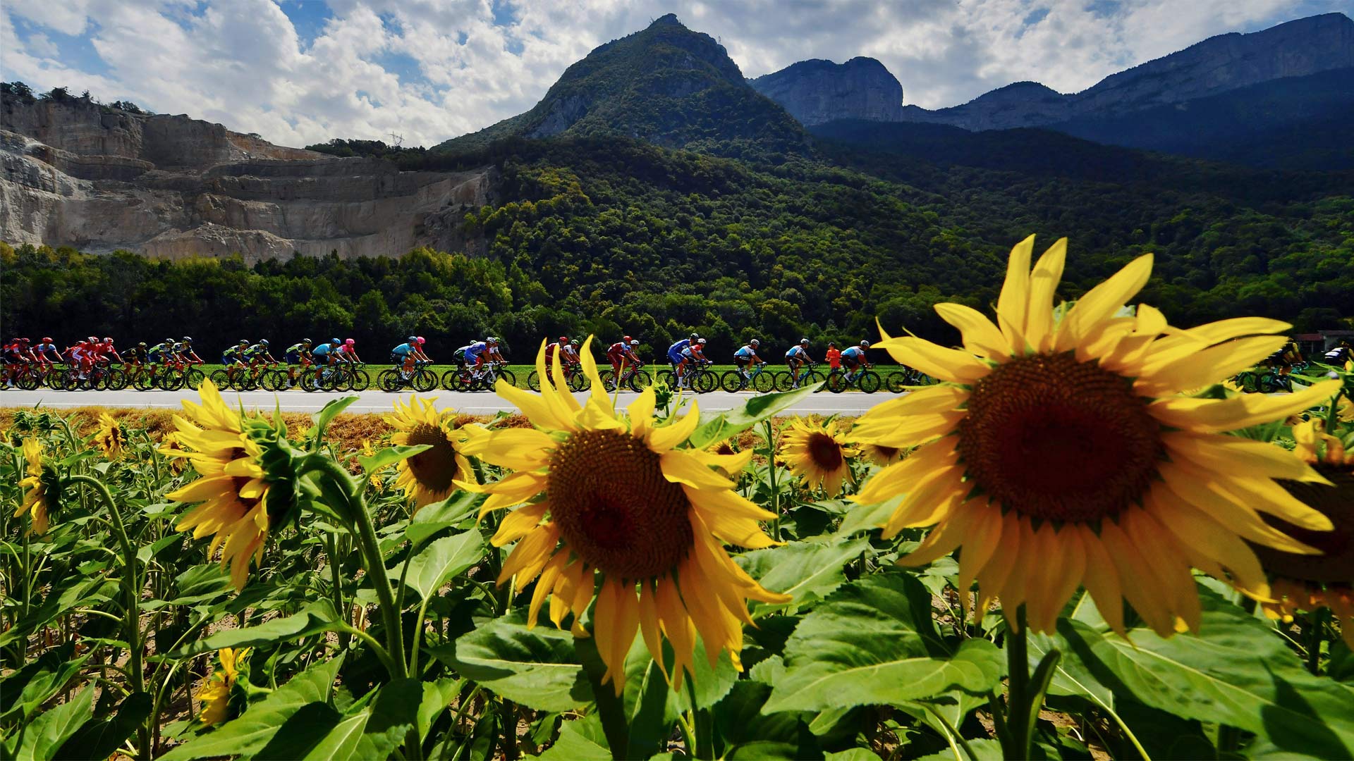
Racers pushing past sunflowers in the 2018 Tour de France
Cyclists have been competing in this prestigious, multi-stage race since 1903. The route is changed every year but always includes a mix of terrains and elevations, mostly in France. Originally conceived as a promotion for a newspaper, the Tour is now a worldwide sporting event that draws billions of viewers each year, making it more popular than the Super Bowl. Here, competitors are biking alongside the summertime sunflowers of southern France that are in full bloom during the race each year. This scenic image is a foil to the grueling duration of the race, which covers more than 2,000 miles over a 23-day span. Although athletes are organized into teams, the individual who completes the strenuous course in the overall shortest amount of time wins and gets a cash prize often shared with teammates. This year's race starts in Belgium and will pedal past the iconic sunflowers around stage 16 before coming to a stop in Paris.
圣帕特里克岛上的皮尔城堡,马恩岛 Peel Castle on St Patrick’s Isle, Isle of Man (© Massimo Ripani/SIME/eStock Photo)
圣帕特里克岛上的皮尔城堡,马恩岛 Peel Castle on St Patrick's Isle, Isle of Man (© Massimo Ripani/SIME/eStock Photo)
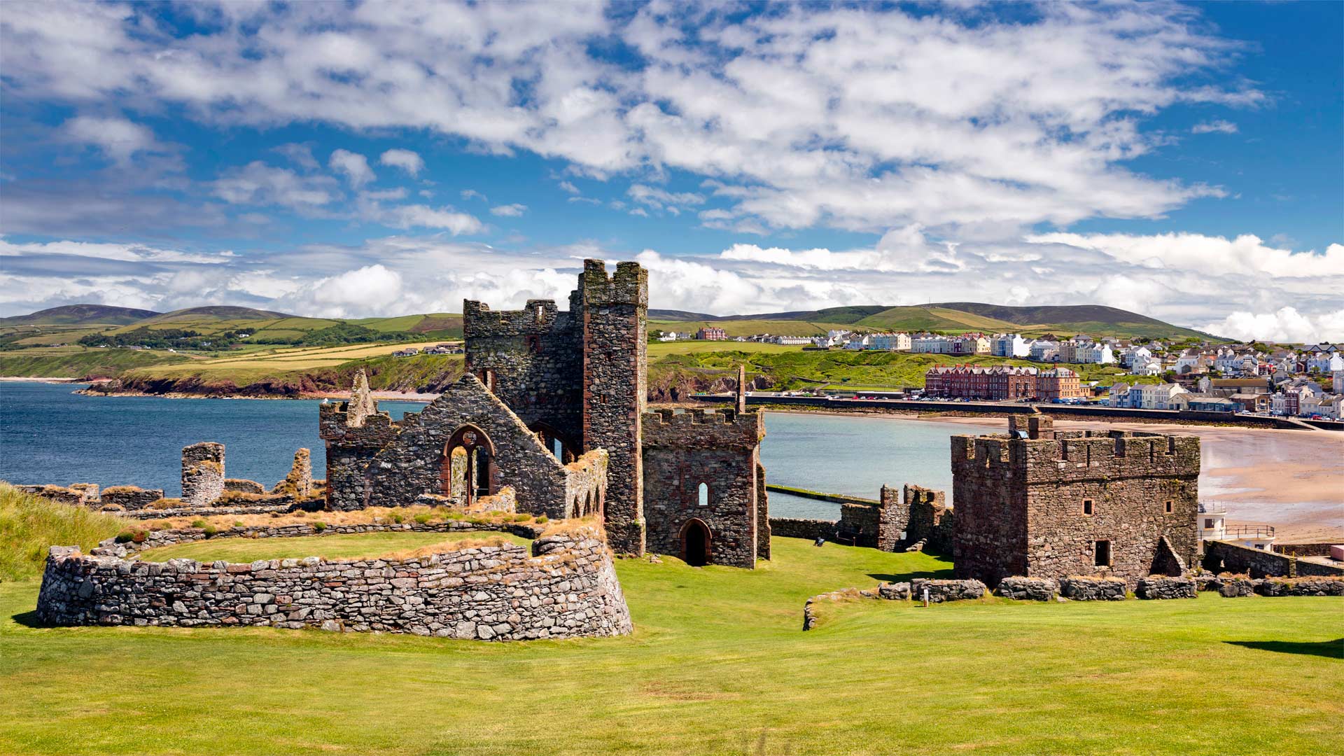
Peel Castle on St. Patrick's Isle with the Isle of Man in the background
The Isle of Man has a long and complicated history of invasions, conquests, and systems of government. Pictured on today's homepage is the ruins of the cathedral on the grounds of Peel Castle, on St. Patrick's Isle (which is connected by a causeway to the rest of the island). Vikings built the original wooden fortification during the 11th century on a location that had older Celtic monastic structures made of stone, which were incorporated into the castle. Over the next eight centuries, the various Norse, Scottish, and English rulers of the area added battlements, towers, and the cathedral to the grounds.
After the Vikings incorporated the Isle of Man into their Kingdom of the Isles in the 9th century, they also brought their particular tradition of parliamentary government to the island. This tradition survives today as the Tynwald, the island's tricameral parliament. Purportedly the oldest continuous parliament in the world, the Tynwald gathers outside on a special four-tiered hill every Tynwald Day—usually July 5—to promulgate the laws that have been passed in the last year.
德文郡南海岸的索尔科姆港,英国 Salcombe Harbour on the south coast of Devon, England (© Devon and Cornwall Photography/Getty Images)
德文郡南海岸的索尔科姆港,英国 Salcombe Harbour on the south coast of Devon, England (© Devon and Cornwall Photography/Getty Images)
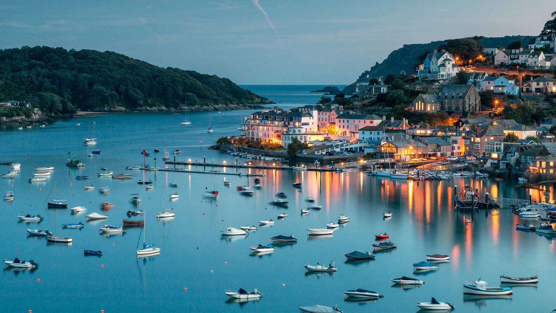
Sandcastles and sailing boats
Now here's a location to add to your bucket (and spade) list. Tucked away on the south coast of Devon, Salcombe is one of England's iconic seaside towns, renowned for its picture-postcard harbour, sun-soaked beaches, rolling hills and breathtaking coastal views. With its estuary location, Salcombe is also a paradise for water sports and famous sailing destination. If you want to keep your feet dry, there are plenty of independent shops to browse and beachside cafes to visit, where you can sit back and relax with a delightful Devon cream tea, a speciality in this part of the world. At this time of year, the town's atmosphere is buzzing as the winter population of about 2,000 swells to more than 10 times that amount in summer months, when tourists flock here for the fairs, regattas and festivals. You might even spot a famous face or two – Salcombe's celebrity residents include the likes of Kate Bush and members of Led Zeppelin.
特兰西瓦尼亚的川斯发格拉山公路,罗马尼亚 The Transfăgărășan in Transylvania, Romania (© Calin Stan/Shutterstock)
特兰西瓦尼亚的川斯发格拉山公路,罗马尼亚 The Transfăgărășan in Transylvania, Romania (© Calin Stan/Shutterstock)
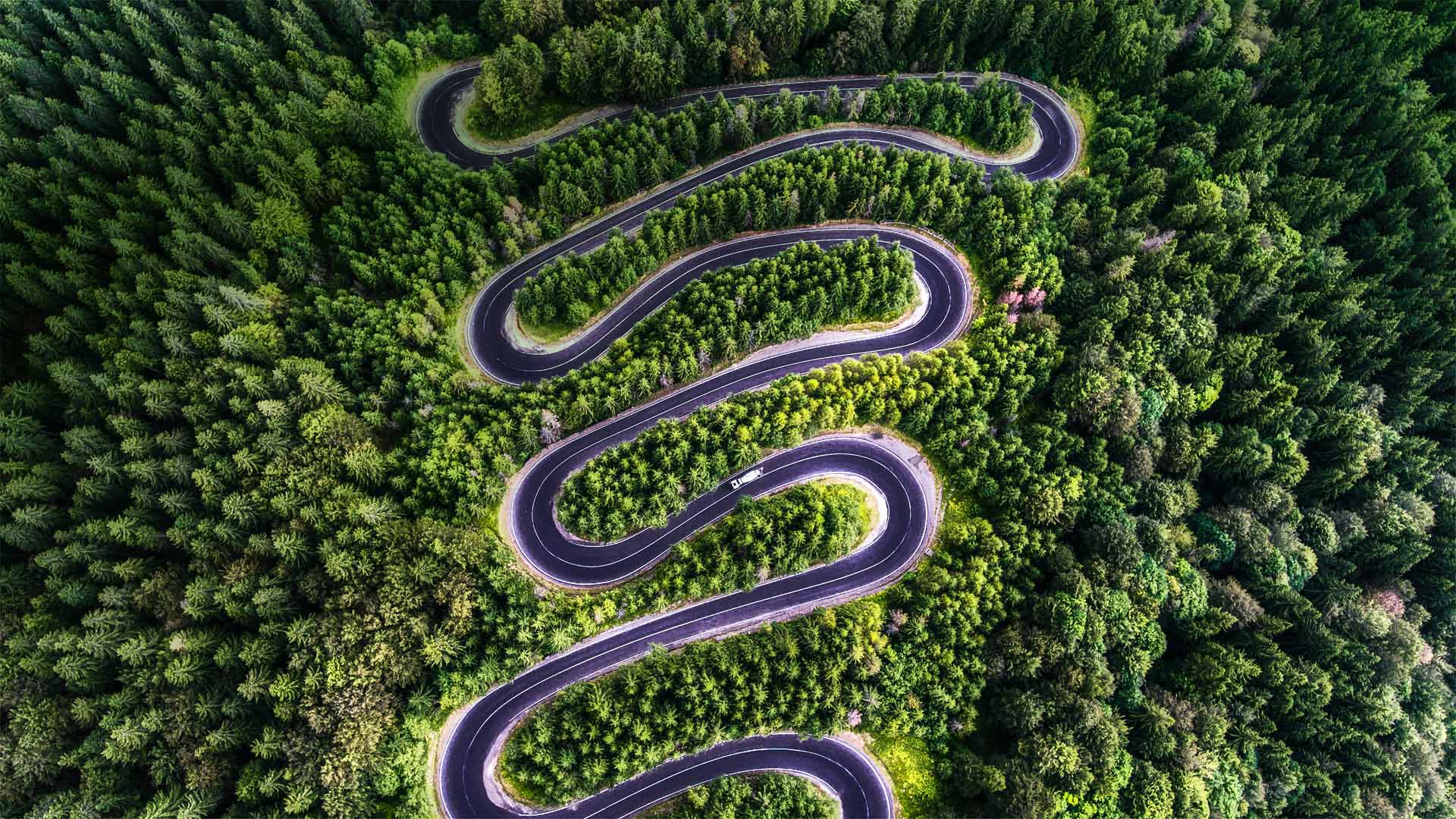
Keep calm and drive on (slowly)
The Transfăgărășan in Romania is open for business. Also known as the DN7 highway, the road cuts through the Fagaras Mountains, offering stunning views of waterfalls, glacial lakes, and lush valleys—plus steep drop-offs and hairpin turns to amp up the drama. Back in 2009, Jeremy Clarkson, co-host of the British TV show 'Top Gear,' called this twisty route the 'best road in the world,' which helped turn it into a major tourist draw. The Transfăgărășan reaches elevations just shy of 6,700 feet and has more tunnels and viaducts in its 55 miles than any other road in this mountainous country. But proceed with caution. The speed limit is a sensible 25 mph. And watch out for herds of sheep that use it as a path to greener pastures, and don't mind blocking traffic as they amble there.
2017年8月21日的一组日食镜头 Solar eclipse sequence from August 21, 2017 (© Lindsay Daniels/Tandem Stills + Motion)

2017年8月21日的一组日食镜头 Solar eclipse sequence from August 21, 2017 (© Lindsay Daniels/Tandem Stills + Motion)
Sequential images of a total solar eclipse
A total solar eclipse is visible today across northern Chile and Argentina. To those lucky observers in South America, this awesome event will look much as it does in our homepage image today, which is a composite of images taken during the Great American Eclipse of 2018.
Just how does the moon perfectly blot out the sun? Through an amazing coincidence, the sun is both 400 times larger than the moon, and also 400 times further away. Therefore, periodically, when the sun, moon, and Earth are aligned just right, the moon can perfectly obscure the sun as seen from the surface of Earth in a total eclipse. But, unlike the sun, the moon is not a smooth sphere; therefore, in the last few moments before the eclipse reaches totality, we see Baily's Beads. In 1836, English astronomer Francis Baily was the first to explain that the phenomenon is created by sunlight passing between the mountains and through the canyons of the moon. Some folks also refer to it as the diamond ring effect. But whatever you call it, it's undeniably brilliant.