初雪与最后的秋色相会,日本 Early season snowfall meets the last of the autumn colors, Japan (© SpontaneousPictures/iStock/Getty Images Plus)
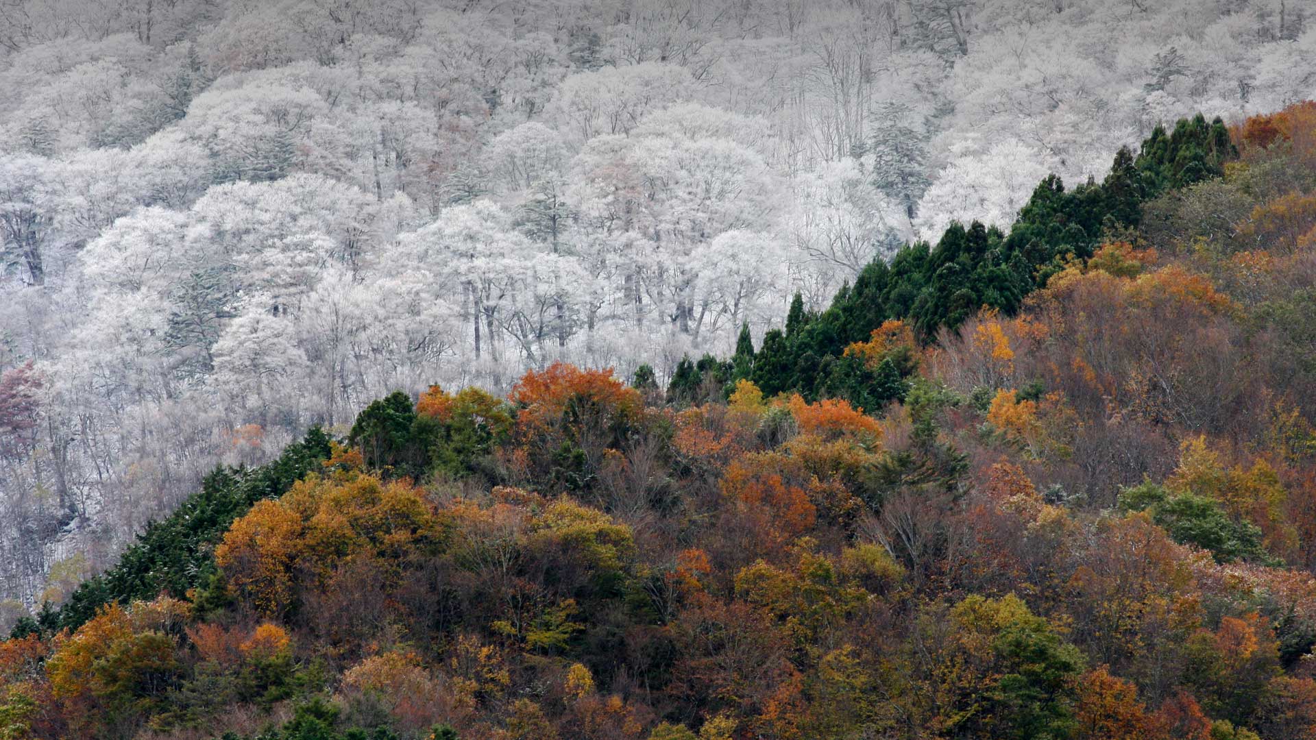
初雪与最后的秋色相会,日本 Early season snowfall meets the last of the autumn colors, Japan (© SpontaneousPictures/iStock/Getty Images Plus)
"Snow and autumn leaves" Tokushima
Today is “Koyuki”. On the calendar, it is said that it is slightly snowing. It's still autumn, but it's getting colder in the morning and feeling the coming of winter ...
This is the mountain landscape of Tokushima. The snow in the far peak is thin, contrasting with the autumn leaves remaining in the foreground. In Tokushima Prefecture, you can enjoy abundant mountain peaks and beautiful autumn leaves that color the Sanuki Mountains that extend to the border with Kagawa Prefecture and the Kenzan Mountains with coniferous forests.
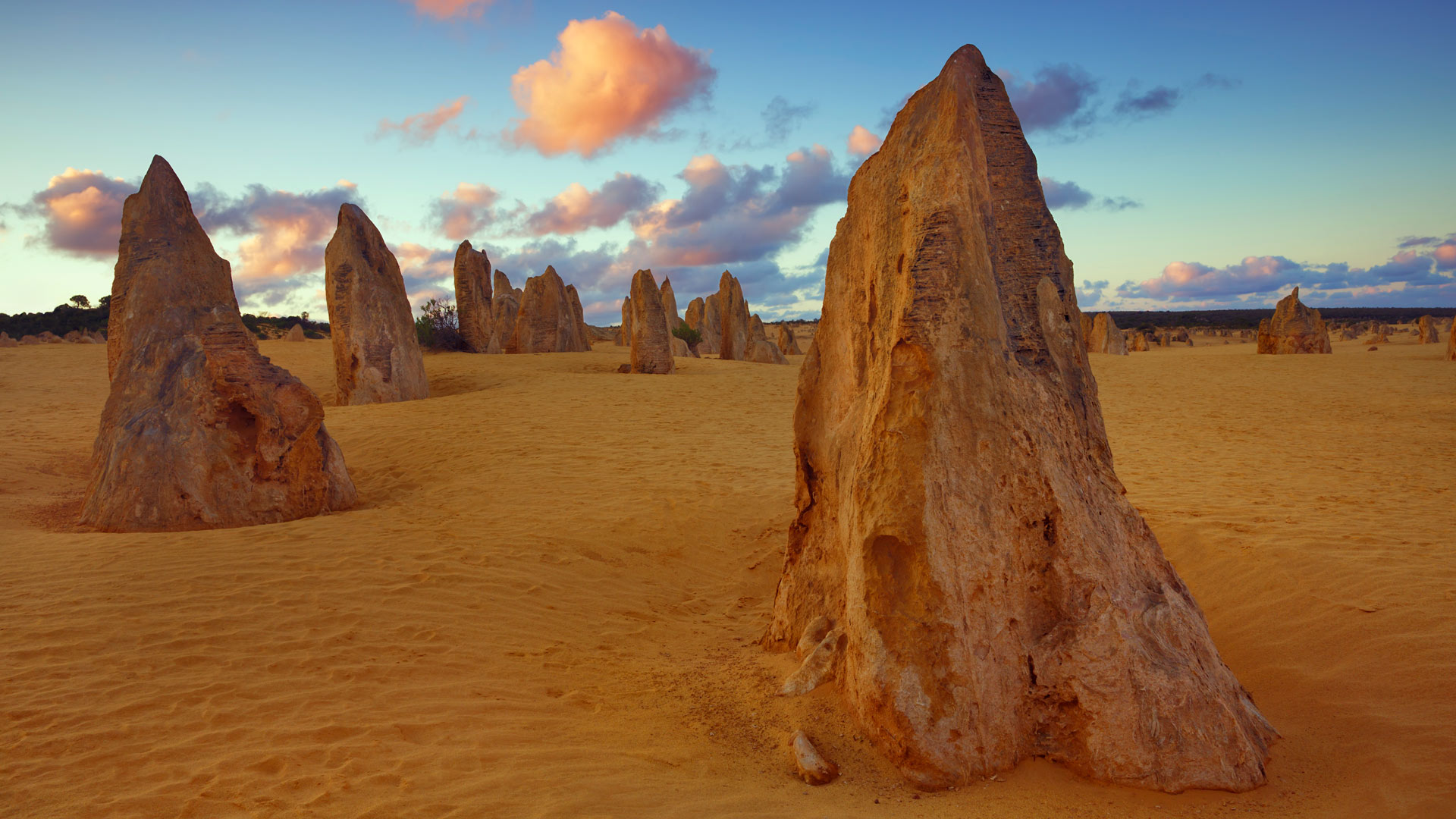
南邦国家公园的尖峰石阵,西澳大利亚州 (© Frank Krahmer/Getty Images Plus)
安大略省的圣诞树农场,加拿大 Christmas tree farm in Ontario, Canada (© FatCamera/Getty Images Plus)
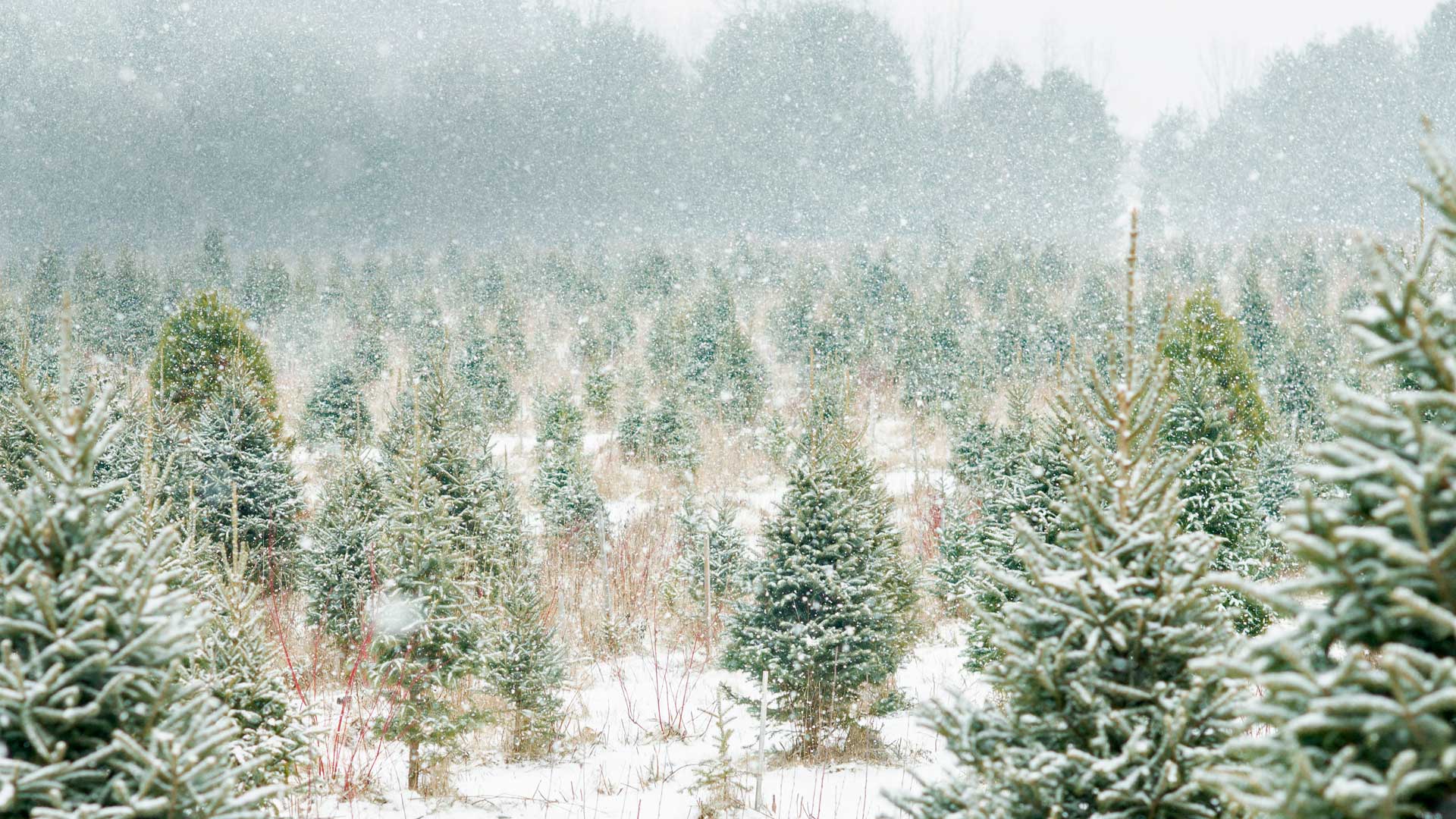
安大略省的圣诞树农场,加拿大 Christmas tree farm in Ontario, Canada (© FatCamera/Getty Images Plus)
A growing business
Today we're showing off a serene scene at a Christmas tree farm outside Peterborough, Ontario, Canada. If you were to visit a farm like this, however, it's unlikely you'd find much peace and quiet. Of the 25 million to 30 million natural Christmas trees sold each year in the US alone, 98 percent of them come from farms. 'Tis the season for tree chopping. Oregon, home to the popular noble and Douglas firs, produces the most Christmas trees of all US states, shipping much of the harvest to California. North Carolina, of Fraser fir fame, comes in at No. 2. Canada is the world's largest exporter of Christmas trees, spreading holiday cheer around the world.
Tonight, the National Tree Lighting Ceremony in Washington, DC, will be held in President's Park near the White House. President Trump will push a button to illuminate a towering evergreen, just as other presidents have done since the first ceremony in 1923.
Exit Glacier at Kenai Fjords National Park in Alaska (© Nathaniel Gonzales/Alamy)
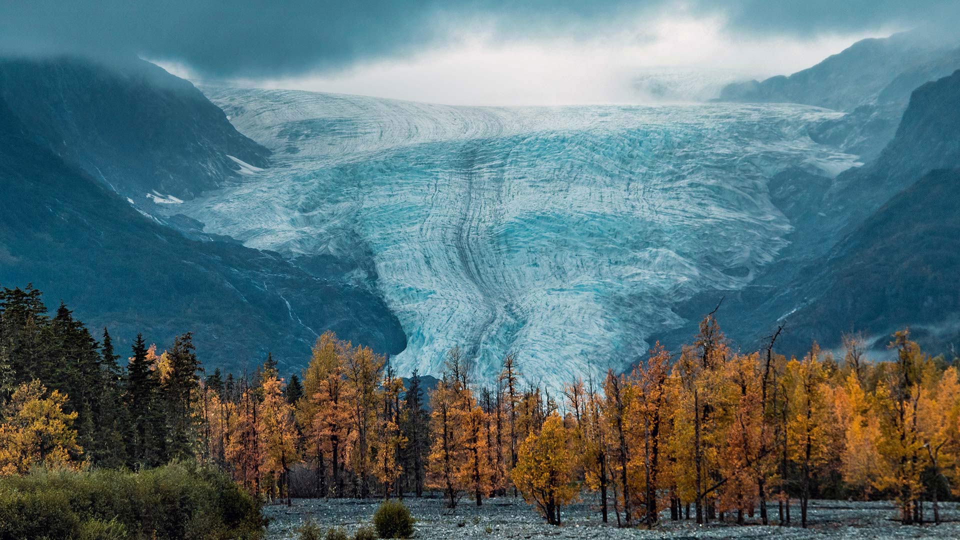
Exit Glacier at Kenai Fjords National Park in Alaska (© Nathaniel Gonzales/Alamy)
Wild and beautiful Alaska
In honor of Alaska National Parks Day, we're traveling to Kenai Fjords National Park—home of the awe-inspiring Exit Glacier seen here. The park sits at the edge of the North Pacific Ocean where frequent winter storms dump the snow that feeds this land of ice. The Harding Icefield crowns the park with at least 38 flowing glaciers—one of which is Exit Glacier. Exit Glacier is known for being one of the most-visited of Alaska's glaciers, likely because it’s accessible via the Seward Highway. In mid-November, the road to the glacier closes due to heavy snowfall, so visitors can only get there via snow-friendly transportation like dogsled or cross-country skis.
Kenai Fjords is just one of Alaska's eight national parks, which together boast the nation’s largest glacial system, incredible wildlife viewing, and North America’s tallest peak. These parks exist in part because of the Alaska National Interest Lands Conservation Act, which President Jimmy Carter signed into law on this day in 1980. It converted massive tracts of Alaskan wilderness into protected land, doubling the amount of national park land in the state. For that, we are grateful. Alaska may be cold, but it sure is beautiful and worth protecting.
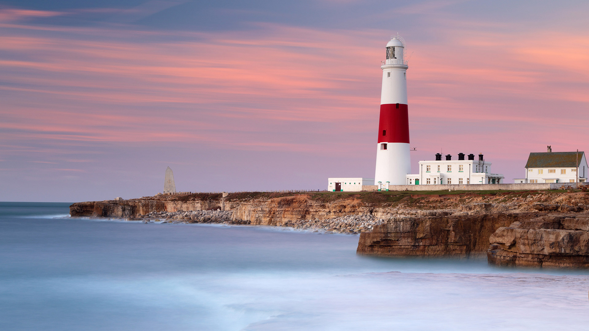
波特兰比尔灯塔处的晨光和海浪,英格兰多塞特郡 (© Lee Pengelly/Getty Images Plus)
“哈雷六号”科考站上空的南极光,南极洲 Aurora Australis over the Halley VI Research Station in Antarctica (© Stuart Holroyd/Alamy)
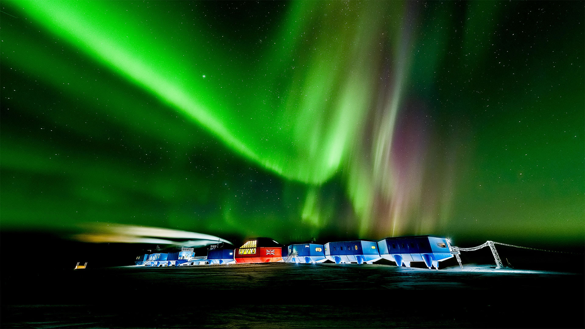
“哈雷六号”科考站上空的南极光,南极洲 Aurora Australis over the Halley VI Research Station in Antarctica (© Stuart Holroyd/Alamy)
Southern lights for Antarctica Day
In honor of Antarctica Day, you're seeing the southern lights dazzle above Halley VI, the latest version of the six-decade-old Halley Research Station in the British Antarctic Territory. The modular building stands on hydraulic legs and is movable via retractable skis. The five previous facilities, Halley I–V, were each compromised by Antarctica's harsh climate and were decommissioned. Since 2017, while scientists monitor dangerous cracks in the surrounding Brunt Ice Shelf, Halley has been unmanned during the dark Antarctic winter months—but the research team equipped it with an autonomous micro-turbine that keeps its atmospheric instruments ticking as the snowdrifts pile up.
The first Antarctica Day was December 1, 1959, when twelve nations peacefully agreed to dedicate Earth's southernmost continent to the pursuit of science by signing the Antarctic Treaty. That agreement, adopted by both the US and the USSR amid the accelerating Cold War, stands 60 years later as an important landmark in global relations and has expanded to include 54 countries.
马拉喀什的Jemaa el-Fnaa广场 Jemaa el-Fnaa Square in Marrakesh (© Pavliha/Getty Images)
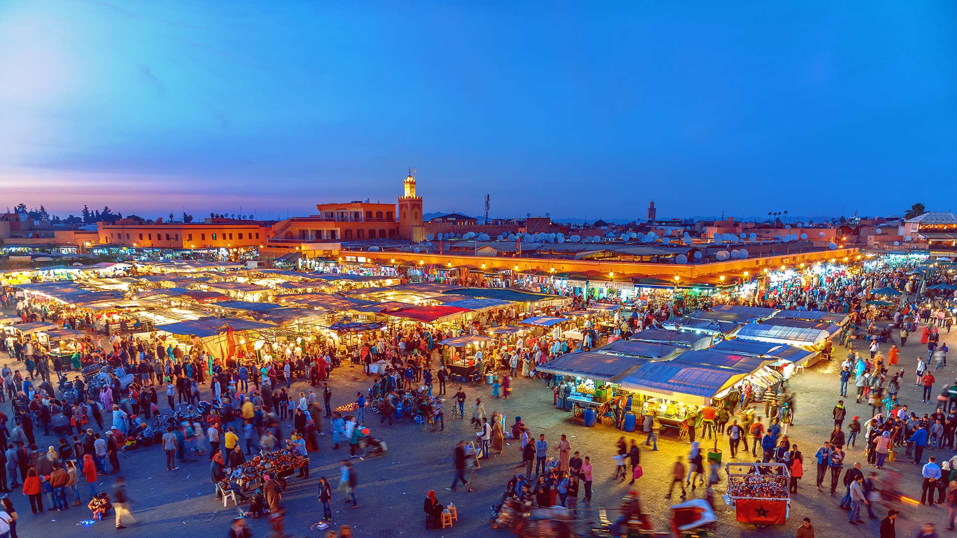
马拉喀什的Jemaa el-Fnaa广场 Jemaa el-Fnaa Square in Marrakesh (© Pavliha/Getty Images)
A big place to shop small
Small Business Saturday started in 2010 to get shoppers out of the big box stores the day after Black Friday and support local retailers. The US is home to more than 30 million small businesses (500 employees or fewer), representing 47 percent of private-sector employees. Of course, the concept of patronizing local merchants is nothing new. Here in Marrakesh, Morocco, souks (markets) like this one in Jemaa el-Fnaa Square have long been a big part of daily life, as well as major tourist attractions. During the day, musicians, dancers, and even snake charmers entertain shoppers as they search for crafts, clothing, and other goods. At night, the focus shifts to dining, with dozens of stalls offering different specialties and takes on traditional Moroccan food.
阿斯本附近的褐铃山,科罗拉多州 The Maroon Bells, near Aspen, Colorado (© Christopher E. Herbert/Getty Images)
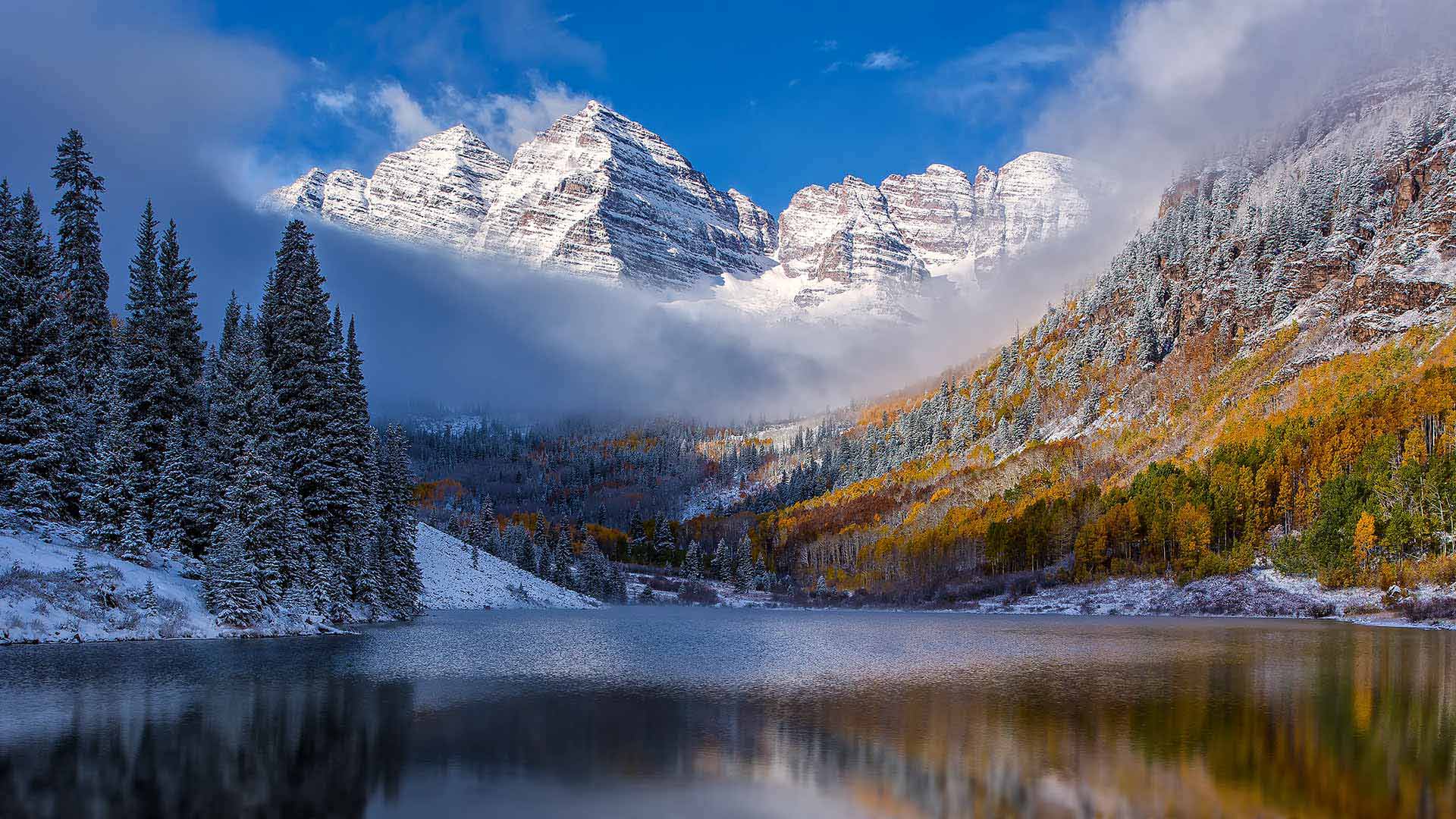
阿斯本附近的褐铃山,科罗拉多州 The Maroon Bells, near Aspen, Colorado (© Christopher E. Herbert/Getty Images)
Opt outside today
Instead of rushing to the mall today for Black Friday deals, perhaps you could make it a Green Friday and find a treasure in a nearby park or a wilderness like the Maroon Bells near Aspen, Colorado pictured here. A few years ago, outdoor retailer REI made news by closing its doors on the biggest shopping day of the year and encouraging its employees and customers to 'Opt Outside' and spend time with their families instead. And while there is still no shortage of shopping options available to the intrepid Black Friday deal-hunter, a growing number of organizations have gotten behind this concept of Green Friday. And let's face it, after all that turkey and pie yesterday, you could probably use a nice walk. (And you can always shop online at work on Cyber Monday ;).)
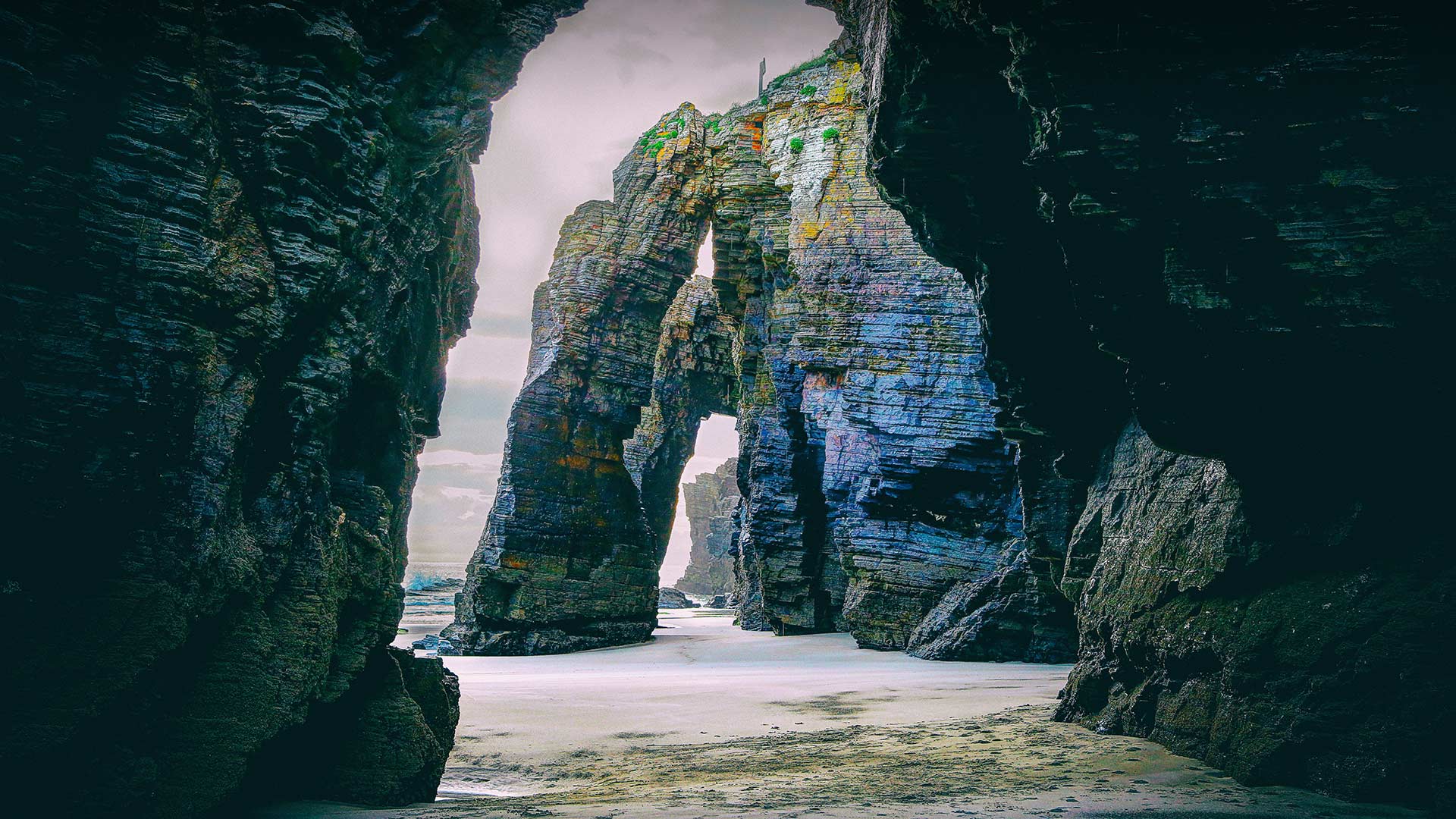
Las Catedrales海滩,西班牙加利西亚 (© Davide Seddio/Getty Images)
凤凰城天港国际机场鸟瞰图,亚利桑那 Aerial view of Sky Harbor International in Phoenix, Arizona (© Nearmap/Getty Images)
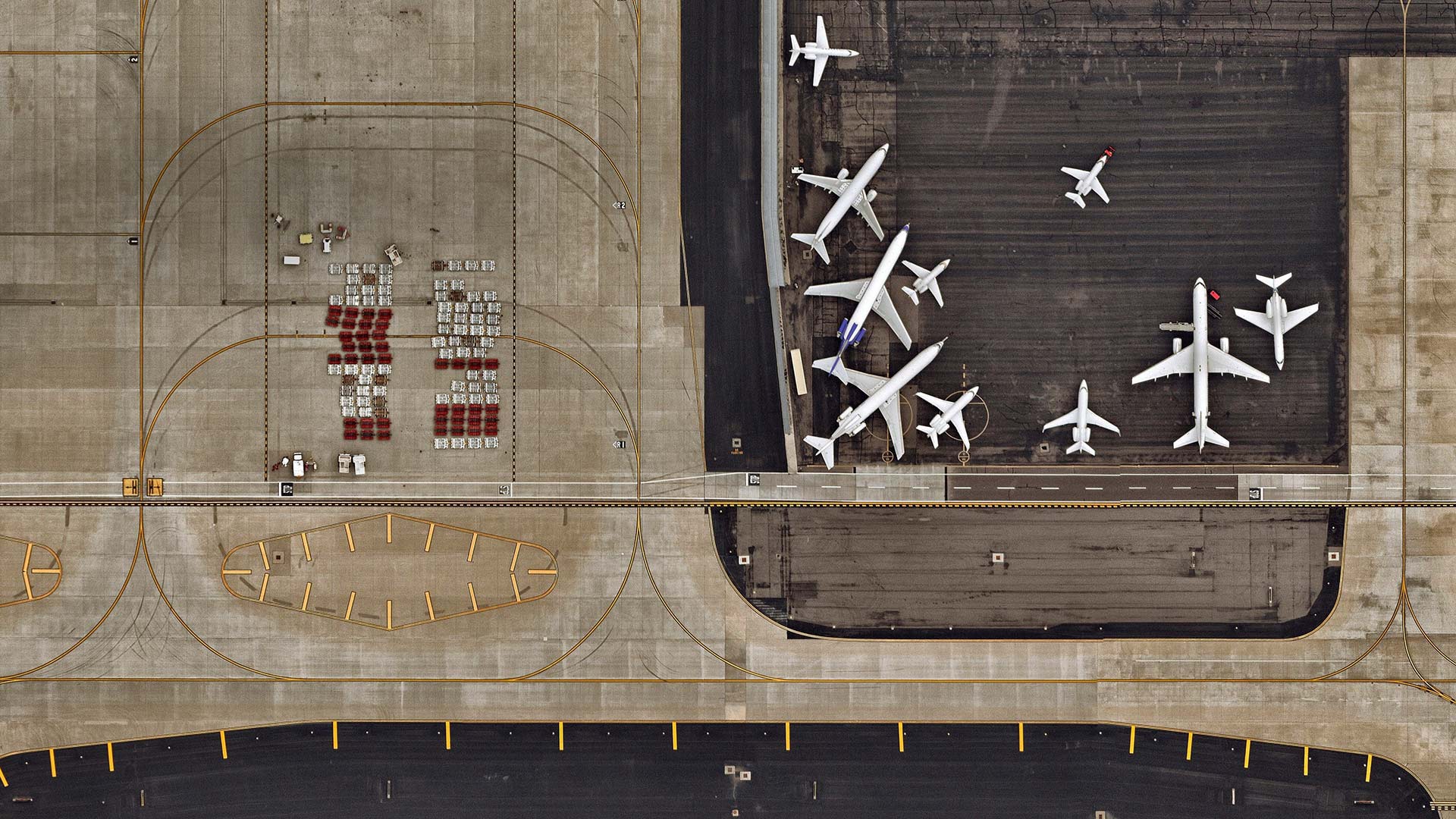
凤凰城天港国际机场鸟瞰图,亚利桑那 Aerial view of Sky Harbor International in Phoenix, Arizona (© Nearmap/Getty Images)
Have you turned off your electric device?
If you're already in the air looking down at this bird's eye view of Sky Harbor International in Phoenix (or some other airport), well then, congrats. You've made it through the terminal on one of the busiest travel days of the year. Wait for a second, isn't the day before Thanksgiving the absolute busiest day to travel? Well, according to travel industry experts, traffic is actually heaviest on Fridays during the lazy, hazy days of summer. That's when crowds of people clog the highways and skyways to get out of their respective towns and go on vacation. You, on the other hand, can relax. Unless your plans are to host a table full of hungry guests on Thanksgiving. In which case, may we suggest yoga and meditation tonight? (And turn off this electronic device before the flight attendant comes by again.)