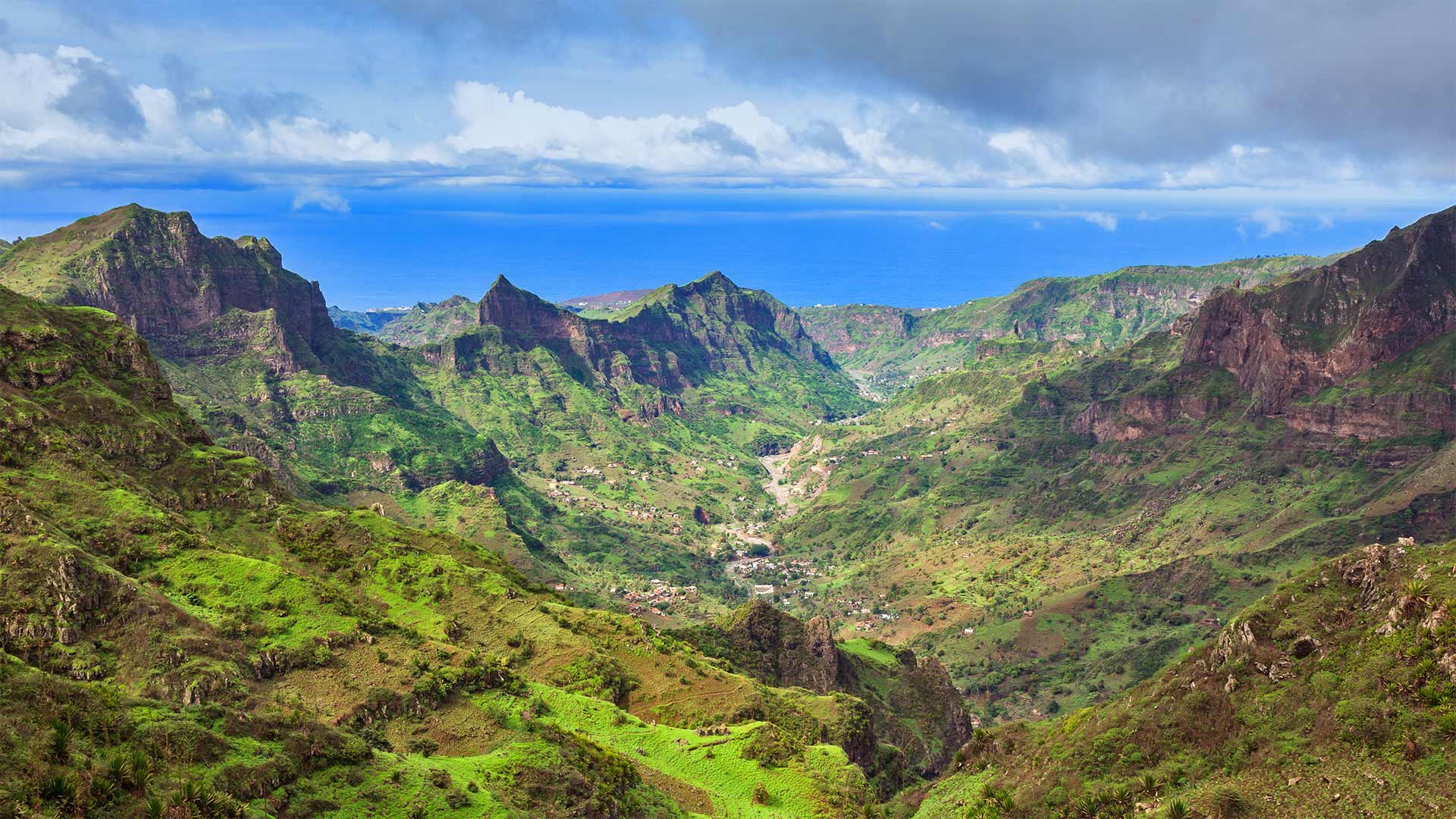
Serra da Malagueta山脉,佛得角圣地亚哥岛 Serra da Malagueta mountains on Santiago Island, Cabo Verde (© Samuel Borges Photography/Shutterstock)
Serra da Malagueta山脉,佛得角圣地亚哥岛 Serra da Malagueta mountains on Santiago Island, Cabo Verde (© Samuel Borges Photography/Shutterstock)
How green is my valley
Cabo Verde ('Green Cape') celebrates its independence today. Located about 350 miles off the western coast of Africa, the country consists of 10 volcanic islands. We're looking at the Serra da Malagueta mountain range in the northern part of the island of Santiago, which is protected as a national park. At nearly 3,500 feet, it's the highest point of northern Santiago and offers views of nearby Fogo and Maio islands, as well as diverse plants and wildlife.
The islands that make up Cabo Verde were uninhabited by people until they were colonized by Portuguese explorers in the 15th century. They remained in Portuguese control until gaining independence on July 5, 1975. Since the 1990s, Cabo Verde has been regarded as one of the most stable democracies in Africa and has steadily developed an economy based largely on tourism.
我的山谷有多绿
佛得角今天庆祝独立。这个国家位于非洲西海岸350英里外,由10个火山岛组成。我们看到的是圣地亚哥岛北部的塞拉-达-马拉盖塔山脉,它被保护为国家公园。在接近3500英尺的地方,它是圣地亚哥北部的最高点,可以看到附近的福戈岛和迈奥岛,以及各种各样的植物和野生动物。
构成佛得角的岛屿在15世纪被葡萄牙探险家殖民之前,一直无人居住。自1990年代以来,佛得角一直被视为非洲最稳定的民主国家之一,并稳步发展了以旅游业为主的经济。
评论已关闭