位于阿肯色州和密西西比州交界处的密西西比河 Mississippi River on the border between Arkansas and Mississippi (© NASA)
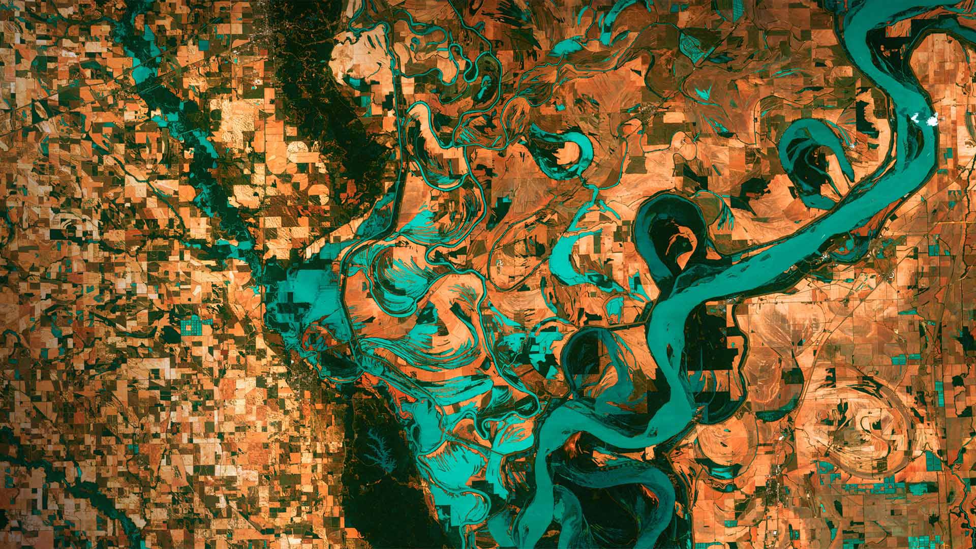
位于阿肯色州和密西西比州交界处的密西西比河 Mississippi River on the border between Arkansas and Mississippi (© NASA)
Gazing down on planet Earth
It's Earth Day today and we are high above the blue marble looking down on the border between Arkansas and Mississippi. Those small, blocky shapes are towns, fields, and pastures–the teal green is the mighty Mississippi River. Anyone who has flown in the window seat of an airplane and has gazed down at Earth below might wonder why the colors in this image are so unreal. That's because they are. These images were taken in 2013 by Landsat 7, a NASA satellite that uses thermal infrared sensors to help scientists better distinguish flora, fauna, water, and manmade objects. For almost 50 years, NASA has been using satellite imagery to understand how climate change and population growth are affecting our fragile planet. These satellites help NASA see where deforestation and wildfires are happening, where glaciers are melting, and how rising waters are encroaching on cities.
The biggest cause of these changes? According to NASA, it's us. Since the first Landsat launched in 1972, the Earth's population has almost doubled, from 4 billion people then to 7.8 billion today. But there is some good news to mark this Earth Day: The Mississippi River we see here is much less toxic now than it was back in 1972, thanks to environmental laws and regulations.
俯瞰地球
今天是地球日,我们在阿肯色州和密西西比州交界处的蓝色大理石上方俯瞰。那些小而块状的形状是城镇、田野和牧场——青绿色是浩瀚的密西西比河。任何坐过飞机靠窗座位的人,都可能会想,为什么这张照片中的颜色如此不真实。那是因为他们是。这些图像是2013年由美国宇航局的陆地卫星7号拍摄的,该卫星使用热红外传感器帮助科学家更好地区分动植物、水和人造物体。近50年来,美国宇航局一直在利用卫星图像来了解气候变化和人口增长是如何影响我们这个脆弱的星球的。这些卫星有助于美国宇航局了解森林砍伐和野火正在发生的地方,冰川正在融化的地方,以及上涨的海水如何侵蚀城市。
这些变化的最大原因是什么?据美国宇航局说,是我们。自从1972年第一颗陆地卫星发射以来,地球人口几乎翻了一番,从当时的40亿人增加到今天的78亿人。但是,有一些好消息值得纪念这个地球日:由于环境法律和法规,我们在这里看到的密西西比河现在的毒性比1972年时要小得多。
评论已关闭