标签 加拿大 下的文章
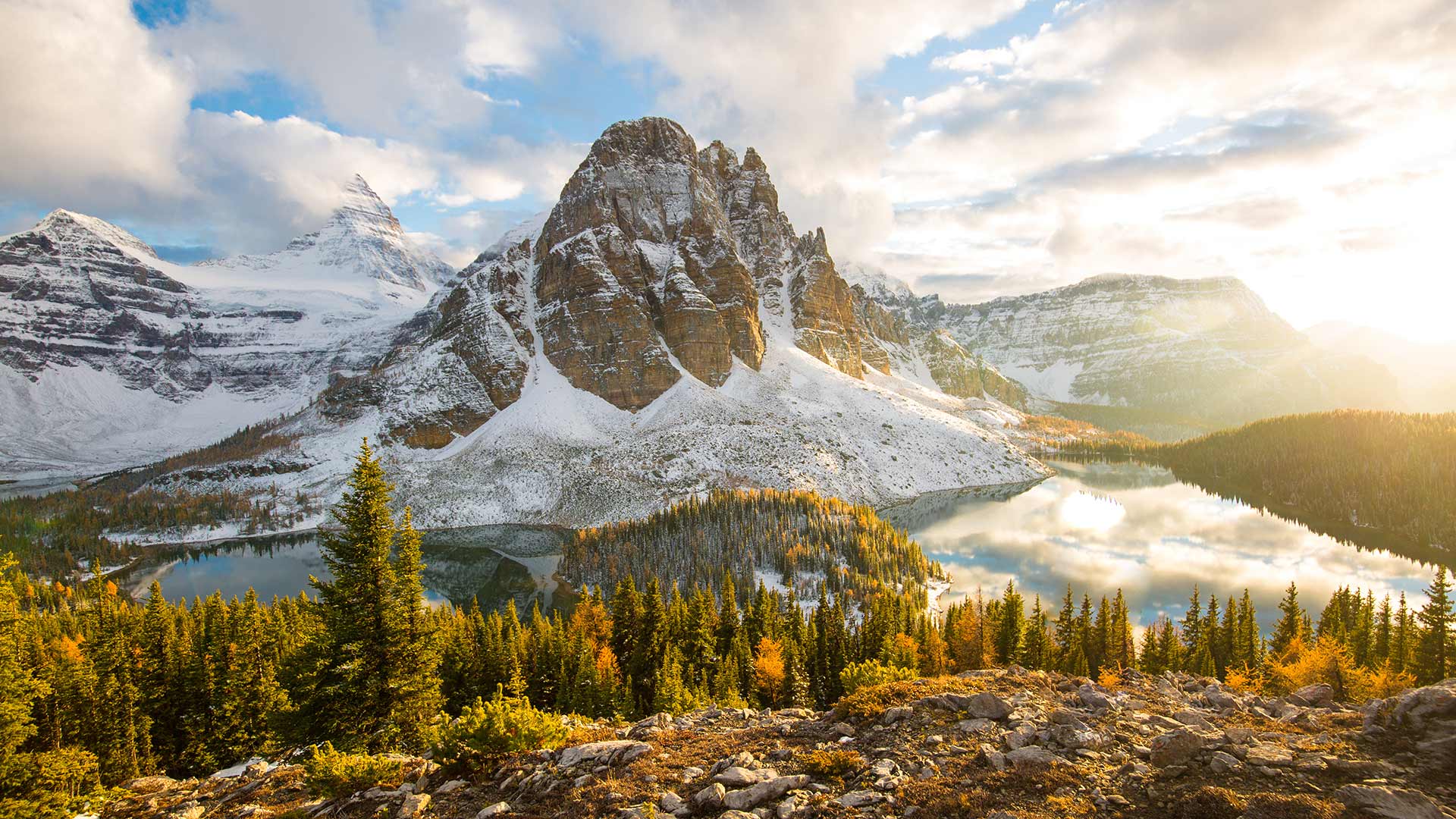
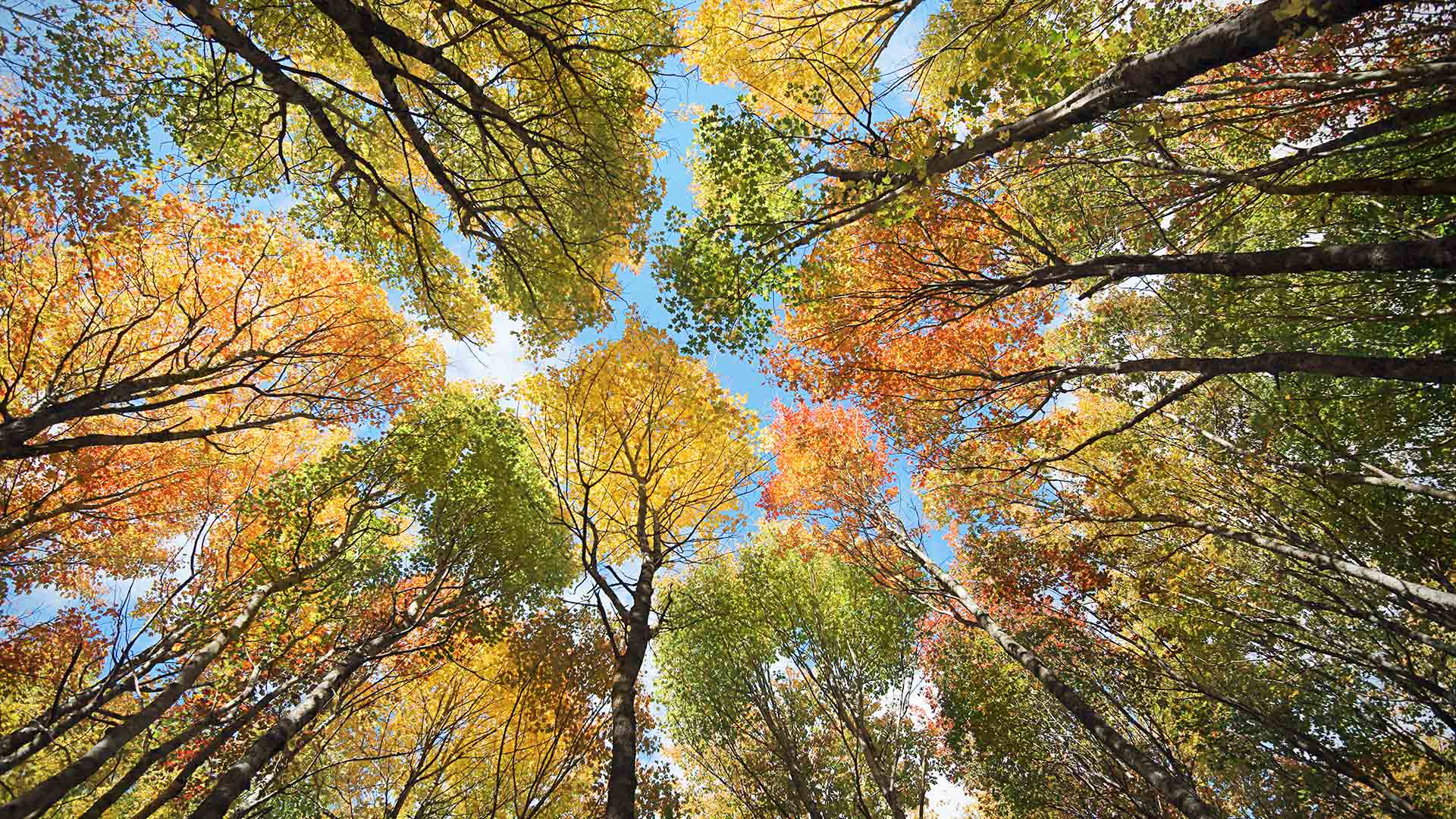
阿西尼博因山公园的秋叶,加拿大不列颠哥伦比亚省 (© Mitch Pittman/TANDEM Stills + Motion)
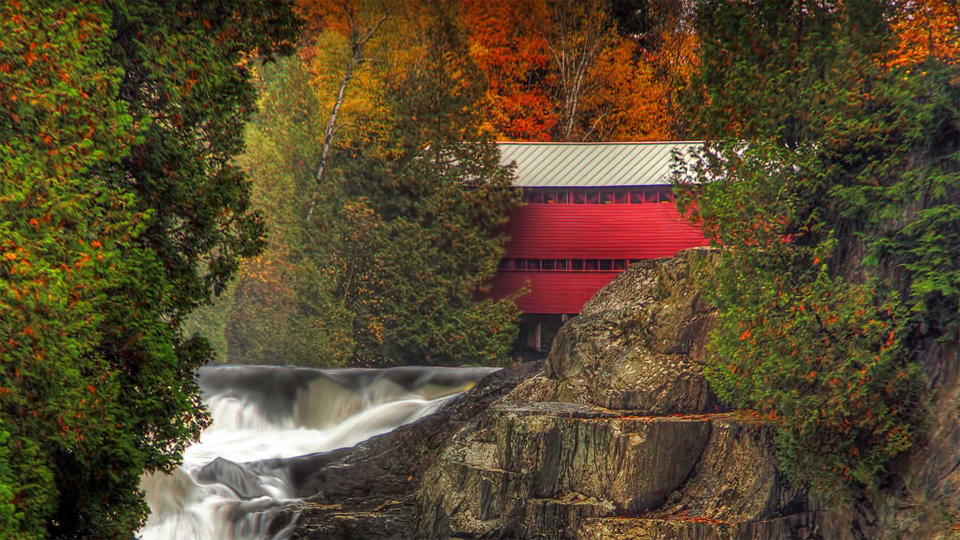
帕尔默河上的红桥,加拿大魁北克省 Pont Rouge (Red Bridge) over the Palmer River in Sainte-Agathe-de-Lotbinière, Quebec, Canada (© Jean Surprenant/Getty Images)
帕尔默河上的红桥,加拿大魁北克省 Pont Rouge (Red Bridge) over the Palmer River in Sainte-Agathe-de-Lotbinière, Quebec, Canada (© Jean Surprenant/Getty Images)
Canada, Quebec Red Bridge
When the Pont Rouge (Red Bridge) of Sainte-Agathe-de-Lotbinière was built over the Palmer River in 1928, covered bridges were already commonplace here in Quebec. Simple designs imported from the United States allowed relatively untrained workers to quickly construct crossings like this. 'Ponts rouges' (often called this whether or not they were painted red) popped up wherever rural French Canadians required a convenient river crossing—as many as 1,500 were built between the late 1800s and the 1950s. Today fewer than 100 still stand, and some—like this one—are protected by local and provincial agencies for historic preservation.
加拿大魁北克红桥
1928年,圣阿加泰德·洛比尼埃的红桥(Pont Rouge)在帕尔默河上修建时,盖梁桥在魁北克已经司空见惯。从美国进口的简单设计允许相对未经培训的工人快速建造这样的过境点19世纪末至20世纪50年代,在法裔加拿大人需要方便的河流穿越的地方,就出现了红桥(无论是否被漆成红色,通常称之为红桥),修建了多达1500座。今天,只有不到100个仍然存在,像这一个这样的一些是由地方和省级机构保护的历史保护。
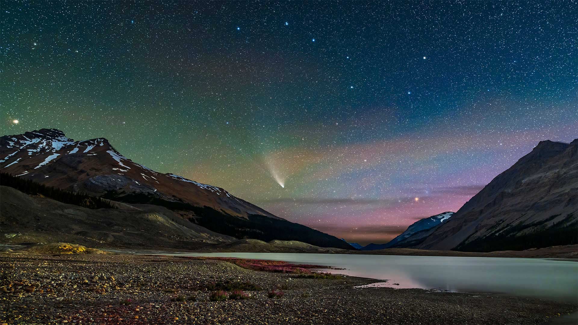
划过湖面上空的新智彗星,加拿大贾斯珀国家公园 (© Stocktrek Images, Inc./Alamy)
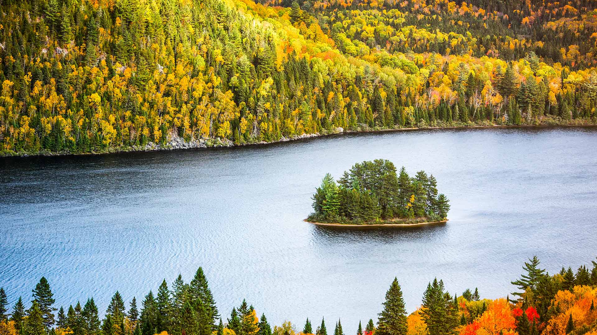
拉莫里斯国家公园中的Wapizagonke湖区,加拿大魁北克 The Wapizagonke Lake in La Mauricie National Park, Quebec, Canada (© Instants/Getty Images)
拉莫里斯国家公园中的Wapizagonke湖区,加拿大魁北克 The Wapizagonke Lake in La Mauricie National Park, Quebec, Canada (© Instants/Getty Images)
Vibrant colours of Fall
This majestic view of the Wapizagonke Lake encapsulates the spirit of autumn through the vibrant display of colours. Located between Québec City and Montréal, La Mauricie National Park is a site for all types of nature lovers. The park offers activities such as hiking, kayaking, paddling, bird watching, ice climbing and even star gazing. With more than 150 lakes and home to one of the oldest mountain ranges – the Laurentian Mountains - La Mauricie National Park is a destination filled with spectacular vistas all-year-round.
秋天的鲜艳色彩
瓦皮扎贡克湖的壮丽景色通过生动的色彩展示,体现了秋天的精神。La Mauricie国家公园位于魁北克市和蒙特勒尔之间,是各类自然爱好者的聚集地。公园里有徒步旅行、皮划艇、划船、观鸟、攀冰,甚至还有观星等活动。拉莫里西国家公园拥有150多个湖泊,是最古老的山脉之一——劳伦斯山脉的所在地,是一个终年景色壮观的目的地。
爱德华王子岛的森林和树冠,加拿大 (© OliverChilds/Getty Images)
注入海中的马更些河,加拿大 The Mackenzie River in Canada emptying into the Beaufort Sea (© Norman Kuring, GSFC/NASA/USGS Landsat)
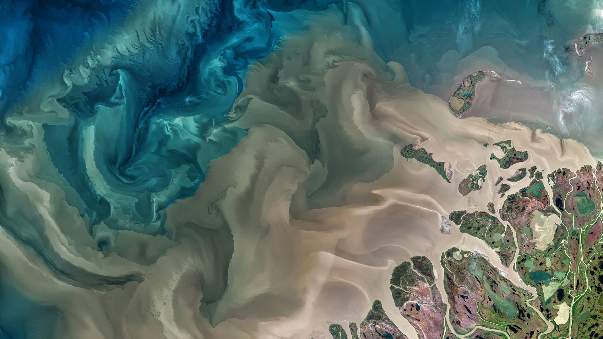
注入海中的马更些河,加拿大 The Mackenzie River in Canada emptying into the Beaufort Sea (© Norman Kuring, GSFC/NASA/USGS Landsat)
World Rivers Day
Today we're recognizing World Rivers Day, a celebration of our planet's waterways. The event branched off in 2005 from its source, BC Rivers Day, which has been observed by British Columbians in Canada since 1980. The annual event is now celebrated on the fourth Sunday of September by millions of people in more than 100 countries. It is a day that raises public awareness about rivers around the world and encourages their conservation.
Our photo, captured by NASA's Earth-imaging Landsat 8 satellite, shows part of the Mackenzie River delta and the river's turbid waters as they flow from the far north of Canada and Alaska into the Beaufort Sea in the Arctic Ocean. The Mackenzie River—the longest river in Canada and second-largest drainage basin of any North American river after the Mississippi–plays a vital role in modulating the Arctic climate as warmer fresh water mixes with colder seawater.
世界河流日
今天,我们要纪念世界河流日,这是一个庆祝地球水路的节日。这一活动于2005年从其源头——不列颠哥伦比亚河日开始,自1980年以来,加拿大的不列颠哥伦比亚人就一直在观察这一活动。现在,100多个国家的数百万人在9月的第四个星期日庆祝这项一年一度的活动。这一天提高了公众对世界各地河流的认识,并鼓励保护河流。
我们的照片由美国宇航局地球成像陆地卫星8号(Landsat 8)卫星拍摄,显示了麦肯齐河三角洲的一部分和河流的浑浊水域,它们从加拿大和阿拉斯加的最北部流入北冰洋的波弗特海。麦肯齐河是加拿大最长的河流,也是仅次于密西西比河的北美第二大流域,在调节北极气候方面起着至关重要的作用,因为温暖的淡水与寒冷的海水混合。
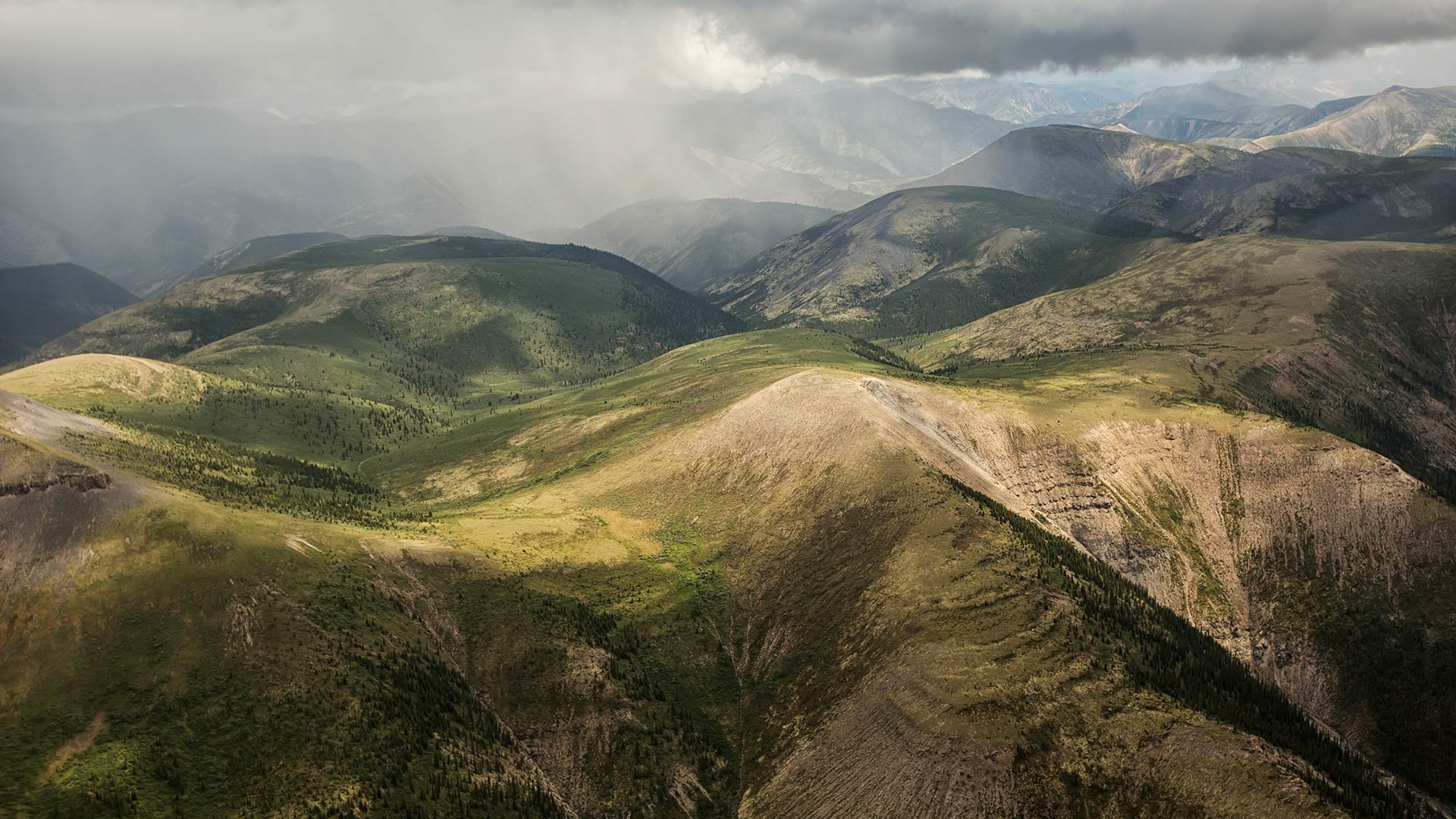
纳汉尼国家公园保护区的鸟瞰图,加拿大西北部 (© Robert Postma/Getty Images)
Manicouagan火山口, 魁北克加拿大 Manicouagan Crater in Québec, Canada (© Universal History Archive/Universal Images Group via Getty Images)
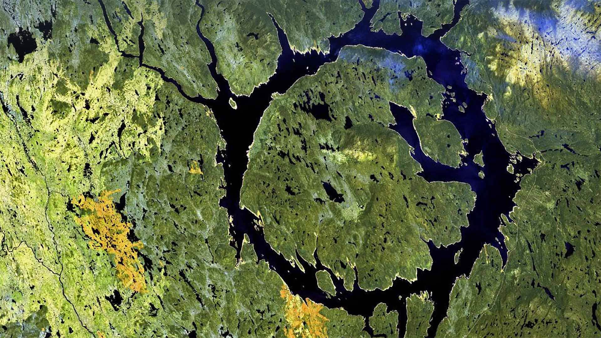
Manicouagan火山口, 魁北克加拿大 Manicouagan Crater in Québec, Canada (© Universal History Archive/Universal Images Group via Getty Images)
An impactful day
We'll be the ones to drop the news on you: It's Asteroid Day! Today you're invited to explore a realm of science usually encountered only through white-knuckle action flicks: Asteroid impact avoidance, or the study of what the heck we do if we spot a big chunk of space junk hurtling right at Earth. That's right, don't worry: People somewhere are coming up with plans for this.
Good thing, because as our photo shows, asteroid impacts do happen. Manicouagan Crater, aka the 'eye of Québec,' was formed by a 3-mile-wide meteorite that hit Earth about 215 million years ago. Much more recently, an explosive meteoroid leveled 800 square miles of Siberian forest in what's called the Tunguska event. It was 113 years ago today, and Asteroid Day's date was chosen in recognition.
So, if you find yourself casting paranoid glances at the sky today, maybe do a little searching on how scientists are learning to prevent potential impacts. Proposed plans involve everything from altering an asteroid's course via a gravitational field, to delaying its approach by attaching rocket thrusters, to good old-fashioned blowing it up. Yay science!
充实的一天
我们会把这个消息告诉你:今天是小行星日!今天,你被邀请去探索一个科学领域,这个领域通常只能通过白痴般的动作来实现:小行星撞击避免,或者研究如果我们发现一大块太空垃圾正朝地球飞来,我们该怎么办。是的,别担心:某地的人们正在为此制定计划。
好事情,因为正如我们的照片所示,小行星撞击确实发生过。Manicouagan火山口,又名“Qu之眼”é“bec”是由一块3英里宽的陨石形成的,它在大约2.15亿年前撞击地球。最近,在通古斯卡事件中,一个爆炸性流星体将800平方英里的西伯利亚森林夷为平地。那是113年前的今天,小行星日的日期被选为纪念日。
所以,如果你发现自己今天对天空投下了偏执的目光,或许可以做一些探索,看看科学家们是如何学会防止潜在的影响的。拟议中的计划涉及到从通过引力场改变小行星的轨道,到通过安装火箭推进器推迟其接近,再到老式的炸毁小行星的各种方法。耶,科学!
加拿大亚伯达省贾斯珀国家公园马利尼湖的精神岛 Spirit Island in Maligne Lake, Jasper National Park, Alberta, Canada (© Jeff Penner/EyeEm/Getty Images)
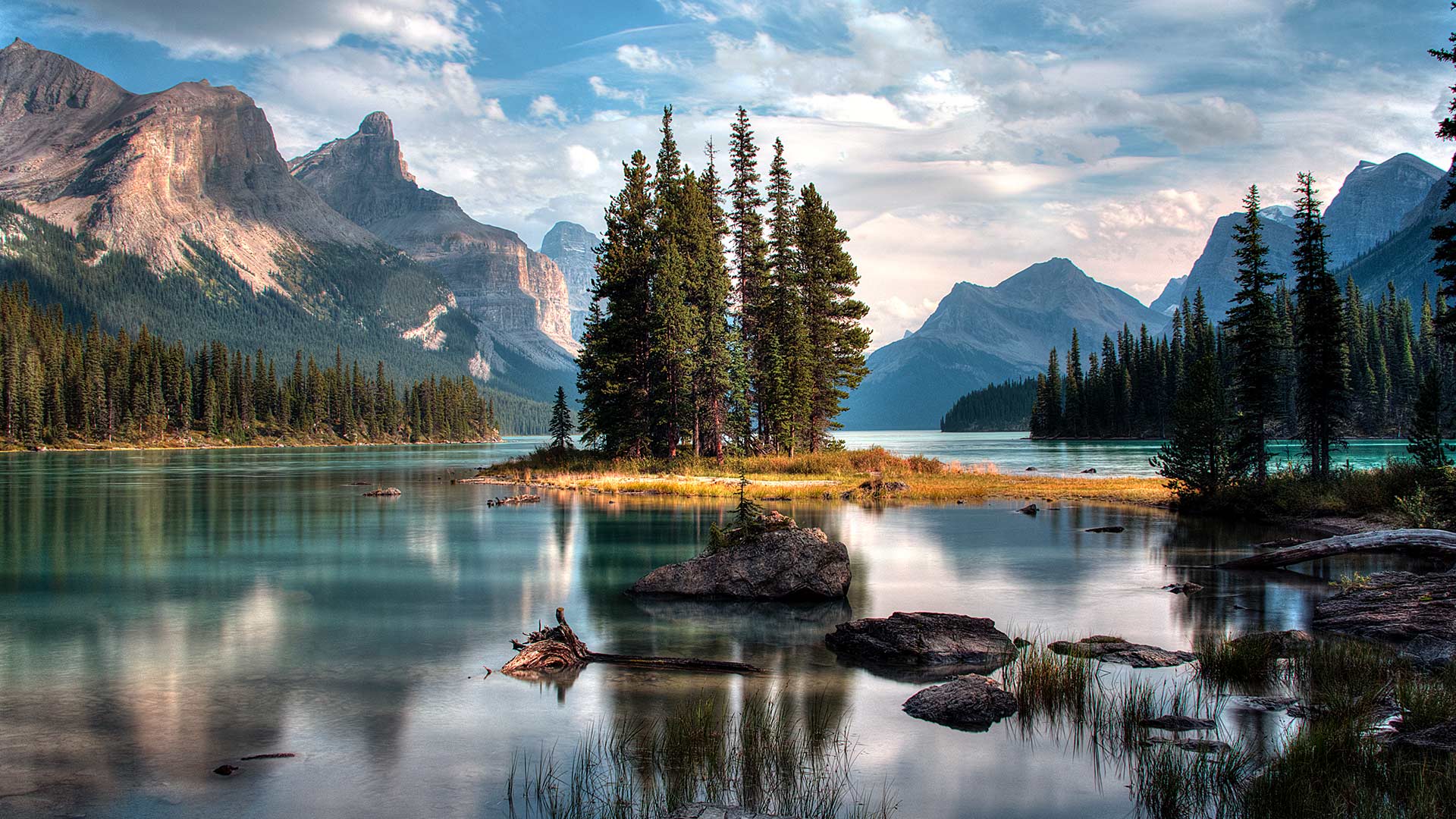
Spirit Island in Maligne Lake, Jasper National Park, Alberta, Canada (© Jeff Penner/EyeEm/Getty Images)
A photographer's paradise
If you are dreaming of an escape to paradise, look no further. Welcome to one of the most photographed sites in the majestic Canadian Rockies. Located in Jasper National Park in Alberta, the scenic Maligne Lake is 22 kilometres long, making it the largest natural lake out here. In the middle of this lake, sits the iconic Spirit Island which is only accessible via tour boats or private boats. The glacial, azure-blue waters, pine trees and snow-capped peaks frame Spirit Island, epitomizing the beauty of Jasper. In addition to admiring the natural beauty here, visitors can engage in activities such as hiking, fishing and kayaking during summer and skiing and snowshoeing in the winter.
摄影师的天堂
如果你梦想着逃往天堂,不要再看了。欢迎来到雄伟的加拿大落基山脉最受欢迎的景点之一。位于艾伯塔省贾斯珀国家公园,风景秀丽的马林湖长22公里,是这里最大的天然湖泊。在这个湖的中央,坐落着标志性的精神岛,只有通过旅游船或私人船只才能到达。冰川、湛蓝的海水、松树和白雪皑皑的山峰构成了精灵岛,是碧玉之美的缩影。除了欣赏这里的自然美景外,游客还可以在夏季进行徒步旅行、钓鱼和皮划艇活动,在冬季进行滑雪和雪鞋运动。
亚伯拉罕湖中的树,加拿大艾伯塔 Tree trunks in Abraham Lake, Alberta, Canada (© Coolbiere/Getty Images)
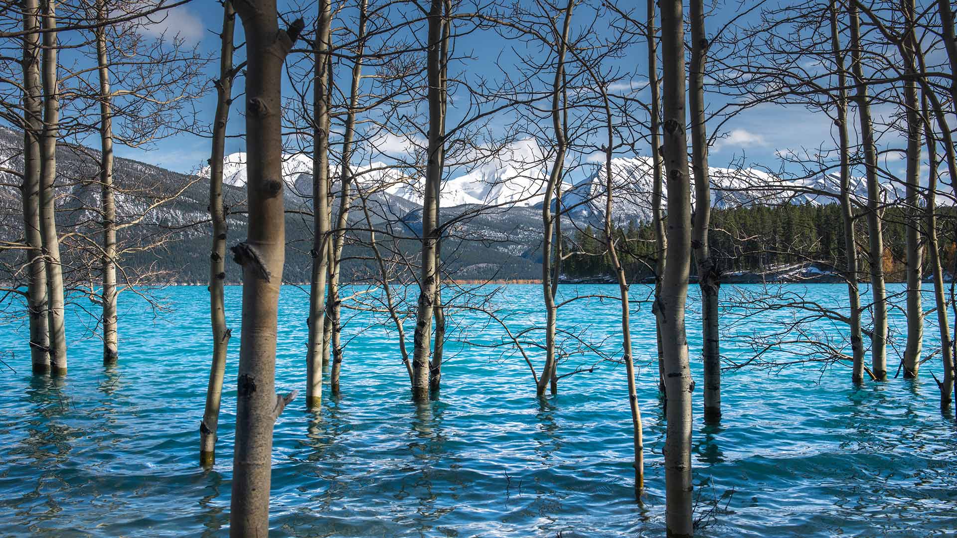
亚伯拉罕湖中的树,加拿大艾伯塔 Tree trunks in Abraham Lake, Alberta, Canada (© Coolbiere/Getty Images)
Lake and a reservoir
Today, we’re taking in views of Alberta’s largest reservoir – Abraham Lake. It was created in 1972 following the completion of the Bighorn Dam on the North Saskatchewan River. The dam was built by then Calgary Power Company, now TransAlta, to produce hydroelectric power. As seen here, Abraham Lake boasts a vivid shade of blue, further contributing to the breathtaking view with the mountains in the background. Of late, this gem in the Rockies has become a must-see for photographers every winter, for the emergence of the extraordinary frozen bubbles trapped under the lake. As the temperature drops, methane gas released from water-dwelling bacteria, forms into bubbles and freezes under the surface of the frozen lake. When the layer of ice on the lake is clear, the frozen bubbles can be seen and make for a remarkable spectacle.
湖和水库
今天,我们将欣赏艾伯塔省最大的水库——亚伯拉罕湖。它是1972年在北萨斯喀彻温河上的比格霍恩大坝完工后建造的。大坝由当时的卡尔加里电力公司(现为TransAlta)建造,用于生产水力发电。如图所示,亚伯拉罕湖拥有一个生动的蓝色阴影,进一步促进了以山脉为背景的惊险景色。最近,落基山脉的这块宝石每年冬天都成为摄影师们的必看之地,因为湖底出现了异常冰冻的气泡。随着温度下降,水中细菌释放出的甲烷气体形成气泡,冻结在结冰的湖面下。当湖面上的冰层清澈见底时,可以看到结冰的气泡,形成一种非凡的景象。